North End of Lake Powell and Southern Tip of Capitol Reef

CaptnKidd

Member
Joined
Dec 31, 2014
Messages
52
So, this is my first solo trip and it was a blast. I had several people lined up to take this trip with me but due to various illness and life events this turned into a solo trip, my first ever. There was a break in my schooling and other reasons so this had to be the weekend that I went. I had some trepidation about taking a trip by myself, one of the concerns was could I be with myself for 4 days :)

Turns out that I could and I had a ton of fun. I have been to Capitol Reef six times, between the Southern Water Pocket Fold and Cathedral Valley up North I can't get enough of this place. I have already been to Capitol Reef once this year with the family back in February. It was in Capitol Reef where I first experienced hiking a slot canyon which has sent me on this six year journey hiking canyons in Southern Utah. I have been up and down the Swell both documented and undocumented trails. I have been to Zions, Canyon Lands, slot canyons along the Escalante, hole in the rock road, etc. but the one spot I had not ventured until now was the canyons surrounding Lake Powell, and wow, where they amazing.

Day 1, camp lonely:
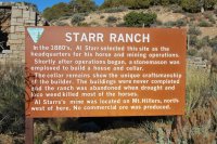
This campground is on the way to the Bullfrog marina and it was amazing. From the pictures you can tell that the first day was going to be a cold one.. The campground is called Starr Springs and it newly rebuilt. It was open but still under construction so they where not charging. It had all new equipment (fire pits, grills, tent spots, etc.) so it was a nice base camp. I was a bit higher up than where I would be hiking so the temps where still pretty cool at night. I was the only one there Thursday and Friday night. It was funny becasue at first I was thinking that it would be nice to have a few other people there, then on Saturday night 3 other groups showed up and I though, can't they find somewhere else to camp...
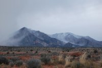
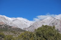
1.JPG
1a.JPG
2.JPG
3.JPG

4.JPG
5.JPG
 
Day 2, time for some canyons:

Because I was on my own I did not hike as far into the canyon as I normally would but it was a lot of fun dropping into more canyons and then hiking in 4 or 5 miles then backing out and checking out another one.


5a.JPG

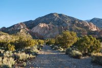
Got up early and took a drive and a short hike to check out the area surrounding the campground, this was a pretty cool place and I will be returning to camp here many times.


6.JPG
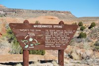
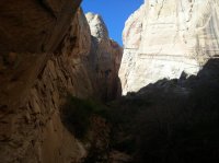
First on my list of canyons was Maidenwater Canyon. This place was pretty incredible.


7.JPG
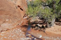
This is some of the run off from the actual spring, seemed to flow pretty good.

8.jpg
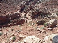
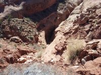
Not sure what this canyon was called but I wanted to get down there, bad. I hiked up and down the ridge line but could not find a spot to drop in. I had accidentally left some of my tops back at camp so I could not identify it or find the proper route down, something for next time.

8a.jpg
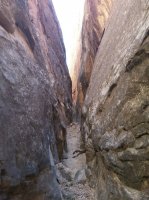
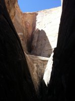
Another shot of the same unknown canyon, it looked really amazing and narrow.

9.jpg
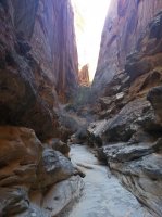
Second canyon of the day was Woodruff Canyon. This was by far one of my favorites so far in the area. It's on my list to hike all the way through next time when I have more than just myself.

9a.jpg
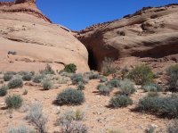
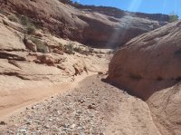
This is the wash I headed down to enter Woodruff Canyon.

10.jpg

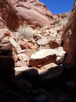
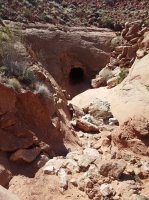
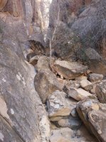
Ah yes, my favorite thing, a huge pile of rocks. I was not sure about hiking down this but I had seen a few other people who had just dropped down and figured what the hell.


11.jpg

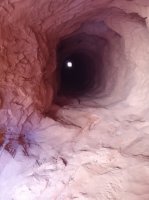
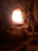
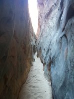
Once I got down though I was glad that I did, this little tunnel was awesome. I assume it is here becasue then they filled in the canyon to build the road the water had to go somewhere, not sure about that though. It was pretty dark and pretty long. There was one spot in the middle that if you are not paying attention you will drop straight down about 5 feet, could be a really bad day. The bypass is easy but in the dark if you didn't have a light you would be in trouble.

12.jpg


13.jpg

That's it for day two. I ended up going into a few other canyons although I really wanted to head into Swett Creek but never found a way down as I left my detailed map and description back at camp but it was still a full day.
 
Day 3, Capitol Reef:

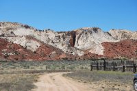
I had no intention of hiking the trails over in Capitol Reef but I have always wanted to finish driving the Burr Trail. I have been on all of the parts except for this section near Lake Powell. There was a dirt road that left right from my camp and headed out towards the Reef, how could I resist?

14.JPG
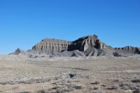
Some pretty cool black rock formations that I really enjoyed. I have never seen black rock like that in such huge quantities.

15.JPG
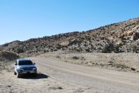
Ah, my new adventure vehicle, having so much fun with this getting out and exploring. I had a very modified 1996 Tahoe, lift, 35" tires and locked up, it was a lot of fun and I have been on many off road adventures with it. But I really enjoy having something a bit more reliable and I find these days I enjoy having a vehicle to get met o a trial head more than the off-roading option.

16.JPG

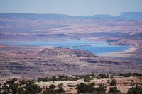
This is as close as I got to Lake Powell, seems like it might be a pretty amazing place although it appears to really be drying up.

The next two canyons are a mix of Surprise and Headquarters canyon. These are the two that started it all and I was not disappointed to re-hike them on this trip, they are pretty awesome canyons and do not require a lot of effort. However I was a bit 'surprised' in Headquarters. I met a fellow solo hiker on the way down and she asked me if she was in the right canyon. I told her that she was and the said the description in her guide said it did not have any major rocky spots. That's actually how I remember it also but not any more. I "think" there has been some pretty significant rock fall in this canyon over the last few years as I had to traverse huge sections of rock to get to the end. It may just be my poor memory but some of the rock seemed very fresh (it was sharply cut and loose everywhere).

18.jpg


18.jpg


19.jpg


19.jpg

20.jpg


21.jpg

End of Surprise Canyon, one of my favorite spots.

22.jpg

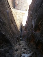
End of headquarters canyon. Also an amazing spot.

23.jpg


24.jpg

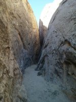
One of the more rocky spots in headquarters canyon.

25.jpg

26.JPG
Alas, lower Muley Twist, I have always wanted to hike this canyon. My plan for day 4 was to get up early and head out here to hike it but I wretched my shoulder pretty good down climbing the day before and was not up to the task for my final day so I ended up packing up and just heading home. It was still and awesome trip and I will make Lower Muley my first stop next time.

27.JPG
 
NIce little trip! Looks like weather cooperated too. Lower Muley is a sweet hike, you do need to get back to it.
I have this area targeted at the end of April. We are thinking of using Starr Springs CG as a base for 3 or 4 days to hike some of the UT276 canyons. Are the sites surrounded by trees (wind protected)? Also is there a water source up there? Decent road in and out? Is construction done? Thanks for report and info.

Not sure how I missed getting a picture of the campground but yes, it has a lot of trees. Actually when they have leaves on them (they did not yet when I was out there) it will be very shady. Thursday night there was a pretty big storm lots of wind and rain. You could hear the wind really build up (it was an odd noise, almost like a huge airplane flying by) but it's tucked pretty close to the foothills so I heard more than felt any. Road is good for any type of vehicle, very well maintained.

They said the construction is not done yet but I am not sure what needs to be finished off other than maybe some clean up and it looks like they where putting in some large drainage pipes. When I was there the water was off. There are places there to get it but nothing was running, maybe that's the last thing they need to finish up. I would call the BLM filed office out there to get a status on the water, but other than that it's an awesome site.
Thanks for your feed back. I thought this might be a good place for a 4 night base camp over a more exposed sandy spot along 276. I'll contact BLM on water opportunity.Would think they'd have it up and running by last week of April.
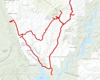
That was a nice loop you made. Our plan is to drive in from Escalante to Boulder. Do the Burr trail to below the switchbacks and then south on the Notom rd just shy of L Powell, and finally north up 276 to campground (same direction you took on your CRNP visit.). Seems way shorter than rt12 to UT24 and UT95.

Yeah, that sounds pretty awesome. I didn't have much a of a plan other than the 3 canyons I did when I was near Powell, once I realize how close I was to CR I just went driving all over the place :)

Looks like I am heading back down for Memorial Day so maybe I will see you there. Going to head back to do some more of the other canyons I didn't get to see on the other side of Powell by UT95 and to do the Muley Twist canyon.
If I'm not mistaken....We will be at this campground about a month before Memorial day, end of April, not May. We plan on doing some off of UT95, besides.... some off the 276 rd. I have not put any time into this area other than a couple rides thru to Powell and across 95. Looking forward to a new area for us.
 
Ah, yeah, my mistake, not sure why I thought Memorial was at the first of May... :)

You will love it.
 
Great report! Glad you enjoyed soloing.

Not sure what this canyon was called but I wanted to get down there, bad. I hiked up and down the ridge line but could not find a spot to drop in. I had accidentally left some of my tops back at camp so I could not identify it or find the proper route down, something for next time.

I think that's North Fork Maidenwater. Was it between Maidenwater Canyon and Maidenwater Spring? If so, that's it.
 
Great report! Glad you enjoyed soloing.


I think that's North Fork Maidenwater. Was it between Maidenwater Canyon and Maidenwater Spring? If so, that's it.

Yeah, looked back over my maps with what you pointed out and that must be it. Will try and get down into that one next time I am out there. Thanks!
 
Great write up, really enjoyed reading it. Soloing is great, and the more you do it, the more you will prefer it I think.
 
Similar threads
Thread starter Title Forum Replies Date
Scott Chandler CPW '15- Amazement on the North End Backpacking 5
Scott Chandler CPW '15- North End Adventuring Backpacking 0
Scott Chandler Summer in the CPW- Tour 7 North End Backpacking 6
Scott Chandler Summer in the CPW- Tour 4 North End Backpacking 6
Timber High Sierra - North Lake to South Lake Loop - Layover Day Trip Planning 9
J Pacific Creek or North Buffalo Fork? Teton Wilderness, Thorofare ,etc. Trip Planning 10
kwc Wandering about In Theodore Roosevelt NP (north unit) Hiking & Camping 5
scatman North Ridge of City Creek Canyon - February 4, 2023 Hiking & Camping 17
kwc Round Lake, north central Adirondacks, in the Round Lake Wilderness On The Water 2
Udink North of Arches Hiking & Camping 6
Janice The Wave - and SO MUCH MORE! (Coyote Buttes North, South, White Pocket, Buckskin, Condors, Bighorns...) - Part 1 Hiking & Camping 14
scatman North Pitchstone Trail, Headwaters of Ouzel Creek, Bechler River and Mr. Bubbles(?) - Yellowstone National Park - September 13, 2021 Backpacking 36
K North To Alaska - The Aleutians and More Everything Else 3
OwenM Anyone here familiar with North Cascades NP? Trip Planning 9
Chuck the Mauler Sierra North Lake / South Lake "loop" questions Trip Planning 10
Bob Morris North Inlet Trail Trip Planning 3
scatman North Summit, Mount Olympus - July 3, 2021 Hiking & Camping 12
BJett Joyce Kilmer-Slickrock Wilderness Area. North Carolina. Backpacking 0
RyanP North Fork Bull Lake Creek Trip Planning 35
BackpackingtheSierras Republic Pass Trail North Absaroka into Yellowstone Cache Creek and Lamar River Trip Planning 1
NorthwestWanderer North Cascades NP : Dee Dee Lakes & the Mcallister Ledge Backpacking 0
NorthwestWanderer North Cascades - Cutthroat/Granite/snowy lakes passes Backpacking 3
scatman North Summit, Mount Olympus - October 17, 2020 Hiking & Camping 16
U Favorite sites in Glacier in North Fork, Lake McDonald or Cole/Nyack? Looking at mid july Trip Planning 2
Bob Grand Canyon North Rim wildfire Trip Planning 4
J North Cascades National Park Black and Corteo Peaks Traverse Aug 21-23, 2007 Retro Backpacking 3
U Glacier North Circle Loop Mid July - Looking for an alternative back-up plan for a 3-4 nighter Trip Planning 0
Mikjik86 FULL Video Part 2 Backpacking Glacier National Park "North Circle Route" Backpacking 0
Dhuff3243 North Fork Robbers Roost and Blarney canyon Trip Planning 0
Mikjik86 Backpacking Glacier National Park (Part 2 Preview) "North Circle Route" Montana, August 2019 Backpacking 2
J Lake Mead Natl Recreation Area North Shore scramble fun. Nov. 28-30, 2019 Hiking & Camping 5
Mikjik86 Backpacking Glacier National Park - North Circle Route Part 1 Preview Video. Backpacking 1
Chuck the Mauler North Lake - South Lake questions Trip Planning 4
Yvonne Kolob Terrace exploration: from Hop Valley to North Gate Peaks, May 2019 Hiking & Camping 7
BJett Linville Gorge Wilderness Area - North Carolina Backpacking 18
Janice Opportunity to provide input on policies for Coyote Buttes North ("The Wave") and nearby areas General Discussion 27
TimeOutside Searching for a 5-ish day trek within 5 to 6 hours of North Dallas Trip Planning 3
DrNed Shift in Magnetic North General Discussion 4
McKee80 Glacier NP, part 2. North Fork, Sept 2018 Backpacking 11
Titans Pharaoh Lake Wilderness - Brilliant Fall Foliage, Pond and Lake Reflections- Adirondacks, North Eastern US Hiking & Camping 20
regehr Mill B North Fork Hiking & Camping 6
msteudel Boulder Mountain North Slope UT: Donkey Res. to Lost Lake? Trip Planning 1
NorthwestWanderer Copper Pass, North Cascades (Day Hike + Bear sighting) Hiking & Camping 1
Jimmy Baker Lake, Lake Diablo, North Cascades, Olympics Family Adventure Hiking & Camping 8
jar155 North Erickson Lake, Uinta Mountains (off trail approach) Backpacking 9
Outdoors24 Things to do north of Durango CO Trip Planning 0
SKLund North Dune Mountain Hiking & Camping 9
KevinBoyer South Lake to North Lake Sierra Nevada Trip Planning 4
Mountain Wanderer Hello from North Idaho! Noobs: Introduce yourself! 4
DrNed Floating The North Platte June 2017 On The Water 5

Similar threads

Back
Top