Ron Diel
Member
- Joined
- Apr 3, 2014
- Messages
- 10
In late April into early May I decided to take advantage of a break between projects to head West to Utah for a nine-day camping / photography trip. On a trip about a year before, my wife and I had driven from Bryce to Moab on the insanely scenic Highway 12 / 24 route, which took us through Capitol Reef National Park. We were blown away by what we saw, but had little time to stop and appreciate the Park. My wife couldn’t join me this time due to work requirements, but I decided to return to Capitol Reef to really see what is there.
Six of the nine nights were spent in a tent, three in the Fruita campground, one in the Cathedral Valley campground, one near the Temples of the Sun / Moon, and one in the Cedar Mesa campground. The settings were great, but the temperatures were well below average with lows in the 20s and a couple of nights with high winds. Luckily, my gear was adequate to the challenge.
To get a campsite, you have to get to the Fruita site by noon or so even in April but the other two were sparsely populated at that time.
Starting from the Fruita site, I explored the central section of the Park. The photos in the first group were taken around on various trails during those days, with each shot described along with the corresponding image below:
The Castle, a rock formation visible from Highway 24 and the Visitor Center
A hoodoo in Cohab Canyon, a trail accessible from the Fruita Campgrounds.
Hickman Arch, accessed via a trail originating along Highway 24.
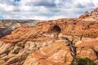
Cassidy Bridge, which can be reached by taking the Frying Pan trail which interconnects with the Cohab Canyon Trail. The bridge was named after Butch Cassidy, who may have hidden out in this area back in the day though the tentative wording I saw in a few places makes me suspect that this was at best apocryphal and at worst marketing hype.
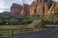
Farm and house from the Gifford Homestead, one of the family farms established in the area long before it became a Park. There is a store in the house which sells some great baked goods, including six-inch pies that make a great lunch if you plan to hike off the calories during the afternoon.
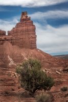
Chimney Rock, a formation near Highway 24 where it enters the Park. One trail ascends the formation behind Chimney Rock to give you a view from above; this image was taken from the back as the trail re-emerged prior to ending back at the parking area.
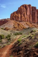
A mesa in the valley behind Chimney Rock viewable from the trail, which can be seen leading toward the mesa.
I next moved on to Cathedral Valley. To explore the Valley you drive around a 57 mile sometimes rough 4WD road that takes you North from Highway 24. Parts aren't bad, but the section near the campsite seems to be made up mostly of 8-inch rocks that shake your car pretty fiercely. Due to repeated photo opportunity stops, I spent most of three days completing the loop with a stop at the campgrounds and an overnight near the Temples of the Sun and Moon.
Although the Park doesn’t give permits to camp near the Temples, they advise you that the boundary of the Bureau of Land Management property is only a mile away and there is no restriction on camping there. Being able to stay nearby overnight was important to me since I planned to capture sunset, sunrise and star shots in this area so I didn't want to have to hike or drive too far away.
The shots from the Cathedral Valley loop drive are included below:
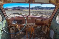
The rusted-out cab of an abandoned water drilling truck that you pass on the way into Cathedral Valley. This was captured as three bracketed shots that were manually balanced and merged in Photoshop (I tried PhotoMatix Pro and automated Photoshop HDR tools, but it came out looking like a sic-fi prop).
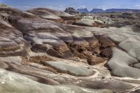
The Bentonite Hills that you also pass on the way into the Valley. These were formed from clay that resulted from volcanic activity back in the days of the dinosaurs. The gentle, smooth slopes are a contrast to the sharp angles and steep cliffs that mostly make up the Park.
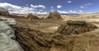
A first view of rock formations in the Lower South Desert section of the Valley. This and a couple of the other images seemed to lose a lot of their red tones as they were uploaded - I guess there is a color space / mapping issue that I need to investigate...
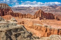
A closer view of some of the Lower South Desert formations - this seems to have kept its color better.
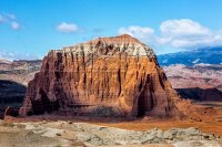
A closeup of Jailhouse Rock, the large formation on the right of the firstLower South Desert shot above.
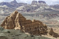
A final image from the Lower South Desert area - weak color again.
After visiting these formations, I drove on to the Cathedral Valley campground where I overnighted. The next morning I captured some images near the campsite and in Upper Cathedral Valley, which haven't been processed yet, and proceeded on to the Lower Valley.
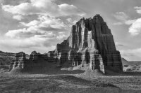
The Temple of the Sun in the Lower Cathedral Valley area. On this one I took out the color (using Silver Effex Pro). Just channeling my inner Ansel as we all must do from time to time.
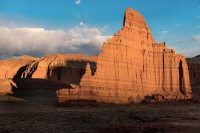
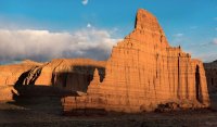
Sunset capture of The Temple of the Moon. The two temples are close together; this shot and the black and white image above were taken from the same hill behind the Temples. The Temple of the Sun is the larger of the two by a considerable margin. By the time I took these, the other two cars that came through during the afternoon had left and there was no sign of humanity (other than the dirt roads and three small wooden signs) within view, and you could see a very long way from that hilltop.
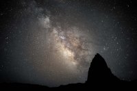
The Milky Way and stars behind the Temple of the Sun. This shot was my number one goal in visiting this area of the Park. I brought along a 24mm f/1.4 lens and a 5D Mark iii to be able to capture this quickly enough to mostly freeze the stars while getting enough light to show the Milky Way. There is a little motion that you can see at full size, and a couple of small streaks that may be planes or meteors (or satellites?).
Based on advice from the Rangers, I adjusted my schedule to have a clear night, which clearly worked out as you can see (and I also benefitted from the 25 degree low which both made it even clearer and eventually mad my feet numb and from the fact we were within one day of the new moon). Over and above timing, this is a very dark area in general - there was probably no one within 15 or 20 miles when I took the shot, and the nearest town is more like 30 miles away (and has under 200 residents). It was a hassle in some ways getting the image but I feel it was worth it. I also really enjoyed the quiet and sense of solitude you get being in a place like this; it's a very different feel than the everyday atmosphere back here in NYC.
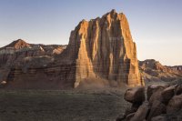
Temple of the Sun at sunrise, from a hill on the other side of the Temples.
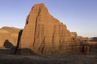
Temple of the Moon, also at sunrise from the same hill.
Finally, I headed South from Highway 24 to visit the Waterpocket District. I followed the Notom-Bullfrog Road down to camp at the Cedar Mesa campgrounds and then proceeded onto the Burr Trail Road to get to a trail where I could get an overlook of the Waterpocket Fold that gave rise to this Park.
A few shots from the the Southern part of the Park are included below:
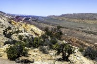
Waterpocket Fold, looking North - you have to drive all the way down the spine of this valley to get here from highway 24. This fold, which resulted from two continents colliding long ago, is geologically significant and was one basis for identifying the Park itself as important to preserve. In person this appears as distinctive as it seems in these shots - you can tell that some extraordinary force was needed to create a seam as large and uniform as the fold.
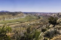
The Waterpocket Fold looking South. I also did a pano that combines these views with some central views, but I'll never get it past the image size limits on bits.
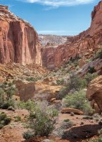
Entrance to a Canyon on the front side of the Southern part of the Park.
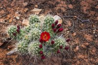
Desert cactus flower brought out by rain we got on my third day here. I saw a variety of wild flowers during the trip, along with some mule deer, marmots, and the occasional lizard (as well as a number of birds). Otherwise, the desert conditions limited the number of animals and plants in the Park - another factor on the quiet that descended when the wind died down. There are reportedly a few mountain lions in the Park, but they're rarely seen and tend to be around the areas where the deer feed.
Overall I was delighted with this trip. The timing was good – the crowds were very light on most trails since it was early in the season and, though a touch chilly, the temperatures were highly preferable to the 100+ temperatures you’d find here in the summer. The Park itself is amazing: very large, lots of good trails, more photographic opportunities than I could take advantage of during nine days, and the fewest people of any of the Utah National Parks. And, as usual, the Park Rangers were very well informed, very helpful, and always friendly.
I plan to go back, perhaps during the fall to get fall colors (and again avoid the temperatures of the summer).
Featured image for home page:
Six of the nine nights were spent in a tent, three in the Fruita campground, one in the Cathedral Valley campground, one near the Temples of the Sun / Moon, and one in the Cedar Mesa campground. The settings were great, but the temperatures were well below average with lows in the 20s and a couple of nights with high winds. Luckily, my gear was adequate to the challenge.
To get a campsite, you have to get to the Fruita site by noon or so even in April but the other two were sparsely populated at that time.
Starting from the Fruita site, I explored the central section of the Park. The photos in the first group were taken around on various trails during those days, with each shot described along with the corresponding image below:

The Castle, a rock formation visible from Highway 24 and the Visitor Center

A hoodoo in Cohab Canyon, a trail accessible from the Fruita Campgrounds.

Hickman Arch, accessed via a trail originating along Highway 24.

Cassidy Bridge, which can be reached by taking the Frying Pan trail which interconnects with the Cohab Canyon Trail. The bridge was named after Butch Cassidy, who may have hidden out in this area back in the day though the tentative wording I saw in a few places makes me suspect that this was at best apocryphal and at worst marketing hype.

Farm and house from the Gifford Homestead, one of the family farms established in the area long before it became a Park. There is a store in the house which sells some great baked goods, including six-inch pies that make a great lunch if you plan to hike off the calories during the afternoon.

Chimney Rock, a formation near Highway 24 where it enters the Park. One trail ascends the formation behind Chimney Rock to give you a view from above; this image was taken from the back as the trail re-emerged prior to ending back at the parking area.

A mesa in the valley behind Chimney Rock viewable from the trail, which can be seen leading toward the mesa.
I next moved on to Cathedral Valley. To explore the Valley you drive around a 57 mile sometimes rough 4WD road that takes you North from Highway 24. Parts aren't bad, but the section near the campsite seems to be made up mostly of 8-inch rocks that shake your car pretty fiercely. Due to repeated photo opportunity stops, I spent most of three days completing the loop with a stop at the campgrounds and an overnight near the Temples of the Sun and Moon.
Although the Park doesn’t give permits to camp near the Temples, they advise you that the boundary of the Bureau of Land Management property is only a mile away and there is no restriction on camping there. Being able to stay nearby overnight was important to me since I planned to capture sunset, sunrise and star shots in this area so I didn't want to have to hike or drive too far away.
The shots from the Cathedral Valley loop drive are included below:

The rusted-out cab of an abandoned water drilling truck that you pass on the way into Cathedral Valley. This was captured as three bracketed shots that were manually balanced and merged in Photoshop (I tried PhotoMatix Pro and automated Photoshop HDR tools, but it came out looking like a sic-fi prop).

The Bentonite Hills that you also pass on the way into the Valley. These were formed from clay that resulted from volcanic activity back in the days of the dinosaurs. The gentle, smooth slopes are a contrast to the sharp angles and steep cliffs that mostly make up the Park.

A first view of rock formations in the Lower South Desert section of the Valley. This and a couple of the other images seemed to lose a lot of their red tones as they were uploaded - I guess there is a color space / mapping issue that I need to investigate...

A closer view of some of the Lower South Desert formations - this seems to have kept its color better.

A closeup of Jailhouse Rock, the large formation on the right of the firstLower South Desert shot above.

A final image from the Lower South Desert area - weak color again.
After visiting these formations, I drove on to the Cathedral Valley campground where I overnighted. The next morning I captured some images near the campsite and in Upper Cathedral Valley, which haven't been processed yet, and proceeded on to the Lower Valley.

The Temple of the Sun in the Lower Cathedral Valley area. On this one I took out the color (using Silver Effex Pro). Just channeling my inner Ansel as we all must do from time to time.

Sunset capture of The Temple of the Moon. The two temples are close together; this shot and the black and white image above were taken from the same hill behind the Temples. The Temple of the Sun is the larger of the two by a considerable margin. By the time I took these, the other two cars that came through during the afternoon had left and there was no sign of humanity (other than the dirt roads and three small wooden signs) within view, and you could see a very long way from that hilltop.

The Milky Way and stars behind the Temple of the Sun. This shot was my number one goal in visiting this area of the Park. I brought along a 24mm f/1.4 lens and a 5D Mark iii to be able to capture this quickly enough to mostly freeze the stars while getting enough light to show the Milky Way. There is a little motion that you can see at full size, and a couple of small streaks that may be planes or meteors (or satellites?).
Based on advice from the Rangers, I adjusted my schedule to have a clear night, which clearly worked out as you can see (and I also benefitted from the 25 degree low which both made it even clearer and eventually mad my feet numb and from the fact we were within one day of the new moon). Over and above timing, this is a very dark area in general - there was probably no one within 15 or 20 miles when I took the shot, and the nearest town is more like 30 miles away (and has under 200 residents). It was a hassle in some ways getting the image but I feel it was worth it. I also really enjoyed the quiet and sense of solitude you get being in a place like this; it's a very different feel than the everyday atmosphere back here in NYC.

Temple of the Sun at sunrise, from a hill on the other side of the Temples.

Temple of the Moon, also at sunrise from the same hill.
Finally, I headed South from Highway 24 to visit the Waterpocket District. I followed the Notom-Bullfrog Road down to camp at the Cedar Mesa campgrounds and then proceeded onto the Burr Trail Road to get to a trail where I could get an overlook of the Waterpocket Fold that gave rise to this Park.
A few shots from the the Southern part of the Park are included below:

Waterpocket Fold, looking North - you have to drive all the way down the spine of this valley to get here from highway 24. This fold, which resulted from two continents colliding long ago, is geologically significant and was one basis for identifying the Park itself as important to preserve. In person this appears as distinctive as it seems in these shots - you can tell that some extraordinary force was needed to create a seam as large and uniform as the fold.

The Waterpocket Fold looking South. I also did a pano that combines these views with some central views, but I'll never get it past the image size limits on bits.

Entrance to a Canyon on the front side of the Southern part of the Park.

Desert cactus flower brought out by rain we got on my third day here. I saw a variety of wild flowers during the trip, along with some mule deer, marmots, and the occasional lizard (as well as a number of birds). Otherwise, the desert conditions limited the number of animals and plants in the Park - another factor on the quiet that descended when the wind died down. There are reportedly a few mountain lions in the Park, but they're rarely seen and tend to be around the areas where the deer feed.
Overall I was delighted with this trip. The timing was good – the crowds were very light on most trails since it was early in the season and, though a touch chilly, the temperatures were highly preferable to the 100+ temperatures you’d find here in the summer. The Park itself is amazing: very large, lots of good trails, more photographic opportunities than I could take advantage of during nine days, and the fewest people of any of the Utah National Parks. And, as usual, the Park Rangers were very well informed, very helpful, and always friendly.
I plan to go back, perhaps during the fall to get fall colors (and again avoid the temperatures of the summer).
Featured image for home page:


