New Hance - Tonto - Grandview loop (Grand Canyon NP)

fossana

Member
Joined
Jan 11, 2018
Messages
855
DSC00404.jpg

My Tucson trip failed to happen due to a 3-day migraine, which I like to blame on premonition of the Barr summary (that's not really a summary) of the Mueller report. Clearly I needed to destress with a backcountry excursion. I had originally planned to do Deer Creek/Thunder River on the N Rim of the Grand Canyon, so I called the Kaibab ranger station, who reported that the dirt roads were fine up to Big Springs, but they weren't sure beyond that. I packed a shovel and various traction devices into my 4WD vehicle, and headed out late Friday afternoon. As expected the roads were fine up to Big Springs, but the shady hill immediately after was covered with 8"+ of wet snow, and I did not want to get stuck or try to back down the hill in the slick conditions.

Fortunately, I had brought along a plan B topo map/trail description and my cross bike for New Hance/Grandview. My side trip had wasted only a little over an hour, so I still had time to make it to the S rim before it got too late.

Logistics
Start/end: I started and finished at the Grandview Point, riding my bike to avoid the 5.5 mile pavement section to New Hance trailhead. You could do it either direction. It's mostly downhill to New Hance, but you'll make it up on the trail. New Hance trailhead is unmarked and parking is not allowed there. See the NP link for alternate parking arrangements.
Mileage: ~21 miles trail + 5.5 mile bike shuttle
Elevation gain: 5700 ft+
Difficulty: class 2 (a few 3ish spots)
Navigation: Map useful since some of the trails/junctions aren't marked. Some cairns.
Filterable water: Page Spring, Hance Creek and Colorado River
Designation: Grand Canyon NP
Fees: NP park fee (currently $35 for a week)
Nearest town/gas: Cameron, AZ
Date hiked: 30 Mar 2019
References: NP's trail descriptions for
New Hance, Grandview

note: The route is in the Grand Canyon no fly zone, so no annoying tourist helicopters buzzing overhead.

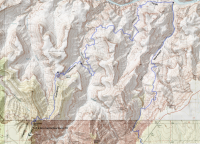
Approximate Route
map.png

History
Hance Creek and trail were named after John Hance, the first white person to settle at the Grand Canyon. If you look closely at the map, you'll notice that New Hance trail goes nowhere near Hance Canyon drainage, but instead descends Red Canyon. The original Hance trail was rerouted due to erosion. Much of the trails in the area are old mining trails with some of mining relics (and contamination) still intact.

Trip Report
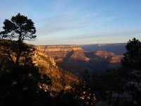
After a restless night, I woke up to 24F temps, scraped the frost off my windows, and headed to Grandview Point to drop off my car. It was sunrise and there were ~6 cars in the lot to catch first light on the canyon. I was hoping that the park's spring break madness warning didn't extend to the more obscure trails.
DSC00351.jpg


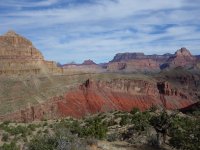
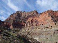
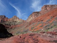
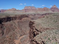
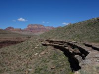
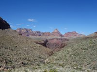
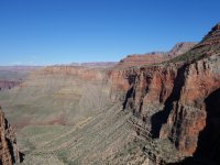
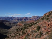
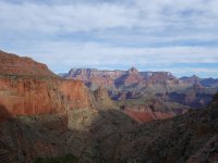
I had neglected to bring my red blinky bike light, so stalled until the sun rose before I began the chilly downhill ride to New Hance trailhead. I locked my bike to a tree, and tried to regain the feeling in my toes. New Hance dropped off steeply, with fun exposed trails and minor scrambles. Fortunately, the trail was completely dry. I quickly warmed up, and took in the expansive views. The upper trail was loose and heads-up, so the flatter lower sections provided a welcome break.
DSC00371.jpg DSC00374.jpg DSC00381.jpg DSC00384.jpg DSC00397.jpg

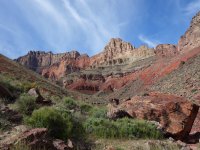
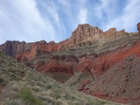
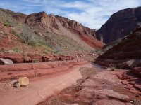
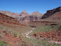
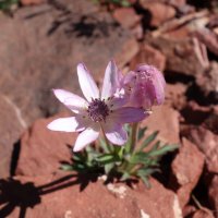
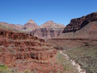
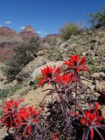
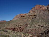
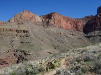
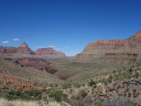
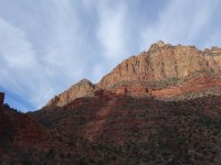
Eventually the trail dropped into Red Canyon proper. With striking stepped red walls, it was obvious from where it got its name. With the lower elevation and warmer temps, more wildflowers were in bloom. There was some water left in the canyon, but I still had plenty in my pack. Before too long I reached the Colorado River and the unsigned junction with Tonto trail. 3 rafts passed over Hance Rapids just as I approached.
DSC00398.jpg DSC00404.jpg DSC00407.jpg DSC00411.jpg DSC00421.jpg

Almost immediately Tonto trail began to gain elevation instead of following the shoreline. The Colorado soon went out of view. The trail contoured along the ledges and headed the dry Mineral Canyon.
DSC00427.jpg DSC00431.jpg DSC00447.jpg DSC00449.jpg DSC00452.jpg


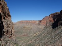
The next major canyon is hard to miss. Hance Creek canyon is deep and the trail precipitously skirts its eastern rim. It is possible to ascend Hance Canyon instead of the trail, but I suspect you'd want to approach from the west on Tonto trail (out of way for today's trip). The trail followed a ledge system to where it was possible to cross the canyon. There was only 1 tent in the wash, but as I later learned from multiple inquiries, it appeared to be a popular place to camp.
DSC00487.jpg DSC00496.jpg DSC00504.jpg DSC00509.jpg


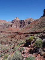
After a snack and filtering water I started up the long climb to the canyon rim. After a short distance I left Tonto trail for the signed, but unnamed connector to Horseshoe Mesa.
DSC00528.jpg DSC00530.jpg DSC00532.jpg DSC00535.jpg DSC00540.jpg


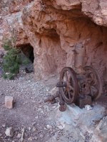
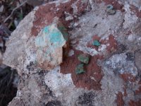
As I climbed higher I could see tailings piles, and there was an old wheelbarrow at the Page Spring junction. I also started noticing bits of malachite and azurite in the gravel. Near the top of the mesa was more mining equipment and a closed off mine shaft.
DSC00551.jpg DSC00555.jpg DSC00558.jpg DSC00561.jpg


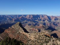
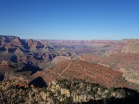
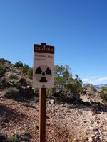
I topped out on Horseshoe Mesa to radiation contamination signs, a few people, and the disappointing fact that I still had 2400 ft more to ascend. The climbs on this portion were steep at times, and I was feeling the 18 miles I had traveled earlier in the day. Part way up the hill I felt myself bonking, and stopped for a snack. A false summit put me at a precipitous saddle, sigh, I continued on. Near the top I started to hit small patches of snow, fortunately not icy. Finally I reached the rim at Grandview Point and found myself surrounded by selfie sticks and the car touring crowd. I retrieved my bike, grabbed a sandwich, and headed home for cat pets, a shower, and a decent night's sleep.
DSC00562.jpg DSC00566.jpg DSC00581.jpg DSC00586.jpg
 
Wow!!! You are inspirational, it’s really incredible what you can do in one day. This is the first TR, where I sense you were getting tired at the end of the hike. How is your spine and knees doing today after such a steep descend? Did it flare up any sciatica pinching? Great TR and I loved seeing the photos too.
 
View attachment 76351

My Tucson trip failed to happen due to a 3-day migraine, which I like to blame on premonition of the Barr summary (that's not really a summary) of the Mueller report. Clearly I needed to destress with a backcountry excursion. I had originally planned to do Deer Creek/Thunder River on the N Rim of the Grand Canyon, so I called the Kaibab ranger station, who reported that the dirt roads were fine up to Big Springs, but they weren't sure beyond that. I packed a shovel and various traction devices into my 4WD vehicle, and headed out late Friday afternoon. As expected the roads were fine up to Big Springs, but the shady hill immediately after was covered with 8"+ of wet snow, and I did not want to get stuck or try to back down the hill in the slick conditions.

Fortunately, I had brought along a plan B topo map/trail description and my cross bike for New Hance/Grandview. My side trip had wasted only a little over an hour, so I still had time to make it to the S rim before it got too late.

Logistics
Start/end: I started and finished at the Grandview Point, riding my bike to avoid the 5.5 mile pavement section to New Hance trailhead. You could do it either direction. It's mostly downhill to New Hance, but you'll make it up on the trail. New Hance trailhead is unmarked and parking is not allowed there. See the NP link for alternate parking arrangements.
Mileage: ~21 miles trail + 5.5 mile bike shuttle
Elevation gain: 5700 ft+
Difficulty: class 2 (a few 3ish spots)
Navigation: Map useful since some of the trails/junctions aren't marked. Some cairns.
Filterable water: Page Spring, Hance Creek and Colorado River
Designation: Grand Canyon NP
Fees: NP park fee (currently $35 for a week)
Nearest town/gas: Cameron, AZ
Date hiked: 30 Mar 2019
References: NP's trail descriptions for
New Hance, Grandview

note: The route is in the Grand Canyon no fly zone, so no annoying tourist helicopters buzzing overhead.

Approximate Route
View attachment 76377

History
Hance Creek and trail were named after John Hance, the first white person to settle at the Grand Canyon. If you look closely at the map, you'll notice that New Hance trail goes nowhere near Hance Canyon drainage, but instead descends Red Canyon. The original Hance trail was rerouted due to erosion. Much of the trails in the area are old mining trails with some of mining relics (and contamination) still intact.

Trip Report
After a restless night, I woke up to 24F temps, scraped the frost off my windows, and headed to Grandview Point to drop off my car. It was sunrise and there were ~6 cars in the lot to catch first light on the canyon. I was hoping that the park's spring break madness warning didn't extend to the more obscure trails.
View attachment 76344


I had neglected to bring my red blinky bike light, so stalled until the sun rose before I began the chilly downhill ride to New Hance trailhead. I locked my bike to a tree, and tried to regain the feeling in my toes. New Hance dropped off steeply, with fun exposed trails and minor scrambles. Fortunately, the trail was completely dry. I quickly warmed up, and took in the expansive views. The upper trail was loose and heads-up, so the flatter lower sections provided a welcome break.
View attachment 76345 View attachment 76346 View attachment 76347 View attachment 76348 View attachment 76349

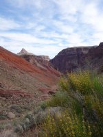
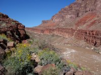
Eventually the trail dropped into Red Canyon proper. With striking stepped red walls, it was obvious from where it got its name. With the lower elevation and warmer temps, more wildflowers were in bloom. There was some water left in the canyon, but I still had plenty in my pack. Before too long I reached the Colorado River and the unsigned junction with Tonto trail. 3 rafts passed over Hance Rapids just as I approached.
View attachment 76350 View attachment 76351 View attachment 76352 View attachment 76353 View attachment 76354

Almost immediately Tonto trail began to gain elevation instead of following the shoreline. The Colorado soon went out of view. The trail contoured along the ledges and headed the dry Mineral Canyon.
View attachment 76355 View attachment 76356 View attachment 76357 View attachment 76358 View attachment 76359


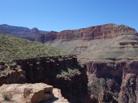
The next major canyon is hard to miss. Hance Creek canyon is deep and the trail precipitously skirts its eastern rim. It is possible to ascend Hance Canyon instead of the trail, but I suspect you'd want to approach from the west on Tonto trail (out of way for today's trip). The trail followed a ledge system to where it was possible to cross the canyon. There was only 1 tent in the wash, but as I later learned from multiple inquiries, it appeared to be a popular place to camp.
View attachment 76361 View attachment 76362 View attachment 76363 View attachment 76364


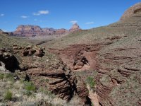
After a snack and filtering water I started up the long climb to the canyon rim. After a short distance I left Tonto trail for the signed, but unnamed connector to Horseshoe Mesa.
View attachment 76365 View attachment 76366 View attachment 76367 View attachment 76368 View attachment 76369


As I climbed higher I could see tailings piles, and there was an old wheelbarrow at the Page Spring junction. I also started noticing bits of malachite and azurite in the gravel. Near the top of the mesa was more mining equipment and a closed off mine shaft.
View attachment 76370 View attachment 76371 View attachment 76390 View attachment 76372


I topped out on Horseshoe Mesa to radiation contamination signs, a few people, and the disappointing fact that I still had 2400 ft more to ascend. The climbs on this portion were steep at times, and I was feeling the 18 miles I had traveled earlier in the day. Part way up the hill I felt myself bonking, and stopped for a snack. A false summit put me at a precipitous saddle, sigh, I continued on. Near the top I started to hit small patches of snow, fortunately not icy. Finally I reached the rim at Grandview Point and found myself surrounded by selfie sticks and the car touring crowd. I retrieved my bike, grabbed a sandwich, and headed home for cat pets, a shower, and a decent night's sleep.
View attachment 76373 View attachment 76374 View attachment 76375 View attachment 76376

Way to go!
 
@Titans Thanks for asking. No sciatica, just slightly sore quads and hip flexors. Running, even a few miles, is the only thing that reliably makes my sciatica flare up now.
 
That's a hard core day hike! Very awesome. And great to see the flowers in bloom.

I did an out-and-back from Grandview Point to Horseshoe Mesa a few weeks ago and was very pleased I limited myself to those 6 miles. That hike up was brutal. Hell, it was brutal on the way down too, just with the strain it puts on a person's knees. And it was very icy/snowy on the upper 1/3.

I was hoping that the park's spring break madness warning didn't extend to the more obscure trails.
My trip was during a major college spring break weekend, and we only came across 3 or 4 groups on that Grandview Point/Horseshoe Mesa hike. I was surprised.
 
Goodness...you are hardcore! Hah
Love the views and flowers! Thanks for sharing!
 

Similar threads

Back
Top