Kullaberg63
Member
- Joined
- Mar 6, 2014
- Messages
- 683
Sunday's hike with wife and kid was in the Needles district.
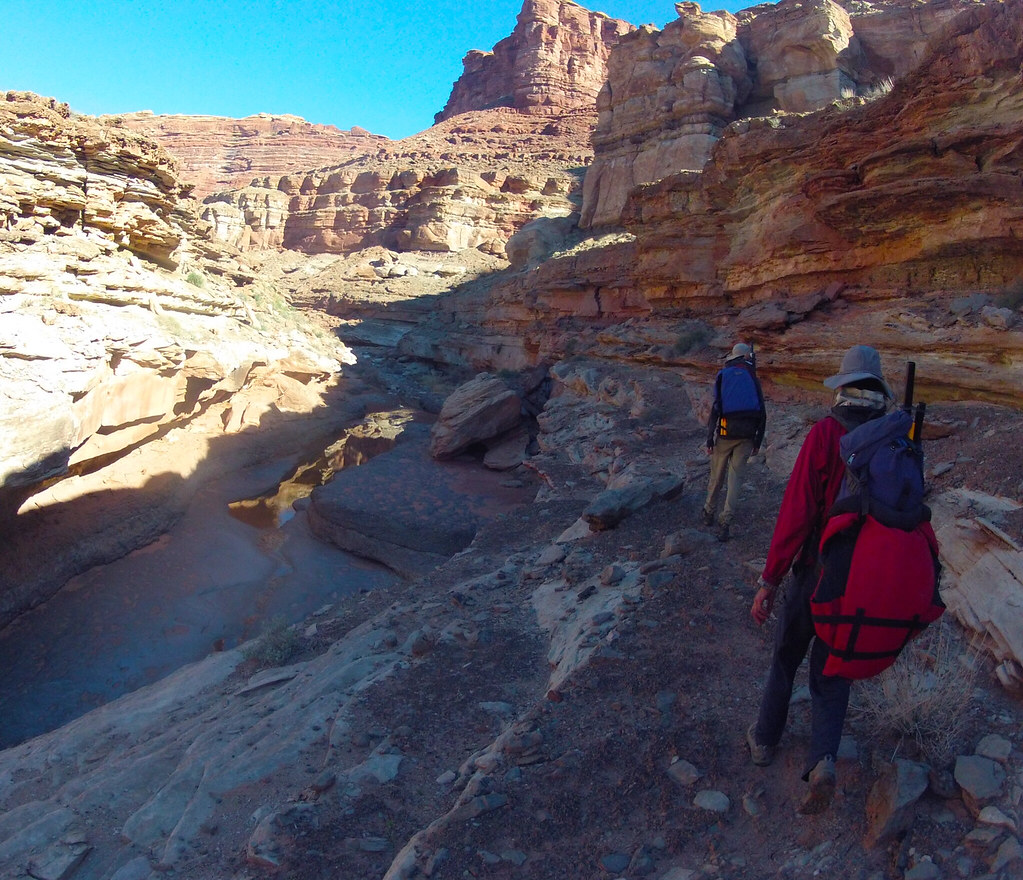
image by kullaberg631, on Flickr
We started at the end of the road by the Confluence trailhead. After a few minuutes we veered off the trail right into Big Spring Canyon. Crisp morning air and abundant water made for pleasant hiking, with the odd minor obstacle thrown in now and then.
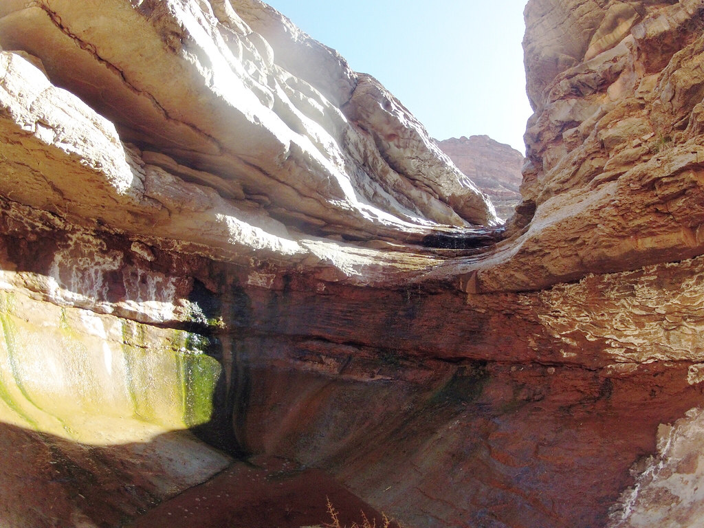
image by kullaberg631, on Flickr
This slimy little descent on polished wet limestone was tricky. No anchors above, but also without huge consequences if one slipped (which some of us did), except getting soaked as the landing was a deep pothole.
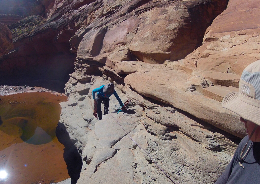
image by kullaberg631, on Flickr
A little downstream of the confluence between Big Spring and Salt Creek was the only halfway serious hinderance to reaching the Colorado River: a 40' pour off. Here Sonja is rigging the anchor, a couple of rusty 1/4" bolts, with a backup piece of fresh webbing.
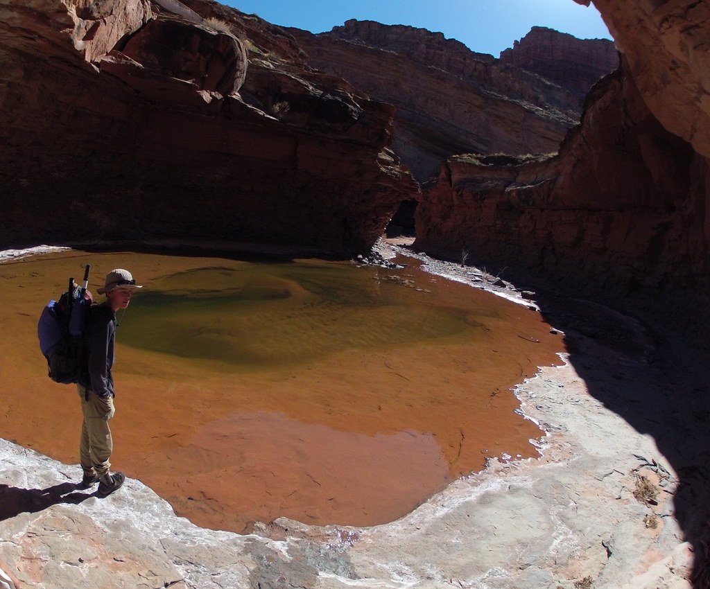
image by kullaberg631, on Flickr
The serene pool below the rap.
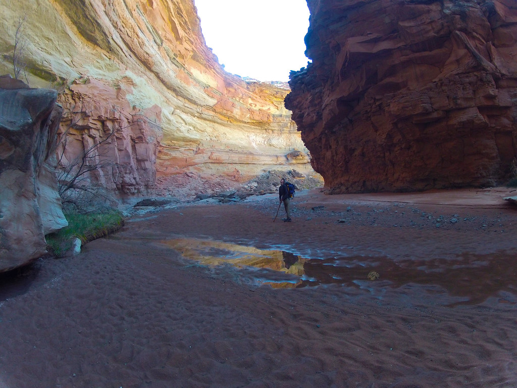
image by kullaberg631, on Flickr
Lower Salt is deep and scoured clean by the huge floods coming down this long drainage. Here we are less than a mile from the river.
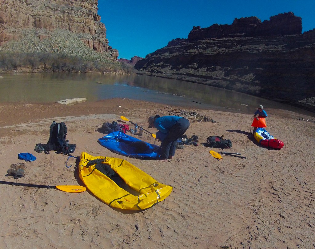
image by kullaberg631, on Flickr
Getting to water's edge was simple with no impenetrable tamarisk thickets or expansive mudflats. Rigging our packrafts at this sunny open beach was a joy compared to the typical fare.
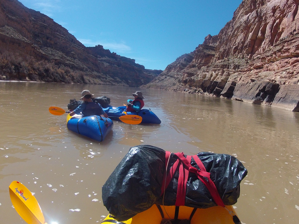
image by kullaberg631, on Flickr
The float in the frigid runoff was about 4 miles and featured the Slide, probably the only ripple between Moab and Spanish Bottom. Not pictured, but it was pretty exciting.
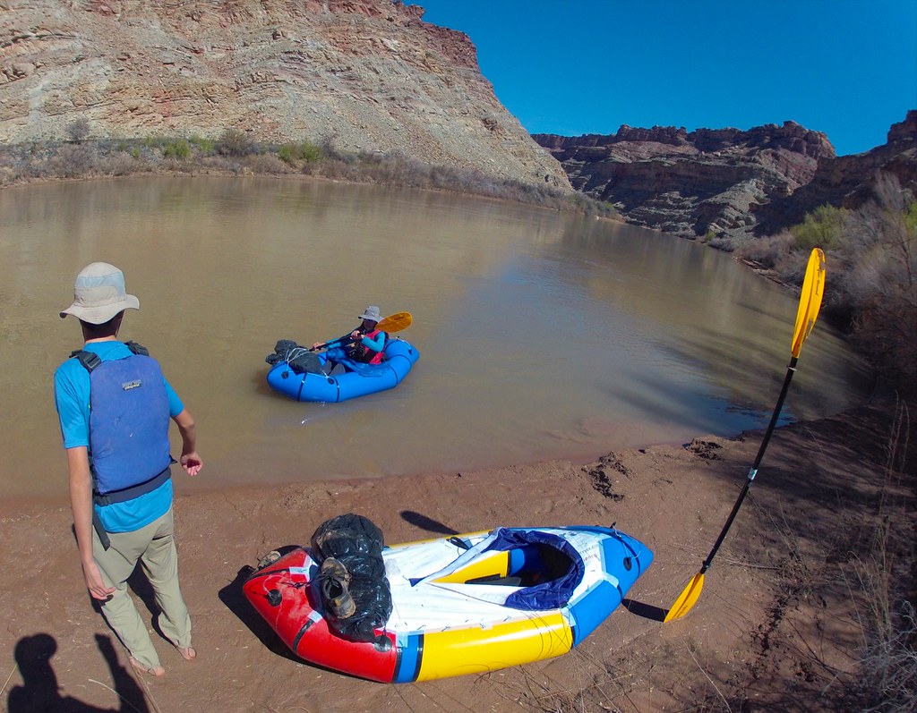
image by kullaberg631, on Flickr
At a spot just upstream of the confluence between the Green and the Colorado we scoped out a break in the canyon walls the we hoped would lead to the top. We landed here, packed up and started scrambling up.
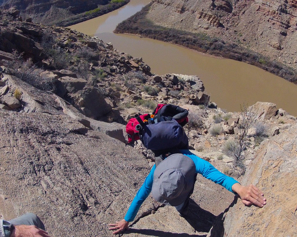
image by kullaberg631, on Flickr
The route was steep and scenic. It lead up talus, exposed ramps and little walls. Here Sonja is grappling with one of the little problems.
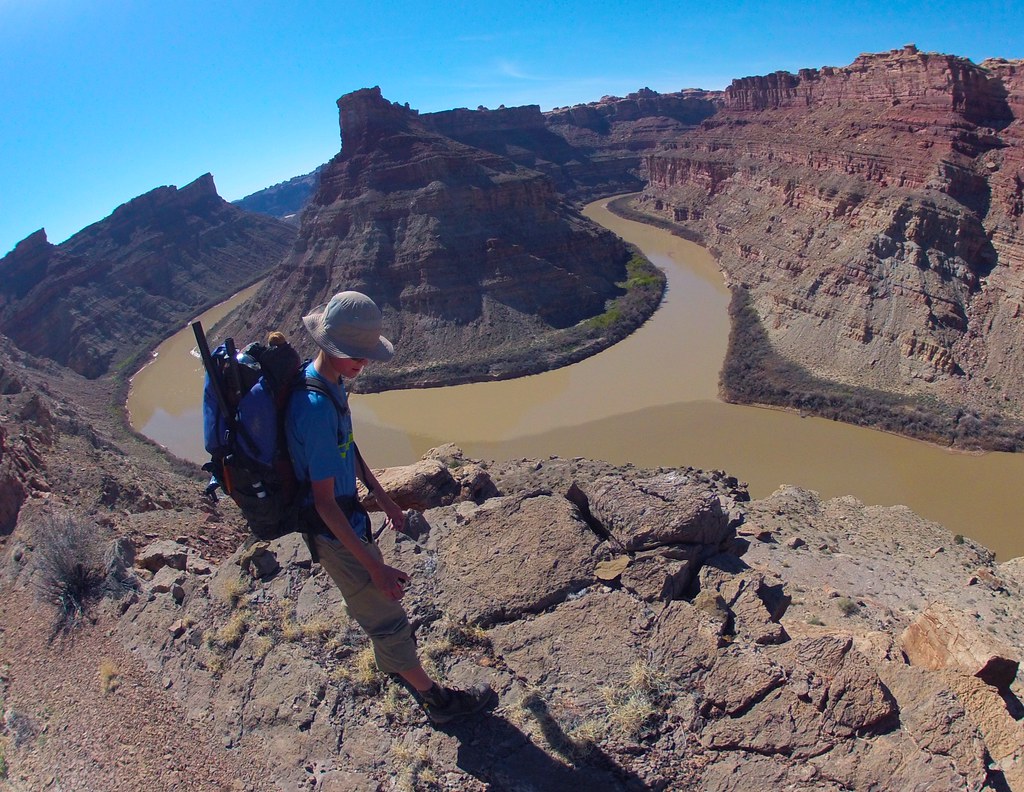
image by kullaberg631, on Flickr
This was a pretty good view of the Confluence. Bjorn posing.
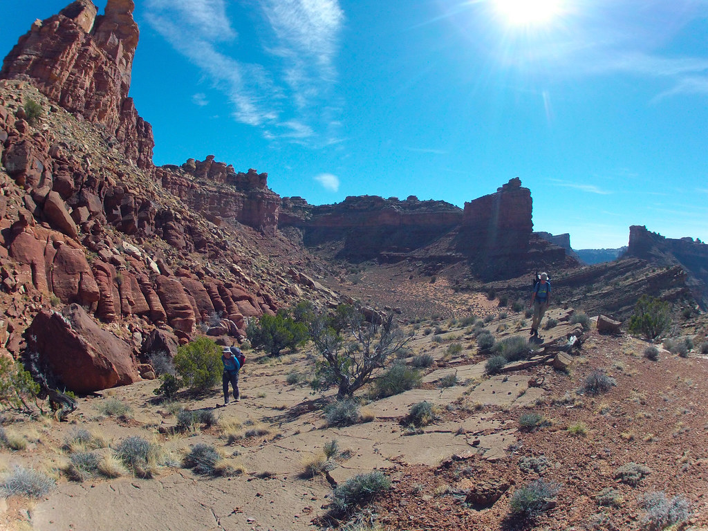
image by kullaberg631, on Flickr
Up higher we encountered hard to follow cairns leading us on a circuitous route around a multitude of buttresses and benches before getting us safely deposited on the maintained Confluence trail, which in turn took us back to the start.
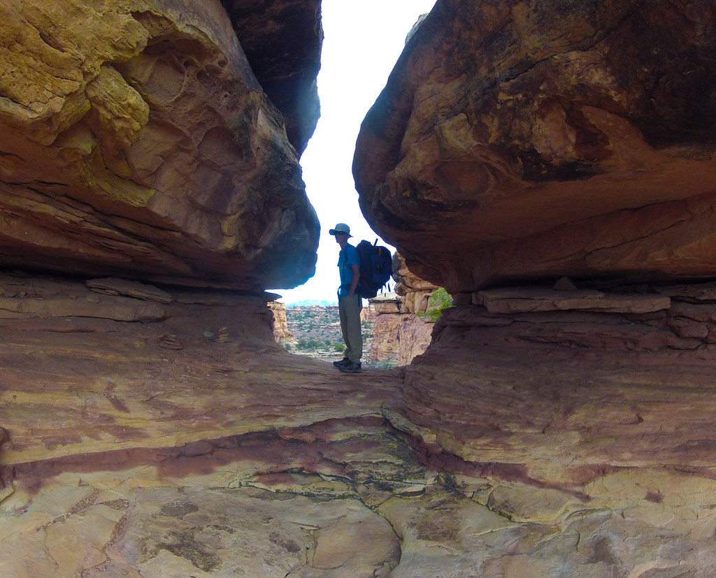
image by kullaberg631, on Flickr
Near the finish.
Featured image for home page:

image by kullaberg631, on Flickr
We started at the end of the road by the Confluence trailhead. After a few minuutes we veered off the trail right into Big Spring Canyon. Crisp morning air and abundant water made for pleasant hiking, with the odd minor obstacle thrown in now and then.
image by kullaberg631, on Flickr
This slimy little descent on polished wet limestone was tricky. No anchors above, but also without huge consequences if one slipped (which some of us did), except getting soaked as the landing was a deep pothole.
image by kullaberg631, on Flickr
A little downstream of the confluence between Big Spring and Salt Creek was the only halfway serious hinderance to reaching the Colorado River: a 40' pour off. Here Sonja is rigging the anchor, a couple of rusty 1/4" bolts, with a backup piece of fresh webbing.
image by kullaberg631, on Flickr
The serene pool below the rap.
image by kullaberg631, on Flickr
Lower Salt is deep and scoured clean by the huge floods coming down this long drainage. Here we are less than a mile from the river.
image by kullaberg631, on Flickr
Getting to water's edge was simple with no impenetrable tamarisk thickets or expansive mudflats. Rigging our packrafts at this sunny open beach was a joy compared to the typical fare.
image by kullaberg631, on Flickr
The float in the frigid runoff was about 4 miles and featured the Slide, probably the only ripple between Moab and Spanish Bottom. Not pictured, but it was pretty exciting.
image by kullaberg631, on Flickr
At a spot just upstream of the confluence between the Green and the Colorado we scoped out a break in the canyon walls the we hoped would lead to the top. We landed here, packed up and started scrambling up.
image by kullaberg631, on Flickr
The route was steep and scenic. It lead up talus, exposed ramps and little walls. Here Sonja is grappling with one of the little problems.
image by kullaberg631, on Flickr
This was a pretty good view of the Confluence. Bjorn posing.
image by kullaberg631, on Flickr
Up higher we encountered hard to follow cairns leading us on a circuitous route around a multitude of buttresses and benches before getting us safely deposited on the maintained Confluence trail, which in turn took us back to the start.
image by kullaberg631, on Flickr
Near the finish.
Featured image for home page:
Last edited: