chandlerwest
Member
- Joined
- Feb 7, 2015
- Messages
- 550
When @Scott Chandler moved to Moab in the spring of 2017 I felt it was going to be a great opportunity to spend some time in the area. Then the reality that it is an over 700 miles round trip set in. I finally decided it was time. I looked into what there was that I could do in the Needles District of Canyonlands. On paper it looked within my skill set to do a 15 mile loop. I asked Scott if I might be biting off more than I can chew. After all it is the topography of The Needles and it was bound to be hot because I didn't want to wait until the fall because it would be easier for me to back out if I put it off. I interpreted his lack of critical response as....he wanted to really do this route also. So off I went on a 4 night 3 day visit.
I had time to use before Scott got home from work so I drove into Arches National Park. There was a little hike that I never took the time to explore. So I can cross that off my list.
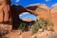
Broken Arch
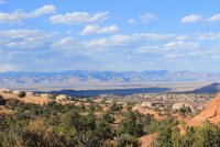
View to the northeast
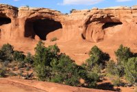
Tapestry Arch
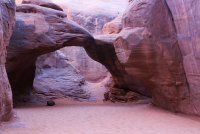
Sand Dune Arch
The next morning we arose at 5:00AM so that we could hit the trail at first light. Our trip would first take us to Druid Arch, then up the slope and over the hill (what a simplification) to Chesler Park, through The Joint, and back up to Chesler Park, then back to the car.
We hit the trail at 7:00AM. Wonderful morning light and temperatures.
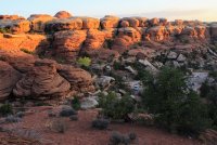
The La Sal Mountains looking crisp on the horizon
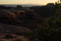
One of the Six Shooters tucked in the elbow of the rocks.
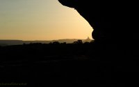
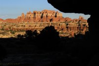
Looking over towards the Island in the Sky District of Canyonlands.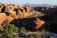
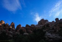
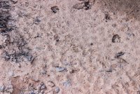
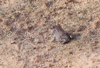
We came across a moist sandy area and saw movement. At first we thought they were simply big flies but closer examination saw "they're toads!!!!!" Little tiny Red Spotted Toads. At most they were 3/4 of an inch long. When we moved they would scurry back under the ledge but shortly come hopping back out. Eating the tinier knat-like bugs.
Can you see the toad in this shot? A little right of center.
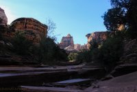
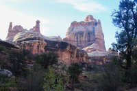
We make our way up Elephant Canyon toward Druid Arch.
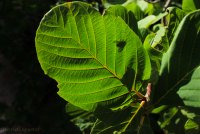
I just thought this would be a simple backlit leaf picture but I got home and went....."there's a fly on the back"
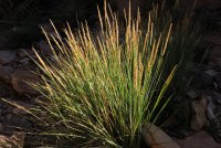
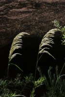
Even the autumn grasses were putting on a nice show
In January 2016 this was an icy slope that caused Scott to get creative to get around. He showed me how he went. All I could think was it must have looked more open with a layer of snow on it. I had one of those retroactive holy shit moments for his plight.
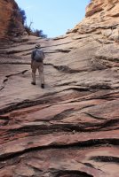
When you approach Druid Arch you only get this nose shot. Then it disappears. Then you have to grind up this boulder slope to actually see it. I told Scott that I did a good job of not realizing that this was how it was to get to Druid.
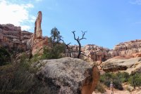
Druid Arch
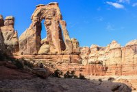
I had seen the shot back down Elephant Canyon in other trip reports. To be honest I was more excited about getting to the arch just for this shot! I find it other worldly. That our route in is essentially underground in this picture.
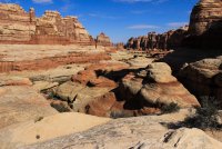
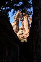
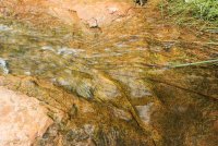
Then I turn to the right and I see this stair step wall/shelf.....wonder. I would love to see how water flows over all this in a hard rain.
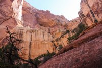
To me this destination had three awe inspiring, magical views. Definitely near the very top in lifetime destinations. I was beside myself with awe!!!
This is a view up the boulder slope we had to go up to get to this wonderful location.
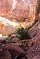
We then explored a short way around the other side of Druid Arch. It was a fight trying to get a shot because of the sun and surrounding rocks but we got a view.
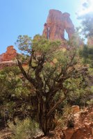
Making our way down Elephant Canyon
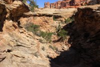
I was pleased with this "find". I was looking at the dark circle then I saw the light at the top of it. "That's an arch!"
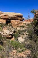
Something I thought was peculiar were seemingly ordinary plants that seemed to be much taller than usual. I said a few times "that plant is owning that cubic yard of area space." This is a single violet plant/bush/flower
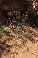
Then we made our way up and over the hill to Chesler Park. How it hung to the edge of the cliffs. Traversed narrow, to non-existent ledges. Weaving in and out. A Very creative trail!!!
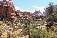
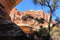
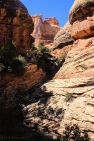
Scott's posture says it all. "What the heck?" We explored up the right nostril
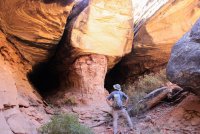
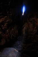
Making it up to the shelf we began wondering how we get through this wall.
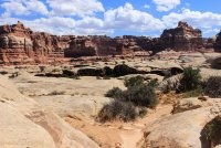
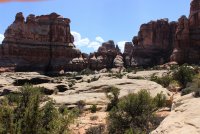
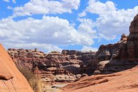
Chesler Park - We headed across the park toward "The Joint". The park is a great expanse of land surrounded by towering "Needles". It appears to have a weak spot off to the west but don't you believe it. That barrier is simply below sight level. By this time I was starting to feel the day weighing on me. Acutely aware that I had one liter less water than I wanted. Legs feeling like they weighed a hundred pounds. I asked myself "why am I better prepared then those poor souls who die coming out of the Wave every year." The only thing I could think of was "90's are better than over 100 degrees and.....I have Scott." At one point I asked him how much water he had hoping that he had more than I knew he had.
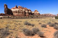
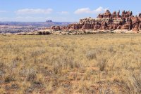
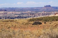
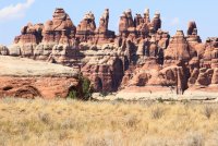
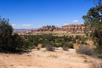
We sat down at this viewpoint for lunch and this guy flew in, like I am sure he has done hundreds of times in the past. It was quite patient and polite waiting for a handout. Eventually he flew off disappointed.
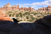
Off to "The Joint". The crack you see isn't the Joint but it is a similar structure. A crack in the earth that leaves Chesler Park.
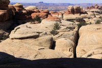
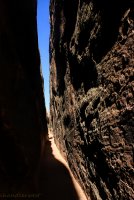
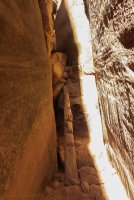
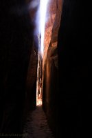
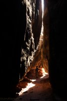
Both of us were amazed at how well the crypto soil was doing below The Joint. Seemed like acres!
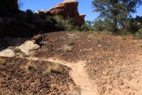
This is one of those "you had to have been there" stories" but I am going to tell it anyway. I was beat....sun beating down.....could not be farther from the car....blah blah blah. Scott was beginning to think that my glorious trip was imploding. We sat in the shade, in a creek full of sand. Scott gets out his map and reassures me that "yeah it will be tough getting back up to Chesler Park but after that it should be okay." I didn't TRY to say it like I did but it conveyed my emotions accurately. "I'll just be fine.... once we get back up to the MAGgical MAJesty of CHESler Park." Sardonic to the hilt. Scott came up with the word besmirching. He busted out laughing and I worked up a smirk. We started up the trail with me stopping a lot. To show how "off" I was I didn't even get a photo of a spot that is seared in my brain and has become a vital part of my tale. I came around a corner and saw Scott switchbacking up the tall slope/cliff. I plopped down on a rock and dropped my head. I somehow got up it only to come across this shot. Look at where the cairns go. Damn!
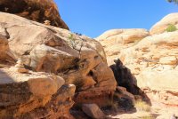
We approach this fortress of a wall and I mumble to myself. "There better be a door in that wall!"
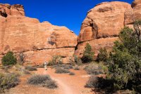
THE DOOR into Chesler Park. I perked right up!
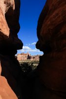
We sat on this spot for surely an hour. Enjoying the shade and bit of breeze. Happily I would have napped. My goal was to get through an entire Clif Bar. I didn't realize a person could eat so slow but I nibbled it all gone!!!!! What a view, which I saw mostly sideways as I relaxed.
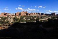
I was seeing the desert in a much brighter light when are restarted. Get it? Brighter light? Backlit tiny plant?
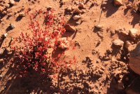
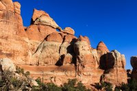
The incredible view to the north from the exit of Chesler Park. I reassured Scott that this is near the top of adventures that I have had.
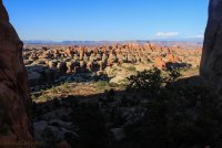
We got back to the car a bit after 8:00PM. What a day!
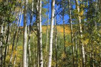
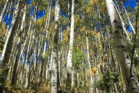
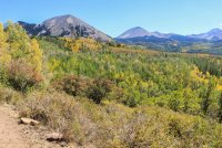
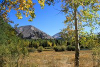
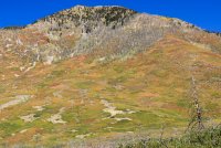
The next day we drove up into the La Sal Mountains to get away from the heat and hopefully see some fall foliage. We went to Warner Lake and hiked a short circle trail through the ever changing aspen.
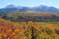
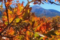
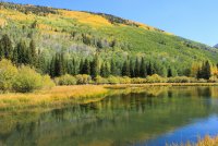
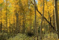
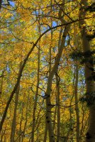
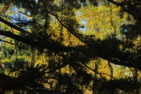
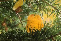
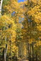
If Scott hadn't left me.....he would have had to drag me away from this mature stand of aspen. I just stood in awe.
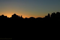
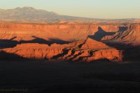
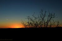
Later that night we drove up to Dead Horse Point State Park for the sunset. While there Scott presented me with a private Night Sky Program. He drug out his telescope and gave me a tour of the sky. Seeing Saturn.......oh my! He showed me a binary star where one was blue and the other white. I told him "that is a show stopper!" He is a pro at this because I believe I saw what he wanted to show me. Which is difficult at times because he is pointed out variations of black.
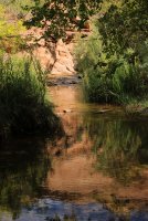
Our final day we hiked up Grandstaff Canyon to Morning Glory Bridge. This was a special trip because there was running water....in the desert.
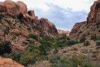
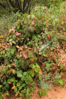
Poison Ivy got in on the fall foliage
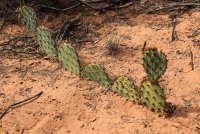
I included this next shot because when @Jeffrey Chandler saw it he exclaimed how it was the Chesler Park walls in a cactus.
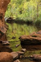
First view of Morning Glory Bridge
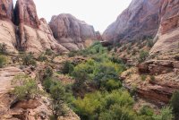
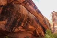
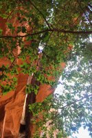
Making our way out
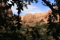
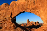
The last morning it was time for Scott to head back to work and for me to head home and pick up Jeff at school. I took in sunrise at The Windows in Arches National Park. I have see this spot in calendars and on poster but had never made my way up to it. I got away from the mass of people and scrambled up to the shelf where you can see Turret Arch through the North Window.
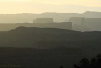
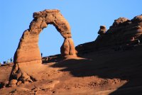
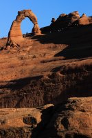
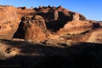
Then I drove over to something else I don't think I have ever taken the time to do. Hike the short trail to the Upper Viewpoint of Delicate Arch. At trails end I kept going across the slick rock to closer and grander perspectives of the environment where Delicate Arch sits. This location is definitely the place to see Delicate Arch early in the morning. On the main trail the arch is back lit or the sun is in your eyes.
It was wonderful sharing a few days and these experiences with my son. I hope you enjoyed my take on areas that are well travelled in BCP, yet deserving of another interpretation.
I had time to use before Scott got home from work so I drove into Arches National Park. There was a little hike that I never took the time to explore. So I can cross that off my list.
Broken Arch

View to the northeast

Tapestry Arch

Sand Dune Arch

The next morning we arose at 5:00AM so that we could hit the trail at first light. Our trip would first take us to Druid Arch, then up the slope and over the hill (what a simplification) to Chesler Park, through The Joint, and back up to Chesler Park, then back to the car.
We hit the trail at 7:00AM. Wonderful morning light and temperatures.

The La Sal Mountains looking crisp on the horizon

One of the Six Shooters tucked in the elbow of the rocks.


Looking over towards the Island in the Sky District of Canyonlands.


We came across a moist sandy area and saw movement. At first we thought they were simply big flies but closer examination saw "they're toads!!!!!" Little tiny Red Spotted Toads. At most they were 3/4 of an inch long. When we moved they would scurry back under the ledge but shortly come hopping back out. Eating the tinier knat-like bugs.
Can you see the toad in this shot? A little right of center.


We make our way up Elephant Canyon toward Druid Arch.


I just thought this would be a simple backlit leaf picture but I got home and went....."there's a fly on the back"

Even the autumn grasses were putting on a nice show

In January 2016 this was an icy slope that caused Scott to get creative to get around. He showed me how he went. All I could think was it must have looked more open with a layer of snow on it. I had one of those retroactive holy shit moments for his plight.

When you approach Druid Arch you only get this nose shot. Then it disappears. Then you have to grind up this boulder slope to actually see it. I told Scott that I did a good job of not realizing that this was how it was to get to Druid.

Druid Arch

I had seen the shot back down Elephant Canyon in other trip reports. To be honest I was more excited about getting to the arch just for this shot! I find it other worldly. That our route in is essentially underground in this picture.


Then I turn to the right and I see this stair step wall/shelf.....wonder. I would love to see how water flows over all this in a hard rain.

To me this destination had three awe inspiring, magical views. Definitely near the very top in lifetime destinations. I was beside myself with awe!!!
This is a view up the boulder slope we had to go up to get to this wonderful location.

We then explored a short way around the other side of Druid Arch. It was a fight trying to get a shot because of the sun and surrounding rocks but we got a view.

Making our way down Elephant Canyon

I was pleased with this "find". I was looking at the dark circle then I saw the light at the top of it. "That's an arch!"

Something I thought was peculiar were seemingly ordinary plants that seemed to be much taller than usual. I said a few times "that plant is owning that cubic yard of area space." This is a single violet plant/bush/flower

Then we made our way up and over the hill to Chesler Park. How it hung to the edge of the cliffs. Traversed narrow, to non-existent ledges. Weaving in and out. A Very creative trail!!!


Scott's posture says it all. "What the heck?" We explored up the right nostril


Making it up to the shelf we began wondering how we get through this wall.


Chesler Park - We headed across the park toward "The Joint". The park is a great expanse of land surrounded by towering "Needles". It appears to have a weak spot off to the west but don't you believe it. That barrier is simply below sight level. By this time I was starting to feel the day weighing on me. Acutely aware that I had one liter less water than I wanted. Legs feeling like they weighed a hundred pounds. I asked myself "why am I better prepared then those poor souls who die coming out of the Wave every year." The only thing I could think of was "90's are better than over 100 degrees and.....I have Scott." At one point I asked him how much water he had hoping that he had more than I knew he had.


We sat down at this viewpoint for lunch and this guy flew in, like I am sure he has done hundreds of times in the past. It was quite patient and polite waiting for a handout. Eventually he flew off disappointed.

Off to "The Joint". The crack you see isn't the Joint but it is a similar structure. A crack in the earth that leaves Chesler Park.


Both of us were amazed at how well the crypto soil was doing below The Joint. Seemed like acres!

This is one of those "you had to have been there" stories" but I am going to tell it anyway. I was beat....sun beating down.....could not be farther from the car....blah blah blah. Scott was beginning to think that my glorious trip was imploding. We sat in the shade, in a creek full of sand. Scott gets out his map and reassures me that "yeah it will be tough getting back up to Chesler Park but after that it should be okay." I didn't TRY to say it like I did but it conveyed my emotions accurately. "I'll just be fine.... once we get back up to the MAGgical MAJesty of CHESler Park." Sardonic to the hilt. Scott came up with the word besmirching. He busted out laughing and I worked up a smirk. We started up the trail with me stopping a lot. To show how "off" I was I didn't even get a photo of a spot that is seared in my brain and has become a vital part of my tale. I came around a corner and saw Scott switchbacking up the tall slope/cliff. I plopped down on a rock and dropped my head. I somehow got up it only to come across this shot. Look at where the cairns go. Damn!

We approach this fortress of a wall and I mumble to myself. "There better be a door in that wall!"

THE DOOR into Chesler Park. I perked right up!

We sat on this spot for surely an hour. Enjoying the shade and bit of breeze. Happily I would have napped. My goal was to get through an entire Clif Bar. I didn't realize a person could eat so slow but I nibbled it all gone!!!!! What a view, which I saw mostly sideways as I relaxed.

I was seeing the desert in a much brighter light when are restarted. Get it? Brighter light? Backlit tiny plant?


The incredible view to the north from the exit of Chesler Park. I reassured Scott that this is near the top of adventures that I have had.

We got back to the car a bit after 8:00PM. What a day!

The next day we drove up into the La Sal Mountains to get away from the heat and hopefully see some fall foliage. We went to Warner Lake and hiked a short circle trail through the ever changing aspen.


If Scott hadn't left me.....he would have had to drag me away from this mature stand of aspen. I just stood in awe.


Later that night we drove up to Dead Horse Point State Park for the sunset. While there Scott presented me with a private Night Sky Program. He drug out his telescope and gave me a tour of the sky. Seeing Saturn.......oh my! He showed me a binary star where one was blue and the other white. I told him "that is a show stopper!" He is a pro at this because I believe I saw what he wanted to show me. Which is difficult at times because he is pointed out variations of black.


Our final day we hiked up Grandstaff Canyon to Morning Glory Bridge. This was a special trip because there was running water....in the desert.

Poison Ivy got in on the fall foliage

I included this next shot because when @Jeffrey Chandler saw it he exclaimed how it was the Chesler Park walls in a cactus.


First view of Morning Glory Bridge


Making our way out


The last morning it was time for Scott to head back to work and for me to head home and pick up Jeff at school. I took in sunrise at The Windows in Arches National Park. I have see this spot in calendars and on poster but had never made my way up to it. I got away from the mass of people and scrambled up to the shelf where you can see Turret Arch through the North Window.


Then I drove over to something else I don't think I have ever taken the time to do. Hike the short trail to the Upper Viewpoint of Delicate Arch. At trails end I kept going across the slick rock to closer and grander perspectives of the environment where Delicate Arch sits. This location is definitely the place to see Delicate Arch early in the morning. On the main trail the arch is back lit or the sun is in your eyes.


It was wonderful sharing a few days and these experiences with my son. I hope you enjoyed my take on areas that are well travelled in BCP, yet deserving of another interpretation.
Last edited:

