Vegan.Hiker
Member
- Joined
- Jul 5, 2014
- Messages
- 2,099
Work-life balance… it’s a bitch. But as a hiker and a dreamer, it’s a reality I must deal with. I only had two vacation days left for the remainder of the summer, and wanted to make them count. See that’s the whole key to a healthy work-life balance in my opinion: making your time-off count.
I decided to sandwich the weekend by taking off a Friday and Monday, and fly across the country to fulfill one of my life-long dreams: to hike in the Rocky Mountains.
There was no shortage of people to scoff at my plans. From friends who told me “it doesn’t make sense”, to co-workers who shook their head, to fellow hikers on forums (not this forum) who politely expressed doubts about the feasibility of my plan. But working in an urban city, I see people on the streets every day that don’t have the means to leave their environment and see new places. So while others scoffed, I just felt blessed to have opportunities like this in my life. Besides, the long travel distance and compressed time frame would only add to the challenge and sense of accomplishment right?
Here’s an outline of how I spent my 48 hours in Utah:
Friday - 9/19/14
- 4:29 pm – Flight departed JFK International Airport, NYC (stop-over in Phoenix, AZ)
- 10:50 pm – Flight arrived into Salt Lake City International Airport
Saturday - 9/21/14
- 6:30 am to 5:00 pm - Hiked Mount Timpanogos via the Timpooneke Trail
Length of hike: 15 miles
Elevation gain: 4,371 feet
Sunday - 9/21/14
- 6:30 am to 11:30 am - Hiked to Lake Blanche, Lake Lillian, Lake Florence
Length of hike: 7 miles
Elevation gain: 2,720 feet
- 2:00 pm to 5:00 pm – Timpanogos Cave National Monument
Length of hike: 3 miles (not really a hike though)
Elevation gain: 1,065 feet
- 5:00 pm to 8:00 pm – Drove the Alpine Loop to Bridal Veil Falls
- 11:59 pm - Flight departed Salt Lake City International Airport (stop-over in Charlotte, NC)
Monday - 9/22/14
- 9:30 am – Flight arrived at JFK International Airport, NYC
Two day total - 25 miles hiked, 8,156 feet of elevation climbed.
And so the story goes:
Friday - 9/19/14
Well, things got off to a bad start. I left my house in New Jersey at 7:30 am Friday morning for JFK International Airport, NYC; 3 hours before my flight. After hitting 2.5 hours of traffic in NYC, I ended up missing my flight. I was put on the next flight to Salt Lake City (stopping in Phoenix) and didn’t land in Salt Lake City until 10:50 pm. Luckily, this debacle didn’t cut into my hiking time since I hadn’t planned on hiking Friday anyway. I just had to get some of my sleep on the plane. When I arrived in SLC and got my rental car, I headed to my hotel in Lehi, prepared my hiking equipment for the following morning and went back to sleep with the alarm set for 5:00 am.
Saturday – 9/20/14
Driving towards the trailhead Saturday morning, I still hadn’t seen Utah in the daylight. Driving down the Alpine Loop towards the Timpooneke trailhead I could sense the enormous mountains around me although I couldn’t see them in the darkness. I knew they were surrounding me because the moon which was nearly directly overhead kept disappearing behind the invisible giants. I was pumped to finally immerse myself in the Uinta wilderness.
Mount Timpanogos
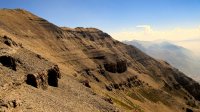
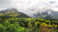
From the trailhead, the Timpooneke trail slowly ascends through hardwood forests. The light shining from my headlamp revealed that I was surrounded by golden yellow foliage. About a half mile up the trail the sun began to rise and I was able to see Utah in the daylight for the very first time! I was approaching the area that I believe they call the Giant Staircase around this time and I was in awe of light bouncing off the mountains in the distance and the broad mountain cliffs surrounding me.
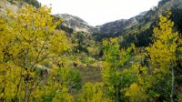
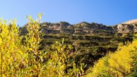
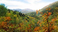
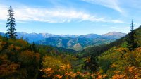
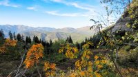
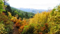
After ascending through countless switchbacks in the early morning light through alpine forest, I arrived at Timp Basin; a high elevation meadow. I could see Mt Timp across the basin and the sun was out in full force. It was a beautiful day with perfect temps, no bugs, and clear blue skies. I was captivated by the sheer size of the basin. It felt like you could fit a small city up there in it. The trail meandered through the meadow towards the saddle and I stopped along the way for my first rest and snack.
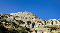
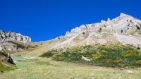
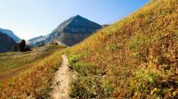
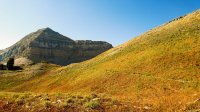
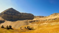
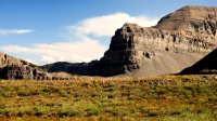
About half way up the switchbacks which climb to the saddle, I began to feel the first effects of the altitude. I’m not sure exactly what elevation it was (I’m guessing around 10k) but my body definitely knew it wasn’t at sea level anymore. I still felt good, but I noticed my breathing was having a harder time keeping up with my legs. I learned that slowing my pace down did the trick and I continued on towards the saddle.
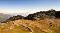
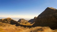
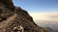
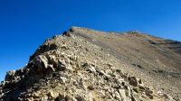
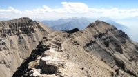
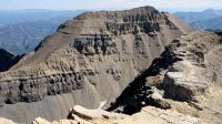
When I arrived at the saddle, spectacular views of the valley and Salt Lake opened up to the west. It was breathtaking to have that much vertical exposure so close on both sides of you. From the saddle, you can see the old shack at the summit of Mount Timp. I read online that the shack was built by early surveyors and used as a triangulation point. From the saddle to the summit, the trail wraps around the west side through various pitches of rocky trail that is somewhat interpretive at points. The altitude kicked in even harder during this last section to the summit and I had to rest several times and allow my breathing to normalize.
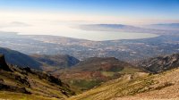
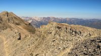
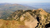
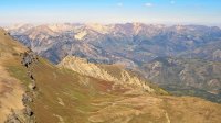
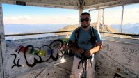
I had imagined for years what it would be like to stand atop a summit in the Rockies. I had been longing for it. I had dreamt about it. So when I finally arrived at the summit and took it all in, it was a surreal experience. I felt truly alive as I stood in the vastness of the surrounding beauty and was exhilarated that I had achieved my goal.
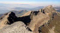
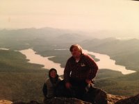
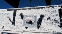
My dad was the one who instilled a love of nature in me. When he passed away in February, I began carrying my favorite picture of him in my hiking pack; a picture of us atop Whiteface Mountain in the Adirondacks when I was a little boy. I suppose I carried the picture because I wanted him to see the places that I see. Rather than sign my name on the shack with one of the sharpie markers left in the shack for hikers, I decided to tape my dad’s picture to the side of the shack facing the best view. I then began my ascent down from the summit.
Sunday – 9/21/14
Lake Blanche, Lake Lillian, Lake Florence
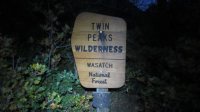
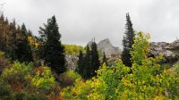
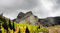
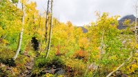
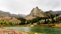
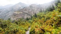
While I had perfect weather the day before, Sunday brought thunderstorms. I woke at 5 am again and checked out of my motel in Lehi. I arrived at the Lake Blanch trailhead on Big Cottonwood Canyon Road and began hiking in the dark again at 6:30. I was hoping that I would beat the rain as the forecast predicted the rain would hold off until around 10-11 am. However, around an hour into my hike the rain rolled in and on went the rain cover and rain gear. The colors along the Lake Blanche trail were so beautiful I hardly minded the rain. As I approached, the unmistakable silhouette of Sundial Peak kept drawing me closer. I arrived at Lake Blanche a little before 9 am. I had originally hoped to scramble to the summit of Sundial Peak but I knew that would be a bad idea with slick rocks and forecasted thunderstorms. Instead I decided to hike around the western end of Lake Blanche to nearby Lake Florence and Lake Lillian. In a strange false illusion, Lake Lillian appears much smaller than Lake Florence at first but as you get closer, you realize that it is actually quite a bit larger. The rain died down while I was exploring Lillian and Florence and I got to spend some time in dry weather at Lake Blanche before heading back down. I arrived back at the trailhead a little before noon.
Timpanogos Cave National Monument
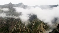
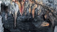
I had planned on doing some scenic driving after hiking Lake Blanche but another thunderstorm rolled as I was driving to the Alpine Loop. So I thought it might be a good idea to stop by the Timpanogos Cave National Monument which was conveniently located at the beginning of the Alpine Loop. The weather radar showed that by the time I finished in the caves, the weather would be clear again. I was able to get a tour ticket without purchasing a ticket in advance (I assume because of the rain). The tour consisted of a 3 mile round trip walk up paved switchbacks to the Timp Caves. The walk up to the caves is a little over a thousand foot gain in elevation but is quite easy since the switchbacks keep you climbing at a low grade and pavement makes for easy walking compared to actual hiking trails. The views of the Wasatch front on the trail were pretty awesome, especially since the clouds were constantly dancing around and about. When you arrive at the caves, you are given a guided tour of the cave system. Pretty cool stuff and a great way to get out of the thunderstorm for an hour. By the time the cave tour was over, the sun had come out and I was excited to descend back down to my car and drive the Alpine Loop in some good weather.
Alpine Loop and Bridal Veil Falls
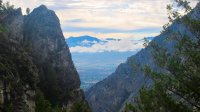
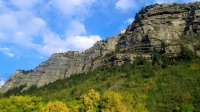
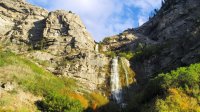
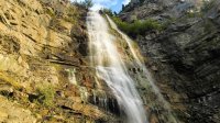
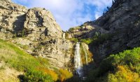
It was around 5:00 pm when I returned to my car after the Timp Caves and I began driving east on the Alpine Loop. Fall foliage seemed to be in full effect in many spots especially east of Cascade Springs Rd where there were tons of beautiful Aspen trees. When I reached the end of Rt. 92, I made a right onto Rt. 189 south. A few miles down Rt. 189 I pulled onto the adjacent side street and into the parking lot for Bridal Veil Falls. The steep jagged cliffs surrounding the falls are a beautiful backdrop for the double-terraced falls. I took a few pictures from the bottom where there are vending machines with fish food for children to feed the fish (carp perhaps?). I was glad that I still had my hiking boots on because there was a small spur trail up to the lower falls. I took the spur trail and got a few pictures and enjoyed some cool mist.
Unfortunately, it was time to head back to SLC. I needed to find “Loves Truck Stop” to shower, change, and pack up the equipment and clothes now strewn around my rental car. After showering and packing my bags, I still had an hour to kill. I hadn’t eaten “real” food for 2 days. I had been living off of Clif bars and trail mix. I searched Yelp and was able to find a vegan diner close by called the Vertical Diner. I ate a feast fit for a vegan king before heading to SLC International Airport.
Post-scriptum – two other quick observations from my trip
- The people of Utah are extremely nice and have extraordinary trailside manners. I’m ashamed to say that in the northeast, it’s the norm for hikers (at least day hikers) to just ignore each other. You’ll occasionally get a nod or half-hearted “hey” but more times than not, people just act as if they don’t see you. Nearly every person I crossed on the trail in Utah gave me a warm greeting and many started chatting with me. I wasn’t used to it at first but these small interactions collectively became one of the highlights of my trip. From the metal band from SLC that I hung out with at Gate 36 at JFK (they had just played a festival in Brooklyn and were returning home), to the hair stylist from Phoenix I chatted with on the flight out, to the hiker from Boston that I met walking to the Timp trailhead (we realized that we had the same connecting flight home and would see each other again), to the family of four that I tagged along and chatted with for a few miles along the Timpooneke trail, it all added to the experience. Throughout the trip I often thought about a quote from one of my favorite hiking books, "Just Passin Thru" by Winton Porter...
- I found the trails in Utah to be much more pleasant and well-designed than the trails in the northeast. Switchbacks were almost always used to keep the grade easy to manage and the terrain was much smoother and less rocky overall. In the northeast it feels as though the trails are designed to punish you. The trails pretty much head straight up, rarely using switchbacks, and seemingly go out of their way to make sure you hit every up and down along the way. I’m not in any way implying that the hiking in Utah is easier, but rather, a more pleasant experience.
Lastly, I want to thank this forum and its members for helping me plan this trip. I originally intended to just use this site for planning this one trip but it has grown on me and I’m sure I’ll end up hanging around the site even though my trip has ended.
John
Featured image for home page:
I decided to sandwich the weekend by taking off a Friday and Monday, and fly across the country to fulfill one of my life-long dreams: to hike in the Rocky Mountains.
There was no shortage of people to scoff at my plans. From friends who told me “it doesn’t make sense”, to co-workers who shook their head, to fellow hikers on forums (not this forum) who politely expressed doubts about the feasibility of my plan. But working in an urban city, I see people on the streets every day that don’t have the means to leave their environment and see new places. So while others scoffed, I just felt blessed to have opportunities like this in my life. Besides, the long travel distance and compressed time frame would only add to the challenge and sense of accomplishment right?
Here’s an outline of how I spent my 48 hours in Utah:
Friday - 9/19/14
- 4:29 pm – Flight departed JFK International Airport, NYC (stop-over in Phoenix, AZ)
- 10:50 pm – Flight arrived into Salt Lake City International Airport
Saturday - 9/21/14
- 6:30 am to 5:00 pm - Hiked Mount Timpanogos via the Timpooneke Trail
Length of hike: 15 miles
Elevation gain: 4,371 feet
Sunday - 9/21/14
- 6:30 am to 11:30 am - Hiked to Lake Blanche, Lake Lillian, Lake Florence
Length of hike: 7 miles
Elevation gain: 2,720 feet
- 2:00 pm to 5:00 pm – Timpanogos Cave National Monument
Length of hike: 3 miles (not really a hike though)
Elevation gain: 1,065 feet
- 5:00 pm to 8:00 pm – Drove the Alpine Loop to Bridal Veil Falls
- 11:59 pm - Flight departed Salt Lake City International Airport (stop-over in Charlotte, NC)
Monday - 9/22/14
- 9:30 am – Flight arrived at JFK International Airport, NYC
Two day total - 25 miles hiked, 8,156 feet of elevation climbed.
And so the story goes:
Friday - 9/19/14
Well, things got off to a bad start. I left my house in New Jersey at 7:30 am Friday morning for JFK International Airport, NYC; 3 hours before my flight. After hitting 2.5 hours of traffic in NYC, I ended up missing my flight. I was put on the next flight to Salt Lake City (stopping in Phoenix) and didn’t land in Salt Lake City until 10:50 pm. Luckily, this debacle didn’t cut into my hiking time since I hadn’t planned on hiking Friday anyway. I just had to get some of my sleep on the plane. When I arrived in SLC and got my rental car, I headed to my hotel in Lehi, prepared my hiking equipment for the following morning and went back to sleep with the alarm set for 5:00 am.
Saturday – 9/20/14
Driving towards the trailhead Saturday morning, I still hadn’t seen Utah in the daylight. Driving down the Alpine Loop towards the Timpooneke trailhead I could sense the enormous mountains around me although I couldn’t see them in the darkness. I knew they were surrounding me because the moon which was nearly directly overhead kept disappearing behind the invisible giants. I was pumped to finally immerse myself in the Uinta wilderness.
Mount Timpanogos
From the trailhead, the Timpooneke trail slowly ascends through hardwood forests. The light shining from my headlamp revealed that I was surrounded by golden yellow foliage. About a half mile up the trail the sun began to rise and I was able to see Utah in the daylight for the very first time! I was approaching the area that I believe they call the Giant Staircase around this time and I was in awe of light bouncing off the mountains in the distance and the broad mountain cliffs surrounding me.


After ascending through countless switchbacks in the early morning light through alpine forest, I arrived at Timp Basin; a high elevation meadow. I could see Mt Timp across the basin and the sun was out in full force. It was a beautiful day with perfect temps, no bugs, and clear blue skies. I was captivated by the sheer size of the basin. It felt like you could fit a small city up there in it. The trail meandered through the meadow towards the saddle and I stopped along the way for my first rest and snack.


About half way up the switchbacks which climb to the saddle, I began to feel the first effects of the altitude. I’m not sure exactly what elevation it was (I’m guessing around 10k) but my body definitely knew it wasn’t at sea level anymore. I still felt good, but I noticed my breathing was having a harder time keeping up with my legs. I learned that slowing my pace down did the trick and I continued on towards the saddle.


When I arrived at the saddle, spectacular views of the valley and Salt Lake opened up to the west. It was breathtaking to have that much vertical exposure so close on both sides of you. From the saddle, you can see the old shack at the summit of Mount Timp. I read online that the shack was built by early surveyors and used as a triangulation point. From the saddle to the summit, the trail wraps around the west side through various pitches of rocky trail that is somewhat interpretive at points. The altitude kicked in even harder during this last section to the summit and I had to rest several times and allow my breathing to normalize.


I had imagined for years what it would be like to stand atop a summit in the Rockies. I had been longing for it. I had dreamt about it. So when I finally arrived at the summit and took it all in, it was a surreal experience. I felt truly alive as I stood in the vastness of the surrounding beauty and was exhilarated that I had achieved my goal.


My dad was the one who instilled a love of nature in me. When he passed away in February, I began carrying my favorite picture of him in my hiking pack; a picture of us atop Whiteface Mountain in the Adirondacks when I was a little boy. I suppose I carried the picture because I wanted him to see the places that I see. Rather than sign my name on the shack with one of the sharpie markers left in the shack for hikers, I decided to tape my dad’s picture to the side of the shack facing the best view. I then began my ascent down from the summit.


Sunday – 9/21/14
Lake Blanche, Lake Lillian, Lake Florence
While I had perfect weather the day before, Sunday brought thunderstorms. I woke at 5 am again and checked out of my motel in Lehi. I arrived at the Lake Blanch trailhead on Big Cottonwood Canyon Road and began hiking in the dark again at 6:30. I was hoping that I would beat the rain as the forecast predicted the rain would hold off until around 10-11 am. However, around an hour into my hike the rain rolled in and on went the rain cover and rain gear. The colors along the Lake Blanche trail were so beautiful I hardly minded the rain. As I approached, the unmistakable silhouette of Sundial Peak kept drawing me closer. I arrived at Lake Blanche a little before 9 am. I had originally hoped to scramble to the summit of Sundial Peak but I knew that would be a bad idea with slick rocks and forecasted thunderstorms. Instead I decided to hike around the western end of Lake Blanche to nearby Lake Florence and Lake Lillian. In a strange false illusion, Lake Lillian appears much smaller than Lake Florence at first but as you get closer, you realize that it is actually quite a bit larger. The rain died down while I was exploring Lillian and Florence and I got to spend some time in dry weather at Lake Blanche before heading back down. I arrived back at the trailhead a little before noon.


Timpanogos Cave National Monument
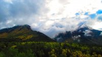
I had planned on doing some scenic driving after hiking Lake Blanche but another thunderstorm rolled as I was driving to the Alpine Loop. So I thought it might be a good idea to stop by the Timpanogos Cave National Monument which was conveniently located at the beginning of the Alpine Loop. The weather radar showed that by the time I finished in the caves, the weather would be clear again. I was able to get a tour ticket without purchasing a ticket in advance (I assume because of the rain). The tour consisted of a 3 mile round trip walk up paved switchbacks to the Timp Caves. The walk up to the caves is a little over a thousand foot gain in elevation but is quite easy since the switchbacks keep you climbing at a low grade and pavement makes for easy walking compared to actual hiking trails. The views of the Wasatch front on the trail were pretty awesome, especially since the clouds were constantly dancing around and about. When you arrive at the caves, you are given a guided tour of the cave system. Pretty cool stuff and a great way to get out of the thunderstorm for an hour. By the time the cave tour was over, the sun had come out and I was excited to descend back down to my car and drive the Alpine Loop in some good weather.


Alpine Loop and Bridal Veil Falls
It was around 5:00 pm when I returned to my car after the Timp Caves and I began driving east on the Alpine Loop. Fall foliage seemed to be in full effect in many spots especially east of Cascade Springs Rd where there were tons of beautiful Aspen trees. When I reached the end of Rt. 92, I made a right onto Rt. 189 south. A few miles down Rt. 189 I pulled onto the adjacent side street and into the parking lot for Bridal Veil Falls. The steep jagged cliffs surrounding the falls are a beautiful backdrop for the double-terraced falls. I took a few pictures from the bottom where there are vending machines with fish food for children to feed the fish (carp perhaps?). I was glad that I still had my hiking boots on because there was a small spur trail up to the lower falls. I took the spur trail and got a few pictures and enjoyed some cool mist.


Unfortunately, it was time to head back to SLC. I needed to find “Loves Truck Stop” to shower, change, and pack up the equipment and clothes now strewn around my rental car. After showering and packing my bags, I still had an hour to kill. I hadn’t eaten “real” food for 2 days. I had been living off of Clif bars and trail mix. I searched Yelp and was able to find a vegan diner close by called the Vertical Diner. I ate a feast fit for a vegan king before heading to SLC International Airport.
Post-scriptum – two other quick observations from my trip
- The people of Utah are extremely nice and have extraordinary trailside manners. I’m ashamed to say that in the northeast, it’s the norm for hikers (at least day hikers) to just ignore each other. You’ll occasionally get a nod or half-hearted “hey” but more times than not, people just act as if they don’t see you. Nearly every person I crossed on the trail in Utah gave me a warm greeting and many started chatting with me. I wasn’t used to it at first but these small interactions collectively became one of the highlights of my trip. From the metal band from SLC that I hung out with at Gate 36 at JFK (they had just played a festival in Brooklyn and were returning home), to the hair stylist from Phoenix I chatted with on the flight out, to the hiker from Boston that I met walking to the Timp trailhead (we realized that we had the same connecting flight home and would see each other again), to the family of four that I tagged along and chatted with for a few miles along the Timpooneke trail, it all added to the experience. Throughout the trip I often thought about a quote from one of my favorite hiking books, "Just Passin Thru" by Winton Porter...
"Miles, days, hours, and minutes, are for those who choose to keep the score card in life.
One day you'll come to learn, it ain't about the miles. It's all about the smiles"
One day you'll come to learn, it ain't about the miles. It's all about the smiles"
- I found the trails in Utah to be much more pleasant and well-designed than the trails in the northeast. Switchbacks were almost always used to keep the grade easy to manage and the terrain was much smoother and less rocky overall. In the northeast it feels as though the trails are designed to punish you. The trails pretty much head straight up, rarely using switchbacks, and seemingly go out of their way to make sure you hit every up and down along the way. I’m not in any way implying that the hiking in Utah is easier, but rather, a more pleasant experience.
Lastly, I want to thank this forum and its members for helping me plan this trip. I originally intended to just use this site for planning this one trip but it has grown on me and I’m sure I’ll end up hanging around the site even though my trip has ended.
John
Featured image for home page:

Last edited:
