- Joined
- Dec 23, 2013
- Messages
- 4,327
I set out yesterday to hike the ridge that extends to the northeast from Mount Van Cott and see if it marries up to the Black Mountain Ridge to the north. I had attempted this hike the week before but ran into some deep snow along the ridge that I didn't want to deal with so I tuned around and headed back.
The loop is a touch over eight miles in length and I started around 9:15 in the morning. I made my way along the usual route to the top of Van Cott and then followed the trail to the northeast along the ridge, which I had never hiked before. The trail is easy to follow across the first three humps along the ridge, after that the trail is still visible but the scrub oak became more numerous and thicker.
I worked my way along the ridge and eventually arrived at the head of the South Fork of Dry Creek. At this point, I made my way towards a lone tree up the hillside to my north. As I approached the tree, I noticed a box at the base of the tree. When I arrived at the tree, I realized that it was an old military ammunition box. It turns out the box is used for geo-caching. I opened it up and it had some play money inside and of course the wind blew it out of the box. I spent the next few minutes running down all the bills and returning them to the box.
I then hiked up to the top of the hill where the tree was located so that I could get a good view of Black Mountain Ridge. At this point, the minimal trail headed off into some deep snow and I stopped following it. It does look like it heads in the direction of the top of Black Mountain Ridge; though it would be a very steep climb from where I stood.
I returned to the geo-cache and took fifteen minutes to eat my lunch. After lunch, I decided that instead of heading back the way I had come, I would bushwhack down into the South Fork of Dry Creek and follow it out. I had never hiked down this drainage before, so I was interested to see what it was like. At first, there is quite a bit of underbrush that I had to hike through and while bushwhacking I ran into an elk carcass. About halfway down the canyon a more formal trail exists and eventually I was just hiking down the dry stream bed. Along the way, I did run into a small spring and the creek did run for a short distance before seeping back into the ground. Also, I saw a ton of deer remains as the canyon narrows. I wondered if a cougar was killing them, though I did not see any track.
Once out of the canyon, I popped back out onto the Bonneville Shoreline Trail which led me back to my vehicle.
Now is a great time to do this loop. It took me about five hours to complete it. Once the scrub oak and other underbrush get their foliage though, not only will the going be more difficult, but the trail will be hard to pick up and follow in a number of spots.
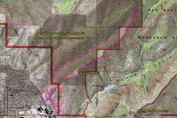
Route Map
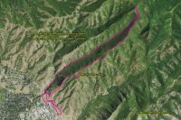
Route Imagery
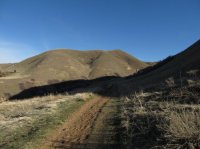
Shoreline Trail
Contrail over the ridge
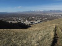
Old Jeep road heading up the ridge with a good view of the University of Utah
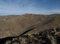
Avenues Twin Peaks and Dry Creek Canyon
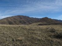
The knob on the right of the image is the beginning of the ridge I hiked along with Black Mountain Ridge in the background
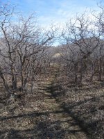
Trail heading through some oak trees
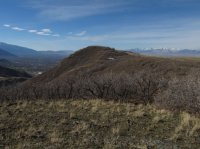
Looking Back at Mount Van Cott
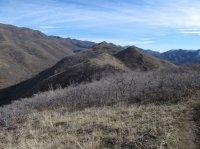
Good look along the ridge
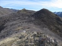
Working my way along the ridge
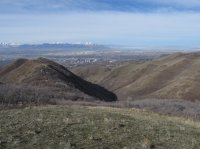
The South Fork of Dry Creek drainage with Salt Lake City in the background
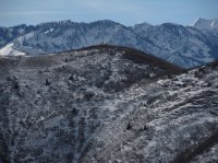
View of Mount Wire (Big Beacon) with a portion of Wildcat Ridge in the background
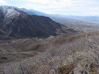
Red Butte Canyon and Reservoir
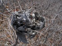
Old hornet's nest
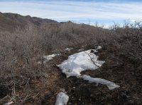
View along the ridge
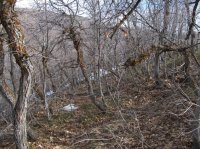
Trail becoming harder to follow
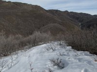
Some snow along the way, Black Mountain Ridge in the background
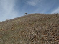
Lone tree on hillside
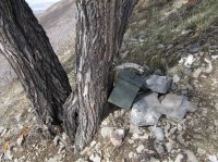
Geo-cache
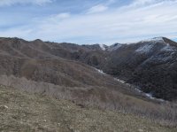
Black Mountain Ridge and the headwaters of Red Butte Creek
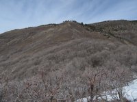
Looking up towards the top of Black Mountain Ridge
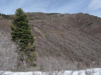
Black Mountain Ridge
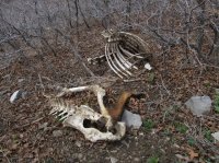
Elk Carcass
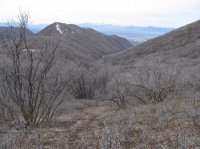
The South Fork of Dry Creek drainage
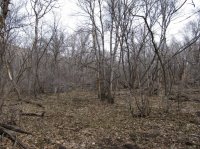
Making my way down the drainage
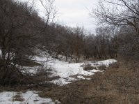
View along the drainage
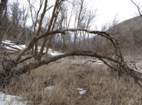
Trees bent over the game trail
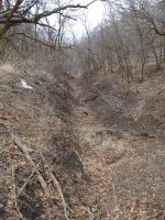
The South Fork of Dry Creek
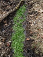
Some vegetation growing in the South Fork of Dry Creek
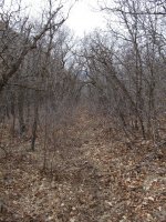
More established trail
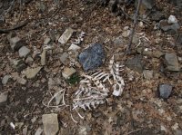
Deer remains
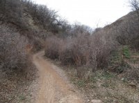
Bonneville Shoreline Trail
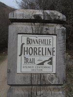
Shoreline trail sign
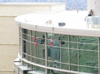
Looks like a fun job at the Huntsman Cancer Institute
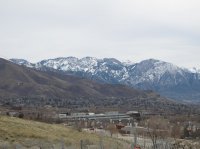
The end - with a good view of Wildcat Ridge and Broads Fork Twin Peaks peaking through the gap between Mount Olympus and Triangle Peak
Featured image for home page:
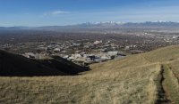
The loop is a touch over eight miles in length and I started around 9:15 in the morning. I made my way along the usual route to the top of Van Cott and then followed the trail to the northeast along the ridge, which I had never hiked before. The trail is easy to follow across the first three humps along the ridge, after that the trail is still visible but the scrub oak became more numerous and thicker.
I worked my way along the ridge and eventually arrived at the head of the South Fork of Dry Creek. At this point, I made my way towards a lone tree up the hillside to my north. As I approached the tree, I noticed a box at the base of the tree. When I arrived at the tree, I realized that it was an old military ammunition box. It turns out the box is used for geo-caching. I opened it up and it had some play money inside and of course the wind blew it out of the box. I spent the next few minutes running down all the bills and returning them to the box.
I then hiked up to the top of the hill where the tree was located so that I could get a good view of Black Mountain Ridge. At this point, the minimal trail headed off into some deep snow and I stopped following it. It does look like it heads in the direction of the top of Black Mountain Ridge; though it would be a very steep climb from where I stood.
I returned to the geo-cache and took fifteen minutes to eat my lunch. After lunch, I decided that instead of heading back the way I had come, I would bushwhack down into the South Fork of Dry Creek and follow it out. I had never hiked down this drainage before, so I was interested to see what it was like. At first, there is quite a bit of underbrush that I had to hike through and while bushwhacking I ran into an elk carcass. About halfway down the canyon a more formal trail exists and eventually I was just hiking down the dry stream bed. Along the way, I did run into a small spring and the creek did run for a short distance before seeping back into the ground. Also, I saw a ton of deer remains as the canyon narrows. I wondered if a cougar was killing them, though I did not see any track.
Once out of the canyon, I popped back out onto the Bonneville Shoreline Trail which led me back to my vehicle.
Now is a great time to do this loop. It took me about five hours to complete it. Once the scrub oak and other underbrush get their foliage though, not only will the going be more difficult, but the trail will be hard to pick up and follow in a number of spots.

Route Map

Route Imagery

Shoreline Trail

Contrail over the ridge

Old Jeep road heading up the ridge with a good view of the University of Utah

Avenues Twin Peaks and Dry Creek Canyon

The knob on the right of the image is the beginning of the ridge I hiked along with Black Mountain Ridge in the background

Trail heading through some oak trees

Looking Back at Mount Van Cott

Good look along the ridge

Working my way along the ridge

The South Fork of Dry Creek drainage with Salt Lake City in the background

View of Mount Wire (Big Beacon) with a portion of Wildcat Ridge in the background

Red Butte Canyon and Reservoir

Old hornet's nest

View along the ridge

Trail becoming harder to follow

Some snow along the way, Black Mountain Ridge in the background

Lone tree on hillside

Geo-cache

Black Mountain Ridge and the headwaters of Red Butte Creek

Looking up towards the top of Black Mountain Ridge

Black Mountain Ridge

Elk Carcass

The South Fork of Dry Creek drainage

Making my way down the drainage

View along the drainage

Trees bent over the game trail

The South Fork of Dry Creek

Some vegetation growing in the South Fork of Dry Creek

More established trail

Deer remains

Bonneville Shoreline Trail

Shoreline trail sign

Looks like a fun job at the Huntsman Cancer Institute

The end - with a good view of Wildcat Ridge and Broads Fork Twin Peaks peaking through the gap between Mount Olympus and Triangle Peak
Featured image for home page:

Last edited:
