Udink
Still right here.
- Joined
- Jan 17, 2012
- Messages
- 1,734
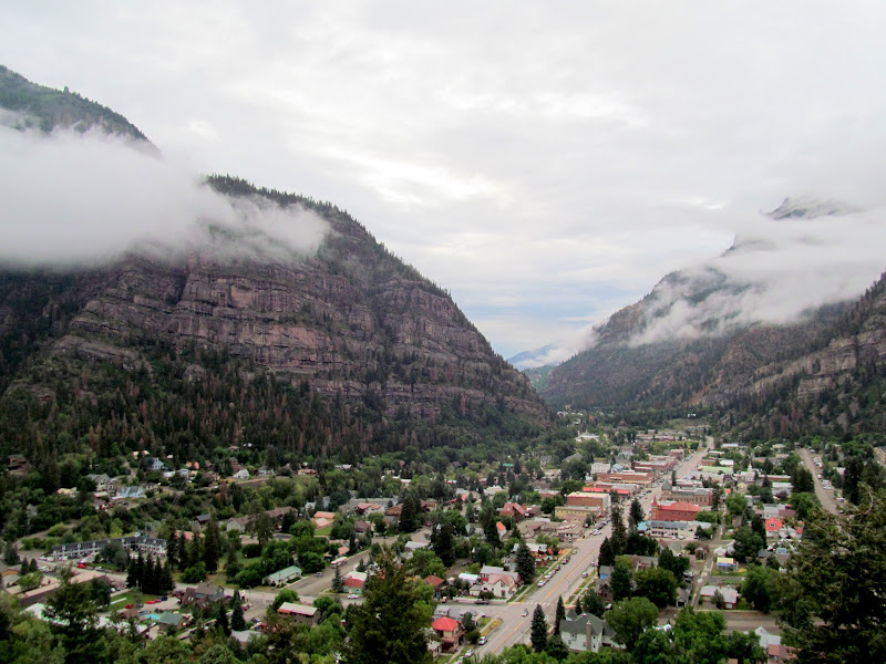
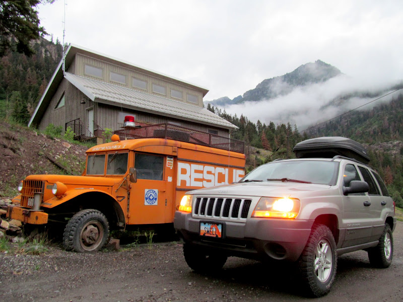
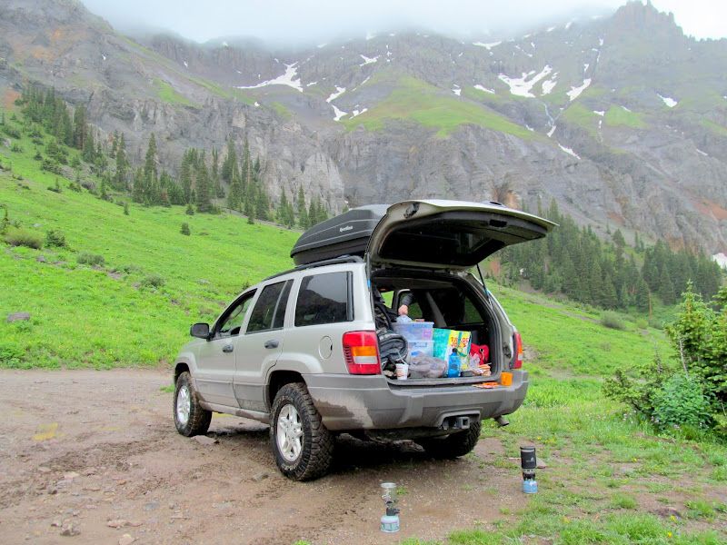
O'er the 4th of July holiday weekend I road-tripped to Colorado with Chris and we hiked a couple of 14,000'+ peaks--my first ever. Chris has been going to Colorado each summer for the past several years to hike 14ers, and when he invited me this year it worked out well with the 4th falling on a Monday. We could spend the weekend hiking and camping but still make it home for my family's annual get-together. We left Price after 3PM on Friday and rolled through Ouray at 8PM, with our goal being to hike the nearby Mount Sneffels the following day. We did a little sightseeing around town and then drove up Canyon Creek to find a place to camp. Both campgrounds were full so we continued up the canyon and, after darkness had set in, eventually found a place to crash along a side road below Silver Basin. We ate a quick dinner, then I set up my tent while Chris slept on the ground under his rainfly. It didn't rain during the night but a mist hung in the air and clung to everything.
Ouray, CO
Old rescue truck along Canyon Creek
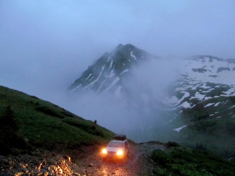
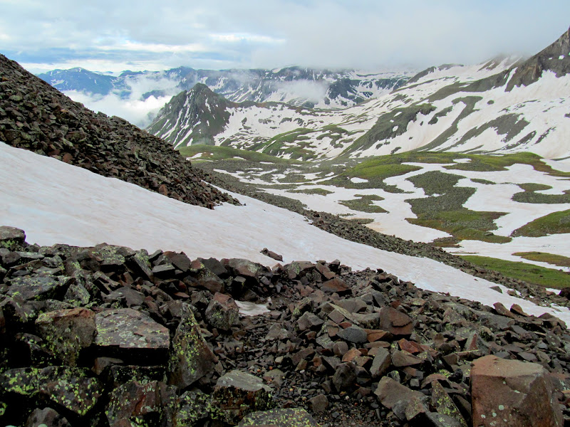
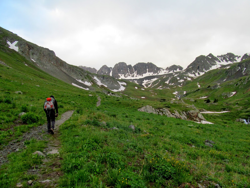
My alarm went off at 4AM and I hadn't slept well. I got up and made coffee and munched on a donut. We packed our wet gear into the Jeep and headed back to the main road, then crawled up the steep road to the trailhead in 4-low. A sign proclaimed the road closed before the upper trailhead, presumably due to snow drifts. I parked near two other vehicles at the closure then Chris and I started hiking. It was a little before 6AM and already light enough to see well despite the low clouds and mist in the air. Another hiker walked alongside us for a brief while, and we'd see only a few others the rest of the hike. It was a steep and loose climb up to the ridge below Lavender Colouir. Chris stayed well ahead of me but stopped to wait at the top of the ridge.
Jeep climbing to the Mount Sneffels trailhead
Snow on the road
Upper trailhead
Snow on the trail
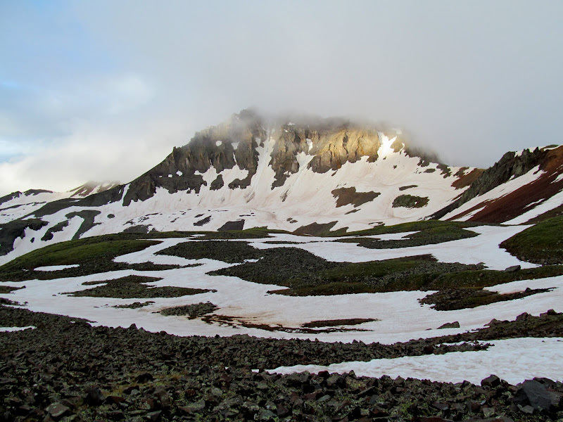
Gilpin Peak
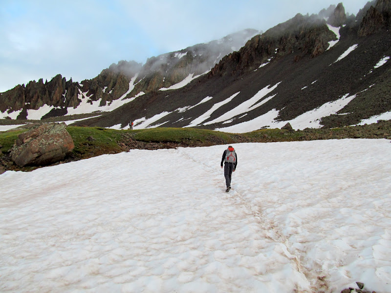
Climbing up to Lavender Col
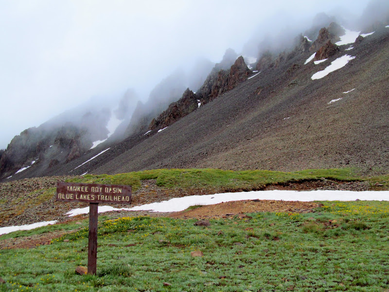
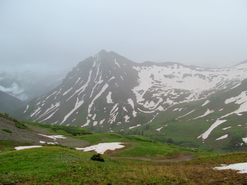
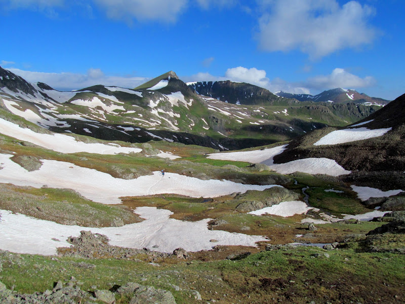
Yankee Boy Basin
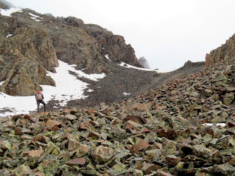
Chris at the bottom of Lavender Col
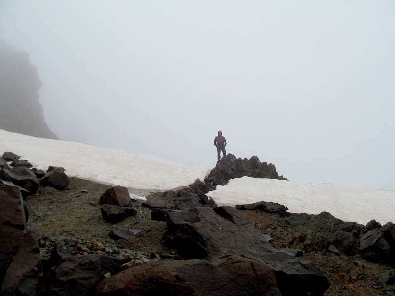
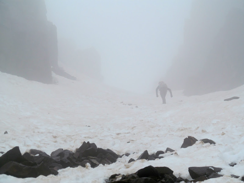
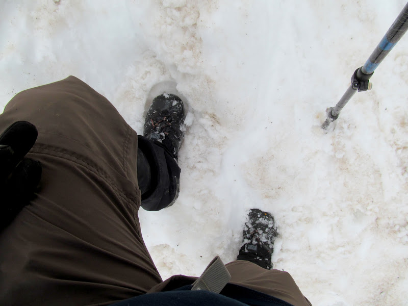
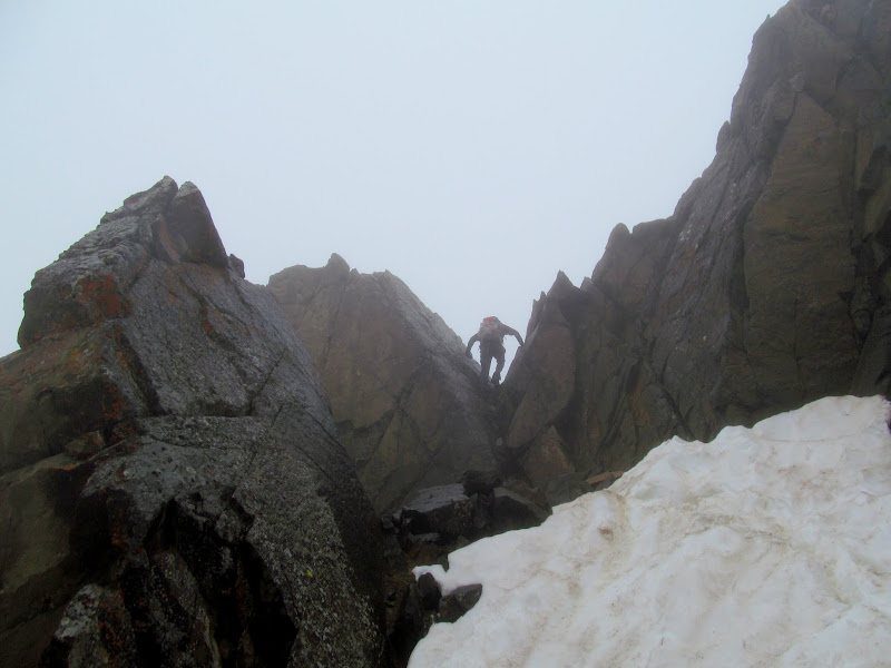
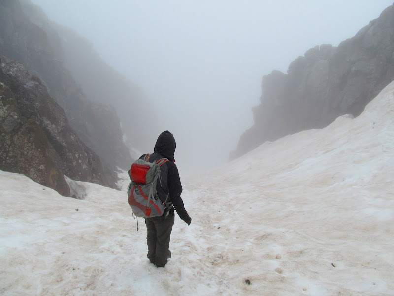
Climbing up Lavender Col was sketchy AF. An ice axe and crampons would have been better suited for the snow conditions. I had only a trekking pole, and I was very grateful that I'd thrown some gaiters in my pack at the last minute before leaving home. We kicked steps into the snow, made easier by a couple of guys who were ascending ahead of us. At the top of the colouir the route to the summit wasn't clear. Chris climbed up a notch over a short ridge that got closer to the peak, but I had trouble climbing the same notch. I was ready to give up, only a few hundred feet from the summit. Chris scouted around the ridge, however, and found an easier spot for me to climb. From there we had one more snow-filled gully to cross before the final, easy scramble to the summit of Mount Sneffels at 14,048'.
Lavender Col
Unusual gear for me in July: gaiters, gloves, and a trekking pole
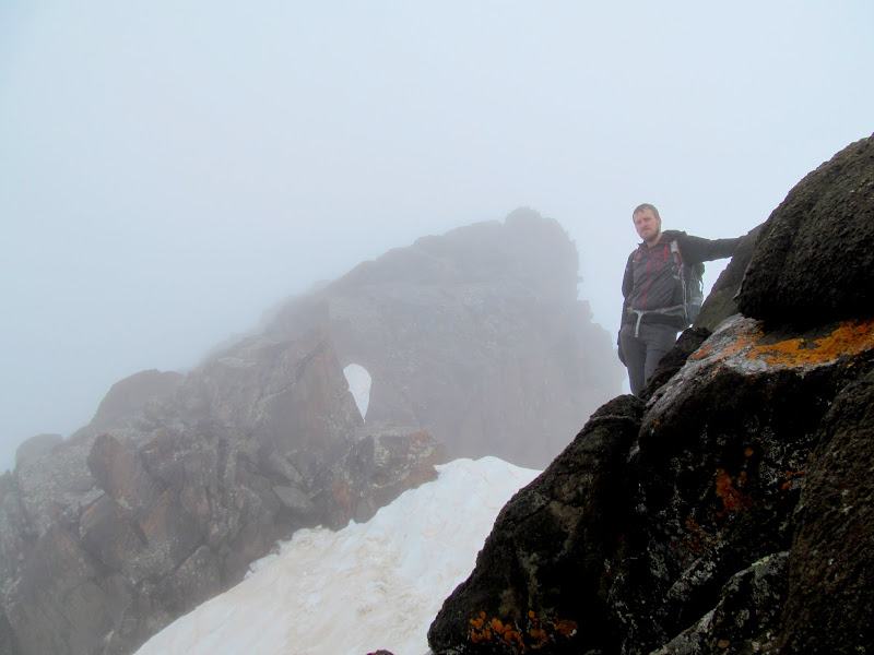
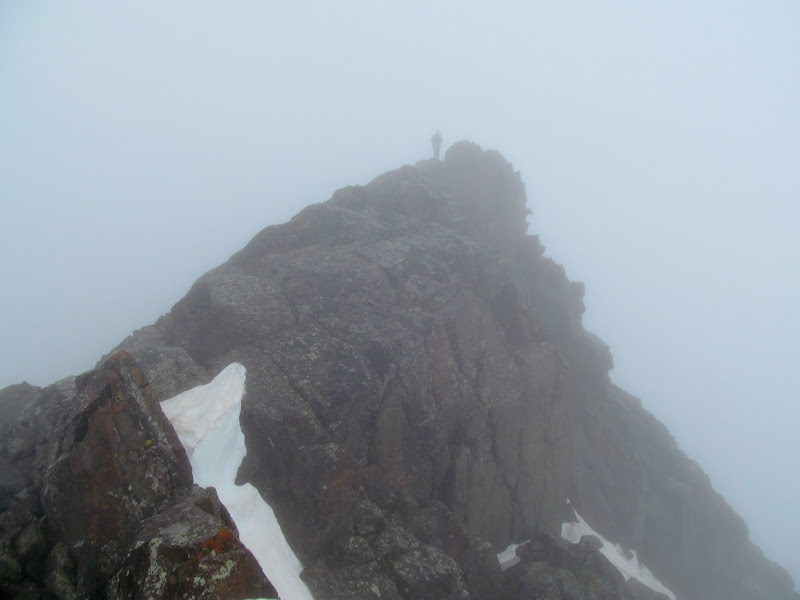
Chris on the final climb to the summit
Chris below the Mount Sneffels summit
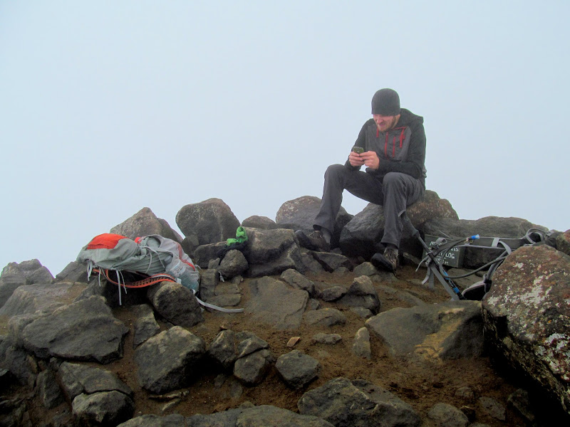
Chris on the Mount Sneffels summit
Chris on the Mount Sneffels summit (yay, cell service!)
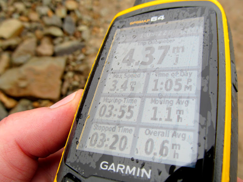
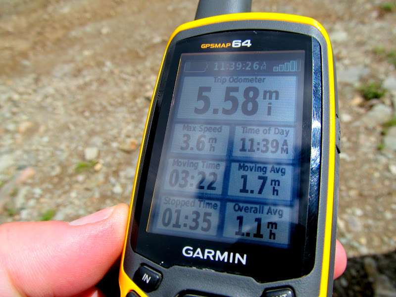
Descending Lavender Col was sketchier than going up! Our heels wouldn't stick in the toe-holds in the snow, but Chris found that we could descend more easily by walking backwards and kicking our toes into the holes. It seemed to take just as long going down as it had going up, and it was just as strenuous. It was extremely nerve-wracking for me knowing that on this steep, snow-covered slope, one slip could send me sliding into the boulder field below. I don't think the trekking pole would have been much help in arresting a slide. Chris cheered when he reached solid ground at the bottom of the colouir and I was only a few minutes behind him. From there it was a straightforward downhill hike back to the Jeep. We'd hiked 4.3 miles total with 2,100' elevation gain in 7.25 hours. It was easily one of the most harrowing hikes I've done. No one thing was any more difficult than anything I've done before, but the combination of steepness, snow conditions, and simply being far from home made it mentally challenging.
Descending Lavender Col
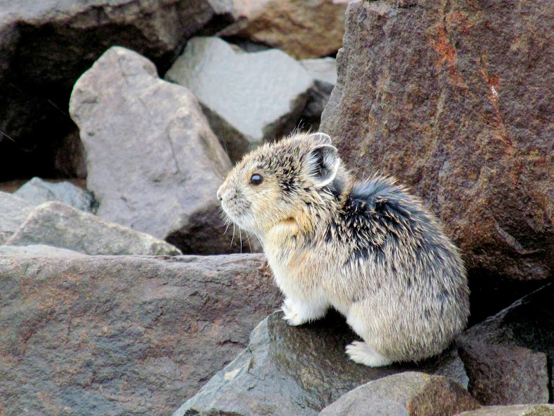
Pika-chu!
Almost back to the Jeep (barely visible in the lower-right)
GPS stats for the Mount Sneffels hike
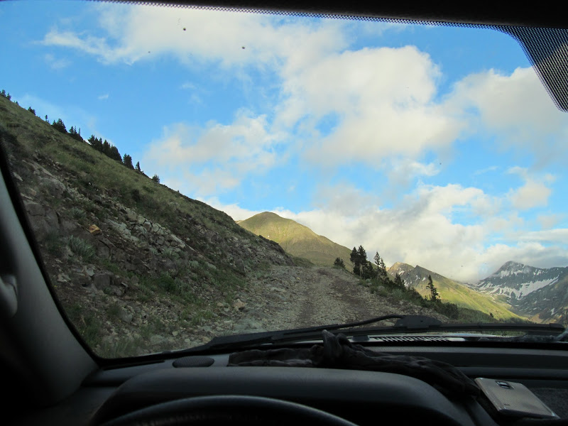
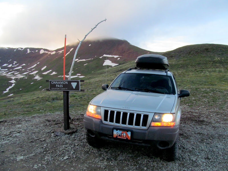
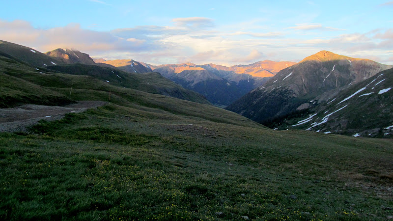
We spent the rest of the day wandering our way to American Basin where we planned to hike to Handies Peak the next morning. After a lunch of cup-of-noodles and coffee, and a quick stop in Ouray, we tried following Google Maps' directions to American Basin, but County Road 18 started out gnarly and then got worse. I backtracked to the Million Dollar Highway and we followed that to Silverton, where we followed the road along the Animas River and took Cinnamon Pass over to American Basin. There was a lot of neat stuff to see along the way. Animas Forks ghost town was especially interesting, though I think I picked up a nail in one of the Jeep's tires there that I didn't discover until two days later--good thing it didn't blow out on the drive home! We got to American Basin after sunset and found it fairly crowded, but there was still a spot alongside the road to park and set up camp. Again I slept in a tent and Chris slept out in the open, but a 1AM thunderstorm forced him to relocate inside the Jeep for the rest of the night.
Lunch time
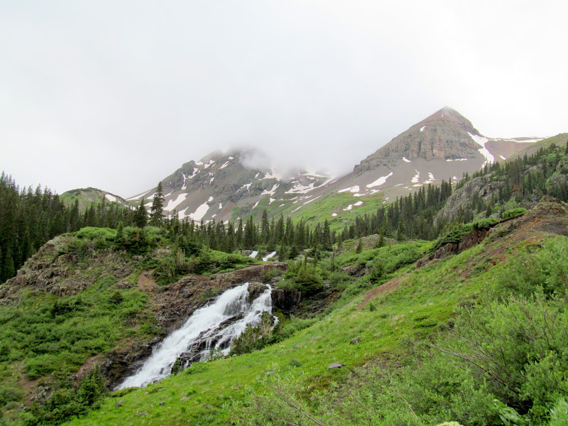
Waterfall above Sneffels Creek
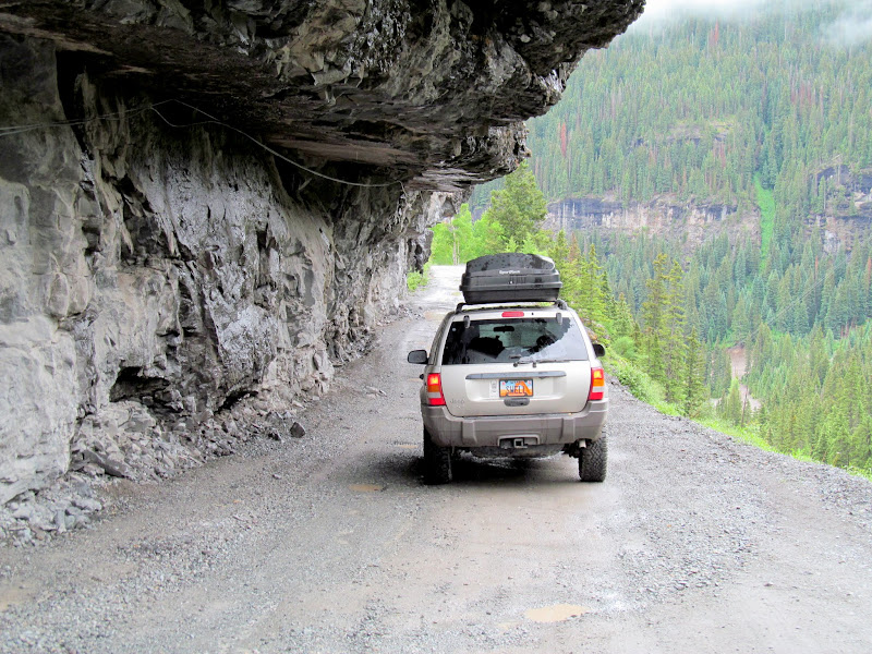
Sneffels Creek shelf road
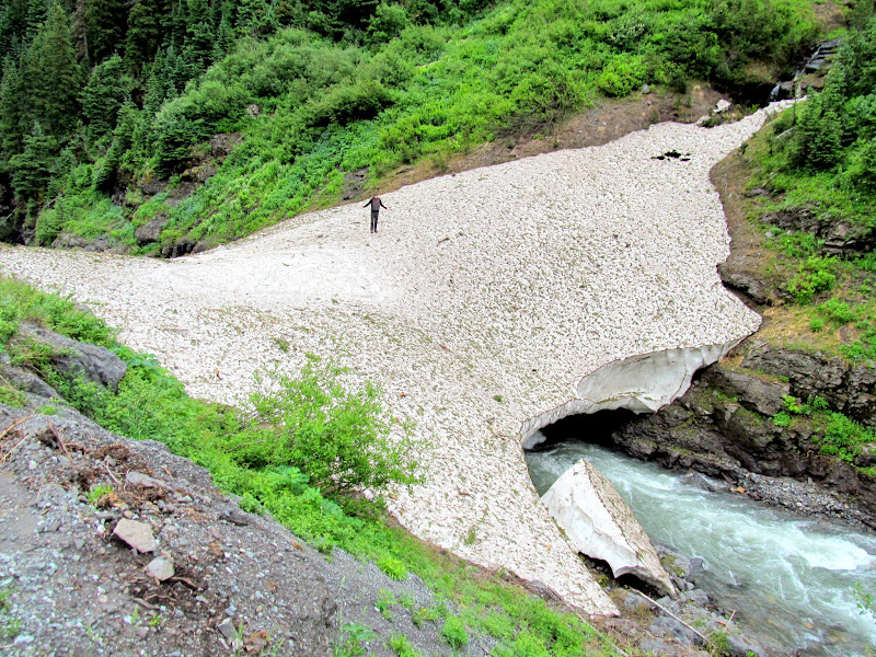
Snow bridge over Canyon Creek
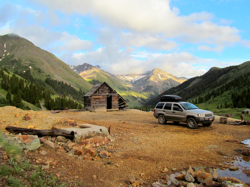
Red Mountain mining ruins
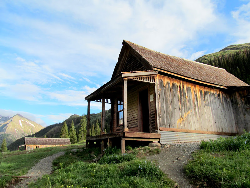
Mining ruins and modern building at Middleton
Hrmm?
Sunnyside Mill at Eureka
Animas Forks ghost town
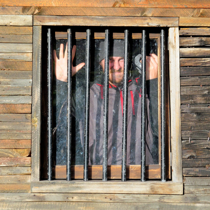
Animas Forks jail
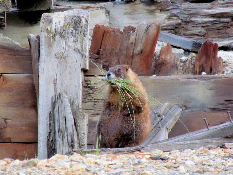
Marmot
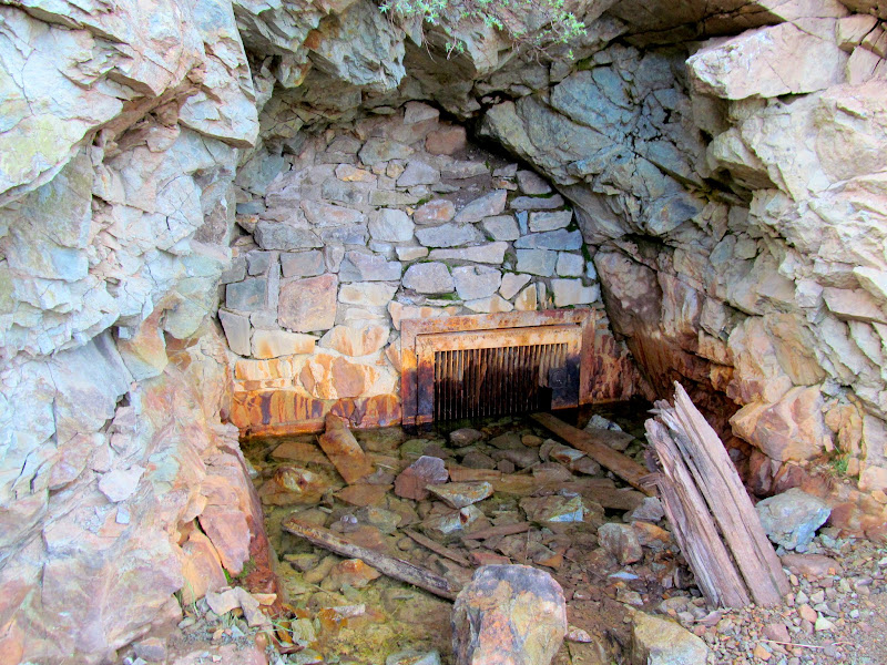
Walled-off mine opening at Animas Forks
Animas Forks ghost town
Climbing up to Cinnamon Pass
Cinnamon Pass
Last sunlight on the peaks east of Cinnamon Pass
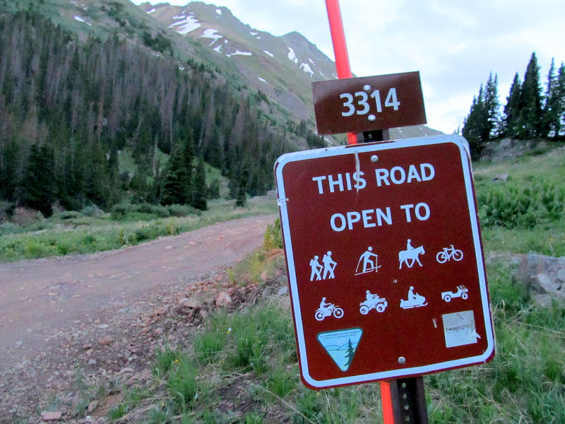
Unusual BLM sign: open to EVERYONE!
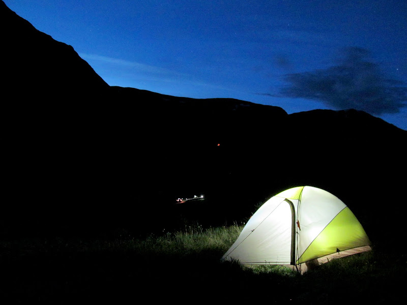
Tent aglow in American Basin
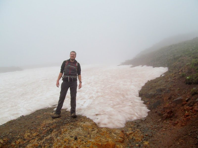
With an easier hike and better weather in the forecast for Sunday, we didn't rise until 5:30AM. Breakfast was done, gear stowed, and the Jeep parked at the trailhead by 6:45 for the start of this hike. We shared the trail with quite a few more people than on the previous day. With tired muscles, I kept a slow pace but got into a rhythm and didn't have to stop to rest as much as I had while ascending Sneffels. There was a lot more vegetation with wildflowers here, and with clearer weather the views were better as well. It took a little over three hours to make the summit at 14,150'. I was amazed by the view! We rested for a while and then made the descent in half the time. The total hiking distance was 5.5 miles with 2,550' elevation gain, but with a more gradual slope to the trail it was a breeze.
First light in American Basin
Glowing cliffs
Ascending the Handies Peak trail
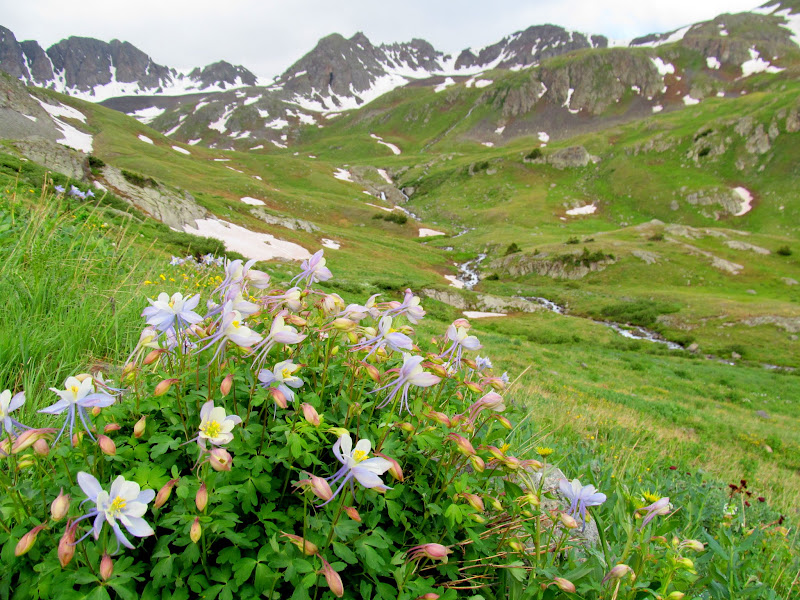
Colorado Columbine (Aquilegia coerulea)
Thick carpet of Heartleaf Bittercress (Cardamine cordifolia)
Fresh dusting of snow on Handies Peak
American Basin
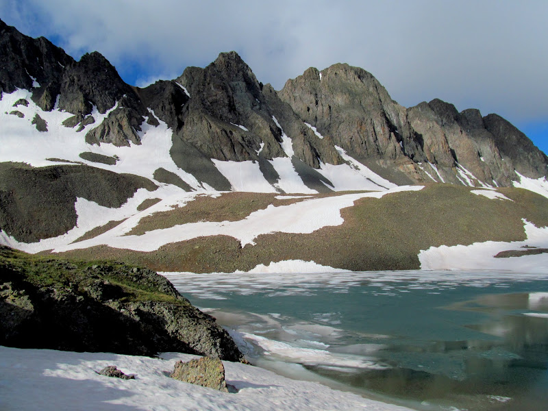
Sloan Lake
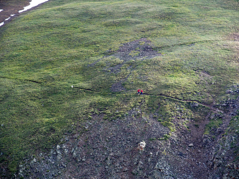
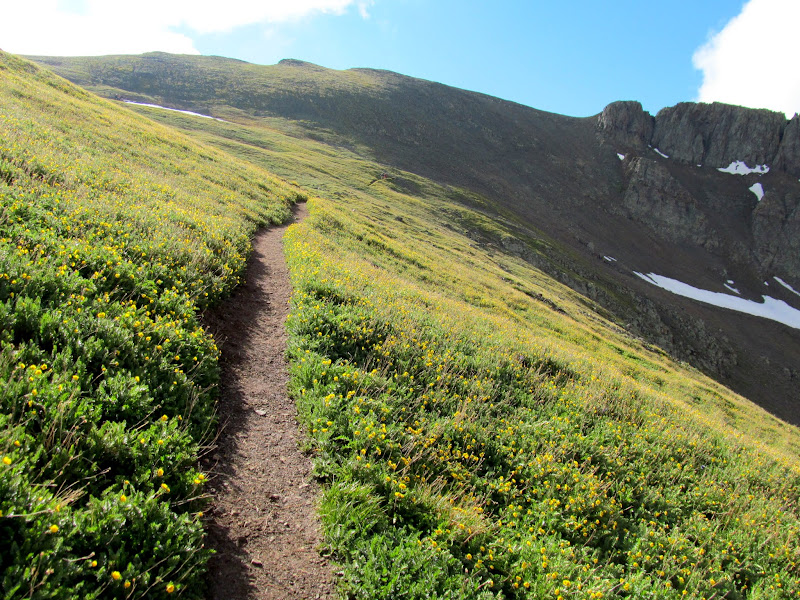
Trail cutting across a slope
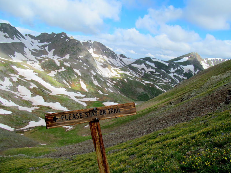
Please stay on trail
Almost to the ridge
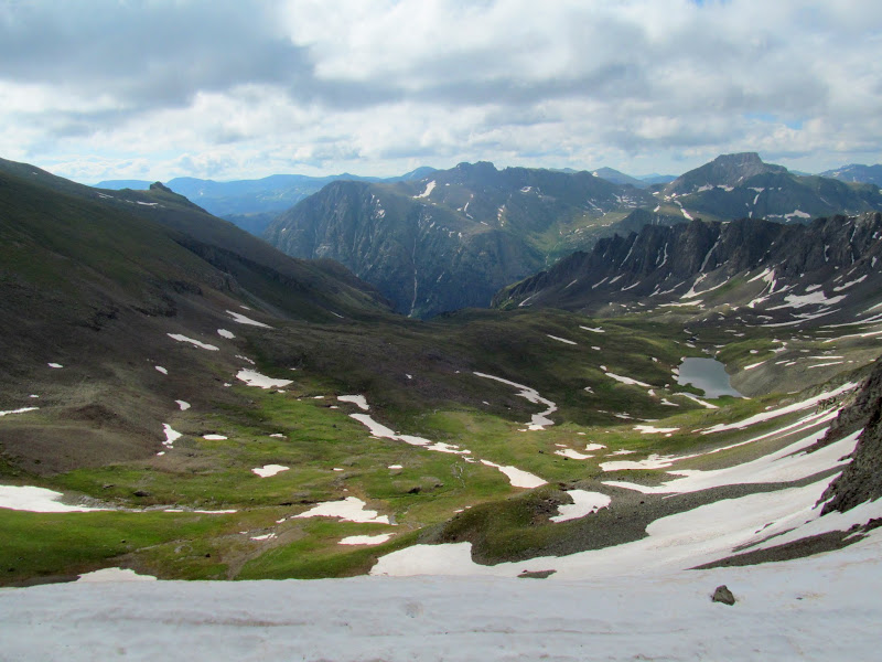
Boulder Gulch from the saddle
Almost to the summit of Handies Peak
Grizzly Gulch
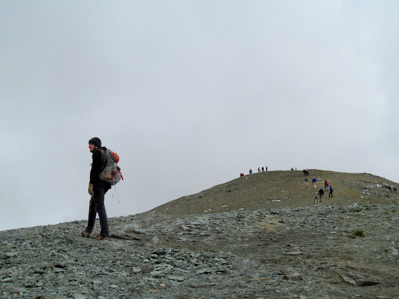
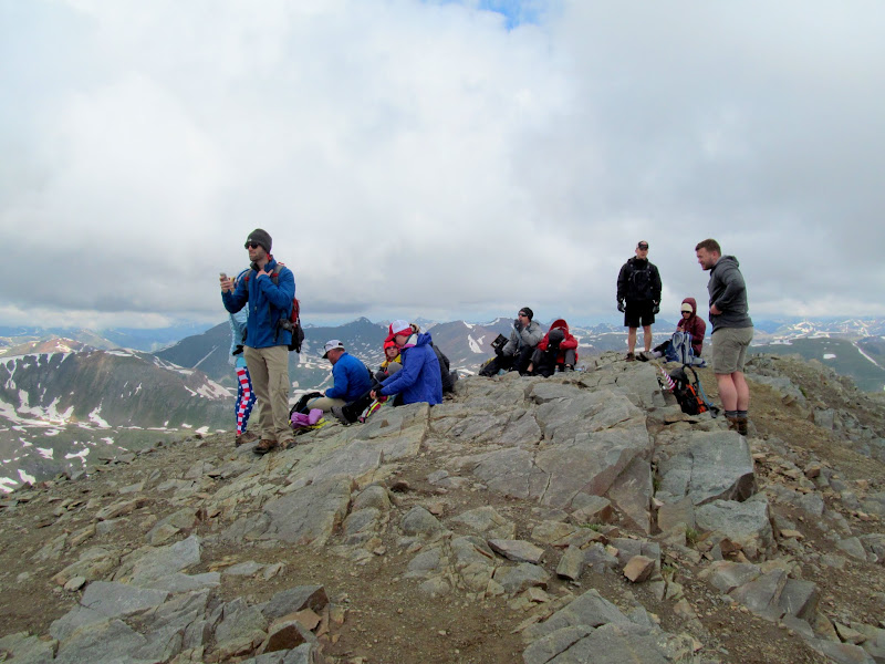
People at the summit
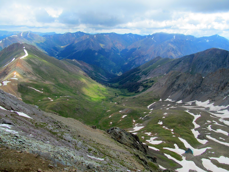
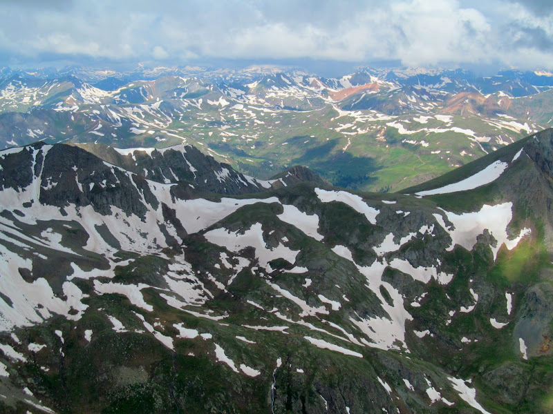
View west from Handies Peak
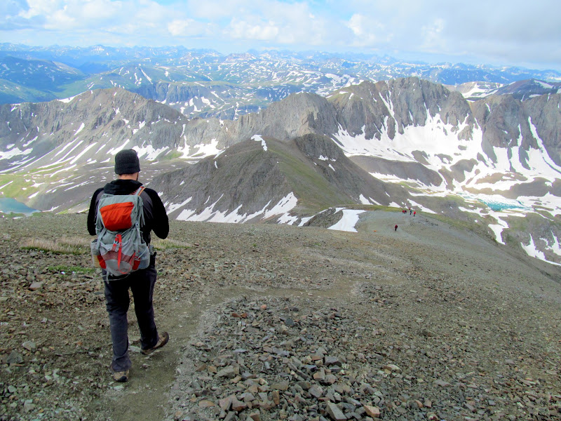
Beginning the descent
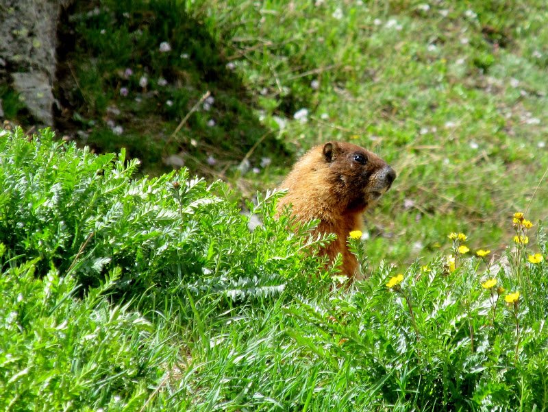
Trailside marmot
GPS stats for the Handies Peak hike
We left the area via Lake Fork, taking Highway 149 and US-50 back to Montrose and then Grand Junction, stopping a few times along the way to take in the sights. In GJ we made the requisite stop at Liquor Barn to stock up on beer before heading back into Utah, and we made it to my place in time to down a couple of those beers.
Leaving American Basin
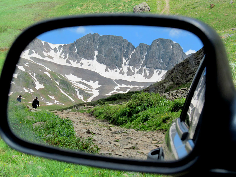
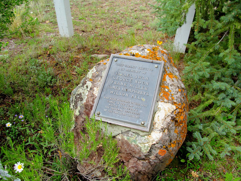
Memorial to the victims of Alferd Packer
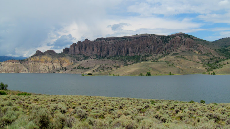
Dillon Pinnacles at Blue Mesa Reservoir
Quick stop in Montrose
Photo Gallery: Mount Sneffels and Handies Peak
GPS Track and Photo Waypoints:
[ Google Earth KMZ ] [ Gmap4 Satellite ] [ Gmap4 Topo ]
Ouray, CO
Old rescue truck along Canyon Creek
My alarm went off at 4AM and I hadn't slept well. I got up and made coffee and munched on a donut. We packed our wet gear into the Jeep and headed back to the main road, then crawled up the steep road to the trailhead in 4-low. A sign proclaimed the road closed before the upper trailhead, presumably due to snow drifts. I parked near two other vehicles at the closure then Chris and I started hiking. It was a little before 6AM and already light enough to see well despite the low clouds and mist in the air. Another hiker walked alongside us for a brief while, and we'd see only a few others the rest of the hike. It was a steep and loose climb up to the ridge below Lavender Colouir. Chris stayed well ahead of me but stopped to wait at the top of the ridge.
Jeep climbing to the Mount Sneffels trailhead
Snow on the road
Upper trailhead
Snow on the trail
Gilpin Peak
Climbing up to Lavender Col
Yankee Boy Basin
Chris at the bottom of Lavender Col
Climbing up Lavender Col was sketchy AF. An ice axe and crampons would have been better suited for the snow conditions. I had only a trekking pole, and I was very grateful that I'd thrown some gaiters in my pack at the last minute before leaving home. We kicked steps into the snow, made easier by a couple of guys who were ascending ahead of us. At the top of the colouir the route to the summit wasn't clear. Chris climbed up a notch over a short ridge that got closer to the peak, but I had trouble climbing the same notch. I was ready to give up, only a few hundred feet from the summit. Chris scouted around the ridge, however, and found an easier spot for me to climb. From there we had one more snow-filled gully to cross before the final, easy scramble to the summit of Mount Sneffels at 14,048'.
Lavender Col
Unusual gear for me in July: gaiters, gloves, and a trekking pole
Chris on the final climb to the summit
Chris below the Mount Sneffels summit
Chris on the Mount Sneffels summit
Chris on the Mount Sneffels summit (yay, cell service!)
Descending Lavender Col was sketchier than going up! Our heels wouldn't stick in the toe-holds in the snow, but Chris found that we could descend more easily by walking backwards and kicking our toes into the holes. It seemed to take just as long going down as it had going up, and it was just as strenuous. It was extremely nerve-wracking for me knowing that on this steep, snow-covered slope, one slip could send me sliding into the boulder field below. I don't think the trekking pole would have been much help in arresting a slide. Chris cheered when he reached solid ground at the bottom of the colouir and I was only a few minutes behind him. From there it was a straightforward downhill hike back to the Jeep. We'd hiked 4.3 miles total with 2,100' elevation gain in 7.25 hours. It was easily one of the most harrowing hikes I've done. No one thing was any more difficult than anything I've done before, but the combination of steepness, snow conditions, and simply being far from home made it mentally challenging.
Descending Lavender Col
Pika-chu!
Almost back to the Jeep (barely visible in the lower-right)
GPS stats for the Mount Sneffels hike
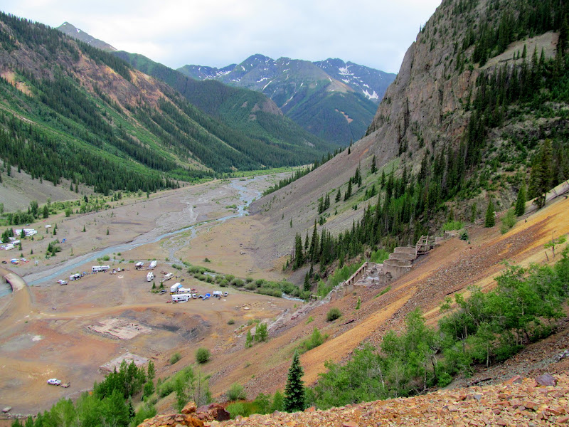
We spent the rest of the day wandering our way to American Basin where we planned to hike to Handies Peak the next morning. After a lunch of cup-of-noodles and coffee, and a quick stop in Ouray, we tried following Google Maps' directions to American Basin, but County Road 18 started out gnarly and then got worse. I backtracked to the Million Dollar Highway and we followed that to Silverton, where we followed the road along the Animas River and took Cinnamon Pass over to American Basin. There was a lot of neat stuff to see along the way. Animas Forks ghost town was especially interesting, though I think I picked up a nail in one of the Jeep's tires there that I didn't discover until two days later--good thing it didn't blow out on the drive home! We got to American Basin after sunset and found it fairly crowded, but there was still a spot alongside the road to park and set up camp. Again I slept in a tent and Chris slept out in the open, but a 1AM thunderstorm forced him to relocate inside the Jeep for the rest of the night.
Lunch time
Waterfall above Sneffels Creek
Sneffels Creek shelf road
Snow bridge over Canyon Creek
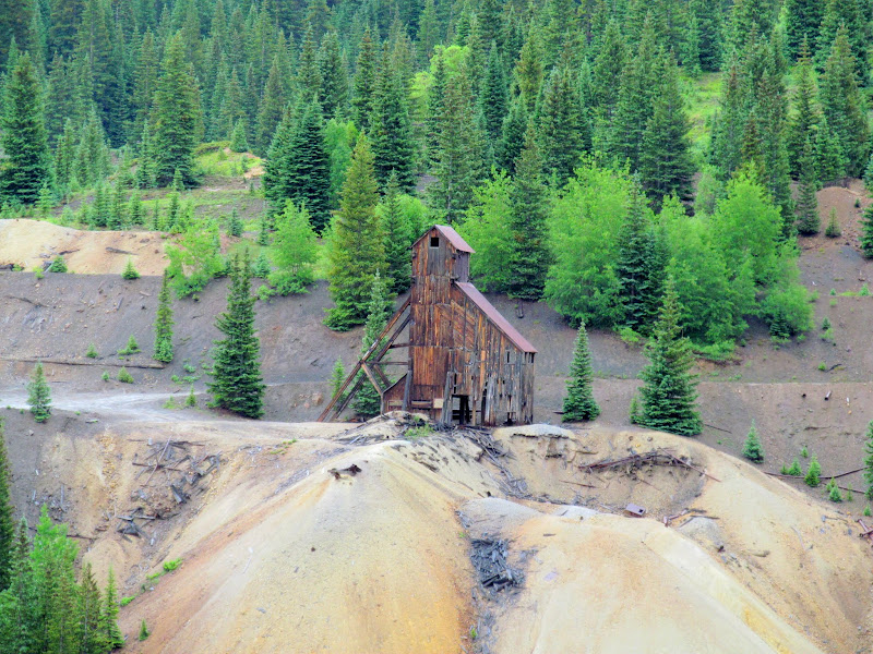
Red Mountain mining ruins
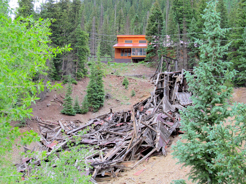
Mining ruins and modern building at Middleton
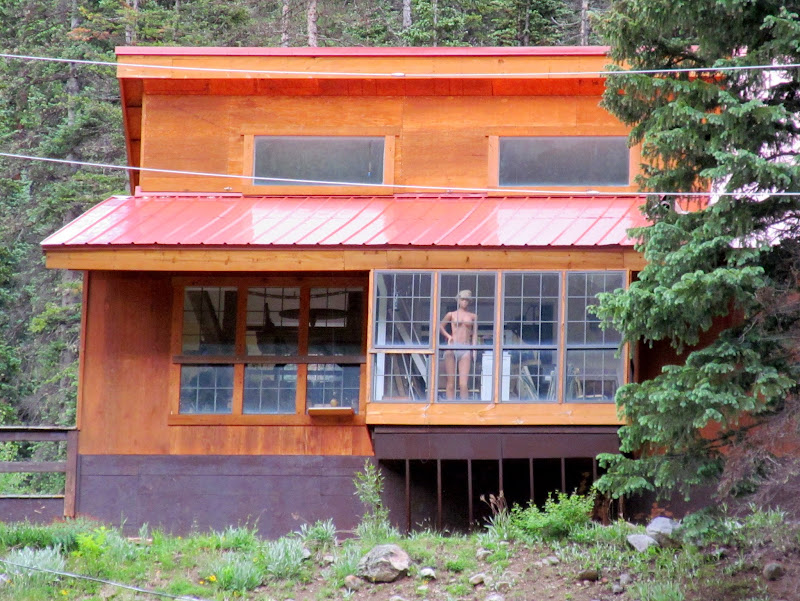
Hrmm?
Sunnyside Mill at Eureka
Animas Forks ghost town
Animas Forks jail
Marmot
Walled-off mine opening at Animas Forks
Animas Forks ghost town
Climbing up to Cinnamon Pass
Cinnamon Pass
Last sunlight on the peaks east of Cinnamon Pass
Unusual BLM sign: open to EVERYONE!
Tent aglow in American Basin
With an easier hike and better weather in the forecast for Sunday, we didn't rise until 5:30AM. Breakfast was done, gear stowed, and the Jeep parked at the trailhead by 6:45 for the start of this hike. We shared the trail with quite a few more people than on the previous day. With tired muscles, I kept a slow pace but got into a rhythm and didn't have to stop to rest as much as I had while ascending Sneffels. There was a lot more vegetation with wildflowers here, and with clearer weather the views were better as well. It took a little over three hours to make the summit at 14,150'. I was amazed by the view! We rested for a while and then made the descent in half the time. The total hiking distance was 5.5 miles with 2,550' elevation gain, but with a more gradual slope to the trail it was a breeze.
First light in American Basin
Glowing cliffs
Ascending the Handies Peak trail
Colorado Columbine (Aquilegia coerulea)
Thick carpet of Heartleaf Bittercress (Cardamine cordifolia)
Fresh dusting of snow on Handies Peak
American Basin
Sloan Lake
Trail cutting across a slope
Please stay on trail
Almost to the ridge
Boulder Gulch from the saddle
Almost to the summit of Handies Peak
Grizzly Gulch
People at the summit
View west from Handies Peak
Beginning the descent
Trailside marmot
GPS stats for the Handies Peak hike
We left the area via Lake Fork, taking Highway 149 and US-50 back to Montrose and then Grand Junction, stopping a few times along the way to take in the sights. In GJ we made the requisite stop at Liquor Barn to stock up on beer before heading back into Utah, and we made it to my place in time to down a couple of those beers.
Leaving American Basin
Memorial to the victims of Alferd Packer
Dillon Pinnacles at Blue Mesa Reservoir
Quick stop in Montrose
Photo Gallery: Mount Sneffels and Handies Peak
GPS Track and Photo Waypoints:
[ Google Earth KMZ ] [ Gmap4 Satellite ] [ Gmap4 Topo ]
