Most Scenic Route to Traverse the Gros Ventre?

stretch

Member
Joined
Dec 16, 2020
Messages
18
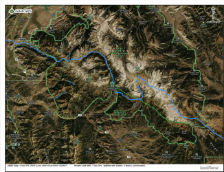
This summer I'm planning to hike from Jackson, WY east across the Gros Ventre Wilderness. I was wondering if anybody had any tips on the best/most scenic route? Off-trail travel is fine (up to some minimal class 3 scrambling, though I would like to keep it to class 2 if possible). I've attached a GPX of the route as I currently have it planned out, but I would hate to miss any highlights of the wilderness there.

Thanks!
 

Attachments

  • Gros Ventre Traverse.gpx
    288.6 KB · Views: 63
Get a hold of Scatman on here.... He planned and did a route.

You need to adjust your gox so we can see it without download.
 
Haven't done it, but check the FS's website re the Granite Highline Trail portion of your plan. Apparently it's in pretty rough shape in places.

I see you're planning to go thru a notch WSW of Brewster Lake. I'm pretty sure @seekinglost went thru that notch a few years back.
 
This summer I'm planning to hike from Jackson, WY east across the Gros Ventre Wilderness. I was wondering if anybody had any tips on the best/most scenic route? Off-trail travel is fine (up to some minimal class 3 scrambling, though I would like to keep it to class 2 if possible). I've attached a GPX of the route as I currently have it planned out, but I would hate to miss any highlights of the wilderness there.

Thanks!

Great backpacking choice - a very underappreciated area if you ask me. It has beautiful scenery throughout and when I did it, we saw very few people up until our exit at the Granite Hot Springs Trailhead.

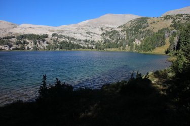
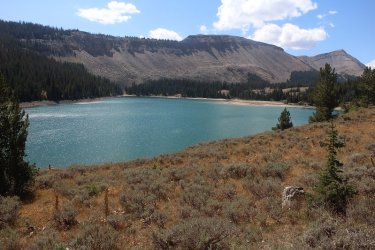
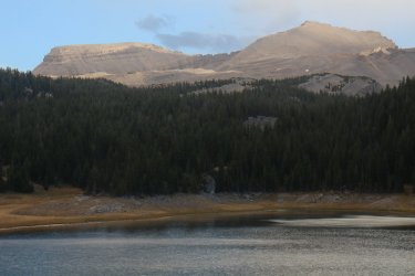
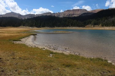
I'd alter your route to hit some of the lakes ( Turquoise, Shoal, Brewster, Lunch, The Six Lakes, etc.) within the wilderness area if you have time. The views from all the lakes are tremendous. Of course , staying high on the ridge you've chosen, you'll get to see a couple of them down below. The hike up or down Granite Creek is worthwhile too in my opinion.

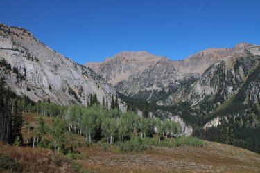
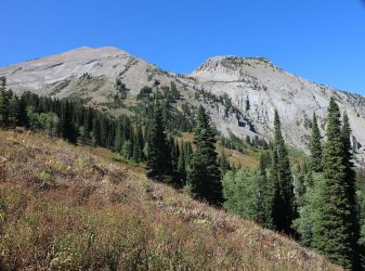
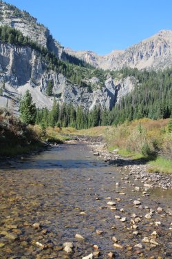
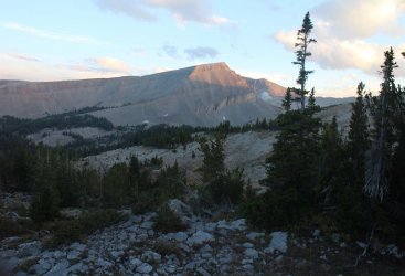
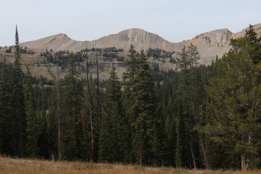
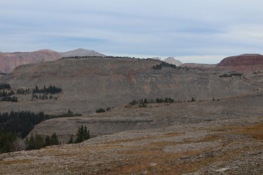
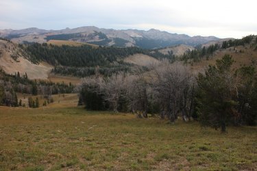
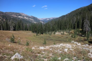
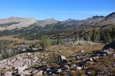
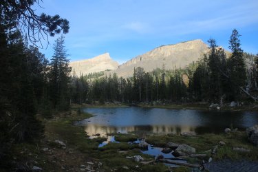
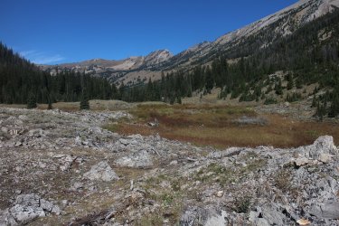
Here is some Gros Ventre eye candy for you to keep you psyched up. :) Have a great trip.


04.jpg
05.jpg
06.jpg
07.jpg
08.jpg
09.jpg
10.jpg
11.jpg
12.jpg
13.jpg
14.jpg
15.jpg
16.jpg
17.jpg
18.jpg
 
Get a hold of Scatman on here.... He planned and did a route.

You need to adjust your gox so we can see it without download.
After a search I did find Scatman's trip report, with great maps and pictures as well. Thank you for the tip!
 
Great backpacking choice - a very underappreciated area if you ask me. It has beautiful scenery throughout and when I did it, we saw very few people up until our exit at the Granite Hot Springs Trailhead.

I'd alter your route to hit some of the lakes ( Turquoise, Shoal, Brewster, Lunch, The Six Lakes, etc.) within the wilderness area if you have time. The views from all the lakes are tremendous. Of course , staying high on the ridge you've chosen, you'll get to see a couple of them down below. The hike up or down Granite Creek is worthwhile too in my opinion.

Here is some Gros Ventre eye candy for you to keep you psyched up. :) Have a great trip.
I was just reading your trip report! Thanks for the reply. This is great info, and wow those are some beautiful pictures. I think I will alter my route to hit some of those lakes, and maybe even granite creek as well. I'm even more excited to get out there now, summer really can't get here quickly enough.
 
Haven't done it, but check the FS's website re the Granite Highline Trail portion of your plan. Apparently it's in pretty rough shape in places.

I see you're planning to go thru a notch WSW of Brewster Lake. I'm pretty sure @seekinglost went thru that notch a few years back.
Ah, that would explain why I couldn't find many (or any) trip reports about it online. Hard to pass up a trail named "granite highline"... But maybe I'll just take it as an excuse to detour and see some other parts of the wilderness.
 
Ah, that would explain why I couldn't find many (or any) trip reports about it online. Hard to pass up a trail named "granite highline"... But maybe I'll just take it as an excuse to detour and see some other parts of the wilderness.

@ramblinman man and I went over the notch near brewster. its not bad. TR here. Brewster is waaay worth a stopover.

 
just want to say I am very interested in the eventual answer here
Scatman's loop seems like probably the best way to get the highlights of the Gros Ventre. But, if like me, you need to traverse from West to East (or vice versa) in a semi-efficient way - the updated route I'm linking in this comment seems to be pretty good. It goes by turquoise lake, granite creek, and shoal lake, then an off-trail high route in the eastern portion. I'll try and remember to post some pics to this thread after I do the route this summer.Screen Shot 2021-02-19 at 7.22.54 PM.png
 

Attachments

  • 8-wilson-wy-to-green-river-snowmobile-trailhead-hwy-352.gpx
    328 KB · Views: 36
@ramblinman man and I went over the notch near brewster. its not bad. TR here. Brewster is waaay worth a stopover.

G

Always tough to tell from a computer screen whether an off-trail route will go, so I'm very glad to hear that you've already done it! Pics look really beautiful. I may try and time it so that I end up camping at Brewster too. Thanks for the good info.
 
Scatman's loop seems like probably the best way to get the highlights of the Gros Ventre. But, if like me, you need to traverse from West to East (or vice versa) in a semi-efficient way - the updated route I'm linking in this comment seems to be pretty good. It goes by turquoise lake, granite creek, and shoal lake, then an off-trail high route in the eastern portion. I'll try and remember to post some pics to this thread after I do the route this summer.
wow, thanks!!
 
Wonderful Wilderness One of the most stunning locations we've ever seen! It's well managed, teeming with species, and eerily silent. In the Jackson region, this is a necessity. It's much better if you do it with a horse! I had already explored the United States and had chosen to go much further. This year, I decided to travel to Europe in search of something unique in terms of history. Various points of interest, castles, and fortifications. I haven't made up my mind yet, but I'm going to start with Germany's most popular tourist destination. Everyone has a beautiful trip.
 
Last edited:
Scatman's loop seems like probably the best way to get the highlights of the Gros Ventre. But, if like me, you need to traverse from West to East (or vice versa) in a semi-efficient way - the updated route I'm linking in this comment seems to be pretty good. It goes by turquoise lake, granite creek, and shoal lake, then an off-trail high route in the eastern portion. I'll try and remember to post some pics to this thread after I do the route this summer.View attachment 96330
I'm a little late to the game on this thread, but I hiked nearly this exact route in 2018 on my CDT thru hike. It's a pretty beautiful area. Tosi Creek offers some decent game trails/light foot trails to follow, but in the upper basin, these disappear as the terrain turns to rock. We took an off-trail pass, north of Hodges Peak, towards Doubletop Peak. Sharp rocks, some snow patches in August, slow going, but beautiful. West of Doubletop Peak, you'll come across a ridge with a steep wall on the west side that you'll be looking for a way down. I found the notch just west of peak 10750' to be our way down, about a 60ft climb. It's easier than it looks, but not class 2 by any means. Solid class 3. Very doable, just take your time. The slope below the climb itself was the "fun" part, we slid on our butts down, mostly. We continued off-trail towards Palmer Peak, staying east of the ridge. Again, really nice area. Lots of wildflowers, cool peaks and rock formations, and no trails. Pretty easy going for off-trail, though. North of Steamboat Peak, we dropped down to Shoal Lake. The Shoal Creek drainage is AWESOME. Really impressive views here. After being off trail, the trails here are pretty good. There is excellent camping opportunities in the Shoal Creek area. The hike from Deer Ridge to Granite Creek campground is not as interesting, but good trail, so it's fast hiking.

From the Granite Creek CG, you have two options.... the Granite Highline Trail or Granite Creek. Naturally, anything with "highline" in it sounds good. However, I have heard that this trail is not that great. There is practically no camp spots from what I have heard. Instead, we opted for Granite Creek to Cache Creek. Granite Creek is a pretty nice hike on it's own, and I doubt you will be that disappointed in skipping the Granite Highline Trail. Good trail here, easy to follow. Cache Creek, the upper parts are nice, but there is a lot more traffic the closer you get to Jackson. We camped in lower Cache Creek the night before walking through Jackson to resupply, but there were not many campsite options. If I could camp anywhere along this route, I would camp in upper Tosi Creek, Shoal Creek, and upper Granite Creek.

I have pictures and a write up on this route here, if you're interested: https://seekinglost.com/dubois-to-jackson-cdt-thru-hike-2018/

Hope this helps the next Gros Ventre hiker.
 
Years ago I did a two week hike across the Gros Ventre Range with walking out of Jackson to the east end then down the infant Gros Ventre River back to Jackson Hole. It was Great! Lots of country in here. One could actually spend all spring and summer in the Gros Ventres away from it all. Sooooo need to get back in here again. Places of places in here really away from it all.
 
Last edited:
Looking back over this thread I'm getting serious Gros Ventre envy. I had intended to do a nice tough loop up there last summer but our dates ended up being pretty unsettled weather-wise so we snagged permits for TCT instead, which was very scenic but too many people and too much red tape for my taste. Maybe this summer it'll happen!
 
Looking back over this thread I'm getting serious Gros Ventre envy. I had intended to do a nice tough loop up there last summer but our dates ended up being pretty unsettled weather-wise so we snagged permits for TCT instead, which was very scenic but too many people and too much red tape for my taste. Maybe this summer it'll happen!
Permits for tct? Could have done it without easy enough
 
Similar threads
Thread starter Title Forum Replies Date
TrailScot Capitol Reef NP - Scenic Drive closure for several months General Discussion 0
BJett Packrafting the Obed National Wild & Scenic River - Tennessee On The Water 1
Jimmy Ozark National Scenic Riverways Multi-Day Trips General Discussion 0
frahminator Scenic drive: PHX to Green River Trip Planning 1
uintahiker Most Scenic Trailhead- Wind Rivers Trip Planning 5
Tyler Big Cottonwood scenic drive to Sundance (Stewart Falls) Oct. 2006 Hiking & Camping 1
Tyler Mt Nebo Scenic Loop area camping August 2005 Hiking & Camping 3
Kullaberg63 15 day canyon route Backpacking 13
fossana A challenging week on the Escalante Overland Route Backpacking 21
TheMountainRabbit Dana Meadows to Twin Lakes via the High Route (Yosemite/Hoover Wilderness) - August 2023 Backpacking 8
meowtaingal Wind river high route mid september Trip Planning 7
D Wind River offtrail route questions Trip Planning 28
scatman Grandeur Peak - Dragon Tail Route - June 10, 2023 Hiking & Camping 13
B Sawtooths - Off Trail Route Plan Trip Planning 9
TheMountainRabbit Red's Meadow to Tuolumne Meadows via the High Route (Ansel Adams/Yosemite Wilderness) - August 2022 Backpacking 5
climbhigh1119 How doable is the sneak route out of Death Hollow with kids and a dog? Trip Planning 6
PaulMags Grand - Moab Route Backpacking 1
seekinglost Introducing the Mojave-Sonoran Trail: A NEW 625-mile Winter Thru-Hiking Route Backpacking 4
RyanP Young's/Lean-To Route in DC Trip Planning 7
M Grand Canyon NP, Royal Arch Route Backpacking 0
Yvonne Climbing Mount Saint Helens via Monitor Ridge Route, July 2021 Hiking & Camping 16
scatman Grandeur Peak - Dagon's Tail Route - November 21, 2021 Hiking & Camping 9
RyanP Coyote Gulch to Halls Creek via Steven's Canyon and the Baker Route (car/key swap) Meet Up (Members Only) 8
W 9 Days Solo Escalante Loop in October (water advice) - Stevens Canyon, Baker Route over Waterpocket fold, Halls Narrows to Moody Canyons Trip Planning 11
M 5 days Green > Elk Wind River route advice August 17th Trip Planning 9
Mikjik86 FULL Video Part 2 Backpacking Glacier National Park "North Circle Route" Backpacking 0
Mikjik86 Backpacking Glacier National Park (Part 2 Preview) "North Circle Route" Montana, August 2019 Backpacking 2
Nick Dirty Devil Miner's Route Trip Planning 0
K Cycling The Divide Mountain Route Trip Planning 16
Mikjik86 Backpacking Glacier National Park - North Circle Route Part 1 Preview Video. Backpacking 1
b.stark Wrangell-St Elias "Seven Pass Route" Backpacking 29
Devin Ashby The Lower Gulch - Escalante (Seeking info on the route) Trip Planning 14
LarryBoy A Route In Between: Mexico to Canada Through the Heart of the West Backpacking 50
Perry Any Beta in this Proposed Route Near Coffin Benchmark? Trip Planning 5
NorthwestWanderer Route Finding adventure, Copper Pass to Blue Lake - Goats, Bears, Lions, Oh my! Backpacking 3
Hiker Seth Thinking about this Wind River Route. Trip Planning 11
H Wind River Range route planning Trip Planning 6
NorthwestWanderer 6 Day backpacking trip in Glacier Peak Wilderness (3 days of off trail route) Backpacking 9
RyanP 5-day route in Winds in late July? Trip Planning 0
C Route 9 Through Zion closed indefinitely. General Discussion 25
DrNed Recommendation for 35-45 Mile Route in the Uintas Trip Planning 7
LarryBoy Critique the Route: Deseret Hiking Route Trip Planning 11
fossana Stephens Canyon Loop, part of Escalante Overland Route or ? Trip Planning 18
scatman Grandeur Peak - West Slope Route - September 3, 2018 Hiking & Camping 12
Jimmy Glacier Route Help Trip Planning 0
J White Cloud Route. 2018 June 22 Trip Planning 3
SKLund Cat Mesa via Alternate Pfeiffer Route Hiking & Camping 2
Gregg B. Powell Route Gypsum Canyon, UT Trip Planning 0
D Wind River High Route Trip Planning 4
LarryBoy Absarokas Fun Route - 12 Days of High Adventure Backpacking 21

Similar threads

Back
Top