IntrepidXJ
ADVENTR
- Joined
- Jan 17, 2012
- Messages
- 3,488
Saturday, April 4, 2015
Today I headed back into Utah so I could visit Moonshine Wash in the San Rafael Desert which has been on my list of places to visit for way too long, especially since it's not too far away from home! Moonshine Wash received it's name from the moonshiners who were active here during prohibition. While I didn't have a chance to visit the cement tanks near Moonshine Spring that were used to make the moonshine, I was finally able to visit and photograph the narrow slot that makes up part of this canyon.
It just so happened that there was also a Lunar Eclipse early this morning so I made sure and left home early enough so that I could stop in Rabbit Valley to photograph the Blood Moon.
A simple photo of the Blood Moon that I took from Rabbit Valley near the state line.
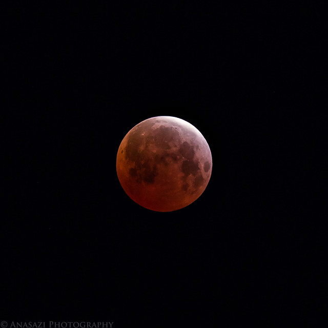
Blood Moon by IntrepidXJ, on Flickr
The partially eclipsed moon sets over the desert at the base of the Book Cliffs in Utah near Thompson Springs.
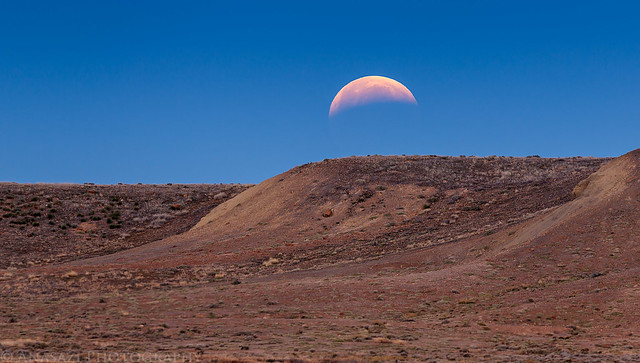
Lunar Eclipse Moonset by IntrepidXJ, on Flickr
After stopping to fuel up in Green River, I took the Green River Road south into the San Rafael Desert to begin my adventure. It had been pretty cold overnight (compared to the recent warmer temperatures we've been having) and when I passed by the Horse Bench Reservoir I noticed that it was covered with a thin sheet of ice.
Icy Reservoir by IntrepidXJ, on Flickr
I took a short side trip to Fossil Point.
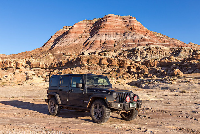
Fossil Point by IntrepidXJ, on Flickr
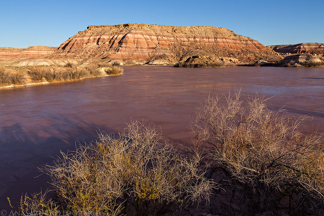
Layers of the desert to the Book Cliffs from the edge of Horse Bench.
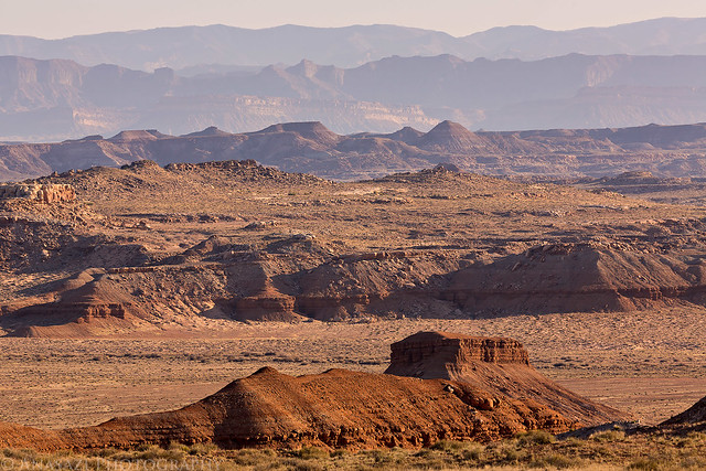
Desert Layers by IntrepidXJ, on Flickr
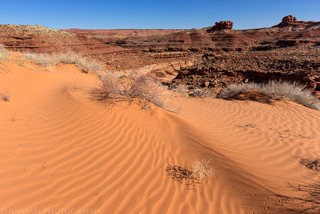
After reaching the trailhead, I hiked down a shallow wash to where it dropped down into Moonshine Wash, which I followed to the slot.
Moonshine Wash by IntrepidXJ, on Flickr
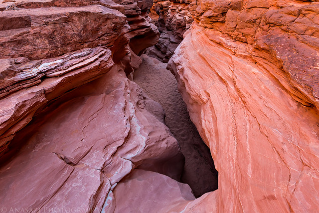
I followed the shallow slot which got progressively deeper...
Reflected Light by IntrepidXJ, on Flickr
Shallow Narrows by IntrepidXJ, on Flickr
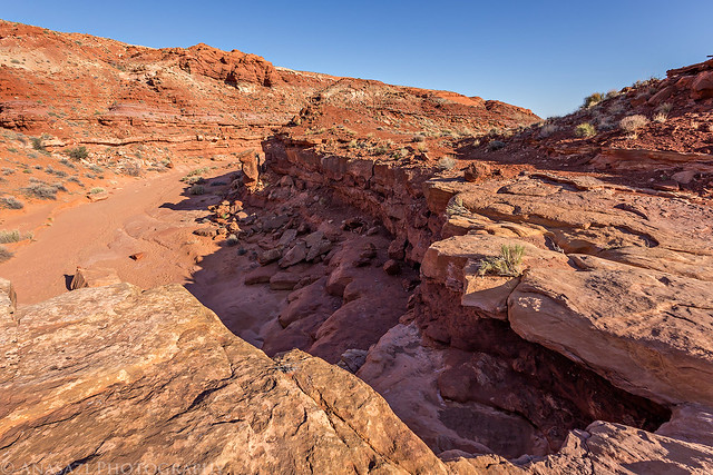
...until I reached this bigger drop that led into the deeper part of the slot canyon. I could have easily climbed down this drop, but I didn't think I would be able to get back up it by myself if I needed to, and since I wasn't quite sure what was ahead, I decided to be cautious and not go any further this way.
The First Drop by IntrepidXJ, on Flickr
I knew there was a steep exit down below the narrows somewhere, but I wasn't sure what it was like and didn't want to take the chance that I would be able to get up it. I'm not the best climber around, so I'm usually pretty cautious when I'm hiking alone. I decided to retrace my steps so I could find the escape route after the narrows and try coming back up the slot.
The Beginning by IntrepidXJ, on Flickr
As I hiked across the sandy bench above the canyon I came across this old 1911 survey marker.
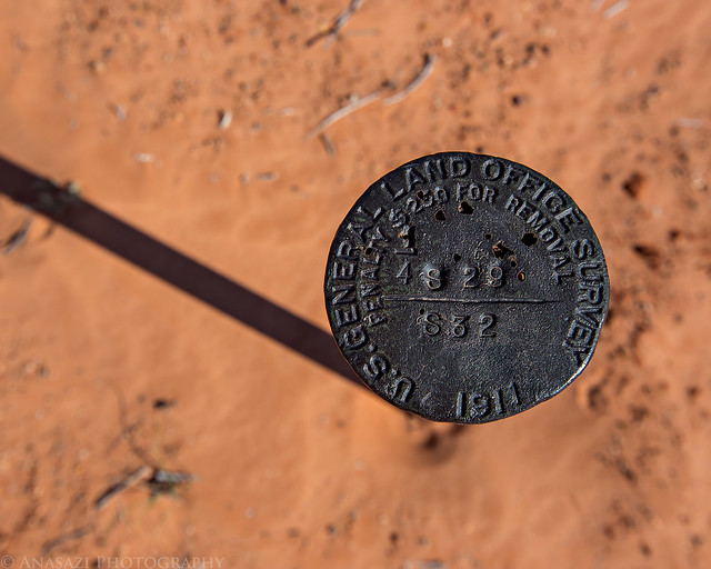
1911 Survey Marker by IntrepidXJ, on Flickr
I took a short detour to visit the Moonshiner Bridge that crosses the narrow slot canyon. I have read that this bridge was used by the old bootleggers so that they could drive their cars from the San Rafael and walk across the bridge to reach their operations at Moonshine Spring. I certainly wouldn't trust this bridge today!
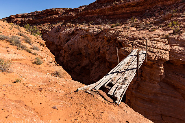
Moonshiner Bridge by IntrepidXJ, on Flickr
There was a lot of sand to hike through on my way across the top of the mesa.
Sandy Hike by IntrepidXJ, on Flickr
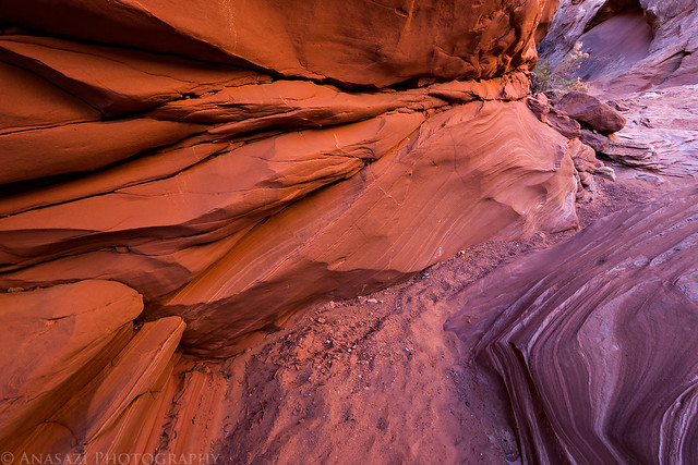
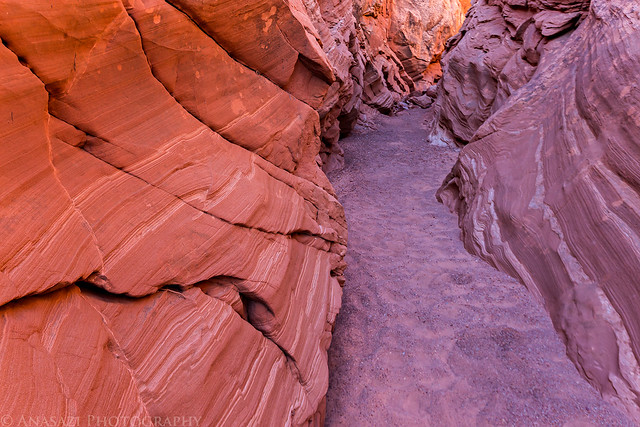
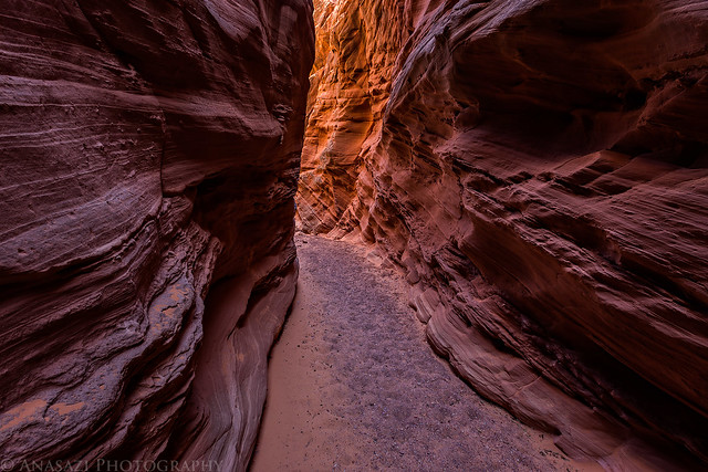
After finding the exit route out of the canyon, I followed it down to the wash at the bottom and hiked back up to the narrows. The light inside the exit (entrance for me) of the slot was very nice when I arrived.
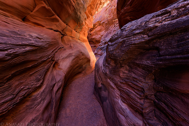
Moonshine Exit by IntrepidXJ, on Flickr
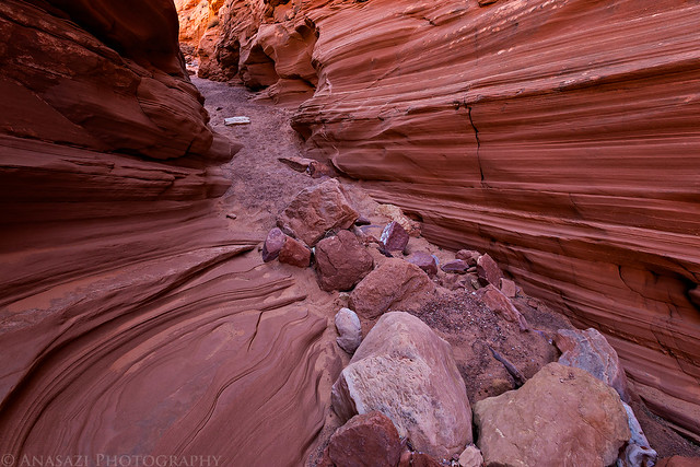
It was a fun little slot canyon to climb up with nice light around every bend. There were a few places I had to climb that would have been easier coming down, but I managed to get through it OK.
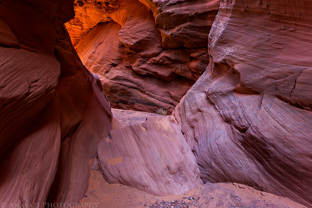
Light Chamber by IntrepidXJ, on Flickr
Dark Passage by IntrepidXJ, on Flickr
A view of the Moonshiner Bridge from below.
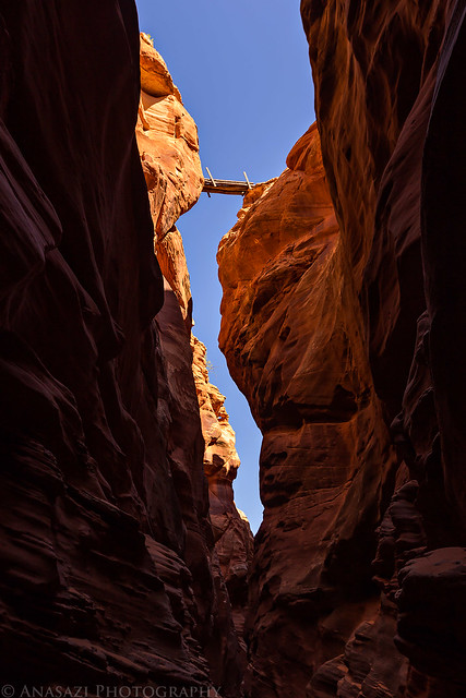
Moonshiner Bridge Above by IntrepidXJ, on Flickr
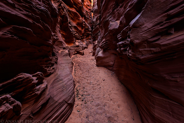
Moonshine Passage by IntrepidXJ, on Flickr
Since I wasn't able to climb back out of the canyon this way, I had to turn around return the way I had come in. Before exiting the canyon I decided to see if I could get up the West Fork to the old cement tanks near Moonshine Spring.
Shortly after entering the West Fork, I was stopped by this climb and turned around again to exit the canyon the way I had originally come down.
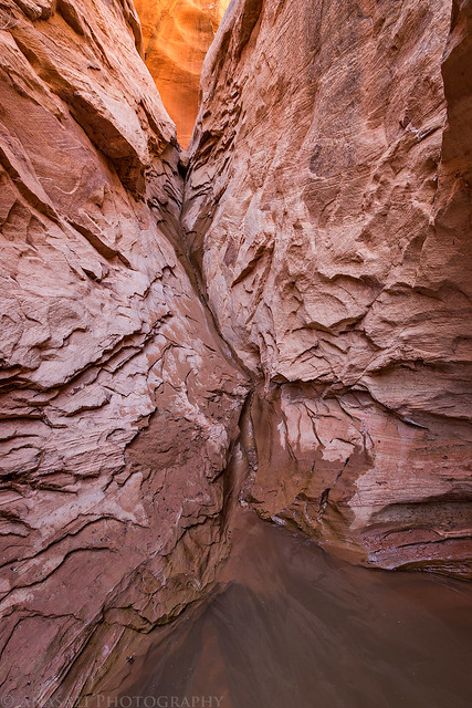
West Fork Climb by IntrepidXJ, on Flickr
After returning to my Jeep at the trailhead, I decided to take a quick side trip over to the Trin-Alcove Bend of the Green River since it was nearby and I hadn't been there in years.
As I hiked to the edge of the Trin-Alcove Bend from the end of the road, I passed this large hand made out of dark-colored rocks on the lighter sandstone.
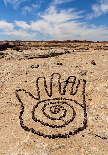
Big Hand by IntrepidXJ, on Flickr
A view over the Trin-Alcove Bend from the point of the confluence with Three Canyon.
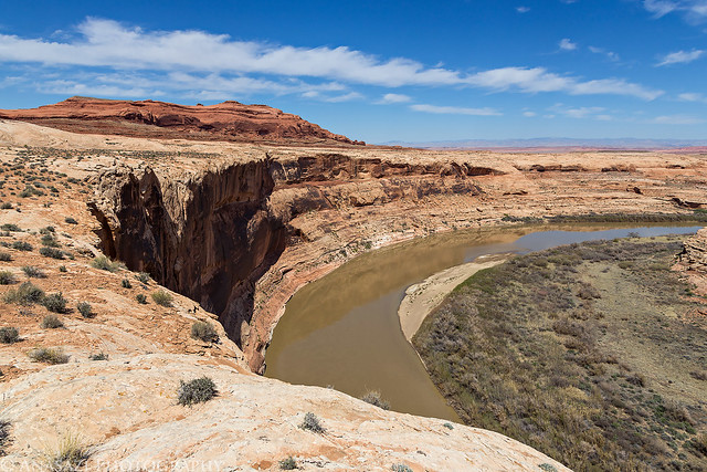
Trin-Alcove Bend by IntrepidXJ, on Flickr
As I drove back towards Green River I noticed that the ice on the Horse Bench Reservoir had melted off and now there was a muddy reflection.
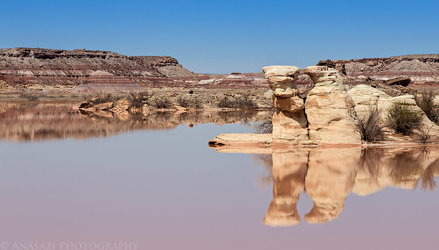
Muddy Reflection by IntrepidXJ, on Flickr
Before returning to Green River I took one more detour so I could try and find a few petroglyphs at Butterfly Bend along the Green River.
Following this wash through the badlands on my way to Butterfly Bend.
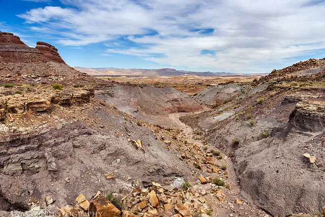
Badlands Wash by IntrepidXJ, on Flickr
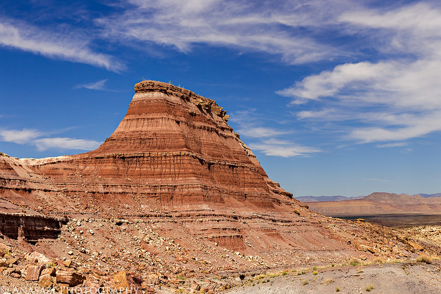
Colorful Butte by IntrepidXJ, on Flickr
I found a few boulders with petroglyphs on them, but I'm sure that I missed some since I was getting short on time. This was one of the better panels I found.

Boulder Petroglyphs by IntrepidXJ, on Flickr
This boulder was separate from the rest and closer to the Green River. I was actually standing on top of the boulder looking down to take this photo.

Butterfly Bend Boulder by IntrepidXJ, on Flickr
Before leaving the area, I spotted what I thought looked like a small panel of Barrier Canyon Style pictographs on the ledge below me, so I found a way to reach them. Unfortunately, it looks like I was deceived since I'm pretty sure these are fakes based on the 'DINASAR' written above them in the same pigment.

Deceived by IntrepidXJ, on Flickr
One last photo of the Green River at Butterfly Bend before I hiked back to my Jeep.

Butterfly Bend by IntrepidXJ, on Flickr
After reaching the trailhead it was a short drive back to Green River where I stopped for the obligatory burger at Ray's Tavern before the drive home.
>> Moonshine Wash Photo Gallery
Featured image for home page:

Today I headed back into Utah so I could visit Moonshine Wash in the San Rafael Desert which has been on my list of places to visit for way too long, especially since it's not too far away from home! Moonshine Wash received it's name from the moonshiners who were active here during prohibition. While I didn't have a chance to visit the cement tanks near Moonshine Spring that were used to make the moonshine, I was finally able to visit and photograph the narrow slot that makes up part of this canyon.
It just so happened that there was also a Lunar Eclipse early this morning so I made sure and left home early enough so that I could stop in Rabbit Valley to photograph the Blood Moon.
A simple photo of the Blood Moon that I took from Rabbit Valley near the state line.
Blood Moon by IntrepidXJ, on Flickr
The partially eclipsed moon sets over the desert at the base of the Book Cliffs in Utah near Thompson Springs.
Lunar Eclipse Moonset by IntrepidXJ, on Flickr
After stopping to fuel up in Green River, I took the Green River Road south into the San Rafael Desert to begin my adventure. It had been pretty cold overnight (compared to the recent warmer temperatures we've been having) and when I passed by the Horse Bench Reservoir I noticed that it was covered with a thin sheet of ice.
Icy Reservoir by IntrepidXJ, on Flickr
I took a short side trip to Fossil Point.
Fossil Point by IntrepidXJ, on Flickr
Layers of the desert to the Book Cliffs from the edge of Horse Bench.
Desert Layers by IntrepidXJ, on Flickr
After reaching the trailhead, I hiked down a shallow wash to where it dropped down into Moonshine Wash, which I followed to the slot.
Moonshine Wash by IntrepidXJ, on Flickr
I followed the shallow slot which got progressively deeper...
Reflected Light by IntrepidXJ, on Flickr
Shallow Narrows by IntrepidXJ, on Flickr
...until I reached this bigger drop that led into the deeper part of the slot canyon. I could have easily climbed down this drop, but I didn't think I would be able to get back up it by myself if I needed to, and since I wasn't quite sure what was ahead, I decided to be cautious and not go any further this way.
The First Drop by IntrepidXJ, on Flickr
I knew there was a steep exit down below the narrows somewhere, but I wasn't sure what it was like and didn't want to take the chance that I would be able to get up it. I'm not the best climber around, so I'm usually pretty cautious when I'm hiking alone. I decided to retrace my steps so I could find the escape route after the narrows and try coming back up the slot.
The Beginning by IntrepidXJ, on Flickr
As I hiked across the sandy bench above the canyon I came across this old 1911 survey marker.
1911 Survey Marker by IntrepidXJ, on Flickr
I took a short detour to visit the Moonshiner Bridge that crosses the narrow slot canyon. I have read that this bridge was used by the old bootleggers so that they could drive their cars from the San Rafael and walk across the bridge to reach their operations at Moonshine Spring. I certainly wouldn't trust this bridge today!
Moonshiner Bridge by IntrepidXJ, on Flickr
There was a lot of sand to hike through on my way across the top of the mesa.
Sandy Hike by IntrepidXJ, on Flickr
After finding the exit route out of the canyon, I followed it down to the wash at the bottom and hiked back up to the narrows. The light inside the exit (entrance for me) of the slot was very nice when I arrived.
Moonshine Exit by IntrepidXJ, on Flickr
It was a fun little slot canyon to climb up with nice light around every bend. There were a few places I had to climb that would have been easier coming down, but I managed to get through it OK.
Light Chamber by IntrepidXJ, on Flickr
Dark Passage by IntrepidXJ, on Flickr
A view of the Moonshiner Bridge from below.
Moonshiner Bridge Above by IntrepidXJ, on Flickr
Moonshine Passage by IntrepidXJ, on Flickr
Since I wasn't able to climb back out of the canyon this way, I had to turn around return the way I had come in. Before exiting the canyon I decided to see if I could get up the West Fork to the old cement tanks near Moonshine Spring.
Shortly after entering the West Fork, I was stopped by this climb and turned around again to exit the canyon the way I had originally come down.
West Fork Climb by IntrepidXJ, on Flickr
After returning to my Jeep at the trailhead, I decided to take a quick side trip over to the Trin-Alcove Bend of the Green River since it was nearby and I hadn't been there in years.
As I hiked to the edge of the Trin-Alcove Bend from the end of the road, I passed this large hand made out of dark-colored rocks on the lighter sandstone.
Big Hand by IntrepidXJ, on Flickr
A view over the Trin-Alcove Bend from the point of the confluence with Three Canyon.
Trin-Alcove Bend by IntrepidXJ, on Flickr
As I drove back towards Green River I noticed that the ice on the Horse Bench Reservoir had melted off and now there was a muddy reflection.
Muddy Reflection by IntrepidXJ, on Flickr
Before returning to Green River I took one more detour so I could try and find a few petroglyphs at Butterfly Bend along the Green River.
Following this wash through the badlands on my way to Butterfly Bend.
Badlands Wash by IntrepidXJ, on Flickr
Colorful Butte by IntrepidXJ, on Flickr
I found a few boulders with petroglyphs on them, but I'm sure that I missed some since I was getting short on time. This was one of the better panels I found.
Boulder Petroglyphs by IntrepidXJ, on Flickr
This boulder was separate from the rest and closer to the Green River. I was actually standing on top of the boulder looking down to take this photo.
Butterfly Bend Boulder by IntrepidXJ, on Flickr
Before leaving the area, I spotted what I thought looked like a small panel of Barrier Canyon Style pictographs on the ledge below me, so I found a way to reach them. Unfortunately, it looks like I was deceived since I'm pretty sure these are fakes based on the 'DINASAR' written above them in the same pigment.
Deceived by IntrepidXJ, on Flickr
One last photo of the Green River at Butterfly Bend before I hiked back to my Jeep.
Butterfly Bend by IntrepidXJ, on Flickr
After reaching the trailhead it was a short drive back to Green River where I stopped for the obligatory burger at Ray's Tavern before the drive home.
>> Moonshine Wash Photo Gallery
Featured image for home page:
") . impressive looking conditions for sure!
. impressive looking conditions for sure! I was in Moonshine Wash the weekend before you & there was a family group of at least 20+ climbing through the slot like a pack of wild monkeys...kids and all! I was slightly devastated when I first saw them, as I was in search of solitude, but it turned out fine, only passed them once & they were exceptionally friendly