Monument Mysteries

Stephanie B

Steph and Blake
.
Joined
Dec 7, 2017
Messages
264
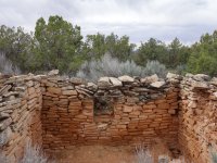
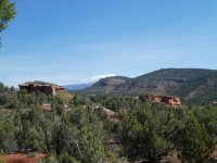
In plain sight from oft-traveled dirt roads in Bears Ears National Monument are numerous built structures that you aren't found on any topo or Trails Illustrated map. These are sites that continue to intrigue and puzzle leading archaeologists.

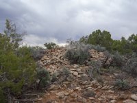
Was this place a Great House of Chaco influence?
P1040514.JPG

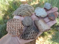
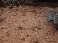
An insane amount of sherds :

P1040515.JPG

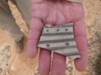
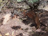
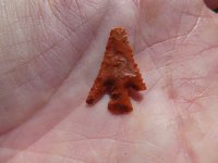
As Udink would say...."Ooh, a pretty rock!"
P1040529.JPG

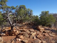
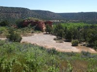
Was this flat area for pageantry or play or just a flat area?
P1040524.JPG

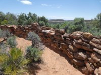
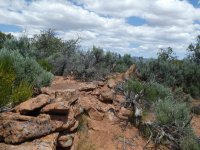
Was this circular assemblage of stones for ceremony and, if yes, what were the ceremonies all about?
P1040351.JPG

P1040352.JPG

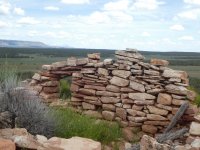
Was this site part of a network of sites connected by near-to-invisible roads?
P1040553.JPG

P1040554.JPG

P1040562.JPG

As is usually the case, we left each site with more questions than answers. If only Kane Gulch took phone calls...
 
In plain sight from oft-traveled dirt roads in Bears Ears National Monument are numerous built structures that you aren't found on any topo or Trails Illustrated map. These are sites that continue to intrigue and puzzle leading archaeologists.

Was this place a Great House of Chaco influence?

View attachment 78187

An insane amount of sherds :

View attachment 78188

As Udink would say...."Ooh, a pretty rock!"

View attachment 78189

Was this flat area for pageantry or play or just a flat area?

View attachment 78190

Was this circular assemblage of stones for ceremony and, if yes, what were the ceremonies all about?

View attachment 78191

View attachment 78192

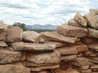
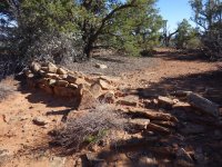
Was this site part of a network of sites connected by near-to-invisible roads?
View attachment 78193

View attachment 78194

View attachment 78195

As is usually the case, we left each site with more questions than answers. If only Kane Gulch took phone calls...

Hi Stephanie,

I have a research paper on the second site you show, sw of Bear's Ears. It may answer some of your questions, though the researchers pose more, just like us!
Though I've driven past, I've never walked out to the Twin Buttes. Now I have to! Can you map it and see how it lines up with the Great House lower in Cottonwood Wash? Wouldn't be surprised if they pointed to Chaco.

On my trip this April we found a surprise mesa top site that was round or oval as well. The mesa had only one non technical access, and a scramble notch separated the round wall from a unit pueblo about 500 yards away.

Round/oval wall:

DSC00086.JPG


Multi unit site (500 yards away through a narrow notch):

DSC00090.JPG


On another day we found another multi unit site, Cedar Mesa, that is similar to your second site (lucrative with cherds though i don't want to show them):

DSC00201.JPGDSC00203.JPG


Weeks later, in the Kayenta/Virgin River Anasazi territory I found two neat cysts. Located on a mesa top with profound petroglyph panels in an alcove below:


DSC01139.JPG

DSC01146.JPG

This mesa had only one Cl 3 access, otherwise surrounded by a vertical seam in the Navajo sandstone.
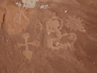
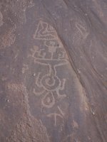
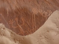
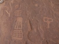
Some may recognize the art in the alcove below. Very interesting elements :

DSC01093.JPGDSC01103.JPGDSC01096.JPGDSC01113.JPG

I, too, have become really interested in the mesa top stuff. Watch towers, line of sight signal towers, ceremonial sites, unit pueblos....all so interesting.

John
 
Last edited:
<following this thread>
Also an interest of mine. Especially since my first visit to Chaco and seeing the alignment of so many of the great houses.
 

Don't like ads? Become a BCP Supporting Member and kiss them all goodbye. Click here for more info.

Back
Top