Udink
Still right here.
- Joined
- Jan 17, 2012
- Messages
- 1,734
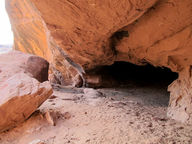
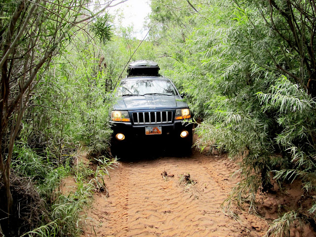
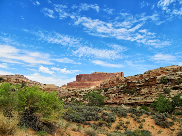
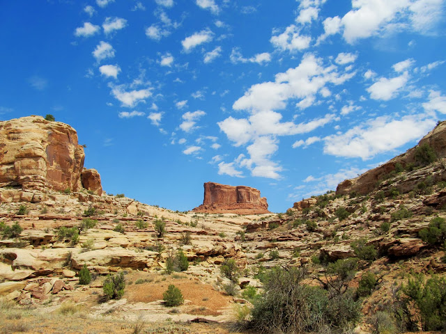
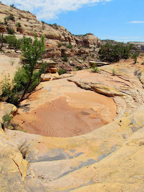
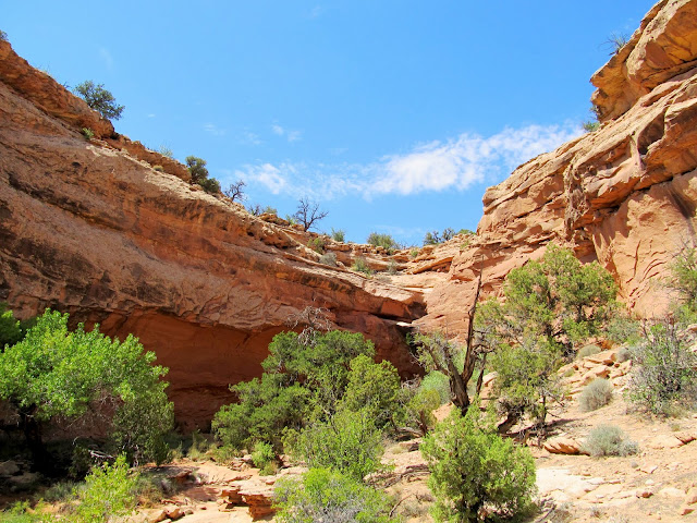
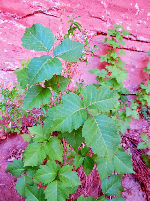
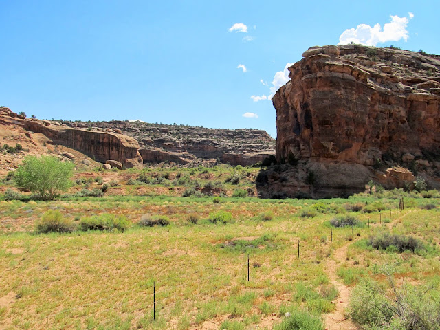
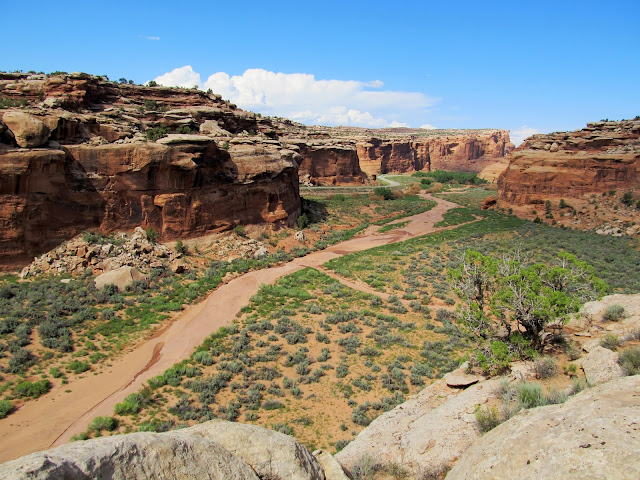
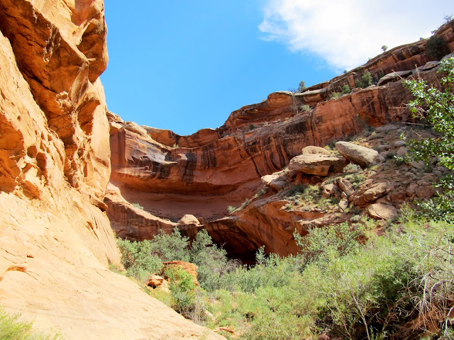
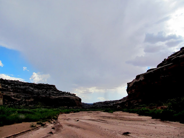
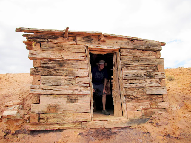
@Chris Mosbacker and I made plans for Labor Day weekend to hike and camp in the Moab area. I arrived early Friday (which was also my 37th birthday) and hiked around solo, while Chris was planning on showing up late that evening. I had no fixed agenda--just a list of options to choose from--and the first thing I did was explore a few areas of Sevenmile Canyon just off UT-313. One side canyon had an old road or trail leading to an alcove that was visible in Google Earth and I parked alongside the highway, hopped the fence, and hiked over to it. I hoped to find some rock art but instead found a heavily-graffitied alcove with an interesting cave at the back. I returned to the Jeep and tried driving up the South Fork of Sevenmile Canyon. It had recently flooded and there were cut banks and sand bars cris-crossing the wide bottom of the canyon, with no other vehicle tracks for me to follow. In addition, I hadn't checked the travel map to verify whether this was an open route. I backed off my plan to drive up the canyon and instead returned to the highway and parked where the main fork of Sevenmile Canyon crosses the road, then began hiking up the canyon. As I hiked I kept an eye out for rock art, but not knowing whether there was any in this part of the canyon (there wasn't, at least not that I saw). First Merrimac Butte came into view, then Monitor Butte. I came to a fork and went right, then continued up as far as I could until reaching a big dryfall that hid some poison ivy.
Cave in a side canyon
Driving through the jungle in Sevenmile Canyon
Merrimac Butte
Monitor Butte
Above a dryfall in right fork of Sevenmile Canyon
Dryfall that ended my travel up the right fork of Sevenmile Canyon
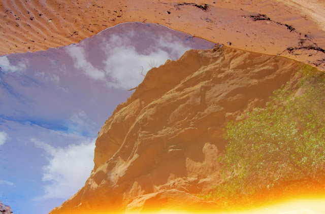
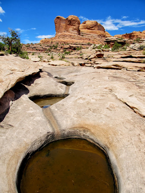
Cliffs reflected in a pool
Poison ivy
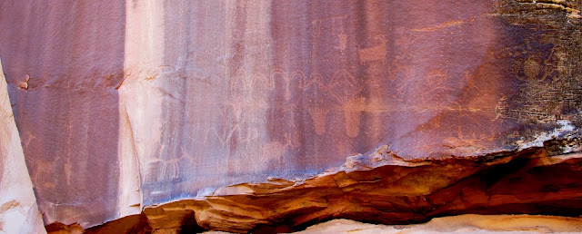
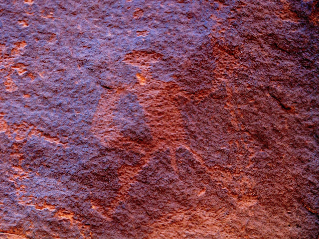
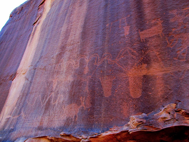
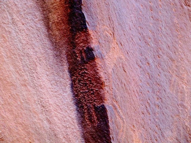
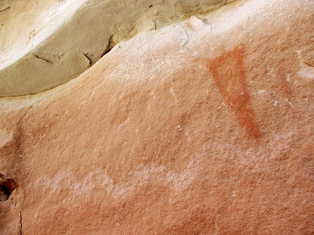
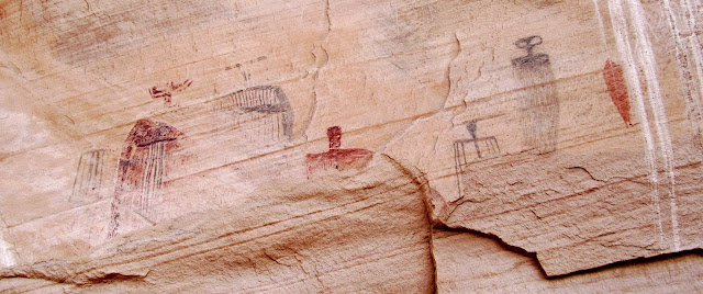
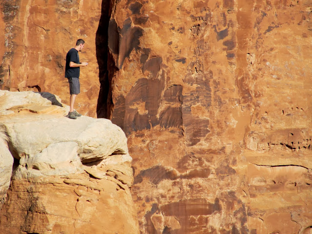
I hiked back to the Jeep without seeing anything terribly interesting in the canyon after a little over three miles round-trip. I then decided to have another shot at the South Fork of Sevenmile Canyon, this time hiking in from the highway. There was a somewhat well-used trail leading from where I'd parked, and I followed it straight to a great petroglyph panel. There were many interesting figures, my favorite of which were a couple of bighorn sheep that wrapped around a 90-degree corner in the sandstone. There was a geocache up a side canyon so I began making my way toward it and stumbled upon a small set of pictographs on the way. A foot trail was visible leading toward the rock art but it appeared to end at a small, uninteresting alcove. I almost walked away without seeing the pictographs, but I decided to un-shoulder my pack to retrieve my monocular. I spotted the rock art higher up in the ledges above the alcove, and I'm glad I stuck around--I knew there had to be a reason for that foot trail!")
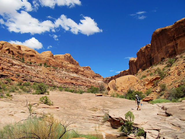
Sevenmile Canyon
Petroglyphs in Sevenmile Canyon
Petroglyphs in Sevenmile Canyon
Petroglyphs in Sevenmile Canyon
Sheep petroglyphs going around a 90-degree corner
Pictographs in Sevenmile Canyon
I scrambled around a bit in the ledges above the pictographs before moving on toward the side canyon. I found the geocache there easily, and had just replaced it in its hiding spot when I heard a thunderclap. The sky was clear overhead, though I only had a narrow view of it over the canyon walls. Not knowing from which direction the storm was coming, or how big it was, I hurried out of there. Back in the main canyon I could see that it was a small storm and there probably wasn't any flash flood danger but I returned to the Jeep anyway after having only hiked a couple of additional miles for the day.
Sevenmile Canyon
Side canyon in Sevenmile Canyon
Sevenmile Canyon
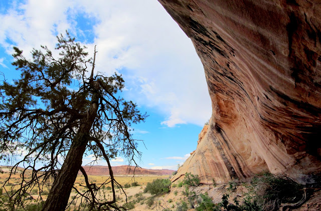
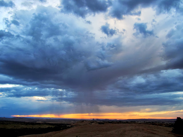
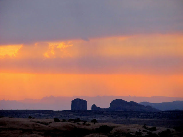
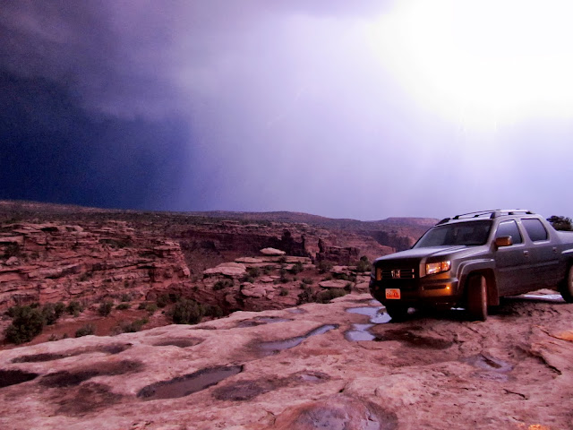
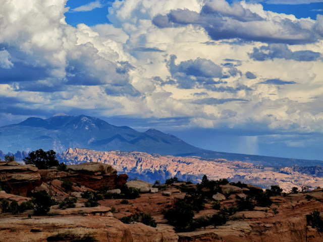
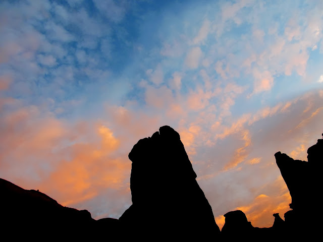
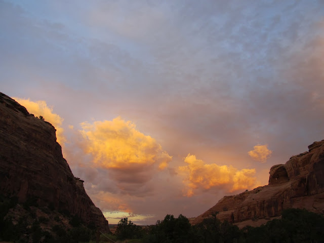
Next I drove to the Bartlett Flat pictograph panel. The figures there were very large and beautiful but had suffered quite a bit from the elements over the centuries. The alcove was huge and I shot a couple of panoramas to take it all in. By then I was a little tired and bored from being solo. I found a secluded spot a short distance from UT-313 and took a snooze. At sunset there were more dark clouds moving east and I could see rain falling in several places to the west. I met Chris a little later than we'd planned then he followed me to a camp spot I'd found at the rim of Hell Roaring Canyon. Just before we pulled in to camp it started raining lightly and it didn't fully let up until after we'd been there for several hours. Despite not knowing whether the storm had passed, we decided to take a chance and sleep on the ground. It was my first time sleeping outside not in a tent. It was warm and humid all night but it didn't rain again. We'd stayed up far too late and so ended up sleeping late as well.
Bartlett Flat pictographs
Bartlett Flat alcove
Bartlett Flat alcove
Sunset and storm clouds
Sunset over the Needles
Lightning behind Chris' Ridgeline on the rim of Hell Roaring Canyon
Saturday's sunrise
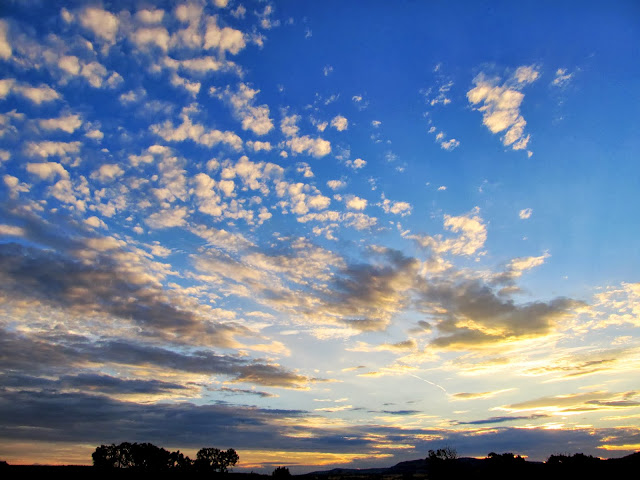
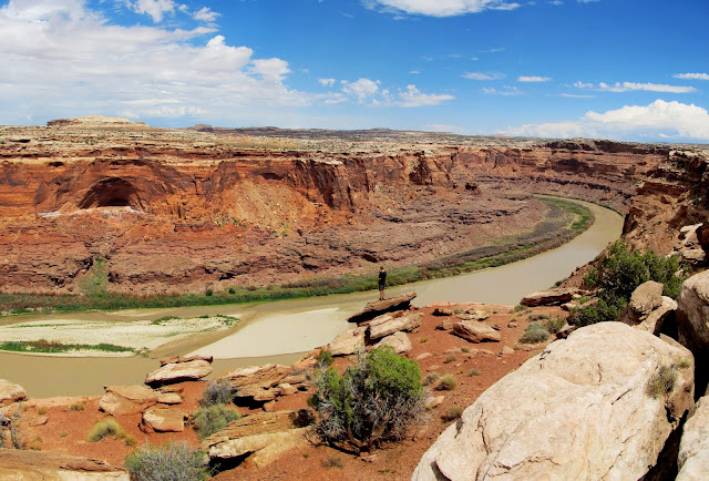
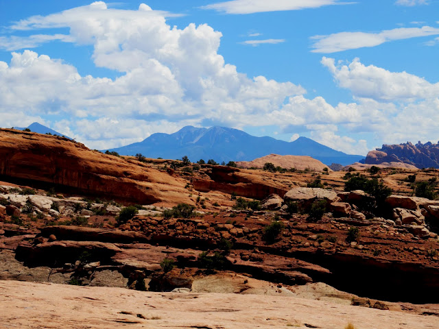
The late night made me rethink my plan for the day, which was to hike down into the canyon and see the Comet Thrower pictographs. Instead we decided to drive the Jeep around and find a couple of geocaches and seek out some views into Labyrinth Canyon. We visited a couple of overlooks of the Green River along Spring Canyon Point. The road to the very end of Spring Canyon Point was in good shape, but a side road that led to a natural arch was a rough, 4-low affair. The views of the Green River through Labyrinth Canyon were typical, i.e., amazing, but not much different from the many others I've seen from various overlooks.
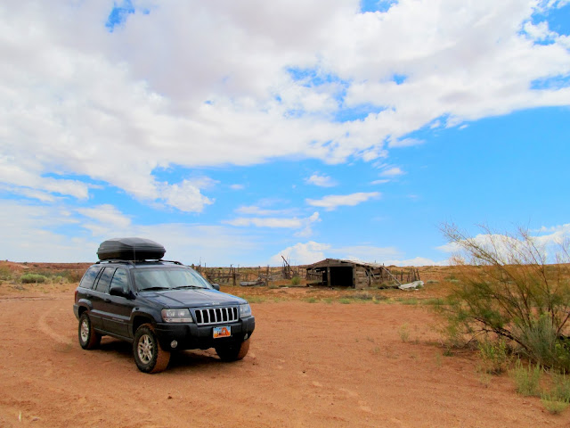
Old building along Dubinky Wash
Corral along Dubinky Wash
View of the Green River from Spring Canyon Point
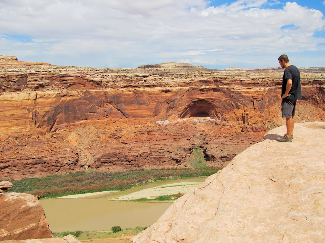
View of the Green River from Spring Canyon Point
Natural arch above the Green on Spring Canyon Point
View of the Green River from Spring Canyon Point
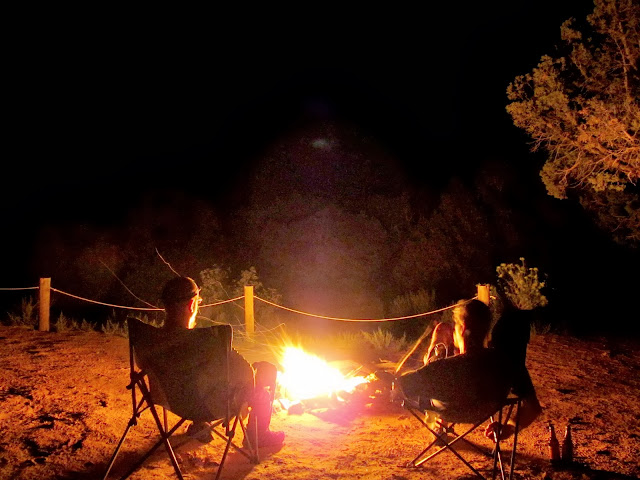
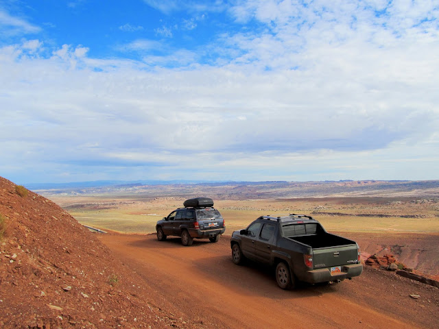
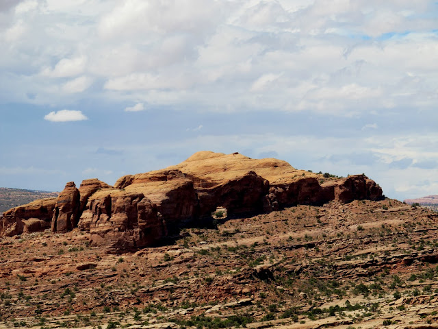
We returned to camp to rest a while and pick up Chris' truck. While trying to decide where to camp for the night, Chris suggested we head toward Gemini Bridges. He'd been there before but I hadn't and it sounded great to me. We visited Gemini Bridges and hiked around a bit, taking in the vastly different views from where we'd spent the previous day. We ended up landing in Bride Canyon for the night, where only one other small group was camped far enough away that they weren't any bother. After dinner and some campfire time we went to bed relatively early, and each of us slept in the back of our vehicles. Sunrise was beautiful the next morning, but I could only bring myself to hold the camera out of the Jeep's windows for a few shots before getting a little more sleep.
The gap between Gemini Bridges
Bull Canyon
Chris looking down into Bull Canyon
Fins and the La Sals
Goonie Bird Rock
Cliffs above camp in Bride Canyon
'Round the campfire
Sunrise in Bride Canyon
Sunrise in Bride Canyon
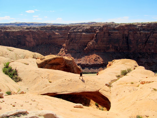
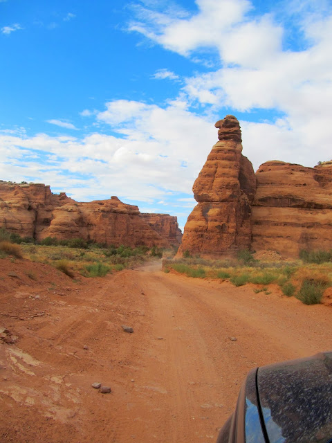
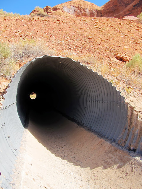
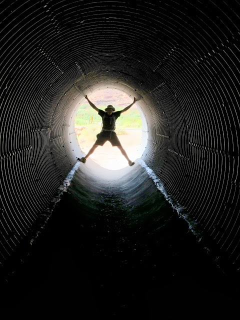
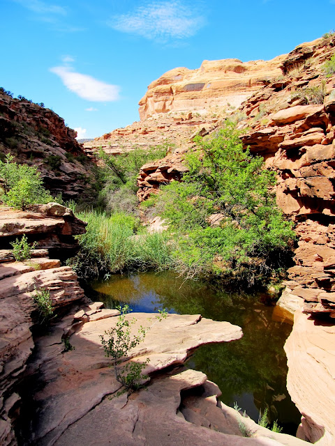
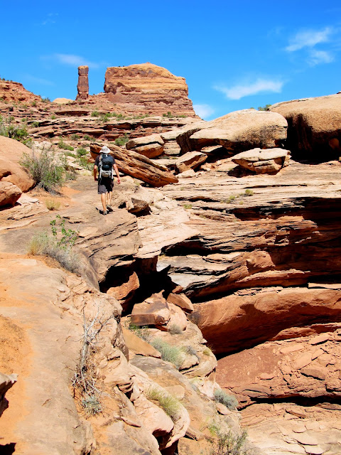
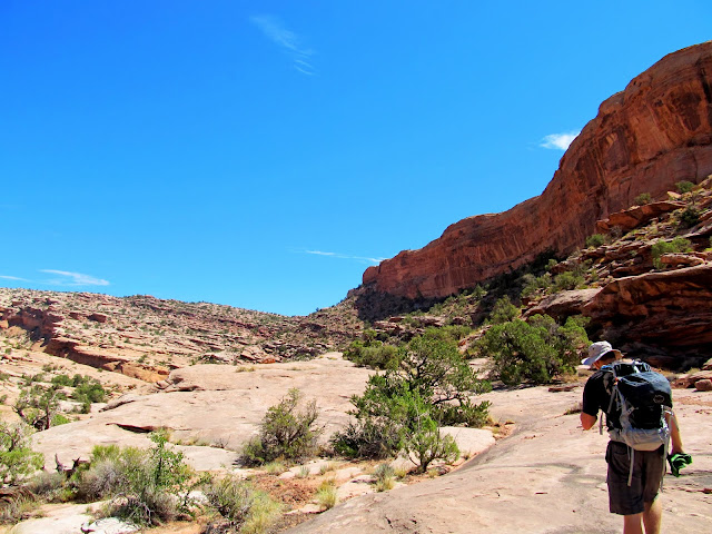
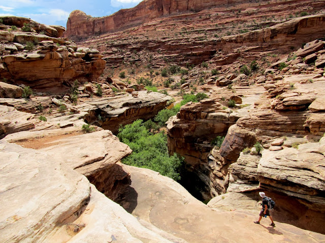
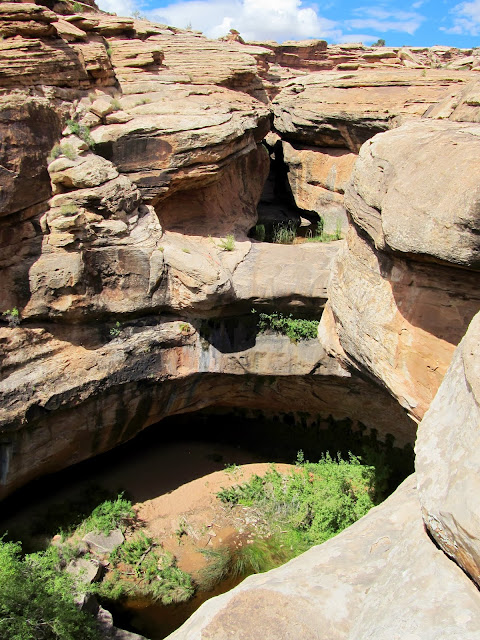
While eating breakfast we talked about what to do on our final day in the area. I panned around the map on my GPS and looked to see which geocaches interested me. A few caught my eye in a canyon just off Potash Road (UT-279) near Corona Arch. Chris agreed that would be a good area to explore so we headed into Moab for fuel then out to Potash Road. The canyon we'd be hiking up is called Culvert Canyon due to a large culvert under UP's Cane Creek Branch railroad tracks, but it's also known as Dragonfly Canyon, a name which I like better than Culvert. We walked through the culvert and up the canyon and found one geocache at a big pool. Although it was already pretty warm out and we would have liked a quick swim, the water was quite dark and nasty looking. We continued on and went left when we reached a fork in the canyon and found another geocache at the bottom of a big dryfall and took a long break there.
Stopped to take in the view along the Gemini Bridges road
Start of the hike through Dragonfly Canyon (aka Culvert Canyon)
Culvert Chris
Dragonfly Canyon
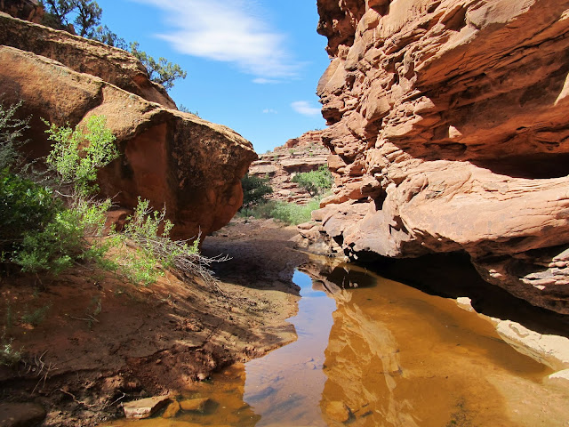
Dragonfly Canyon
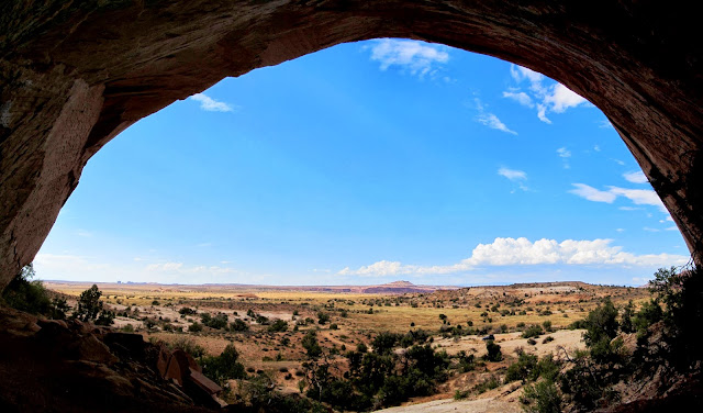
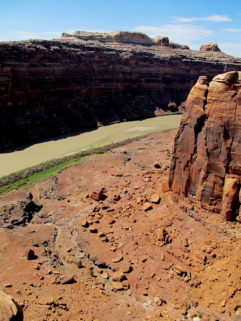
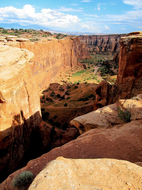
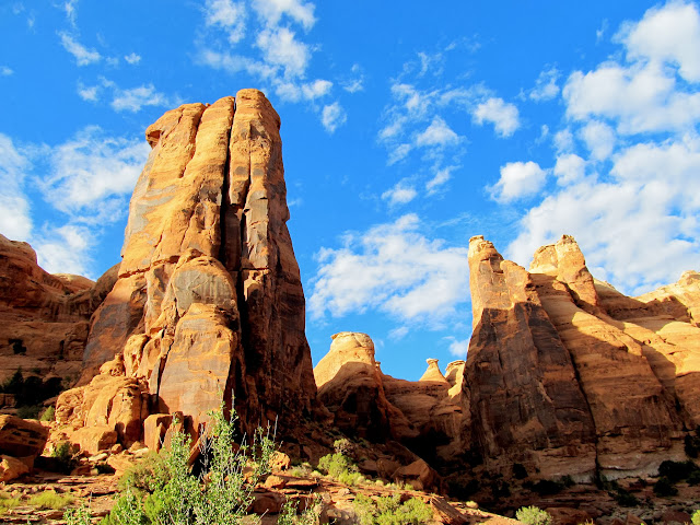
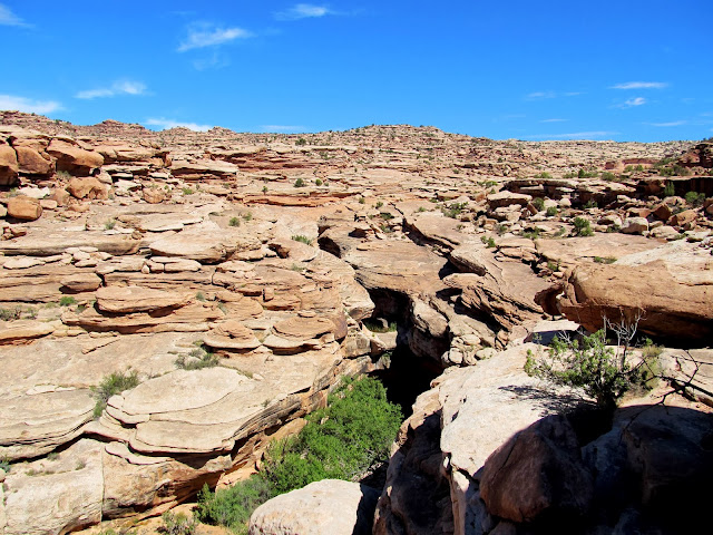
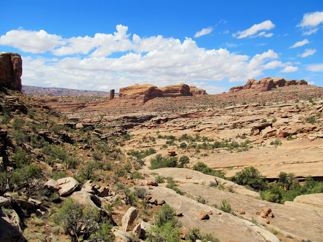
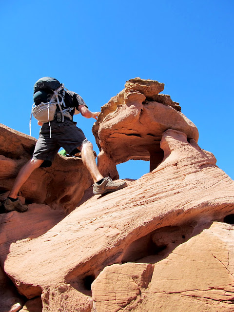
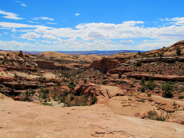
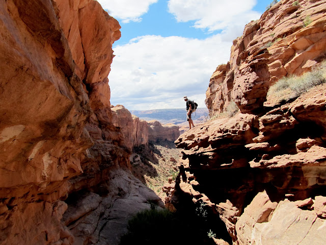
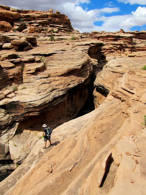
The next geocache was a long distance up the canyon, on the divide between the left and right forks. We didn't realize it at the time but the cache was eight years old and only had six finds--that's a good indicator that it's the type Chris and I both enjoy. The canyon began to deepen and we realized that walking the rim would be the wisest choice to avoid getting stopped by a dryfall. We did so, but despite a lot of braided trails through some areas, we still did a lot of scrambling and climbing to get above the ledges and to the divide. The geocache was in a small natural arch that required a slightly tricky climbing move to access, but we both did it. Up on the divide there were good views down the left fork of the canyon where we'd come from and toward the La Sals.
Dragonfly Canyon
Dragonfly Canyon
On the rim of Dragonfly Canyon, making our way to the small notch in the center of the photo
View down Dragonfly Canyon
Retrieving the 'Eye of the Spider' geocache
Panorama over Dragonfly Canyon

La Sal Mountains
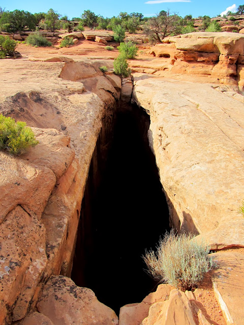
We hoped to complete a loop by descending the right fork of the canyon because there was one final geocache in there. We didn't descend the right fork far before reaching a huge, impassible dryfall. I spent quite a bit of time studying the topo map in my GPS, hoping we had an option other than returning the way we'd come, but there was no easier way. The descent of the left fork of Dragonfly Canyon went much more smoothly than the ascent. Back at the fork we went right and ascended toward the last geocache. The coordinates turned out to be off and it took us a long time to find the cache, almost long enough that we gave up. I'd already shared some water with Chris and now we were both close to running out, but we'd completed our mission and from there it was a relatively easy descent to our vehicles. We made it back, after having hiked over seven miles in 90-degree heat and relatively high humidity, and had a long rest. We traveled together as far as Price where Chris fueled up continued his drive and I headed home, sweet, home.
View down the right fork of Dragonfly Canyon
Gold Bar Arch
A dryfall at the top of the right fork of Dragonfly Canyon that stopped us from descending
Dragonfly Canyon
Dragonfly Canyon
Dragonfly Canyon
Chain of potholes in Dragonfly Canyon
Approaching the right fork of Dragonfly Canyon from the bottom
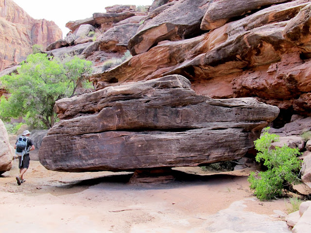
Balanced boulder in Dragonfly Canyon
Full photo gallery:
https://picasaweb.google.com/Dennis.Udink/MoabIsh
[parsehtml]<iframe width="700" height="500" frameborder="0" scrolling="no" marginheight="0" marginwidth="0" src="https://maps.google.com/maps?q=http:%2F%2Fudink.org%2Fgeo%2FMoab-ish.kmz&hl=en&sll=39.60063,-110.806334&sspn=0.076582,0.169086&t=h&ie=UTF8&ll=38.611505,-109.806976&spn=0.268271,0.480652&z=11&output=embed"></iframe><br /><small><a href="https://maps.google.com/maps?q=http:%2F%2Fudink.org%2Fgeo%2FMoab-ish.kmz&hl=en&sll=39.60063,-110.806334&sspn=0.076582,0.169086&t=h&ie=UTF8&ll=38.611505,-109.806976&spn=0.268271,0.480652&z=11&source=embed" style="color:#0000FF;text-align:left">View Larger Map</a></small>[/parsehtml]http://udink.org/geo/Moab-ish.kmz
Featured image for home page:

Cave in a side canyon
Driving through the jungle in Sevenmile Canyon
Merrimac Butte
Monitor Butte
Above a dryfall in right fork of Sevenmile Canyon
Dryfall that ended my travel up the right fork of Sevenmile Canyon
Cliffs reflected in a pool
Poison ivy
I hiked back to the Jeep without seeing anything terribly interesting in the canyon after a little over three miles round-trip. I then decided to have another shot at the South Fork of Sevenmile Canyon, this time hiking in from the highway. There was a somewhat well-used trail leading from where I'd parked, and I followed it straight to a great petroglyph panel. There were many interesting figures, my favorite of which were a couple of bighorn sheep that wrapped around a 90-degree corner in the sandstone. There was a geocache up a side canyon so I began making my way toward it and stumbled upon a small set of pictographs on the way. A foot trail was visible leading toward the rock art but it appeared to end at a small, uninteresting alcove. I almost walked away without seeing the pictographs, but I decided to un-shoulder my pack to retrieve my monocular. I spotted the rock art higher up in the ledges above the alcove, and I'm glad I stuck around--I knew there had to be a reason for that foot trail!
Sevenmile Canyon
Petroglyphs in Sevenmile Canyon
Petroglyphs in Sevenmile Canyon
Petroglyphs in Sevenmile Canyon
Sheep petroglyphs going around a 90-degree corner
Pictographs in Sevenmile Canyon
I scrambled around a bit in the ledges above the pictographs before moving on toward the side canyon. I found the geocache there easily, and had just replaced it in its hiding spot when I heard a thunderclap. The sky was clear overhead, though I only had a narrow view of it over the canyon walls. Not knowing from which direction the storm was coming, or how big it was, I hurried out of there. Back in the main canyon I could see that it was a small storm and there probably wasn't any flash flood danger but I returned to the Jeep anyway after having only hiked a couple of additional miles for the day.
Sevenmile Canyon
Side canyon in Sevenmile Canyon
Sevenmile Canyon
Next I drove to the Bartlett Flat pictograph panel. The figures there were very large and beautiful but had suffered quite a bit from the elements over the centuries. The alcove was huge and I shot a couple of panoramas to take it all in. By then I was a little tired and bored from being solo. I found a secluded spot a short distance from UT-313 and took a snooze. At sunset there were more dark clouds moving east and I could see rain falling in several places to the west. I met Chris a little later than we'd planned then he followed me to a camp spot I'd found at the rim of Hell Roaring Canyon. Just before we pulled in to camp it started raining lightly and it didn't fully let up until after we'd been there for several hours. Despite not knowing whether the storm had passed, we decided to take a chance and sleep on the ground. It was my first time sleeping outside not in a tent. It was warm and humid all night but it didn't rain again. We'd stayed up far too late and so ended up sleeping late as well.
Bartlett Flat pictographs
Bartlett Flat alcove
Bartlett Flat alcove
Sunset and storm clouds
Sunset over the Needles
Lightning behind Chris' Ridgeline on the rim of Hell Roaring Canyon
Saturday's sunrise
The late night made me rethink my plan for the day, which was to hike down into the canyon and see the Comet Thrower pictographs. Instead we decided to drive the Jeep around and find a couple of geocaches and seek out some views into Labyrinth Canyon. We visited a couple of overlooks of the Green River along Spring Canyon Point. The road to the very end of Spring Canyon Point was in good shape, but a side road that led to a natural arch was a rough, 4-low affair. The views of the Green River through Labyrinth Canyon were typical, i.e., amazing, but not much different from the many others I've seen from various overlooks.
Old building along Dubinky Wash
Corral along Dubinky Wash
View of the Green River from Spring Canyon Point
View of the Green River from Spring Canyon Point
Natural arch above the Green on Spring Canyon Point
View of the Green River from Spring Canyon Point
We returned to camp to rest a while and pick up Chris' truck. While trying to decide where to camp for the night, Chris suggested we head toward Gemini Bridges. He'd been there before but I hadn't and it sounded great to me. We visited Gemini Bridges and hiked around a bit, taking in the vastly different views from where we'd spent the previous day. We ended up landing in Bride Canyon for the night, where only one other small group was camped far enough away that they weren't any bother. After dinner and some campfire time we went to bed relatively early, and each of us slept in the back of our vehicles. Sunrise was beautiful the next morning, but I could only bring myself to hold the camera out of the Jeep's windows for a few shots before getting a little more sleep.
The gap between Gemini Bridges
Bull Canyon
Chris looking down into Bull Canyon
Fins and the La Sals
Goonie Bird Rock
Cliffs above camp in Bride Canyon
'Round the campfire
Sunrise in Bride Canyon
Sunrise in Bride Canyon
While eating breakfast we talked about what to do on our final day in the area. I panned around the map on my GPS and looked to see which geocaches interested me. A few caught my eye in a canyon just off Potash Road (UT-279) near Corona Arch. Chris agreed that would be a good area to explore so we headed into Moab for fuel then out to Potash Road. The canyon we'd be hiking up is called Culvert Canyon due to a large culvert under UP's Cane Creek Branch railroad tracks, but it's also known as Dragonfly Canyon, a name which I like better than Culvert. We walked through the culvert and up the canyon and found one geocache at a big pool. Although it was already pretty warm out and we would have liked a quick swim, the water was quite dark and nasty looking. We continued on and went left when we reached a fork in the canyon and found another geocache at the bottom of a big dryfall and took a long break there.
Stopped to take in the view along the Gemini Bridges road
Start of the hike through Dragonfly Canyon (aka Culvert Canyon)
Culvert Chris
Dragonfly Canyon
Dragonfly Canyon
The next geocache was a long distance up the canyon, on the divide between the left and right forks. We didn't realize it at the time but the cache was eight years old and only had six finds--that's a good indicator that it's the type Chris and I both enjoy. The canyon began to deepen and we realized that walking the rim would be the wisest choice to avoid getting stopped by a dryfall. We did so, but despite a lot of braided trails through some areas, we still did a lot of scrambling and climbing to get above the ledges and to the divide. The geocache was in a small natural arch that required a slightly tricky climbing move to access, but we both did it. Up on the divide there were good views down the left fork of the canyon where we'd come from and toward the La Sals.
Dragonfly Canyon
Dragonfly Canyon
On the rim of Dragonfly Canyon, making our way to the small notch in the center of the photo
View down Dragonfly Canyon
Retrieving the 'Eye of the Spider' geocache
Panorama over Dragonfly Canyon
La Sal Mountains
We hoped to complete a loop by descending the right fork of the canyon because there was one final geocache in there. We didn't descend the right fork far before reaching a huge, impassible dryfall. I spent quite a bit of time studying the topo map in my GPS, hoping we had an option other than returning the way we'd come, but there was no easier way. The descent of the left fork of Dragonfly Canyon went much more smoothly than the ascent. Back at the fork we went right and ascended toward the last geocache. The coordinates turned out to be off and it took us a long time to find the cache, almost long enough that we gave up. I'd already shared some water with Chris and now we were both close to running out, but we'd completed our mission and from there it was a relatively easy descent to our vehicles. We made it back, after having hiked over seven miles in 90-degree heat and relatively high humidity, and had a long rest. We traveled together as far as Price where Chris fueled up continued his drive and I headed home, sweet, home.
View down the right fork of Dragonfly Canyon
Gold Bar Arch
A dryfall at the top of the right fork of Dragonfly Canyon that stopped us from descending
Dragonfly Canyon
Dragonfly Canyon
Dragonfly Canyon
Chain of potholes in Dragonfly Canyon
Approaching the right fork of Dragonfly Canyon from the bottom
Balanced boulder in Dragonfly Canyon
Full photo gallery:
https://picasaweb.google.com/Dennis.Udink/MoabIsh
[parsehtml]<iframe width="700" height="500" frameborder="0" scrolling="no" marginheight="0" marginwidth="0" src="https://maps.google.com/maps?q=http:%2F%2Fudink.org%2Fgeo%2FMoab-ish.kmz&hl=en&sll=39.60063,-110.806334&sspn=0.076582,0.169086&t=h&ie=UTF8&ll=38.611505,-109.806976&spn=0.268271,0.480652&z=11&output=embed"></iframe><br /><small><a href="https://maps.google.com/maps?q=http:%2F%2Fudink.org%2Fgeo%2FMoab-ish.kmz&hl=en&sll=39.60063,-110.806334&sspn=0.076582,0.169086&t=h&ie=UTF8&ll=38.611505,-109.806976&spn=0.268271,0.480652&z=11&source=embed" style="color:#0000FF;text-align:left">View Larger Map</a></small>[/parsehtml]http://udink.org/geo/Moab-ish.kmz
Featured image for home page: