- Joined
- Aug 8, 2016
- Messages
- 2,077
My wife does not like me to go hiking alone but we managed to strike a compromise of solo day hikes are okay but no solo over nighters. It's only an hour and half drive to Bald Mountain Pass in the Uintas from my house so I've been looking for the possibility of a more off-the-beaten-path route that I might be able do in a day. Checking the maps I stumbled on a possible loop starting at Mirror Lake. The route would start at the North Fork trail head heading south east down the North Fork Duchesne River trail, heading north along the East Fork Duchesne River trail hooking up with the Highline trail. From here I could head back west connecting up with the Mirror Lake trail returning south me to Mirror Lake.
This route would not have any high-elevation views and would be almost 100% in the forest but I thought at least the first half would be on less-traveled trails until hooking up with the Highline. Also this would provide me a good workout mileage-wise with a quick map check showing fourteen or so miles. I decided to name this route the Mirror Lake-Highline Loop. Weather looked reasonable on Sunday so I headed out to arrive at the trail head at 7:00am.
Here's a video if you would like to see a bit of live action. If not, read on.
When I started out there were scattered clouds at day break so I was hoping they would be no threat, at least until afternoon.
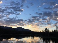
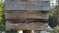
The North Fork Duchesne River trail is a really nice trail. Well established but not overused. I would not see a single soul until hitting the Highline trail as I had hoped. Ran across this interesting sign a ways down...
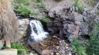
And right behind it this beautiful little water fall...
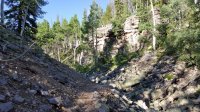
The trail continued to drop at a comfortable rate until I was within sight of the ridge line separating the North and East forks of the Duchesne rivers. Here's a sample of what the trail looks like just above the trail junction...
The confluence of the North and East forks of the Duchesne rivers...
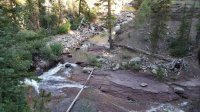
The easy start going down was now over, time to start back up hill along the East Fork Duchesne River trail. It was really not that bad, being pretty constant the whole way.
Ran across this cute little guy just to the side of the trail...
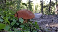
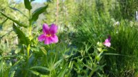
The wildflowers were out all over. I particularly like these...
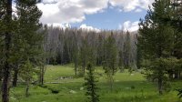
Reaching a beautiful meadow brought me to the junction with the Highline trail...
At this point clouds were building but did not seem to be too threatening. I had thought about heading up to Rocky Sea Pass at this point but was concerned about weather and time. The longest part of the trip was yet to come. I made the call to give it a try because I really wanted to get a look into the Rock Creek drainage so I headed up.
I passed Pigeon Milk Spring and headed up the switch backs to where the trees begin to thin out. I was about one mile from the pass when a big black cloud formed directly above me and brought a bunch of thunder. Really??? I decided to err on the side of caution and headed back down. Of course, I wasn't twenty minutes down and the thunder stopped. Sheesh! However the clouds we spreading out, it looked like I would be getting wet at some point.
Back past the junction with the East Fork Duchesne River trail I picked up the pace to make sure I could get the loop completed before dark. I was nearing the junction with the Naturalist Basin trail it had started to rain just a bit with fairly active thunder up to the north. I decided to take a quick snack stop under a tree and filter some water before continuing on.
I stopped for probably 15 minutes when it began to rain just a bit harder. Looked like I would have to break out my new MyTrailCo Ponch UL Tarp for the first time. It turned out to be a really nice piece of gear (thanks @Nick for the recommendation). Good thing I made the call to put it on as I wasn't on the trail for five minutes when the clouds opened up. It rained steadily until I reached the junction with the Mirror Lake Trail. Finally I could take off the poncho and get back to a nicer hiking experience.
The scenery along the Mirror Lake trail was surprisingly beautiful, particularly when I reached the Bonny Lake area. The sun made a bit of an appearance and made for some nice photo ops.
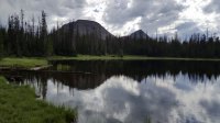
My beauties, Bald Mountain and Reids Peak...
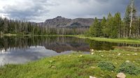
Hayden Peak...
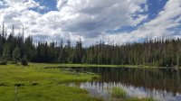
Mount Marsell...
I managed to roll back into Mirror Lake at 5:30 pm. I was quite pleased that I was able to pull off the loop in good time in spite of the added attempt at Rocky Sea Pass and the rainy weather. The trip distance on my InReach showed 20.0 miles! Wow! That made me feel pretty good! And, all things considered, I wasn't all that worse for the wear.
This route would not have any high-elevation views and would be almost 100% in the forest but I thought at least the first half would be on less-traveled trails until hooking up with the Highline. Also this would provide me a good workout mileage-wise with a quick map check showing fourteen or so miles. I decided to name this route the Mirror Lake-Highline Loop. Weather looked reasonable on Sunday so I headed out to arrive at the trail head at 7:00am.
Here's a video if you would like to see a bit of live action. If not, read on.
When I started out there were scattered clouds at day break so I was hoping they would be no threat, at least until afternoon.

The North Fork Duchesne River trail is a really nice trail. Well established but not overused. I would not see a single soul until hitting the Highline trail as I had hoped. Ran across this interesting sign a ways down...

And right behind it this beautiful little water fall...

The trail continued to drop at a comfortable rate until I was within sight of the ridge line separating the North and East forks of the Duchesne rivers. Here's a sample of what the trail looks like just above the trail junction...

The confluence of the North and East forks of the Duchesne rivers...

The easy start going down was now over, time to start back up hill along the East Fork Duchesne River trail. It was really not that bad, being pretty constant the whole way.
Ran across this cute little guy just to the side of the trail...

The wildflowers were out all over. I particularly like these...

Reaching a beautiful meadow brought me to the junction with the Highline trail...

At this point clouds were building but did not seem to be too threatening. I had thought about heading up to Rocky Sea Pass at this point but was concerned about weather and time. The longest part of the trip was yet to come. I made the call to give it a try because I really wanted to get a look into the Rock Creek drainage so I headed up.
I passed Pigeon Milk Spring and headed up the switch backs to where the trees begin to thin out. I was about one mile from the pass when a big black cloud formed directly above me and brought a bunch of thunder. Really??? I decided to err on the side of caution and headed back down. Of course, I wasn't twenty minutes down and the thunder stopped. Sheesh! However the clouds we spreading out, it looked like I would be getting wet at some point.
Back past the junction with the East Fork Duchesne River trail I picked up the pace to make sure I could get the loop completed before dark. I was nearing the junction with the Naturalist Basin trail it had started to rain just a bit with fairly active thunder up to the north. I decided to take a quick snack stop under a tree and filter some water before continuing on.
I stopped for probably 15 minutes when it began to rain just a bit harder. Looked like I would have to break out my new MyTrailCo Ponch UL Tarp for the first time. It turned out to be a really nice piece of gear (thanks @Nick for the recommendation). Good thing I made the call to put it on as I wasn't on the trail for five minutes when the clouds opened up. It rained steadily until I reached the junction with the Mirror Lake Trail. Finally I could take off the poncho and get back to a nicer hiking experience.
The scenery along the Mirror Lake trail was surprisingly beautiful, particularly when I reached the Bonny Lake area. The sun made a bit of an appearance and made for some nice photo ops.
My beauties, Bald Mountain and Reids Peak...

Hayden Peak...

Mount Marsell...

I managed to roll back into Mirror Lake at 5:30 pm. I was quite pleased that I was able to pull off the loop in good time in spite of the added attempt at Rocky Sea Pass and the rainy weather. The trip distance on my InReach showed 20.0 miles! Wow! That made me feel pretty good! And, all things considered, I wasn't all that worse for the wear.
Last edited:
