Navigation
Install the app
How to install the app on iOS
Follow along with the video below to see how to install our site as a web app on your home screen.
Note: This feature may not be available in some browsers.
More options
Style variation
You are using an out of date browser. It may not display this or other websites correctly.
You should upgrade or use an alternative browser.
You should upgrade or use an alternative browser.
Micro Trip Reports
- Thread starter steve
- Start date
- Status
- Not open for further replies.
- Joined
- Jul 23, 2013
- Messages
- 1,665
That is awesome. Glad she enjoyed it. Lightweight gear is definitely a good way to go, especially when introducing someone to how easy backpacking can be. Not only is the scenery great, but your UL gear pics have become eye candy for me.
Sent from my HTCONE using Tapatalk
Sent from my HTCONE using Tapatalk
Vegan.Hiker
Member
- Joined
- Jul 5, 2014
- Messages
- 2,099
This isn't cool enough to post in the real trip report section so I'll put it here.
Due to rain the past 2 weekends, yesterday was my first time out on the trail since my trip to Utah. It was nice to be back on familiar trails in my own neck of the woods. Perhaps an unintended benefit of travelling out west to hike... the trails, the hardwoods, the familiar scents... it felt like "home". A comforting notion, I never really noticed before.
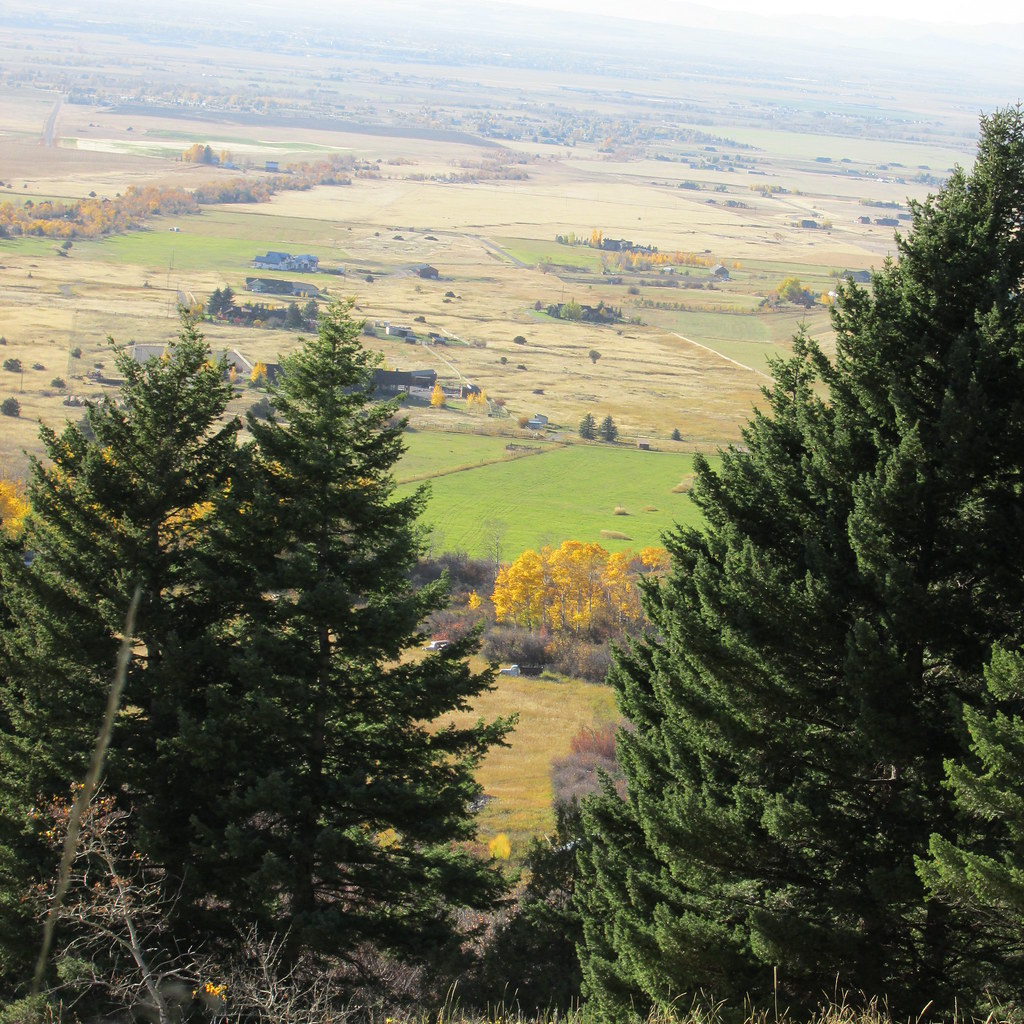
My wife and I took a ride to the Catskills, NY. It certainly wasn't the nicest day with mostly overcast skies and the foliage a bit past peak. But anytime I can find sanctuary in the woods with my wife and my dog it's a good day in my book. I also got to play with my new Sony mirror-less camera for the first time. I have no clue what I'm doing with it.. but I guess experimenting is how you learn.
Driving to the trailhead, we stopped along the way and did a quick 2 mile out and back to Kaaterskill Falls. The water level was VERY low so it wasn't too spectacular. We were planning on scrambling up to the bottom of the top waterfall because the rocks are shaped like an amphitheater behind the top falls and you can walk behind the falls for a cool vantage point. With the rocks being wet from rain that morning and the water flow being virtually non-existent we decided to wait for a better day.

Several miles down this gravel road, we arrived at the trailhead. We were hiking to the two summits of Twin Mountain. The hike is only about 5 miles round trip and gains about 1,700 to the 3,652' summit. But as I learned hiking out west, trail conditions, terrain, and trail design make all the difference in the world. About 2 miles of this hike takes place on the "Devils Path". The Devils Path is considered the most difficult and dangerous trail in the northeast. It's 24 miles long and gains 18,000 in elevation, mostly going straight up and down craggy talus boulder trails. http://en.wikipedia.org/wiki/Devil's_Path_(hiking_trail)
Anyways, here's the gravel road to the trailhead.

One of the cool things about this hike is that the trail passes through a bluestone quarry. Over the course of many years, hikers have used the slabs of bluestone to create a sort of "living room". It includes several slab recliners, a functional grille area, table, etc.
Here's a picture of Tyne standing in the quarry. Twin Mountain is behind her and you can see some of the bluestone configurations behind her to the right.
Here's a better look at what hikers have done with the bluestone slabs
Four recliners

The recliners look out over a the Catskills countryside and a grilling area with some slab tables

Joey likes the couch at home better

I tried to take a few pictures of the Devils Path so you guys from out west can see how the northeast trails make you use all fours and go straight up.
Notice the two red circular blazes in the picture below marking the trail (one is closer, one is further)

This is actually an easier section of the Devils Path. Another red blaze can be seen in the background.
Another example and last pic of me bitching about the trail. You can see the red blaze up top. This happens over and over again where you look up and see the blaze and mutter "are you f**** kidding me".

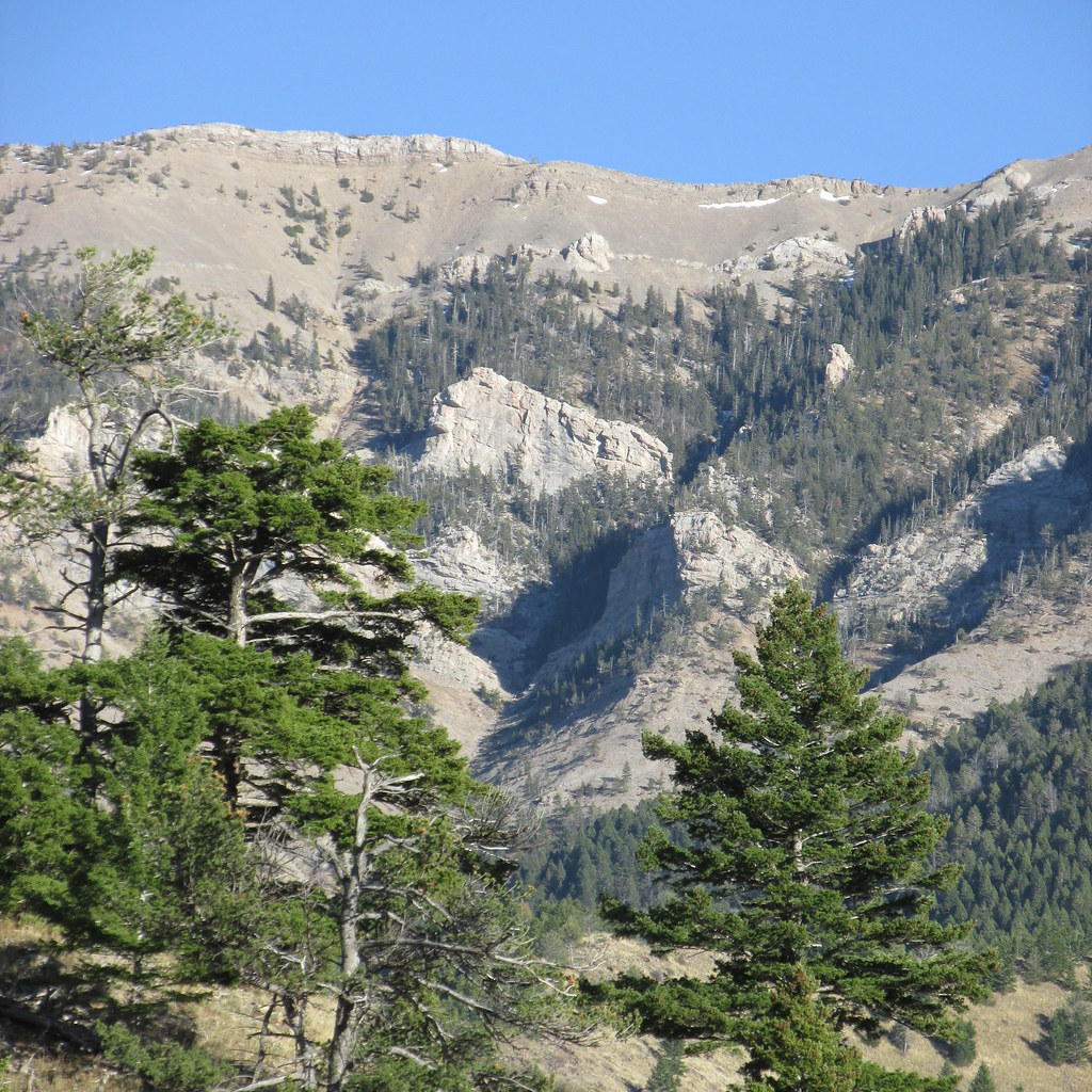
Unfortunately, by the time we reached the two twin summits each 0.7 miles apart from eachother, it had gotten pretty cloudy. I took some pictures anyways and played around with the pano setting. We knew that the hardest part of the hike was still to come... navigating how to get Joey down the Devils Path.
Some shots from the southern summit of Twin


Pano setting would be useful I think in a better setting

Time to head down and face the Devils Path again

Due to rain the past 2 weekends, yesterday was my first time out on the trail since my trip to Utah. It was nice to be back on familiar trails in my own neck of the woods. Perhaps an unintended benefit of travelling out west to hike... the trails, the hardwoods, the familiar scents... it felt like "home". A comforting notion, I never really noticed before.
My wife and I took a ride to the Catskills, NY. It certainly wasn't the nicest day with mostly overcast skies and the foliage a bit past peak. But anytime I can find sanctuary in the woods with my wife and my dog it's a good day in my book. I also got to play with my new Sony mirror-less camera for the first time. I have no clue what I'm doing with it.. but I guess experimenting is how you learn.
Driving to the trailhead, we stopped along the way and did a quick 2 mile out and back to Kaaterskill Falls. The water level was VERY low so it wasn't too spectacular. We were planning on scrambling up to the bottom of the top waterfall because the rocks are shaped like an amphitheater behind the top falls and you can walk behind the falls for a cool vantage point. With the rocks being wet from rain that morning and the water flow being virtually non-existent we decided to wait for a better day.
Several miles down this gravel road, we arrived at the trailhead. We were hiking to the two summits of Twin Mountain. The hike is only about 5 miles round trip and gains about 1,700 to the 3,652' summit. But as I learned hiking out west, trail conditions, terrain, and trail design make all the difference in the world. About 2 miles of this hike takes place on the "Devils Path". The Devils Path is considered the most difficult and dangerous trail in the northeast. It's 24 miles long and gains 18,000 in elevation, mostly going straight up and down craggy talus boulder trails. http://en.wikipedia.org/wiki/Devil's_Path_(hiking_trail)
Anyways, here's the gravel road to the trailhead.
One of the cool things about this hike is that the trail passes through a bluestone quarry. Over the course of many years, hikers have used the slabs of bluestone to create a sort of "living room". It includes several slab recliners, a functional grille area, table, etc.
Here's a picture of Tyne standing in the quarry. Twin Mountain is behind her and you can see some of the bluestone configurations behind her to the right.
Here's a better look at what hikers have done with the bluestone slabs
Four recliners
The recliners look out over a the Catskills countryside and a grilling area with some slab tables
Joey likes the couch at home better
I tried to take a few pictures of the Devils Path so you guys from out west can see how the northeast trails make you use all fours and go straight up.
Notice the two red circular blazes in the picture below marking the trail (one is closer, one is further)
This is actually an easier section of the Devils Path. Another red blaze can be seen in the background.
Another example and last pic of me bitching about the trail. You can see the red blaze up top. This happens over and over again where you look up and see the blaze and mutter "are you f**** kidding me".
Unfortunately, by the time we reached the two twin summits each 0.7 miles apart from eachother, it had gotten pretty cloudy. I took some pictures anyways and played around with the pano setting. We knew that the hardest part of the hike was still to come... navigating how to get Joey down the Devils Path.
Some shots from the southern summit of Twin
Pano setting would be useful I think in a better setting
Time to head down and face the Devils Path again
Last edited:
Vegan.Hiker
Member
- Joined
- Jul 5, 2014
- Messages
- 2,099
Nice trip report and pics. Definitely good enough to stand on it's own, IMO. Thanks for posting.")
I intended on just a quick paragraph and a picture or two but my fingers kept yapping away on the keyboard.
John Goering
Member
- Joined
- Sep 30, 2014
- Messages
- 502
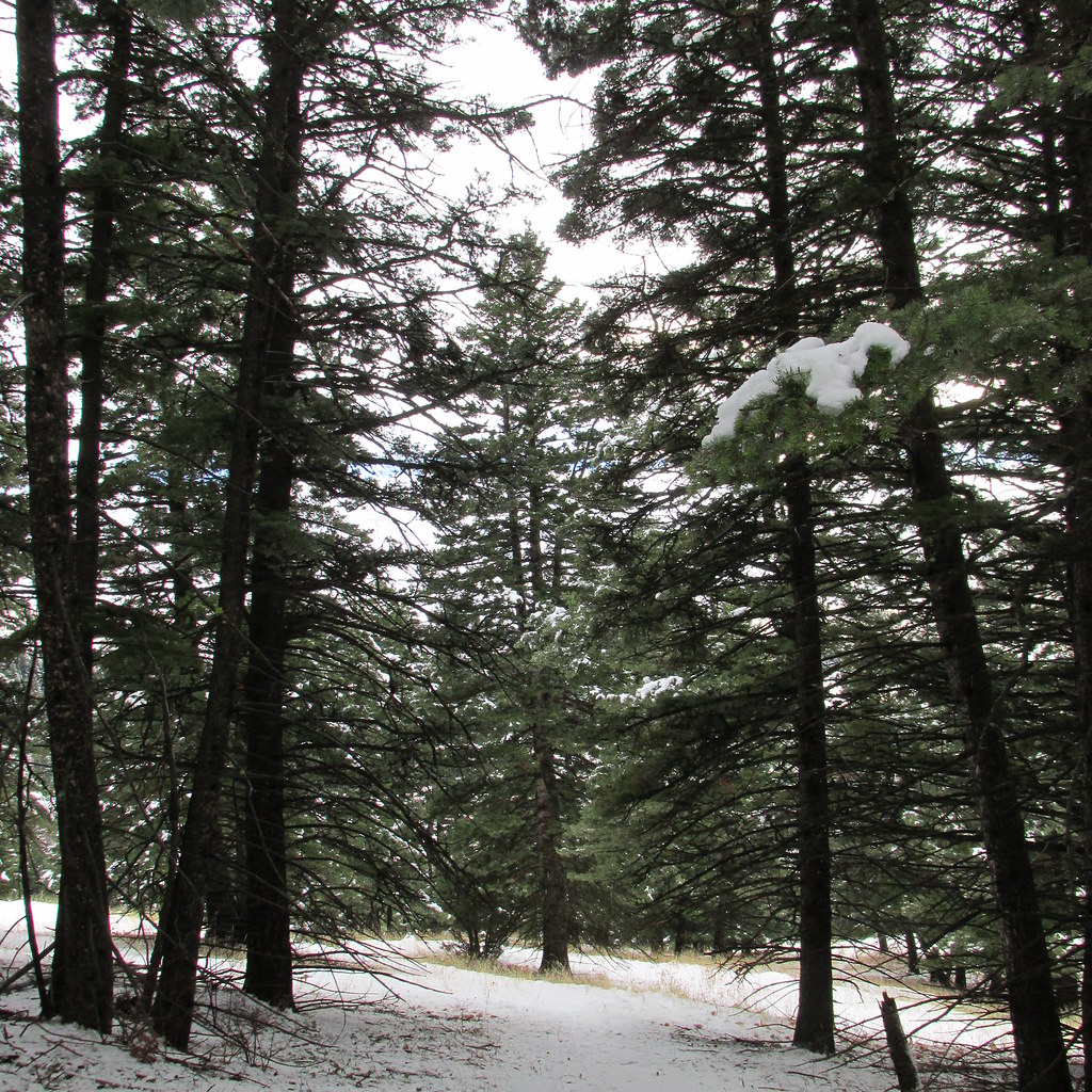
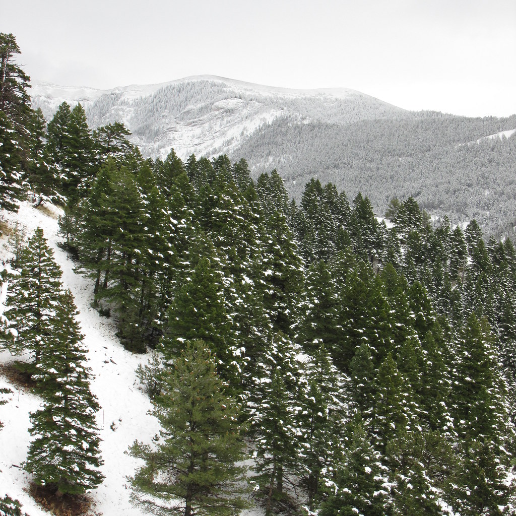
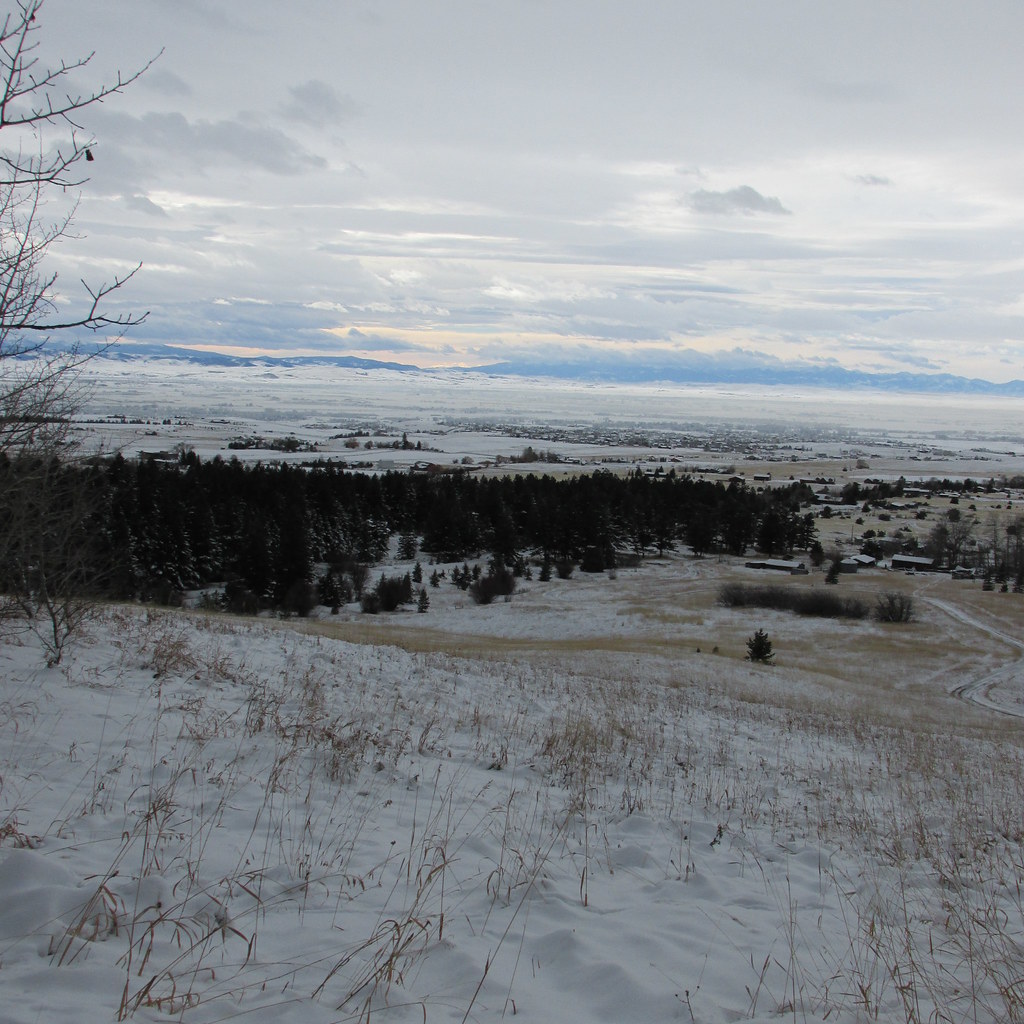
My wife and I did a hike Sunday on the ranch. Nothing special, just a couple mile loop with about 700-800' elev gain we do to sort of stay in shape. Our place is on the west side of the Bridger's, about 9 miles north of Bozeman.
Looking west. The green hayfield is ours with the neighbors cabin (about 12k sq ft) hiding behind the firs. Don't know that Bozeman will ever become another Jackson but people keep trying.
Bridger ridge-between Baldy and Bridger Peaks. Still a few limber pines that have escaped the pine beetles and the doug firs tend to get pretty limby in the open on south exposures.
John Goering
Member
- Joined
- Sep 30, 2014
- Messages
- 502
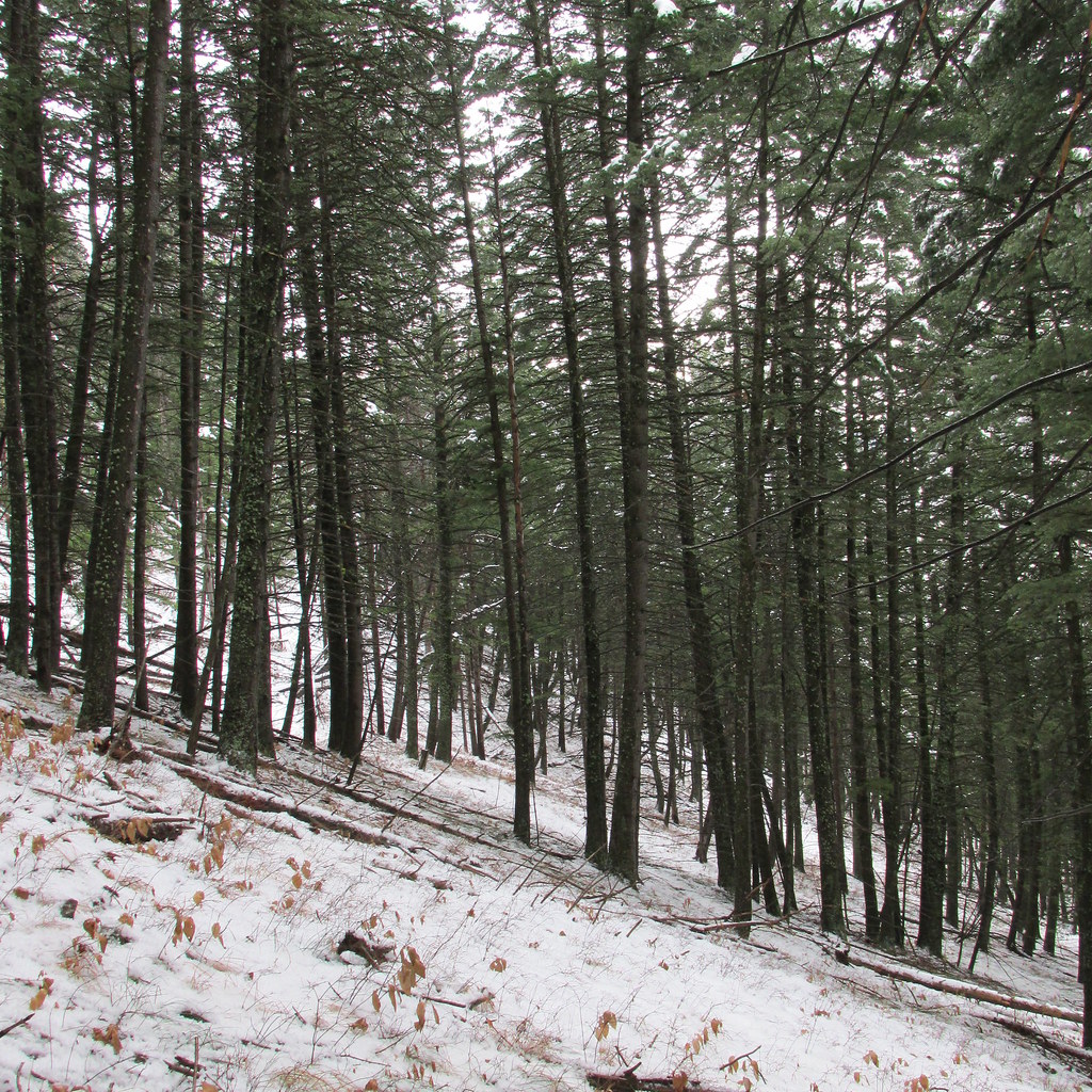
A few more pics from last week. Our usual route drops a little from the house and then cuts north to Watts Creek.My wife and I did a hike Sunday on the ranch. Nothing special, just a couple mile loop with about 700-800' elev gain we do to sort of stay in shape. Our place is on the west side of the Bridger's, about 9 miles north of Bozeman.
Looking west. The green hayfield is ours with the neighbors cabin (about 12k sq ft) hiding behind the firs. Don't know that Bozeman will ever become another Jackson but people keep trying.
Bridger ridge-between Baldy and Bridger Peaks. Still a few limber pines that have escaped the pine beetles and the doug firs tend to get pretty limby in the open on south exposures.
Meadow before getting to the creek.
After crossing the creek, the trail follows an old horse logging trail along the north side.
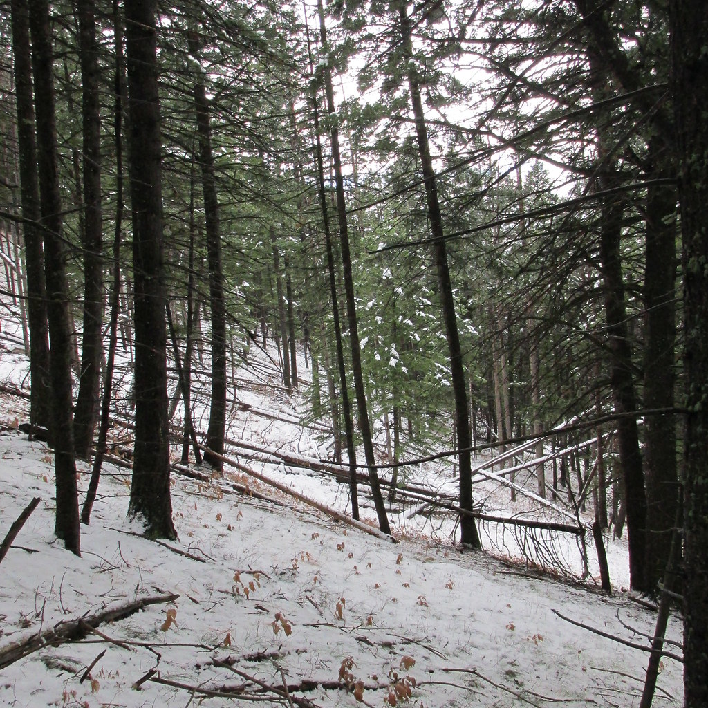
A short reach of open south aspect.
Then into a mixed mess of doug fir, aspen, and mountain maple.
And opens up to a small meadow right before the Forest Service boundary.
From there, we cross to the south side of Watts Creek and climb through the timber. This section gets a little steep, some about 70% which makes hiking it when iced up a little interesting.
Watts Creek.
In the timber.
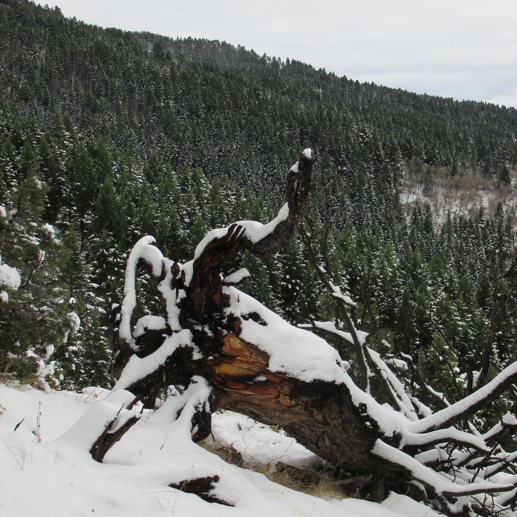
Those dead fall were lodgepole pine before the mountain pine beetles got them.
Out on the ridge. Patty Creek drainage below, Bozeman and Gallatin Range behind.
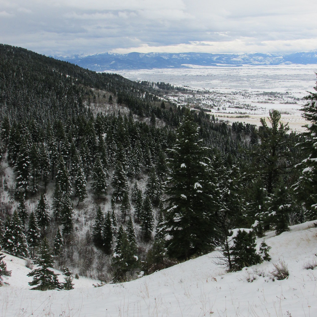
A little more of Bozeman with Madison Range in distance, from the same spot.
Heading down the ridge in broken timber.
A view of Baldy Mountain.
Large woody debris.
Dropping into Patty Creek.
On another horse logging trail in Patty Creek.
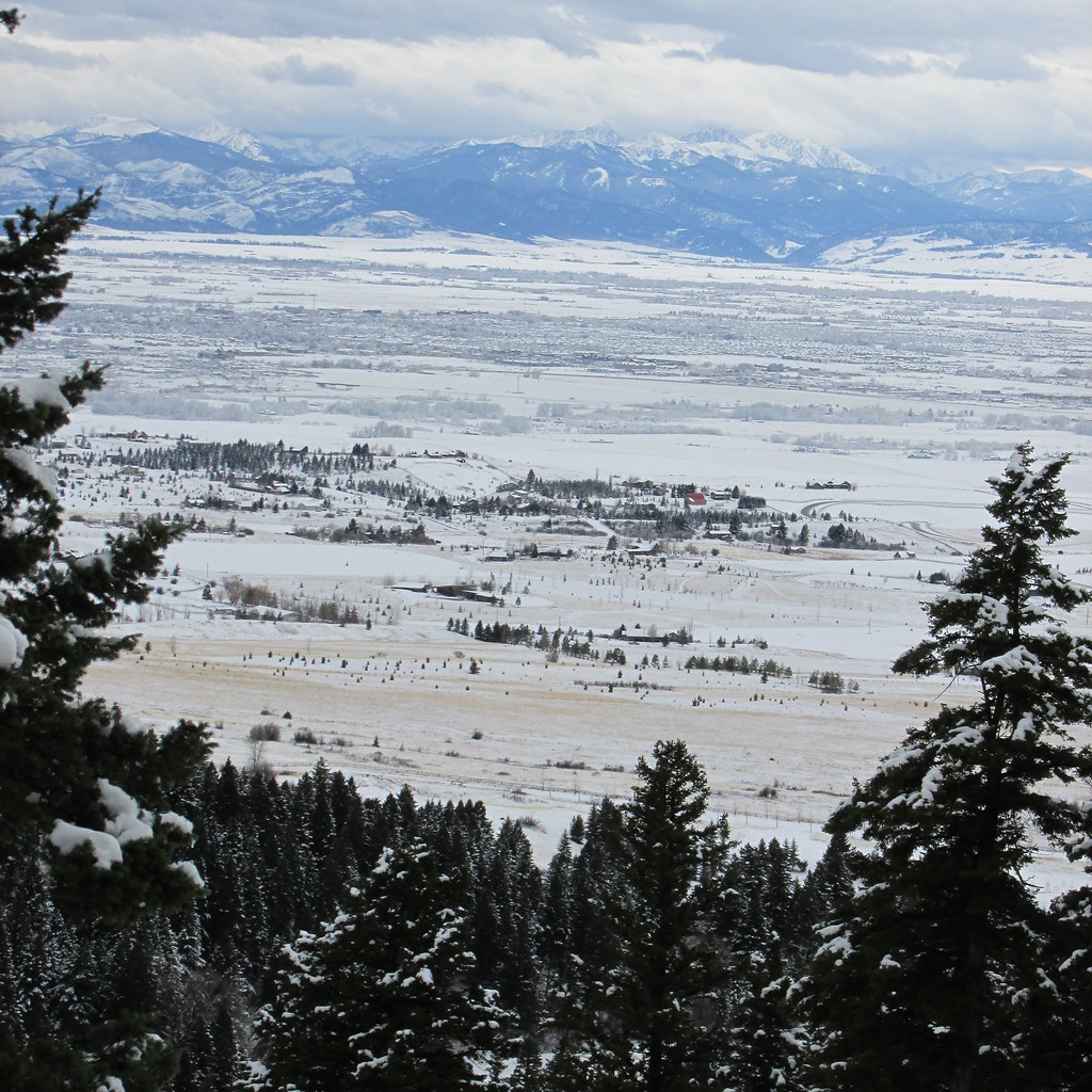
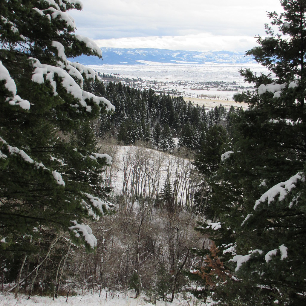
And breaking out on the hay meadow south of the house. Tobacco Roots at far side of Gallatin Valley.
From there, it's a few hundred yards back to the house.
OK, out the door to make another run of it---
Vegan.Hiker
Member
- Joined
- Jul 5, 2014
- Messages
- 2,099
Looks beautiful in the snow out there John.
Vegan.Hiker
Member
- Joined
- Jul 5, 2014
- Messages
- 2,099
I haven't had much luck this winter with the bigger trips I've been trying to plan. I had to cancel 2 trips to the ADK's and 1 trip to the Whites due to weather. So far I've only had one winter trip I thought was worthy of a report : http://backcountrypost.com/threads/white-mountain-national-forest-nh-carter-range.3861/
Since then I've done a handful of uneventful, impromptu day hikes. I need to stay in hiking shape since I plan on doing the Pemi Loop and Great Range Traverse this year which have been ranked #2 and #3 on Backpacker.com's list of "America's Hardest Day Hikes". http://www.backpacker.com/trips/wyoming/grand-teton-national-park/america-s-hardest-dayhikes/ I have no clue who these maniacs are that dayhike those loops. I plan on spending 3 days on each, which will be more than challenging enough for me. Btw, Backpacker.com is way off on those elevation gains, each is only about 10k feet gain, not the higher stats they printed but I digress.
These trips were pretty mundane and I hadn't intended to post any of it. They are not worthy to be TR's but my buddy @ben cowan is addicted to trip reports and needs to know where I've been lol. I've put my whereabouts for Ben here in one post.
BUCK MOUNTAIN - Southeast Adirondacks, NY overlooking Lake George (not in the Adirondack High Peaks Region). This was a month ago or so, right in the middle of a terrible thaw we had that all but eliminated the snowfall from Nov and Dec.


GREAT LEDGE, PANTHER MOUNTAIN - Catskills, NY - This was a much nicer day but the snowpack still hadn't fully recovered so I able to do this hike in just microspikes. I love the Catskills, but it's just one of those places that's much nicer in the Summer and Fall.


Wittenburg and Cornell Mountains on the right. I hope to do those this summer as well.

There are 5 or 6 of these natural ledges on the trail to the summit, hence the name.

Summit of Panther Mtn.

I realized going through my pictures for this post that I have a picture of my wife taking a picture from this same spot as the above pic during the summer.


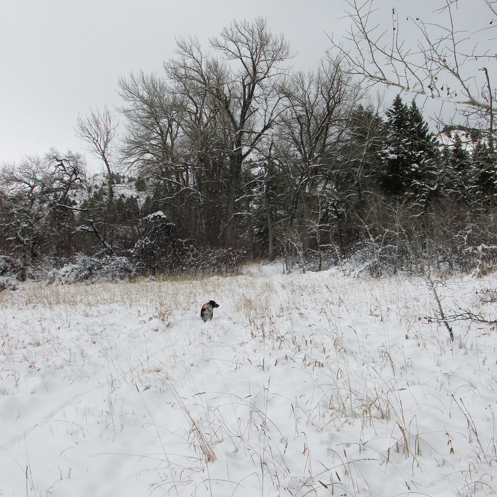
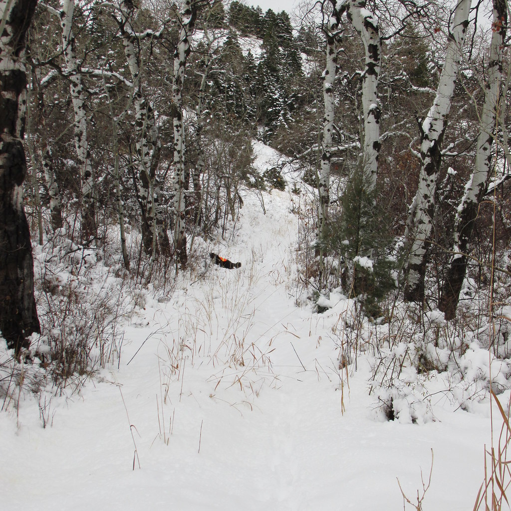
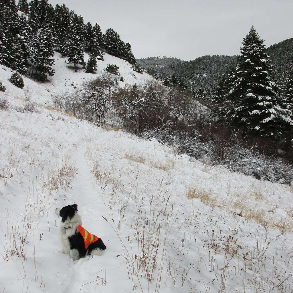
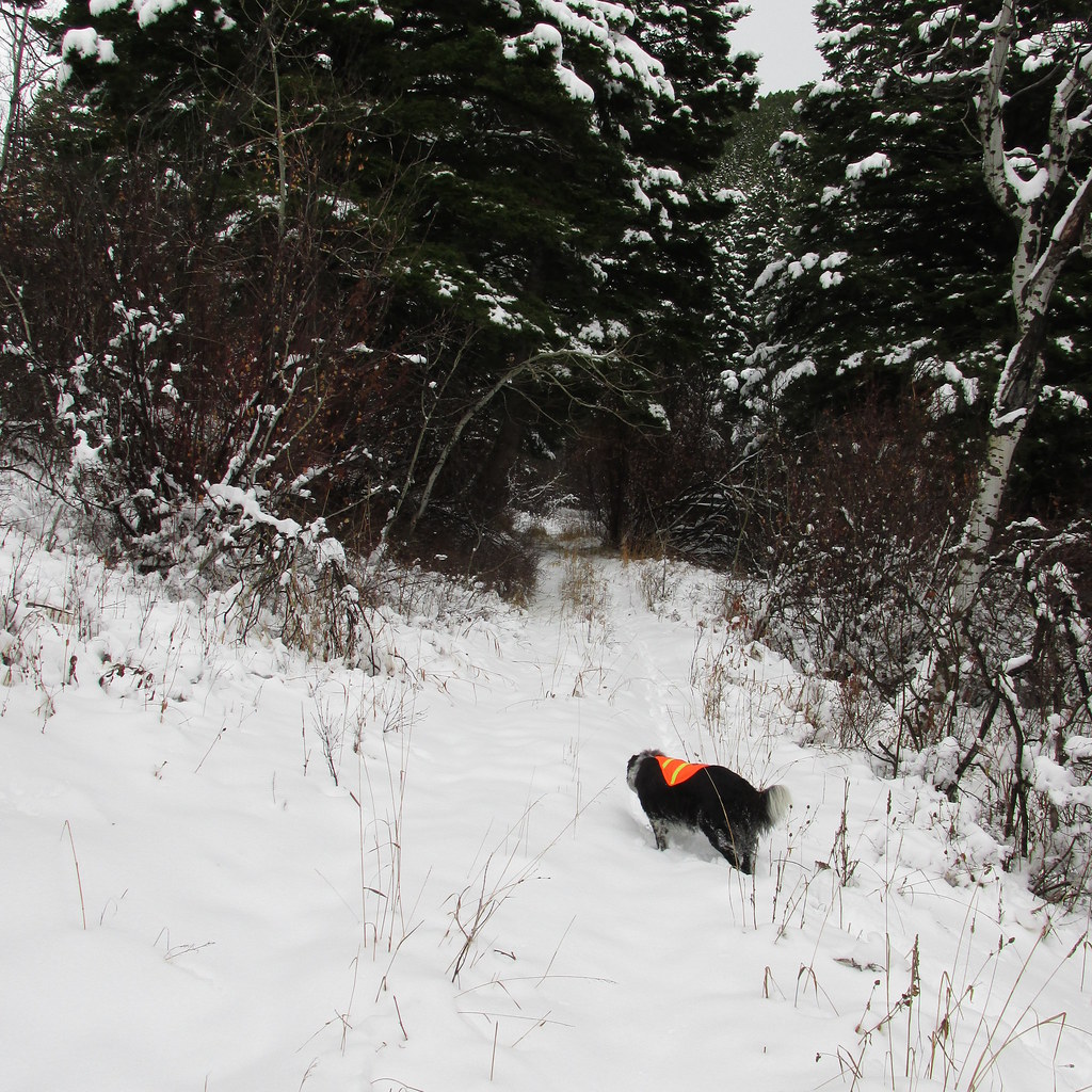
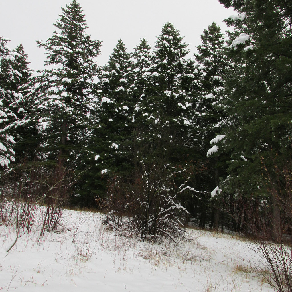
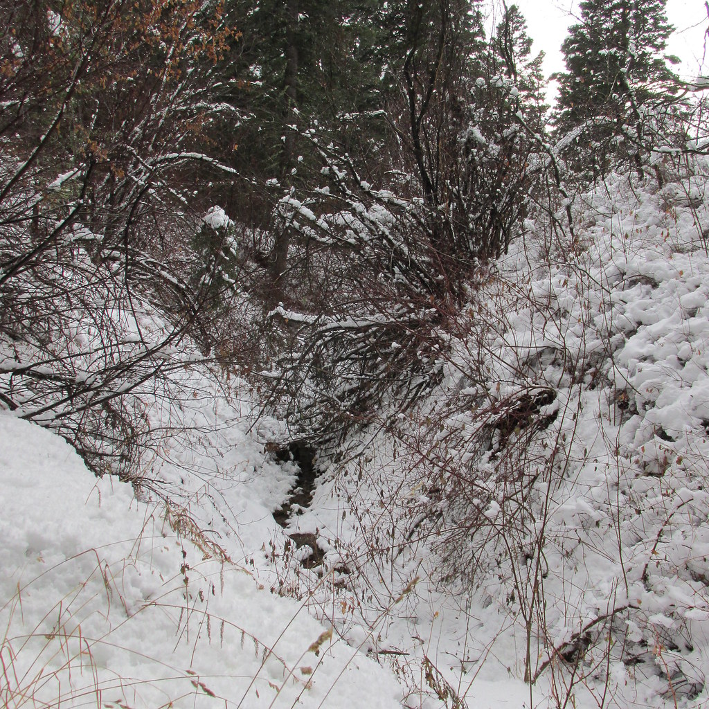
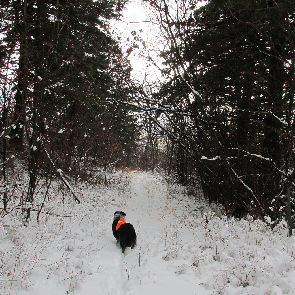
RAMAPO RESERVATION/RINGWOOD STATE PARK, NJ - Literally 10 minutes from my house. This was a dreary colorless day. I took a few pics and they all look black and white. I was glad I had my dog Joey with me because the dreariness gave off a profound loneliness. These are NOT black and white pics, it was actually that colorless of a day.
A wooden bridge takes you over the Ramapo River into the reservation.


Joey trying to figure out how to get a drink.

The trail was unbroken, fortunately it was well blazed.

A barren frozen lake

Came across a small waterfall that I'm pretty sure I swam under several years ago.


BEAR MOUNTAIN STATE PARK, NY - I took two shorter day hikes in the Park on this day. A loop on the Long Path (a 356 mile trail from the NJ side of the Hudson River to near Albany NY) and a short spur on the AT (Appalachian Trail).
LONG PATH LOOP - The morning and afternoon were nice and sunny but got gradually cloudier as the day went on. By the drive home the sky had become a dreary gray again.

Today warranted snow shoes and I broke trail all day which was a nice workout. Am I the only hiker in NJ?
From the ridge atop Long Mountain


On the way home through the park I ended up stopping where the AT (Appalachian Trail) crossed road and decided I wanted to hike a little more.

I hiked to the Bear Mountain area where two of the more unique parts of the AT are. This is the Bear Mountain Bridge which is the lowest elevation of the entire 2,160 miles of the AT at 124' above sea level. I assume the bridge is 124' tall and the Hudson River below is sea level. There are white blazes further down the bridge but I didn't cross. It was time to head home.

Another weird part of the AT is that on the south side of the Bear Mountain Bridge, the AT actually goes through this bizarre trailside zoo. I circumvented it as I had no desire to see wildlife locked in cages.

On the drive home the sky had become cloudy after a day of sun. Ice fisherman were out on some of the lakes doing their thing. I stopped and took a few pictures of them.


Since then I've done a handful of uneventful, impromptu day hikes. I need to stay in hiking shape since I plan on doing the Pemi Loop and Great Range Traverse this year which have been ranked #2 and #3 on Backpacker.com's list of "America's Hardest Day Hikes". http://www.backpacker.com/trips/wyoming/grand-teton-national-park/america-s-hardest-dayhikes/ I have no clue who these maniacs are that dayhike those loops. I plan on spending 3 days on each, which will be more than challenging enough for me. Btw, Backpacker.com is way off on those elevation gains, each is only about 10k feet gain, not the higher stats they printed but I digress.
These trips were pretty mundane and I hadn't intended to post any of it. They are not worthy to be TR's but my buddy @ben cowan is addicted to trip reports and needs to know where I've been lol. I've put my whereabouts for Ben here in one post.
BUCK MOUNTAIN - Southeast Adirondacks, NY overlooking Lake George (not in the Adirondack High Peaks Region). This was a month ago or so, right in the middle of a terrible thaw we had that all but eliminated the snowfall from Nov and Dec.
GREAT LEDGE, PANTHER MOUNTAIN - Catskills, NY - This was a much nicer day but the snowpack still hadn't fully recovered so I able to do this hike in just microspikes. I love the Catskills, but it's just one of those places that's much nicer in the Summer and Fall.
Wittenburg and Cornell Mountains on the right. I hope to do those this summer as well.
There are 5 or 6 of these natural ledges on the trail to the summit, hence the name.
Summit of Panther Mtn.
I realized going through my pictures for this post that I have a picture of my wife taking a picture from this same spot as the above pic during the summer.
RAMAPO RESERVATION/RINGWOOD STATE PARK, NJ - Literally 10 minutes from my house. This was a dreary colorless day. I took a few pics and they all look black and white. I was glad I had my dog Joey with me because the dreariness gave off a profound loneliness. These are NOT black and white pics, it was actually that colorless of a day.
A wooden bridge takes you over the Ramapo River into the reservation.
Joey trying to figure out how to get a drink.
The trail was unbroken, fortunately it was well blazed.
A barren frozen lake
Came across a small waterfall that I'm pretty sure I swam under several years ago.
BEAR MOUNTAIN STATE PARK, NY - I took two shorter day hikes in the Park on this day. A loop on the Long Path (a 356 mile trail from the NJ side of the Hudson River to near Albany NY) and a short spur on the AT (Appalachian Trail).
LONG PATH LOOP - The morning and afternoon were nice and sunny but got gradually cloudier as the day went on. By the drive home the sky had become a dreary gray again.
Today warranted snow shoes and I broke trail all day which was a nice workout. Am I the only hiker in NJ?
From the ridge atop Long Mountain
On the way home through the park I ended up stopping where the AT (Appalachian Trail) crossed road and decided I wanted to hike a little more.
I hiked to the Bear Mountain area where two of the more unique parts of the AT are. This is the Bear Mountain Bridge which is the lowest elevation of the entire 2,160 miles of the AT at 124' above sea level. I assume the bridge is 124' tall and the Hudson River below is sea level. There are white blazes further down the bridge but I didn't cross. It was time to head home.
Another weird part of the AT is that on the south side of the Bear Mountain Bridge, the AT actually goes through this bizarre trailside zoo. I circumvented it as I had no desire to see wildlife locked in cages.
On the drive home the sky had become cloudy after a day of sun. Ice fisherman were out on some of the lakes doing their thing. I stopped and took a few pictures of them.
Last edited:
Ben
Member
- Joined
- Sep 12, 2014
- Messages
- 1,873
@Vegan.Hiker , i really like some of those pictures. thanks for sharing.
I'll play. January 13 i went and spent a night out in the snow near Stanley, ID. In the vicinity of Pettit Lake. I had the idea of hiking around there for a couple days, but i didn't do it. Blue skies and a low avalanche risk made it look like a good idea, but low temperatures and a tent that i was unhappy with changed my mind. I had checked predicted temperatures for higher elevations, which were appreciably warmer than down in the valley where i was.
Here's where i pulled off the highway. Check the snow mobile tracks.

I packed down the snow here to place my tent. Not far from my car, still in sight of the highway. You can see the sun's going down.
The temperature once inside the tent. The last i'd checked it before i got every thing set up it said about 10*. I think i warmed up the air in the tent moving all around. It was a cold night. When i got home i checked a report that said the temperature at the Stanley ranger station got down to -7. In the morning i packed things up and went back to the car.
Looking back as i near the car. I was just on one of the low ridges in the mid ground.
A view of the Sawtooths from along the highway. Packing up in the cold had been awful, but snowshoeing back out had warmed me back up. But there wasn't any point in staying where i was, so i decided to head home and stop near Bulltrout Lake to look at an old homesteader cabin there.


The cabin.
I laid down on my stomach to take a picture through the door.

This is some out building next to the cabin.
This is the out house.
Snow angel.
And some posts for good measure.
Really all i ended up doing was sleeping in a tent in the snow and hiking around in a couple places for a couple hours. But i learned some thing from it.
I'll play. January 13 i went and spent a night out in the snow near Stanley, ID. In the vicinity of Pettit Lake. I had the idea of hiking around there for a couple days, but i didn't do it. Blue skies and a low avalanche risk made it look like a good idea, but low temperatures and a tent that i was unhappy with changed my mind. I had checked predicted temperatures for higher elevations, which were appreciably warmer than down in the valley where i was.
Here's where i pulled off the highway. Check the snow mobile tracks.
I packed down the snow here to place my tent. Not far from my car, still in sight of the highway. You can see the sun's going down.
The temperature once inside the tent. The last i'd checked it before i got every thing set up it said about 10*. I think i warmed up the air in the tent moving all around. It was a cold night. When i got home i checked a report that said the temperature at the Stanley ranger station got down to -7. In the morning i packed things up and went back to the car.
Looking back as i near the car. I was just on one of the low ridges in the mid ground.
A view of the Sawtooths from along the highway. Packing up in the cold had been awful, but snowshoeing back out had warmed me back up. But there wasn't any point in staying where i was, so i decided to head home and stop near Bulltrout Lake to look at an old homesteader cabin there.
The cabin.
I laid down on my stomach to take a picture through the door.
This is some out building next to the cabin.
This is the out house.
Snow angel.
And some posts for good measure.
Really all i ended up doing was sleeping in a tent in the snow and hiking around in a couple places for a couple hours. But i learned some thing from it.
Last edited:
Vegan.Hiker
Member
- Joined
- Jul 5, 2014
- Messages
- 2,099
That cabin looked like a good spot to crawl into to sleep for the night, especially if it was windy. Were you able to stay warm? Did you use your fly creek?
Ben
Member
- Joined
- Sep 12, 2014
- Messages
- 1,873
That cabin looked like a good spot to crawl into to sleep for the night, especially if it was windy. Were you able to stay warm? Did you use your fly creek?
i was able to stay warm. and i did use my fly creek. i was not pleasantly warm, but i survived the night without issue. i did see some thing that i had never seen before that night though, and that was a line of frost running the whole way down the zipper of my outer sleeping bag. the problem that i ran into using the fly creek was that it was too cold and too dry for me to be able to pack any of the snow at all. so there was no thing to plant a stake in. the snow just stayed like sugar.
- Joined
- Aug 9, 2007
- Messages
- 12,967
You guys and your micro trip reports!  Awesome stuff and TOTALLY full TR-worthy! If this was below the benchmark, I think we'd all be screwed. And hey, it's not like we're gonna run out of space, right? But if it's this or nothing, I'll definitely take this! Great stuff!
Awesome stuff and TOTALLY full TR-worthy! If this was below the benchmark, I think we'd all be screwed. And hey, it's not like we're gonna run out of space, right? But if it's this or nothing, I'll definitely take this! Great stuff! Vegan.Hiker
Member
- Joined
- Jul 5, 2014
- Messages
- 2,099
so there was no thing to plant a stake in. the snow just stayed like sugar.
I don't have any personal experience with them but have you tried using those horizontal dead men anchors made for soft sand/snow? Probably wouldn't have helped if the snow was soft powder though.
John Goering
Member
- Joined
- Sep 30, 2014
- Messages
- 502
Yep, but they still leave a whole lot to be desired in really cold, loose snow. You need an avalanche shovel to bury them deep enough so they don't pull out.I don't have any personal experience with them but have you tried using those horizontal dead men anchors made for soft sand/snow? Probably wouldn't have helped if the snow was soft powder though.
http://www.rei.com/product/725165/rei-snow-and-sand-tent-anchors
I think a free standing tent is much better in snow, especially if some of that happens to be on top of the tent. But it makes it more interesting to get up in the morning. Even with a freestanding, you still need the guys so the problem doesn't go away.
12trysomething
Member
- Joined
- Oct 2, 2014
- Messages
- 43
These are excellent, thanks for sharing!!
Ben
Member
- Joined
- Sep 12, 2014
- Messages
- 1,873
On valentines day we did a short hike along the Boise River. It's about two miles between the dam for Lucky Peak Reservoir, and an old diversion dam for an irrigation canal. It's a great place to take the dogs, cliffs on one side, water on the other. They can run where ever they want with out getting lost.
Looking down the canyon from near the parking area. Spring colored grass, fall colored trees. February.

Looking back at the dam and the diversion outlets.
Irony.
Isaac. It was nice out.
Old retaining wall, or some thing, that's been seasonally submerged for years. You can see part of the diversion dam, originally built in 1909, and the power house that was added later, 1912.
Dogs. It looks like a stand off, but really Oscar's just skeptical about getting in the water.

Looking back up the river.

The dam.
The gates on the left open for the New York Canal, the grate below the power house lets the water bypass the dam. During the summer most of the river runs over the spillway spreading to the right.
The canal's gates. And Isaac. And Oscar's tail if you can find it.
Looking down the canyon from near the parking area. Spring colored grass, fall colored trees. February.
Looking back at the dam and the diversion outlets.
Irony.
Isaac. It was nice out.
Old retaining wall, or some thing, that's been seasonally submerged for years. You can see part of the diversion dam, originally built in 1909, and the power house that was added later, 1912.
Dogs. It looks like a stand off, but really Oscar's just skeptical about getting in the water.
Looking back up the river.
The dam.
The gates on the left open for the New York Canal, the grate below the power house lets the water bypass the dam. During the summer most of the river runs over the spillway spreading to the right.
The canal's gates. And Isaac. And Oscar's tail if you can find it.
- Status
- Not open for further replies.