IntrepidXJ
ADVENTR
- Joined
- Jan 17, 2012
- Messages
- 3,488
The Doll House | Memorial Day Weekend
Thursday – Monday, May 26-30, 2016
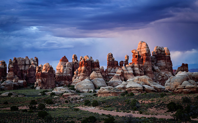
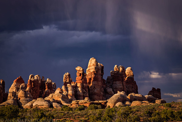
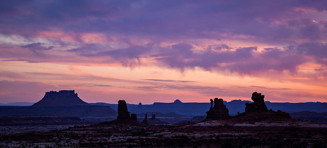
A beautiful sunset over The Doll House in Canyonlands National Park.
While crowds of people were lined up to get into Arches National Park and Island in the Sky this holiday weekend, Diane and I were back in The Maze District of Canyonlands National Park where we would only see a couple other people the entire time. This is why Diane and I have kept coming back back here for the past three years over Memorial Day weekend. Make sure to check out our previous trip reports from 2014 and 2015. This year we invited our friends Marty and Dave along to spend a few days down in The Doll House and the Land of Standing Rocks. It has been a few years since I last visited this area and I was looking forward to getting back and actually spending a few nights in The Doll House.
Diane and I left home after work on Thursday evening and drove west into Utah where we topped off the fuel tank in Green River and then resumed the drive across the San Rafael Desert towards the Hans Flat Ranger Station. We continued past the ranger station to our first campsite at Happy Canyon near the top of the Flint Trail where we planned to meet up with Marty and Dave. As we drove along the edge of the Orange Cliffs, we stopped at a few of the overlooks to catch the sunset and take a couple of pictures. We made it to camp just after the sun had set and found Dave and Marty already there. We quickly got our tent setup and went to bed early.
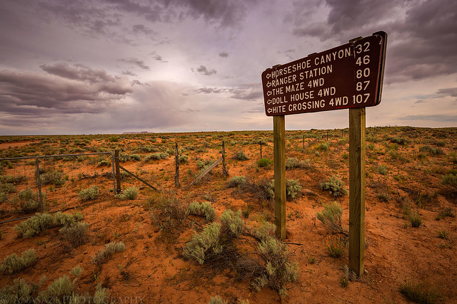
Passing this sign always signals the beginning of an adventure.
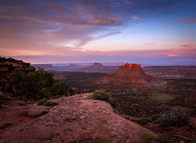
A nice view from the Millard Canyon Overlook shortly before sunset.
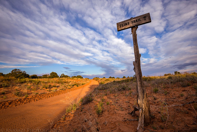
This way to the Flint Trail…
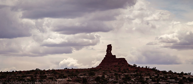
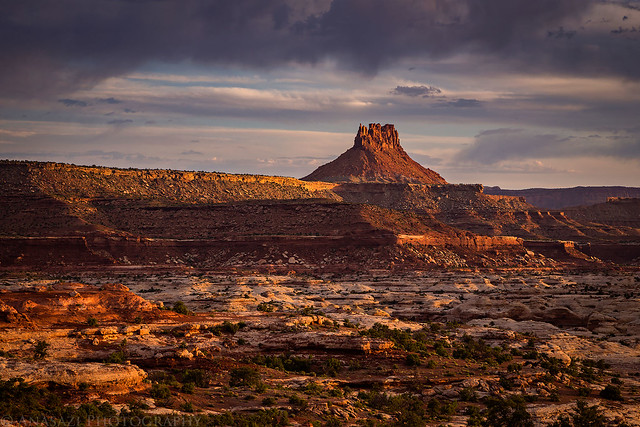
We made it to the Bagpipe Butte Overlook just in time to catch a little color.
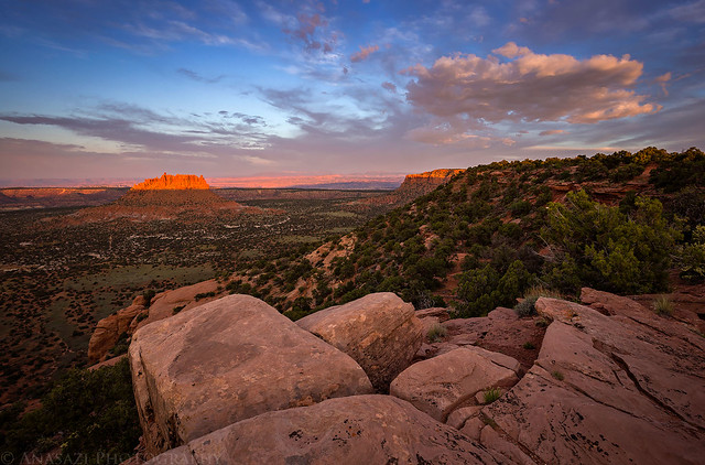
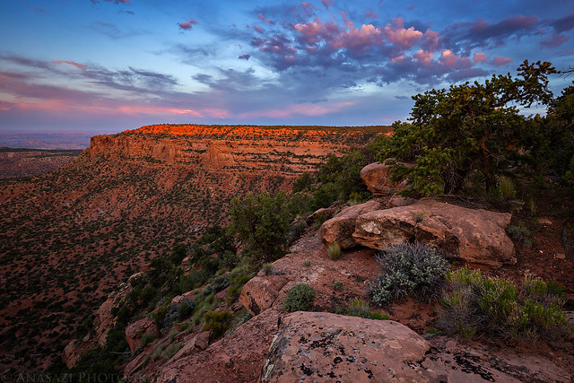
The Orange Cliffs were certainly glowing orange this evening.
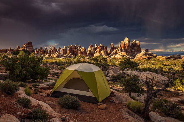
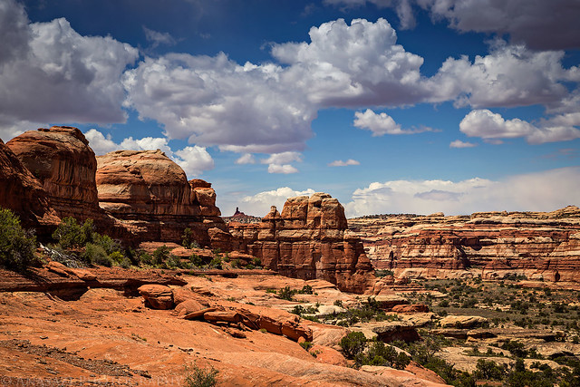
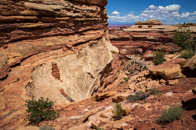
On Friday morning I woke up a little before the sunrise and hiked along the rim of the South Fork of Happy Canyon to take a few photos. After that we packed up camp and decided to drive out on The Big Ridge to see how far the road would go since none of us had been out that way very far before. Dave was hoping we could make it out to Buckacre Point for a view over the Dirty Devil River Canyon, but after about an hour of driving the road got too washed out to safely continue, so we turned around and descended the Flint Trail on our way to The Doll House. It’s been over five years since I drove this road around the head of Teapot Canyon to the Land of Standing Rocks and for some reason I remembered it being rougher than it was on this trip? We made good time and were soon setting up camp at the Doll House 3 campsite. After camp was setup we we hiked out into Ernies Country to do a little exploring and search for some rock art. We found everything I was looking for and watched a beautiful sunset as we returned to camp for the night. The view from camp was spectacular, but the gnats and no-see-ums were pretty terrible on this trip.
A narrow peninsula of sandstone juts out into the South Fork of Happy Canyon before sunrise.
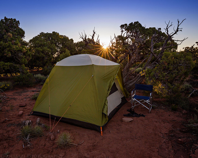
Our tent at the Happy Canyon Camp as the sun comes up.
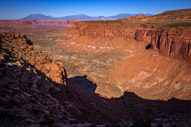
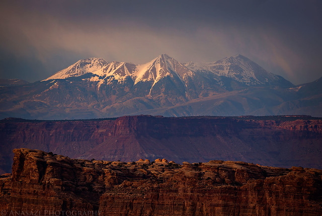
The Henry Mountains and view over North Hatch Canyon from our turn-around spot on The Big Ridge.
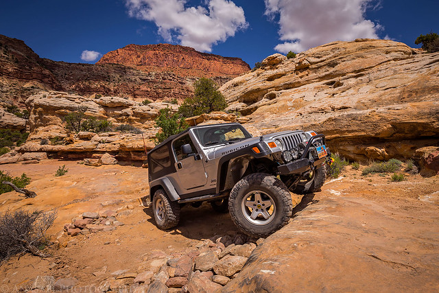
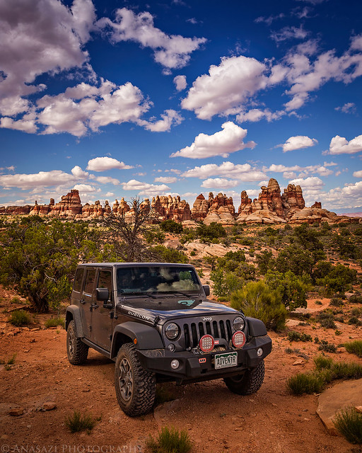
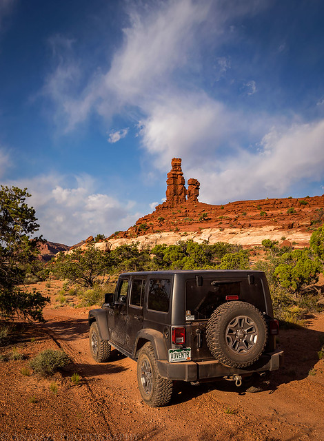
My new JK tackling it’s first rough trail as we drove around Teapot Canyon on our way to The Doll House.
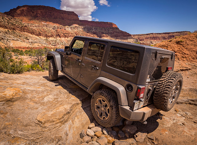
Dave’s Jeep has seen this road many times before.
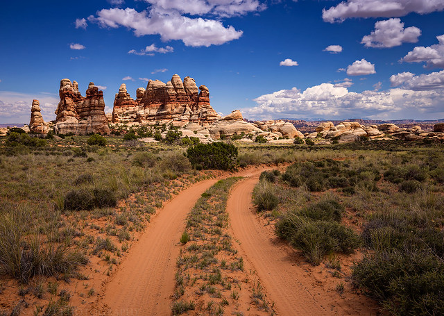
Two-track into The Doll House.
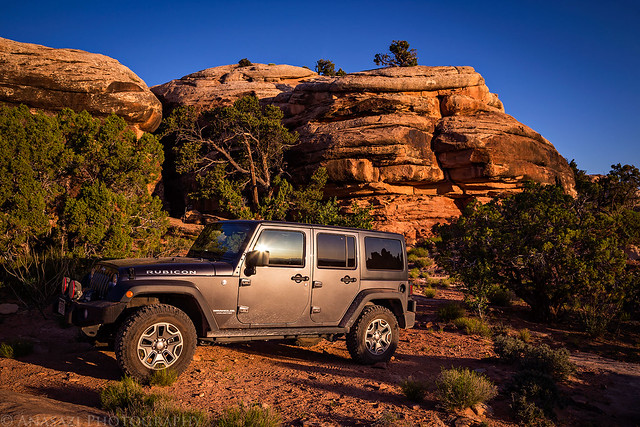
The end of the road…my Jeep parked in the Doll House 3 campsite.
Dave climbed up to this narrow ledge for a closer look at some faint Barrier Canyon Style pictographs I spotted from below.

A big red pictograph of a bear.

Another nice panel of pictographs we found.

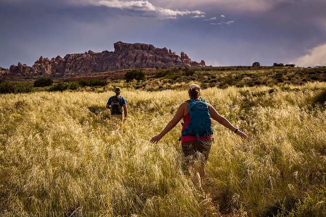
Dave and Diane hike through tall grass in Ernies Country.
One last panel of faint pictographs we discovered. Look closely to see the tiny sheep in the center.

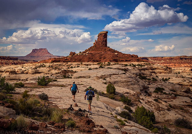
On our way back to camp we were treated to some amazing views.
Make sure to stop and enjoy the scenery.
Some nice virga developed over The Doll House on our hike back.
Not a bad view from camp…
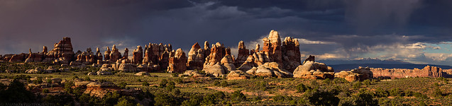
Click on this image for a larger panoramic view of The Doll House this evening.
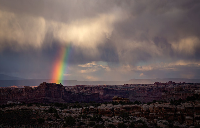
We even had a rainbow in the sky for a little while before sunset.
It looked like there was some nice light in The Needles across the Colorado River this evening, too.

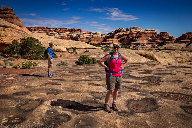
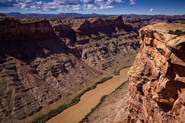
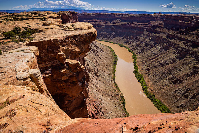
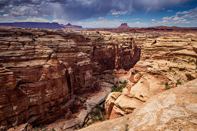
Saturday I had planned for our longest hike of the weekend and it looked like it was going to be a warm one, so we tried to get started early. After dropping my Jeep off at Chimney Rock we returned to The Doll House and hiked out on the Green and Colorado Rivers Overlook Trail. For some reason I had the idea that this was going to be a flat and boring trail (don’t ask me where I got that idea from?) and I was pleasantly surprised to find it very scenic and enjoyable. When we reached the intersection with the connector trail to Water Canyon Diane found some shade to rest in while Dave and I continued to the edge overlooking the Colorado River in Cataract Canyon. We then returned to Diane and continued down into Water Canyon and quickly crossed the divide into Shot Canyon. By this point the sun was beating down, the temperature was pretty warm, and the heat was taking it’s toll on us. Because of this, we weren’t really able to enjoy the hike through Shot Canyon as much as I would have liked to, especially since we had to climb 400 feet out of the canyon at the end. We definitely slowed down at the end of this hike, but we made it out OK. We returned to camp and rested up the remainder of the evening. I had gotten pretty dehydrated on the hike, so I made sure to drink plenty of fluids and kept out of the sun. The bugs were still pretty annoying.
Sunrise at Doll House #3
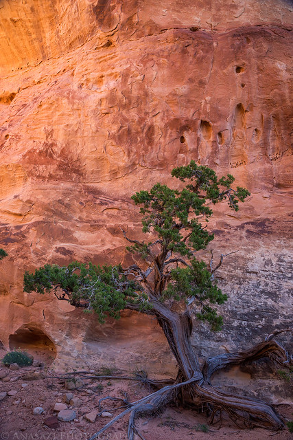
A twisted juniper and beautiful reflected light.
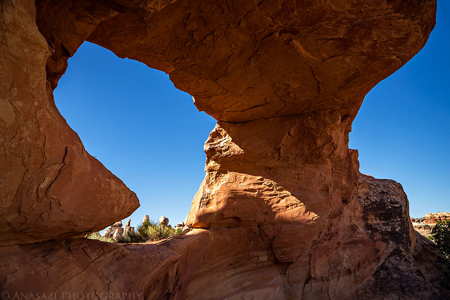
Underneath Beehive Arch.
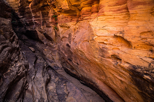
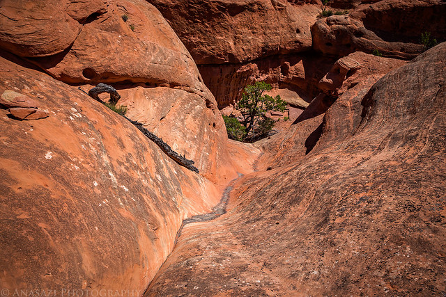
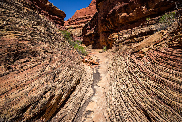
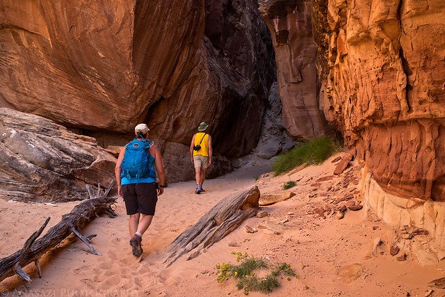
Reflected light in a very short slot canyon along the trail.
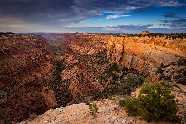
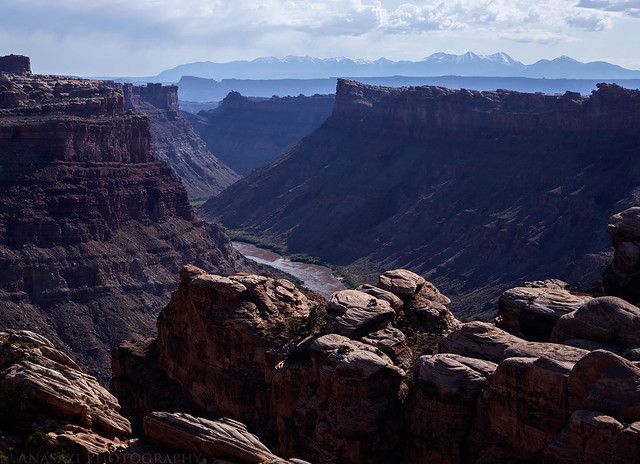
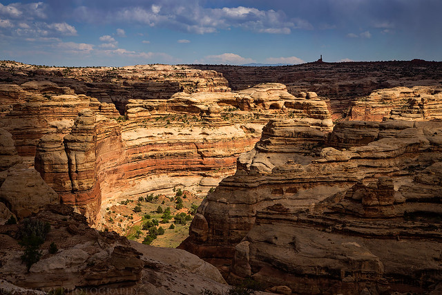
Overlooking Cataract Canyon near the end of the the trail.
The way down to Water Canyon.
Passing through a narrow canyon in the divide between Water and Shot Canyons.
We could see Chimney Rock, our destination, from the divide.
The upper part of the steep trail we used to exit Shot Canyon.
There was a nice view over Jasper Canyon after we exited Shot Canyon.
When we got out of the canyon we were able to see my Jeep on the horizon below Chimney Rock…the final destination.
An evening view of the La Sal Mountains from camp.
Just another evening in The Doll House.
We were moving camp on Sunday, so we packed up and then went on a short easy hike on the Granary Loop trail. Dave and I had done this hike on our trip here about five years ago, but for some reason we didn’t remember too much about it (besides the granaries, of course) and were pleasantly surprised to recall just how nice of a hike it is even though it’s pretty short. We took our time on this trail before returning to our vehicles at the trailhead and then drove back into the Land of Standing Rocks to our last campsite at The Wall. While the view from this camp was outstanding, the actual camp site offered little in protection and shade and was pretty exposed. Plus, the gnats and no-see-ums seemed to be even worse at this site! We setup camp camp and then rested for a few hours in what little shade we could find. I was originally planning for us to hike out to the Chocolate Drops on Monday morning before heading home, but we thought it might be better to hike it this evening instead and decided to do that. Luckily, we had some clouds blocking the sun for most of the hike out which helped keep us a little cooler. I have to say that this was a really nice trail with great views in every direction. I enjoyed it more than I thought I would and it was great to see the Chocolate Drops up close and personal. We returned to camp just in time was catch another spectacular sunset and then got to watch a little lightning storm off in the distance before going to bed.
A hazy morning view from the trail down to Spanish Bottom.
Storage bins at the end of the Granary Trail.

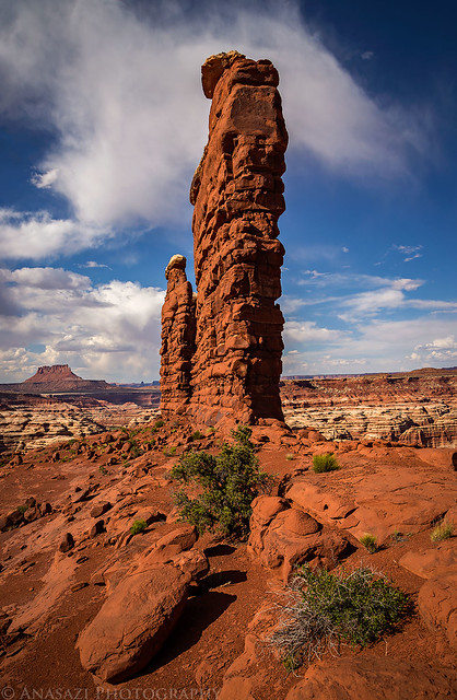
I loved the colors reflecting off the sandstone here.

Hiking back to the trailhead through a slot in the rock.
Spotlight in The Maze below as we hiked across the ridge to the Chocolate Drops.
Almost there!
View from the side.
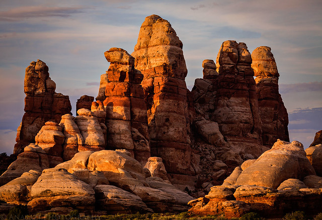
I’ve seen them many times from afar, but they were even more impressive up close.
Hiking back to The Wall.
Our three Jeeps at the trailhead.
We made it back to camp just in time to catch another nice sunset.
Another spectacular view from camp.
Can’t beat the view from inside our tent.
Diane enjoyed the view from camp, despite the bugs that were constantly bothering us.
Interesting clouds looking the other direction.
Just as I was getting ready to go to bed there were a few bolts of lightning in the distance near the Island in the Sky, so I set my camera up and stayed up a little later trying to photograph them.
After photographing a colorful sunrise on Monday morning we packed up camp for the last time this trip and started the drive back home. Marty decided to split off from us and head back through Hite since he had never been that way before, while Dave and I returned back up the Flint Trail. As soon as we reached the pavement we noticed how busy the roads were with people heading back home from the holiday weekend. There seemed to be a line of traffic coming back from Moab towards Salt Lake City, plus plenty of vehicles driving back into Colorado on I-70. It was nice to avoid that kind of traffic in The Maze for the past few days. Aside from the bugs and the heat,we had another great ADVENTR weekend on the Colorado Plateau!
I wasn’t planning to get up and photograph sunrise this morning, but when I noticed these colors from my sleeping bag I had to get up and take a few photos.

Driving back out past The Mother and Child Rock.
Marty’s Jeep at the end of the roughest part of the road around Teapot Canyon. From here it was an easy drive the rest of the way home.
>> Maze Memorial Weekend III Photo Gallery
>> The Original Trip Report on ADVENTR.CO
Thursday – Monday, May 26-30, 2016
A beautiful sunset over The Doll House in Canyonlands National Park.
While crowds of people were lined up to get into Arches National Park and Island in the Sky this holiday weekend, Diane and I were back in The Maze District of Canyonlands National Park where we would only see a couple other people the entire time. This is why Diane and I have kept coming back back here for the past three years over Memorial Day weekend. Make sure to check out our previous trip reports from 2014 and 2015. This year we invited our friends Marty and Dave along to spend a few days down in The Doll House and the Land of Standing Rocks. It has been a few years since I last visited this area and I was looking forward to getting back and actually spending a few nights in The Doll House.
Diane and I left home after work on Thursday evening and drove west into Utah where we topped off the fuel tank in Green River and then resumed the drive across the San Rafael Desert towards the Hans Flat Ranger Station. We continued past the ranger station to our first campsite at Happy Canyon near the top of the Flint Trail where we planned to meet up with Marty and Dave. As we drove along the edge of the Orange Cliffs, we stopped at a few of the overlooks to catch the sunset and take a couple of pictures. We made it to camp just after the sun had set and found Dave and Marty already there. We quickly got our tent setup and went to bed early.
Passing this sign always signals the beginning of an adventure.
A nice view from the Millard Canyon Overlook shortly before sunset.
This way to the Flint Trail…
We made it to the Bagpipe Butte Overlook just in time to catch a little color.
The Orange Cliffs were certainly glowing orange this evening.
On Friday morning I woke up a little before the sunrise and hiked along the rim of the South Fork of Happy Canyon to take a few photos. After that we packed up camp and decided to drive out on The Big Ridge to see how far the road would go since none of us had been out that way very far before. Dave was hoping we could make it out to Buckacre Point for a view over the Dirty Devil River Canyon, but after about an hour of driving the road got too washed out to safely continue, so we turned around and descended the Flint Trail on our way to The Doll House. It’s been over five years since I drove this road around the head of Teapot Canyon to the Land of Standing Rocks and for some reason I remembered it being rougher than it was on this trip? We made good time and were soon setting up camp at the Doll House 3 campsite. After camp was setup we we hiked out into Ernies Country to do a little exploring and search for some rock art. We found everything I was looking for and watched a beautiful sunset as we returned to camp for the night. The view from camp was spectacular, but the gnats and no-see-ums were pretty terrible on this trip.
A narrow peninsula of sandstone juts out into the South Fork of Happy Canyon before sunrise.
Our tent at the Happy Canyon Camp as the sun comes up.
The Henry Mountains and view over North Hatch Canyon from our turn-around spot on The Big Ridge.
My new JK tackling it’s first rough trail as we drove around Teapot Canyon on our way to The Doll House.
Dave’s Jeep has seen this road many times before.
Two-track into The Doll House.
The end of the road…my Jeep parked in the Doll House 3 campsite.
Dave climbed up to this narrow ledge for a closer look at some faint Barrier Canyon Style pictographs I spotted from below.
A big red pictograph of a bear.
Another nice panel of pictographs we found.
Dave and Diane hike through tall grass in Ernies Country.
One last panel of faint pictographs we discovered. Look closely to see the tiny sheep in the center.
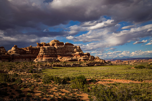
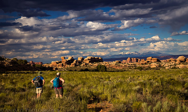
On our way back to camp we were treated to some amazing views.
Make sure to stop and enjoy the scenery.
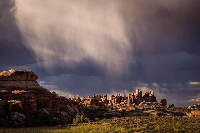
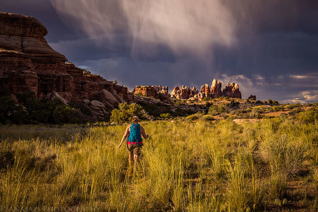
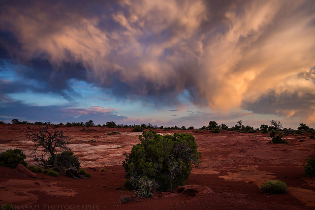
Some nice virga developed over The Doll House on our hike back.
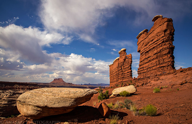
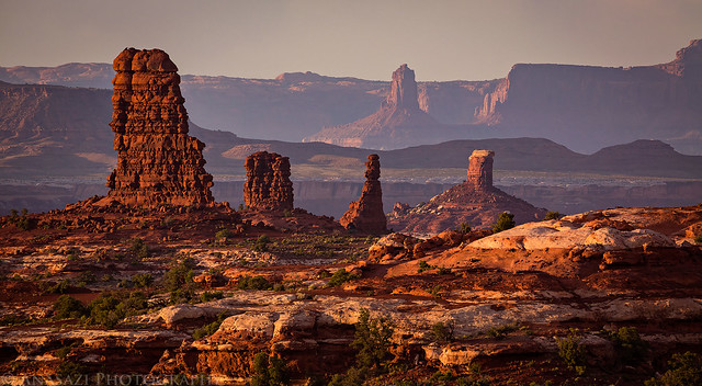
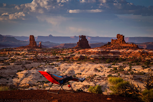
Not a bad view from camp…
Click on this image for a larger panoramic view of The Doll House this evening.
We even had a rainbow in the sky for a little while before sunset.
It looked like there was some nice light in The Needles across the Colorado River this evening, too.
Saturday I had planned for our longest hike of the weekend and it looked like it was going to be a warm one, so we tried to get started early. After dropping my Jeep off at Chimney Rock we returned to The Doll House and hiked out on the Green and Colorado Rivers Overlook Trail. For some reason I had the idea that this was going to be a flat and boring trail (don’t ask me where I got that idea from?) and I was pleasantly surprised to find it very scenic and enjoyable. When we reached the intersection with the connector trail to Water Canyon Diane found some shade to rest in while Dave and I continued to the edge overlooking the Colorado River in Cataract Canyon. We then returned to Diane and continued down into Water Canyon and quickly crossed the divide into Shot Canyon. By this point the sun was beating down, the temperature was pretty warm, and the heat was taking it’s toll on us. Because of this, we weren’t really able to enjoy the hike through Shot Canyon as much as I would have liked to, especially since we had to climb 400 feet out of the canyon at the end. We definitely slowed down at the end of this hike, but we made it out OK. We returned to camp and rested up the remainder of the evening. I had gotten pretty dehydrated on the hike, so I made sure to drink plenty of fluids and kept out of the sun. The bugs were still pretty annoying.
Sunrise at Doll House #3
A twisted juniper and beautiful reflected light.
Underneath Beehive Arch.
Reflected light in a very short slot canyon along the trail.
Overlooking Cataract Canyon near the end of the the trail.
The way down to Water Canyon.
Passing through a narrow canyon in the divide between Water and Shot Canyons.
We could see Chimney Rock, our destination, from the divide.
The upper part of the steep trail we used to exit Shot Canyon.
There was a nice view over Jasper Canyon after we exited Shot Canyon.
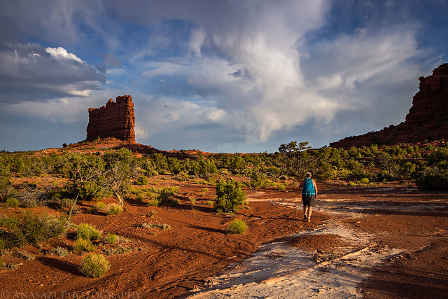
When we got out of the canyon we were able to see my Jeep on the horizon below Chimney Rock…the final destination.
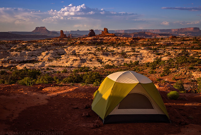
An evening view of the La Sal Mountains from camp.
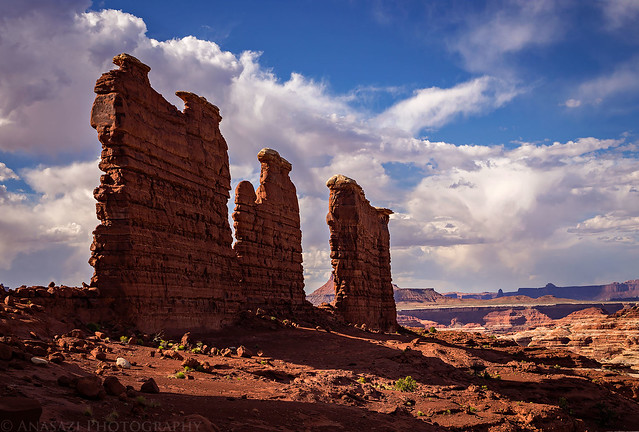
Just another evening in The Doll House.
We were moving camp on Sunday, so we packed up and then went on a short easy hike on the Granary Loop trail. Dave and I had done this hike on our trip here about five years ago, but for some reason we didn’t remember too much about it (besides the granaries, of course) and were pleasantly surprised to recall just how nice of a hike it is even though it’s pretty short. We took our time on this trail before returning to our vehicles at the trailhead and then drove back into the Land of Standing Rocks to our last campsite at The Wall. While the view from this camp was outstanding, the actual camp site offered little in protection and shade and was pretty exposed. Plus, the gnats and no-see-ums seemed to be even worse at this site! We setup camp camp and then rested for a few hours in what little shade we could find. I was originally planning for us to hike out to the Chocolate Drops on Monday morning before heading home, but we thought it might be better to hike it this evening instead and decided to do that. Luckily, we had some clouds blocking the sun for most of the hike out which helped keep us a little cooler. I have to say that this was a really nice trail with great views in every direction. I enjoyed it more than I thought I would and it was great to see the Chocolate Drops up close and personal. We returned to camp just in time was catch another spectacular sunset and then got to watch a little lightning storm off in the distance before going to bed.
A hazy morning view from the trail down to Spanish Bottom.
Storage bins at the end of the Granary Trail.
I loved the colors reflecting off the sandstone here.
Hiking back to the trailhead through a slot in the rock.
Spotlight in The Maze below as we hiked across the ridge to the Chocolate Drops.
Almost there!
View from the side.
I’ve seen them many times from afar, but they were even more impressive up close.
Hiking back to The Wall.
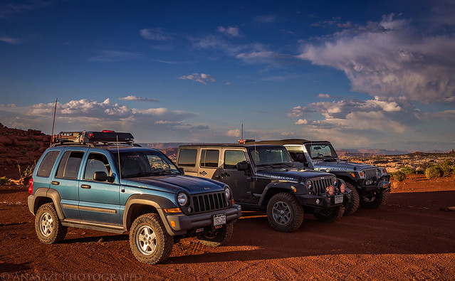
Our three Jeeps at the trailhead.
We made it back to camp just in time to catch another nice sunset.
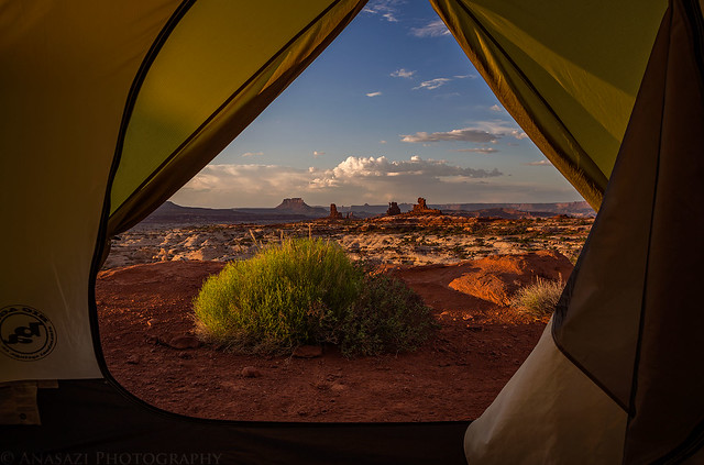
Another spectacular view from camp.
Can’t beat the view from inside our tent.
Diane enjoyed the view from camp, despite the bugs that were constantly bothering us.
Interesting clouds looking the other direction.
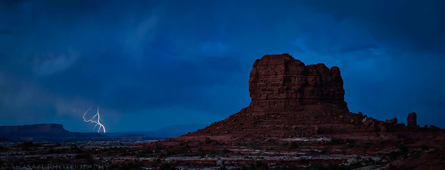
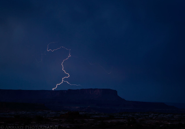
Just as I was getting ready to go to bed there were a few bolts of lightning in the distance near the Island in the Sky, so I set my camera up and stayed up a little later trying to photograph them.
After photographing a colorful sunrise on Monday morning we packed up camp for the last time this trip and started the drive back home. Marty decided to split off from us and head back through Hite since he had never been that way before, while Dave and I returned back up the Flint Trail. As soon as we reached the pavement we noticed how busy the roads were with people heading back home from the holiday weekend. There seemed to be a line of traffic coming back from Moab towards Salt Lake City, plus plenty of vehicles driving back into Colorado on I-70. It was nice to avoid that kind of traffic in The Maze for the past few days. Aside from the bugs and the heat,we had another great ADVENTR weekend on the Colorado Plateau!
I wasn’t planning to get up and photograph sunrise this morning, but when I noticed these colors from my sleeping bag I had to get up and take a few photos.
Driving back out past The Mother and Child Rock.
Marty’s Jeep at the end of the roughest part of the road around Teapot Canyon. From here it was an easy drive the rest of the way home.
>> Maze Memorial Weekend III Photo Gallery
>> The Original Trip Report on ADVENTR.CO
Last edited:
")