Udink
Still right here.
- Joined
- Jan 17, 2012
- Messages
- 1,734
I haven't been posting trip reports here much lately 'cause of some recent negative vibes regarding Bears Ears (yeah, lame, right?), but some discussion with @Nick on Facebook tonight reminded me that we may not all be that far apart on our views. I'm sad that it seems to be such a partisan issue, and with me leaning more toward libertarianism it makes it that much more difficult to identify with either of the two major sides. Anyhow, I think the love for the outdoors is strong on this site, and wanted to share our mutual interest in a place that we can probably all agree is pretty special.
-----------------------------------
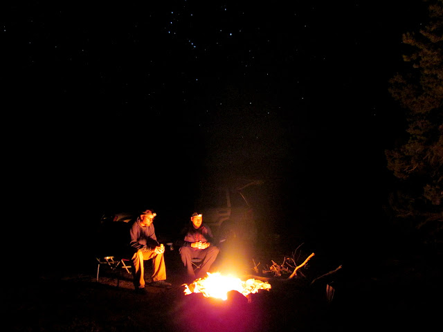
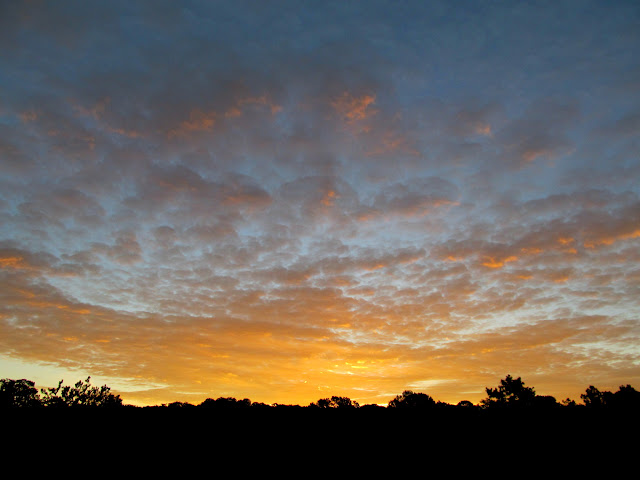
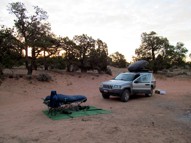
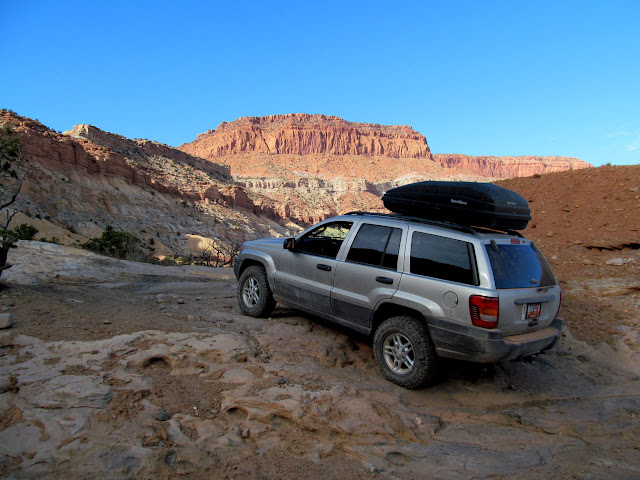
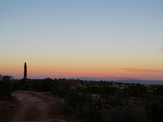
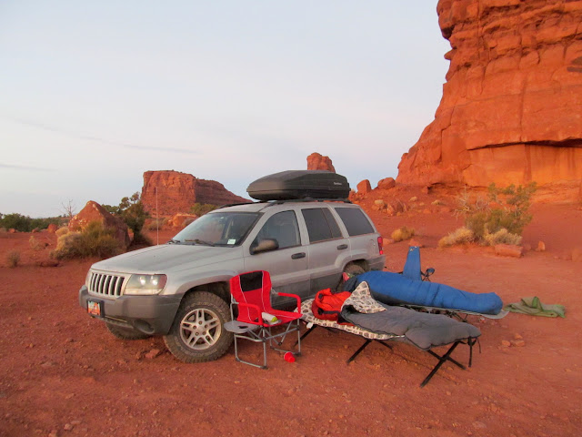
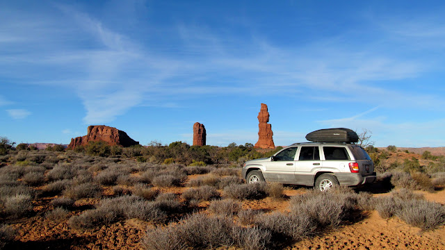
My first trip into the Maze took me out of my comfort zone. I was perfectly in my element on this, my second time driving a full-sized vehicle into the region. I had done two day trips into the area on a motorcycle since that first trip, but a multi-day 4WD tour takes on an entirely different character. Chris and I began planning this trip a while back. I had made reservations in advance, not knowing what the weather would be like in mid-November. As the dates got closer, the weather forecast showed warmer and drier weather than we could have hoped for. Chris arrived at my house on a Tuesday evening and threw his gear into my Jeep, which was already heavily loaded with my own stuff. We headed south, camping on BLM land at Hans Flats and enjoying our only camp fire of the entire week. Temperatures were very comfortable at night and we awoke to a splendid sunrise.
Time-lapse video spanning two days between the Flint Trail and the Doll House
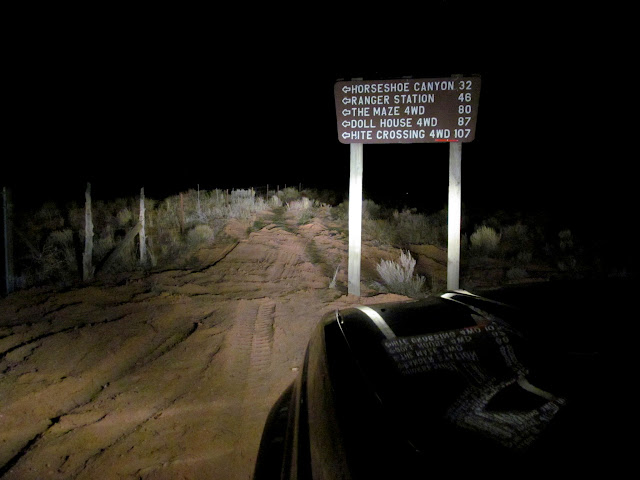
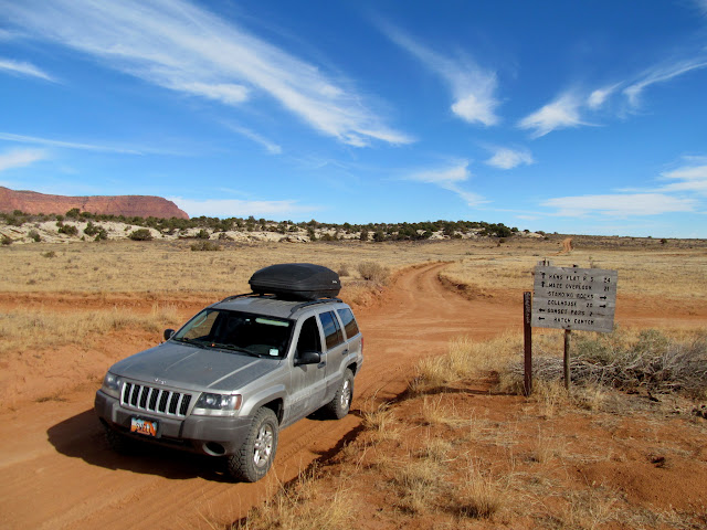
My seventh time driving past this sign in the last month
Camp fire on BLM land at Hans Flats
Wednesday morning sunrise
Chris still asleep on his cot
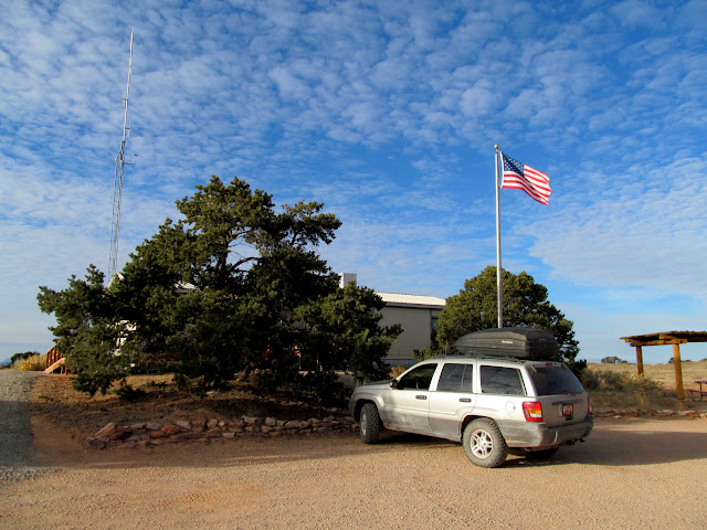
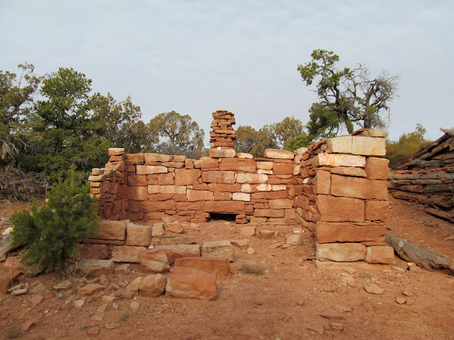
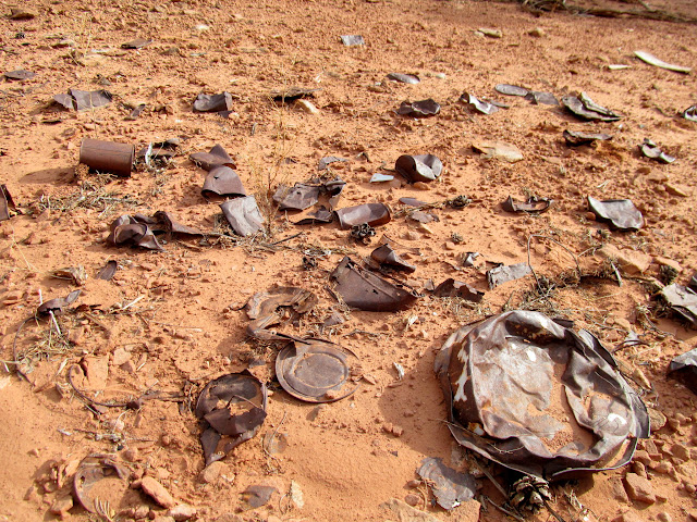
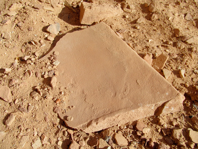
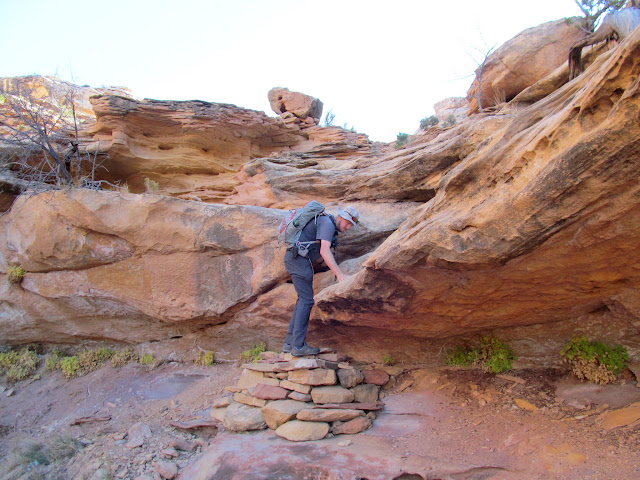
The Hans Flats Ranger Station opened at 8:00AM, and we were there shortly after opening to pick up the permit. I humbly endured the lecture from park rangers about the dangers of driving into the Maze. I stifled a laugh, then just pursed my lips and nodded and said, "Hmm..." when the female park ranger claimed that I would definitely do damage to at least two body panels on my Grand Cherokee. Like, what the hell? Can't they just be honest, without all the hyperbole? With that ridiculosity over and permit in hand, we got our trip started. Between the ranger station and the top of the Flint Trail, we stopped to visit French Cabin and the Flint Cabins. The Flint Cabins were awesome, with a large amount of interesting refuse lying all around. I found out after our visit that there are inscriptions in the sandstone blocks of one of the cabins, definitely making it worth a return visit sometime.
Hans Flats Ranger Station
French Cabin
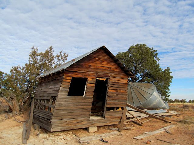
Flint Cabins
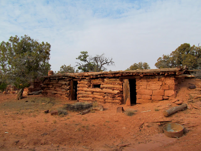
Stone Flint Cabin
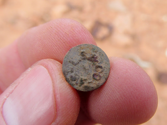
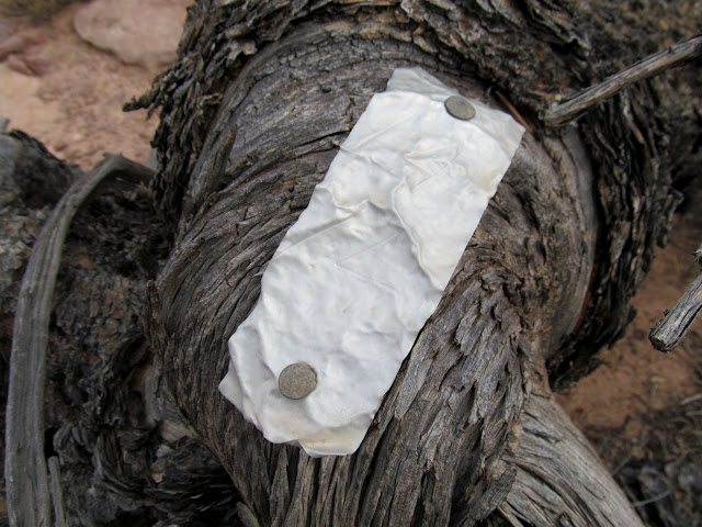
Rivet from a pair of Levi Strauss jeans
Can dump at the Flint Cabins
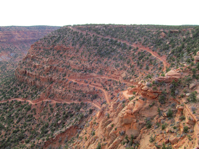
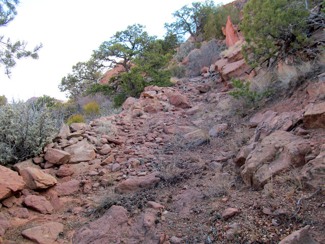
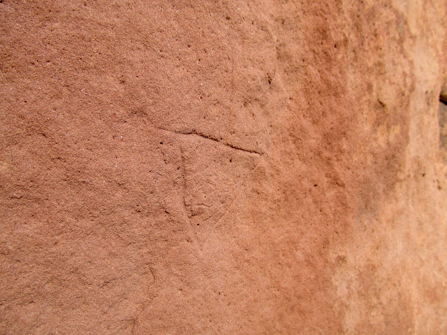
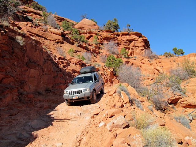
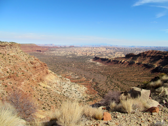
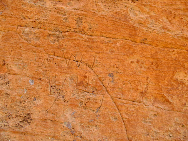
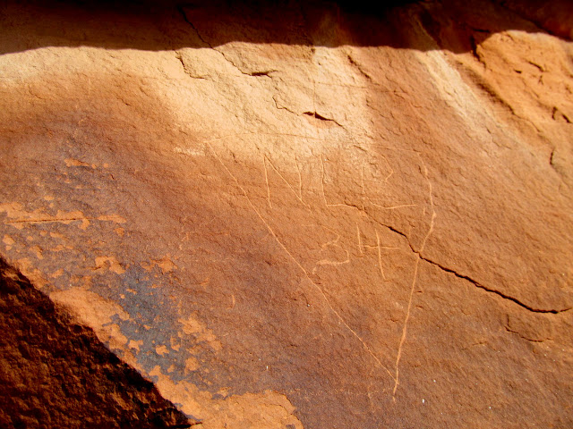
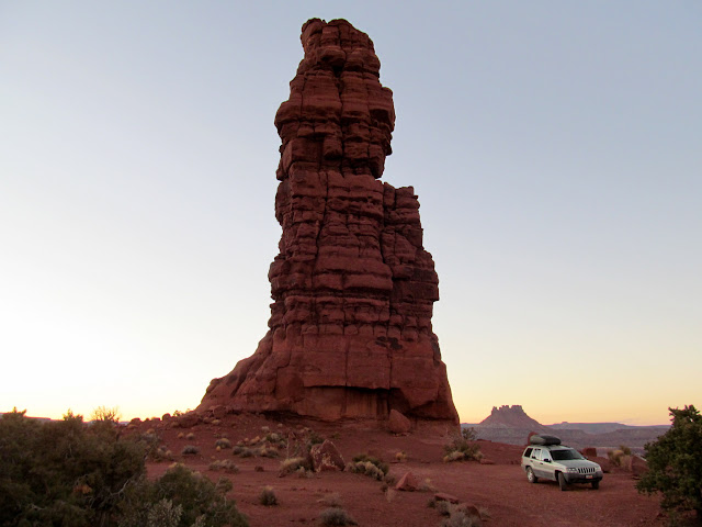
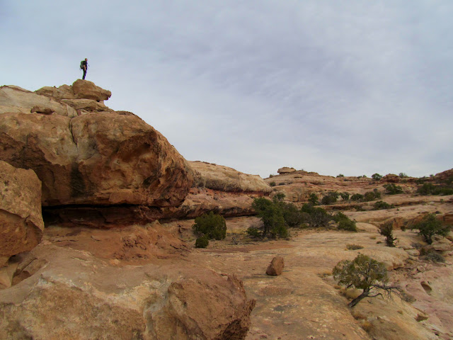
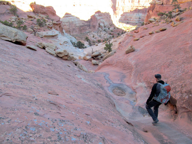
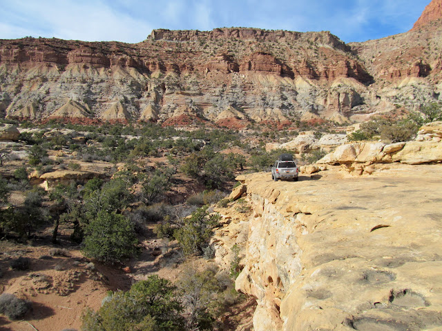
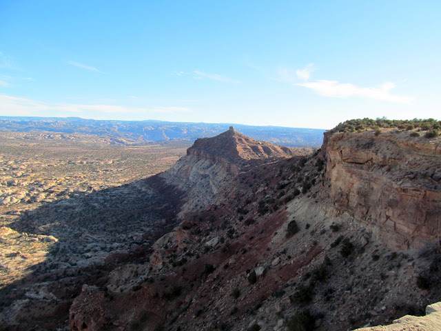
The Flint Trail was our next target. What started out as a stock trail was widened into a wagon road in 1919 by E.T. Wolverton, and then further improved into its current configuration by the Atomic Energy Commission in the 1950s. A short stretch of the original stock trail is left near the upper end of the road, and I hiked as much of it as I could find. A considerable amount of construction went into the stock trail. A boulder near the trail had a small, downward-pointing arrow that I later figured out was left there by Ned Chaffin. Lower along the Flint Trail, well below the switchbacks but before Waterhole Flat, Chris and I spotted several inscriptions on boulders near the road.
Flint Trail
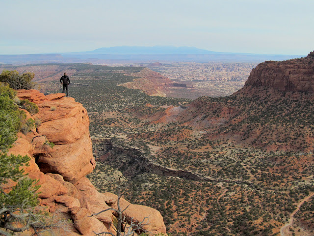
Flint Trail Overlook
The original Flint Trail
Flint Trail views
Ned Chaffin 'brand'
Jeep descending the steep Flint Trail
Lower Flint Trail views
L.H. (Lorin) Wilson 1/4/26
N.L.C. (Ned Chaffin) 1934
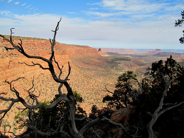
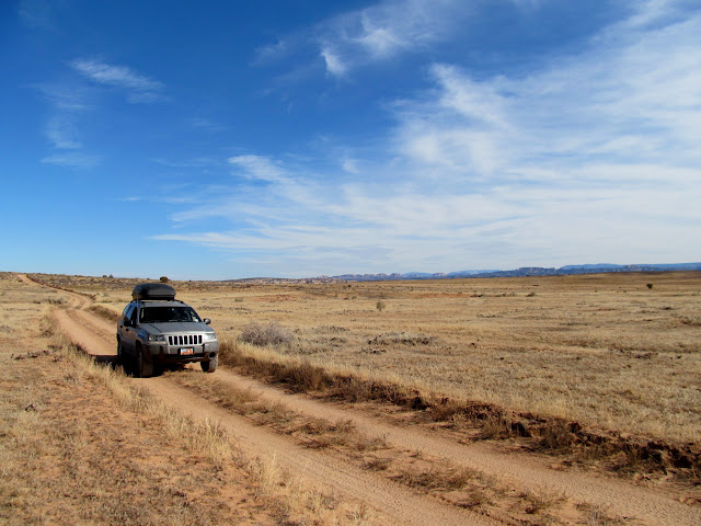
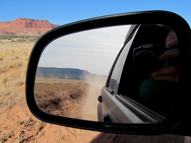
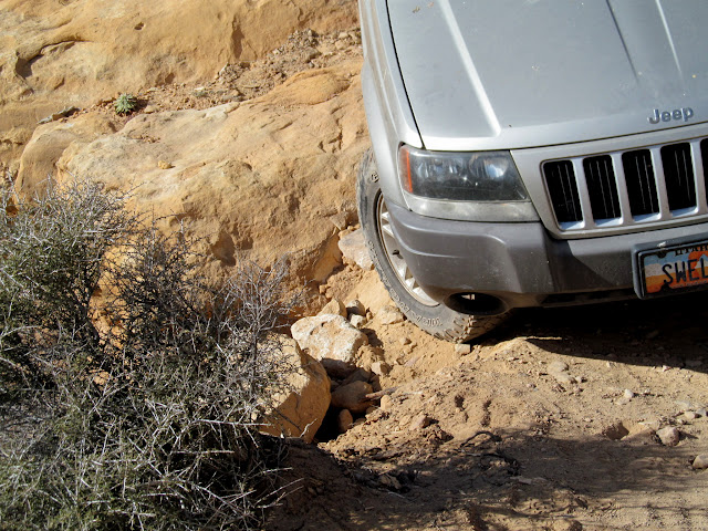
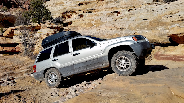
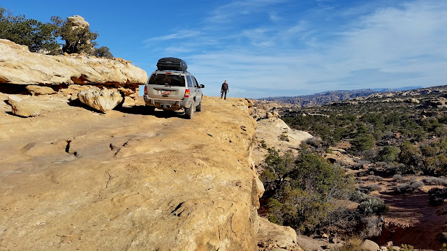
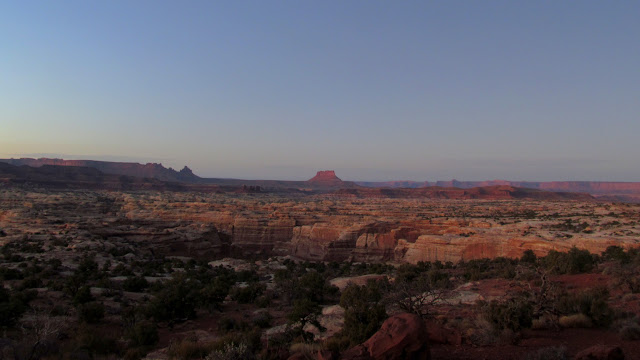
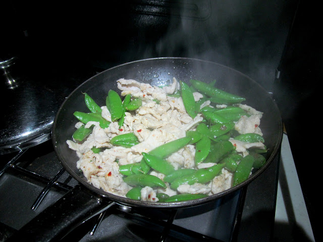
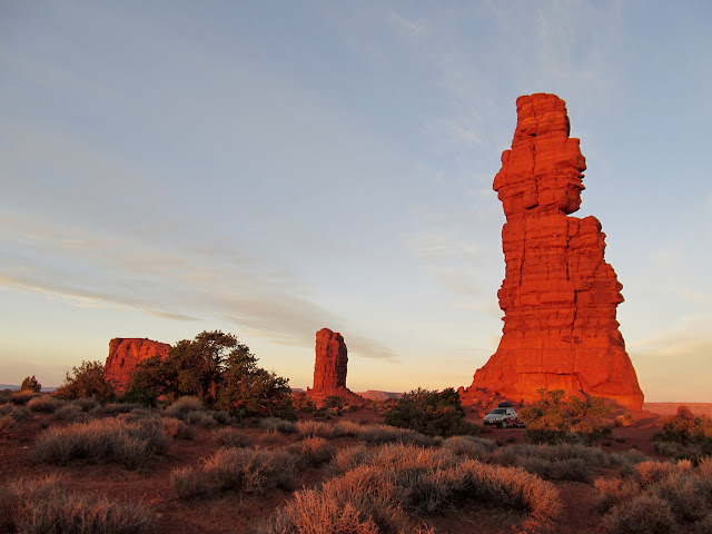
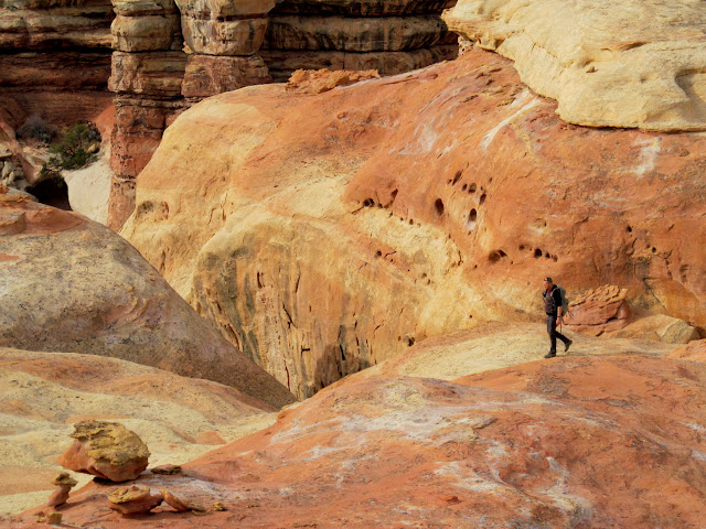
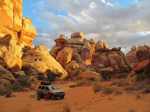
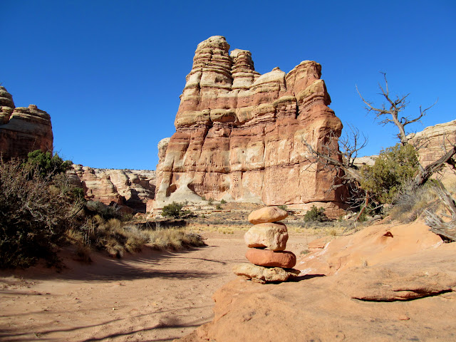
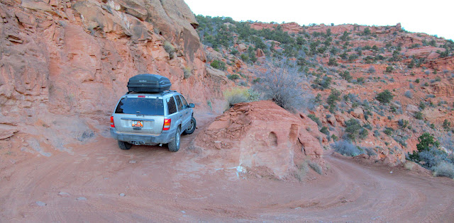
The roads over Waterhole Flat are the smoothest of the entire drive, followed closely by the roughest roads around the head of Teapot Canyon. Near the big ledge obstacle, where many rocks are stacked up to make access easier, my right-front tire fell into a spot where the sand and rocks began to slide off a small cliff. I finessed my way out of that hole and then easily made it up the ledge, but not without a lot of stress and worry. The rest of the drive into the Land of Standing Rocks, and our campsite at Standing Rock, was easy. I had uncharacteristically planned some home-style meals for this outing, rather than the usual camping fare of canned or dehydrated food and snacks. This night we enjoyed orange chicken with sugar snap peas before retiring to our cots.
Superhighway at Waterhole Flat
Dust cloud chasing the Jeep
Road around the head of Teapot Canyon
Sand and rocks sloughing off the road
Halfway up the big ledge
Road across a narrow shelf
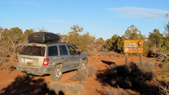
Entering Canyonlands National Park
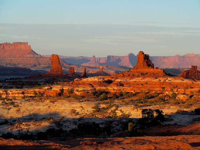
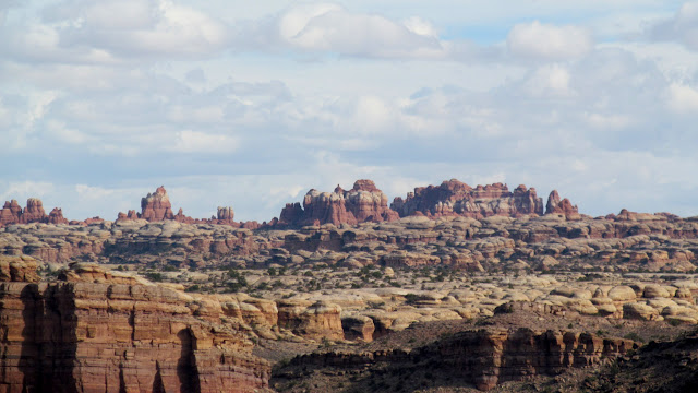
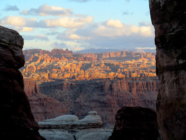
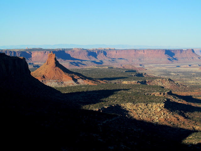
Land of the Standing Rocks
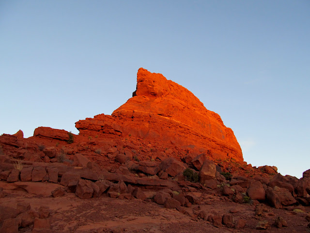
Last light on Lizard Rock
Standing rock and the earth's shadow
Standing Rock camp
15-second exposure over the Maze
The beginnings of orange chicken and sugar snap peas
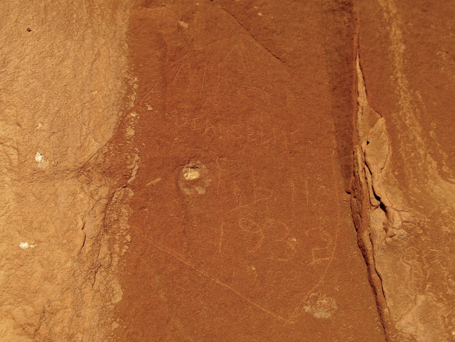
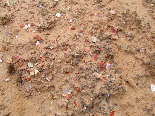
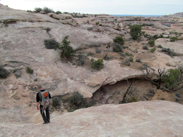
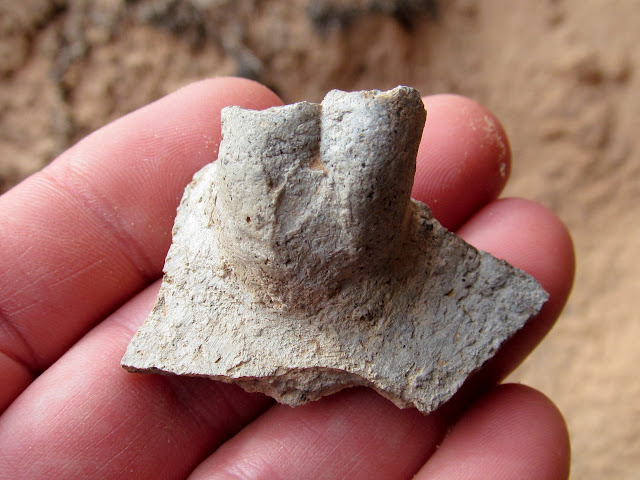
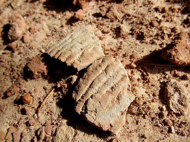
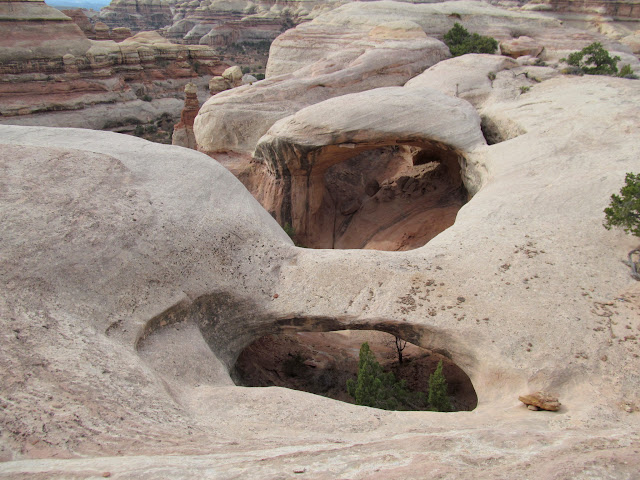
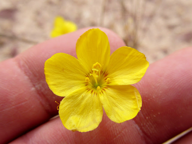
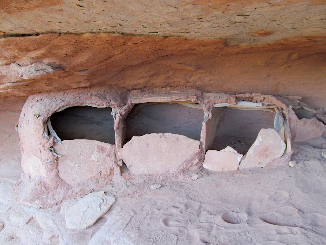
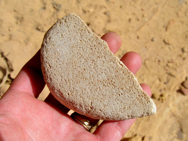
Before sunrise on Thursday morning at Standing Rock, I awakened early and walked around camp taking photos. I photographed some inscriptions on Standing Rock, a few of which were made by a guy from Price, Utah, in the 1930s. Chris and I had breakfast and packed up our gear, then drove a short distance and started hiking. We explored the canyon rims south of the road, finding a few dense lithic scatters, some potsherds, and a granary. We also visited Parachute Arch but failed to find a way to get below it. I also spotted a couple of pretty rocks along the way.
Thursday morning camp
Sunrise at Standing Rock
Handcarts and Wagons
Albert Jeanselme, Feb. 11, 1932
Small but dense lithic scatter
Exploring the canyon rims
Potsherd with broken handle
Granary built from sandstone slabs, sticks, and adobe
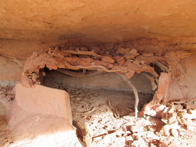
Potsherds in the granary
Chris wandering on the slickrock
Pothole arch and Parachute Arch
Wildflower blooms in November
Exploring more canyon rims
Aluminum tag nailed to a dead pinyon pine
Ooh, a pretty rock! Just the tip, though.
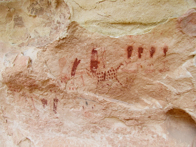
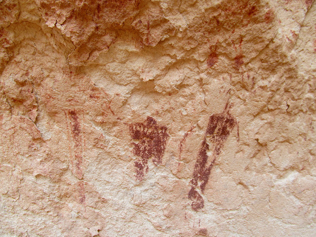
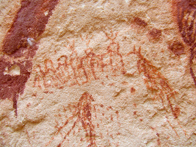
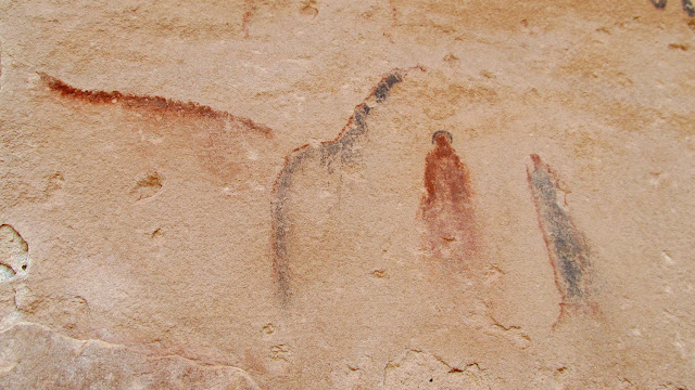
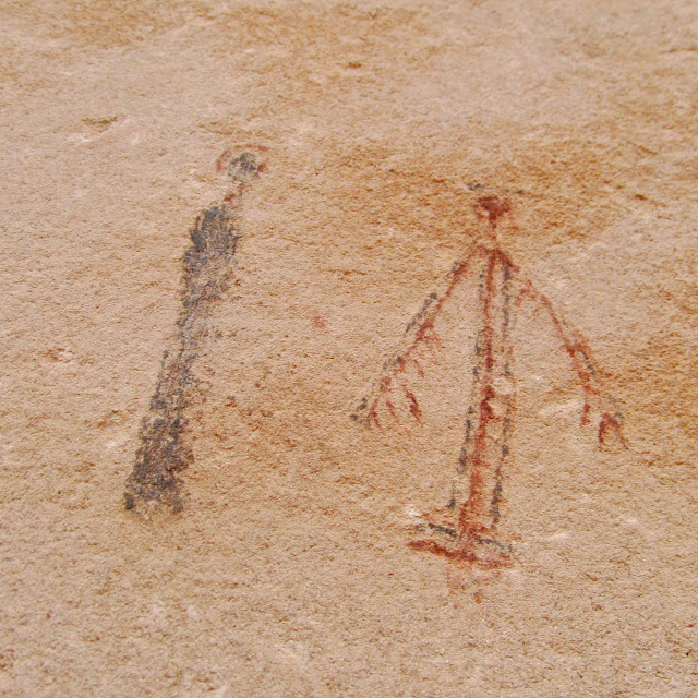
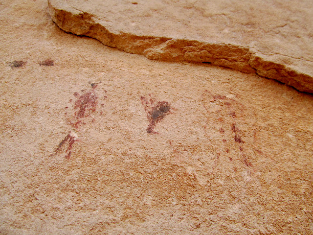
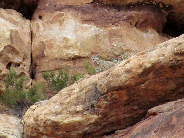
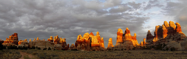
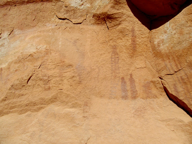
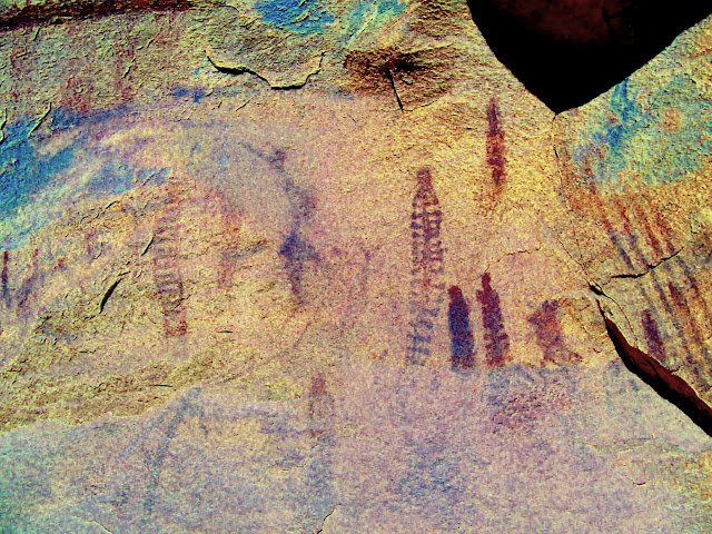
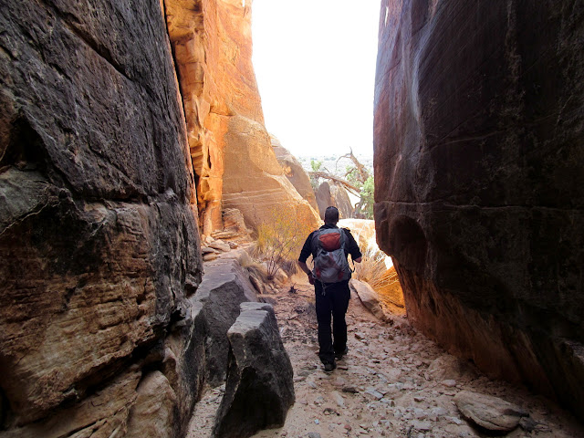
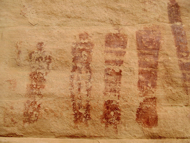
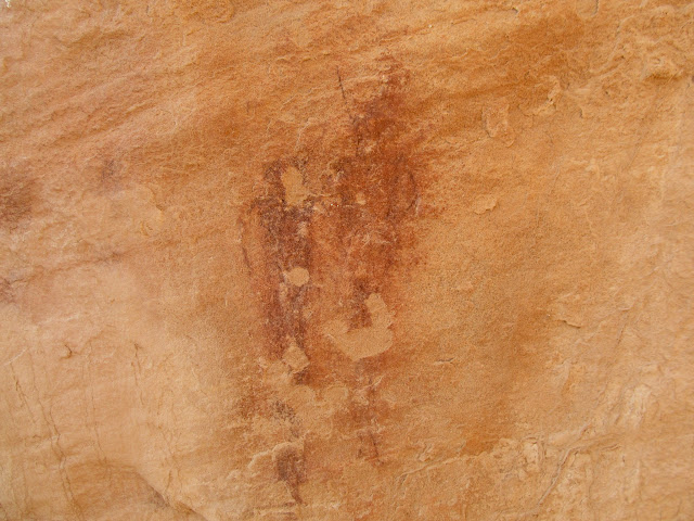
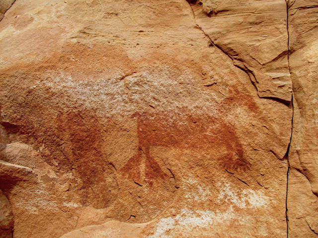
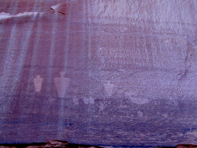
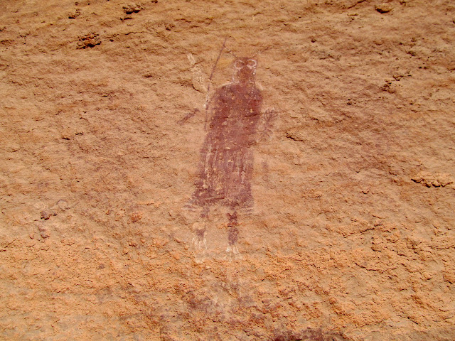
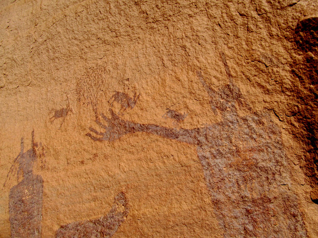
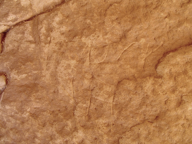
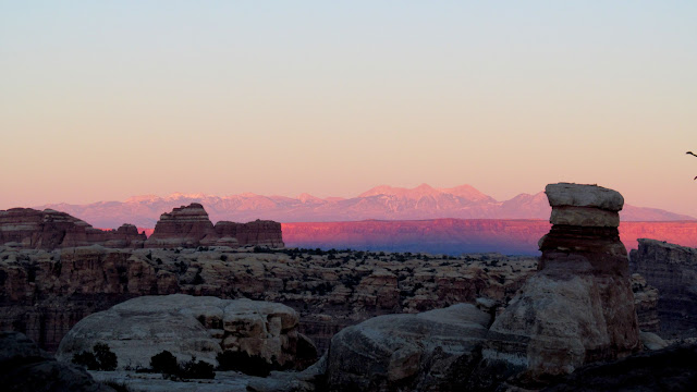
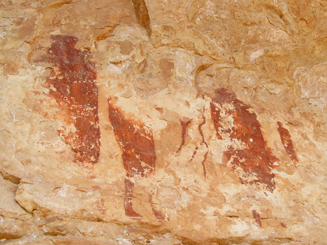
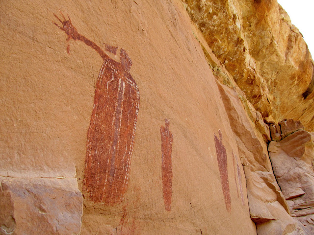
Chris and I continued hiking in and out of small side canyons, and I was extremely surprised to find a couple of very nice Barrier Canyon Style pictograph panels. We also saw a bobcat and a couple of old brush corrals. I hadn't expected to find much on this portion of the trip, but it turned out to be my favorite part. We got back to the Jeep and drove into the Doll House just in time to witness a wonderful sunset, with orange light on the formations and dark clouds behind them. We enjoyed fajitas for dinner, and then endured a warm but windy night. I awoke a couple of times to wipe the sand out of my eyes and off my pillow.
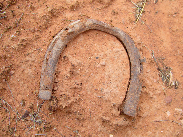
Horseshoe
Broken point
Amazingly-detailed Barrier Canyon Style pictograph panel
Three disparate figures
Tiny figures, perhaps half an inch tall
Four conventional figures with very unusual pictographs beneath
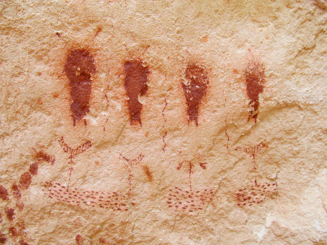
Unusual and finely-detailed pictographs
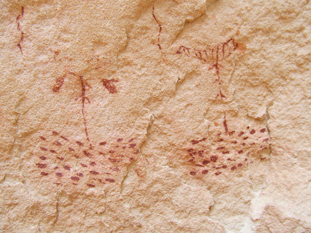
Another nearby BCS panel
Tiny figures and maybe a rain cloud
Two-tone lines and figures
Halo guy and bird guy
Three tiny figures--an upside-down bird in the middle, perhaps?
Brush corral
Curious bobcat
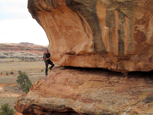
High overhang with faded BCS pictographs
Sketchy route getting to the rock art
The two most detailed of the figures
A row of several faded figures
The Doll House at sunset
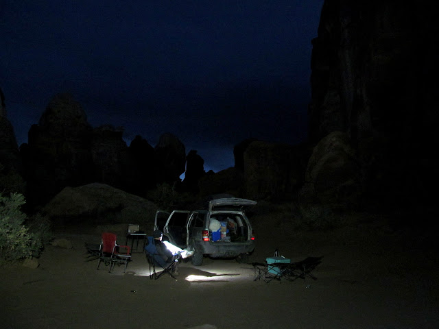
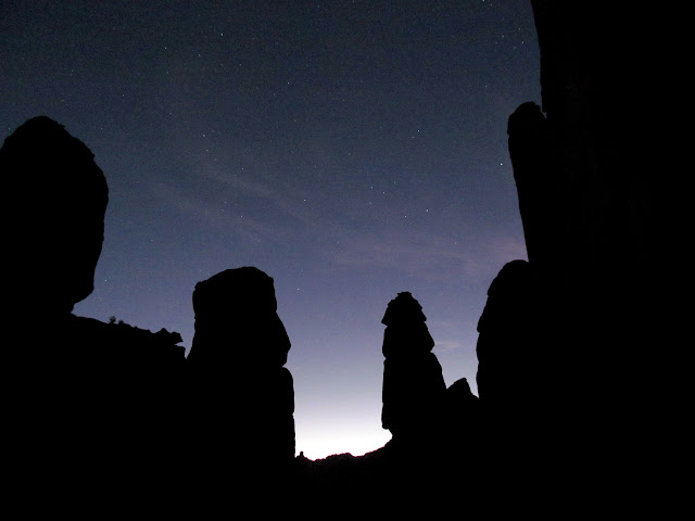
Doll House campsite #1 after dark
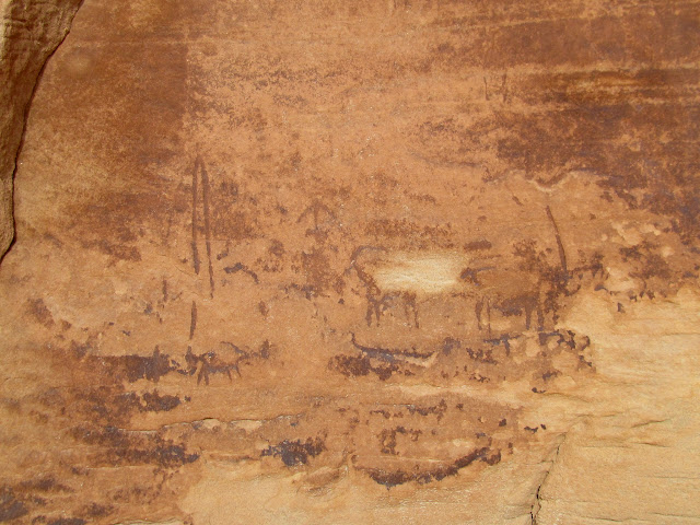
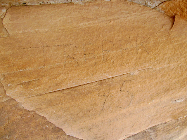
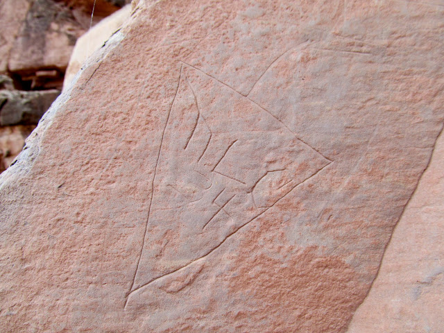
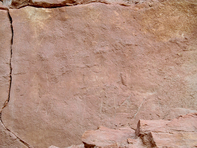
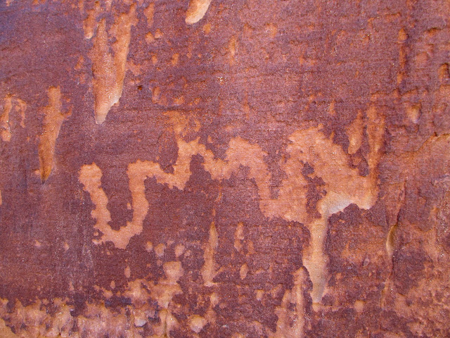
On Friday, we hiked the trail to Ernie's Country, exploring for more rock art I'd read about. In addition to some pictographs, we found some curious petroglyphs that appeared to be quite old. Patina had covered the petroglyphs, and later the patina had been weathered off the high spots surrounding the rock art, leaving the petroglyphs unusually dark compared to the surrounding surfaces. We found an inscription by H. Mellor from 1900, and another that merely said "Trappr 45".
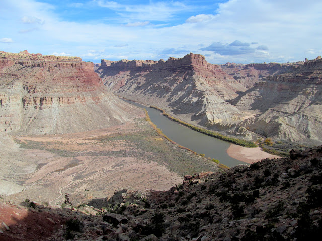
View from camp over the Colorado River gorge
Grinding stone
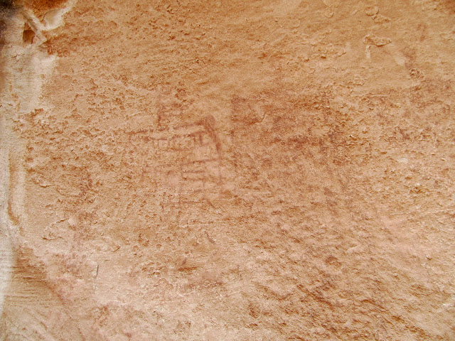
Faded pictographs
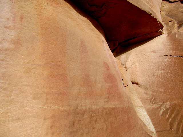
More faded pictographs
DStretch enhanced pictographs
Walking between huge sandstone blocks
Some of the better figures in a row of weathered pictographs
Very old looking petroglyphs
H. Mellor 1900
Small, weathered figures
The Bear
Curious inscription: Trappr 45
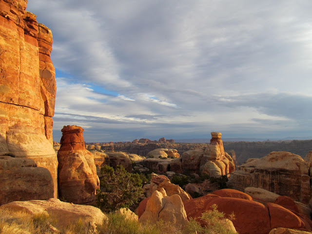
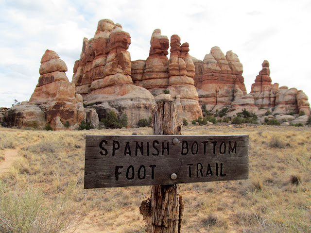
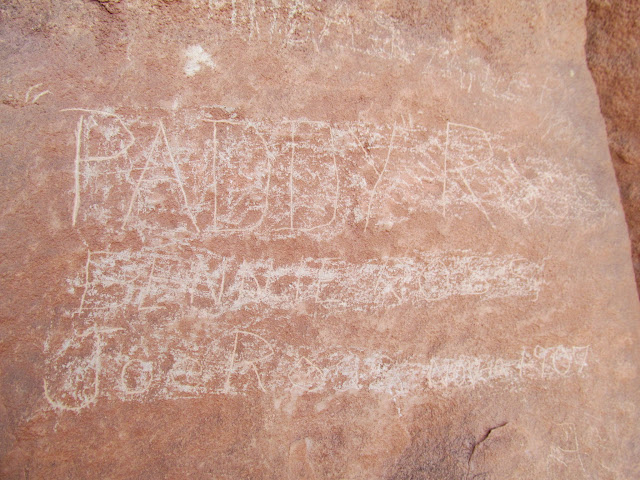
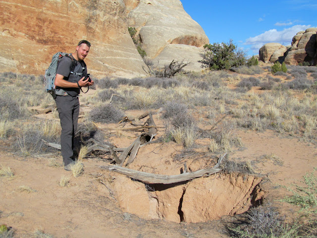
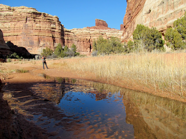
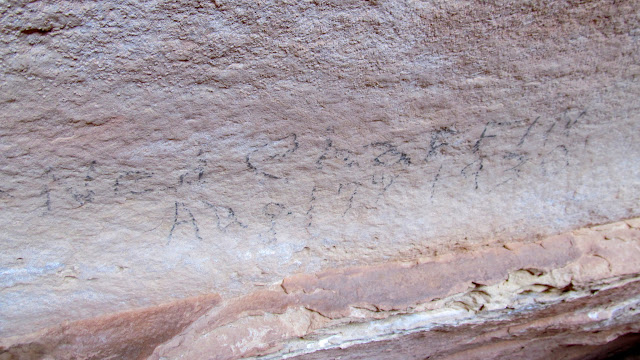
We had enough daylight left to hike part of the Spanish Bottom and Granary trails near the Doll House. There are some great inscriptions along the Spanish Bottom trail that, unfortunately, some short-sighted individuals have tried to obliterate. While looking at the inscriptions along the trail, Chris and I noticed a dude hauling a paddleboard up the trail. We later ran into him while coming back from the granaries and had a brief chat. The guy's name was Jedediah, and he'd been running the Green and Colorado rivers on a stand-up paddleboard for 50 days. That's just insane! His first question to us was, "Could a Ford F-250 make into this area?" I laughed and told him briefly of my experience driving a truck there five years earlier, but warned him that most trucks and/or drivers would have some difficulty getting to the Doll House. Jedediah told us he was going to try to get cell service to make a phone call to a friend, and Chris and I returned to camp where I fixed fried potatoes and kielbasa for dinner. It rained a little bit that night, and we ended up sleeping in the front seats of the Jeep. I even awoke during the night to start the engine and run the heater. It wasn't the most comfortable night, but it seemed better than a damp cot or a wind-battered tent.
Spanish Bottom Foot Trail
Colorado River and Spanish Bottom
Ned Chaffin inscription from 1934
Paddy Ross, Bennie Ross, Joe Ross, Nov. 10, 1907
Harry Aleson inscription from October 1947
Granaries
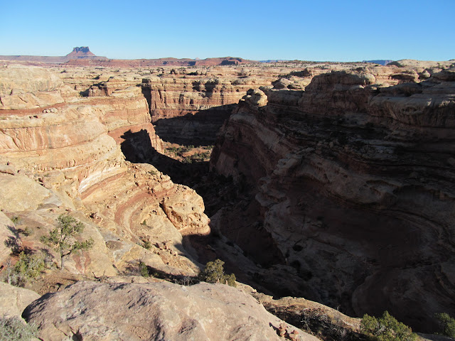
View across the river to the Needles District
Sinkhole in a graben
Standing above the sinkhole
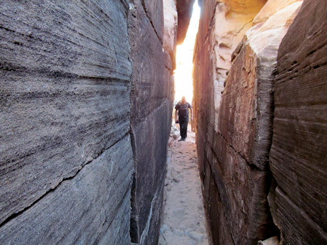
A tight squeeze along the trail
Friday evening at camp
Warm light over at the Needles District
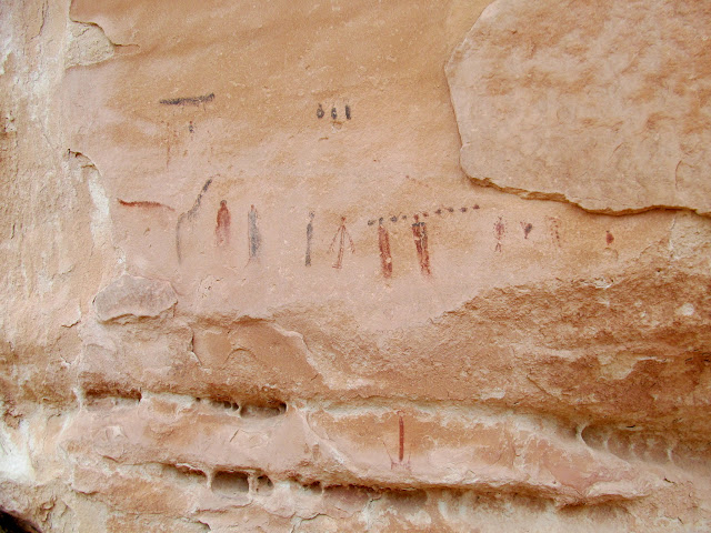
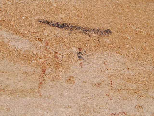
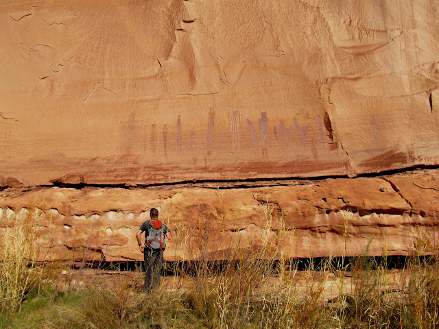
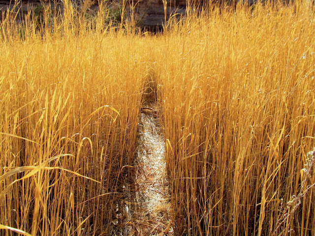
Saturday morning rolled around and I'd already accomplished everything I wanted to for this trip. However, Chris had never been to the Harvest Scene, so we drove to Chimney Rock and made the nine mile round trip hike. I was pleasantly surprised to find a Barrier Canyon Style petroglyph panel on our way to visit the pictographs. We did a little more exploration on our way out and found a small rock shelter, a couple of crude inscriptions and petroglyphs, and we still made it back to camp to witness sunset from there.
Dropping into Pictograph Fork
Descending into the canyon
Cairn at a canyon junction
Petroglyph panel in Pictograph Fork
Canyon reflections
My favorite little dude at the Harvest Scene
Harvest Scene
Chris below the Harvest Scene
Crude shelter in an overhang
Strange inscription: F**k ???
Trail through tall grasses
Wavy line petroglyph
Chimney Rock on the canyon rim
The climb out
Jeep at the trailhead
Pink light on the La Sals viewed from camp
Doll House at night
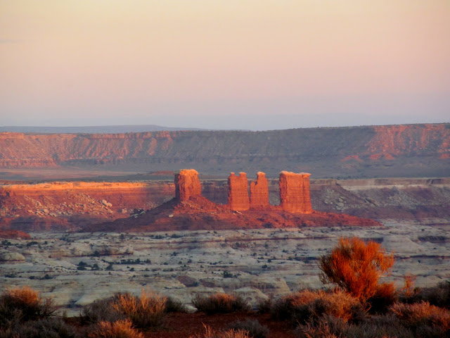
Sunday was mostly a travel day, much as Wednesday had been. The obstacles around the head of Teapot Canyon were much easier after having passed through there only a few days earlier. We took a side trip to visit Perfect Panel, which I had been to but Chris had never seen. It was well worth the detour, since it's one of the best pictograph panels around.
Passing through the Land of Standing Rocks
Around the head of Teapot Canyon
Road junction at Waterhole Flat
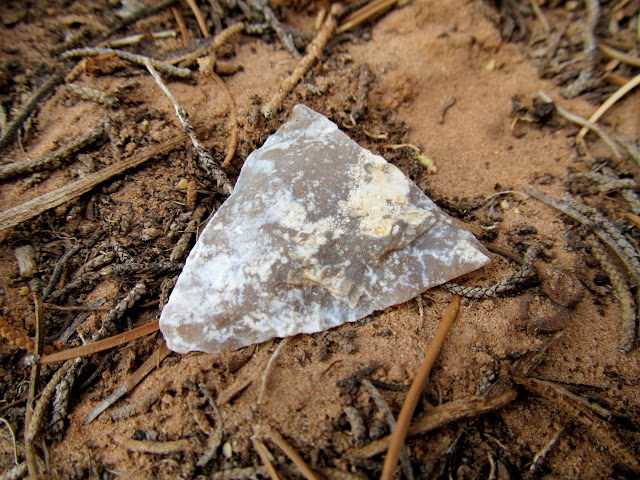
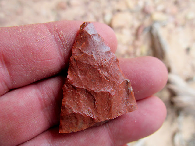
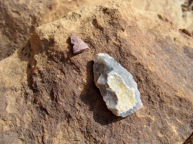
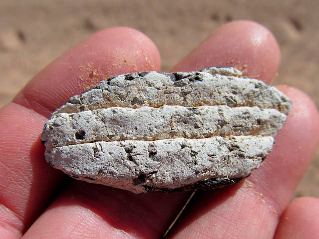
Worked flint
A broken mano en mi mano
Imperfect Panel
Ned Chaffin, Aug. 17, 1930
Perfect Panel
Potsherd in the watercourse above Perfect Panel
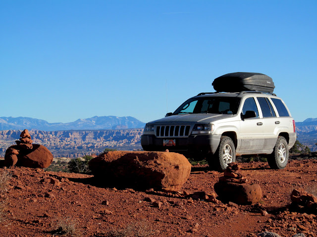
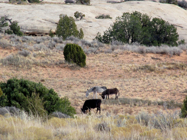
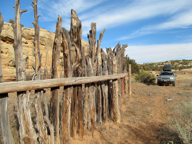
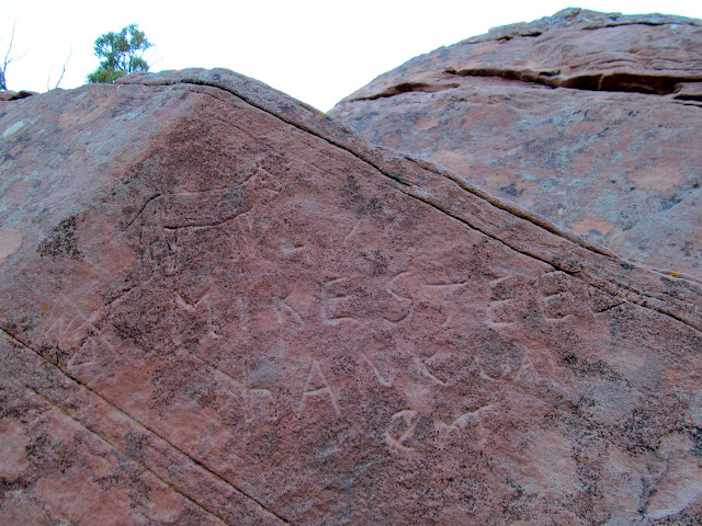
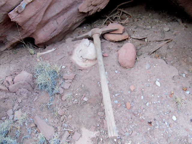
We visited a corral near Waterhole Flat hoping to find some inscriptions, but came up empty there. It was interesting to see some wild burros grazing alongside cattle in that area. The climb up the Flint Trail went smoothly. Chris spotted an undated inscription by Mike Steele along the Flint Trail, and I noticed a pick below the boulder with the inscription. It seems pretty unlikely that I would find a pick along two different, far-apart stock trails in the same year! I was hoping to arrive at the Hans Flats Ranger Station before they closed at 4:30PM, but we got there 19 minutes late. I wanted to know if there was a prize for beating the odds and not doing any damage to my mostly-stock vehicle, but the rangers had retired for the evening. I took the opportunity to pose the Swell Jeep with the NPS Jeep Wrangler Rubicon. Thanks to my lovely wife, Traci, I had an appointment with a steak dinner back at home, so we cruised back toward Price quickly, not having to stop for fuel in Green River 'cause I'd brought 10 extra gallons with me on the trip. Chris and I enjoyed another great dinner before parting ways after yet another enjoyable adventure.
Wild burros and a cow grazing at Waterhole Flat
Corral near Waterhole Flat
Teapot Canyon
Teapot Rock
Mike Steele, Hankval (Hanksville)
Pick near the Flint Trail
Flint Trail switchback
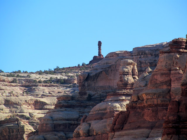
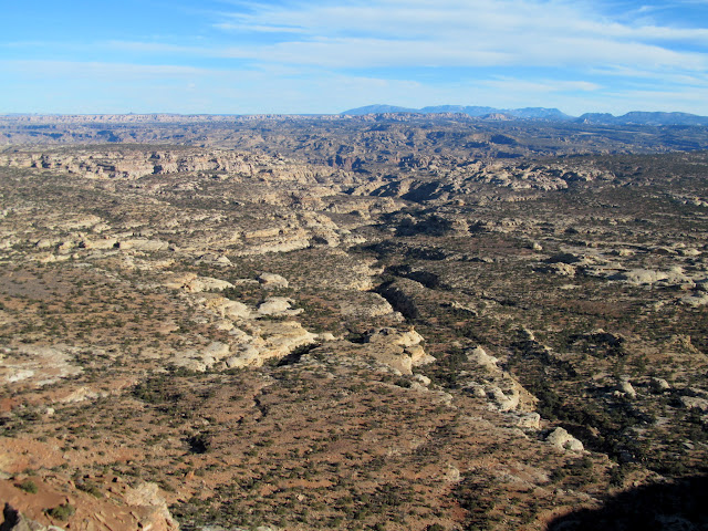
Bagpipe Butte and North Point
NPS and Swell Jeeps at the Hans Flats Ranger Station
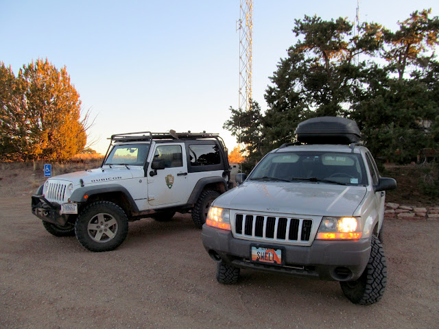
Photo Gallery: Maze II
-----------------------------------
My first trip into the Maze took me out of my comfort zone. I was perfectly in my element on this, my second time driving a full-sized vehicle into the region. I had done two day trips into the area on a motorcycle since that first trip, but a multi-day 4WD tour takes on an entirely different character. Chris and I began planning this trip a while back. I had made reservations in advance, not knowing what the weather would be like in mid-November. As the dates got closer, the weather forecast showed warmer and drier weather than we could have hoped for. Chris arrived at my house on a Tuesday evening and threw his gear into my Jeep, which was already heavily loaded with my own stuff. We headed south, camping on BLM land at Hans Flats and enjoying our only camp fire of the entire week. Temperatures were very comfortable at night and we awoke to a splendid sunrise.
Time-lapse video spanning two days between the Flint Trail and the Doll House
My seventh time driving past this sign in the last month
Camp fire on BLM land at Hans Flats
Wednesday morning sunrise
Chris still asleep on his cot
The Hans Flats Ranger Station opened at 8:00AM, and we were there shortly after opening to pick up the permit. I humbly endured the lecture from park rangers about the dangers of driving into the Maze. I stifled a laugh, then just pursed my lips and nodded and said, "Hmm..." when the female park ranger claimed that I would definitely do damage to at least two body panels on my Grand Cherokee. Like, what the hell? Can't they just be honest, without all the hyperbole? With that ridiculosity over and permit in hand, we got our trip started. Between the ranger station and the top of the Flint Trail, we stopped to visit French Cabin and the Flint Cabins. The Flint Cabins were awesome, with a large amount of interesting refuse lying all around. I found out after our visit that there are inscriptions in the sandstone blocks of one of the cabins, definitely making it worth a return visit sometime.
Hans Flats Ranger Station
French Cabin
Flint Cabins
Stone Flint Cabin
Rivet from a pair of Levi Strauss jeans
Can dump at the Flint Cabins
The Flint Trail was our next target. What started out as a stock trail was widened into a wagon road in 1919 by E.T. Wolverton, and then further improved into its current configuration by the Atomic Energy Commission in the 1950s. A short stretch of the original stock trail is left near the upper end of the road, and I hiked as much of it as I could find. A considerable amount of construction went into the stock trail. A boulder near the trail had a small, downward-pointing arrow that I later figured out was left there by Ned Chaffin. Lower along the Flint Trail, well below the switchbacks but before Waterhole Flat, Chris and I spotted several inscriptions on boulders near the road.
Flint Trail
Flint Trail Overlook
The original Flint Trail
Flint Trail views
Ned Chaffin 'brand'
Jeep descending the steep Flint Trail
Lower Flint Trail views
L.H. (Lorin) Wilson 1/4/26
N.L.C. (Ned Chaffin) 1934
The roads over Waterhole Flat are the smoothest of the entire drive, followed closely by the roughest roads around the head of Teapot Canyon. Near the big ledge obstacle, where many rocks are stacked up to make access easier, my right-front tire fell into a spot where the sand and rocks began to slide off a small cliff. I finessed my way out of that hole and then easily made it up the ledge, but not without a lot of stress and worry. The rest of the drive into the Land of Standing Rocks, and our campsite at Standing Rock, was easy. I had uncharacteristically planned some home-style meals for this outing, rather than the usual camping fare of canned or dehydrated food and snacks. This night we enjoyed orange chicken with sugar snap peas before retiring to our cots.
Superhighway at Waterhole Flat
Dust cloud chasing the Jeep
Road around the head of Teapot Canyon
Sand and rocks sloughing off the road
Halfway up the big ledge
Road across a narrow shelf
Entering Canyonlands National Park
Land of the Standing Rocks
Last light on Lizard Rock
Standing rock and the earth's shadow
Standing Rock camp
15-second exposure over the Maze
The beginnings of orange chicken and sugar snap peas
Before sunrise on Thursday morning at Standing Rock, I awakened early and walked around camp taking photos. I photographed some inscriptions on Standing Rock, a few of which were made by a guy from Price, Utah, in the 1930s. Chris and I had breakfast and packed up our gear, then drove a short distance and started hiking. We explored the canyon rims south of the road, finding a few dense lithic scatters, some potsherds, and a granary. We also visited Parachute Arch but failed to find a way to get below it. I also spotted a couple of pretty rocks along the way.
Thursday morning camp
Sunrise at Standing Rock
Handcarts and Wagons
Albert Jeanselme, Feb. 11, 1932
Small but dense lithic scatter
Exploring the canyon rims
Potsherd with broken handle
Granary built from sandstone slabs, sticks, and adobe
Potsherds in the granary
Chris wandering on the slickrock
Pothole arch and Parachute Arch
Wildflower blooms in November
Exploring more canyon rims
Aluminum tag nailed to a dead pinyon pine
Ooh, a pretty rock! Just the tip, though.
Chris and I continued hiking in and out of small side canyons, and I was extremely surprised to find a couple of very nice Barrier Canyon Style pictograph panels. We also saw a bobcat and a couple of old brush corrals. I hadn't expected to find much on this portion of the trip, but it turned out to be my favorite part. We got back to the Jeep and drove into the Doll House just in time to witness a wonderful sunset, with orange light on the formations and dark clouds behind them. We enjoyed fajitas for dinner, and then endured a warm but windy night. I awoke a couple of times to wipe the sand out of my eyes and off my pillow.
Horseshoe
Broken point
Amazingly-detailed Barrier Canyon Style pictograph panel
Three disparate figures
Tiny figures, perhaps half an inch tall
Four conventional figures with very unusual pictographs beneath
Unusual and finely-detailed pictographs
Another nearby BCS panel
Tiny figures and maybe a rain cloud
Two-tone lines and figures
Halo guy and bird guy
Three tiny figures--an upside-down bird in the middle, perhaps?
Brush corral
Curious bobcat
High overhang with faded BCS pictographs
Sketchy route getting to the rock art
The two most detailed of the figures
A row of several faded figures
The Doll House at sunset
Doll House campsite #1 after dark
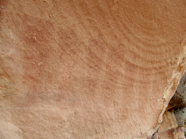
On Friday, we hiked the trail to Ernie's Country, exploring for more rock art I'd read about. In addition to some pictographs, we found some curious petroglyphs that appeared to be quite old. Patina had covered the petroglyphs, and later the patina had been weathered off the high spots surrounding the rock art, leaving the petroglyphs unusually dark compared to the surrounding surfaces. We found an inscription by H. Mellor from 1900, and another that merely said "Trappr 45".
View from camp over the Colorado River gorge
Grinding stone
Faded pictographs
More faded pictographs
DStretch enhanced pictographs
Walking between huge sandstone blocks
Some of the better figures in a row of weathered pictographs
Very old looking petroglyphs
H. Mellor 1900
Small, weathered figures
The Bear
Curious inscription: Trappr 45
We had enough daylight left to hike part of the Spanish Bottom and Granary trails near the Doll House. There are some great inscriptions along the Spanish Bottom trail that, unfortunately, some short-sighted individuals have tried to obliterate. While looking at the inscriptions along the trail, Chris and I noticed a dude hauling a paddleboard up the trail. We later ran into him while coming back from the granaries and had a brief chat. The guy's name was Jedediah, and he'd been running the Green and Colorado rivers on a stand-up paddleboard for 50 days. That's just insane! His first question to us was, "Could a Ford F-250 make into this area?" I laughed and told him briefly of my experience driving a truck there five years earlier, but warned him that most trucks and/or drivers would have some difficulty getting to the Doll House. Jedediah told us he was going to try to get cell service to make a phone call to a friend, and Chris and I returned to camp where I fixed fried potatoes and kielbasa for dinner. It rained a little bit that night, and we ended up sleeping in the front seats of the Jeep. I even awoke during the night to start the engine and run the heater. It wasn't the most comfortable night, but it seemed better than a damp cot or a wind-battered tent.
Spanish Bottom Foot Trail
Colorado River and Spanish Bottom
Ned Chaffin inscription from 1934
Paddy Ross, Bennie Ross, Joe Ross, Nov. 10, 1907
Harry Aleson inscription from October 1947
Granaries
View across the river to the Needles District
Sinkhole in a graben
Standing above the sinkhole
A tight squeeze along the trail
Friday evening at camp
Warm light over at the Needles District
Saturday morning rolled around and I'd already accomplished everything I wanted to for this trip. However, Chris had never been to the Harvest Scene, so we drove to Chimney Rock and made the nine mile round trip hike. I was pleasantly surprised to find a Barrier Canyon Style petroglyph panel on our way to visit the pictographs. We did a little more exploration on our way out and found a small rock shelter, a couple of crude inscriptions and petroglyphs, and we still made it back to camp to witness sunset from there.
Dropping into Pictograph Fork
Descending into the canyon
Cairn at a canyon junction
Petroglyph panel in Pictograph Fork
Canyon reflections
My favorite little dude at the Harvest Scene
Harvest Scene
Chris below the Harvest Scene
Crude shelter in an overhang
Strange inscription: F**k ???
Trail through tall grasses
Wavy line petroglyph
Chimney Rock on the canyon rim
The climb out
Jeep at the trailhead
Pink light on the La Sals viewed from camp
Doll House at night
Sunday was mostly a travel day, much as Wednesday had been. The obstacles around the head of Teapot Canyon were much easier after having passed through there only a few days earlier. We took a side trip to visit Perfect Panel, which I had been to but Chris had never seen. It was well worth the detour, since it's one of the best pictograph panels around.
Passing through the Land of Standing Rocks
Around the head of Teapot Canyon
Road junction at Waterhole Flat
Worked flint
A broken mano en mi mano
Imperfect Panel
Ned Chaffin, Aug. 17, 1930
Perfect Panel
Potsherd in the watercourse above Perfect Panel
We visited a corral near Waterhole Flat hoping to find some inscriptions, but came up empty there. It was interesting to see some wild burros grazing alongside cattle in that area. The climb up the Flint Trail went smoothly. Chris spotted an undated inscription by Mike Steele along the Flint Trail, and I noticed a pick below the boulder with the inscription. It seems pretty unlikely that I would find a pick along two different, far-apart stock trails in the same year! I was hoping to arrive at the Hans Flats Ranger Station before they closed at 4:30PM, but we got there 19 minutes late. I wanted to know if there was a prize for beating the odds and not doing any damage to my mostly-stock vehicle, but the rangers had retired for the evening. I took the opportunity to pose the Swell Jeep with the NPS Jeep Wrangler Rubicon. Thanks to my lovely wife, Traci, I had an appointment with a steak dinner back at home, so we cruised back toward Price quickly, not having to stop for fuel in Green River 'cause I'd brought 10 extra gallons with me on the trip. Chris and I enjoyed another great dinner before parting ways after yet another enjoyable adventure.
Wild burros and a cow grazing at Waterhole Flat
Corral near Waterhole Flat
Teapot Canyon
Teapot Rock
Mike Steele, Hankval (Hanksville)
Pick near the Flint Trail
Flint Trail switchback
Bagpipe Butte and North Point
NPS and Swell Jeeps at the Hans Flats Ranger Station
Photo Gallery: Maze II
Last edited:
")