Lower Sisquoc Loop

toejam

Member
Joined
Oct 2, 2014
Messages
83
The weather forecast, a rare thing in southern California, ended our trip plans to drive, camp & work the trail on a 6000' ridge above Santa Barbara. I'd been itching for this trip and had to fight to get Friday off work, my wife made plans to party like a rock star while I was gone, so I had to go somewhere. I decided on a remote loop in the lower elevations behind the ridge I'd been planning to visit. It didn't look to me like the weather was going to be that bad, and I started down the trail under a bluebird sky, enjoying the early spring.
DSCF0780.JPG

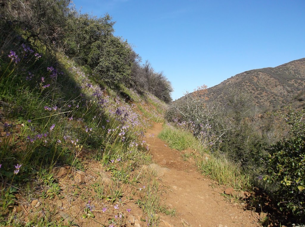
This is a loop in the San Rafael Wilderness (not this San Rafael Swell I keep hearing about), which is close to where I live and my go-to wild land for weekend getaways. This trail starts on Manzana Creek and is well-used for about 8 miles both upstream and downstream. But past the 8-mile boy scout zone in both directions is where the good stuff is. This loop starts downstream, meets the Sisquoc River and follows it up into the mountains, then crosses a gentle ridge to find Manzana Creek again upstream from where I started.

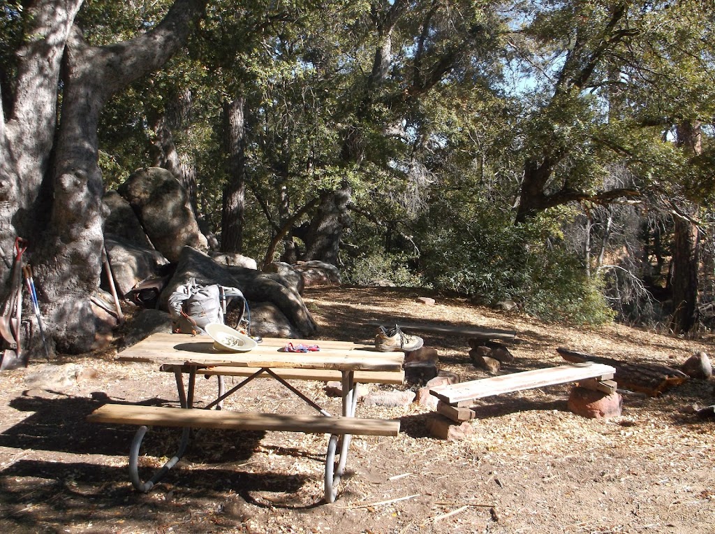
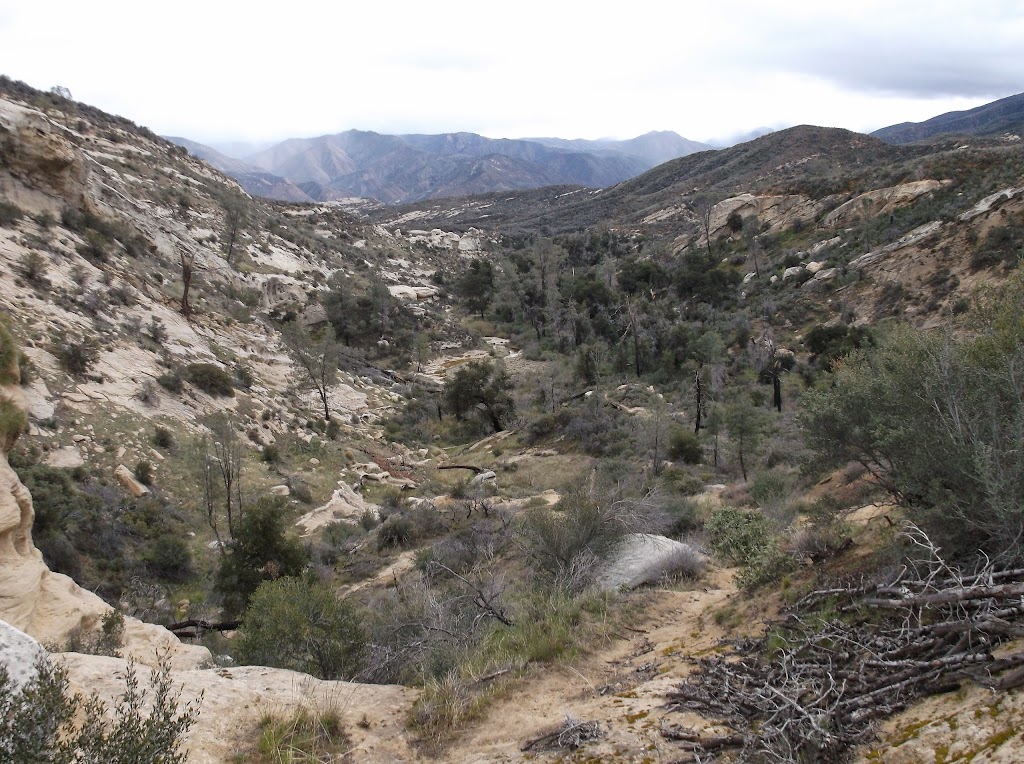
I hiked 17 miles the first day and had great weather. I stayed at an old camp in the heart of the wilderness. The next day I followed 12 miles of rough and faint trail to an old ranger cabin that is maintained by volunteers. I had it to myself and spent the night inside out of the rain. Then 15 miles back to the car the next day with several hours of rain.

I do lots of volunteer trail maintenance trips here so I have to take pictures of all the deadfall and share them with the other volunteers. Here is a link to my photo album.

https://picasaweb.google.com/toejam...authkey=Gv1sRgCJKVk_nF2pu42QE&feat=directlink

DSCF0906.JPG
 
Last edited:
I envy that you live so close to such a beautiful wilderness area. That's great that you volunteer doing trail maintainance. If I'm still living in this area when I retire I'd like to volunteer for the NY/NJ Trail Conference which maintains and maps all of my local trails. I've been the beneficiary of all of their work since I started hiking and owe them big time.
 
My first solo trip in this wilderness involved crawling on my hands & knees following bear tracks to stay on the trail. I started asking locals about what tools to use to clear paths through the brush, and was directed to the volunteer organization. It's given me lots of opportunities to hike with great people and see great places.
 
So @toejam, I was looking at your trail maintainance photo album that you gave the link for... Why would a bear chew a table? Is. It because food was spilled on it maybe?
 
So @toejam, I was looking at your trail maintainance photo album that you gave the link for... Why would a bear chew a table? Is. It because food was spilled on it maybe?
I guess the same reason that horses chew their stalls - looking for something yummy. I've seen that at several campsites in that wilderness. Good bears though - always run away when they see you.
DSCF0674.JPG
 
I am planning to do this loop In a few weeks taking my time to do some exploring along the way. Where was their good water and do you have any suggestions for the best camps along the route or any other suggestions you have would be greatly appreciated.
 
I am planning to do this loop In a few weeks taking my time to do some exploring along the way. Where was their good water and do you have any suggestions for the best camps along the route or any other suggestions you have would be greatly appreciated.
Most of the route has lots of water. Notably missing water is Manzana Schoolhouse, although the water is getting closer when I camped there last weekend on a trail project. The campground at the Schoolhouse is great and worth packing water into, but can get crowded. If you are starting down Manzana Creek and doing the loop clockwise, there will be two creek crossings past Dabney Cabin that have water. Going up the Sisquoc from the Schoolhouse, you won't have water until the crossing just below Water Canyon Camp. The rest of the route has lots water. The Sisquoc has beavers, so treat it.

My favorite camp on the lower Sisquoc is Lorna - it's not on the map but it's between Water Canyon & Mormon. I hiked past so I could spend an extra hour at South Fork the next night. Cliff is a nice camp that has water, which it rarely does. Sycamore is a horse camp with a table & crapper. South Fork Station is on the trail heading up the upper Sisquoc, about 1/4 mile past the intersection for the trail back to Manzana Creek. South Fork Station cabin is a rare gem lovingly preserved by volunteers. Treat it gently - when it's gone it won't be rebuilt. I won't stay inside unless it's raining, and then it's really appreciated. Headed back to NIRA, Lonnie Davis & White Ledge are great camps. Over the ridge there is a camp near the dry Alcove waterfall that we call Alcove camp. There is water 1/2 mile before you get there.

I won't camp at Manzana Narrows unless the trail crew insists. It's always full of idiots and picked clean of firewood. Fish Camp is worse.

I hope you have Bryan Conant's map (http://www.bryanconant.com/sanrafael2009.html). If not, I guess you should wait for the new one to come out. The Lower Sisquoc Trail between Manzana Schoolhouse & Sycamore is faint. Social trails near the river are easier to follow in places than the old trail, which often climbs out of the river bottom. But either way, you shouldn't get lost. Just follow the river and be prepared to push through brush at every crossing. The area is beautiful and historic, and it's great if you have time to explore.
 
Similar threads
Thread starter Title Forum Replies Date
BJett Part 3 - Tour de Canyon Country. Lower Escalante Loop Hiking & Camping 0
fiber Lower Grand Gulch Pour-off Trip Planning 10
slieb Lower Muddy Creek in Winter? Trip Planning 7
regehr water in lower muley twist? Trip Planning 0
regehr Lower Horseshoe Canyon and Big Spring Trip Planning 7
J Scrambles in the Lower Colorado River Corridor AZ/NV; Dec. 11-14, 2020 Hiking & Camping 5
Devin Ashby The Lower Gulch - Escalante (Seeking info on the route) Trip Planning 14
RyanP Lower Death Hollow next week (late May/early June), miscellaneous questions Trip Planning 16
Stephanie B Sixteen Room Ruin and Lower Butler Wash Hiking & Camping 15
Boognish Lower Death Hollow Narrows April 2018 Backpacking 17
fossana Sheep Bridge/Lower JEM trail (Virgin, UT) Conservation Project General Discussion 5
T Dark canyon - lower blm portion with pack goats?? Canyoneering 2
pstm13 Texas Pass Cirque of Towers Lower Wind River Range August 2018 Trip Planning 7
Ross West Canyon quicksand (a/one want to go lower West/Face/Labyrinth August? Trip Planning 3
Strawsome Lower Death Hollow at it's finest Backpacking 3
DiscGo Lower Watermaiden [Video] Hiking & Camping 5
RyanP Lower Death Hollow, mid-April Trip Planning 8
Outdoors24 Overnight in Lower Spring Canyon Backpacking 5
Ravialdo Lower Muley Twist water situation? Trip Planning 13
Udink Lower Horseshoe Canyon Hiking & Camping 0
Kullaberg63 Lower Dirty Devil Backpacking 7
Jackson Lower Red Castle Lake Backpacking 4
scatman Lower and Midway Geyser Basins plus Buffalo Meadows - Yellowstone National Park - June 26, 2016 Backpacking 5
BJett Lower Escalante Trifecta - Davis Gulch to Fiftymile Creek Backpacking 8
BJett Lower Escalante Trifecta - Willow Gulch to Davis Gulch Backpacking 14
mattvogt7 Lower Escalante Packraft Loop Backpacking 12
Jackson Lower Spring Canyon in Winter Backpacking 14
Nick Floating lower Cataract into Glen Canyon Trip Planning 2
mattvogt7 Lower Cataract Canyon Loop Backpacking 16
Parma Lower Salmon River - Hammer Creek to Heller Bar On The Water 7
lostlandscapes Lower Red Castle Lake -- 6/13/15 Backpacking 19
IntrepidXJ The Lower San Juan River On The Water 8
IntrepidXJ Lower Grand Gulch Backpacking 5
ram Crash Site/Lower Hades Canyon 2-15-15 Canyoneering 1
LarryBoy Water Sources in Lower Grand Gulch Trip Planning 15
Ben wind river range, elkhart park to lower jean lake Backpacking 13
Dave December in Lower Muley Twist Backpacking 20
Udink Lower Price River Hiking & Camping 8
westerner54 Lower Grand Gulch, Below the Narrows Backpacking 3
IntrepidXJ Lower Calf Creek Falls Hiking & Camping 5
Scott Chandler Chimney Rock-Lower Spring Canyon, Cap Reef NP Hiking & Camping 6
Nick Lower Black Box Trip Planning 0
BJett Lower Big Creek - Great Smoky Mountains National Park On The Water 2
Nick Lower Bells Canyon Hiking & Camping 3
Udink Lower San Rafael Hiking & Camping 4
Bill Lower Brimstone Gulch - Escalante Hiking & Camping 11
Cody Halls Creek Loop via Lower Muley and Red Slide Backpacking 16
slc_dan Lower-Lower Muley Twist 4/12/2013 Backpacking 14
Nick Lower Muley Twist vs. Upper Muley Twist Trip Planning 19
slc_dan Lower Salt Creek/Paul Bunyan's Potty Backpacking 11

Similar threads

Back
Top