mattvogt7
Member
- Joined
- Jan 20, 2012
- Messages
- 108
Lower Cataract Canyon Loop
November 20, 2015
Finding a non-technical west side entrance to lower (far south of Spanish Bottom) Cataract Canyon can be a challenge. This trip had been proposed a year earlier but it was shelved for other plans. The time seemed right this past October to finally strike.
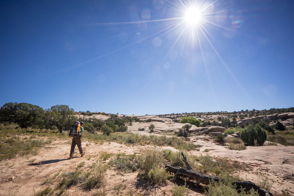
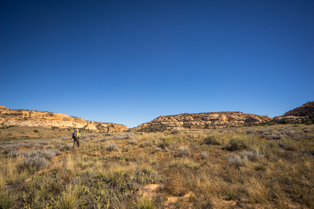
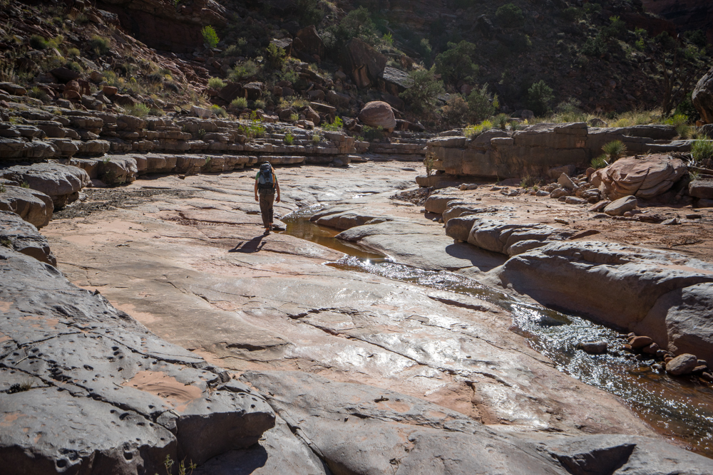
We drop the car at Waterhole Flat and begin walking in a north west direction.
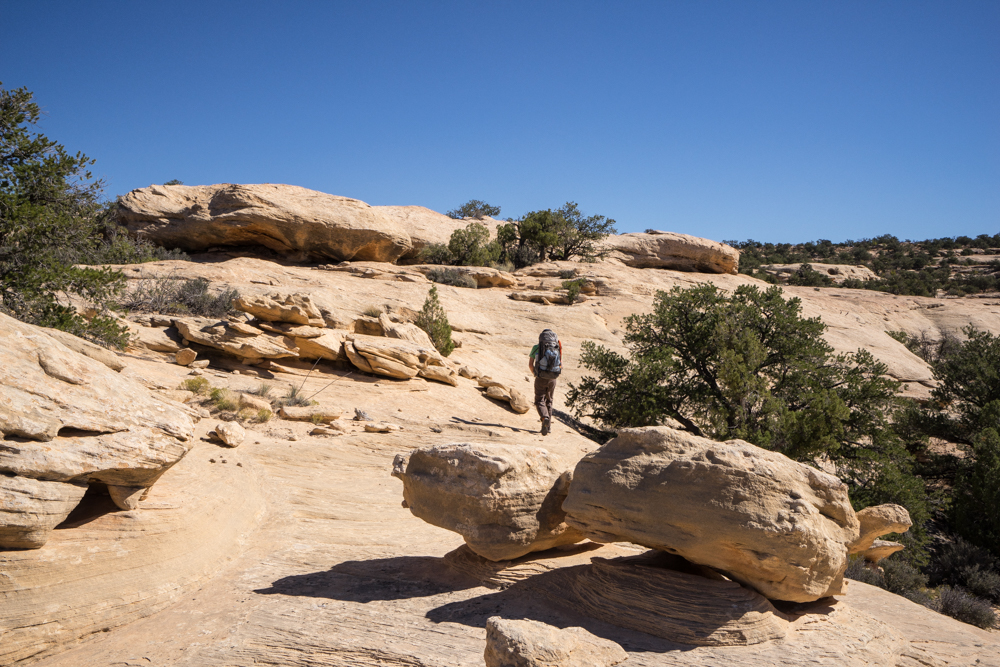
Eventually we spy the depressed valley we are looking for.
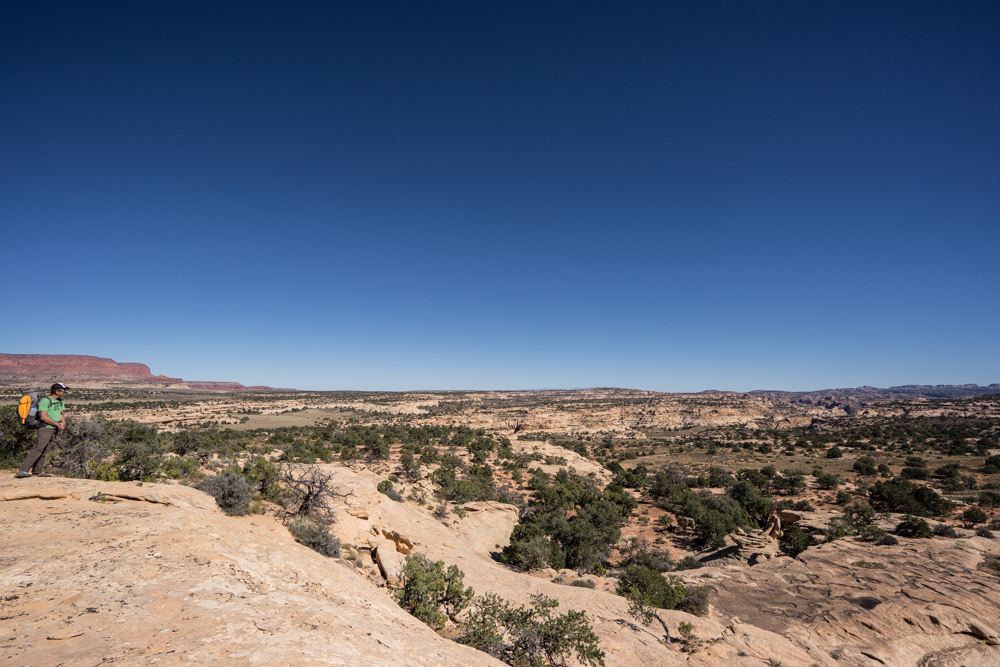
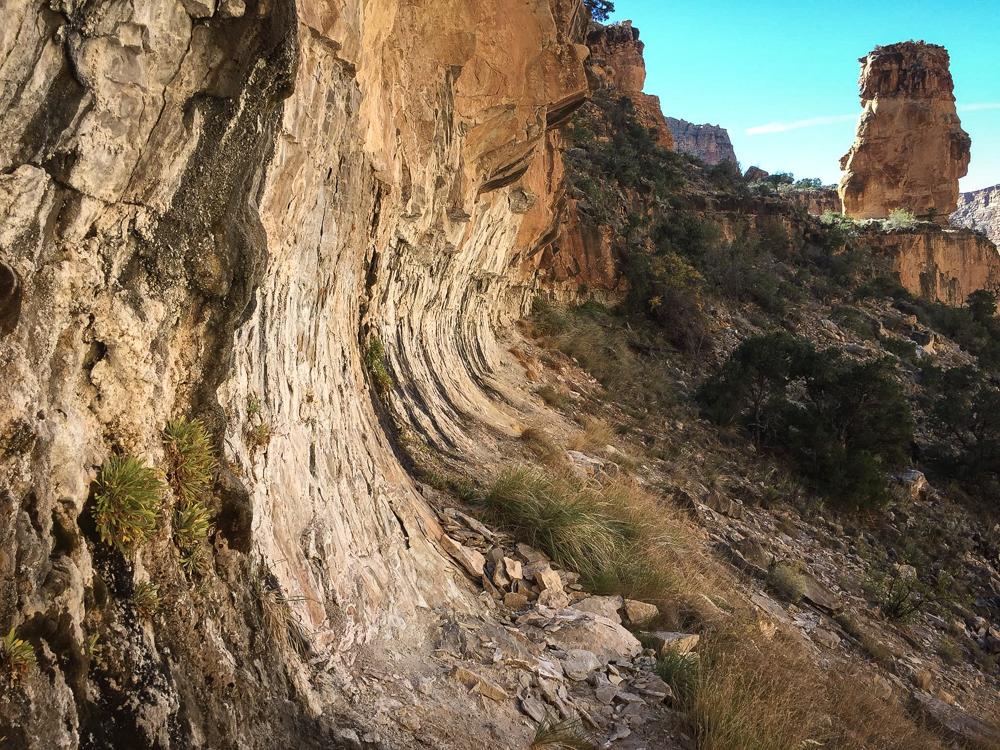
At the head of the canyon we look an assess our standing. We've been told this canyon while physically short is "scrappy" in nature.
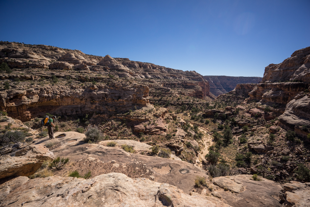
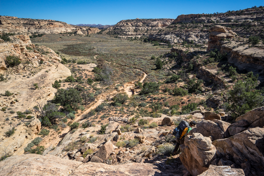
We head the first dry fall to the north and down-climb into the canyon bottom.
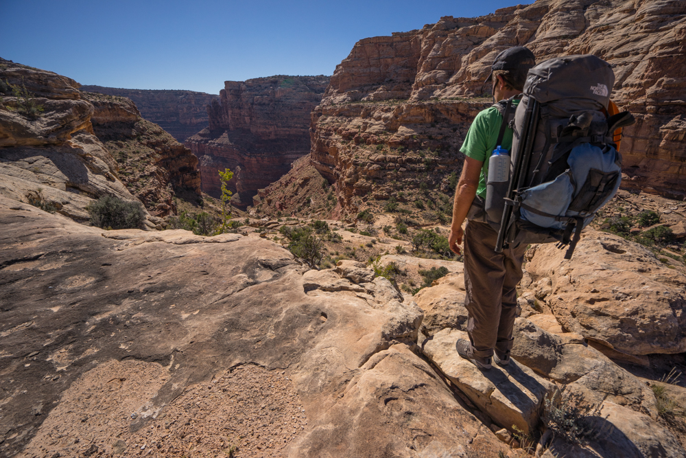
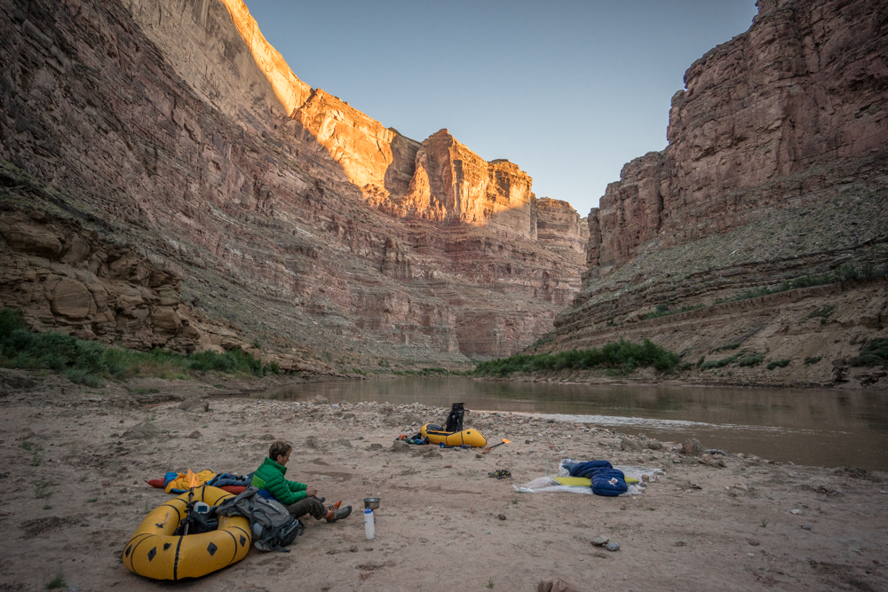
No pictures are taken for quite a while and all told it takes us the better part of 6 hours to get from Waterhole Flat to the Colorado inside Cataract Canyon. The idea of an "early start" is laughable as it was four hours just to get to the Hite Road from Moab then another 2.5 hours to do some 28 miles - leaving us starting at noon. As it stands we reach the river close to 6pm and know we have an hour max before lights out.
I can't speak for the whole group but I will say the descent was more demanding than I had imagined. A year of working night shift has made the belly soft and the will weak - I am feeling it, not a good sign this early in the trip.
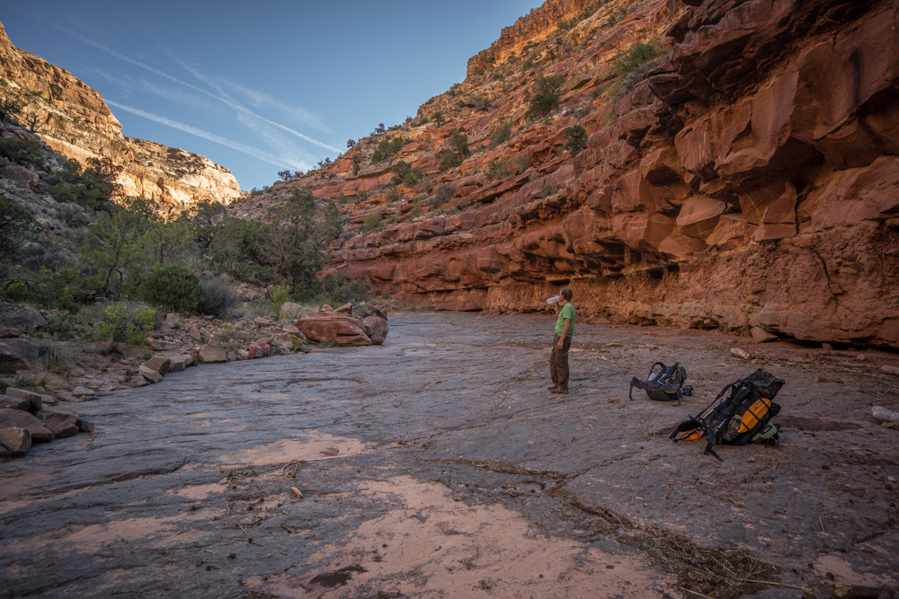
Our goal is the mouth of Bowdie but that won't happen given the time we get to the river corridor. We instead decide to throw down at the mouth of Clearwater.
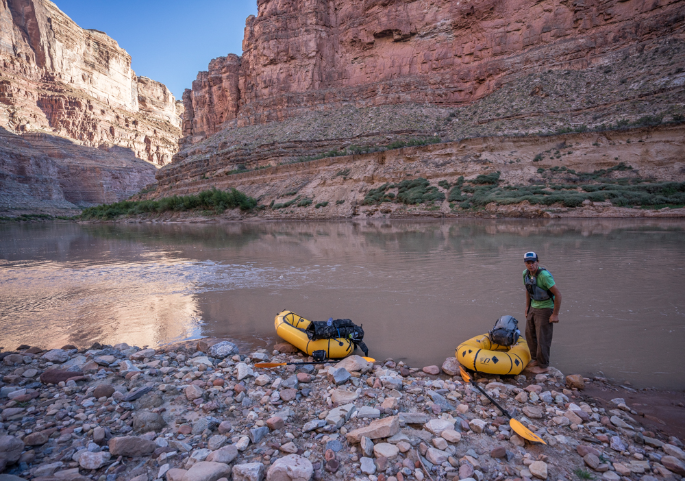
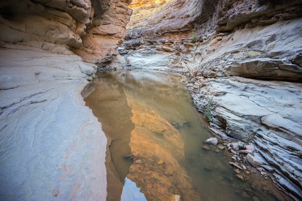
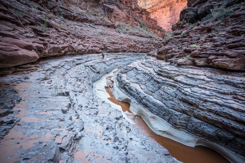
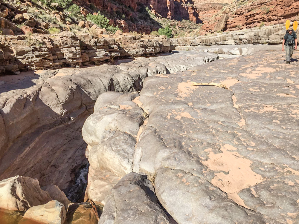
Getting an early start allows us to cruise into Bowdie and spend ample time checking out the lower portion.
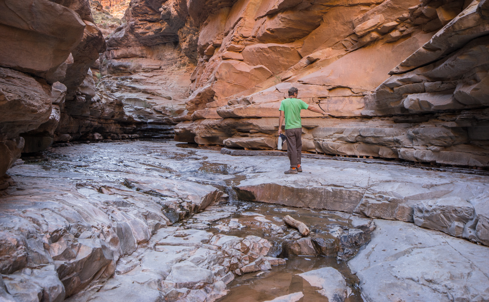
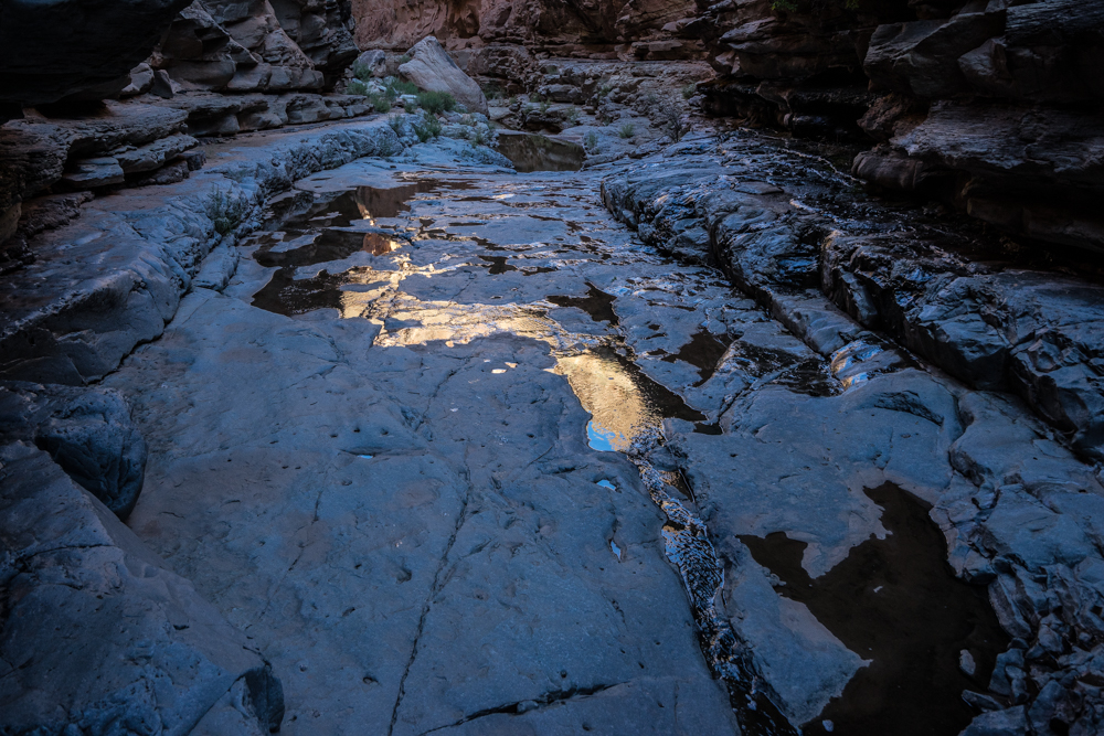
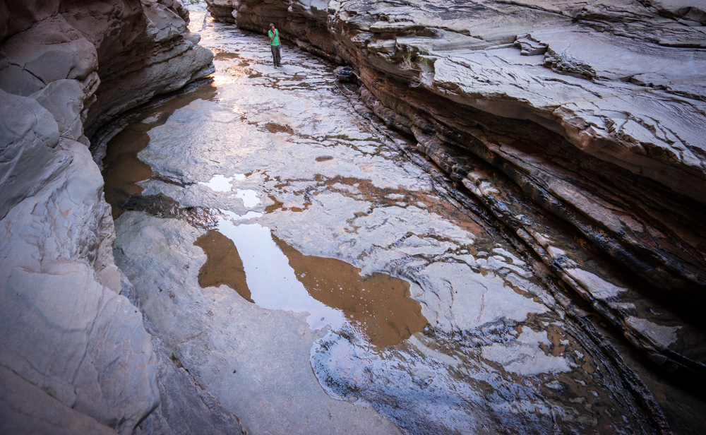
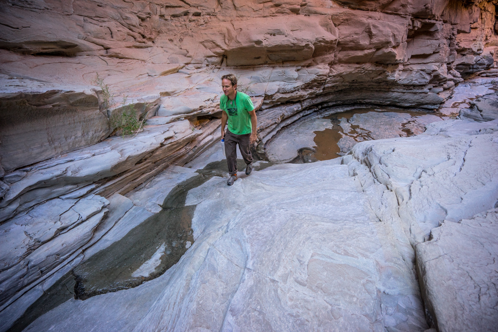
We decide to call it at this huge pool and head back to the river.
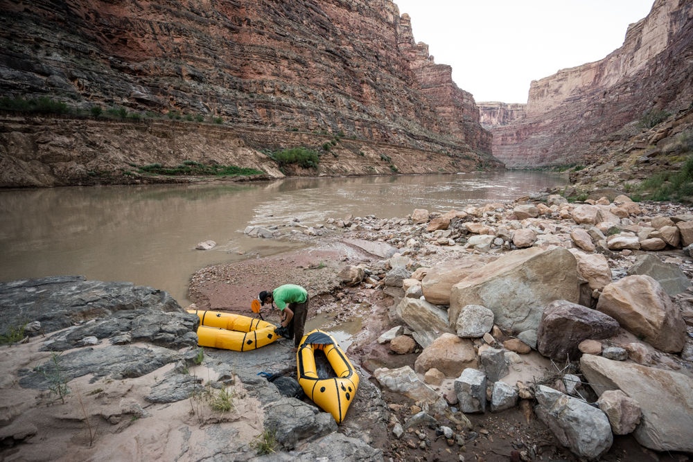
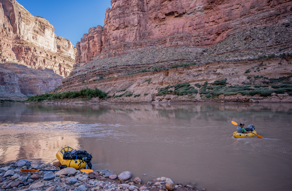
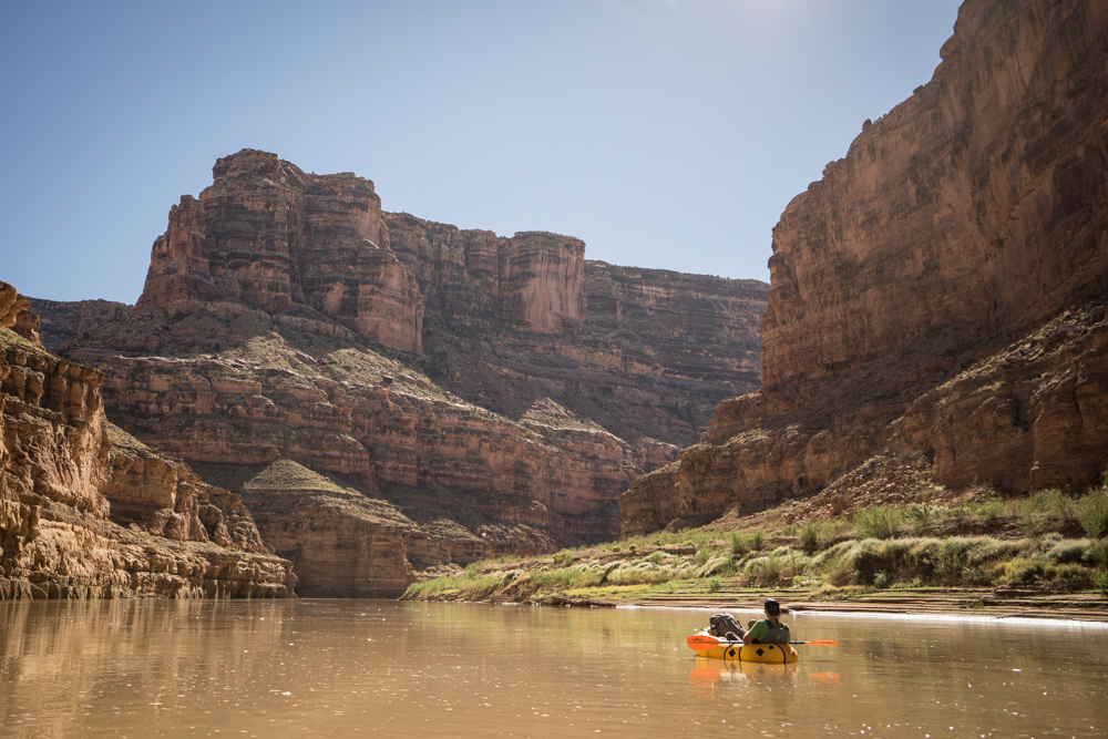
Getting back on the water before noon we are feeling good and say to hell with paddling. Warm temps with a very slight downstream breeze carry us southward. At one point we pass a private group who are kind enough to provide cold beers. From the suffering of the previous day to the joy of having actual running current in lower Cataract Canyon with no upstream winds is sublime.
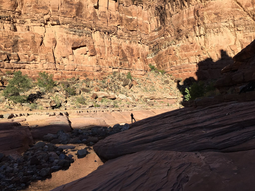
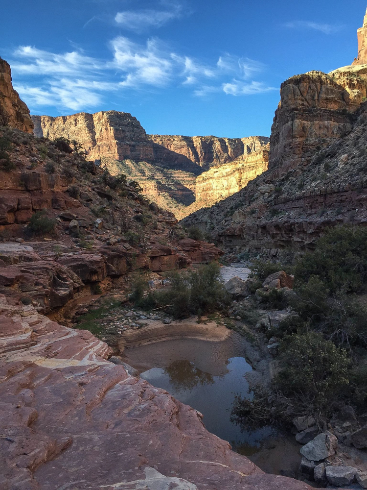
Eventually we spy our exit point - Dark Canyon.
We transform once more into bipedal mode.
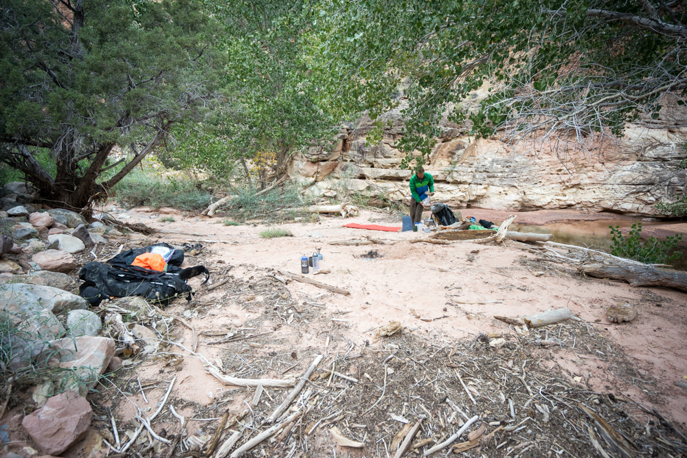
We spend the first night camped in the wash. Gawking so hard at the canyon before us we miss our "cut" to a bypass trail and instead of hiking back we decide to relish in this lower canyon and bed down under clear skies.
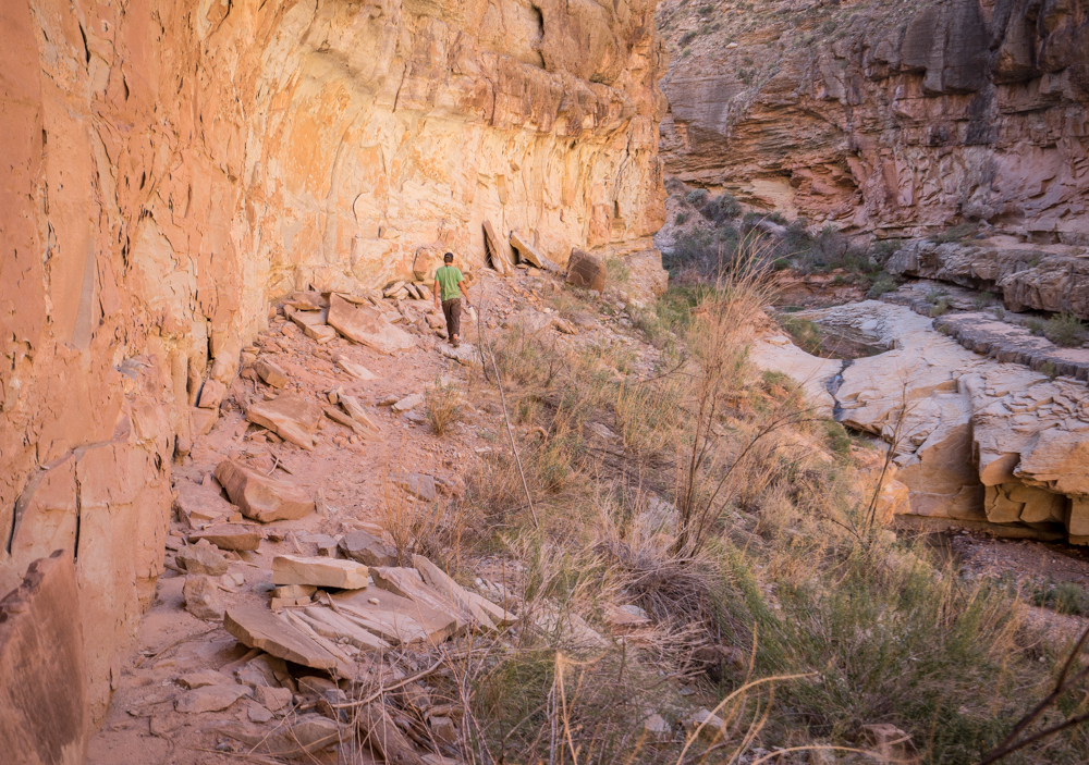
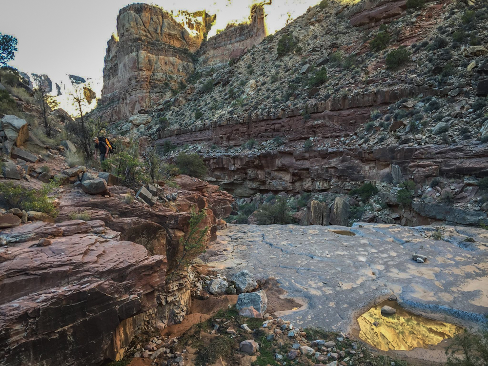
In the morning we make our way up and out of the lower gorge and pass the Sundance Trail cut and continue moving up-canyon.
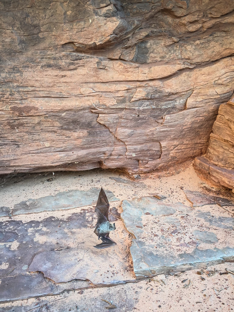
Hoping for some good Karma we cut this guy free - I dont think the spider will mind.
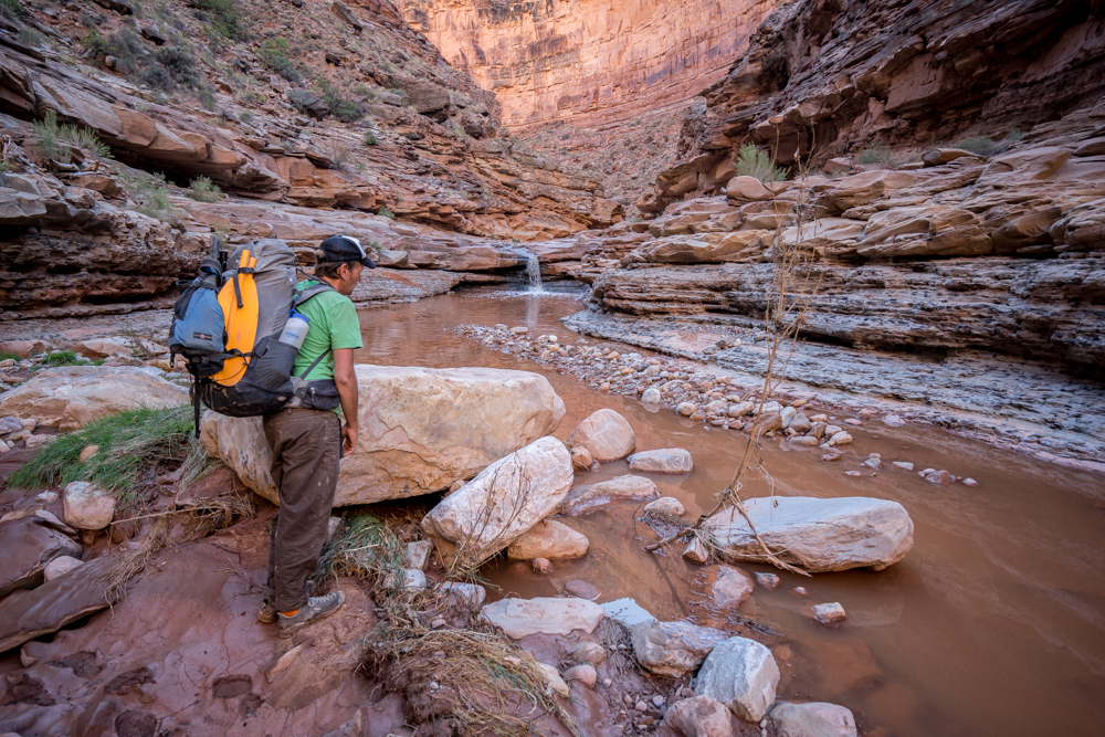
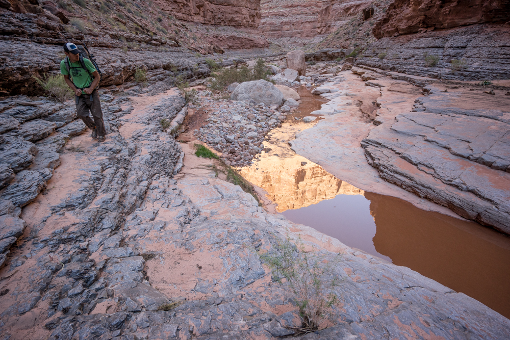
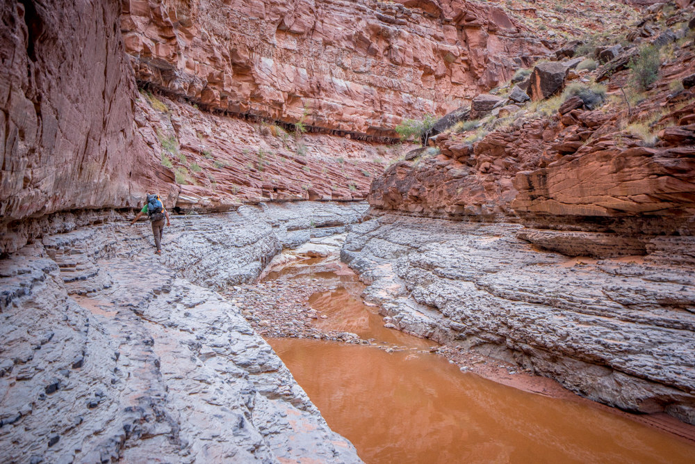
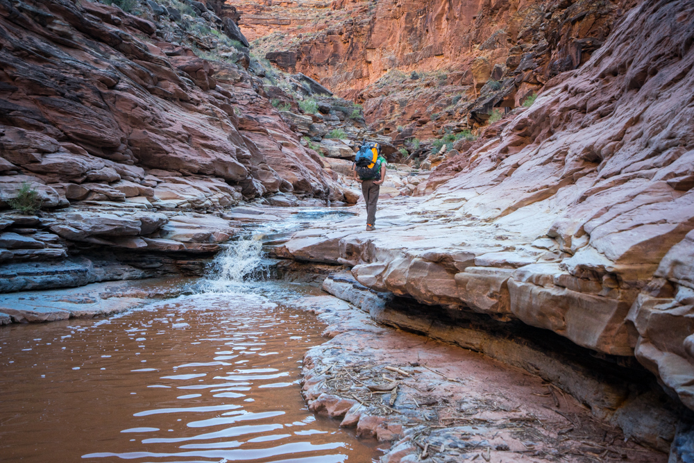
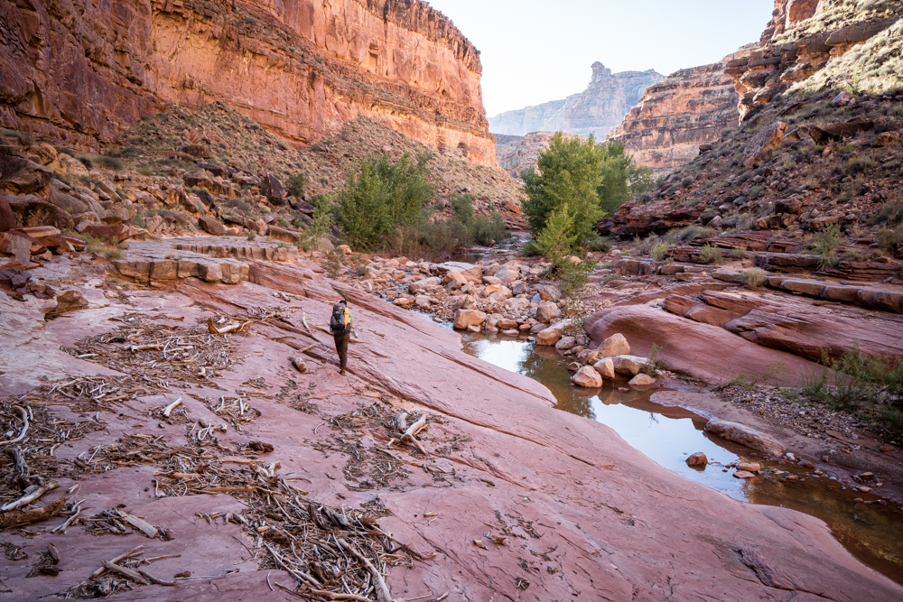
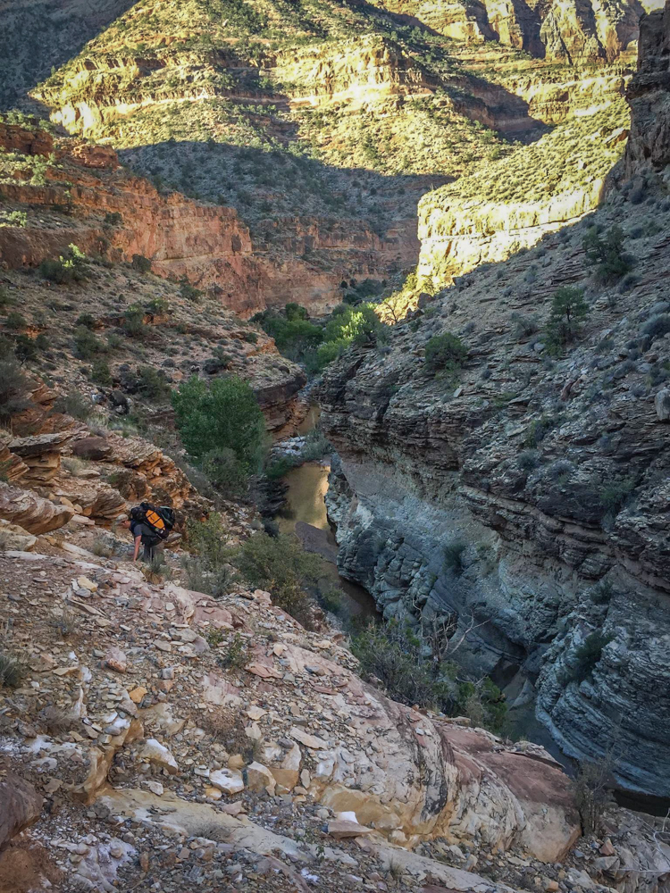
In my head I had imagined Dark Canyon to be simpler in terms of movement but it was trickier at times than I expected.
After a long day we camp at the confluence of Young's - our exit out of the underworld.
Things get started right away early the next morning.
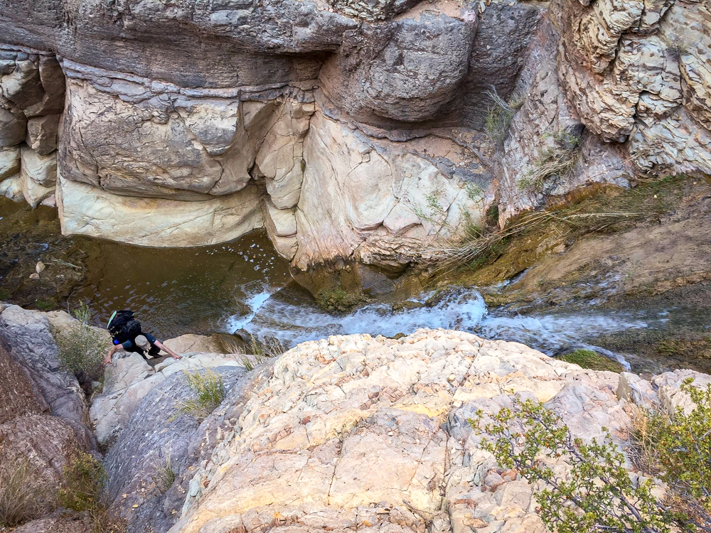
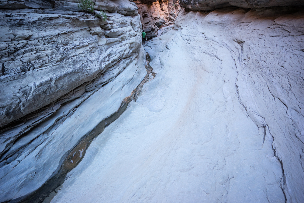
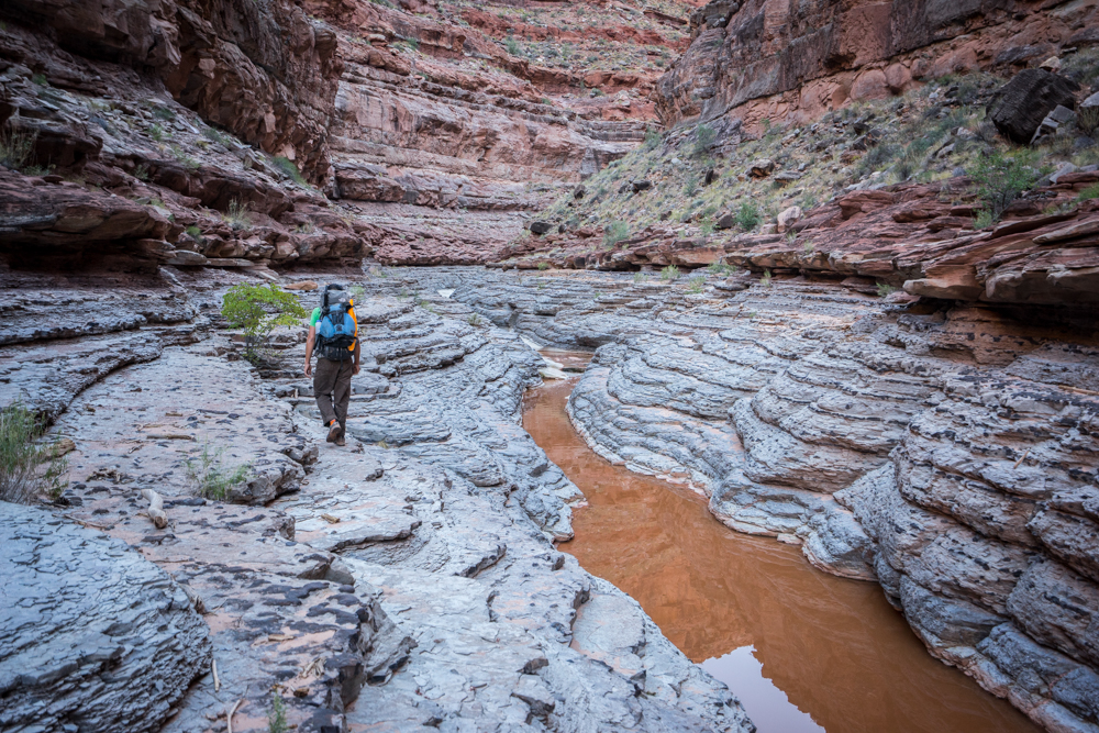
The theme for the day is dry-fall navigation. A few times we guess wrong and are forced to back track and climb up to yet another level. Humbling to say the least. Attempting to stay up with my partner was proving harder and harder.
Eventually we traverse the base of another layer and make our way to a beehive shaped pinnacle where we climb completely out of Young's proper. Not many pictures are taken here as we are both intent on navigation. We knew we are to eventually drop back down into Young's but finding said drop point is a matter of opinion. After some searching and scrambling we finally touch back down in the upper canyon. Our goal is just to get to the Sweet Alice road before nightfall knowing we can walk the road all night if we have to but we can't navigate the canyon in the dark.
Well into the night we make it to the Fable Valley trail head via headlamp. Its been a long day for sure and I am so tired I fall asleep while my dinner is cooking and have to be woken up by my partner.
In the morning we are notified via inReach that there is a flash flood advisory for our area. With one car of two exceeding friendly folks parked at the trail head we consider pulling the plug knowing what is ahead of us in terms of terrain and the fact that our truck will be difficult to maneuver on a waterlogged road. We have coffee with the couple from Taos and we eagerly tune into the radio in their camper until the weather forecast comes on - "scattered showers" - we decide to head out.
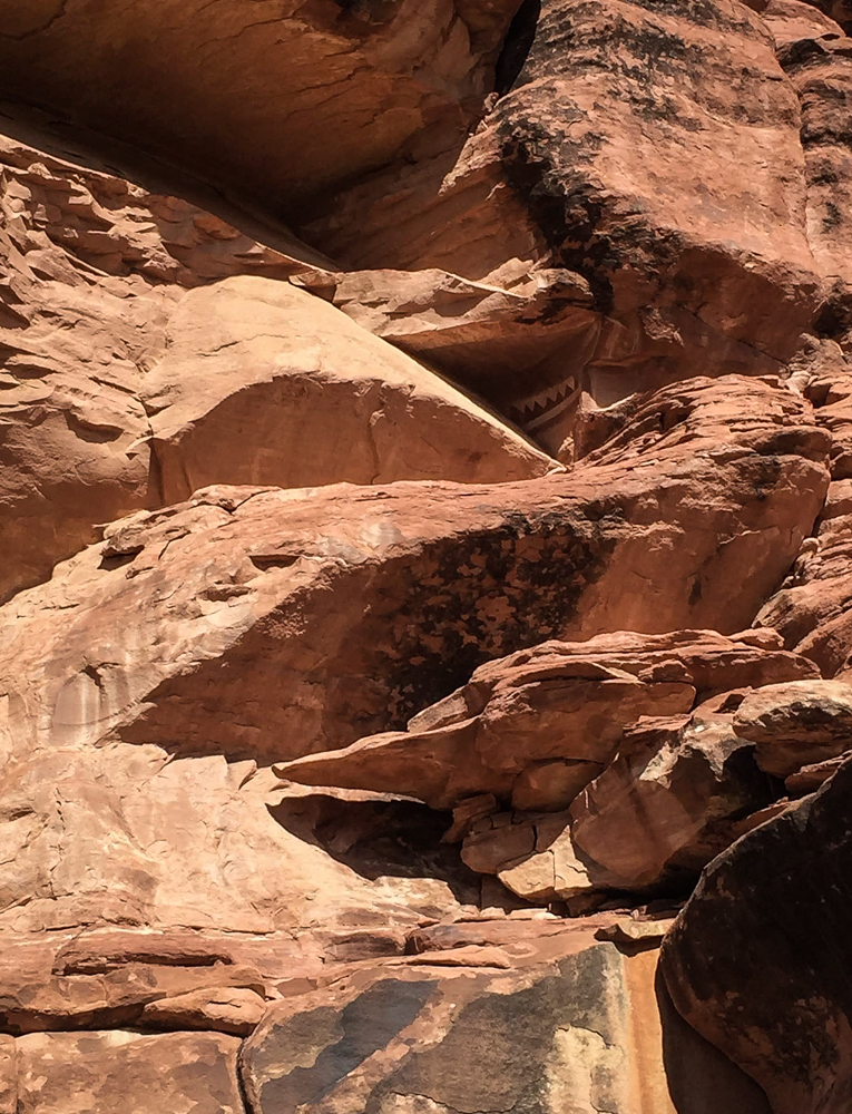
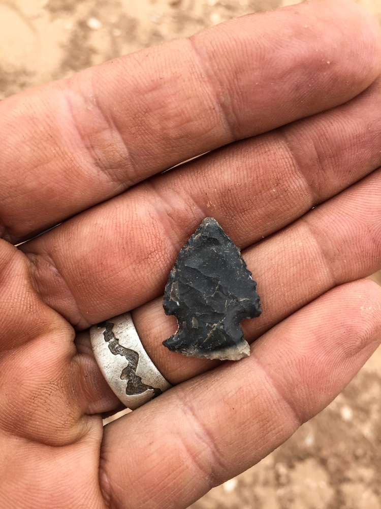
We drop down into Fable Vally - but unfortunately due to our schedule are offered but a glimpse of what is here to explore including this rock art. I tell myself I have to come back here and approach this place with a different mindset.
We follow Fable Valley all the way down to it's intersection with Gypsum Canyon and take an old stock trail out of the canyon. The trail is incredibly user friendly, fast, hard-pack and the views into Gypsum as we climb are breath-taking.
This is where things start getting interesting. Feet firmly on the flat ground of a good trail we fly through this section of the trip. Close to where the trail meets the Beef Basin road I step off a ledge in a careless fashion and landing on loose gravel feel a twist and a pop to my right knee. The sharp pain lasts momentarily and I press on thinking I'm no worse for wear.
We eat dinner at dusk below a small spring marked on our topo that is still running. We tank of with nearly an extra 2 gallons of water as we know we have much road walking to do with little to no chance of water save a passing vehicle.
We spend the night right smack dab in the roadway.
In the morning we get an early start. My right knee causes me to wince with the first few steps. I search and find my small supply of ibuprofen taking a full dose and continue on. Eventually the stride of my step seems to tamp down any residual pain.
At Ruin Park after hours of walking we cut west on an old ATV road that loosely contours the head of Gypsum Canyon as it breaks towards the Colorado River. It is at this point despite a brief break and another round of ibuprofen that my knee begins to sear with each step. I press on telling myself it will go away but on this our 7th day out it had other plans.
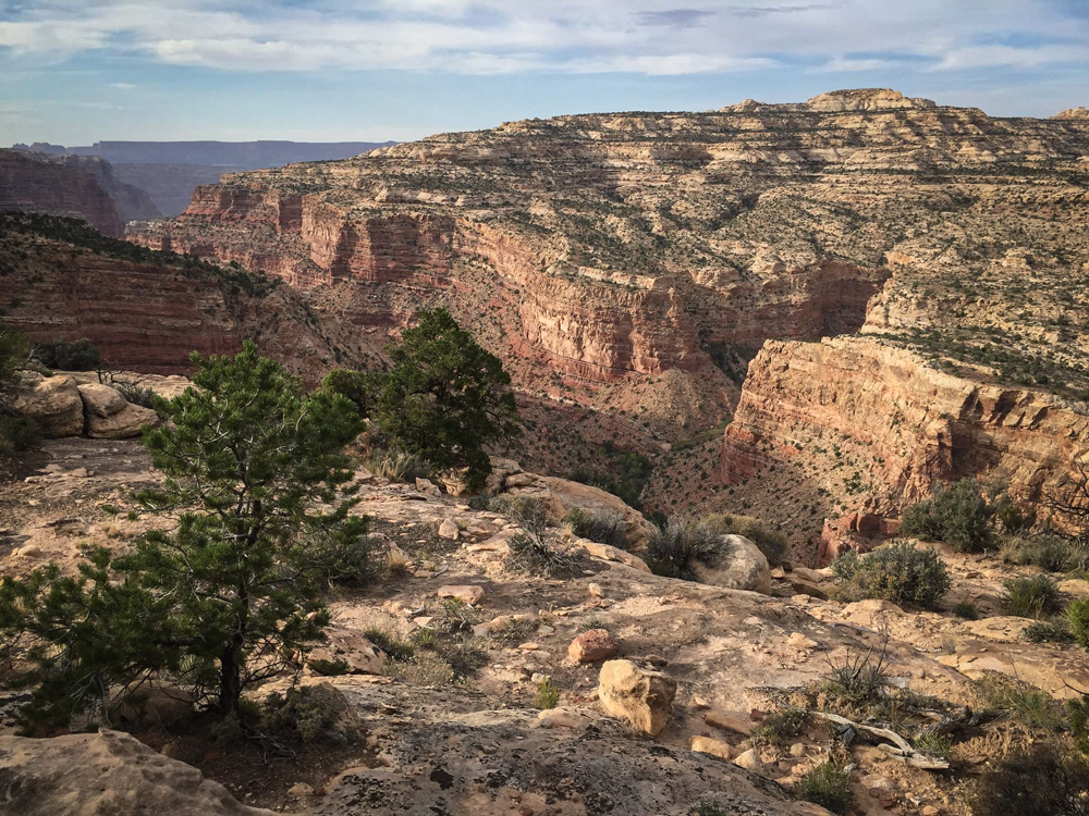
I don't know how often this area is visited but there is much to see.
Late into the evening we reach the valley that will take us to the head of Gypsum and our route back down to Cataract Canyon via the Powell route into Gypsum. Before we walk away from the road I have to humble myself and let my partner know I do not think it is a good idea to go one. Though we are less than 1 day from the car, and with 90% of the 7 day trek behind us I know that my knee will not handle the difficult terrain found in the descent and ascent that will be needed to get us back to the car. I feel that I will be a liability with flash flood warnings and two narrow canyons still to go.
I've never found myself in this type of situation and on the back-end while it hurts to have not finished the route I am at the same time glad that I made the call here and thus did not force an unnecessarily difficult rescue in much more difficult terrain. My partner was amazingly supportive and helped to ease the pain to my ego. To make a long story short his wonderful wife (via us talking to her via sat messaging) set up a (what I call a courtesy shuttle) with the Monticello Depty. It's a long convoluted (hilarious) story but I was picked up the next morning via ATV while my buddy finished the walk solo returning home the next morning near 2 am.
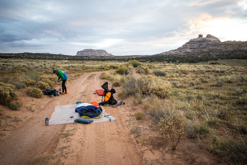
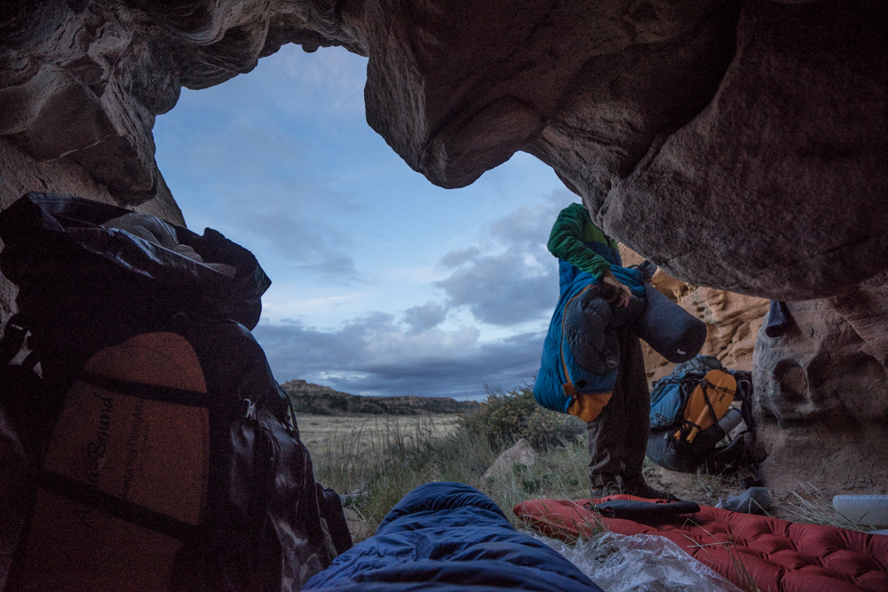
Below is the parting shot right off the ATV track where we spent the night. Good shelter, warm sleeping bag, and the camaraderie of friendship spent in wild places is one I will not soon forget.
In the end, this trip was huge - both in the amount of terrain covered in an all too short 7 days and the knowledge ascertained from that travel - that this blog post is but a cursory overview of a pretty involved effort. My words, descriptions, and explanations are simple due to the fact that I am still reflecting on such a big adventure and have not fully wrapped my head around everything that came to pass but wanted to share the adventure none the less. My travel partner, (who took many of the pictures above as my camera was packed away much of the time) who is an exceedingly talented artist offers a better explanation and reflection that I am able to at this time. It is his words that will close the chapter on this outing:
When I’m actually on a trip like this, I’m usually pretty focused on the task at hand — making it to the night’s camp, finding an obscure route out, searching for a water source. But after the trip, and especially when telling someone ‘what I’ve been up to lately’, I often find myself trying to justify why I go on these trips. How it could possibly be a responsible, worthy, healthy, sane way to spend one’s time? How in hell this does anything to improve the world? I don’t have the answers completely figured out, and I probably never will. But — I do know that my sense of belonging in this landscape, my desire to protect it, my respect for the natural world, and my passion to convey these feelings through my art, are all strengthened in a way that nothing else can really touch.
November 20, 2015
Finding a non-technical west side entrance to lower (far south of Spanish Bottom) Cataract Canyon can be a challenge. This trip had been proposed a year earlier but it was shelved for other plans. The time seemed right this past October to finally strike.
We drop the car at Waterhole Flat and begin walking in a north west direction.
Eventually we spy the depressed valley we are looking for.
At the head of the canyon we look an assess our standing. We've been told this canyon while physically short is "scrappy" in nature.
We head the first dry fall to the north and down-climb into the canyon bottom.
No pictures are taken for quite a while and all told it takes us the better part of 6 hours to get from Waterhole Flat to the Colorado inside Cataract Canyon. The idea of an "early start" is laughable as it was four hours just to get to the Hite Road from Moab then another 2.5 hours to do some 28 miles - leaving us starting at noon. As it stands we reach the river close to 6pm and know we have an hour max before lights out.
I can't speak for the whole group but I will say the descent was more demanding than I had imagined. A year of working night shift has made the belly soft and the will weak - I am feeling it, not a good sign this early in the trip.
Our goal is the mouth of Bowdie but that won't happen given the time we get to the river corridor. We instead decide to throw down at the mouth of Clearwater.
Getting an early start allows us to cruise into Bowdie and spend ample time checking out the lower portion.
We decide to call it at this huge pool and head back to the river.
Getting back on the water before noon we are feeling good and say to hell with paddling. Warm temps with a very slight downstream breeze carry us southward. At one point we pass a private group who are kind enough to provide cold beers. From the suffering of the previous day to the joy of having actual running current in lower Cataract Canyon with no upstream winds is sublime.
Eventually we spy our exit point - Dark Canyon.
We transform once more into bipedal mode.
We spend the first night camped in the wash. Gawking so hard at the canyon before us we miss our "cut" to a bypass trail and instead of hiking back we decide to relish in this lower canyon and bed down under clear skies.
In the morning we make our way up and out of the lower gorge and pass the Sundance Trail cut and continue moving up-canyon.
Hoping for some good Karma we cut this guy free - I dont think the spider will mind.
In my head I had imagined Dark Canyon to be simpler in terms of movement but it was trickier at times than I expected.
After a long day we camp at the confluence of Young's - our exit out of the underworld.
Things get started right away early the next morning.
The theme for the day is dry-fall navigation. A few times we guess wrong and are forced to back track and climb up to yet another level. Humbling to say the least. Attempting to stay up with my partner was proving harder and harder.
Eventually we traverse the base of another layer and make our way to a beehive shaped pinnacle where we climb completely out of Young's proper. Not many pictures are taken here as we are both intent on navigation. We knew we are to eventually drop back down into Young's but finding said drop point is a matter of opinion. After some searching and scrambling we finally touch back down in the upper canyon. Our goal is just to get to the Sweet Alice road before nightfall knowing we can walk the road all night if we have to but we can't navigate the canyon in the dark.
Well into the night we make it to the Fable Valley trail head via headlamp. Its been a long day for sure and I am so tired I fall asleep while my dinner is cooking and have to be woken up by my partner.
In the morning we are notified via inReach that there is a flash flood advisory for our area. With one car of two exceeding friendly folks parked at the trail head we consider pulling the plug knowing what is ahead of us in terms of terrain and the fact that our truck will be difficult to maneuver on a waterlogged road. We have coffee with the couple from Taos and we eagerly tune into the radio in their camper until the weather forecast comes on - "scattered showers" - we decide to head out.
We drop down into Fable Vally - but unfortunately due to our schedule are offered but a glimpse of what is here to explore including this rock art. I tell myself I have to come back here and approach this place with a different mindset.
We follow Fable Valley all the way down to it's intersection with Gypsum Canyon and take an old stock trail out of the canyon. The trail is incredibly user friendly, fast, hard-pack and the views into Gypsum as we climb are breath-taking.
This is where things start getting interesting. Feet firmly on the flat ground of a good trail we fly through this section of the trip. Close to where the trail meets the Beef Basin road I step off a ledge in a careless fashion and landing on loose gravel feel a twist and a pop to my right knee. The sharp pain lasts momentarily and I press on thinking I'm no worse for wear.
We eat dinner at dusk below a small spring marked on our topo that is still running. We tank of with nearly an extra 2 gallons of water as we know we have much road walking to do with little to no chance of water save a passing vehicle.
We spend the night right smack dab in the roadway.
In the morning we get an early start. My right knee causes me to wince with the first few steps. I search and find my small supply of ibuprofen taking a full dose and continue on. Eventually the stride of my step seems to tamp down any residual pain.
At Ruin Park after hours of walking we cut west on an old ATV road that loosely contours the head of Gypsum Canyon as it breaks towards the Colorado River. It is at this point despite a brief break and another round of ibuprofen that my knee begins to sear with each step. I press on telling myself it will go away but on this our 7th day out it had other plans.
I don't know how often this area is visited but there is much to see.
Late into the evening we reach the valley that will take us to the head of Gypsum and our route back down to Cataract Canyon via the Powell route into Gypsum. Before we walk away from the road I have to humble myself and let my partner know I do not think it is a good idea to go one. Though we are less than 1 day from the car, and with 90% of the 7 day trek behind us I know that my knee will not handle the difficult terrain found in the descent and ascent that will be needed to get us back to the car. I feel that I will be a liability with flash flood warnings and two narrow canyons still to go.
I've never found myself in this type of situation and on the back-end while it hurts to have not finished the route I am at the same time glad that I made the call here and thus did not force an unnecessarily difficult rescue in much more difficult terrain. My partner was amazingly supportive and helped to ease the pain to my ego. To make a long story short his wonderful wife (via us talking to her via sat messaging) set up a (what I call a courtesy shuttle) with the Monticello Depty. It's a long convoluted (hilarious) story but I was picked up the next morning via ATV while my buddy finished the walk solo returning home the next morning near 2 am.
Below is the parting shot right off the ATV track where we spent the night. Good shelter, warm sleeping bag, and the camaraderie of friendship spent in wild places is one I will not soon forget.
In the end, this trip was huge - both in the amount of terrain covered in an all too short 7 days and the knowledge ascertained from that travel - that this blog post is but a cursory overview of a pretty involved effort. My words, descriptions, and explanations are simple due to the fact that I am still reflecting on such a big adventure and have not fully wrapped my head around everything that came to pass but wanted to share the adventure none the less. My travel partner, (who took many of the pictures above as my camera was packed away much of the time) who is an exceedingly talented artist offers a better explanation and reflection that I am able to at this time. It is his words that will close the chapter on this outing:
When I’m actually on a trip like this, I’m usually pretty focused on the task at hand — making it to the night’s camp, finding an obscure route out, searching for a water source. But after the trip, and especially when telling someone ‘what I’ve been up to lately’, I often find myself trying to justify why I go on these trips. How it could possibly be a responsible, worthy, healthy, sane way to spend one’s time? How in hell this does anything to improve the world? I don’t have the answers completely figured out, and I probably never will. But — I do know that my sense of belonging in this landscape, my desire to protect it, my respect for the natural world, and my passion to convey these feelings through my art, are all strengthened in a way that nothing else can really touch.