- Joined
- Aug 9, 2007
- Messages
- 12,959
The Lower Black Box is a section of the San Rafael River just south of Mexican Mountain, before the river cuts through the reef. It's a long, narrow stretch of canyon that is infamous for it's high flash flood potential. Several lives have been lost in the canyon over the years when people entered during high flows. It's not a hike to take lightly, which is why it was after several planned trips that our group finally made it down to make the hike over the second weekend of September. There was a nice high-pressure system and the river had slowed all the way down to 13 CFS. I've read that the maximum CFS that the hike can be done safely is 50 or less but have no personal experience.
Here is a map of our route. I accidentally deleted my GPS track so this is just a rough estimate. It is a very long day, roughly 13-14 miles round trip.
View larger map.
Our trip started out as it often does, leaving Salt Lake after work on a Friday evening, racing through traffic, trying to get to the desert. It had been a couple months for me since I'd been down south and I was dying for it. Our plan was to meet gnwatts at the Sinkhole on the Buckhorn Draw Road, just north of I-70.
We arrived just minutes before our planned meeting time and found we had beat Greg there so we wandered around in the dark, admiring the sinkhole and chatting. After a while we wondered where he could be so we tried to make contact with no luck. After an hour, we decided to leave a note and go find a campsite for the night. Good thing I always have a stack of BCP stickers in the glove box!
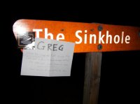
So we made it out to our camp and set things up for the night when I got a call from Greg. I could barely here him because of bad service but I was able to gather that he had been at the Sinkhole for hours but that he would come to us. A while later, he arrived in camp and we figured out the confusion. We were waiting for him at THE Sinkhole. He was waiting for us at the junction at Sinkhole Flat! He was literally 1/3 of a mile from us, just around the bend the whole time we were waiting!! Doh!
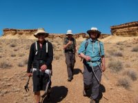
The next day we all piled into my truck and drove the rough, 4WD road to the Lower Black Box trailhead. The first two miles of the hike follows an old road down to the San Rafael River. gnwatts , lostlandscapes and neiloro .
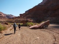
Approaching the river
The San Rafael River. It really stunk here but I laid down in it anyway. I could smell the sulfur on me almost all the way to Swasey's Leap
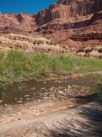
We crossed the river and started following a path on the other side that would lead us up onto a bench and along the east side of the river until just beyond Swasey's Leap where the route drops back down to the river.
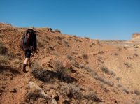
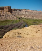
Looking down on the San Rafael River below the Lower Black Box.
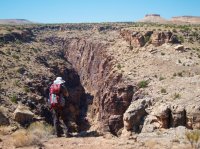
Tim getting a look at the mid-section of the Lower Black Box.
Swasey's Leap. At this spot, the walls of the canyon are only about 10 feet across. It was named Swasey's Leap because of a bet between the Swasey brothers to jump a horse over it. Who knows if Sid Swasey actually did it, but that's how it got the name. There used to be a sheep bridge over it but it fell apart and washed away in the late 1990's.
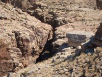
After 5.5 miles, we finally arrived at the river and started hiking downstream
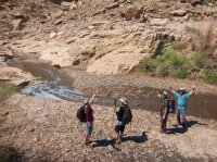
At first we tried to avoid the water and mud. The water was pure brown and it was hard to tell if it was 2" or 6' deep. To add to the fun, there was tons of rip-your-boots-off sticky mud.
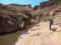
The river immediately below Swasey's Leap
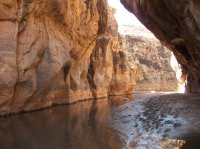
drclef below the leap. We stopped here for lunch before continuing into the canyon.
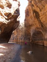
Starting down from Swasey's Leap
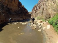
This stuff made for some rough walking. I brought one trekking pole and so wish I'd brought a second one. Oh, and full body armor, knee pads, shin guards, etc. This hike is an ankle breaker!
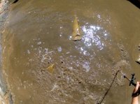
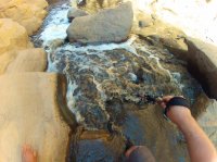
Soon the canyon got deeper and we found ourselves negotiating countless boulders, small waterfalls and various other obstacles. I shot a lot of footage with the GoPro but I'm still figuring out how I want to piece it together, so for now, here are some stills.
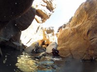
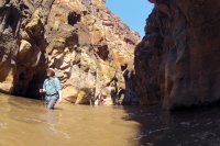
There were some long swimming sections
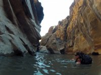
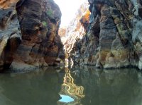
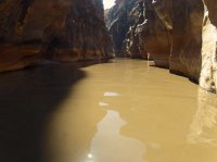
And plenty of knee to waste deep hiking as well. There were plenty of hidden shin-breakers under that water that would sneak up and throw you into the water.
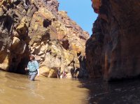
And if the hidden rocks weren't enough fun, we had the mud. There are so many sections of this hike that look like you could just walk the bank and avoid tripping over boulders, but then you run into stuff like this. Thanks to lostlandscapes for shooting this video of me.
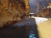
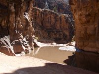
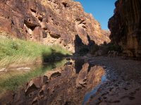
As the canyon started to open up, we had a stretch of easier hiking where several springs flowed into the river.
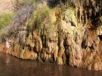
But as we hiked further, the deep mud returned but now it was unavoidable, no matter where in the river we hiked. So it was like knee deep water and calf deep mud. Tough hiking!
The springs kept coming but they were sulfur-laden and smelled awful. It made some cool patterns though.
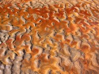
Some of the sulfur springs bubbled right out of the river like it was carbonated water.
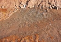
Others flowed in as white waterfalls.
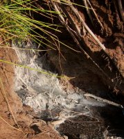
After many hours of hiking, swimming and scrambling, we found the exit and hiked the last two miles back up to the trailhead.
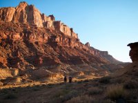
No clouds in the sky; good for hiking the Black Box, bad for sunsets. The light on the reef and Mexican Mountain was nice though.
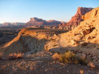
Looking back down at the San Rafael River Gorge as it cuts through the San Rafael Reef.
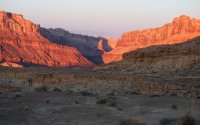
After reading this, you might think that I hated this hike. That would be far from the truth, I had a blast swimming and sloshing around. I would be hesitant to recommend it to most though. And if you do it, make sure you bring TWO trekking poles and good ankle support. And I wasn't joking about shin pads! If you've ever hiked the Zion Narrows, it's kind of like that but with sharper rocks and muddy water. But on the upside, you get it all to yourself.
Featured image for home page:
Here is a map of our route. I accidentally deleted my GPS track so this is just a rough estimate. It is a very long day, roughly 13-14 miles round trip.
View larger map.
Our trip started out as it often does, leaving Salt Lake after work on a Friday evening, racing through traffic, trying to get to the desert. It had been a couple months for me since I'd been down south and I was dying for it. Our plan was to meet gnwatts at the Sinkhole on the Buckhorn Draw Road, just north of I-70.
We arrived just minutes before our planned meeting time and found we had beat Greg there so we wandered around in the dark, admiring the sinkhole and chatting. After a while we wondered where he could be so we tried to make contact with no luck. After an hour, we decided to leave a note and go find a campsite for the night. Good thing I always have a stack of BCP stickers in the glove box!

So we made it out to our camp and set things up for the night when I got a call from Greg. I could barely here him because of bad service but I was able to gather that he had been at the Sinkhole for hours but that he would come to us. A while later, he arrived in camp and we figured out the confusion. We were waiting for him at THE Sinkhole. He was waiting for us at the junction at Sinkhole Flat! He was literally 1/3 of a mile from us, just around the bend the whole time we were waiting!! Doh!

The next day we all piled into my truck and drove the rough, 4WD road to the Lower Black Box trailhead. The first two miles of the hike follows an old road down to the San Rafael River. gnwatts , lostlandscapes and neiloro .

Approaching the river

The San Rafael River. It really stunk here but I laid down in it anyway. I could smell the sulfur on me almost all the way to Swasey's Leap

We crossed the river and started following a path on the other side that would lead us up onto a bench and along the east side of the river until just beyond Swasey's Leap where the route drops back down to the river.

Looking down on the San Rafael River below the Lower Black Box.

Tim getting a look at the mid-section of the Lower Black Box.

Swasey's Leap. At this spot, the walls of the canyon are only about 10 feet across. It was named Swasey's Leap because of a bet between the Swasey brothers to jump a horse over it. Who knows if Sid Swasey actually did it, but that's how it got the name. There used to be a sheep bridge over it but it fell apart and washed away in the late 1990's.

After 5.5 miles, we finally arrived at the river and started hiking downstream

At first we tried to avoid the water and mud. The water was pure brown and it was hard to tell if it was 2" or 6' deep. To add to the fun, there was tons of rip-your-boots-off sticky mud.

The river immediately below Swasey's Leap

drclef below the leap. We stopped here for lunch before continuing into the canyon.

Starting down from Swasey's Leap

This stuff made for some rough walking. I brought one trekking pole and so wish I'd brought a second one. Oh, and full body armor, knee pads, shin guards, etc. This hike is an ankle breaker!


Soon the canyon got deeper and we found ourselves negotiating countless boulders, small waterfalls and various other obstacles. I shot a lot of footage with the GoPro but I'm still figuring out how I want to piece it together, so for now, here are some stills.

There were some long swimming sections


And plenty of knee to waste deep hiking as well. There were plenty of hidden shin-breakers under that water that would sneak up and throw you into the water.

And if the hidden rocks weren't enough fun, we had the mud. There are so many sections of this hike that look like you could just walk the bank and avoid tripping over boulders, but then you run into stuff like this. Thanks to lostlandscapes for shooting this video of me.


As the canyon started to open up, we had a stretch of easier hiking where several springs flowed into the river.

But as we hiked further, the deep mud returned but now it was unavoidable, no matter where in the river we hiked. So it was like knee deep water and calf deep mud. Tough hiking!
The springs kept coming but they were sulfur-laden and smelled awful. It made some cool patterns though.

Some of the sulfur springs bubbled right out of the river like it was carbonated water.

Others flowed in as white waterfalls.

After many hours of hiking, swimming and scrambling, we found the exit and hiked the last two miles back up to the trailhead.

No clouds in the sky; good for hiking the Black Box, bad for sunsets. The light on the reef and Mexican Mountain was nice though.

Looking back down at the San Rafael River Gorge as it cuts through the San Rafael Reef.

After reading this, you might think that I hated this hike. That would be far from the truth, I had a blast swimming and sloshing around. I would be hesitant to recommend it to most though. And if you do it, make sure you bring TWO trekking poles and good ankle support. And I wasn't joking about shin pads! If you've ever hiked the Zion Narrows, it's kind of like that but with sharper rocks and muddy water. But on the upside, you get it all to yourself.
Featured image for home page:


