- Joined
- Dec 23, 2013
- Messages
- 4,308
After dropping my son off t Island Park for the summer, my daughter and I along with @McGimpkins and his wife Susannah began a four day backpacking loop through Lower Geyser Basin, a portion of Midway Geyser Basin with a day hike to Buffalo Meadows thrown in for good measure. This trip was designed to be a relatively easy trip with the total mileage of the loop approximately ten miles in length and the terrain nearly flat throughout, though the day hike to Buffalo Meadows would be a bit more challenging.
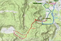 Map of our trip. the pink line is day 1, the green is day 2, the red is day 3 (day hike to Buffalo Meadows) and the blue line represents day 4.
Katie and I arrived at the Fountain Flats Drive Trailhead at 6:00 pm and proceeded to get all of our gear together. McGimkins had hiked in earlier and had already set up camp at campsite 0G1 which is located on Sentinel Creek. 0G1 is located only one mile away from the trailhead and it took us about 25 minutes to reach camp. Along the way, we saw Ojo Caliente (hot spring), crossed the Firehole River and spotted two bull bison just south of the trail. Once at camp, we noticed that the bear pole was down so we were forced to hang our food from a tree instead. While setting up our tents, none other than @Joey himself showed up. He had been staying at the Little Firehole Meadows campsite 0D2 last night and would spend the next two nights with us which is always a welcomed treat.
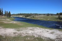 The Firehole River
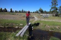 Katie crossing a foot bridge (Fairy Creek)
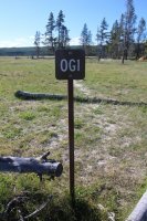
signpost for campsite 0G1
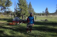 The one and only.
After setting up our tents and eating dinner, Katie and I took a short hike out Steep and Flat Cone Geysers. We didn't spend a lot of time at them because it was getting dark. We also got to see a couple coyotes crossing Sentinel Meadows before our short hike. The coyotes would end up yipping throughout the night. Also, we had a lone bull bison just to the southwest of our campsite that kept us company throughout the night.
On our second day, we made our way to Queen's Laundry and the Queen;s Laundry Bath House which I believe the Park touts as the oldest structure in Yellowstone. It was a bath house back in the 1800's and has two sections to the log structure. I'm not sure if thermal water was diverted to it or if warm water was carried from the hot springs to the bath house.
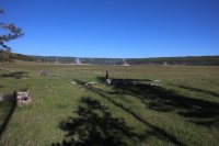 View from our campsite on our second day - looking west.
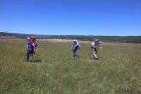 On our way to Queen's Laundry
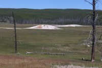 Steep Cone
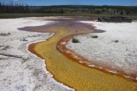 Drainage of thermal pool in Queen's Laundry
 The old bath house
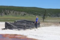 Katie at the bath house
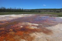
Thermal area at Queen's Laundry
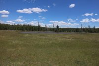 Unnamed pond for @Artemus on the way to campsite 0D4
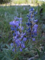
Lupines along the trail
After leaving Queen's Laundry, we made our way towards campsite 0D4 which is located in the Midway Geyser Basin. There were many thermal features along the trail which gave us an opportunity to take some pictures. In the distance we could make out the northern peak of Twin Buttes. Our campsite would be located just east of these peaks. We arrived at 0D4 to find that there was not much shade available to us but we were able to find a small group of trees south of the bear pole and set up our tents.
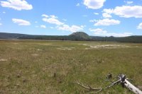 Northern peak of the Twin Buttes
 Trail junction sign
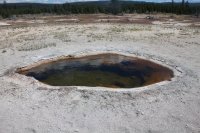 Hot Spring along our route
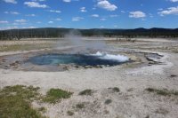 Hot Spring
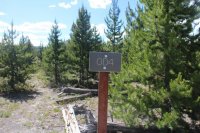 Signpost for campsite 0D4

The amenities of the camping life.

Food area at campsite 0D4
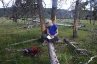 Finding time for a journal entry
While this site might have been exposed, it made up for it in wildlife. We had two bison that called this campsite home. They would graze up to and around our tent sites for the two days we stayed there. On our second morning, we had an elk herd pass through camp at around 5:50 in the morning and on day four there was a bull elk to the north of us. We also were thrilled to see blue herons and sandhill cranes along with more coyotes. Another plus to this site was the tremendous view of Fairy Falls to the south.
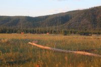
A group of elk checking out our tents
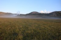
Early morning fog along the meadows
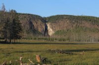
Fairy Falls from our campsite
On day three, Katie and I would be heading to Buffalo Meadows while Joey would leave our group for more adventures on his own. McGimpkins and Susannah decided to explore Fairy Falls and Imperial Geyser for the day.
After wishing Joey a safe trip out, we took off for Buffalo Meadows. Along our route, we stopped at Imperial Geyser before making our way up the ridge. The Lupines and Sulfur Buckwheat were in full bloom along our way which made our hike even more enjoyable. After climbing up to the top of the ridge that looks down on Midway Geyser Basin, the trail proceeds mostly through burn and new growth. Around the 5.5 mile mark of our journey, it was time to do some serious bushwhacking through the burn to get to Buffalo Meadows.
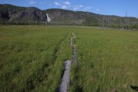
Stepping logs across meadow in Midway Geyser Basin
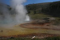
Imperial Geyser
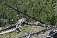
Marmot on a log
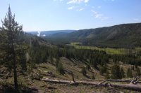
View back down the valley
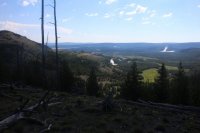
A little higher up
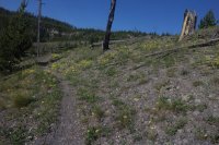
Sulfur Buckwheat along the trail
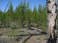
The break off point to begin hiking through the burn
I told my daughter that this was going to be tough. We had a 1.5 miles to reach the meadows with a stop at an unnamed pond just beyond the halfway point to look forward to. I don't think she quite understood though. It took us nearly two hours to go the 1.5 miles. The stretch just before the pond was the worst of it with extremely thick new growth to contend with. We were a couple of happy campers when we arrived at the meadows in one piece.
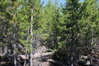
Aargh!
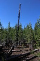
Lone burned snag, 28 years old. I love it!
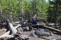
On break about a half mile in. Katie is sitting on some pitchstone
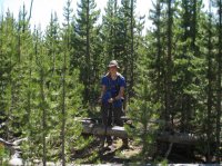
Dad, I think I've had enough of this
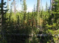
Nasty stretch before reaching the pond
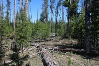
Where is that pond?
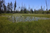
The unnamed pond covered in lily pads. I decided to call it Jabb Pond for @Joey , @Artemus , @Bob and @Ben who were there in spirit.
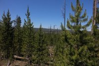
I stood up on some downfall to get the first glimpse of Buffalo Meadows
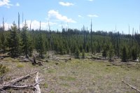
Looking back on what we had just hiked through
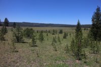
Buffalo Meadows
The meadows were large and peaceful. We stayed for about an hour while we ate our lunch, refilled our water bottles and just enjoyed the stillness. After we were done eating, we made our way down the unnamed stream that eventually flows into the Little Firehole Meadows, before heading back east towards the trail. Fortunately this route was a little more enjoyable that the route in - only partial burn and downfall.

Unnamed stream that flows through Buffalo Meadows
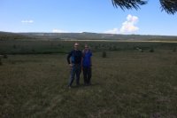
We made it

Back on the trail
The trip back to camp was uneventful for the most part but we did have to outrun an afternoon thunderstorm that hit about one minute before we reached our tent.
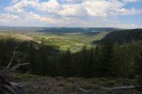
View down the valley in the afternoon
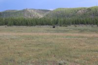
One of the guardians of our campsite
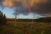
A rainbow after the storm
On our last day, we completed the loop while taking in Fairy Falls and Goose Lake and we got to see yet another coyote.
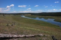
The Firehole River
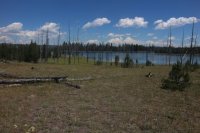
Goose Lake
Overall, I enjoyed all the wildlife encounters except the mosquitoes. The weather was on the hot side the last two days and the route is exposed. I think this loop would be a good beginner's backpacking trip in Yellowstone to get ones feet wet so to speak though I think September would be a better time of year to pull it off.
The end!
 Map of our trip. the pink line is day 1, the green is day 2, the red is day 3 (day hike to Buffalo Meadows) and the blue line represents day 4.
Katie and I arrived at the Fountain Flats Drive Trailhead at 6:00 pm and proceeded to get all of our gear together. McGimkins had hiked in earlier and had already set up camp at campsite 0G1 which is located on Sentinel Creek. 0G1 is located only one mile away from the trailhead and it took us about 25 minutes to reach camp. Along the way, we saw Ojo Caliente (hot spring), crossed the Firehole River and spotted two bull bison just south of the trail. Once at camp, we noticed that the bear pole was down so we were forced to hang our food from a tree instead. While setting up our tents, none other than @Joey himself showed up. He had been staying at the Little Firehole Meadows campsite 0D2 last night and would spend the next two nights with us which is always a welcomed treat.
 The Firehole River
 Katie crossing a foot bridge (Fairy Creek)
signpost for campsite 0G1
 The one and only.
After setting up our tents and eating dinner, Katie and I took a short hike out Steep and Flat Cone Geysers. We didn't spend a lot of time at them because it was getting dark. We also got to see a couple coyotes crossing Sentinel Meadows before our short hike. The coyotes would end up yipping throughout the night. Also, we had a lone bull bison just to the southwest of our campsite that kept us company throughout the night.
On our second day, we made our way to Queen's Laundry and the Queen;s Laundry Bath House which I believe the Park touts as the oldest structure in Yellowstone. It was a bath house back in the 1800's and has two sections to the log structure. I'm not sure if thermal water was diverted to it or if warm water was carried from the hot springs to the bath house.
 View from our campsite on our second day - looking west.
 On our way to Queen's Laundry
 Steep Cone
  Drainage of thermal pool in Queen's Laundry
 The old bath house
 Katie at the bath house
Thermal area at Queen's Laundry
 Unnamed pond for @Artemus on the way to campsite 0D4
Lupines along the trail
After leaving Queen's Laundry, we made our way towards campsite 0D4 which is located in the Midway Geyser Basin. There were many thermal features along the trail which gave us an opportunity to take some pictures. In the distance we could make out the northern peak of Twin Buttes. Our campsite would be located just east of these peaks. We arrived at 0D4 to find that there was not much shade available to us but we were able to find a small group of trees south of the bear pole and set up our tents.
 Northern peak of the Twin Buttes
 Trail junction sign
 Hot Spring along our route
 Hot Spring
 Signpost for campsite 0D4
The amenities of the camping life.

Food area at campsite 0D4
 Finding time for a journal entry
While this site might have been exposed, it made up for it in wildlife. We had two bison that called this campsite home. They would graze up to and around our tent sites for the two days we stayed there. On our second morning, we had an elk herd pass through camp at around 5:50 in the morning and on day four there was a bull elk to the north of us. We also were thrilled to see blue herons and sandhill cranes along with more coyotes. Another plus to this site was the tremendous view of Fairy Falls to the south.

A group of elk checking out our tents

Early morning fog along the meadows

Fairy Falls from our campsite
On day three, Katie and I would be heading to Buffalo Meadows while Joey would leave our group for more adventures on his own. McGimpkins and Susannah decided to explore Fairy Falls and Imperial Geyser for the day.
After wishing Joey a safe trip out, we took off for Buffalo Meadows. Along our route, we stopped at Imperial Geyser before making our way up the ridge. The Lupines and Sulfur Buckwheat were in full bloom along our way which made our hike even more enjoyable. After climbing up to the top of the ridge that looks down on Midway Geyser Basin, the trail proceeds mostly through burn and new growth. Around the 5.5 mile mark of our journey, it was time to do some serious bushwhacking through the burn to get to Buffalo Meadows.

Stepping logs across meadow in Midway Geyser Basin

Imperial Geyser

Marmot on a log

View back down the valley

A little higher up

Sulfur Buckwheat along the trail

The break off point to begin hiking through the burn
I told my daughter that this was going to be tough. We had a 1.5 miles to reach the meadows with a stop at an unnamed pond just beyond the halfway point to look forward to. I don't think she quite understood though. It took us nearly two hours to go the 1.5 miles. The stretch just before the pond was the worst of it with extremely thick new growth to contend with. We were a couple of happy campers when we arrived at the meadows in one piece.

Aargh!

Lone burned snag, 28 years old. I love it!

On break about a half mile in. Katie is sitting on some pitchstone

Dad, I think I've had enough of this

Nasty stretch before reaching the pond

Where is that pond?

The unnamed pond covered in lily pads. I decided to call it Jabb Pond for @Joey , @Artemus , @Bob and @Ben who were there in spirit.

I stood up on some downfall to get the first glimpse of Buffalo Meadows

Looking back on what we had just hiked through

Buffalo Meadows
The meadows were large and peaceful. We stayed for about an hour while we ate our lunch, refilled our water bottles and just enjoyed the stillness. After we were done eating, we made our way down the unnamed stream that eventually flows into the Little Firehole Meadows, before heading back east towards the trail. Fortunately this route was a little more enjoyable that the route in - only partial burn and downfall.

Unnamed stream that flows through Buffalo Meadows

We made it

Back on the trail
The trip back to camp was uneventful for the most part but we did have to outrun an afternoon thunderstorm that hit about one minute before we reached our tent.

View down the valley in the afternoon

One of the guardians of our campsite

A rainbow after the storm
On our last day, we completed the loop while taking in Fairy Falls and Goose Lake and we got to see yet another coyote.

The Firehole River

Goose Lake
Overall, I enjoyed all the wildlife encounters except the mosquitoes. The weather was on the hot side the last two days and the route is exposed. I think this loop would be a good beginner's backpacking trip in Yellowstone to get ones feet wet so to speak though I think September would be a better time of year to pull it off.

The end!
Last edited:
