Ravialdo
Member
- Joined
- Jan 9, 2013
- Messages
- 29
I know its California and not Utah, but thought I'd share a recent trip. Its so enjoyable reading all the TR's here from other folks while sweltering in the South Florida heat so I thought I'd pay it forward.
The Lost Coast Trail (http://www.blm.gov/ca/st/en/fo/arcata/kingrange/krncatrails.html) runs along the Pacific Coast in Northern California. I had my eye on it for a while (its also been written up in Backpacker magazine). Had made plans last year but torrential rains coincided with my planned flight out there, making many of the creeks impassable and the wilderness office advised people to stay away. This year however there were no such warnings.
Flew into SFO. My buddy Jenkins flew in from Chicago (boy were his arms tired). After grabbing our luggage and the rental car, began the 4.5 hr drive up to Shelter Cove. We got delayed in SF city traffic (on a SUNDAY afternoon, no less) and had to stop at REI for fuel but eventually made it up to Shelter Cove by 7pm.
Sherry from the Lost Coast Shuttle (http://www.lostcoastshuttle.com) was waiting for us at the trail head. Now another 2 hr shuttle to the start of the hike at Mattole Campground put us in at around 9pm.
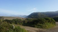
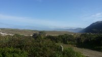
We began the next morning. Mattole Campground is remote and gorgeous. In the morning light we got to see how beautiful the area was:
The trail starts off on soft sand which can be a slog. However, with the waves crashing from the Pacific to our right, and hills descending to our right, who can complain?
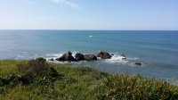
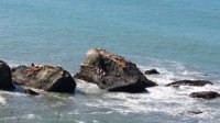
After a while we passed the lighthouse and beyond that, Sealion Gulch. Dropped our packs here and watched the sea lions bark and sun themselves.
Eventually we put in at Spanish Flat and made camp on the sand at the beach. The sky was beautiful when we got there but over the next 1 or so, became darker and darker near sunset. It started to drizzle then flat out rain. We sat in a miserable camp with a pitiful fire until the winds really picked up and kept tossing my tent. My gear became damp including my sleeping bag. Decided to bail sleeping on the beach and moved camp upland about 200 yards. Found a clump of trees that made a small 'tree cave' which had ZERO wind. Funny how that happens. Retired to bed early. All night I heard the storm smashing waves against the beach.
Woke up the next morning to calm clear skies. Broke camp and back on the trail.
There are several sections of the trial that are impassable at high tide so you need to consult your tide chart. Some of these sections are long (several miles) so you don't want to get stuck in the middle of them during high tide. In the past, hikers had to be rescued after being trapped between the cliffs and the sea.
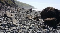
These sections are usually very very rocky.
This should give an indication of HOW rocky. Imagine scrambling over this stuff for 2 miles.
Well, my hiking boots agreed. During one of these traverses I noticed that my right boot started to fall apart. The sole of the boot came completely detached from my boot. I had to hobble miles over these rocks with 1 boot, and 1 'slipper'. I stopped several times to try and jury-rig my sole back onto my booth with rope, etc. but nothing worked. It would hold for 5-10 minutes before smaller rocks would work their way between the sole and the boot and rip it back open.
Eventually my left boot didn't want to be left out and IT also ripped open at the sole. I appreciated the symmetry.
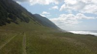
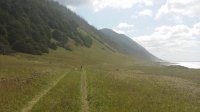
Luckily for me, although the trail does traverse beach and rocks, it also spends a great deal of time on the flats above the ocean, which make for easy hiking in my new "slippers".
Eventually we hiked to Randall Creek and made camp. Of course, after setting up camp I realized that I couldn't find my sleeping pad. Searched all around before I realized to my horror that it must have come loose on the last impassable section and fallen off my pack (I didn't have it secured properly). The prospect of sleeping on the cold ground made me RUN as fast as I can. I found my pack .5 mile back on the beach, partially in the surf. It was about 2 minutes away from being swept out to sea before I plucked it from the water. I high-tailed it back to camp before I got stuck out there as the tide was coming in fast.
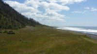
Although my boots were junk, I had a wet sleeping bag and blisters on my feet, I had a view like this:
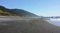
The next day we hiked out. For most part, the hike from Randall's creek to the Shelter Cove was flat and on the beach:
Hiking in soft black sand with a heavy pack isn't fun so we'd try to hike on the hard pack near the water before the surf would roll in and chase us back up the beach. Rinse and repeat.
All in all one of my favorite hikes. I've been very hesitant to hike in California given how nervous I am about bears which are habituated to humans; this hike REQUIRES a bear canister. But we didn't see a single bruin although we saw plenty of tracks in the sand. It really is a remote hike and you get a real sense of wilderness despite being next to the ocean. Highly recommend. If I ever go ultra-light, it would be a really relaxing and easy trail.
EDIT: It appears none of my pics are showing. I have them on Drop-Box, don't know if that's an issue. I'll upload them when I get a chance. Sorry!!


Last edited by a moderator:
