- Joined
- Jan 4, 2015
- Messages
- 2,901
For the past half-decade or so, one of my outdoor projects has been exploring the main crest of the eastern Uintas. Unlike the western Uintas, the eastern part of the range is gentle and rolling - great for walking right on the crest. I hiked the crest from Leidy Peak to Chepeta Lake in 2016 and Chepeta Lake to Divide Pass in 2017 with @Stickerbumper. In 2018, @Stickerbumper, @Capsnack and I walked from Leidy Peak to North Pole Pass as part of a UHT-like sojourn. But that highest/hardest/longest stretch, between Divide Pass and Gilbert Peak, kept eluding me for one reason or another.
So in 2020, I took advantage of a good weather window in late June to finally knock out that Gilbert Peak-Divide Pass section. I did it as a loop hike, "Looping the Highline" style, as our good pal @Perry would put it. Except you don't get his great storytelling ability, video, or photographic abilities. You get my smartphone photos and shoddy writing. We're all pulling for you, @Perry!
Day 1
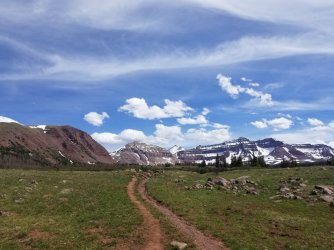
I rolled up to the Henrys Fork Trailhead about mid-afternoon and enjoyed a very lazy stroll up to the Dollar Lake area. There were still patches of snow here and there, but mostly it was just very wet and muddy, particularly when I crossed a meadow to get up above Dollar. I didn't actually camp at Dollar of course - it's kind of a crappy lake in my opinion. I found a wonderful spot just on the edge of treeline and made early camp, resolving to get a nice early start the next morning.
Day 2
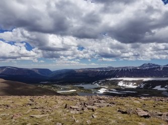
This was the big one. I had 14 tough miles to do between here and Divide Pass - all off-trail, above 12,000 feet. As promised, I got an early start, and was very grateful for my microspikes on some steep, north-facing frozen snow. I ascended the ridge east of Dollar Lake, quickly gaining elevation - and a great view of the Henrys Fork Basin. Once I'd gained a thousand feet or so, things leveled out and turned into a broad plateau. I debated making a side trip to tag Gunsight Peak, but decided against it. As it turns out, that was a wise decision.
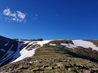
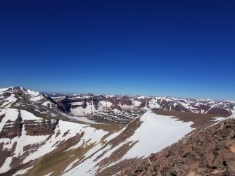
I gradually gained the rest of my elevation, topping out on Gilbert without too much trouble. Gilbert was mostly grassy slopes with embedded talus, and the summit was broader and flatter than it looks from afar. That was a little disappointing, as it didn't make for particularly great photos. But I sure did have a gorgeous view of the Kings/Emmons ridgeline, as well as the various basins below, each lake sparkling in the early morning sunshine.
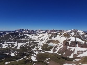
The east ridge of Gilbert was the only spot I was nervous about on this trip. I hadn't found any beta on it, and I was only about 80% sure it would go. It turned out not to be a problem - class II verging on class III in a couple spots, and not much harder than the side trip to Kings from Anderson Pass. After a couple narrow spots, things broadened out again. Shortly thereafter, I hit a large snowfield and ended up doing some pretty obnoxious postholing as the snow baked in the intense sunshine.
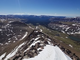
Until about mid-morning, I was rolling right along, making pretty good time and generally loving life. But then I hit the dreaded talus. I'd had pretty severe ankle pain a few months prior - bad enough that I'd had to bail in the middle of a hundred-mile backpacking trip. I thought it was in the rearview mirror... until hours upon hours of tedious talus at twelve thousand feet brought those problems roaring back to life. Throughout the course of the day, the talus got worse and worse, and so did my ankle. @Perry talked up how annoying that talus was on that section of the crest - and he was right. No matter though, it was beautiful, albeit slow and painful going.
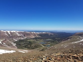
Around mid-afternoon, some clouds built up and a cold wind started blowing, but the monsoon hadn't really fired up yet for the summer, and the clouds passed without incident. I'd planned several bailout options in case I needed to escape off the ridge, but it turned out not to be necessary, even with my slow pace/gimpy ankle.
The whole while, I enjoyed peering into the cirques on the north side of the ridge. The whole Uinta crest is punctuated by cirque after cirque. The crest may be smooth on top, but it quickly drops off precipitously, where you can tell that glaciers did their thing in aeons past.
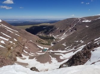
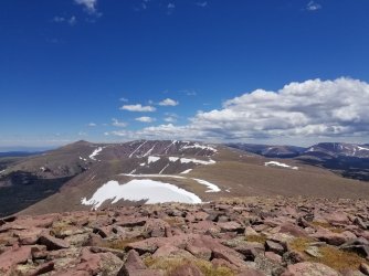
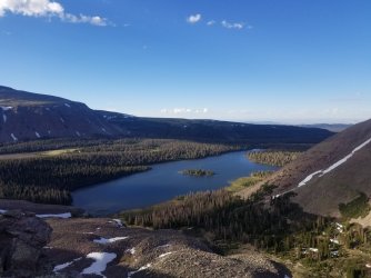
About 14 miles and 13 hours later, I finally dropped down to Divide Pass, ending the ridgetop section of the trip. It was incredibly scenic and I was incredibly blessed to have a stable-enough weather window to spend an entire day on a ridgeline. But mostly at that moment, my ankle was howling at me, and so after a mile or so down a trail to Island Lake, I made a crappy camp in a not-particularly-level site.
Day 3
I woke up, and my ankle just hurt so bad. I could hardly walk on it, and had to spend 15-20 minutes out of every hour just sitting down and resting, getting a break from the pain. Something was seriously wrong.
So progress was slow, as I made my way north down a faint/disappearing trail to the junction with the Northside Highline Trail. I lost the trail several times, but I just headed in the right direction and generally found it again after a few tenths of a mile. At the North Side Highline Trail junction, I headed west, back toward Henrys Fork.
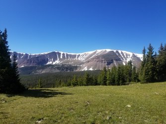
The North Side Highline was an odd mix of really beautiful (near/above treeline) and quite bland (deep in trees, often in burnt/beetle-killed forests). One of the highlights was Thompson Pass, where I spied a massive herd of elk while nursing my ankle. When I stood up again, they suddenly saw me and bolted. Thompson Pass had quite the cornice on its east side, but I was able to find a weakness in it where I could chop some steps.
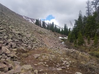
My ankle was very slightly better in the afternoon, but the trail was indistinct and pretty burnt in spots. Oh well, it's a seldom-used trail in a Wilderness area. I don't want all trails to be well-marked, manicured productions. This way adds a little intrigue! I made camp in a really nice spot, having only done about 16 miles or so. But those miles really hurt. Hopefully things would be better in the morning.
Day 4
Things were better in the morning, but not by much. I still had to rest the ankle several times an hour, but at least i was making forward progress. I walked through Deadhorse Park, the only real scenic highlight of the day. Soon enough, I dropped down to Elkhorn Crossing and Henrys Fork Creek, where I closed the loop. A couple quick-ish miles to the trailhead later, I was cooking some hot food at my car and savoring a can of pop. Despite the ankle trouble, it was a fun little adventure, and I was happy to have finally seen that stretch of ridgeline that'd been eluding me for years.
A few weeks later, I started an 800-mile walk through the Greater Yellowstone. On Day 2, the dreaded ankle pain came back with a vengeance. But at lunch on Day 3, I had a sudden realization - I attribute it to divine intervention. My insole was too big. Despite having gone through probably 30 pairs of the exact same shoe over the years, something changed in La Sportiva's 2020 production run. The stock insole just didn't fit the shoe, and put my foot in an awkward position that stressed my foot and ankle. I pulled out my mini Swiss Army knife, cut a quarter inch off the toe of the insole, and within a day, the foot problems were history. Until I broke said foot a few months later, but that's a story for another day!
