- Joined
- Aug 8, 2016
- Messages
- 2,078
This is the second in a series of three day solo backpacking trips in the interior of the Uinta Mountains. The theme involves avoiding out-and-back routes, making a loop involving the Highline trail. You have to get pretty creative to keep the mileage manageable for a three or four day trip. This is one that has become one of my favorites.
Heres a video of the adventure if you would like.
On the way into to the trail head a view of Tokewanna Peak whets the appetite.
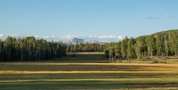
The East Fork Blacks Fork trail traverses through forest, across meadows and of course includes numerous river crossings. I managed to keep dry feet on all crossings only to end up stepping in a hole full of water when crossing a meadow. Grrrr!
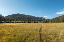
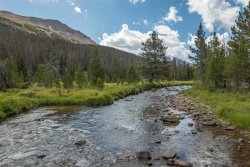
Lunch break would be in a stand of trees next to the river to take shelter from the first of several rain events that day. While having my lunch here I would get rained on, hailed on, sun came out, and wind whipped up a couple of times. I ended up having to get out my poncho tarp to cover up my pack and myself but stayed mostly dry.
As a consolation I had a good view of Mt Tokewanna to the west.
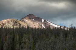
Trail begins climbing up through the trees to reveal the ridge line separating the main canyon from Little East Fork Blacks Fork.

First peek at Quandary Peak.
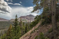
Coming out of the trees I found a nice big meadow with some picture opportunities. Got out the tripod and started shooting when clouds came in bringing rain and hail once again. I did manage at least one picture though.

A look back to the east at the lower end of Little East Fork Blacks Fork.
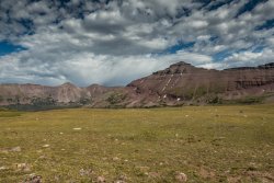
Rain came through again after leaving tree line. There was no place to shelter so I thought I probably should put on my poncho tarp. As hard as I tried could not manage to get the poncho up and over my backpack. I tried everything I could think of. As I continued to wrestle with the dang thing I look up and there is sunshine and blue sky above me (grrrrr). I wasted a bunch of time for nothing.
The trail continues up to the very head of the main drainage then climbs up a series of long switch backs. It was quite a haul.
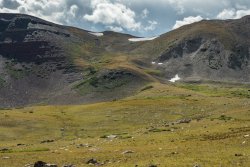
It would rain on me yet again as I neared the top but was rewarded with a beautiful rainbow show.
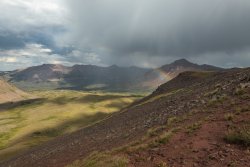
More rewards. Looking off to the west into West Fork Blacks Fork. Impressive Mt Beulah commands respect.
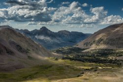
Finally over the top the Lake Fork River Drainage is revealed with Mt Lovenia standing watch.
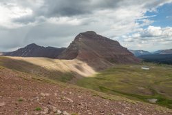
Arriving at Red Knob Pass was a bit disappointing as the clouds were blocking the sun. No good light on the head of West Fork Blacks Fork, home of beautiful Dead Horse Lake.
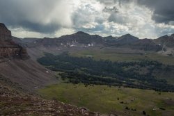
I waited as long as I could hoping for a break in the clouds. Finally got a bit of light and a poor shot of Dead Horse Lake.
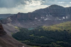
Zooming in I was able to capture the heads of several drainages in the area. I hadn't realized the close proximity of so many of them. I had just crossed over from the East Fork Blacks Fork. Standing on Red Knob Pass I had Lake Fork River Drainage at my back. In the foreground is West Fork Blacks Fork. Over the first low pass is Left Hand Fork Bear River home of Allsop Lake. Over the next ridge running up to Yard Peak is the head of the Rock Creek Drainage flowing to the south. Over the next pass between the Yard Peaks is the Right Hand Fork Bear River Drainage containing Priord Lake. I'm pretty sure over the next high ridge is the Amethyst Lake Basin area. I might be wrong on some of this but seems right to me. Pretty amazing.
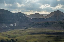
Camp that night would be along the Highline Trail in the Lake Fork drainage not too far from the Lake Fork River Trail junction. Not the best choice as the grass was wet from the rain and it's pretty low-lying near the river. It was damp and cold but after 15.7 miles sleep came quickly.
Next morning I got back on the trail just before 8 am. Arriving in the Lambert Meadow area I was treated to a beautiful stream crossing.
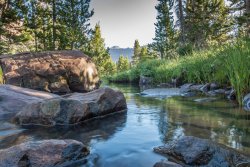
Although I had been through the area in 2017 I never realized how far back it goes.... and how beautiful. Sure wish I could have camped here.
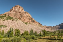
Love the numerous tarns in the area. Reflections are delicious.
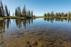
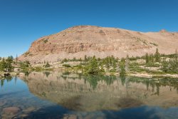
First glimpse of the Oweep Creek Drainage. Sure looks like a long way over there!
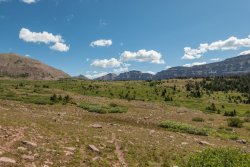
Passing by Squaw Pass leading to the head of Little East Fork Blacks Fork.
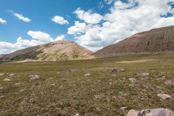
Next up: Off trail, up and over the pass to the Smith Fork Drainage. Actually found some cairns running up right-hand side suggesting a way up. It wasn't all that bad gaining the pass.
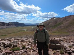
A shot of my favorite view along the Highline Trail.

Over to the Smiths Fork side the views continue to amaze. Wilson Peak and Red Castle Peaks along with three of the Red Castle lakes.

Part way down from the pass Upper Red Castle Lake with Wilson Peak as a back drop.

Passing by Red Castle lake I finally found a normal trail after traveling over rocks and rocks and more rocks. Numerous cliff bands along the way required some navigation to find reasonable routes. I took what I think is an older trail below Red Castle Lake. Foot path was only visible occasionally. I found no blazes or cairns until it would rejoin the more formal trail just above Lower Red Castle Lake the next day.
Glad I went this way though. Otherwise I would have missed this fortuitous tarn.
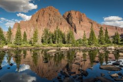
Camp two will definitely do!
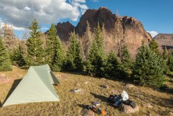
It was a hard day coming over that off-trail pass at the end of a long day. I had hoped to have made it part way up the Bald Mountain trail to make camp so I didn't have a long final day. After 13 miles I was done for the day.
Final day. Looking back at Red Castle as I approach the Bald Mountain Trail junction. What an impressive mountain!
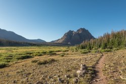
The Bald Mountain trail pulls up through the trees to finally reveal the saddle to which I would head. I was hoping the trail might pass below one of the numerous snow drifts so that I might get a cold drink of water. It was not to be as the trail heads off to the north from the just below the saddle.
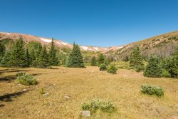
Final climb up to the saddle was pretty steep. Some switch backs helped somewhat but the views rewarded.
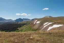
Once on top its a different world. Expansive in every direction.
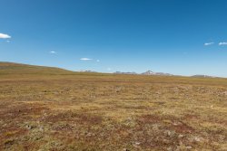
Heading toward Bald Mountain the distances are hard to judge.
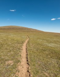
The trail runs along the east below the summit of Bald Mountain providing views of many of the prominent peaks. If I'm not mistaken the peak almost dead center is Kings Peak.
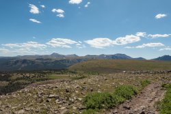
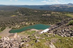
Gorgeous Bald Lake below.
From here the trail descends back down to the East Fork Blacks Fork trail. Since I had to cut day two's miles short this was a longer day that I had planned. However, the incentive of Mexican food in Evanston provided much-needed motivation for the 11+ miles out. It was a great trip. I highly recommend the route.
Heres a video of the adventure if you would like.
On the way into to the trail head a view of Tokewanna Peak whets the appetite.

The East Fork Blacks Fork trail traverses through forest, across meadows and of course includes numerous river crossings. I managed to keep dry feet on all crossings only to end up stepping in a hole full of water when crossing a meadow. Grrrr!


Lunch break would be in a stand of trees next to the river to take shelter from the first of several rain events that day. While having my lunch here I would get rained on, hailed on, sun came out, and wind whipped up a couple of times. I ended up having to get out my poncho tarp to cover up my pack and myself but stayed mostly dry.
As a consolation I had a good view of Mt Tokewanna to the west.

Trail begins climbing up through the trees to reveal the ridge line separating the main canyon from Little East Fork Blacks Fork.

First peek at Quandary Peak.

Coming out of the trees I found a nice big meadow with some picture opportunities. Got out the tripod and started shooting when clouds came in bringing rain and hail once again. I did manage at least one picture though.

A look back to the east at the lower end of Little East Fork Blacks Fork.

Rain came through again after leaving tree line. There was no place to shelter so I thought I probably should put on my poncho tarp. As hard as I tried could not manage to get the poncho up and over my backpack. I tried everything I could think of. As I continued to wrestle with the dang thing I look up and there is sunshine and blue sky above me (grrrrr). I wasted a bunch of time for nothing.
The trail continues up to the very head of the main drainage then climbs up a series of long switch backs. It was quite a haul.

It would rain on me yet again as I neared the top but was rewarded with a beautiful rainbow show.

More rewards. Looking off to the west into West Fork Blacks Fork. Impressive Mt Beulah commands respect.

Finally over the top the Lake Fork River Drainage is revealed with Mt Lovenia standing watch.

Arriving at Red Knob Pass was a bit disappointing as the clouds were blocking the sun. No good light on the head of West Fork Blacks Fork, home of beautiful Dead Horse Lake.

I waited as long as I could hoping for a break in the clouds. Finally got a bit of light and a poor shot of Dead Horse Lake.

Zooming in I was able to capture the heads of several drainages in the area. I hadn't realized the close proximity of so many of them. I had just crossed over from the East Fork Blacks Fork. Standing on Red Knob Pass I had Lake Fork River Drainage at my back. In the foreground is West Fork Blacks Fork. Over the first low pass is Left Hand Fork Bear River home of Allsop Lake. Over the next ridge running up to Yard Peak is the head of the Rock Creek Drainage flowing to the south. Over the next pass between the Yard Peaks is the Right Hand Fork Bear River Drainage containing Priord Lake. I'm pretty sure over the next high ridge is the Amethyst Lake Basin area. I might be wrong on some of this but seems right to me. Pretty amazing.

Camp that night would be along the Highline Trail in the Lake Fork drainage not too far from the Lake Fork River Trail junction. Not the best choice as the grass was wet from the rain and it's pretty low-lying near the river. It was damp and cold but after 15.7 miles sleep came quickly.
Next morning I got back on the trail just before 8 am. Arriving in the Lambert Meadow area I was treated to a beautiful stream crossing.

Although I had been through the area in 2017 I never realized how far back it goes.... and how beautiful. Sure wish I could have camped here.

Love the numerous tarns in the area. Reflections are delicious.


First glimpse of the Oweep Creek Drainage. Sure looks like a long way over there!

Passing by Squaw Pass leading to the head of Little East Fork Blacks Fork.

Next up: Off trail, up and over the pass to the Smith Fork Drainage. Actually found some cairns running up right-hand side suggesting a way up. It wasn't all that bad gaining the pass.

A shot of my favorite view along the Highline Trail.

Over to the Smiths Fork side the views continue to amaze. Wilson Peak and Red Castle Peaks along with three of the Red Castle lakes.

Part way down from the pass Upper Red Castle Lake with Wilson Peak as a back drop.

Passing by Red Castle lake I finally found a normal trail after traveling over rocks and rocks and more rocks. Numerous cliff bands along the way required some navigation to find reasonable routes. I took what I think is an older trail below Red Castle Lake. Foot path was only visible occasionally. I found no blazes or cairns until it would rejoin the more formal trail just above Lower Red Castle Lake the next day.
Glad I went this way though. Otherwise I would have missed this fortuitous tarn.

Camp two will definitely do!

It was a hard day coming over that off-trail pass at the end of a long day. I had hoped to have made it part way up the Bald Mountain trail to make camp so I didn't have a long final day. After 13 miles I was done for the day.
Final day. Looking back at Red Castle as I approach the Bald Mountain Trail junction. What an impressive mountain!

The Bald Mountain trail pulls up through the trees to finally reveal the saddle to which I would head. I was hoping the trail might pass below one of the numerous snow drifts so that I might get a cold drink of water. It was not to be as the trail heads off to the north from the just below the saddle.

Final climb up to the saddle was pretty steep. Some switch backs helped somewhat but the views rewarded.

Once on top its a different world. Expansive in every direction.

Heading toward Bald Mountain the distances are hard to judge.

The trail runs along the east below the summit of Bald Mountain providing views of many of the prominent peaks. If I'm not mistaken the peak almost dead center is Kings Peak.

Gorgeous Bald Lake below.

From here the trail descends back down to the East Fork Blacks Fork trail. Since I had to cut day two's miles short this was a longer day that I had planned. However, the incentive of Mexican food in Evanston provided much-needed motivation for the 11+ miles out. It was a great trip. I highly recommend the route.
Last edited:
