- Joined
- Dec 23, 2013
- Messages
- 4,114
On Bastille Day 2020, I hiked to the top of Broads Fork Twin Peaks for my 56th. So this year, I chose Lone Peak to celebrate good old 57. Now the last time that I summited Lone Peak was nine years ago, and I thought then that it was a pretty strenuous hike for a young lad of 48. So since March, I have been training so to speak for this hike. Being older now, I figure what I've lost in strength, speed, coordination and endurance, I can make up for in wisdom. Can't I? Yeah right! 
A couple of weeks ago, @Ugly suggested that I try the Trail of the Eagle on my summit attempt, instead of the Cherry Canyon Logging Trail. Having never heard of this trail before, Ugly was kind enough to give me some beta on it, and I made the trailhead decision to take it up the mountain.
We, Katie and I that is, arrived at the Orson Smith Trailhead at 5:30 am. The car thermometer read 81 degrees, and to me it felt like there was some humidity in the air. I was expecting it to be a hot day so I had five Nalgene bottles full of water (one of which was frozen) and a 32 oz, green apple Gatorade, while Katie had 4 Nalgenes, again one frozen, and a smaller bottle of blue, sorry, I can't remember the flavor, Gatorade.
We hit the trail at 5:40 and made our way up to the Bonneville Shoreline Trail (Perhaps the old BST). Once reaching the BST, we turned north for about 0.3 miles, where we crossed a suspension bridge that spans Bear Canyon. Right after crossing the bridge, we took the first right and soon after we came to the sign for Trail of the Eagle. The trail begins by switchbacking up the ridge before moving over to north side of the ridge. At this point, you have views down into Little Willow Canyon. Eventually the trail gains the ridge proper again and we made our way up to roughly 8700 feet, where Trail of the Eagle meets the Cherry Canyon Logging Trail. A couple of interesting things to mention along this stretch: One, we found @Ugly's cache of circus peanuts at 7440 feet. I can't tell you how appreciative we were for hiking those up there for us. And be sure and tell your daughter thanks too for leaving us eight peanuts.
Well, soon after the peanut find, we had the bejeebies scared out of us by a grouse that took flight right in front of us. Katie took the brunt of the scare, but it made me jump too.
Once on the Cherry Canyon Logging Trail, it wasn't long before we made to Outlaw Cabin. The cabin was built back in 1978, before the wilderness designation, and it might have some kind of functionality to it today, even though it is a bit run down. At the cabin, we stopped for a snack break and to take some pictures.
Once we left the cabin, it was now time to work our way up the upper portion of Little Willow Canyon, which is kind of steep, and it seems to this old fart to go on forever. I was beginning to feel it as we reached the very upper part of the canyon, but soon was rewarded with our first views of Lone Peak and the Lone Peak Cirque.
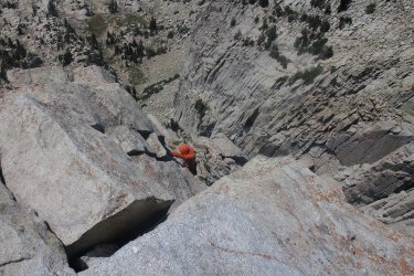
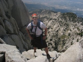
At this point, we made our way down off the ridge and worked our way to the base of the summit ridge of Lone Peak. Once we reached about 2/3rds of the way along the ridge, it's time to put on our scrambling shoes and scramble across the knife edge that leads to the summit.
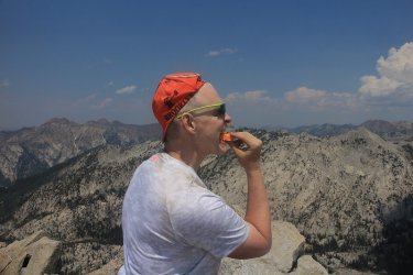
After reaching the summit, we took summit shots and ate our lunches. We also got to chat with a couple of rock climbers who had climbed the face of the peak and arrived at the top during our lunch. We were lucky, all the smoke that had been in the surrounding area from forest fires from other states, up to the 13th, had pretty much cleared out, so the views were incredible.
Just as we were finishing up our lunches, and the climbers had started to work their way over to the south summit of Lone Peak, we heard thunder to the west as some cumulus clouds were beginning to build up above the valley floor. Packing what was left of our lunches away, we beat a hasty retreat off the summit and summit ridge, and dropped down into the cirque proper.
At this point we took the Jacob's Ladder Trail down. "Trail" at this point is being kind. Working our way down, across and through granite slabs and boulders would probably be more accurate. At one point, we ended up heading further south than we should have, and we had to climb back up to find the trail, which did not amuse my daughter. Or maybe it was the drizzling rain that had her out of sorts.
  Of course, on this stretch of being semi-lost and wet, we saw three deer to make up for it.
We eventually found the Jacob's Ladder Trail and began heading down the mountain. Eventually we reached the Draper Ridge Trail, where we followed it for a short distance before hooking up with a connector trail that leads back to the Cherry Canyon Logging Trail. This connector trail has grown up quite a bit over the last nine years, and was hard for me to locate at first. And as we approached the Cherry Canyon end of the trail, small aspen trees had bent down over the connector, making for a bit of bushwhacking that I had not anticipated.
Now that we had reached the Cherry Canyon Logging Trail, we followed its many switchbacks down the mountain and back to the trailhead. I'm pretty sure along this stretch, I saw more lizards than I have ever seen while hiking in the Wasatch.
We got back to the Subaru at 8:02 pm, making it a 14 hour and 22 minute day, but I couldn't think of a better way to celebrate number 57.
What is the French word for Scatman? Homme de caca?
Shots of our hike:
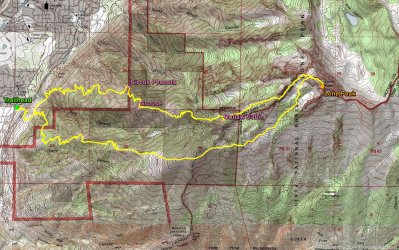
Overview of our route
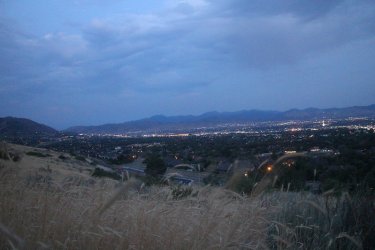
5:45 am, and we have reached the shoreline trail
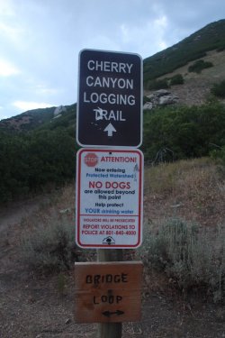
The way we will return to the trailhead
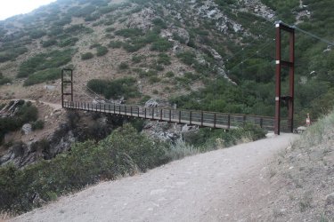
The suspension bridge over Bear Canyon
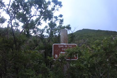
Sign partially covered for Trail of the Eagle
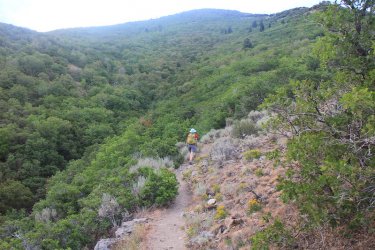
Making our way up Trail of the Eagke
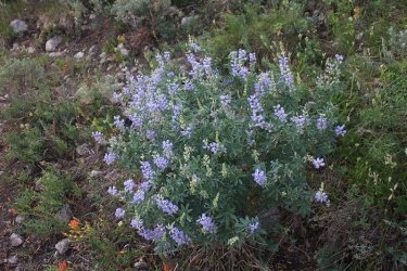
Lupine was plentiful above 7000 feet
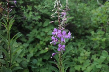
The only fireweed we saw the entire day was a few plants along Trail of the Eagle

Finding @Ugly's cache! Made our day. @Rockskipper, I've got the UTM coordinates of the cache if you are interested. Never
know when you might want a peanut.
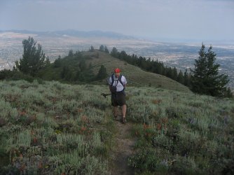
Moseying, amongst the paintbrush, towards the Cherry Canyon Logging Trail
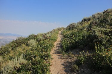
Looking up the Cherry Canyon Logging Trail from the intersection with the Trail of the Eagle Trail
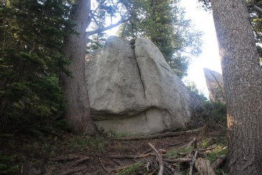
Staring to see some large granite boulders as we climb
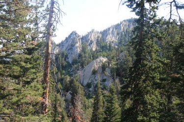
Granite everywhere to our north
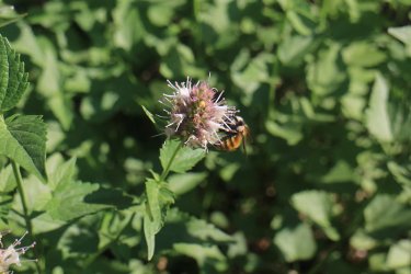
A bumble bee enjoying some horsemint. Some sections of the trail had overwhelming smell of mint as we hiked along.
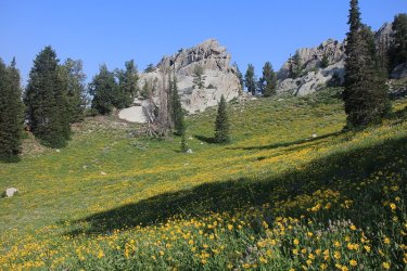
Pretty views as we make our way towards Outlaw Cabin. Meadow full of false sunflowers
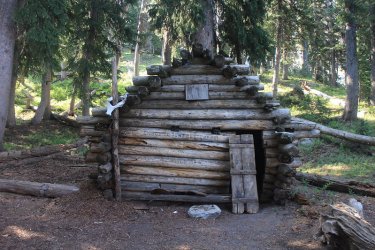
Outlaw Cabin
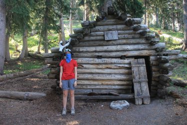
And an Outlaw to boot!
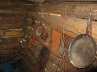
I could use a good cast iron skillet meal about now. Burger Boy is always hungry.
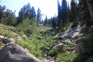
Beginning the section up the Little Willow Creek Drainage
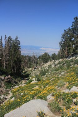
Looking back down the drainage towards the valley
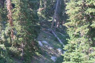
Our first deer sighting
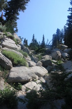
Aargh! Upper reaches of the drainage
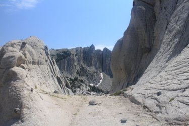
Worth the view though - Lone Peak summit across the cirque
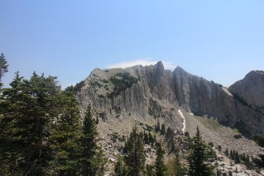
Working our way down to the base of the summit ridge
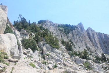
Still working our way across
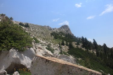
Lone Peak summit above - starting our climb up the ridge
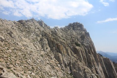
Almost to the top of the ridge
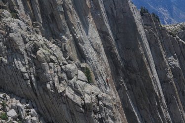
One of the rock climbers moving up the face of Lone Peak
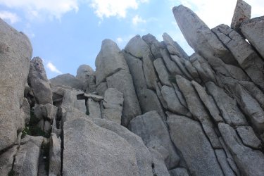
Time to put on our scramble shoes.
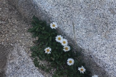
Daisies among the granite rocks
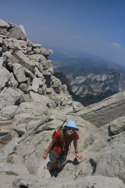
Scrambling towards the summit
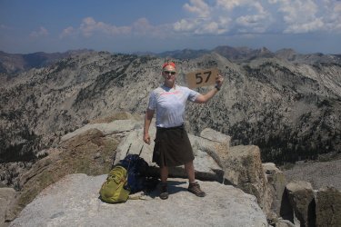
Summit shot
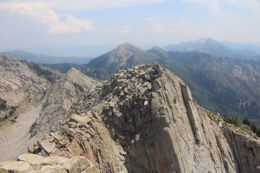
A look over at the south summit
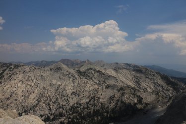
Looking east along "The Beatout" towards the Pfeifferhorn
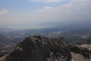
Utah Lake below to the southwest
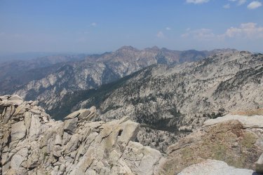
Broads Fork Twin Peaks, Sunrise Peak, and Dromedary Peak to the north
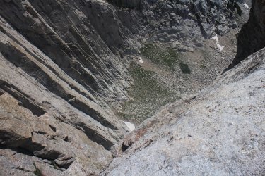
Looking down the cirque from the summit
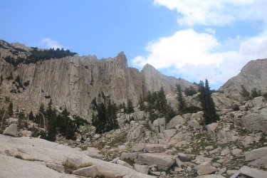
Lone Peak - heading down
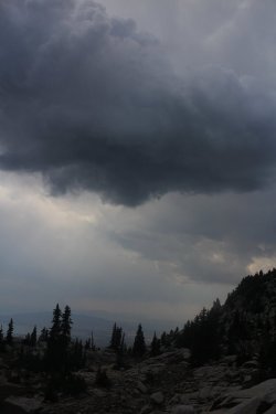
Storm clouds moving in
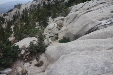
Making our way across, down, through the granite slabs looking for the trail
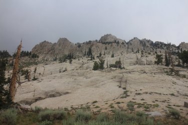
View of the ridge to the north
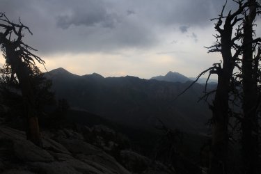
Stormy over Box Elder and Timp.
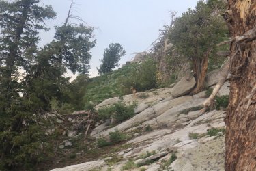
One of the deer that we saw while getting back to the trail
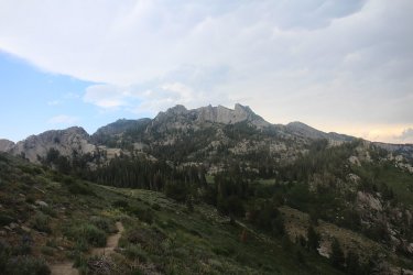
A look back up at Lone Peak
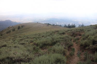
Heading on to the Draper Ridge Trail
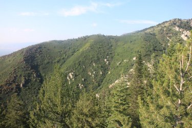
Back on the Cherry Canyon Logging Trail - Looking north at the ridge where the Trail of the Eagle is located and where we were
earlier in the day.
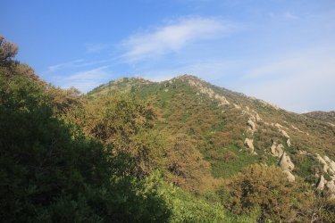
View looking back while heading down the Cherry Canyon Logging Trail
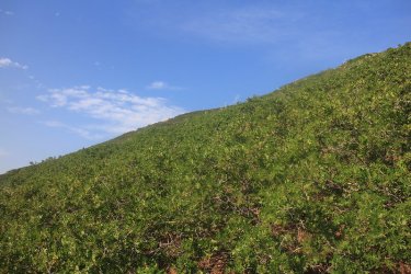
Sea of scrub oak
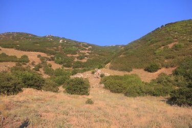
View from the Cherry Canyon Trail intersection with the Shoreline Trail. Almost back to the trailhead at this point.
The End.
A couple of weeks ago, @Ugly suggested that I try the Trail of the Eagle on my summit attempt, instead of the Cherry Canyon Logging Trail. Having never heard of this trail before, Ugly was kind enough to give me some beta on it, and I made the trailhead decision to take it up the mountain.
We, Katie and I that is, arrived at the Orson Smith Trailhead at 5:30 am. The car thermometer read 81 degrees, and to me it felt like there was some humidity in the air. I was expecting it to be a hot day so I had five Nalgene bottles full of water (one of which was frozen) and a 32 oz, green apple Gatorade, while Katie had 4 Nalgenes, again one frozen, and a smaller bottle of blue, sorry, I can't remember the flavor, Gatorade.
We hit the trail at 5:40 and made our way up to the Bonneville Shoreline Trail (Perhaps the old BST). Once reaching the BST, we turned north for about 0.3 miles, where we crossed a suspension bridge that spans Bear Canyon. Right after crossing the bridge, we took the first right and soon after we came to the sign for Trail of the Eagle. The trail begins by switchbacking up the ridge before moving over to north side of the ridge. At this point, you have views down into Little Willow Canyon. Eventually the trail gains the ridge proper again and we made our way up to roughly 8700 feet, where Trail of the Eagle meets the Cherry Canyon Logging Trail. A couple of interesting things to mention along this stretch: One, we found @Ugly's cache of circus peanuts at 7440 feet. I can't tell you how appreciative we were for hiking those up there for us.
Well, soon after the peanut find, we had the bejeebies scared out of us by a grouse that took flight right in front of us. Katie took the brunt of the scare, but it made me jump too.
Once on the Cherry Canyon Logging Trail, it wasn't long before we made to Outlaw Cabin. The cabin was built back in 1978, before the wilderness designation, and it might have some kind of functionality to it today, even though it is a bit run down. At the cabin, we stopped for a snack break and to take some pictures.
Once we left the cabin, it was now time to work our way up the upper portion of Little Willow Canyon, which is kind of steep, and it seems to this old fart to go on forever. I was beginning to feel it as we reached the very upper part of the canyon, but soon was rewarded with our first views of Lone Peak and the Lone Peak Cirque.
At this point, we made our way down off the ridge and worked our way to the base of the summit ridge of Lone Peak. Once we reached about 2/3rds of the way along the ridge, it's time to put on our scrambling shoes and scramble across the knife edge that leads to the summit.
After reaching the summit, we took summit shots and ate our lunches. We also got to chat with a couple of rock climbers who had climbed the face of the peak and arrived at the top during our lunch. We were lucky, all the smoke that had been in the surrounding area from forest fires from other states, up to the 13th, had pretty much cleared out, so the views were incredible.
Just as we were finishing up our lunches, and the climbers had started to work their way over to the south summit of Lone Peak, we heard thunder to the west as some cumulus clouds were beginning to build up above the valley floor. Packing what was left of our lunches away, we beat a hasty retreat off the summit and summit ridge, and dropped down into the cirque proper.
At this point we took the Jacob's Ladder Trail down. "Trail" at this point is being kind. Working our way down, across and through granite slabs and boulders would probably be more accurate. At one point, we ended up heading further south than we should have, and we had to climb back up to find the trail, which did not amuse my daughter.
We eventually found the Jacob's Ladder Trail and began heading down the mountain. Eventually we reached the Draper Ridge Trail, where we followed it for a short distance before hooking up with a connector trail that leads back to the Cherry Canyon Logging Trail. This connector trail has grown up quite a bit over the last nine years, and was hard for me to locate at first. And as we approached the Cherry Canyon end of the trail, small aspen trees had bent down over the connector, making for a bit of bushwhacking that I had not anticipated.
Now that we had reached the Cherry Canyon Logging Trail, we followed its many switchbacks down the mountain and back to the trailhead. I'm pretty sure along this stretch, I saw more lizards than I have ever seen while hiking in the Wasatch.
We got back to the Subaru at 8:02 pm, making it a 14 hour and 22 minute day, but I couldn't think of a better way to celebrate number 57.
What is the French word for Scatman? Homme de caca?
Shots of our hike:

Overview of our route

5:45 am, and we have reached the shoreline trail

The way we will return to the trailhead

The suspension bridge over Bear Canyon

Sign partially covered for Trail of the Eagle

Making our way up Trail of the Eagke

Lupine was plentiful above 7000 feet

The only fireweed we saw the entire day was a few plants along Trail of the Eagle

Finding @Ugly's cache!
know when you might want a peanut.

Moseying, amongst the paintbrush, towards the Cherry Canyon Logging Trail

Looking up the Cherry Canyon Logging Trail from the intersection with the Trail of the Eagle Trail

Staring to see some large granite boulders as we climb

Granite everywhere to our north

A bumble bee enjoying some horsemint. Some sections of the trail had overwhelming smell of mint as we hiked along.

Pretty views as we make our way towards Outlaw Cabin. Meadow full of false sunflowers

Outlaw Cabin

And an Outlaw to boot!

I could use a good cast iron skillet meal about now. Burger Boy is always hungry.

Beginning the section up the Little Willow Creek Drainage

Looking back down the drainage towards the valley

Our first deer sighting

Aargh! Upper reaches of the drainage

Worth the view though - Lone Peak summit across the cirque

Working our way down to the base of the summit ridge

Still working our way across

Lone Peak summit above - starting our climb up the ridge

Almost to the top of the ridge

One of the rock climbers moving up the face of Lone Peak

Time to put on our scramble shoes.

Daisies among the granite rocks

Scrambling towards the summit

Summit shot

A look over at the south summit

Looking east along "The Beatout" towards the Pfeifferhorn

Utah Lake below to the southwest

Broads Fork Twin Peaks, Sunrise Peak, and Dromedary Peak to the north

Looking down the cirque from the summit

Lone Peak - heading down

Storm clouds moving in

Making our way across, down, through the granite slabs looking for the trail

View of the ridge to the north

Stormy over Box Elder and Timp.

One of the deer that we saw while getting back to the trail

A look back up at Lone Peak

Heading on to the Draper Ridge Trail

Back on the Cherry Canyon Logging Trail - Looking north at the ridge where the Trail of the Eagle is located and where we were
earlier in the day.

View looking back while heading down the Cherry Canyon Logging Trail

Sea of scrub oak

View from the Cherry Canyon Trail intersection with the Shoreline Trail. Almost back to the trailhead at this point.
The End.
Last edited:

 We are definitely going to be sauntering along Gneiss Creek and the Bechler come September.