- Joined
- May 31, 2015
- Messages
- 3,354
10-12 August, 2016
I never know how to name these. Lester Pass was a prominent landmark that we walked over, so I guess I'll make it the namesake of this thread.
I went to the Wind River Range with two friends, Gavin and Dan. As usual, the responsibility of planning the location and route fell on me. Everyone usually has me plan the route because they don't like to or don't know how to, I guess.
So we headed out and the drive was fine. I remember reading that the road to Elkhart Park is paved all the way, but when we drove it, it was all ripped up and they were doing a lot of grading. Most of the drive was on dirt. Anyone know whether they are (were) resurfacing it or reverting it to a dirt road?
We got to the trailhead and signed the register. At least 90% of the groups who had signed listed Titcomb Basin as their destination. Impressive.
We cruised through the first few miles to Photographers Point. I really liked the walk through the forest.
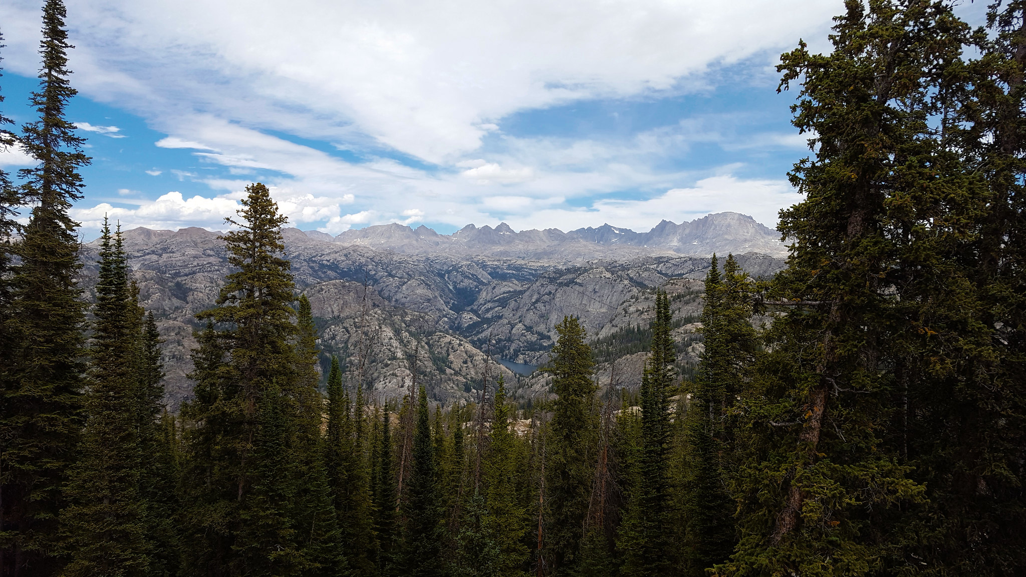
Standard view from Photographers Point
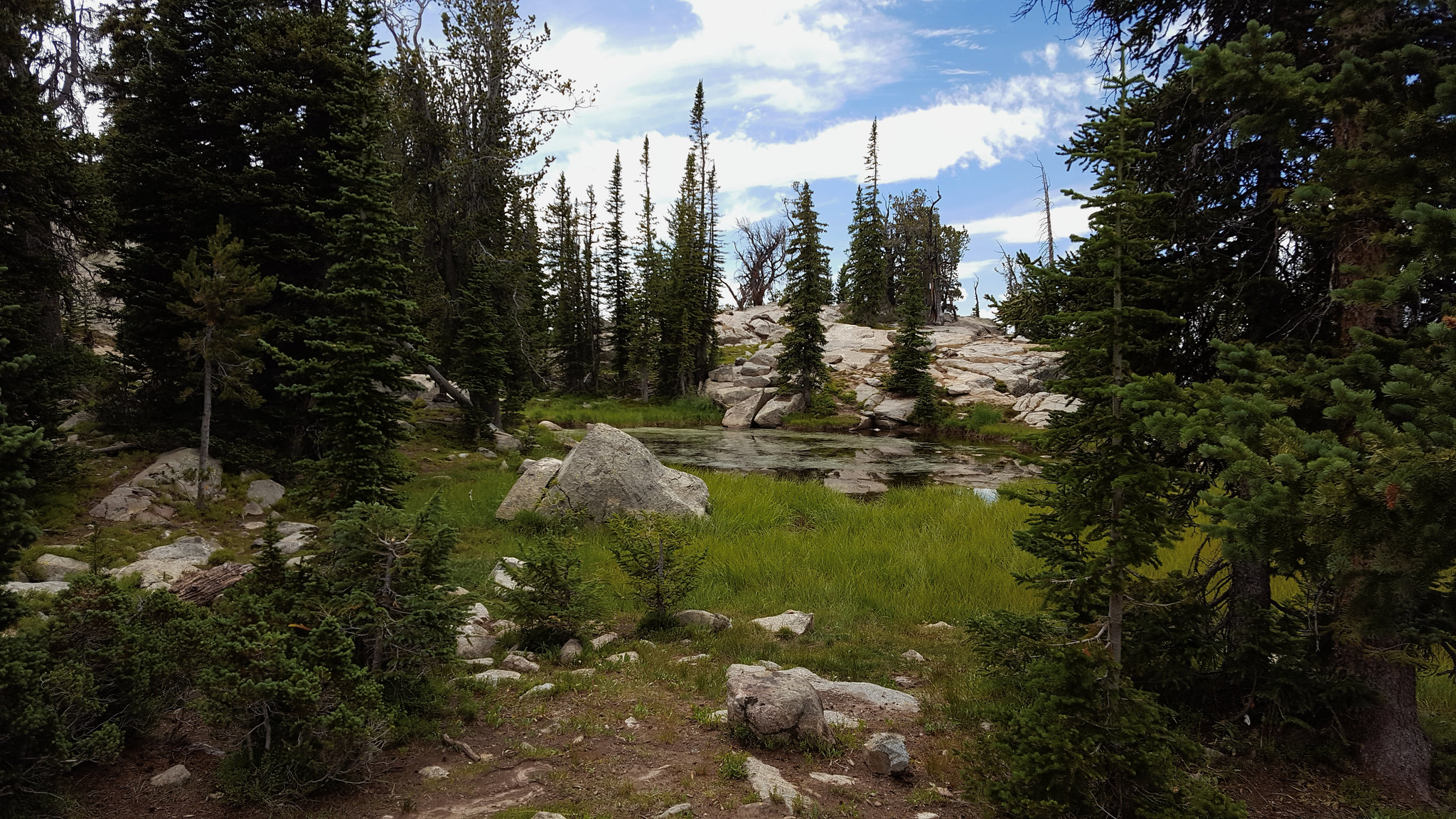
Pond at Photographers Point
We talked briefly to a guy and his two sons who were headed to 1000 Island Lake to fish for a few days. Then we got moving toward Pole Creek Lakes. There were so many ponds and lakes along the way. Very pretty.
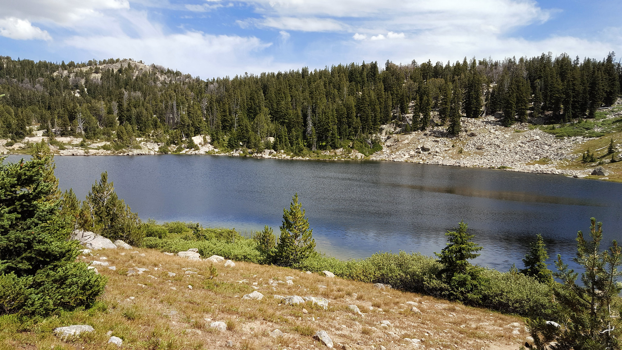
Lots of ponds/lakes like this
We eventually made it to the big Pole Creek Lake, and we headed over toward the others. Some stormy clouds had rolled in, so we looked for a good site, and found a great, flat spot backed up against a hill with some trees. We set up camp and had dinner on a big rock hill nearby. We had only seen one group since we left the Island Lake trail. Right on.
Pole Creek Pond
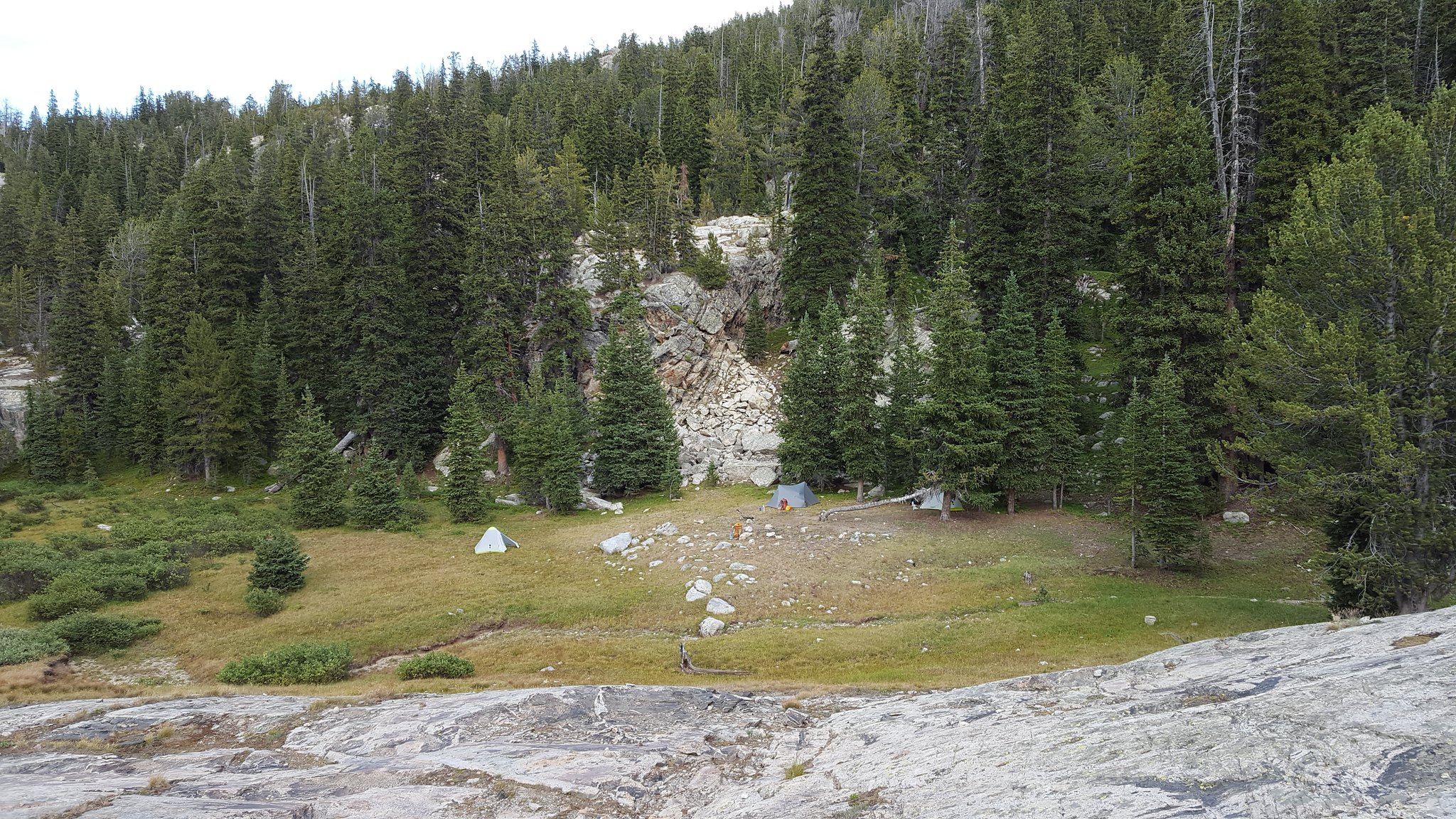
Crappy campsite picture
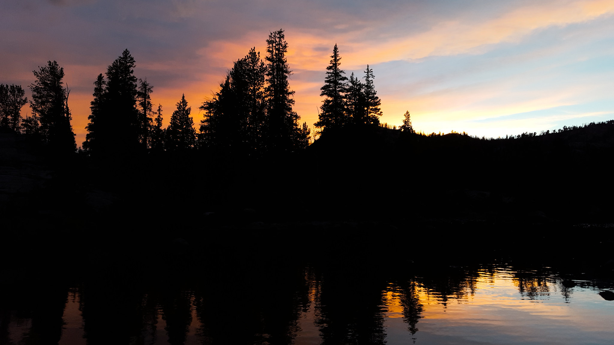
The clouds never produced any rain, and they broke in time for a nice sunset.
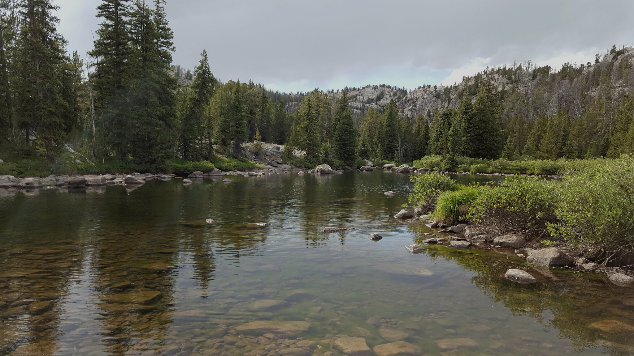
We headed out toward Lester Pass the next morning. Got a fairly early start. The walk was very nice. Lots of water and rocks.
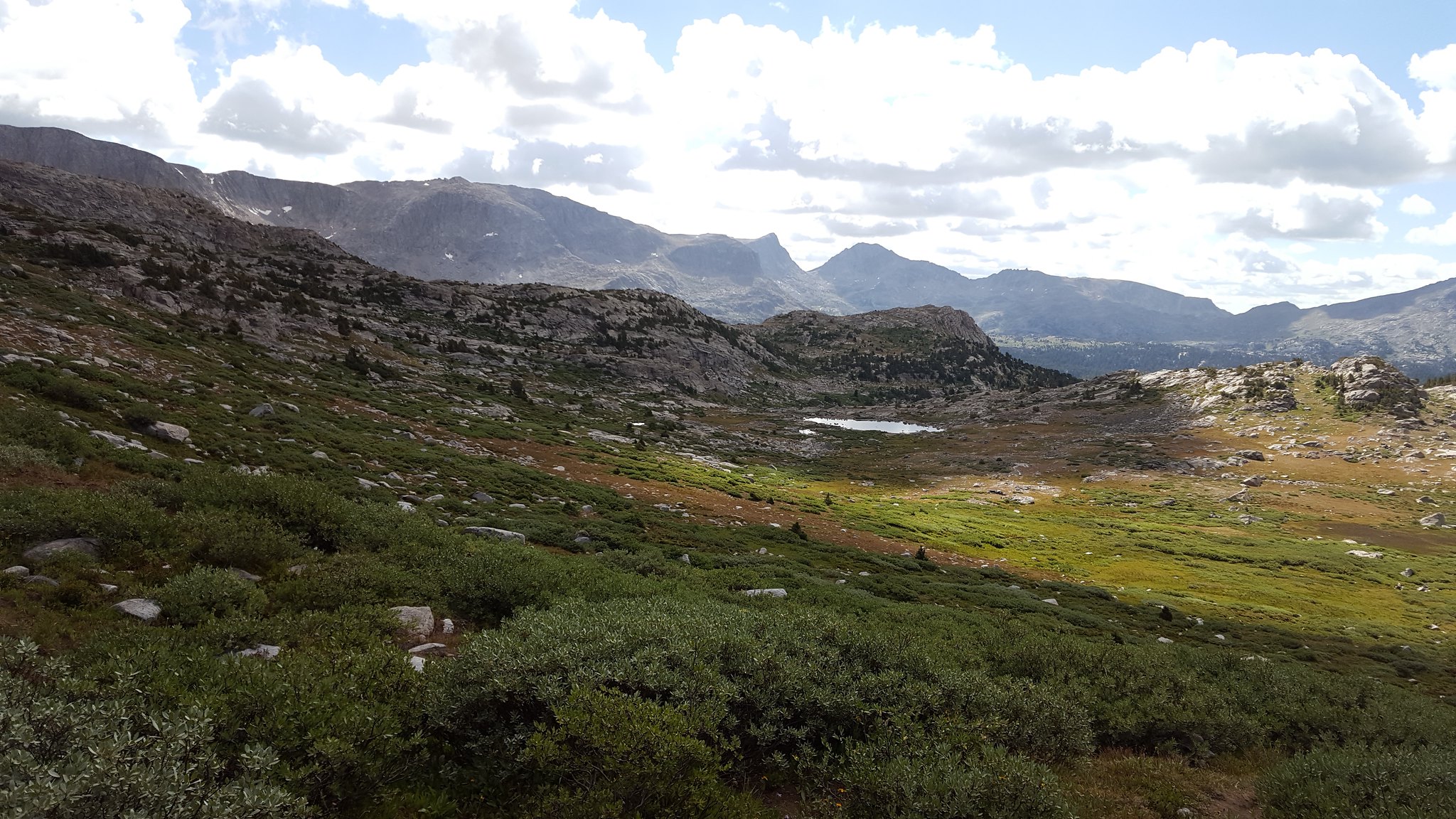
Meadow below Cook Lakes
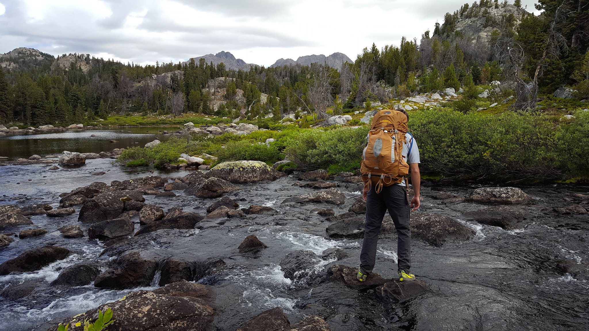
I remembered reading about a fairly large stream that we would have to ford near this area. We never ended up having to cross any high, swift streams. I guess the flow was just not very high when we passed through. This one was fun though.
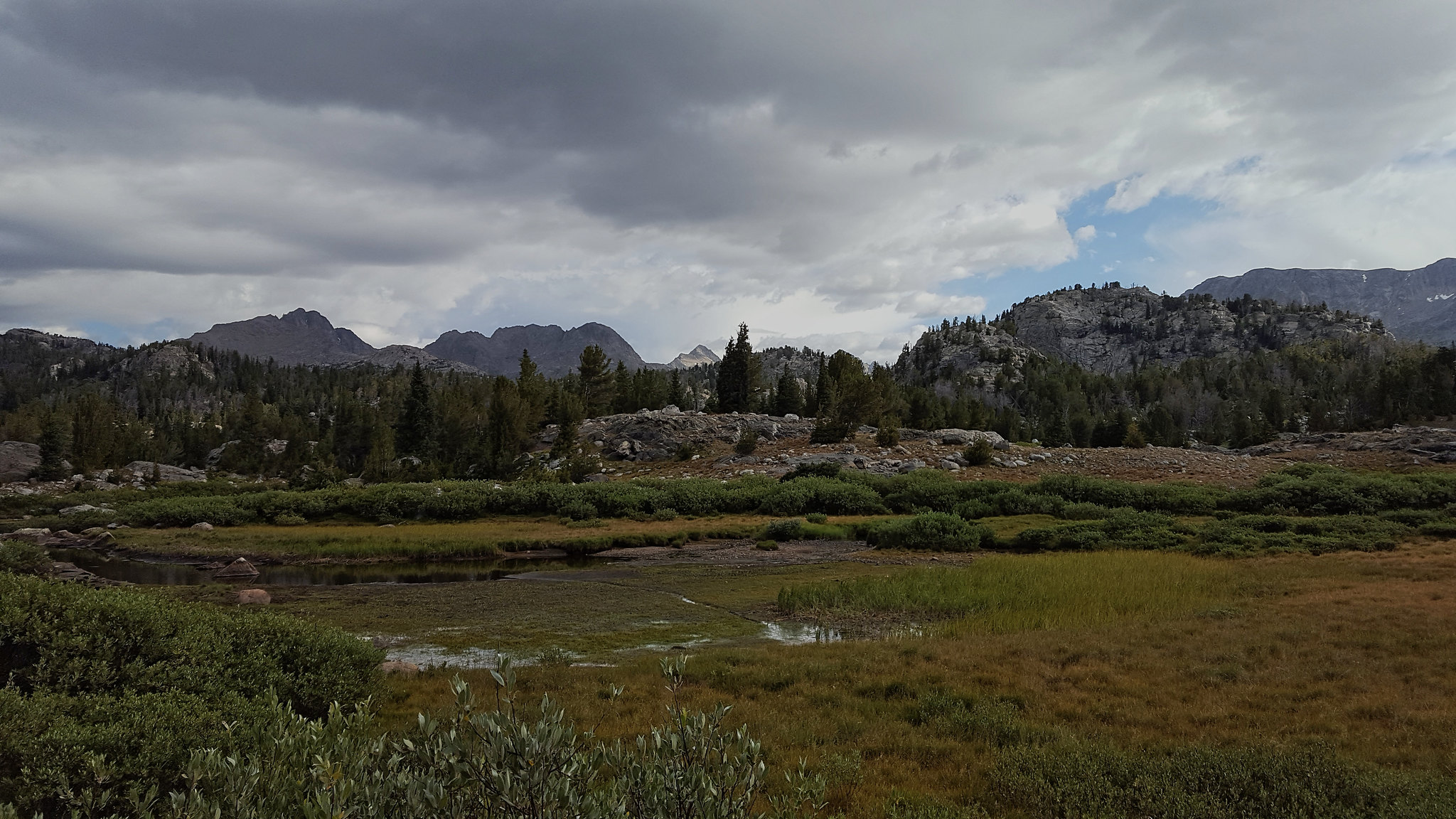
We crossed through some more meadows as we neared the junction with the trail leading to the Cook Lakes and Wall Lake. Maybe I'll make it to those someday. There's too much stuff to see.
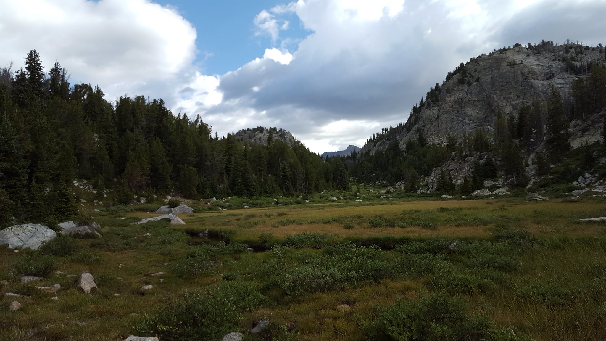
Meadows
We passed the junction and continued on. The trees began to thin out and we walked higher. The lakes up here, like Tommy Lake, were awesome.
Unnamed lake. I believe it's just identified by an elevation on the map.
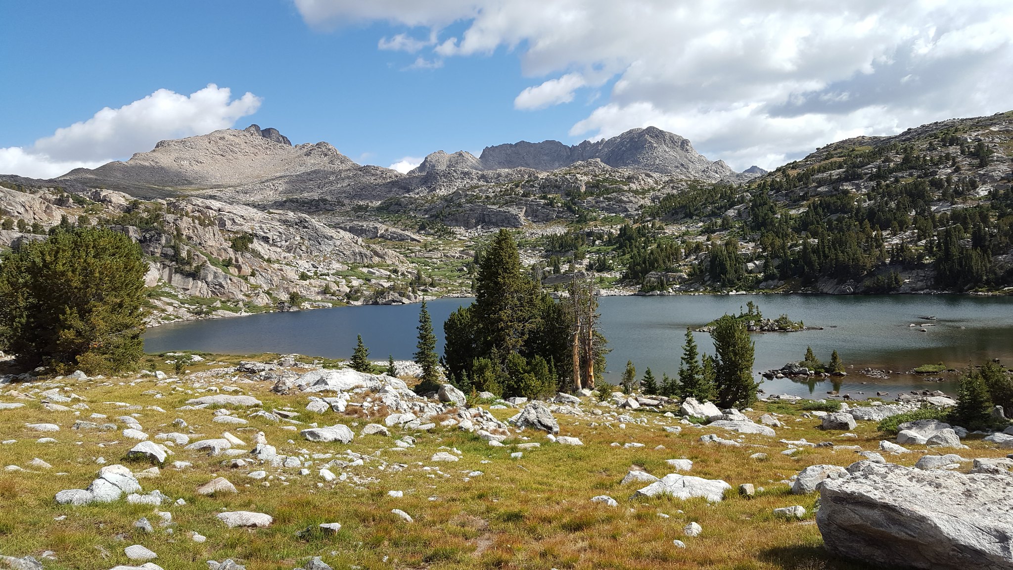
Tommy Lake
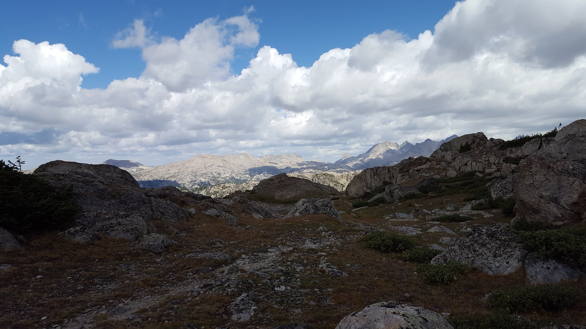
Walking up to Lester Pass was awesome. The day was sunny and warm. Gavin and I decided we'd go for a swim later in the day.
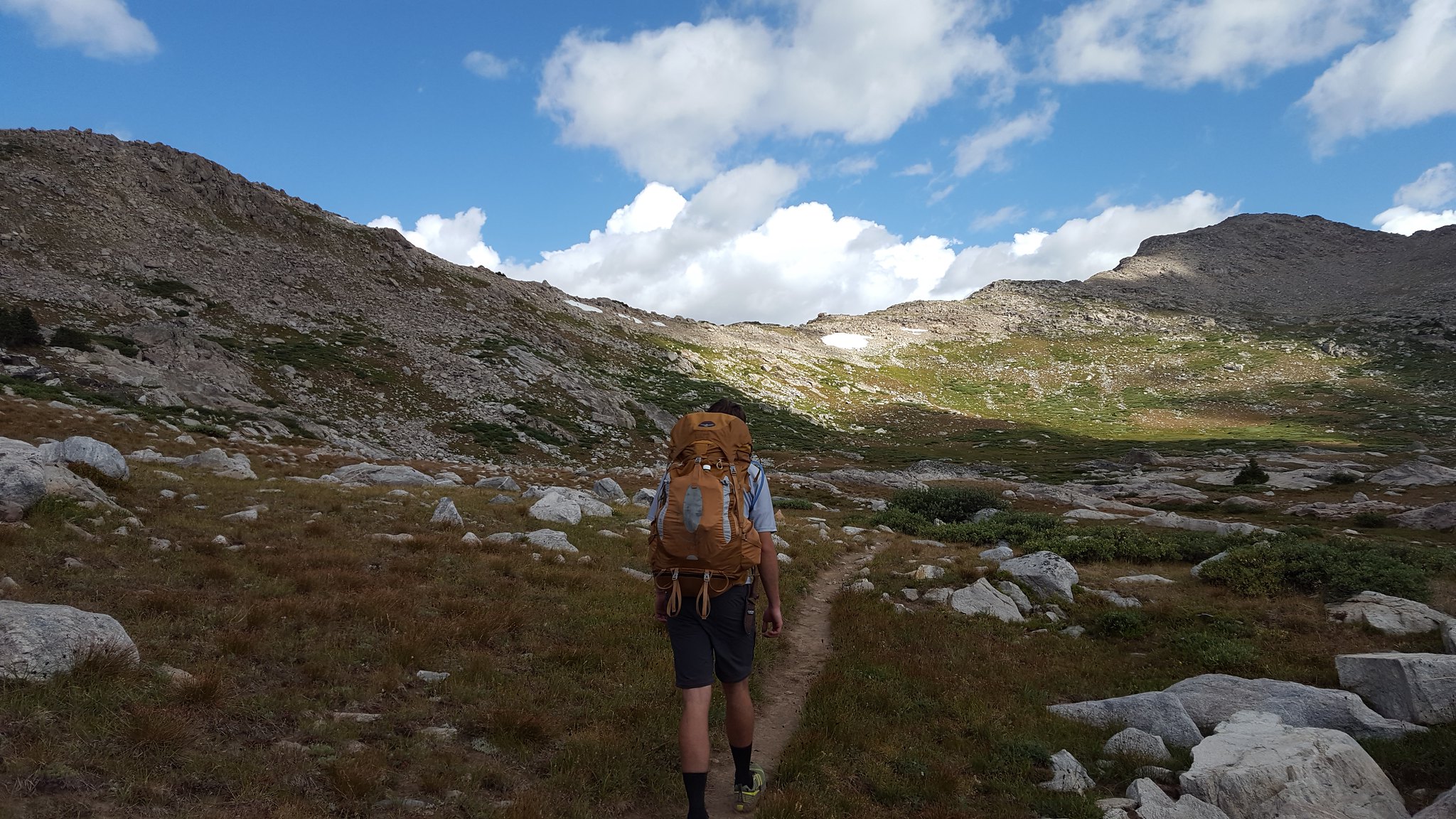
Approaching the pass
Great views all around
As we neared the pass, we came up on a family who asked us to take their photo. The parents were backpacking with their two daughter, aged 7 and 10 if I remember correctly. Amazing that kids that age were out fairly deep in the mountains backpacking. I'd never have done that at that age. I've seen the light now though.
Lots of big rocks at the top.
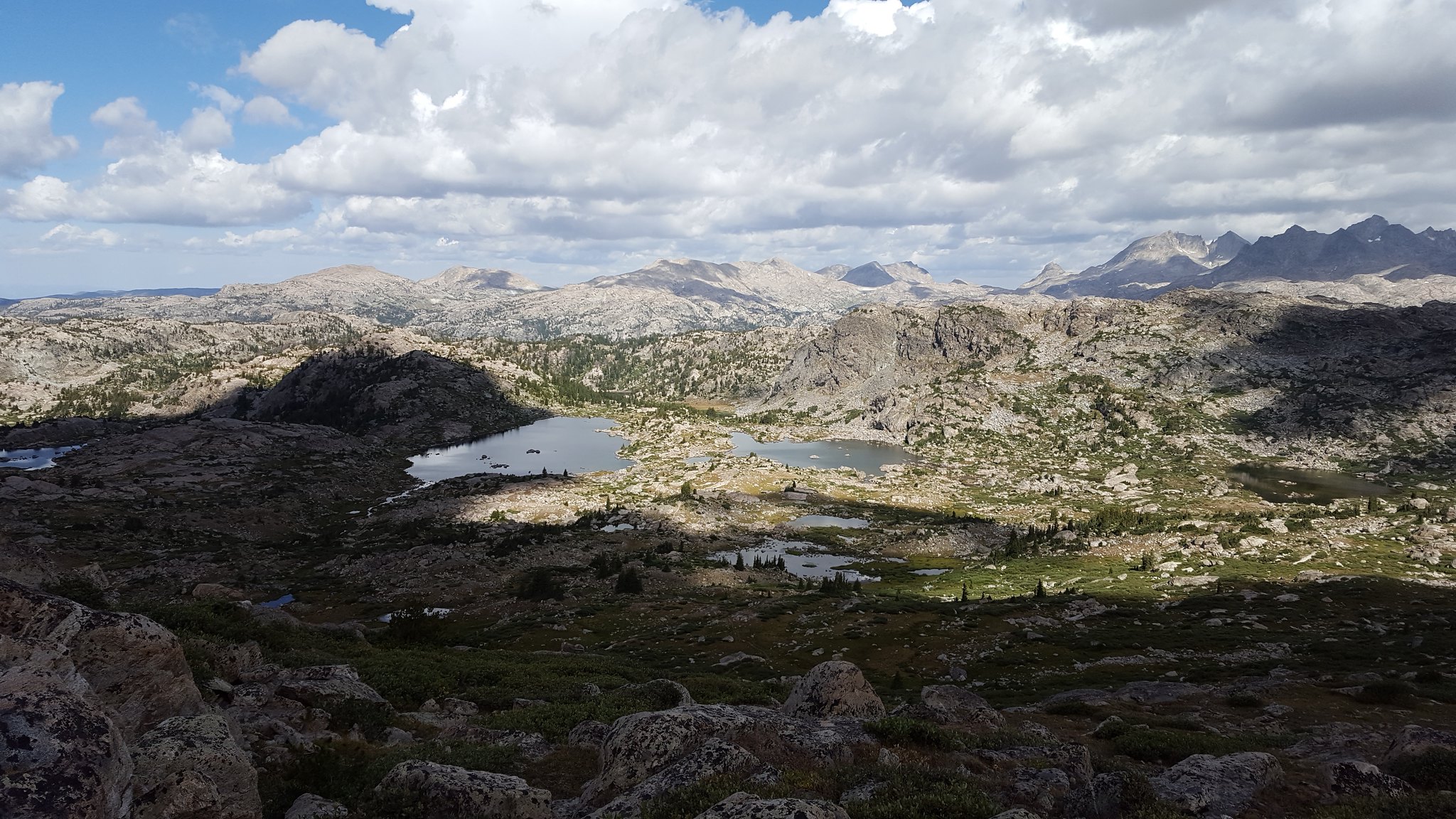
The walk down the other side was great. You could see so many of the Northern Winds peaks. Reminds you that there's so much out there that you still have to see.
We got down to the junction with the Island Lake trail, and we stopped for lunch. A llama pack train passed by us. I had only ever heard about those before. Interesting. We passed them pretty quickly after we got going again. I guess they don't make you that much faster. Maybe less tired though...
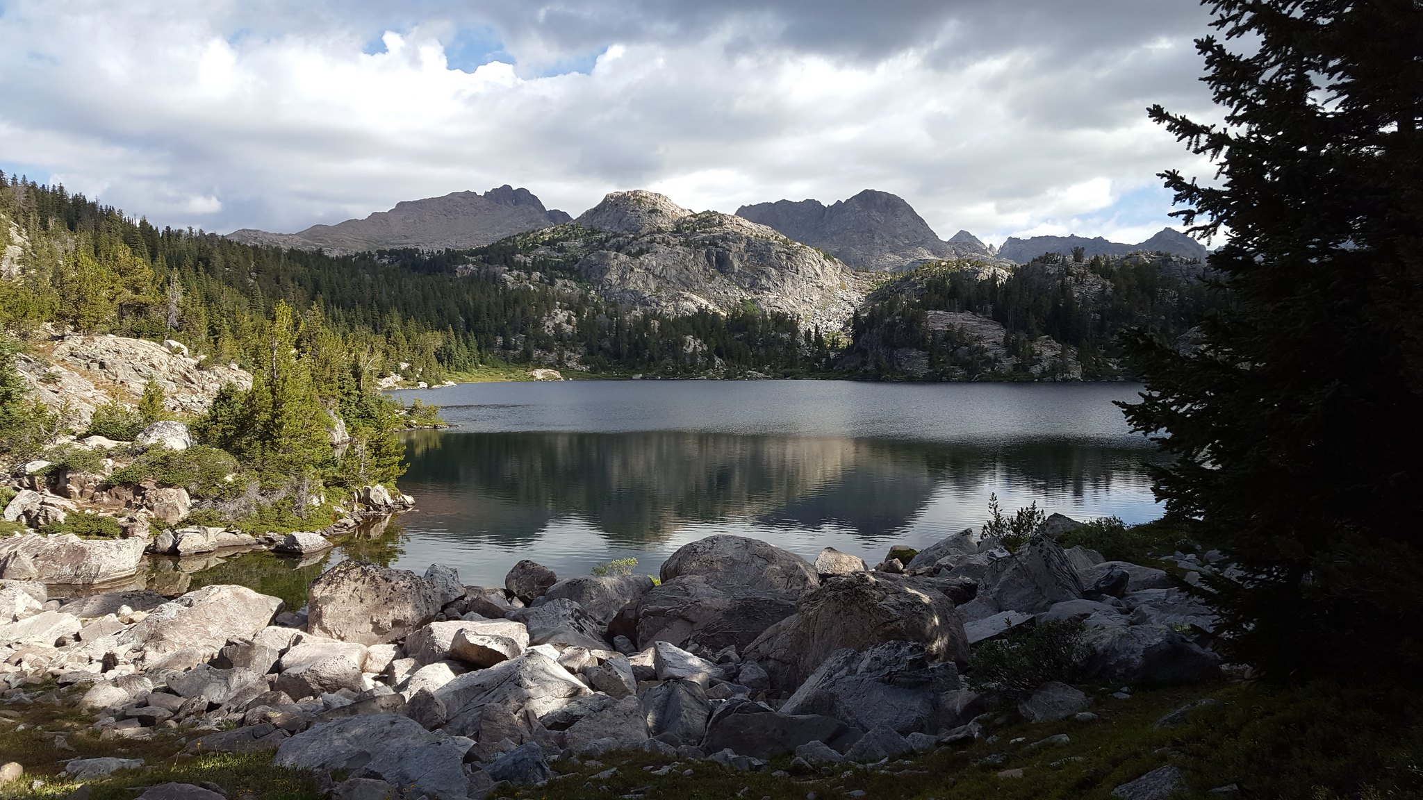
We passed Little Seneca Lake and went over to Seneca Lake.
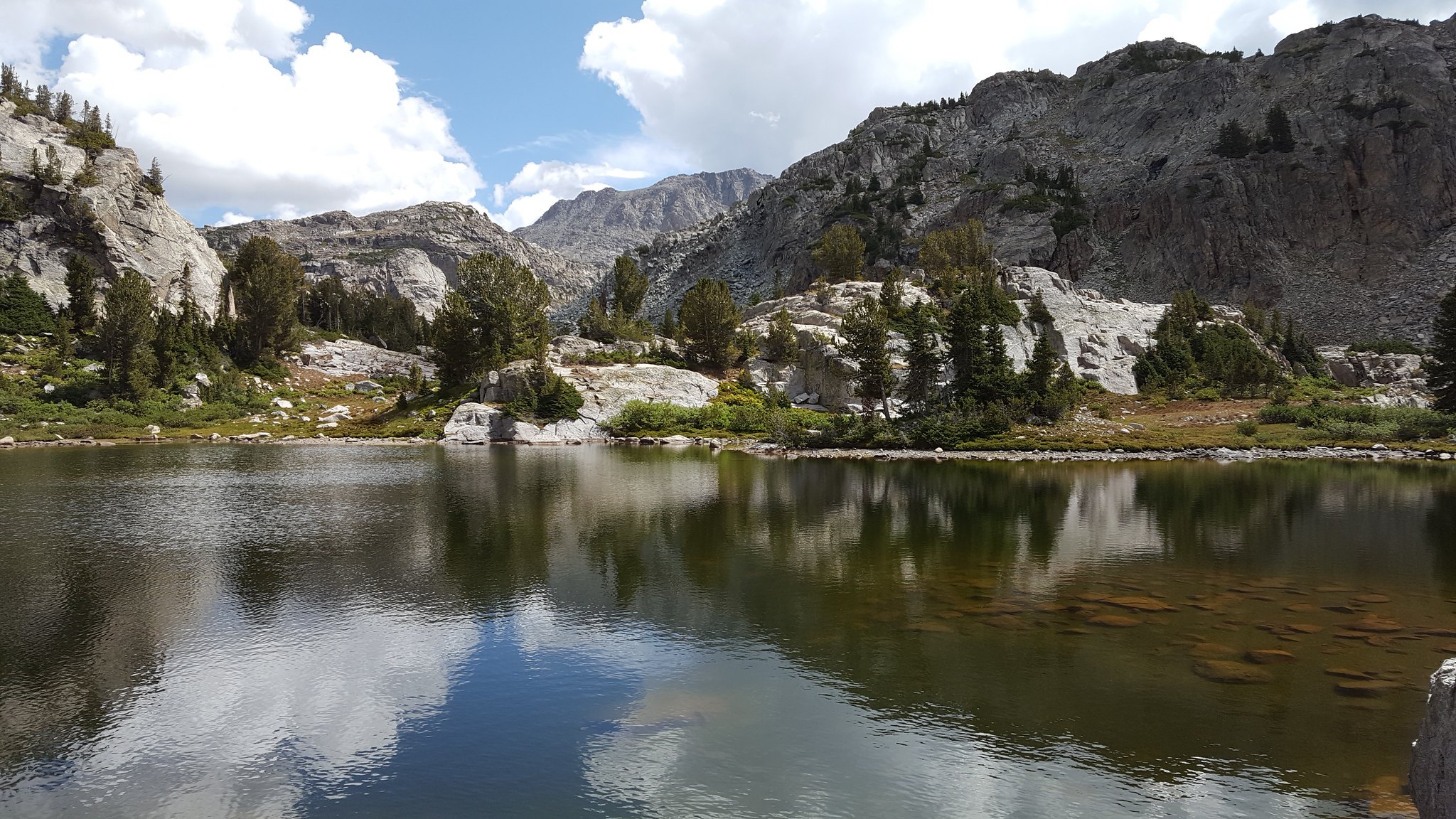
Little Seneca Lake
When we got to Seneca Lake, we decided it was time for a swim. Dan said he'd be sitting it out. We picked our way down to a rather inconvenient spot so we'd be able to change out of our wet clothes in privacy. I didn't get any shots of us in the water, but I promise we actually jumped in. Twice. We timed the whole thing very poorly because some heavy clouds rolled in, the temperature dropped, and the wind picked up right before we jumped. Oh well. Had to do it. That water was very cold.
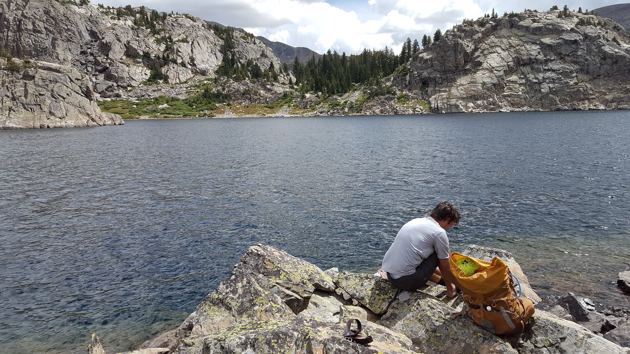
Gavin putting his socks back on
We made our way back up the steep slope and found Dan. We kicked it into gear and headed down the trail. It started to rain, so we put on our rain gear and kept going. There were a LOT of people headed in toward Island Lake and Titcomb Basin.
We were getting pretty tired by the time we got to Hobbes Lake. We decided to keep going, and we ended up finding a decent place to set up on the southern end of Barbara Lake. We needed to get out fairly quickly the next day, so this would put us within a nice striking distance of the trailhead. Would've been cool to have camped at one of the lakes up higher, but oh well.
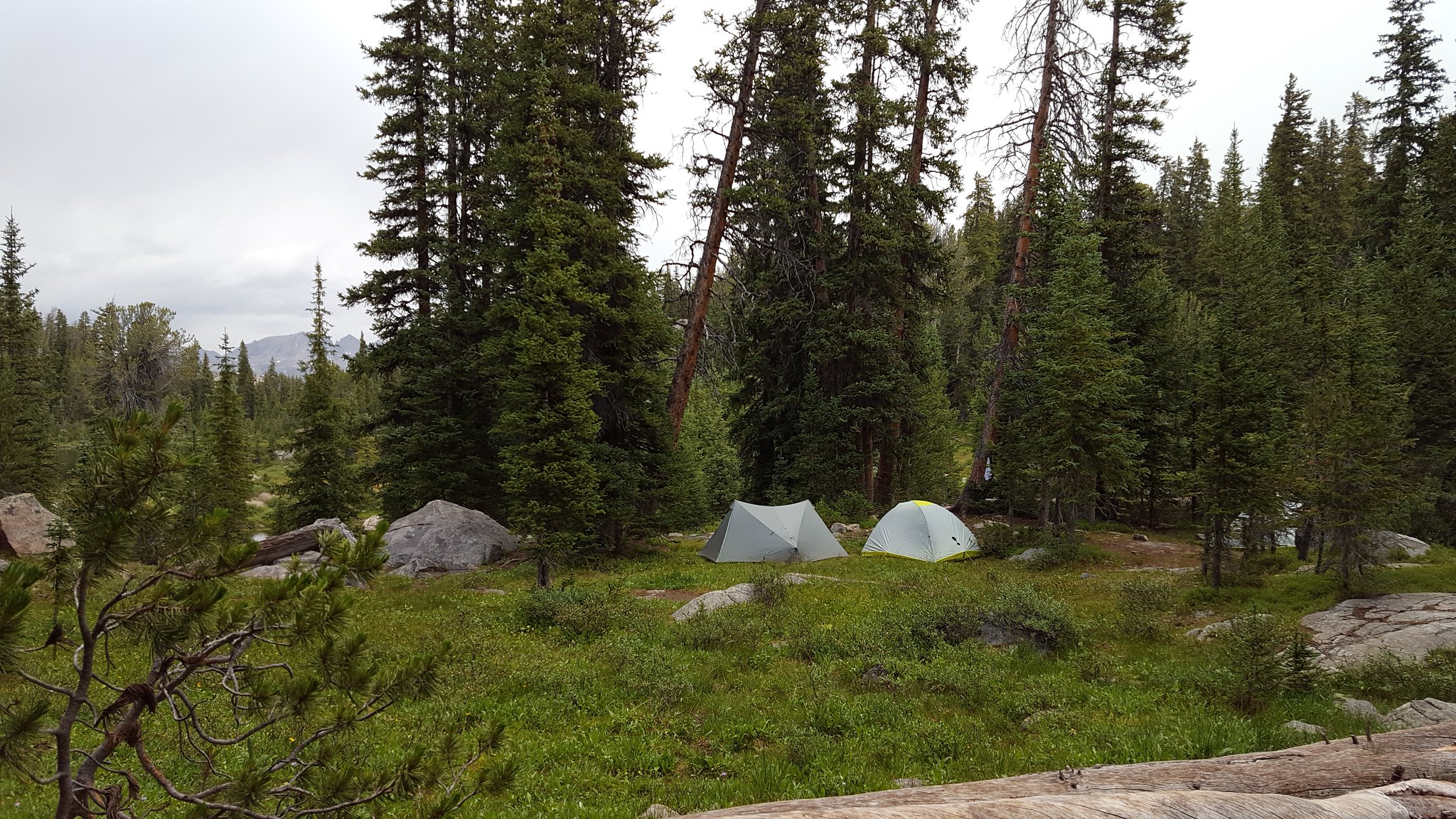
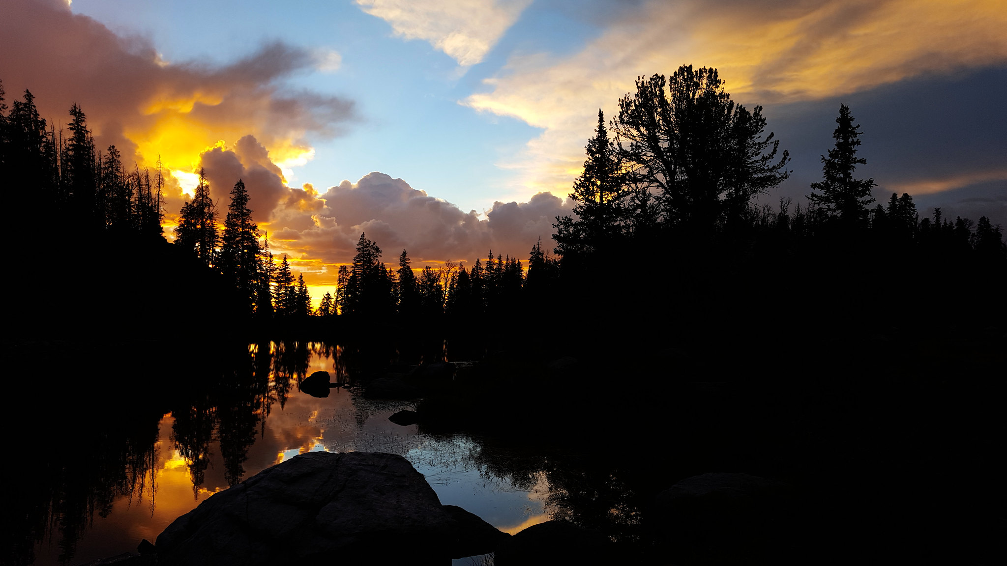
Camp at Barbara Lake
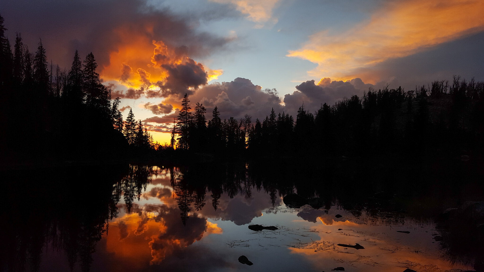
By the time we had our tents set up, it was only 2 in the afternoon, so we just lazed around all afternoon. The clouds had gone away for a few hours, but they came back with a vengeance. We quickly ate so we wouldn't have to eat in the rain. Then we had thunder and lightning, rain, hail, and snow. It was pretty cool. The clouds broke as the sun was setting. Great timing.
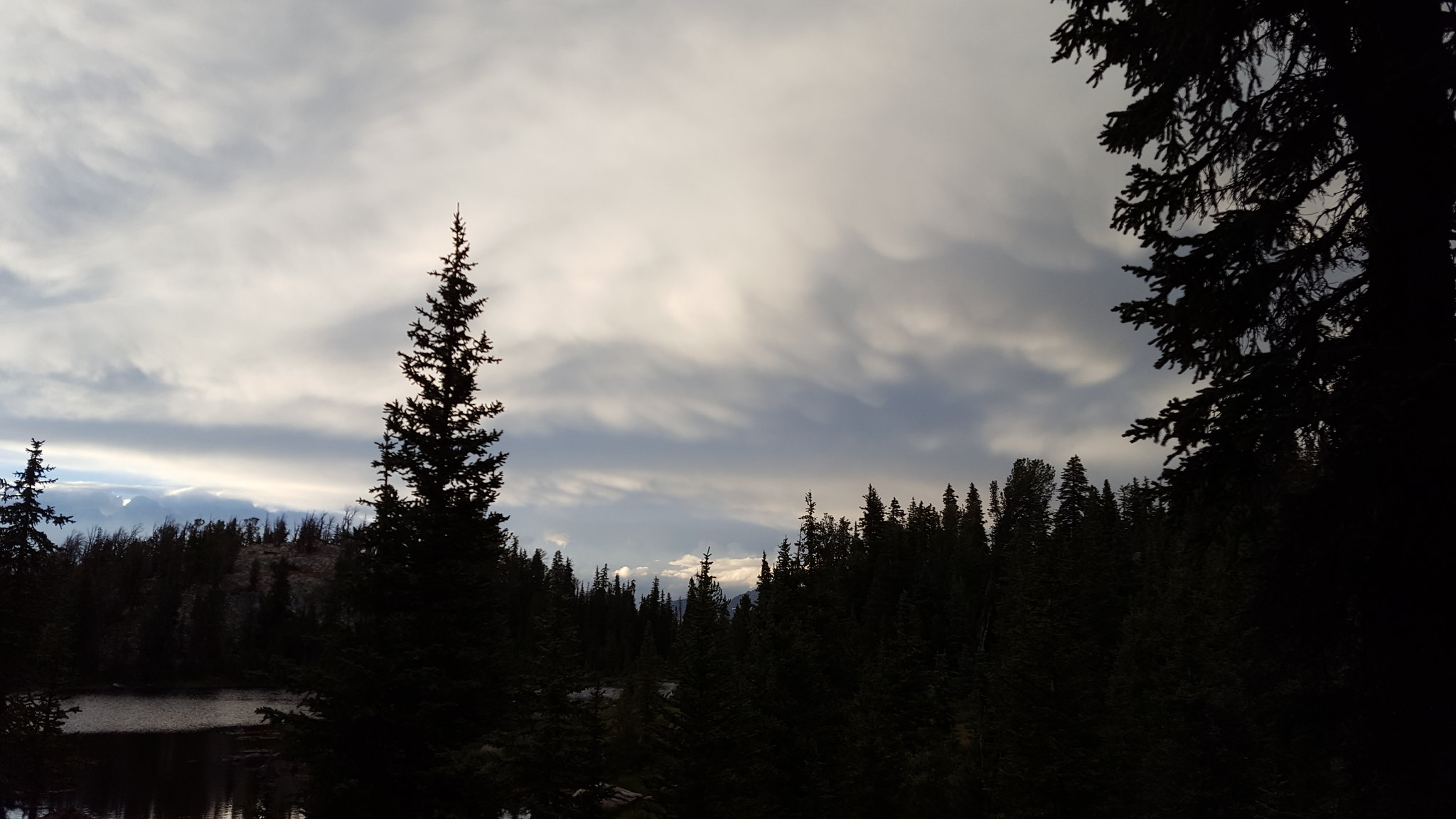
I believe these are mammatus clouds. They didn't become as bulbous as others I've seen.
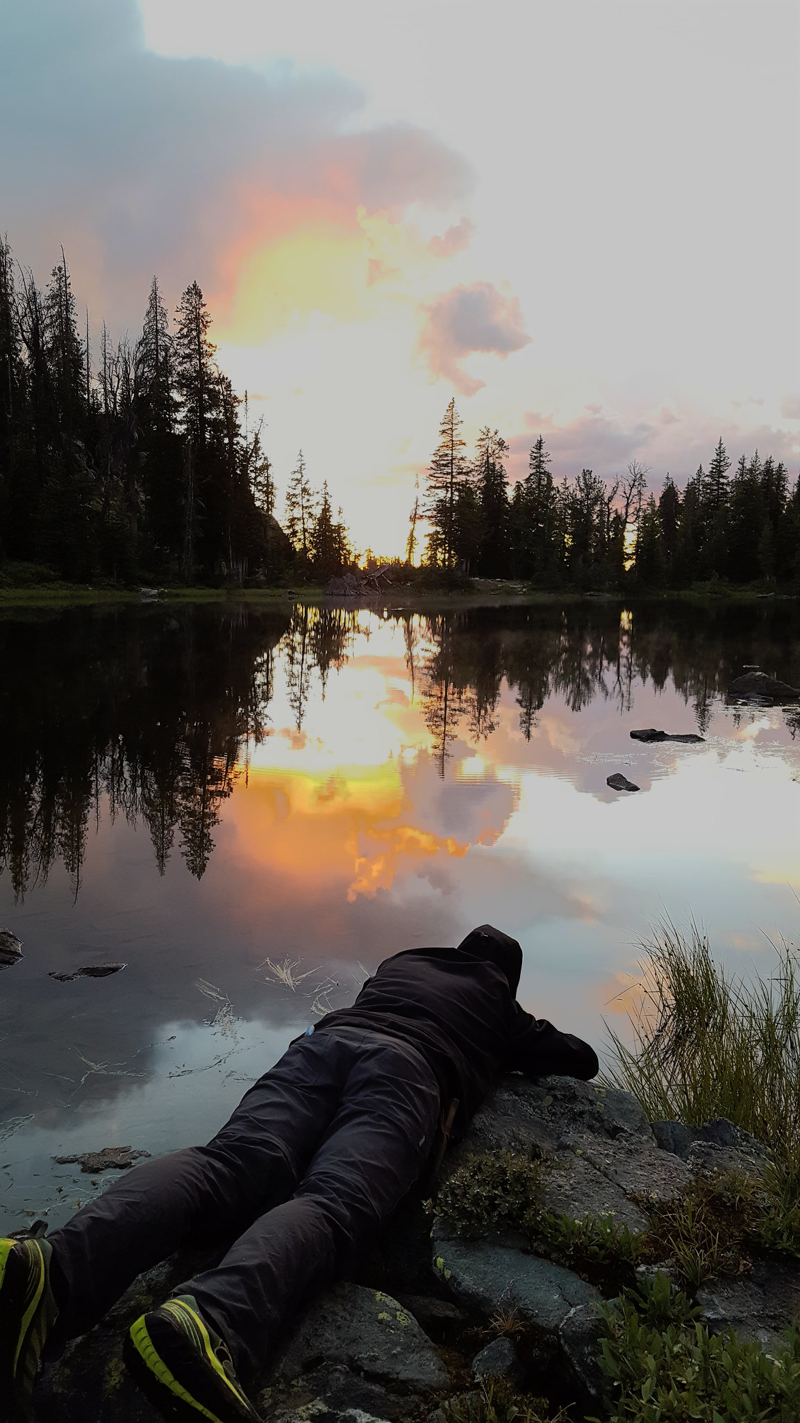
You do what you have to do to get the right angle for your photo.
The sunset was so good. It started off really bright, and it became more red as the sun dropped lower.
The temperature dropped to the low 20s that night, so all the rain and snow froze on our tents. In the morning, all we wanted to do was get moving, so we threw all the wet stuff in our packs and flew down the trail. We made it out in good time.
Great trip! I need to summit a peak or fish or something next time I go.
I never know how to name these. Lester Pass was a prominent landmark that we walked over, so I guess I'll make it the namesake of this thread.
I went to the Wind River Range with two friends, Gavin and Dan. As usual, the responsibility of planning the location and route fell on me. Everyone usually has me plan the route because they don't like to or don't know how to, I guess.
So we headed out and the drive was fine. I remember reading that the road to Elkhart Park is paved all the way, but when we drove it, it was all ripped up and they were doing a lot of grading. Most of the drive was on dirt. Anyone know whether they are (were) resurfacing it or reverting it to a dirt road?
We got to the trailhead and signed the register. At least 90% of the groups who had signed listed Titcomb Basin as their destination. Impressive.
We cruised through the first few miles to Photographers Point. I really liked the walk through the forest.
Standard view from Photographers Point
Pond at Photographers Point
We talked briefly to a guy and his two sons who were headed to 1000 Island Lake to fish for a few days. Then we got moving toward Pole Creek Lakes. There were so many ponds and lakes along the way. Very pretty.
Lots of ponds/lakes like this
We eventually made it to the big Pole Creek Lake, and we headed over toward the others. Some stormy clouds had rolled in, so we looked for a good site, and found a great, flat spot backed up against a hill with some trees. We set up camp and had dinner on a big rock hill nearby. We had only seen one group since we left the Island Lake trail. Right on.
Pole Creek Pond
Crappy campsite picture
The clouds never produced any rain, and they broke in time for a nice sunset.
We headed out toward Lester Pass the next morning. Got a fairly early start. The walk was very nice. Lots of water and rocks.
Meadow below Cook Lakes
I remembered reading about a fairly large stream that we would have to ford near this area. We never ended up having to cross any high, swift streams. I guess the flow was just not very high when we passed through. This one was fun though.
We crossed through some more meadows as we neared the junction with the trail leading to the Cook Lakes and Wall Lake. Maybe I'll make it to those someday. There's too much stuff to see.
Meadows
We passed the junction and continued on. The trees began to thin out and we walked higher. The lakes up here, like Tommy Lake, were awesome.
Unnamed lake. I believe it's just identified by an elevation on the map.
Tommy Lake
Walking up to Lester Pass was awesome. The day was sunny and warm. Gavin and I decided we'd go for a swim later in the day.
Approaching the pass
Great views all around
As we neared the pass, we came up on a family who asked us to take their photo. The parents were backpacking with their two daughter, aged 7 and 10 if I remember correctly. Amazing that kids that age were out fairly deep in the mountains backpacking. I'd never have done that at that age. I've seen the light now though.
Lots of big rocks at the top.
The walk down the other side was great. You could see so many of the Northern Winds peaks. Reminds you that there's so much out there that you still have to see.
We got down to the junction with the Island Lake trail, and we stopped for lunch. A llama pack train passed by us. I had only ever heard about those before. Interesting. We passed them pretty quickly after we got going again. I guess they don't make you that much faster. Maybe less tired though...
We passed Little Seneca Lake and went over to Seneca Lake.
Little Seneca Lake
When we got to Seneca Lake, we decided it was time for a swim. Dan said he'd be sitting it out. We picked our way down to a rather inconvenient spot so we'd be able to change out of our wet clothes in privacy. I didn't get any shots of us in the water, but I promise we actually jumped in. Twice. We timed the whole thing very poorly because some heavy clouds rolled in, the temperature dropped, and the wind picked up right before we jumped. Oh well. Had to do it. That water was very cold.
Gavin putting his socks back on
We made our way back up the steep slope and found Dan. We kicked it into gear and headed down the trail. It started to rain, so we put on our rain gear and kept going. There were a LOT of people headed in toward Island Lake and Titcomb Basin.
We were getting pretty tired by the time we got to Hobbes Lake. We decided to keep going, and we ended up finding a decent place to set up on the southern end of Barbara Lake. We needed to get out fairly quickly the next day, so this would put us within a nice striking distance of the trailhead. Would've been cool to have camped at one of the lakes up higher, but oh well.
Camp at Barbara Lake
By the time we had our tents set up, it was only 2 in the afternoon, so we just lazed around all afternoon. The clouds had gone away for a few hours, but they came back with a vengeance. We quickly ate so we wouldn't have to eat in the rain. Then we had thunder and lightning, rain, hail, and snow. It was pretty cool. The clouds broke as the sun was setting. Great timing.
I believe these are mammatus clouds. They didn't become as bulbous as others I've seen.
You do what you have to do to get the right angle for your photo.
The sunset was so good. It started off really bright, and it became more red as the sun dropped lower.
The temperature dropped to the low 20s that night, so all the rain and snow froze on our tents. In the morning, all we wanted to do was get moving, so we threw all the wet stuff in our packs and flew down the trail. We made it out in good time.
Great trip! I need to summit a peak or fish or something next time I go.
Last edited: