travel2walk
Member
- Joined
- Mar 1, 2018
- Messages
- 104
We spend 5 days and 4 nights in the Lamar River region of Yellowstone. It was recommended by my new friend @TheMountainRabbit for a backpacking experience that represented Yellowstone and accessible during our time frame. To complete the hike as a loop without the highly contested and limited camping spots on Mirror Plateau, we used a suggestion from @scatman here in these forums. My reference material was this thread by @TheMountainRabbit https://backcountrypost.com/threads...alley-yellowstone-np-mid-september-2020.9572/ with @scatman recommendation in the comments. Thanks y'all for all the help!
This is just a quick report with a few raw images without any post processing I look along the loop for now. Eventually, I'll have a more detailed report and video at some point not in the near feature.
I wasn't the smartest regards to my reservation of campsites. The permit I pulled was as follows:
6/29 3F1 (this was a mistake as I was looking for one around 3L7, but was a bit disorganized when the backcountry office returned my call for my permit)
6/30 3T3
7/1 4W2
7/2 4W2 (rest day before off trail section)
7/3 3L4 (planned night if we crossed mirror plateau via @TheMountainRabbit route, which we didn't use since we decided we were done at this point)
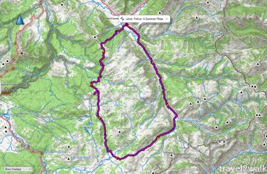
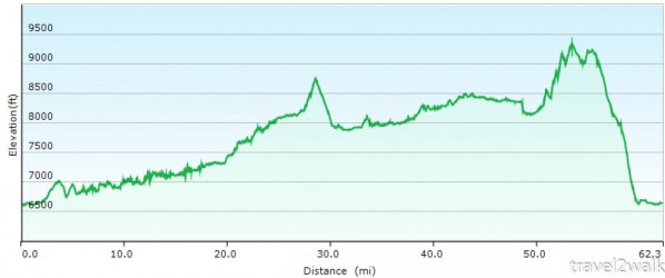
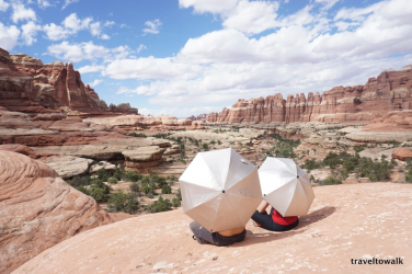
My overall impressions was that we probably did it at the wrong time of the year. We saw no signs of bears, it was incredibly buggy, and the heat wave this year made us feel like we were in the desert. Our MVP gear for the hike was our umbrellas, which provided cover from the sun and rain on a couple of occasions. On the bright side, the wildflowers were everywhere and all the marshy areas were very dry making it an easier hike though our feet were still constantly wet.
As such, we didn't find the hiking and scenery to be the most impressive hiking experience of our hiking careers, but again I don't think it was the right time of year for us to do the hike and we didn't hike it the best way to optimize the experience. We are hikers that typically camp because it is necessary to see cool things and not camp for the sake of camping. I'm ok with bigger miles and not really the way to do this hike. For future trips into the Yellowstone backcountry, I'd plan for shorter days with plenty of time to hang around the many great campsites and look out upon the meadows for passing wildlife. Also maybe later in the year. I don't regret our plan though for this trip since we saw no signs of bears at all along our trail and no wildlife during the days we did have plenty of time at camp. The only wildlife were bisons and infinite mosquitos and horseflies. We were happy to get out earlier as we were being eaten alive, don't worry I did my part to bring down their numbers.
As for solitude on the trail, other than a couple of day hikers near the trailhead, we only saw on other couple camped along Lamar River and 1 guy coming out from 3T3. That was it.
Day 1: Lamar Trailhead/Soda Spring to Cold Creek (3F1)
It was hot and we didn't start until 11am cause of traffic. Umbrellas were our savior for the trip.
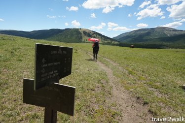
Cache Creek as only at our knees at the end of June during this very hot summer.
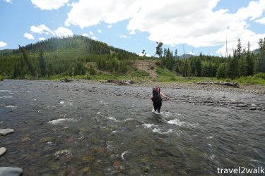
The views of the Lamar River were kinda repetitive or just seems that way when we hiked all 17 miles of it in one day. We were pretty low on morale at this point as the hike was a bit of a drag because of the heat. We kept looking out at the meadows and mountains sides hoping to see a bear, but saw nothing. This would be the theme for the rest of our hike.
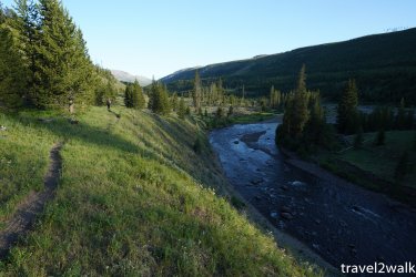
Day 2: Cold Creek to Mist Pass (3T3)
We decided to continue despite low morale since it was going to be an easier day (thanks to our long day before) and we had time to relax at a nice campsite at the end of the short day. There wasn't much to see until we came to Mist Meadow. We really enjoyed the site, but didn't see any passing animals this time around. Evening mosquitos meant we hid in our tent and rain clouds meant we had to have our rain fly on for the night. Though the relaxing afternoon and a soak in the creek rejuvenated us enough to decide on finishing to the loop rather than bailing.
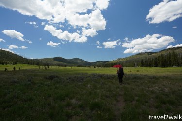
Day 3: Mist Pass to Watipi Lake (4W2).
Another long day begin with the short climb to Mist Pass. Looking back toward the Mist Meadows.
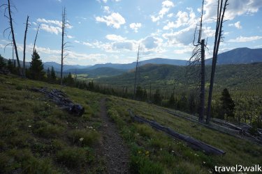
We were hopeful to see Bears as we dropped into the Pelican Bear Management area, but no signs of them here either. We saw Yellowstone Lake in the distance.
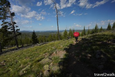
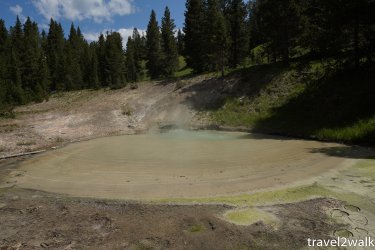
We took the Pelican Cone cutoff across a large meadow before starting to follow the Pelican Creek through another open meadow. There were some thermal features, which we enjoyed as it was something different than.
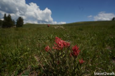
For those that like wildflowers (indian paintbrush), this was the time to hike here. Not so much for wildlife.
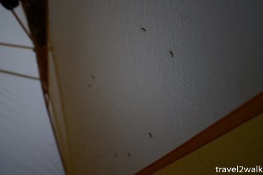
Rainclouds came in by the time we were at the Fern Lake Patrol Cabin and the mosquitos became worse after that so we pushed for our camp at Watipi Lake. There was a constant hum here from all the mosquitos during the evenings.
Day 4. nothing
We were tired.
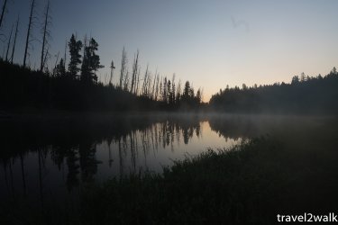
Day 5 - Watipi Lake to Trailhead
We decided to take the most direct way out via @scatman suggestion as we were tired of fighting the bugs and were out of bug spray. The route was actually provided for our most interesting day of hiking on our trip.
We started by following Shadow Creek as it drains Watipi Lake. It was pretty easy going, though our early start meant the wet grass had our feet wet in minutes.
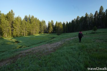
We pass a few small thermal areas and then turned away from the creek to head over to Wrong Creek through a large thermal area (Hot Spring Basin Group).
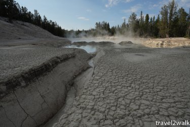
There was a steep downhill section dropping down into Wrong Creek, but the small creek here was dry to it wasn't too bad to just hike in the stream bed for the steepest section.
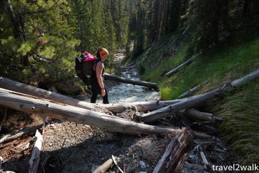
We crossed Wrong Creek and followed a tributary upstream toward a pass. There is a bison trail here, but also plenty of downfall now covering the trail. This was the beginning of the most difficult section of our day,
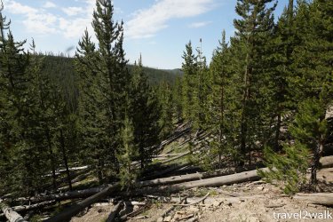
At the pass, the bison trail spits from the route I had from @scatman heading toward Deep Creek further east. I knew they had came the other direction so I wasn't sure if they were aware of the buffalo trail. Had we been in a more exploratory mood rather than getting out mood, I would have liked to follow the bison trail. As such we dropped down to a dry Deep Creek following @scatman's route before beginning our steep and long approach to gain elevation toward Peak 9474 and then 9245, where we'd hit the Pelican Ridge trail weaving through openings and avoiding the forest as much as possible.
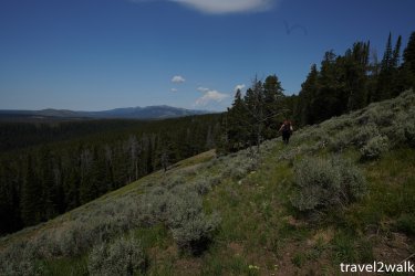
Eventually, we found a nice bison trail to follow and it brought us to the top of a cliff band with a 270 degree view of the mountains we'd seen through out our trip.

Once we neared the Speciman Ridge trail, there were storm clouds all around us. We sheltered for a few minutes among some trees for the storm clouds directly above us to pass before gaining the ridge. While the weather was good for most of our way down the Speciman Ridge trail, it was raining on the area around us on Mirror Plateau and along the Lamar Valley.
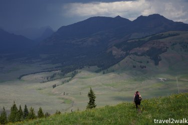
This made our last crossing, the Lamar River, a bit trickier as the river was brown with runoff. It wasn't too deep as the deepest part was at my thighs, but we couldn't see the bottom and the bottom was plenty of slippry rocks.
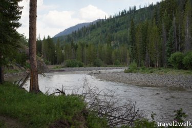
After fording the Lamar, the rain finally dumped on us for a few minutes. We didn't care at this point, we were only a few miles from the car.
This is just a quick report with a few raw images without any post processing I look along the loop for now. Eventually, I'll have a more detailed report and video at some point not in the near feature.
I wasn't the smartest regards to my reservation of campsites. The permit I pulled was as follows:
6/29 3F1 (this was a mistake as I was looking for one around 3L7, but was a bit disorganized when the backcountry office returned my call for my permit)
6/30 3T3
7/1 4W2
7/2 4W2 (rest day before off trail section)
7/3 3L4 (planned night if we crossed mirror plateau via @TheMountainRabbit route, which we didn't use since we decided we were done at this point)


My overall impressions was that we probably did it at the wrong time of the year. We saw no signs of bears, it was incredibly buggy, and the heat wave this year made us feel like we were in the desert. Our MVP gear for the hike was our umbrellas, which provided cover from the sun and rain on a couple of occasions. On the bright side, the wildflowers were everywhere and all the marshy areas were very dry making it an easier hike though our feet were still constantly wet.
As such, we didn't find the hiking and scenery to be the most impressive hiking experience of our hiking careers, but again I don't think it was the right time of year for us to do the hike and we didn't hike it the best way to optimize the experience. We are hikers that typically camp because it is necessary to see cool things and not camp for the sake of camping. I'm ok with bigger miles and not really the way to do this hike. For future trips into the Yellowstone backcountry, I'd plan for shorter days with plenty of time to hang around the many great campsites and look out upon the meadows for passing wildlife. Also maybe later in the year. I don't regret our plan though for this trip since we saw no signs of bears at all along our trail and no wildlife during the days we did have plenty of time at camp. The only wildlife were bisons and infinite mosquitos and horseflies. We were happy to get out earlier as we were being eaten alive, don't worry I did my part to bring down their numbers.
As for solitude on the trail, other than a couple of day hikers near the trailhead, we only saw on other couple camped along Lamar River and 1 guy coming out from 3T3. That was it.
Day 1: Lamar Trailhead/Soda Spring to Cold Creek (3F1)
It was hot and we didn't start until 11am cause of traffic. Umbrellas were our savior for the trip.

Cache Creek as only at our knees at the end of June during this very hot summer.

The views of the Lamar River were kinda repetitive or just seems that way when we hiked all 17 miles of it in one day. We were pretty low on morale at this point as the hike was a bit of a drag because of the heat. We kept looking out at the meadows and mountains sides hoping to see a bear, but saw nothing. This would be the theme for the rest of our hike.

Day 2: Cold Creek to Mist Pass (3T3)
We decided to continue despite low morale since it was going to be an easier day (thanks to our long day before) and we had time to relax at a nice campsite at the end of the short day. There wasn't much to see until we came to Mist Meadow. We really enjoyed the site, but didn't see any passing animals this time around. Evening mosquitos meant we hid in our tent and rain clouds meant we had to have our rain fly on for the night. Though the relaxing afternoon and a soak in the creek rejuvenated us enough to decide on finishing to the loop rather than bailing.

Day 3: Mist Pass to Watipi Lake (4W2).
Another long day begin with the short climb to Mist Pass. Looking back toward the Mist Meadows.

We were hopeful to see Bears as we dropped into the Pelican Bear Management area, but no signs of them here either. We saw Yellowstone Lake in the distance.

We took the Pelican Cone cutoff across a large meadow before starting to follow the Pelican Creek through another open meadow. There were some thermal features, which we enjoyed as it was something different than.

For those that like wildflowers (indian paintbrush), this was the time to hike here. Not so much for wildlife.

Rainclouds came in by the time we were at the Fern Lake Patrol Cabin and the mosquitos became worse after that so we pushed for our camp at Watipi Lake. There was a constant hum here from all the mosquitos during the evenings.

Day 4. nothing
We were tired.

Day 5 - Watipi Lake to Trailhead
We decided to take the most direct way out via @scatman suggestion as we were tired of fighting the bugs and were out of bug spray. The route was actually provided for our most interesting day of hiking on our trip.
We started by following Shadow Creek as it drains Watipi Lake. It was pretty easy going, though our early start meant the wet grass had our feet wet in minutes.

We pass a few small thermal areas and then turned away from the creek to head over to Wrong Creek through a large thermal area (Hot Spring Basin Group).

There was a steep downhill section dropping down into Wrong Creek, but the small creek here was dry to it wasn't too bad to just hike in the stream bed for the steepest section.

We crossed Wrong Creek and followed a tributary upstream toward a pass. There is a bison trail here, but also plenty of downfall now covering the trail. This was the beginning of the most difficult section of our day,

At the pass, the bison trail spits from the route I had from @scatman heading toward Deep Creek further east. I knew they had came the other direction so I wasn't sure if they were aware of the buffalo trail. Had we been in a more exploratory mood rather than getting out mood, I would have liked to follow the bison trail. As such we dropped down to a dry Deep Creek following @scatman's route before beginning our steep and long approach to gain elevation toward Peak 9474 and then 9245, where we'd hit the Pelican Ridge trail weaving through openings and avoiding the forest as much as possible.

Eventually, we found a nice bison trail to follow and it brought us to the top of a cliff band with a 270 degree view of the mountains we'd seen through out our trip.

Once we neared the Speciman Ridge trail, there were storm clouds all around us. We sheltered for a few minutes among some trees for the storm clouds directly above us to pass before gaining the ridge. While the weather was good for most of our way down the Speciman Ridge trail, it was raining on the area around us on Mirror Plateau and along the Lamar Valley.

This made our last crossing, the Lamar River, a bit trickier as the river was brown with runoff. It wasn't too deep as the deepest part was at my thighs, but we couldn't see the bottom and the bottom was plenty of slippry rocks.

After fording the Lamar, the rain finally dumped on us for a few minutes. We didn't care at this point, we were only a few miles from the car.
Last edited:

 I have learned to appreciate the wildflowers as much as scenery and the wildlife.