- Joined
- Feb 15, 2020
- Messages
- 615
I really want to get better about posting some trips reports here, but I figured I should at least post this one and include thanks to @scatman and @Outdoor_Fool for their responses to my earlier thread while planning.
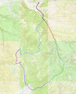
My younger brother and I try to get out together at least once a year and this past year I wanted to figure out a week long route in the Lamar Valley region of Yellowstone NP - despite spending a lot of time in the area, I'd never managed to do much more than day hikes or single night outings. I knew I wanted to do two things: 1) cross Mirror Plateau; and 2) get a much better look at the Upper Lamar River - both goals were achieved and very much worth the effort involved.
Day 1: Soda Butte/Lamar River TH to 3L3 Lower Lamar
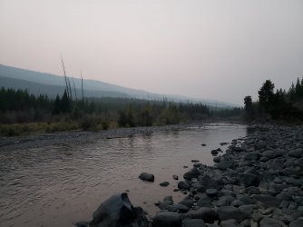
The first day was a short one - we just needed to get to campsite 3L3 about 5 miles from the Soda Butte/Lamar River TH. (Of course, we also drove straight in from CO that day, so it didn't feel too short by the end.) The hike in was fairly uneventful and the air was very smoky in the valley - mostly due to out of state fires to the west I believe, though the Lone Star Fire was still somewhat active at this time, too.
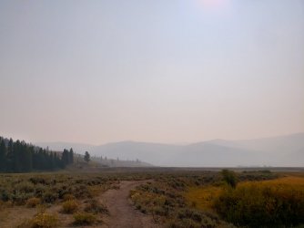
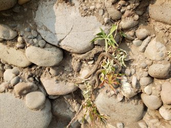
We saw very little in the way of larger fauna - even the bison weren't visible in their usual numbers - but we did spot a number of terrestrial garter snakes that were looking very "healthy". If any reptiles are going to survive winter in Yellowstone, it was these guys.
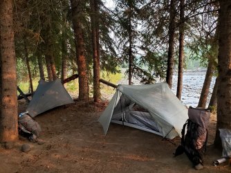
Camp was a very well worn spot along the Lamar River w/ nice tree cover - a pretty standard Yellowstone NP site.
Day 2: 3L3 Lower Lamar to 4W2 Wapiti Lake (Peninsula)
This was definitely the "crux" of our trip: 16 miles of almost exclusively off-trail travel across Mirror Plateau. In mid-summer there are some camping options available up on the plateau, but at this time of year BMA restrictions limit travel to daylight hours only and mandated that we be off the plateau by sunset. As is so often the case, the most challenging part of the trip was also the most rewarding. I think I'd built it up a bit in my head, but travel on the plateau was reasonably straightforward and the deadfall that seemed so concerning during planning was almost a non-issue. (Disclaimer: my brother and I both have significant experience navigating off-trail. This is not a particularly difficult route but it is committing and the time constraints are not forgiving, so not recommended unless you have some experience.)
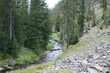
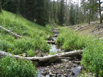
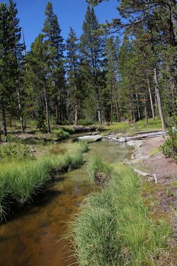
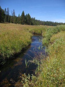
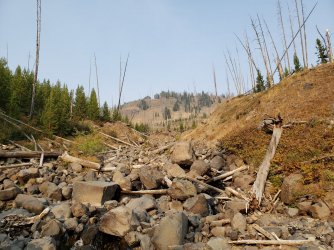
We elected to follow an unnamed (to our knowledge) drainage directly to the west of our overnight accommodation. It was very easy to spot and follow - footing was good all the way up. Early season might be pretty wet, but in September it was just enough water that we never needed to carry any and also never really got our feet wet.
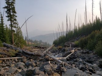
Near the top of the drainage we began to hear a large number of bull elk bugling and shortly thereafter spotted 5+ large groups of elk spread out in front of us. (I apologize for the lack of photos; our paltry phone cameras weren't quite up to the task.) Once at the top, we began the game of finding bison routes across the plateau.
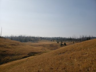
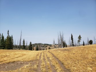
The route across the plateau didn't have any sweeping vistas like you might find in the Wind River Range, geothermal features like the frontcountry, or even much in the way of wildlife - aside for the elk at the top of the drainage and an occasional small group of bison. What it did have though was pure Yellowstone country and not another soul in sight. I could've stayed up in those meadows for days. (Also, the smoke was much less of an issue up here than down in the lower valleys.) Eventually we made our way over to Mirror Lake and had lunch before beginning our steady descent to Wapiti Lake.
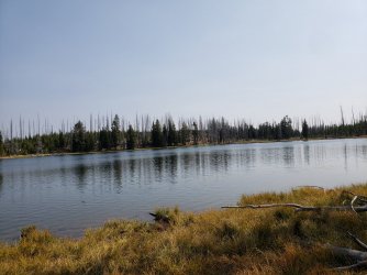
Just before arriving at Wapiti Lake, the foliage began to change dramatically. There was much less evidence of "recent" fires and the trees soared overhead - I typically enjoy the "wide open spaces", but it was pretty comforting to be shielded from the wind and exposure in which we'd spent most of the day hiking.
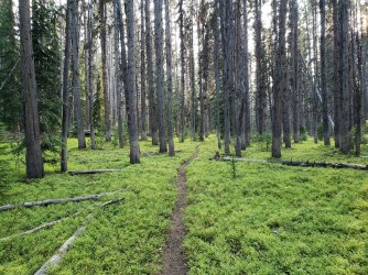
Eventually we made it to our planned campsite for the evening (and the next) and enjoyed a relaxing dinner and the prospect of sleeping in - something we rarely do on our trips together. (Naturally neither of us actually ended up taking advantage of the extra sleep - but it was nice to know we had the option.)
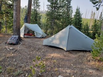
Day 3: Off-Trail Exploration
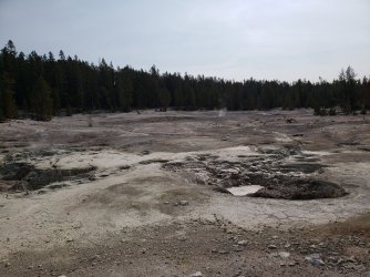
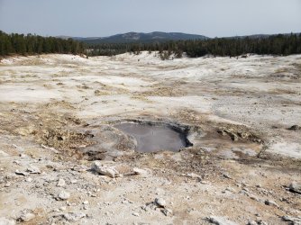
This ended up being one of the longer "zero" days I've ever taken. We had marked a number of nearby areas for consideration on this day and ended up deciding to visit the Hot Spring Basin group of thermal features - as well as some other surrounding areas. This turned out to be an excellent choice, as we enjoyed some of the best looking mudpots I'd ever seen, as well as one of the loudest fumaroles. (I apologize for the lack of video - maybe I'll come back and edit the post if I ever upload them somewhere.) We also spotted an enormous Great Grey Owl barely 20 ft away - but the instant either of use moved to grab a camera it wisely took off.
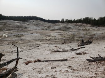
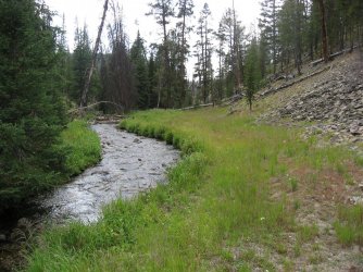
We made our way back to camp predominantly along Shallow Creek - a fairly mellow route. Although we didn't encounter any wildlife, this waterway had possibly the highest concentration of bear signs I've ever encountered. We also found some very recent wolf tracks running both ways - it appeared to have been a decent sized group.
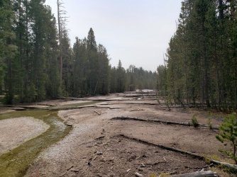
Day 4: 4W2 Wapiti Lake to 3T2 Mist Creek Meadows
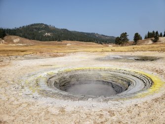
This was another fairly long day at around 17 miles, but it was predominantly on-trail and mellow. While our two previous days were more adventurous - in that we weren't following a determined path - this one found us in a number of different environments and might be the one I most wish I could re-live. Like the second day, seasonal BMA restrictions put us on a pretty demanding schedule - we needed to be up and over Mist Creek Pass by evening because the whole of Pelican Valley is restricted to daytime travel only. (It's also one of the only BMAs w/ specific time requirements - as opposed to more generic "sunrise/sunset" guidelines.) Following Upper Pelican Creek - before entering the valley itself - was probably the highlight in a day of highlights. We shared most of the day with small groups of male bison - as well as the occasional fox, coyote, or mule deer. The thermal areas here were small, but very cool - I particularly enjoyed the impressively circular mushpot that my brother dubbed a "gateway straight to Hell".
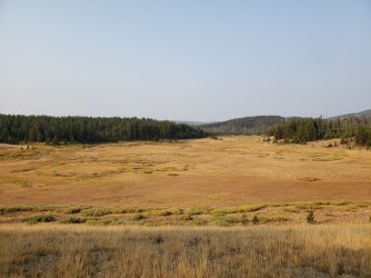
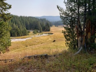
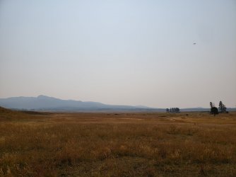
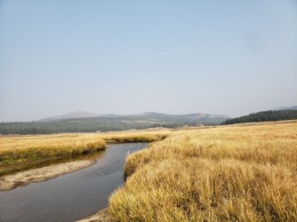
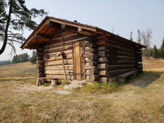
We were in for a bit of a surprise upon entering Pelican Valley. Both maps and conversations with others who've hiked this area seemed to indicate the presence of well-marked trails in this region - at least by Yellowstone standards. We did not find this to be the case and were regularly in "routefinder mode" until we reached the Pelican Springs Ranger Cabin. This wasn't really a problem - if anything it was a nice adventure - but anyone heading to the eastern portion of Pelican Valley should probably be aware. (As opposed to the western portion of the valley - which I've hiked regularly from the TH there - that is typically very well marked/signed.)
Mist Creek Pass was fairly innocuous. Just enough elevation gain to feel a little burn - but not enough to really slow you down. The view was mostly obstructed and the scenery mostly young trees surrounded by deadfall. (I was grateful that this section was manicured trail - going off trail here would have been a beating.) Mist Creek Valley was absolutely stunning - it's probably the top area from the trip that I want to revisit. Considering I somehow failed to take any pictures here, I guess it's that much more necessary.
Day 5: 3T2 Mist Creek Meadows to 3L7 Middle Lamar
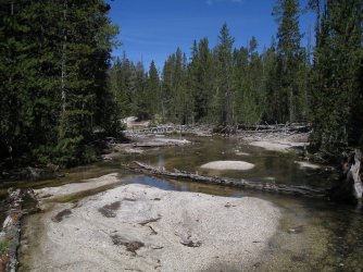
This day was a fairly straightforward drop from Mist Creek down to Lamar River and then heading straight back towards the trailhead. It was also our first contact w/ another human since the very beginning of the first day. (It was downright crowded! We saw five people and two horses in three separate groups!) The Lamar River was spectacular - some portions opened up and resembled the Yellowstone River through the Thorofare while other sections tightened considerably with steep cliffs on either side. I really enjoyed this day, though my brother was nursing a foot injury from the previous day and had to take it a bit slower. At one point I'd considered getting all the way out to the trailhead on this day, but it was nice to be able to relax a bit. (We ended up hiking almost dawn-to-dusk to cover our 12 miles.)
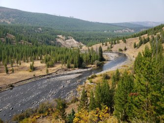
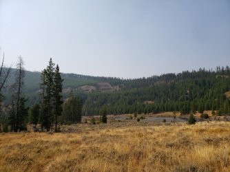
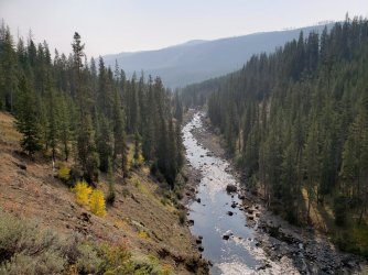
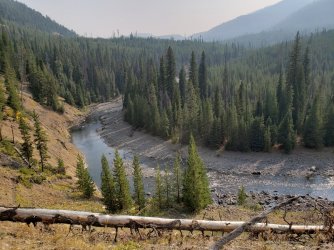
At site 3L7 we got quite a scare when a group of 8 mule deer jumped out of the foliage behind us and bolted through our cooking area. We still hadn't run into a bear on this trip and I'm sure glad that wasn't it.
Day 6: 3L7 Middle Lamar to Soda Butte/Lamar River TH
I may never understand the "last day phenomenon" of backpacking - you're so excited to be done w/ something that you'll miss with all of your heart five minutes after it's over. That said, we were ready to get off the trail and get some "real" food. This day was fairly simple and we were heading back into the denser smoke of Lamar Valley - we did see many more bison on the way out than we had on the way in. We also followed what appeared to be the tracks of a grizzly sow with two cubs for about a mile along the trail - right up until the trail crossed Cache Creek and we began to see a decent number of day hikers.
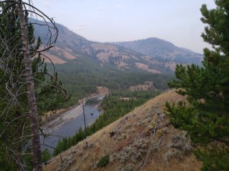
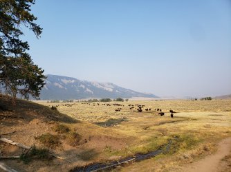
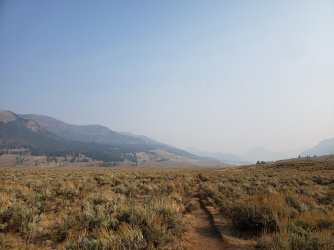
After the backpacking trip I took my brother on a proper tourist "road tour" of the park. Last year - in his first trip to Yellowstone - he'd managed to hike almost 100 miles on trail while driving barely 100 feet on the roads. (We just drove to the South Entrance TH and started hiking.) While I was very jealous of his ratio of trails:roads, I also felt like he needed to see a bit more of the park. We got pretty lucky with the wildlife, spotting a wolf pack crossing the Lamar River, as well as a large grizzly feasting on a bull elk carcass along the Yellowstone River near Hayden Valley. I'm not sure where we'll be going next year after two years in Yellowstone, but it'll be tough to top these past couple trips. (We spent a week the two previous years in Grand Teton and Denali respectively.) Suggestions are welcome - he's obviously an experienced backpacker but I tend to avoid areas that are "stupid steep with all those fucking rocks" (quotations his) for his sake, so some of my favorites like the Winds and San Juans aren't the best option. I'm considering the Uintas, since I've never even been there myself or maybe the southern Thorofare region (outside of the national park).
My younger brother and I try to get out together at least once a year and this past year I wanted to figure out a week long route in the Lamar Valley region of Yellowstone NP - despite spending a lot of time in the area, I'd never managed to do much more than day hikes or single night outings. I knew I wanted to do two things: 1) cross Mirror Plateau; and 2) get a much better look at the Upper Lamar River - both goals were achieved and very much worth the effort involved.

Day 1: Soda Butte/Lamar River TH to 3L3 Lower Lamar
The first day was a short one - we just needed to get to campsite 3L3 about 5 miles from the Soda Butte/Lamar River TH. (Of course, we also drove straight in from CO that day, so it didn't feel too short by the end.) The hike in was fairly uneventful and the air was very smoky in the valley - mostly due to out of state fires to the west I believe, though the Lone Star Fire was still somewhat active at this time, too.

We saw very little in the way of larger fauna - even the bison weren't visible in their usual numbers - but we did spot a number of terrestrial garter snakes that were looking very "healthy". If any reptiles are going to survive winter in Yellowstone, it was these guys.

Camp was a very well worn spot along the Lamar River w/ nice tree cover - a pretty standard Yellowstone NP site.


Day 2: 3L3 Lower Lamar to 4W2 Wapiti Lake (Peninsula)
This was definitely the "crux" of our trip: 16 miles of almost exclusively off-trail travel across Mirror Plateau. In mid-summer there are some camping options available up on the plateau, but at this time of year BMA restrictions limit travel to daylight hours only and mandated that we be off the plateau by sunset. As is so often the case, the most challenging part of the trip was also the most rewarding. I think I'd built it up a bit in my head, but travel on the plateau was reasonably straightforward and the deadfall that seemed so concerning during planning was almost a non-issue. (Disclaimer: my brother and I both have significant experience navigating off-trail. This is not a particularly difficult route but it is committing and the time constraints are not forgiving, so not recommended unless you have some experience.)
We elected to follow an unnamed (to our knowledge) drainage directly to the west of our overnight accommodation. It was very easy to spot and follow - footing was good all the way up. Early season might be pretty wet, but in September it was just enough water that we never needed to carry any and also never really got our feet wet.


Near the top of the drainage we began to hear a large number of bull elk bugling and shortly thereafter spotted 5+ large groups of elk spread out in front of us. (I apologize for the lack of photos; our paltry phone cameras weren't quite up to the task.) Once at the top, we began the game of finding bison routes across the plateau.


The route across the plateau didn't have any sweeping vistas like you might find in the Wind River Range, geothermal features like the frontcountry, or even much in the way of wildlife - aside for the elk at the top of the drainage and an occasional small group of bison. What it did have though was pure Yellowstone country and not another soul in sight. I could've stayed up in those meadows for days. (Also, the smoke was much less of an issue up here than down in the lower valleys.) Eventually we made our way over to Mirror Lake and had lunch before beginning our steady descent to Wapiti Lake.

Just before arriving at Wapiti Lake, the foliage began to change dramatically. There was much less evidence of "recent" fires and the trees soared overhead - I typically enjoy the "wide open spaces", but it was pretty comforting to be shielded from the wind and exposure in which we'd spent most of the day hiking.

Eventually we made it to our planned campsite for the evening (and the next) and enjoyed a relaxing dinner and the prospect of sleeping in - something we rarely do on our trips together. (Naturally neither of us actually ended up taking advantage of the extra sleep - but it was nice to know we had the option.)

Day 3: Off-Trail Exploration
This ended up being one of the longer "zero" days I've ever taken. We had marked a number of nearby areas for consideration on this day and ended up deciding to visit the Hot Spring Basin group of thermal features - as well as some other surrounding areas. This turned out to be an excellent choice, as we enjoyed some of the best looking mudpots I'd ever seen, as well as one of the loudest fumaroles. (I apologize for the lack of video - maybe I'll come back and edit the post if I ever upload them somewhere.) We also spotted an enormous Great Grey Owl barely 20 ft away - but the instant either of use moved to grab a camera it wisely took off.


We made our way back to camp predominantly along Shallow Creek - a fairly mellow route. Although we didn't encounter any wildlife, this waterway had possibly the highest concentration of bear signs I've ever encountered. We also found some very recent wolf tracks running both ways - it appeared to have been a decent sized group.

Day 4: 4W2 Wapiti Lake to 3T2 Mist Creek Meadows
This was another fairly long day at around 17 miles, but it was predominantly on-trail and mellow. While our two previous days were more adventurous - in that we weren't following a determined path - this one found us in a number of different environments and might be the one I most wish I could re-live. Like the second day, seasonal BMA restrictions put us on a pretty demanding schedule - we needed to be up and over Mist Creek Pass by evening because the whole of Pelican Valley is restricted to daytime travel only. (It's also one of the only BMAs w/ specific time requirements - as opposed to more generic "sunrise/sunset" guidelines.) Following Upper Pelican Creek - before entering the valley itself - was probably the highlight in a day of highlights. We shared most of the day with small groups of male bison - as well as the occasional fox, coyote, or mule deer. The thermal areas here were small, but very cool - I particularly enjoyed the impressively circular mushpot that my brother dubbed a "gateway straight to Hell".


We were in for a bit of a surprise upon entering Pelican Valley. Both maps and conversations with others who've hiked this area seemed to indicate the presence of well-marked trails in this region - at least by Yellowstone standards. We did not find this to be the case and were regularly in "routefinder mode" until we reached the Pelican Springs Ranger Cabin. This wasn't really a problem - if anything it was a nice adventure - but anyone heading to the eastern portion of Pelican Valley should probably be aware. (As opposed to the western portion of the valley - which I've hiked regularly from the TH there - that is typically very well marked/signed.)


Mist Creek Pass was fairly innocuous. Just enough elevation gain to feel a little burn - but not enough to really slow you down. The view was mostly obstructed and the scenery mostly young trees surrounded by deadfall. (I was grateful that this section was manicured trail - going off trail here would have been a beating.) Mist Creek Valley was absolutely stunning - it's probably the top area from the trip that I want to revisit. Considering I somehow failed to take any pictures here, I guess it's that much more necessary.
Day 5: 3T2 Mist Creek Meadows to 3L7 Middle Lamar
This day was a fairly straightforward drop from Mist Creek down to Lamar River and then heading straight back towards the trailhead. It was also our first contact w/ another human since the very beginning of the first day. (It was downright crowded! We saw five people and two horses in three separate groups!) The Lamar River was spectacular - some portions opened up and resembled the Yellowstone River through the Thorofare while other sections tightened considerably with steep cliffs on either side. I really enjoyed this day, though my brother was nursing a foot injury from the previous day and had to take it a bit slower. At one point I'd considered getting all the way out to the trailhead on this day, but it was nice to be able to relax a bit. (We ended up hiking almost dawn-to-dusk to cover our 12 miles.)


At site 3L7 we got quite a scare when a group of 8 mule deer jumped out of the foliage behind us and bolted through our cooking area. We still hadn't run into a bear on this trip and I'm sure glad that wasn't it.
Day 6: 3L7 Middle Lamar to Soda Butte/Lamar River TH
I may never understand the "last day phenomenon" of backpacking - you're so excited to be done w/ something that you'll miss with all of your heart five minutes after it's over. That said, we were ready to get off the trail and get some "real" food. This day was fairly simple and we were heading back into the denser smoke of Lamar Valley - we did see many more bison on the way out than we had on the way in. We also followed what appeared to be the tracks of a grizzly sow with two cubs for about a mile along the trail - right up until the trail crossed Cache Creek and we began to see a decent number of day hikers.


After the backpacking trip I took my brother on a proper tourist "road tour" of the park. Last year - in his first trip to Yellowstone - he'd managed to hike almost 100 miles on trail while driving barely 100 feet on the roads. (We just drove to the South Entrance TH and started hiking.) While I was very jealous of his ratio of trails:roads, I also felt like he needed to see a bit more of the park. We got pretty lucky with the wildlife, spotting a wolf pack crossing the Lamar River, as well as a large grizzly feasting on a bull elk carcass along the Yellowstone River near Hayden Valley. I'm not sure where we'll be going next year after two years in Yellowstone, but it'll be tough to top these past couple trips. (We spent a week the two previous years in Grand Teton and Denali respectively.) Suggestions are welcome - he's obviously an experienced backpacker but I tend to avoid areas that are "stupid steep with all those fucking rocks" (quotations his) for his sake, so some of my favorites like the Winds and San Juans aren't the best option. I'm considering the Uintas, since I've never even been there myself or maybe the southern Thorofare region (outside of the national park).
Last edited:

