Udink
Still right here.
- Joined
- Jan 17, 2012
- Messages
- 1,748
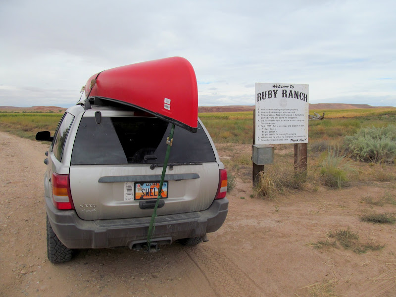
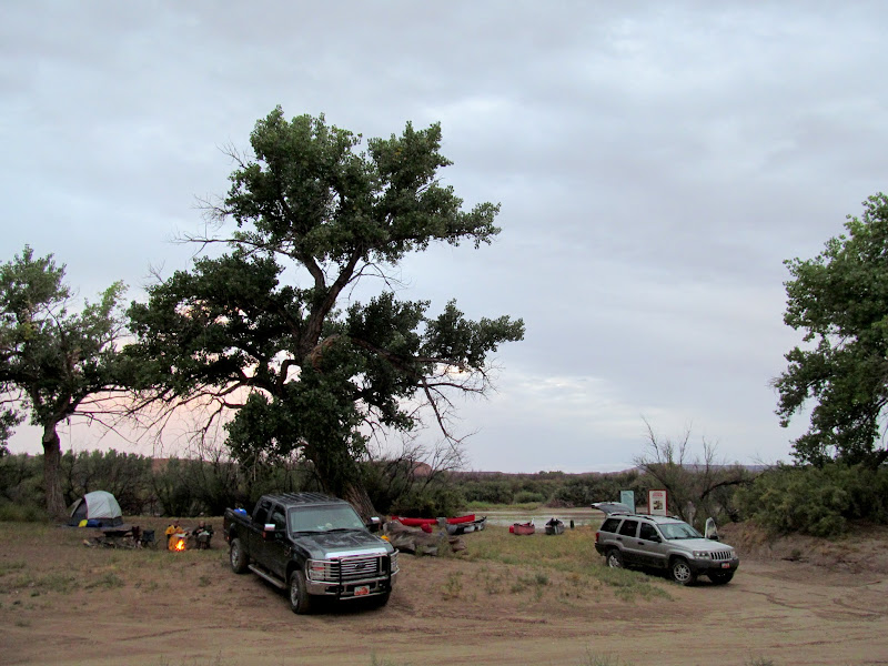
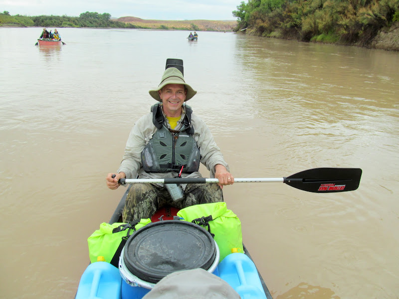
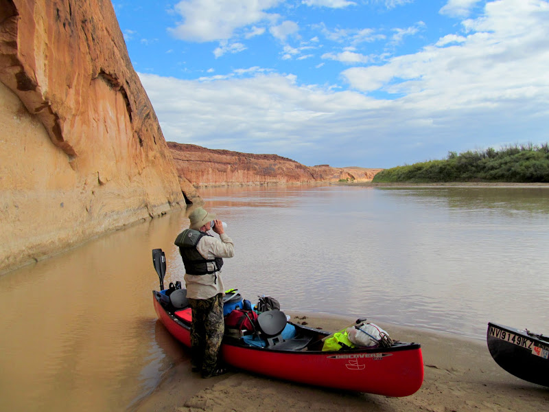
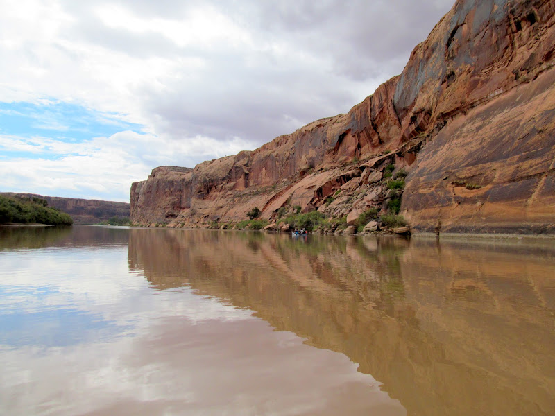
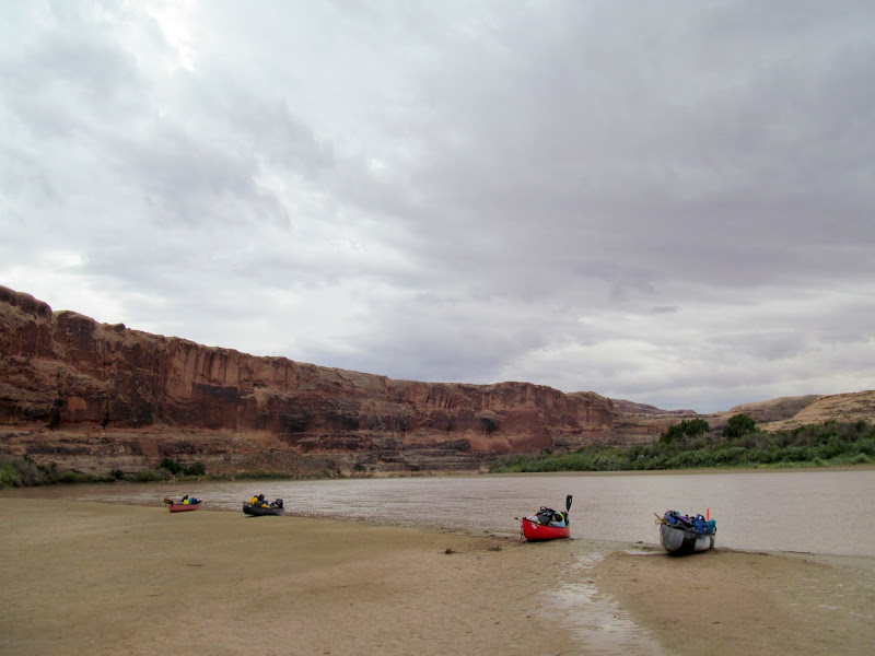
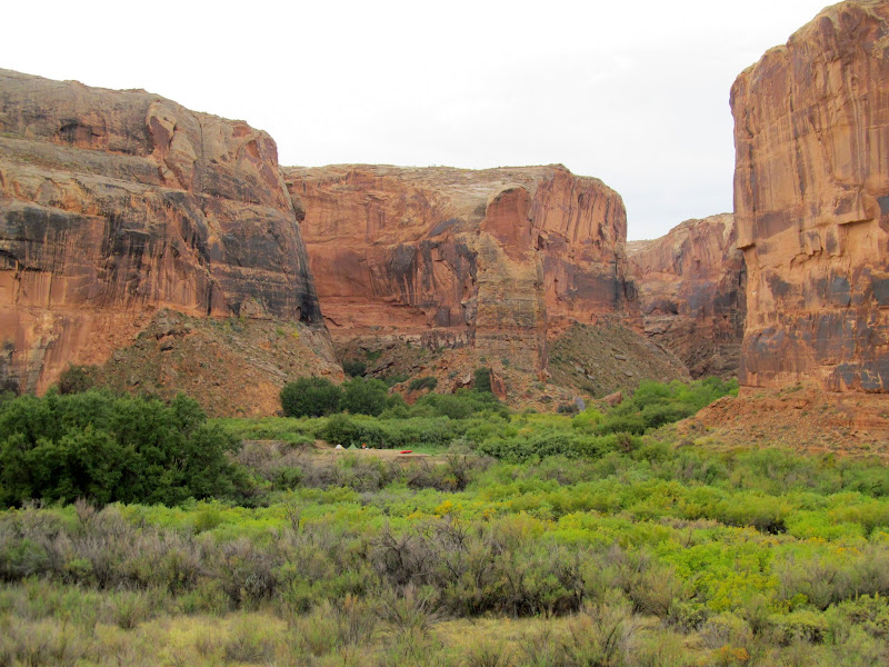
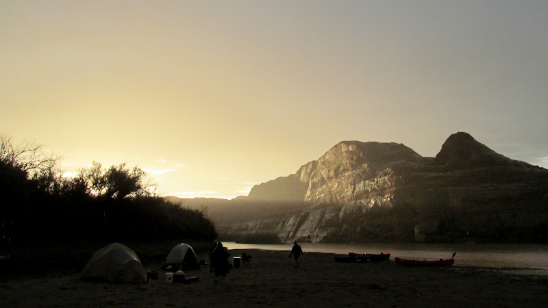
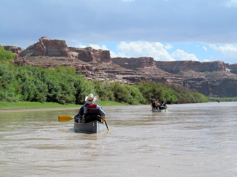
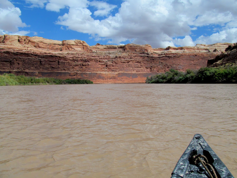
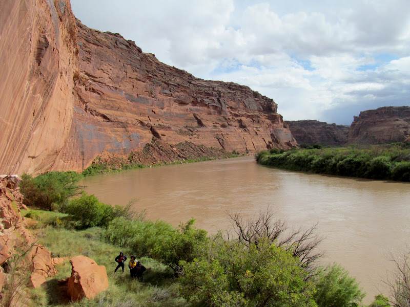
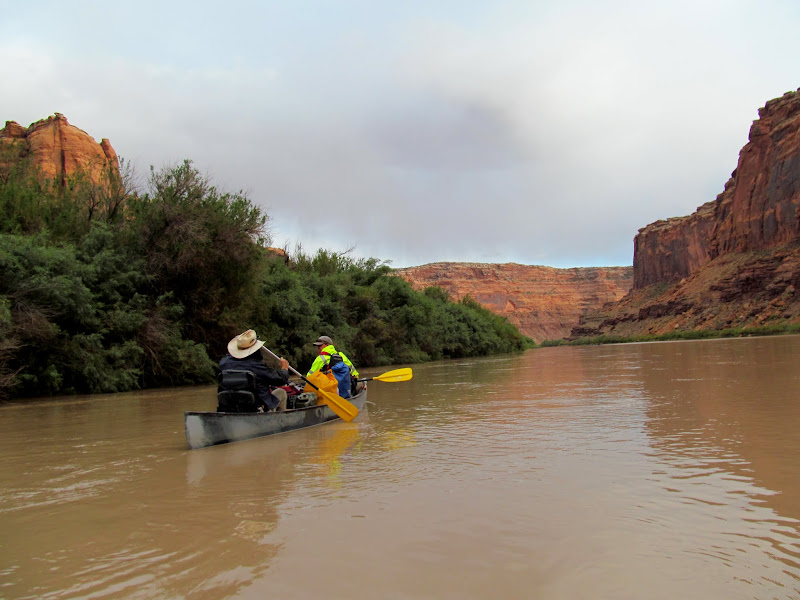
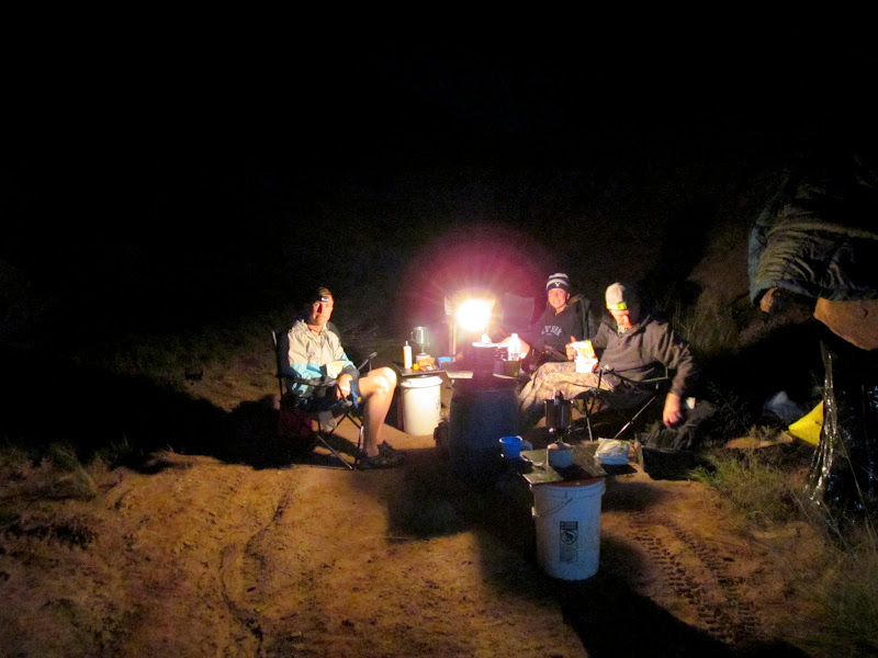
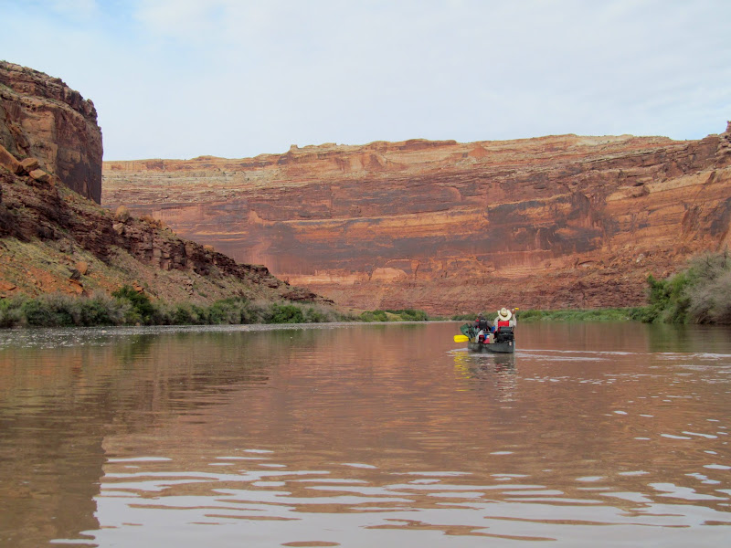
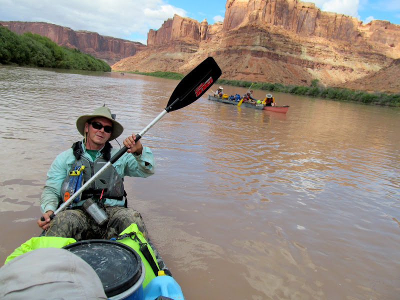
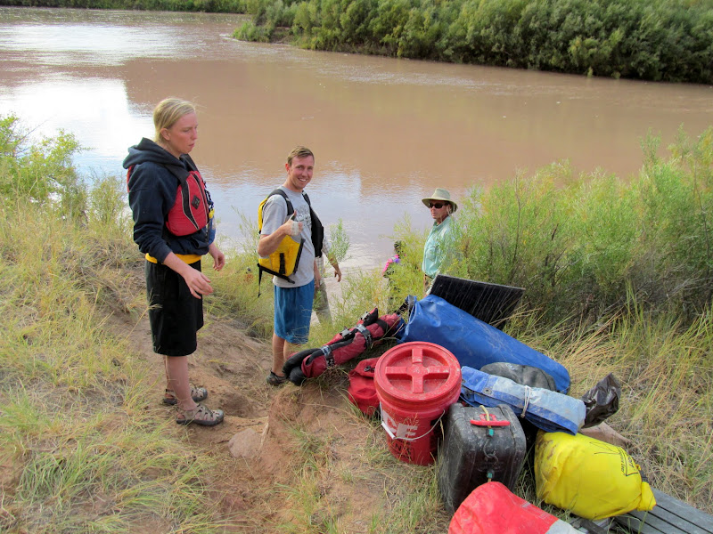
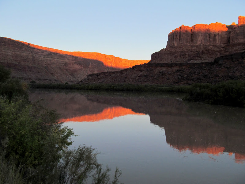
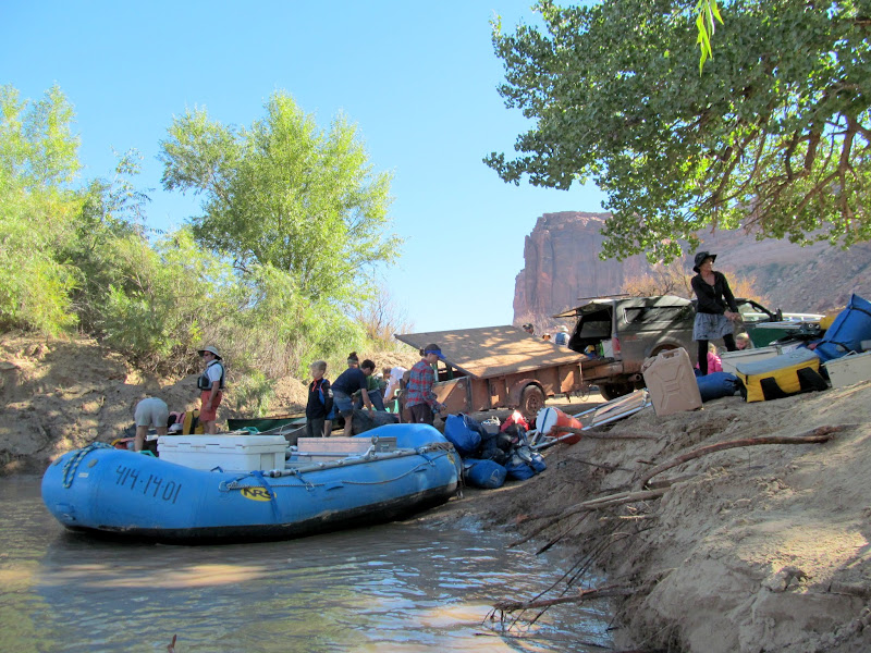
In a sequel to last year's canoe trip through lower Labyrinth Canyon and Stillwater Canyon, this year our group floated upper Labyrinth Canyon from Ruby Ranch to Mineral Bottom. The cast of characters was a little different: we lost three members but gained two others. Alan and I paired up again, as did Wade & Lyman, and Paul & Terri, with Wade's kids Weston and Madi rounding out the group. I arrived at Ruby Ranch on Wednesday afternoon and stuck around to watch gear while three others shuttled two trucks and a trailer to Mineral Bottom. It took a little longer than expected for everyone to regroup at Ruby Ranch so we decided to camp there and begin our river trip in the morning.
Arriving at Ruby Ranch
First night's camp at Ruby Ranch
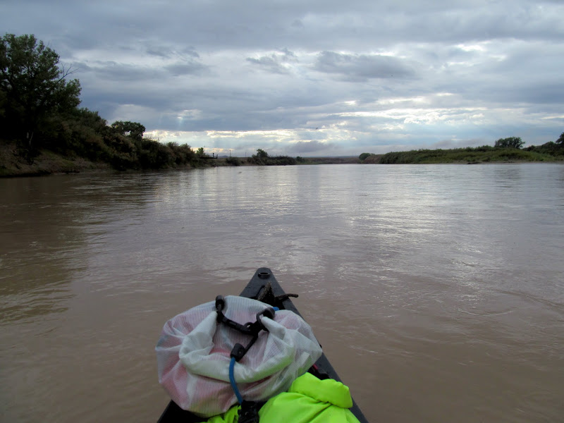
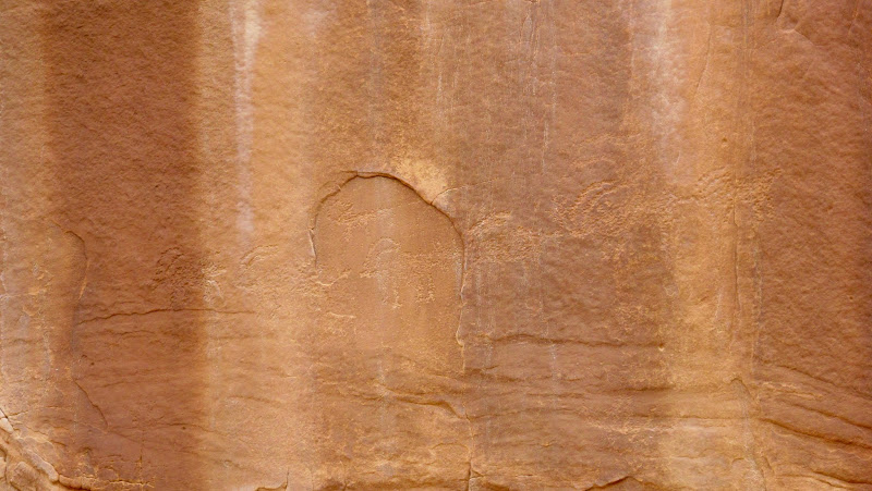
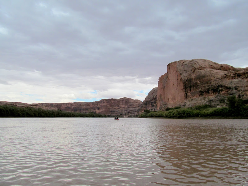
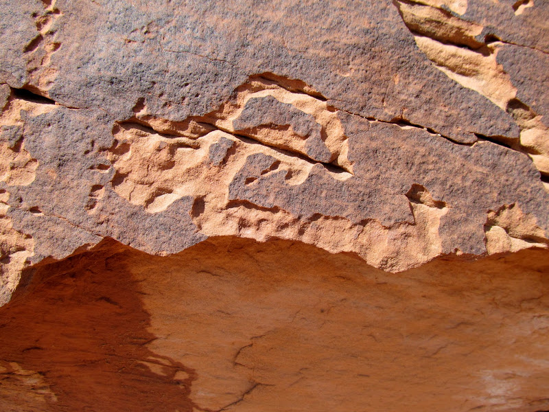
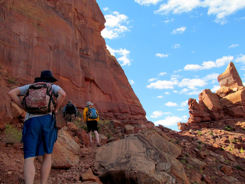
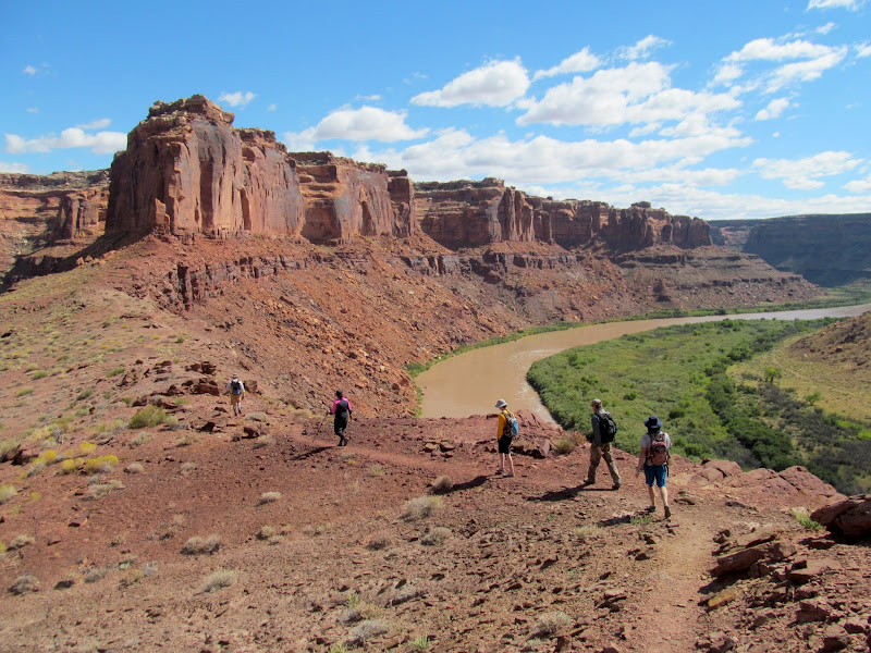
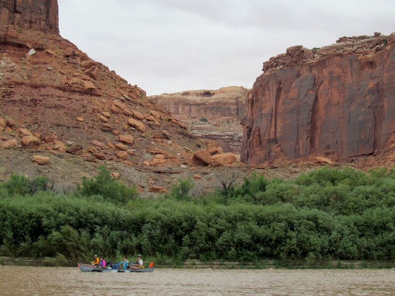
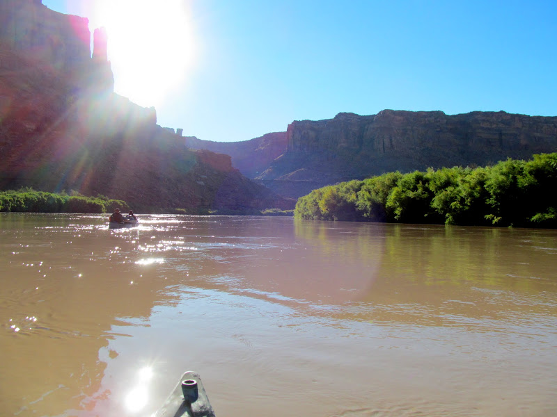
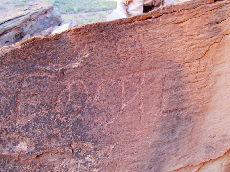
It had rained a little during the night, and we packed our wet gear into the canoes and got underway by 9AM on Thursday morning. The first stop, after paddling a few miles, was a small unnamed canyon just downstream from Red Wash. Alan had remembered some petroglyphs in the canyon on a long-ago trip. We all hiked up the canyon and searched the sandstone walls but didn't see anything. While hiking back down the canyon I spotted a line of faint bighorn sheep petroglyphs that we'd missed on the way up.
Preparing to launch
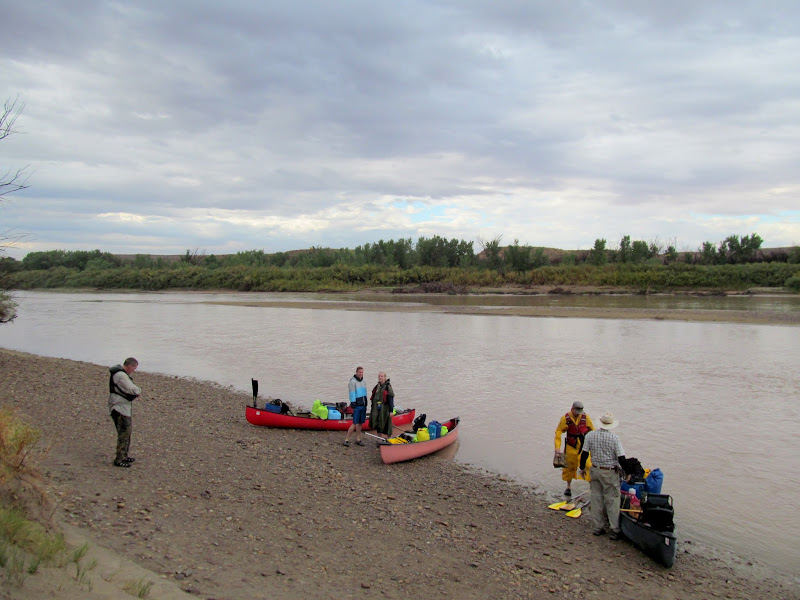
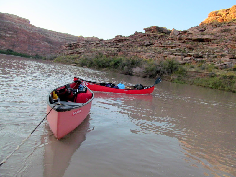
On the water!
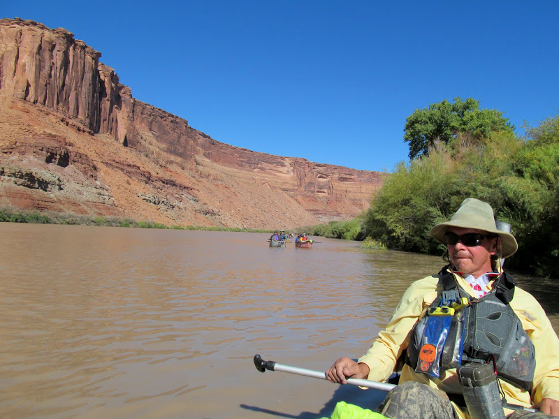
Alan in the back of the canoe
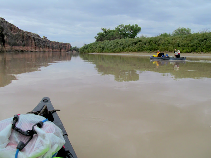
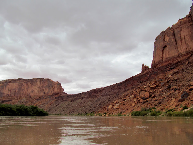
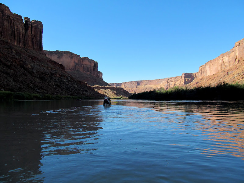
Walls rising on the left bank as we enter Labyrinth Canyon
A line of faint sheep petroglyphs
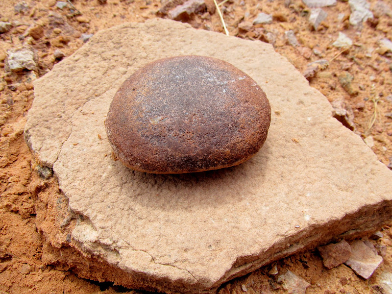
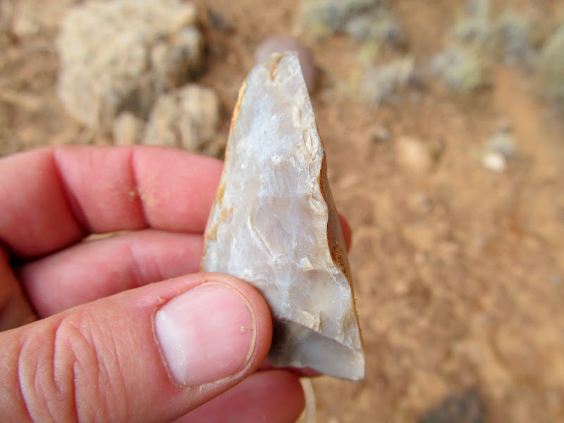
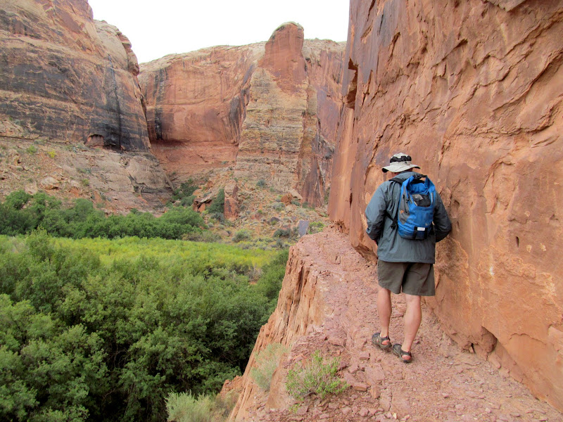
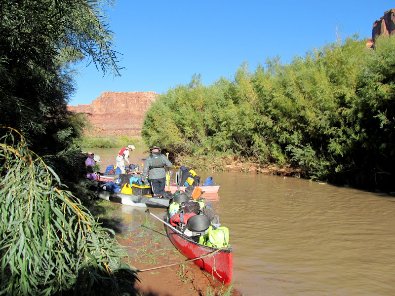
Another mile on the river brought us to Bull Bottom. It's easily accessible by road--I visited Bull Bottom three years ago but was limited in how much I could explore due to having a gimpy dog with me. This time I was delighted to be able to hike the entirety of Bull Bottom. We all explored as far as the stock trail, then the rest of the group agreed to let me and Wade walk the rest of the way down Bull Bottom while they returned to the canoes and met us downstream. Wade and I each went our own ways downstream along the cliffs, searching out any inscriptions, rock art, or anything else of interest. I think we missed some rock art along the way that I'd read about in a guide book. I did see another interesting thing mentioned in the guide book: a dead tree wedged in a crack in the cliffs that, if climbed, would lead out of Bull Bottom. I could imagine that, before the stock trail was built, this was the only way into and out of the bottom without going for a swim. Wade and I did find some very faint petroglyphs, a mano, and one spot that held a lot of worked stone tools. Strangely, there were more worked pieces of flint than there were debitage flakes.
Paddling toward Bull Bottom
Landing spot at upper Bull Bottom
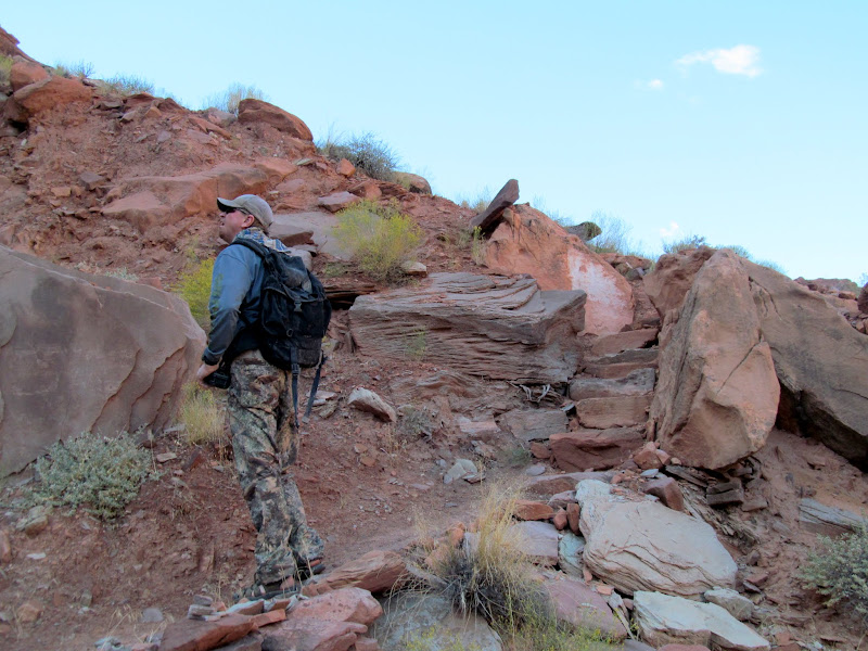
Paul on the Bull Bottom stock trail
Tree leaning against a cliff, creating a possible way to climb out of Bull Bottom
Cottonwoods on Bull Bottom
Just some rocks
Stone tool, side view
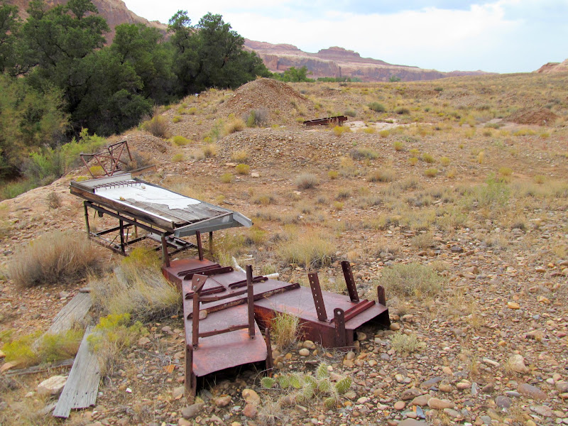
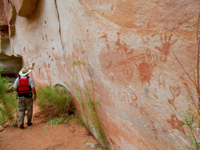
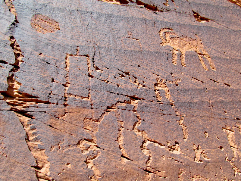
Placer Bottom was the next stop on our list. It's also accessible by road, which accounts for the somewhat modern mining equipment left in the area. Among the piles of gravel and rocks were sorting screens and sluice boxes. The main attraction for the group, however, was the rock art. One scene showed two human figures hunting a bighorn sheep using spears or atlatls.
On the river below Bull Bottom
Mining equipment and gravel piles at Placer Bottom
Placer Bottom petroglyphs
Placer Bottom petroglyph
The boats at Placer Bottom
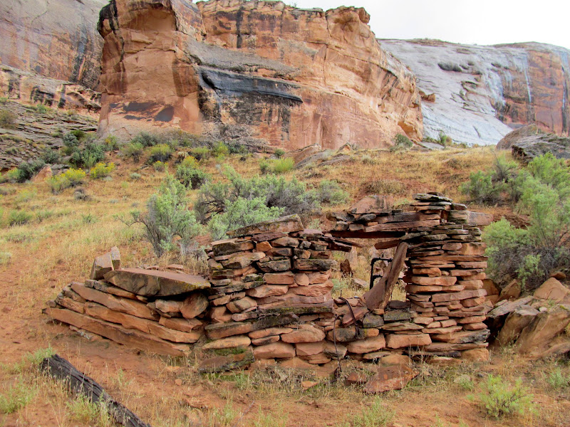
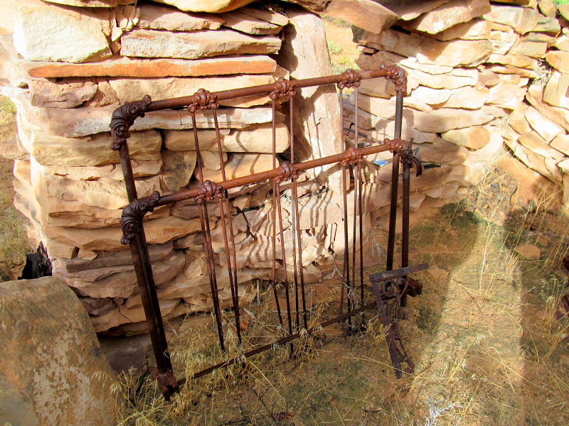
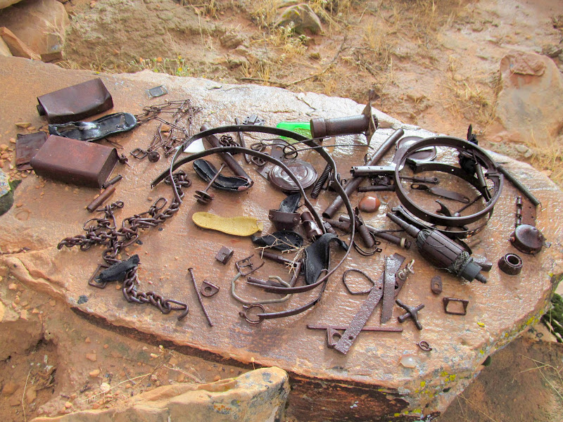
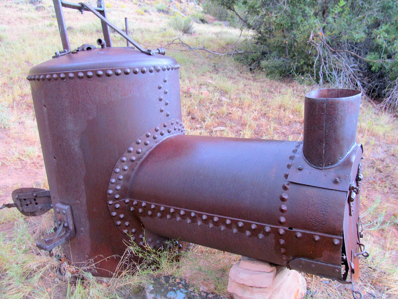
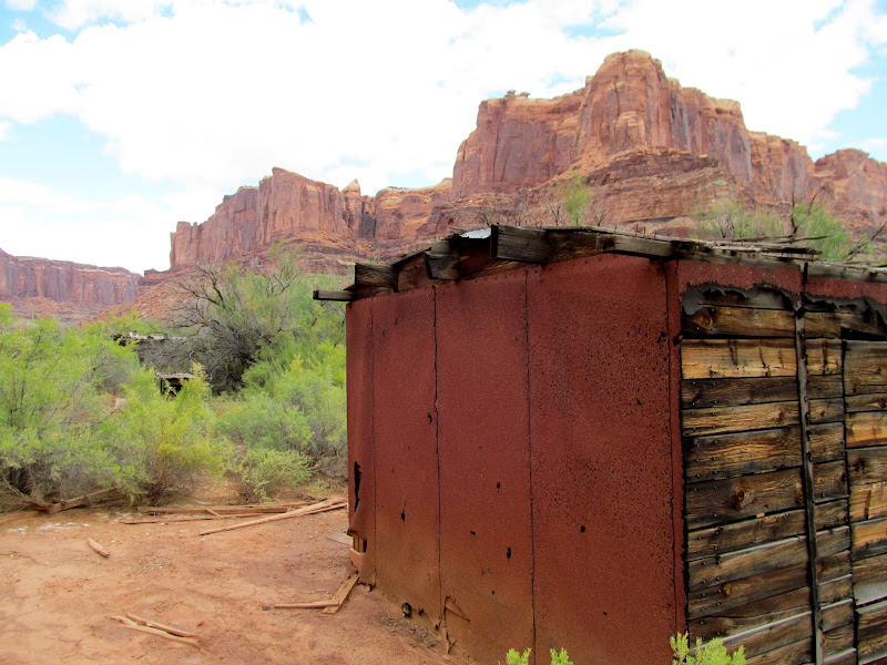
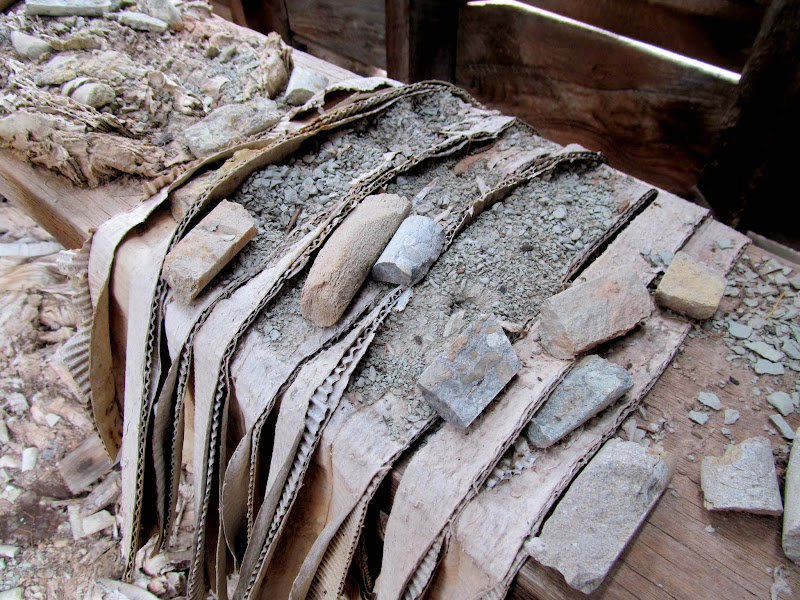
The final points of interest for the day were Trin Alcove Bend and Three Canyon, then June's Bottom. We hadn't really stopped for lunch so, while the group was looking for a stock trail from Trin Alcove Bend up to the east, I stayed with the boats and ate something. I joined them after they'd found the trail, then Alan and I hiked along the bottom of the cliffs upstream looking for any inscriptions but came up blank. In Three Canyon we poked around but didn't find much more than some modern vandalism. June's Bottom was quite interesting, with an old stone dugout cabin used by the Marsing family and a lot of old junk nearby, including a steam boiler that was once used to pump water to irrigate crops.
Entering Trin Alcove Bend
Mouth of Three Canyon
Alan above Trin Alcove Bend
Paul on the ledge above Three Canyon
If only people would keep their children under control!
Rock wall in front of the dugout Marsing house
Bed frame
Bits and pieces
Boiler used to pump water to irrigate June's Bottom
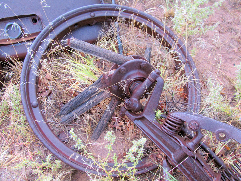
Wooden spoked wheel on an old car axle
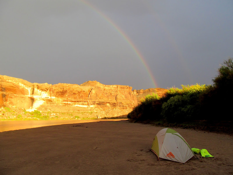
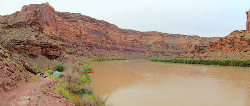
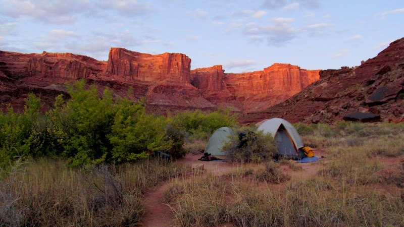
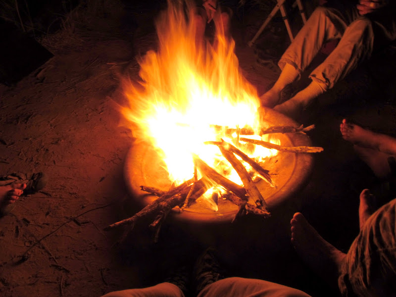
While part of the group was finishing our exploration of June's Bottom, the remainder paddled downstream in search of a place to camp for the night. The rest of us followed a short while later and found the others setting up camp on a nice sand bar about half a mile downstream. The edge of a rain storm passed us over and we set up camp in the rain but with a nice light show by mother nature, including a beautiful double rainbow. We fixed dinner, enjoyed some time around a camp fire, then turned in for the evening. Our choice of campsite was nagging at me, however, and I placed a stick in the sand at the current water level before I went to bed. It turned out that I wasn't the only one worried about the relatively low sand bar that we were camped on. Through the night a couple of storms rolled through, sounding off some truly awesome thunder followed by wind as the rain receded after each storm. The sound of that thunder will always stick with me. It was terrifying and awe-inspiring and I loved every minute of it despite counting off "one-one-thousand two-one-thousand..." after each flash of light. I awoke at 3:30AM to relieve myself and was mortified that the water had extended 10 feet beyond the stick that I'd placed in the sand, but it was only a few hours before we'd all rise and I hoped we'd be okay since there were still dozens more feet between the water and my tent. A little before 7AM I rose to voices. At first it was, "Hey, I don't remember going to sleep on a water bed," then it was, "The canoes are gone!" Although I thought it was all a joke, I still hurried to get dressed and unzipped my tent door to a nightmare. Only one canoe was left where we'd beached them, and two of the tents were in the river!
Sun shining through the rain at Thursday's camp
Rainbows above camp
Flooded camp on Friday morning, with canoes missing!
Everything after that point was frantic. I scurried to get my gear out of the tent and onto higher ground. Weston and Madi had spotted Paul's canoe downstream and hopped into Wade's canoe to retrieve it. Luckily a group camped 1/4-mile downstream from us also saw the derelict canoe and paddled out to grab it. The pair returned with two of our canoes, but that still left two unaccounted for. Wade rallied the troops and tried recruiting two others to paddle downstream to look for the missing boats. I reluctantly volunteered since mine was among the missing canoes. We'd already discussed our options, and we knew that our camp spot was accessible by an old road leading into June's Bottom. Hiking out and calling for help was a distinct possibility. Wade, Weston, and I boarded a canoe and paddled furiously downstream in search of the other canoes. I gave up any hope of finding them after half an hour of rapid downstream travel, but eventually we spotted both canoes fairly close together. Mine had hung up on a sand bar hidden below the water level, so we passed it up and retrieved the other canoe first. I tied its bow line to the stern of our canoe and then we fought the current upstream toward my canoe. I swung the rear of the first canoe toward Wade in the fore of our boat and he tied the bow line of my canoe to the stern of the other boat, and then we headed upstream. The three of us rowed our hearts (and arms) out for over two and a half hours against the current to make the three miles back to our camp spot. We took a few rest breaks by closing in on the shore and grabbing on to willows to hold our progress. The final half-mile we were able to walk in shallow water over the sand bar toward camp. Sore arms and blistered hands would punctuate the remainder of the trip for us three, but we pulled the canoes back to the rest of the group and salvaged the trip.
Towing the missing boats back upstream
Walking the canoes upriver
Taking a break from paddling against the current
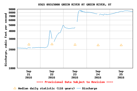
We found out later that, ironically, it was a huge storm at home near Price that caused the river to rise. The Price River had gone from a mere 3 cfs to well over 8,000 cfs on Thursday, making it the biggest river in the state for a short time. The Green had risen from just over 2,000 cfs to about 5,000 cfs that night, and it would rise to over 8,000 cfs the following evening. We were lucky that the mighty Green River tempered all that flow and rose slowly instead of seeing a huge surge in the night. Of course, it was our failure to tie up the boats that caused all our problems. I was reminded of the saying, "If you see something, say something." Most of us were thinking that exact thing after the fact.
Price River flow during the trip

Green River flow during the trip
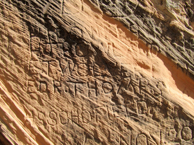
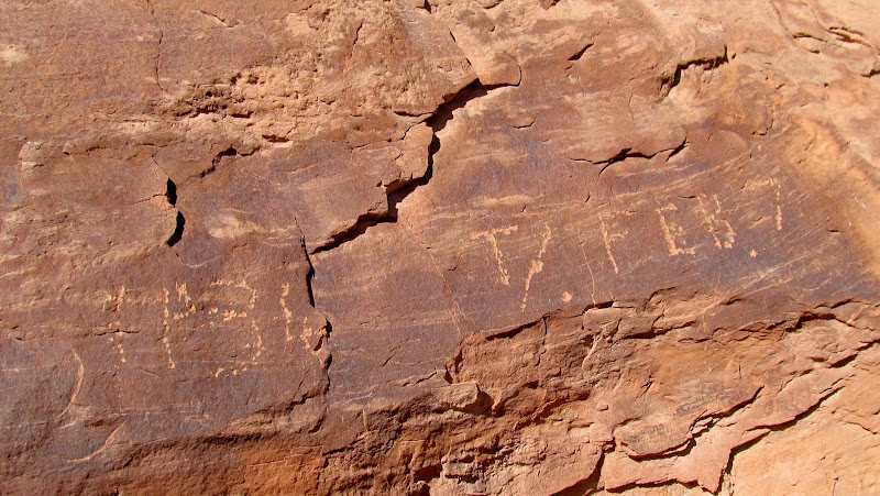
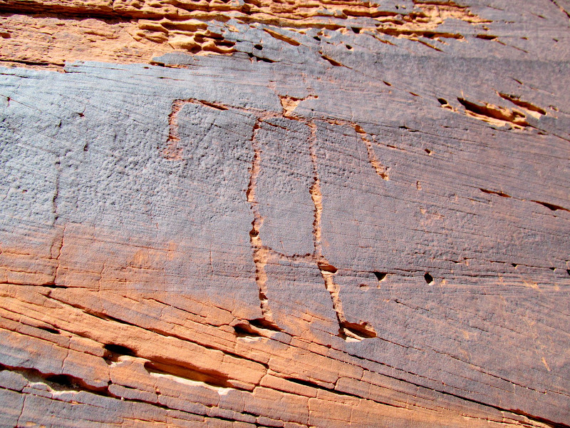
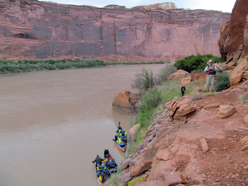
Reunited with the rest of the group, we returned to find that they had taken down tents and other gear and hung it all out to dry on the tamarisks well above the new high water line. I made some coffee and ate a very late breakfast. It felt strange to continue on like normal after such a near disaster. By noon we were back on the river. We skipped a planned stop at Bull Hollow and instead stopped at some inscriptions from the early 1900s just below Bull Hollow. Several of us had stopped there during a 2014 trip on the river via jetboat, but it was well worth visiting again. We also checked out some petroglyphs just downstream from there and avoided a nasty bushwhack by landing farther upstream. As we returned to the canoes and floated past the rock art, I noticed a constructed stock trail that would make for easy land access to that bottom land.
Back on the river for day two
H.I. Bowles, H.T. Howland, E.T. Wolverton, E.D.R Thomas, H.S. Schofield
1934 T/ Feb 7
Petroglyphs
Broken sheep petroglyph
Petroglyphs
Wheeler Trail
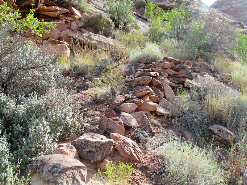
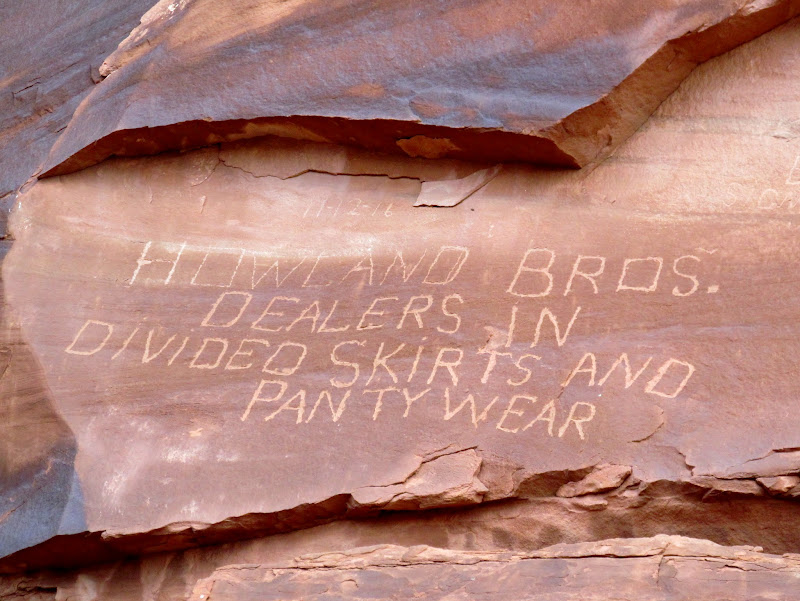
A planned visit to some inscriptions at the mouth of Tenmine Canyon was thwarted by heavy brush and mud. We reluctantly skipped that area but found an interesting 1893 inscription just downstream from the mouth of Tenmile. We landed at Wolverton Canyon, the drainage just upstream from Keg Spring Canyon, to check out a constructed road/trail in the lower end of the canyon, but the abbreviated day kept us from following the trail very far up the canyon. The final two attractions of the day were at the Howland brothers inscription (one of my favorites) and River Register.
On the river heading toward Tenmile Wash
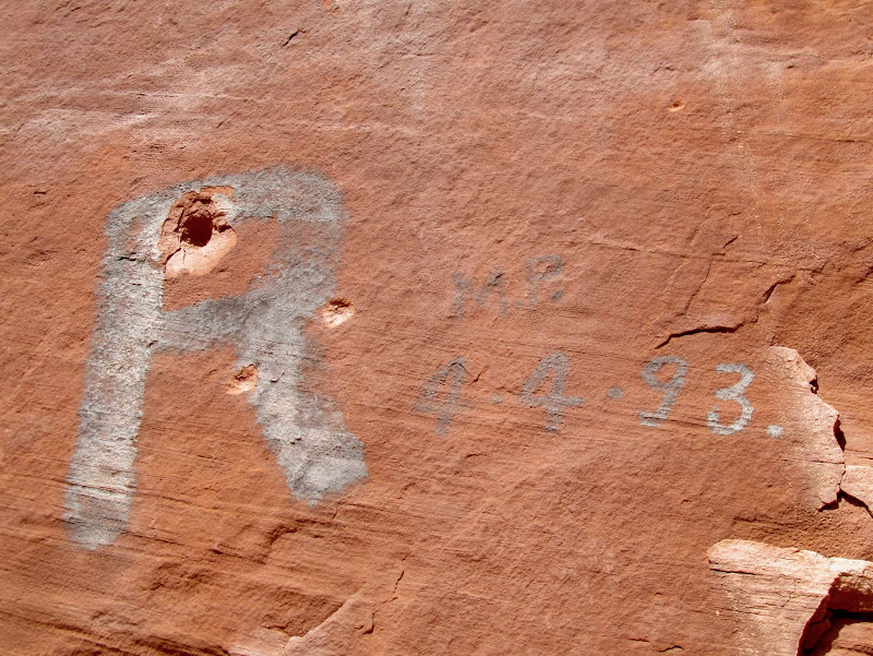
R M.P. 4-4-(18)93.
Small strip of talus and bottom land below Tenmile Wash
Wolverton Trail
Lower Wolverton Canyon
One of my favorite inscriptions, by the Howland brothers in 1916
Checking out a stock trail that follows the river below Keg Spring Canyon
River Register
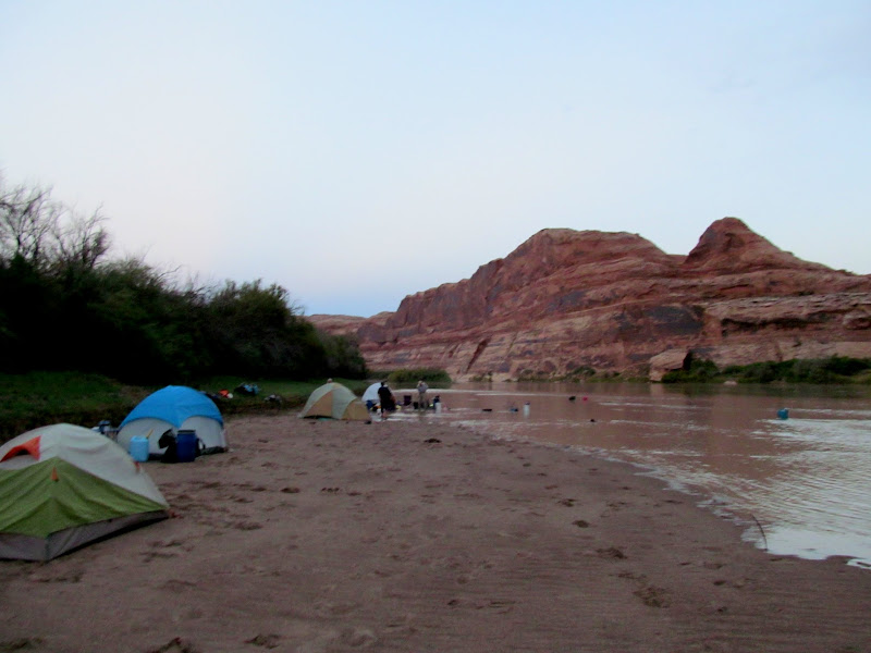
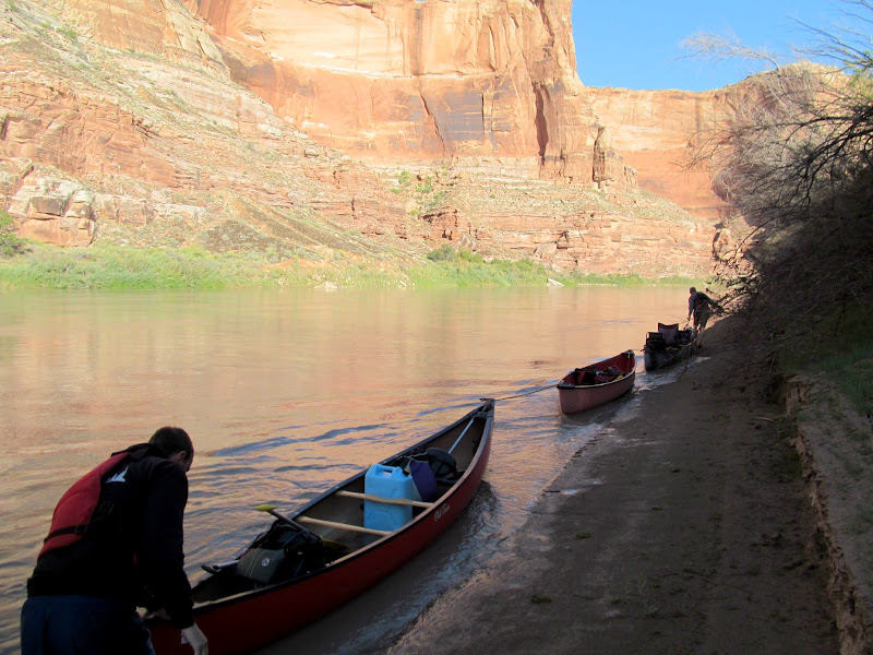
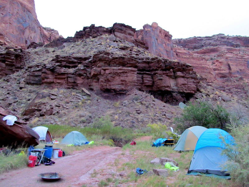
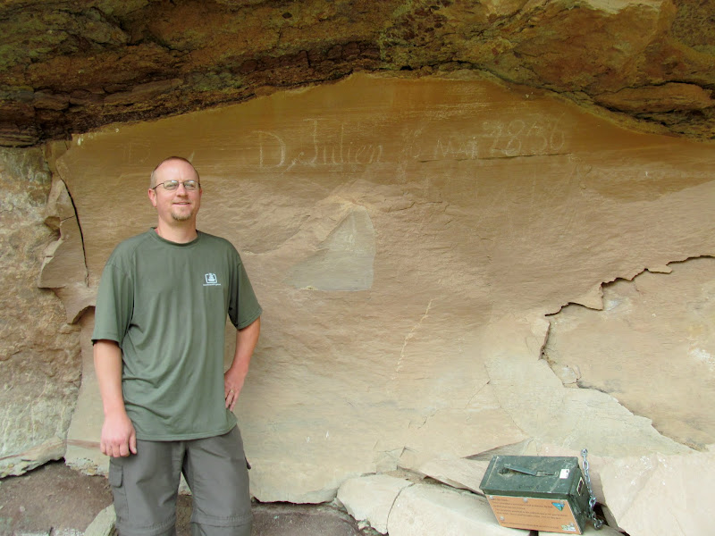
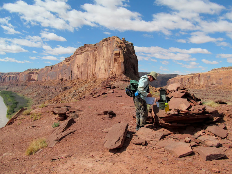
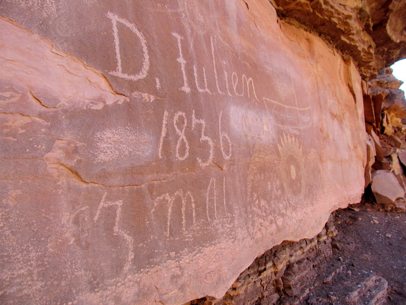
Our final act of the day was to find a camp spot. Of course, this time we were extremely cautious about where chose to set up camp. We were all aware of the road on the east bank of the river that leads to Hey Joe Canyon, so we aimed for that bank and eventually found a decent landing spot where we could climb up high above the water. By walking a short distance up the road we were able to find a suitable place to camp. We utilized a bucket brigade sort of line to haul gear up the steep river bank to the road, then toted the gear a couple hundred feet up the road to our camp spot. With as late in the day as it was, on a remote, dead-end road, there was no compunction about setting up camp directly on the road! In the morning, after taking down camp, we visited the nearby Denis Julien inscription from May 16, 1836.
Paddling past Hey Joe Canyon
Camped right on the Hey Joe Road
Camp along Hey Joe Road
Panorama near camp
Me at the Julien inscription, photo by Lyman
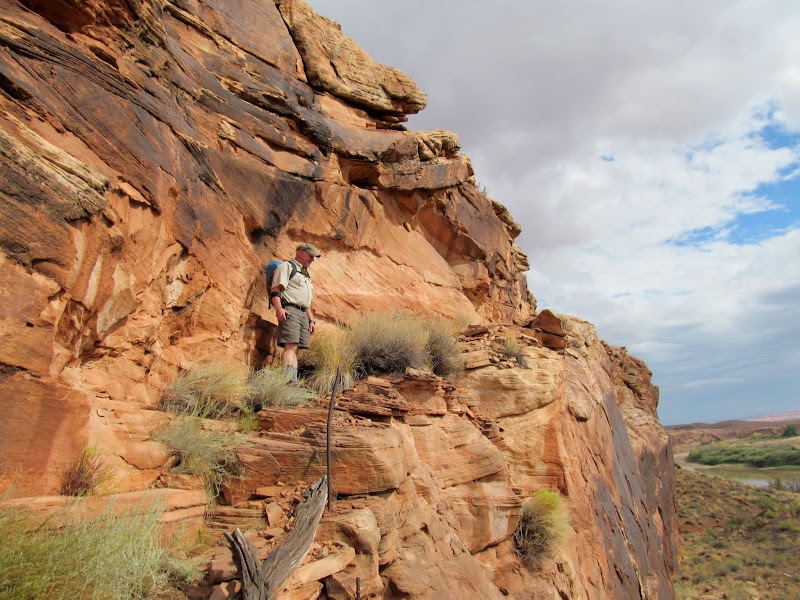
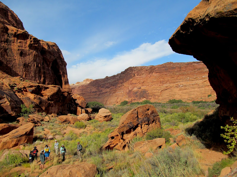
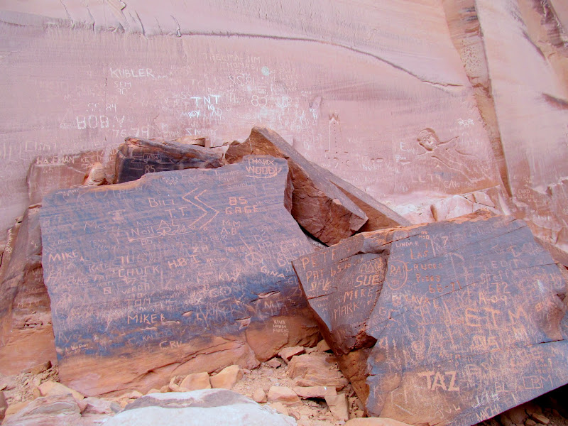
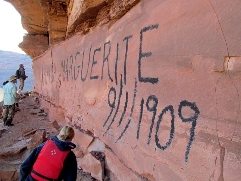
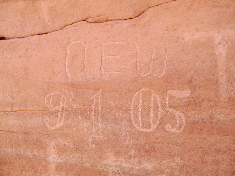
We again set up a human chain and tossed gear from person to person to load the boats in the morning. To begin our third day on the river the group made a brief stop at the Launch Marguerite inscription, left by the crew of a steam powered boat in 1909. I'd been looking forward to the next point of interest, Bowknot Saddle, for a long time. Despite having been there twice (once on a trip to the top of the Bowknot plateau and again during a hike down Twomile Canyon) I had never visited the middle of the saddle in order to claim the geocache there. The trail up the north side of the saddle was in great shape and, in the morning shade, made for a very pleasant hike. We spent time looking through the BLM register and viewing the inscriptions on the west end of the saddle where we also sat in the shade and ate lunch.
Third day on the river
The group at the Launch Marguerite inscription
Another Launch Marguerite inscription at Bowknot Bend
Wade on the Bowknot Saddle trail
Almost to the top of the trail
Alan signing the register at Bowknot Saddle
Bowknot Saddle panorama
Neville Wolverton, 9/1/1905
Kolb Bros 10/11
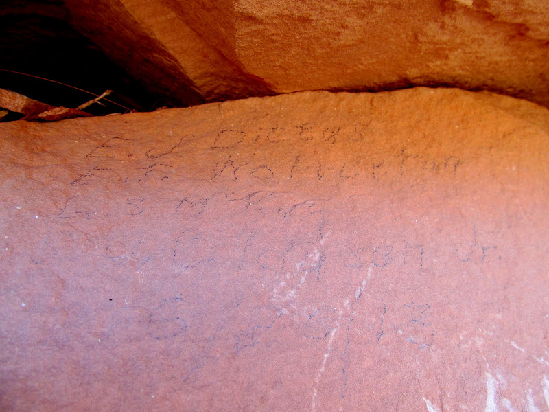
Several names, including E.T. Wolverton, dated 6/20/1913
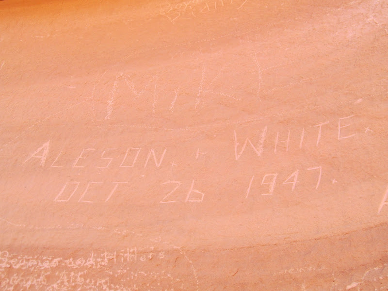
Harry Aleson and Georgie White, Oct. 26, 1947
Dirt bikes on the road to Hey Joe
The crew at Bowknot Saddle
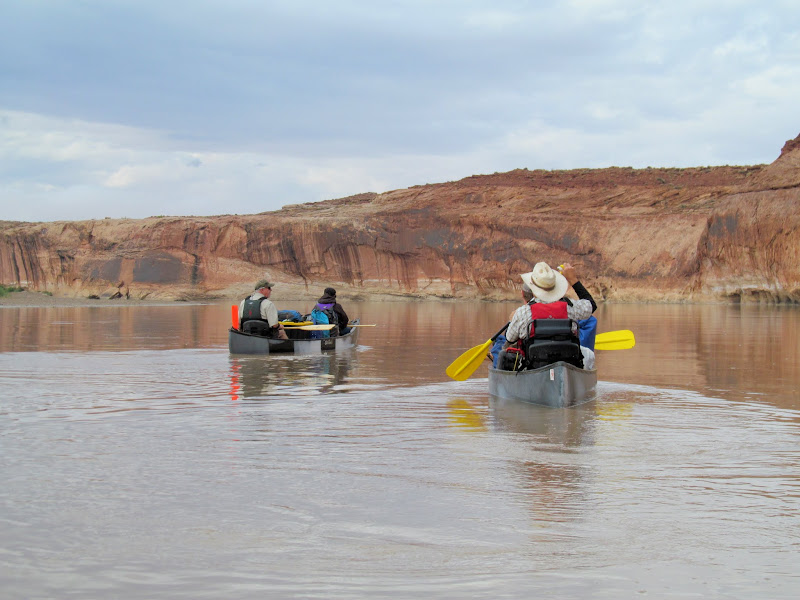
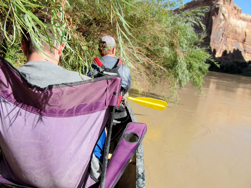
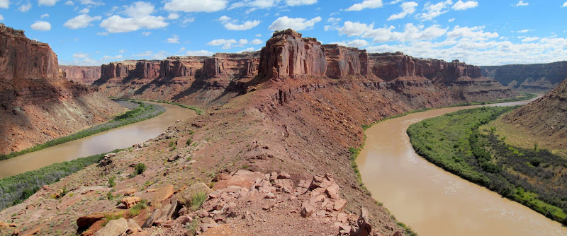
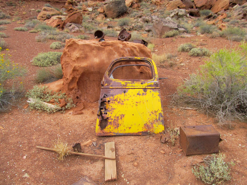
Returning to the river briefly, we floated around to the east side of Bowknot Bend and visited some mining ruins. In addition to two cabins there were old oil barrels and various rusty chunks of metal lying around the area. Although we'd landed at a super sweet campsite, high above the water and sheltered by huge scrub oak, we wanted to press on and find a place to camp closer to the takeout at Mineral Bottom. We launched with no more stops planned for the day, and just put some river miles behind us for a couple of hours. When we did begin looking for a place to camp later in the afternoon, we had some competition. A group of kayaks had overtaken us and were zig-zagging between the river banks, obviously looking for a camp. We caught up to a group with two rafts who were also seeking a spot. With the high water there were no sand bars and camp spots were at a premium. We finally pulled into a decent site at the upper end of Cottonwood Bottom. There were only a few scattered flat spots so we had to spread the tents out pretty wide, but we gathered in a single place to eat together and enjoy the last camp fire of the trip.
Heart Rock
Old junk and a truck door
Cabin at Bowknot Bend
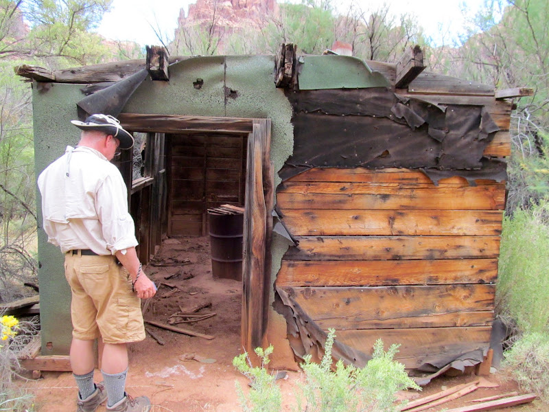
A second cabin
Drill cores
Back on the river and in search of a camp site
Bowknot Saddle
Mouth of Twomile Canyon with Colonnade Arch on the horizon
Passing gear up to our camp site
10-second exposure after sunset
Camp fire
While fixing breakfast on Sunday morning, a delightful sunrise sent me scurrying for the camera. We had a mere 4.5 miles left on the river and I was a little melancholy that the journey was coming to an end. We got on the river and headed toward the final point of interest at the mouth of Hell Roaring Canyon, where Denis Julien, Phil Foote, and the Wolvertons, among several others, had carved their names. Mineral Bottom came up quickly after leaving Hell Roaring. It was a little before 11AM and there were a lot of people taking out and putting in at the main ramp. While we waited for our turn, someone in the group found a spot just downstream from the ramp where we could offload the gear from the canoes. We got the gear on shore and into the trucks, then found an opening at the ramp to carry the empty canoes up toward the trailer. After picking up vehicles at Ruby Ranch and transferring gear and boats, we all regrouped at Ray's Tavern in Green River for a celebratory lunch! A burger and soda tasted great after eating trail mix and freeze-dried food for four days.
Morning on our fourth day on the river
Paddling toward Hell Roaring Canyon
Canoes at the mouth of Hell Roaring Canyon
Denis Julien inscription at Hell Roaring Canyon
Phil Foote inscription from 1881
Final stretch of river
Our group approaching Mineral Bottom
Traffic jam at Mineral Bottom
River and hiking mileage for the entire trip
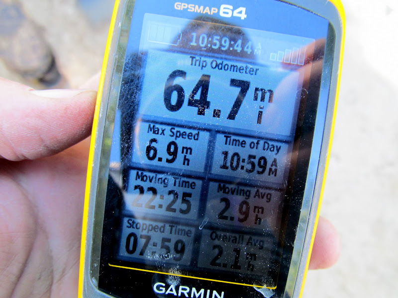
Photo Gallery: Labyrinth: Ruby to Mineral
GPS Track and Photo Waypoints:
[ Google Earth KMZ ] [ Gmap4 Satellite ] [ Gmap4 Topo ]
Arriving at Ruby Ranch
First night's camp at Ruby Ranch
It had rained a little during the night, and we packed our wet gear into the canoes and got underway by 9AM on Thursday morning. The first stop, after paddling a few miles, was a small unnamed canyon just downstream from Red Wash. Alan had remembered some petroglyphs in the canyon on a long-ago trip. We all hiked up the canyon and searched the sandstone walls but didn't see anything. While hiking back down the canyon I spotted a line of faint bighorn sheep petroglyphs that we'd missed on the way up.
Preparing to launch
On the water!
Alan in the back of the canoe
Walls rising on the left bank as we enter Labyrinth Canyon
A line of faint sheep petroglyphs
Another mile on the river brought us to Bull Bottom. It's easily accessible by road--I visited Bull Bottom three years ago but was limited in how much I could explore due to having a gimpy dog with me. This time I was delighted to be able to hike the entirety of Bull Bottom. We all explored as far as the stock trail, then the rest of the group agreed to let me and Wade walk the rest of the way down Bull Bottom while they returned to the canoes and met us downstream. Wade and I each went our own ways downstream along the cliffs, searching out any inscriptions, rock art, or anything else of interest. I think we missed some rock art along the way that I'd read about in a guide book. I did see another interesting thing mentioned in the guide book: a dead tree wedged in a crack in the cliffs that, if climbed, would lead out of Bull Bottom. I could imagine that, before the stock trail was built, this was the only way into and out of the bottom without going for a swim. Wade and I did find some very faint petroglyphs, a mano, and one spot that held a lot of worked stone tools. Strangely, there were more worked pieces of flint than there were debitage flakes.
Paddling toward Bull Bottom
Landing spot at upper Bull Bottom
Paul on the Bull Bottom stock trail
Tree leaning against a cliff, creating a possible way to climb out of Bull Bottom
Cottonwoods on Bull Bottom
Just some rocks
Stone tool, side view
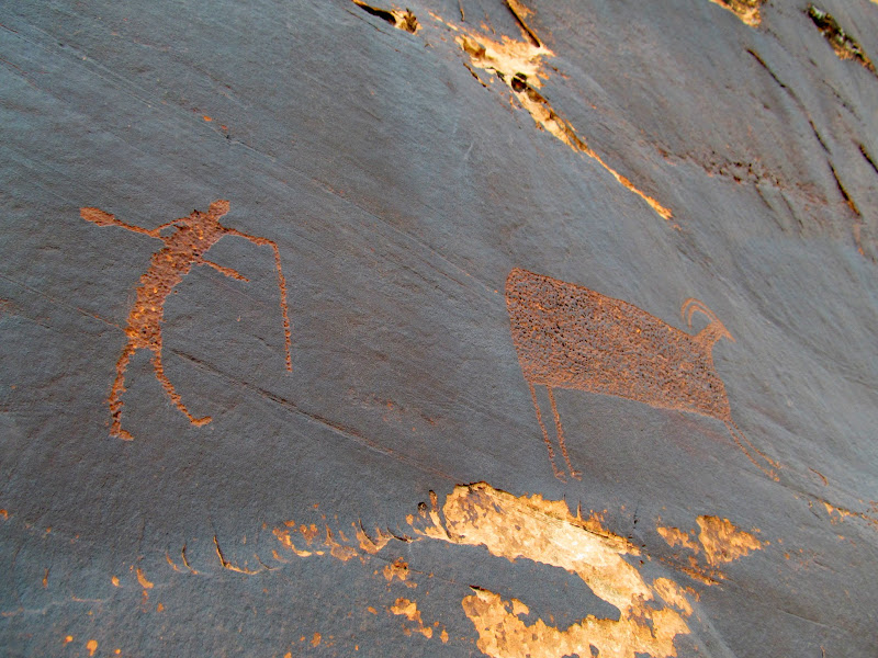
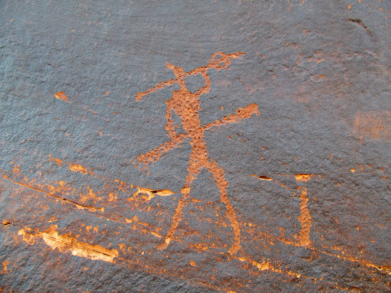
Placer Bottom was the next stop on our list. It's also accessible by road, which accounts for the somewhat modern mining equipment left in the area. Among the piles of gravel and rocks were sorting screens and sluice boxes. The main attraction for the group, however, was the rock art. One scene showed two human figures hunting a bighorn sheep using spears or atlatls.
On the river below Bull Bottom
Mining equipment and gravel piles at Placer Bottom
Placer Bottom petroglyphs
Placer Bottom petroglyph
The boats at Placer Bottom
The final points of interest for the day were Trin Alcove Bend and Three Canyon, then June's Bottom. We hadn't really stopped for lunch so, while the group was looking for a stock trail from Trin Alcove Bend up to the east, I stayed with the boats and ate something. I joined them after they'd found the trail, then Alan and I hiked along the bottom of the cliffs upstream looking for any inscriptions but came up blank. In Three Canyon we poked around but didn't find much more than some modern vandalism.
June's Bottom was quite interesting, with an old stone dugout cabin used by the Marsing family and a lot of old junk nearby, including a steam boiler that was once used to pump water to irrigate crops.Entering Trin Alcove Bend
Mouth of Three Canyon
Alan above Trin Alcove Bend
Paul on the ledge above Three Canyon
If only people would keep their children under control!
Rock wall in front of the dugout Marsing house
Bed frame
Bits and pieces
Boiler used to pump water to irrigate June's Bottom
Wooden spoked wheel on an old car axle
While part of the group was finishing our exploration of June's Bottom, the remainder paddled downstream in search of a place to camp for the night. The rest of us followed a short while later and found the others setting up camp on a nice sand bar about half a mile downstream. The edge of a rain storm passed us over and we set up camp in the rain but with a nice light show by mother nature, including a beautiful double rainbow. We fixed dinner, enjoyed some time around a camp fire, then turned in for the evening. Our choice of campsite was nagging at me, however, and I placed a stick in the sand at the current water level before I went to bed. It turned out that I wasn't the only one worried about the relatively low sand bar that we were camped on. Through the night a couple of storms rolled through, sounding off some truly awesome thunder followed by wind as the rain receded after each storm. The sound of that thunder will always stick with me. It was terrifying and awe-inspiring and I loved every minute of it despite counting off "one-one-thousand two-one-thousand..." after each flash of light. I awoke at 3:30AM to relieve myself and was mortified that the water had extended 10 feet beyond the stick that I'd placed in the sand, but it was only a few hours before we'd all rise and I hoped we'd be okay since there were still dozens more feet between the water and my tent. A little before 7AM I rose to voices. At first it was, "Hey, I don't remember going to sleep on a water bed," then it was, "The canoes are gone!" Although I thought it was all a joke, I still hurried to get dressed and unzipped my tent door to a nightmare. Only one canoe was left where we'd beached them, and two of the tents were in the river!
Sun shining through the rain at Thursday's camp
Rainbows above camp
Flooded camp on Friday morning, with canoes missing!
Everything after that point was frantic. I scurried to get my gear out of the tent and onto higher ground. Weston and Madi had spotted Paul's canoe downstream and hopped into Wade's canoe to retrieve it. Luckily a group camped 1/4-mile downstream from us also saw the derelict canoe and paddled out to grab it. The pair returned with two of our canoes, but that still left two unaccounted for. Wade rallied the troops and tried recruiting two others to paddle downstream to look for the missing boats. I reluctantly volunteered since mine was among the missing canoes. We'd already discussed our options, and we knew that our camp spot was accessible by an old road leading into June's Bottom. Hiking out and calling for help was a distinct possibility. Wade, Weston, and I boarded a canoe and paddled furiously downstream in search of the other canoes. I gave up any hope of finding them after half an hour of rapid downstream travel, but eventually we spotted both canoes fairly close together. Mine had hung up on a sand bar hidden below the water level, so we passed it up and retrieved the other canoe first. I tied its bow line to the stern of our canoe and then we fought the current upstream toward my canoe. I swung the rear of the first canoe toward Wade in the fore of our boat and he tied the bow line of my canoe to the stern of the other boat, and then we headed upstream. The three of us rowed our hearts (and arms) out for over two and a half hours against the current to make the three miles back to our camp spot. We took a few rest breaks by closing in on the shore and grabbing on to willows to hold our progress. The final half-mile we were able to walk in shallow water over the sand bar toward camp. Sore arms and blistered hands would punctuate the remainder of the trip for us three, but we pulled the canoes back to the rest of the group and salvaged the trip.
Towing the missing boats back upstream
Walking the canoes upriver
Taking a break from paddling against the current
We found out later that, ironically, it was a huge storm at home near Price that caused the river to rise. The Price River had gone from a mere 3 cfs to well over 8,000 cfs on Thursday, making it the biggest river in the state for a short time. The Green had risen from just over 2,000 cfs to about 5,000 cfs that night, and it would rise to over 8,000 cfs the following evening. We were lucky that the mighty Green River tempered all that flow and rose slowly instead of seeing a huge surge in the night. Of course, it was our failure to tie up the boats that caused all our problems. I was reminded of the saying, "If you see something, say something." Most of us were thinking that exact thing after the fact.
Price River flow during the trip
Green River flow during the trip
Reunited with the rest of the group, we returned to find that they had taken down tents and other gear and hung it all out to dry on the tamarisks well above the new high water line. I made some coffee and ate a very late breakfast. It felt strange to continue on like normal after such a near disaster. By noon we were back on the river. We skipped a planned stop at Bull Hollow and instead stopped at some inscriptions from the early 1900s just below Bull Hollow. Several of us had stopped there during a 2014 trip on the river via jetboat, but it was well worth visiting again. We also checked out some petroglyphs just downstream from there and avoided a nasty bushwhack by landing farther upstream. As we returned to the canoes and floated past the rock art, I noticed a constructed stock trail that would make for easy land access to that bottom land.
Back on the river for day two
H.I. Bowles, H.T. Howland, E.T. Wolverton, E.D.R Thomas, H.S. Schofield
1934 T/ Feb 7
Petroglyphs
Broken sheep petroglyph
Petroglyphs
Wheeler Trail
A planned visit to some inscriptions at the mouth of Tenmine Canyon was thwarted by heavy brush and mud. We reluctantly skipped that area but found an interesting 1893 inscription just downstream from the mouth of Tenmile. We landed at Wolverton Canyon, the drainage just upstream from Keg Spring Canyon, to check out a constructed road/trail in the lower end of the canyon, but the abbreviated day kept us from following the trail very far up the canyon. The final two attractions of the day were at the Howland brothers inscription (one of my favorites) and River Register.
On the river heading toward Tenmile Wash
R M.P. 4-4-(18)93.
Small strip of talus and bottom land below Tenmile Wash
Wolverton Trail
Lower Wolverton Canyon
One of my favorite inscriptions, by the Howland brothers in 1916
Checking out a stock trail that follows the river below Keg Spring Canyon
River Register
Our final act of the day was to find a camp spot. Of course, this time we were extremely cautious about where chose to set up camp. We were all aware of the road on the east bank of the river that leads to Hey Joe Canyon, so we aimed for that bank and eventually found a decent landing spot where we could climb up high above the water. By walking a short distance up the road we were able to find a suitable place to camp. We utilized a bucket brigade sort of line to haul gear up the steep river bank to the road, then toted the gear a couple hundred feet up the road to our camp spot. With as late in the day as it was, on a remote, dead-end road, there was no compunction about setting up camp directly on the road!
In the morning, after taking down camp, we visited the nearby Denis Julien inscription from May 16, 1836.Paddling past Hey Joe Canyon
Camped right on the Hey Joe Road
Camp along Hey Joe Road
Panorama near camp
Me at the Julien inscription, photo by Lyman
We again set up a human chain and tossed gear from person to person to load the boats in the morning. To begin our third day on the river the group made a brief stop at the Launch Marguerite inscription, left by the crew of a steam powered boat in 1909. I'd been looking forward to the next point of interest, Bowknot Saddle, for a long time. Despite having been there twice (once on a trip to the top of the Bowknot plateau and again during a hike down Twomile Canyon) I had never visited the middle of the saddle in order to claim the geocache there. The trail up the north side of the saddle was in great shape and, in the morning shade, made for a very pleasant hike. We spent time looking through the BLM register and viewing the inscriptions on the west end of the saddle where we also sat in the shade and ate lunch.
Third day on the river
The group at the Launch Marguerite inscription
Another Launch Marguerite inscription at Bowknot Bend
Wade on the Bowknot Saddle trail
Almost to the top of the trail
Alan signing the register at Bowknot Saddle
Bowknot Saddle panorama
Neville Wolverton, 9/1/1905
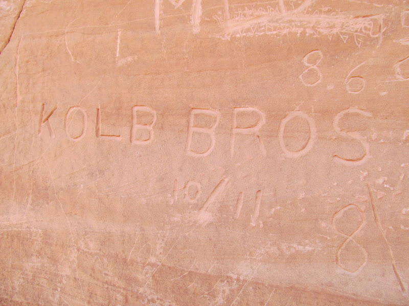
Kolb Bros 10/11
Several names, including E.T. Wolverton, dated 6/20/1913
Harry Aleson and Georgie White, Oct. 26, 1947
Dirt bikes on the road to Hey Joe
The crew at Bowknot Saddle
Returning to the river briefly, we floated around to the east side of Bowknot Bend and visited some mining ruins. In addition to two cabins there were old oil barrels and various rusty chunks of metal lying around the area. Although we'd landed at a super sweet campsite, high above the water and sheltered by huge scrub oak, we wanted to press on and find a place to camp closer to the takeout at Mineral Bottom. We launched with no more stops planned for the day, and just put some river miles behind us for a couple of hours. When we did begin looking for a place to camp later in the afternoon, we had some competition. A group of kayaks had overtaken us and were zig-zagging between the river banks, obviously looking for a camp. We caught up to a group with two rafts who were also seeking a spot. With the high water there were no sand bars and camp spots were at a premium. We finally pulled into a decent site at the upper end of Cottonwood Bottom. There were only a few scattered flat spots so we had to spread the tents out pretty wide, but we gathered in a single place to eat together and enjoy the last camp fire of the trip.
Heart Rock
Old junk and a truck door
Cabin at Bowknot Bend
A second cabin
Drill cores
Back on the river and in search of a camp site
Bowknot Saddle
Mouth of Twomile Canyon with Colonnade Arch on the horizon
Passing gear up to our camp site
10-second exposure after sunset
Camp fire
While fixing breakfast on Sunday morning, a delightful sunrise sent me scurrying for the camera. We had a mere 4.5 miles left on the river and I was a little melancholy that the journey was coming to an end. We got on the river and headed toward the final point of interest at the mouth of Hell Roaring Canyon, where Denis Julien, Phil Foote, and the Wolvertons, among several others, had carved their names. Mineral Bottom came up quickly after leaving Hell Roaring. It was a little before 11AM and there were a lot of people taking out and putting in at the main ramp. While we waited for our turn, someone in the group found a spot just downstream from the ramp where we could offload the gear from the canoes. We got the gear on shore and into the trucks, then found an opening at the ramp to carry the empty canoes up toward the trailer. After picking up vehicles at Ruby Ranch and transferring gear and boats, we all regrouped at Ray's Tavern in Green River for a celebratory lunch! A burger and soda tasted great after eating trail mix and freeze-dried food for four days.
Morning on our fourth day on the river
Paddling toward Hell Roaring Canyon
Canoes at the mouth of Hell Roaring Canyon
Denis Julien inscription at Hell Roaring Canyon
Phil Foote inscription from 1881
Final stretch of river
Our group approaching Mineral Bottom
Traffic jam at Mineral Bottom
River and hiking mileage for the entire trip
Photo Gallery: Labyrinth: Ruby to Mineral
GPS Track and Photo Waypoints:
[ Google Earth KMZ ] [ Gmap4 Satellite ] [ Gmap4 Topo ]
