- Joined
- May 5, 2012
- Messages
- 1,732
As a Boy Scout, I'd backpacked into Henry's Fork Basin with a group of about eight or 10 kids and three or four adults. We'd planned on attacking King's Peak but never even made it close, probably due to all of the three-pound bags of Twizzlers and D-cell batteries stuffed in the kids' packs.
In 2010 I resolved to rectify that. One of my friends from those old days agreed to come along for the journey. Jeff had been out of hiking for awhile and lacked much in the way of modern gear, using an old external frame pack.
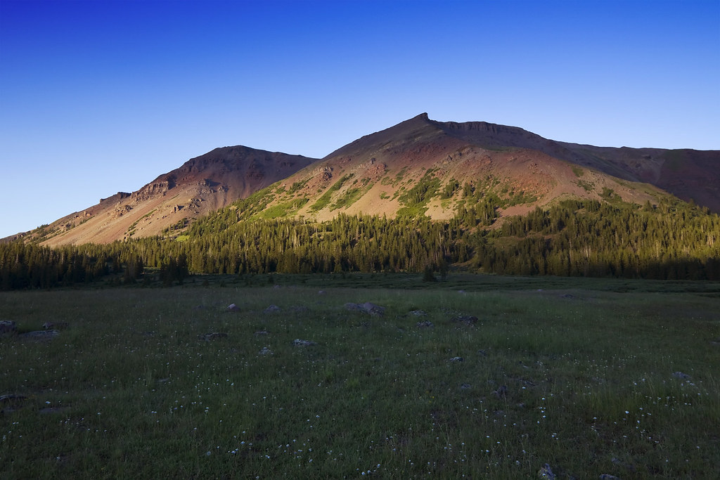
We embarked from Salt Lake City the evening of Sunday, August 1 bound for Uintalands near Bear River Service on the Mirror Lake Highway. I had access to a plot here where we could spend the night. This would cut down our driving time to the trailhead the next morning. The plan was for a three day-two night attack on the peak by way of Henry's Fork.
We were on the trail early Monday, getting a jump on the traffic sure to arrive later in the day. We made pretty good time, leap-frogging the few other groups we encountered on our way up the trail. That is, until we were stopped by an obnoxious U.S. Forest Service ranger. He and his younger (silent, probably bored) partner were coming down from the basin with their llamas.
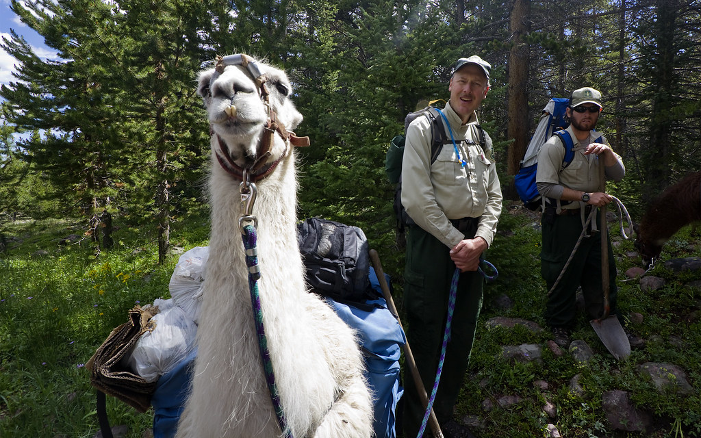
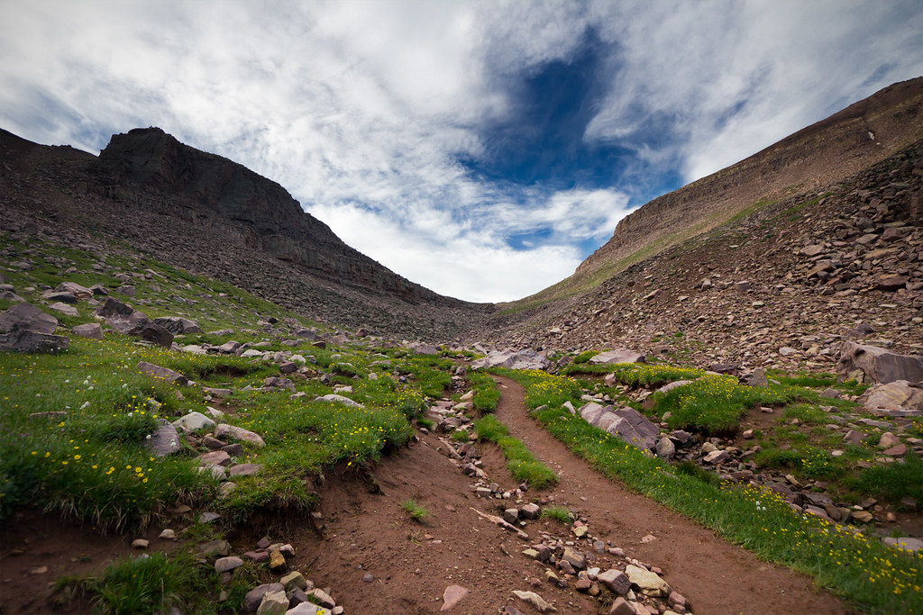
On the Henry's Fork trail by ashergrey, on Flickr
The ranger began to interrogate Jeff and I on our understanding of no trace principles. Our score on the pop quiz was probably somewhere around 80%. He questioned if we planned to bag out our refuse but refused to use adult words to talk about excrement. Instead he talked about "doody", like a child, speaking in a Steve Urkel voice.
Eager to continue we tried to brush him off as kindly as we could, but he insisted. He went on to ask where we'd learned no trace. We answered from the Boy Scouts of America. He then asked which council, to which we replied Great Salt Lake. This made him click his tongue in disapproval.
"The worst no trace campers I see are from the Great Salt Lake Council," he lamented. "In fact, it's the people from outside of Utah that treat this land the best."
To our relief, another group of hikers we had passed near the trailhead caught up at about this time. The ranger honed in on them, restarting his speech. He passed out leaflets about backcountry rules. As he pointed out the bags of trash he'd gathered and gassed on about how much he dislikes Utahns, Jeff and I backed away, tip-toeing with 35-pound packs.

We stopped for lunch just after the river crossing below the basin. Beyond this point the trail became quite muddy, with large sections impassable because of washouts. This forced us to bushwhack long sections of brush 50 to 100 yards at a time. Our plan was to set camp as close to the upper end of the basin as possible. This would allow us to avoid the crowds around the lakes and also shorten our summit climb Tuesday. It would also allow the luxury of a campfire, something that's prohibited around the lakes.
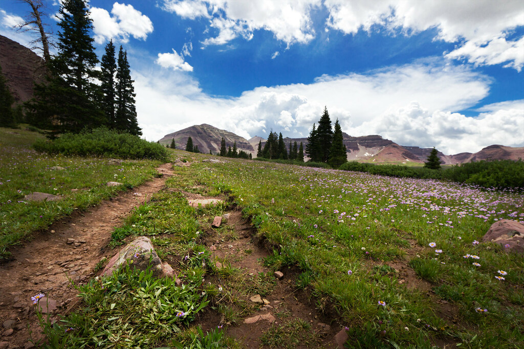
Double Track by ashergrey, on Flickr
As soon as we located a camping spot (GPS track), the Uinta weather did it's usual thing. We dove into the cramped two-man backpacking tent as a steady stream of rain poured from the clouds. Thunder booms reverberated off the talus-covered slopes ringing the basin. Jeff zonked out for a couple hours while I remained awake and restless, listening to the storm.
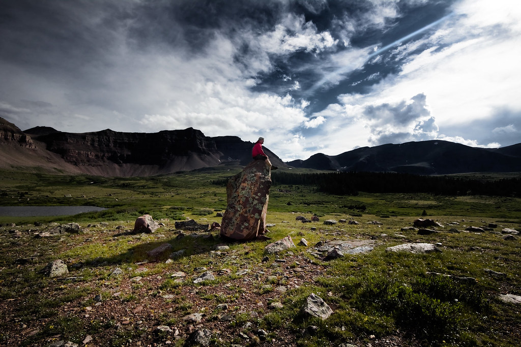
The precipitation at last blew out, leaving everything glistening. With the air clear we could hear a waterfall roaring somewhere off to the southwest. Feeling light without our packs, we set out to find it. Along the way we encountered this awesome rock. I'd never seen photos from this really cool spot before and took advantage.
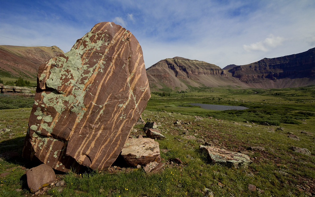
Lichen by ashergrey, on Flickr
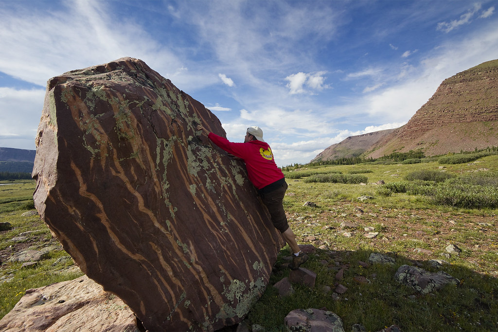
A different kind of ascent by ashergrey, on Flickr
Isolation by ashergrey, on Flickr
We crossed halfway across the basin, chasing big rodents between the rocks and sloshing across the bogs in order to find the waterfall. It turned out to be relatively small, but sound carries so well in the high country that it had tricked us into believing it was much larger.
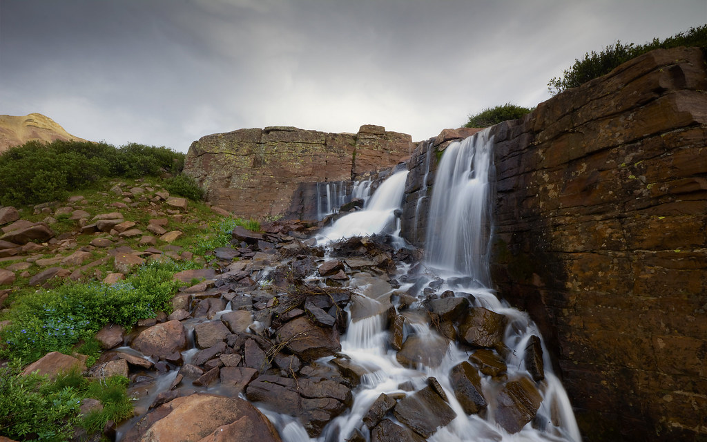
Henry's Fork basin falls by ashergrey, on Flickr
Our exploring done, we headed back to camp and stoked a small fire using what dry scraps we could find. Our camp was up near the tree line and there's a dearth of deadfall in upper Henry's Fork because it's been picked over by so many campers. I took off to take some photos while my buddy tried to cook a can of stew on my backpacking stove. In the process he nearly melted my Nalgene bottle.
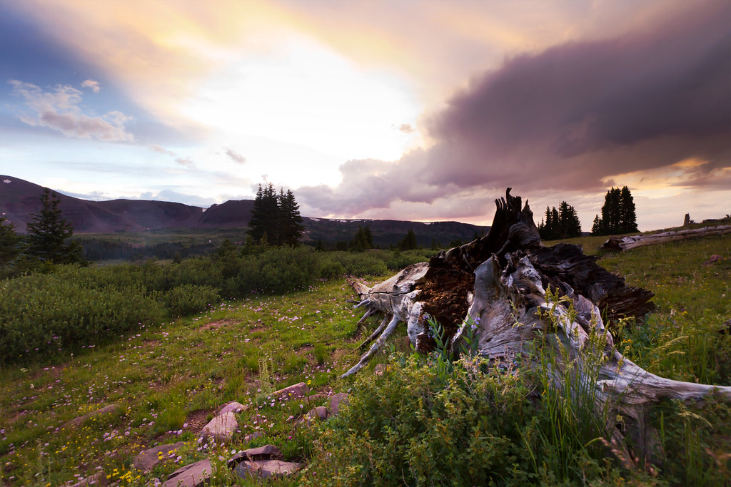
Rotted Woodwork by ashergrey, on Flickr
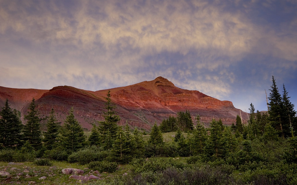
Alpenglow by ashergrey, on Flickr

Henry's Fork at dusk by ashergrey, on Flickr
Our sleep came in restless fits that night. I awoke at about 6 a.m., shivering and eager to be out of the cramped tent. Problem is, the mosquitos were swarming. They were big and landed in the water I boiled for oatmeal. Gross.
A group or two passed by on the trail and looking down into the basin we could see more on their way. Not wanting to fight crowds, Jeff and I packed away our stuff and started out for Gunsight Pass. Two old guys (probably in their late 60s) were carrying heavy packs slowly up the trail. We exchanged pleasantries as we passed, joking about the spryness of youth and doggedness of age conversely.
Gunsight Ascent by ashergrey, on Flickr
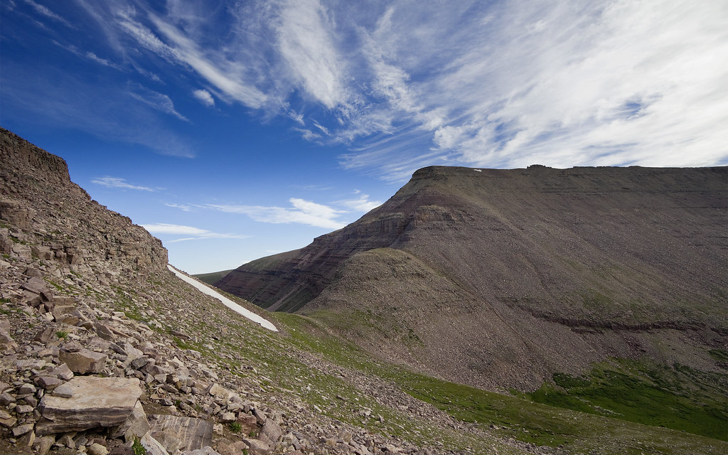
Upon reaching Gunsight Pass we sought out the Gunsight shortcut, a route that climbs southwest from the pass up the rock-covered slope instead of descending down into Painter Basin. There are stories on the internet that say the USFS is trying to dissuade people from using this route but I can't figure quite why. It's a little steep and hard to follow in places but nothing too treacherous. It requires a bit of route finding but anyone with eyes can pick out the path. The hardest part is finding the right place to descend on the way back down. Get it wrong and you can get cliffed out.
Gunsight Pass by ashergrey, on Flickr
The walk between Gunsight and Anderson Pass is probably the worst part of this hike. You're crossing rock to rock on unstable boulders, picking your own path. Every step is hard on the joints and the impact of elevation becomes evident as breathing turns laborious.
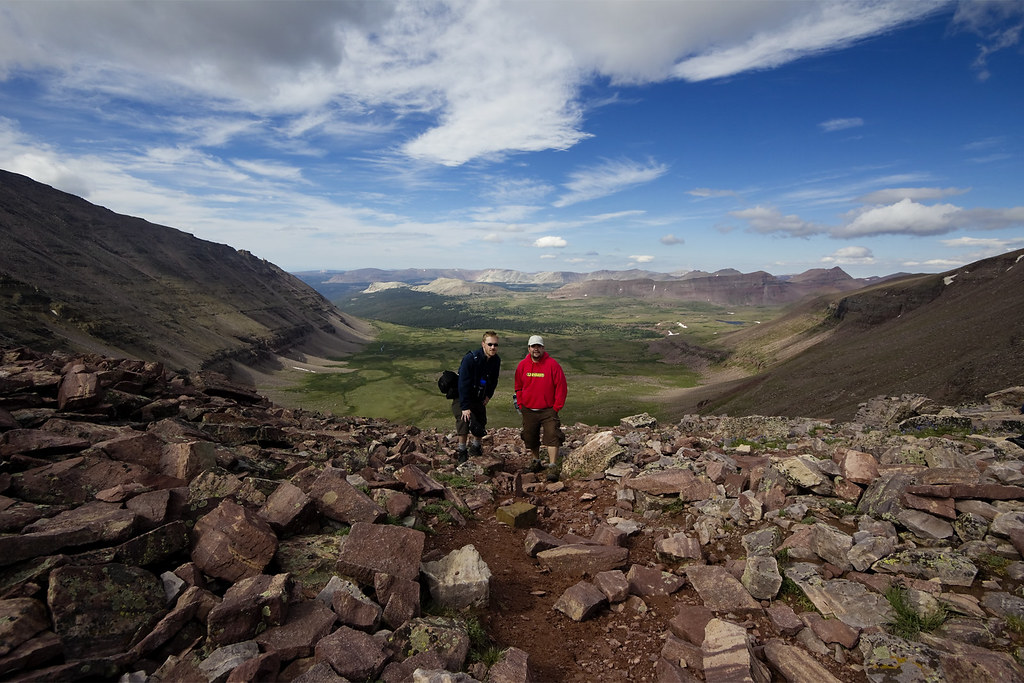
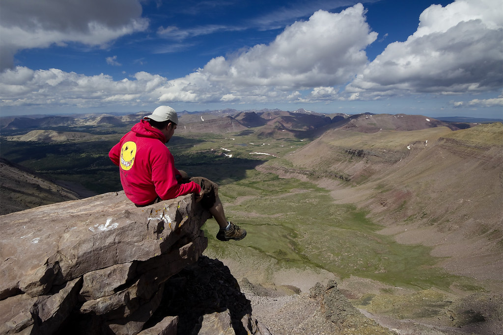
At Anderson Pass we came across a large group of scouts (20+) from the east coast. They were hiking the Highline Trail from east to west. We asked one of their leaders to take our picture. No matter how much I told him to get close with the ultra-wide angle lens he insisted on stepping back, leaving us looking quite small.
At Anderson Pass by ashergrey, on Flickr
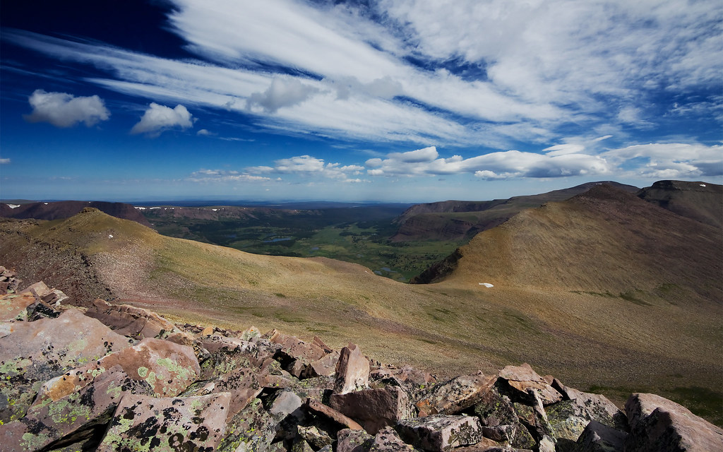
From the pass on, the ascent is just rocks, rocks and more rocks. We watched as a few people bailed out down the toilet bowl.
Above Anderson Pass by ashergrey, on Flickr
We reached the top sometime around 11 a.m. There were a lot of people making the summit so we only spent about 20 minutes on top before heading back down. The mob certainly detracted from the experience. I'd hauled my DSLR along to shoot a pano but was so put off that I just fired off some quick shots from the hip. The result was a composition I'm not wild about.
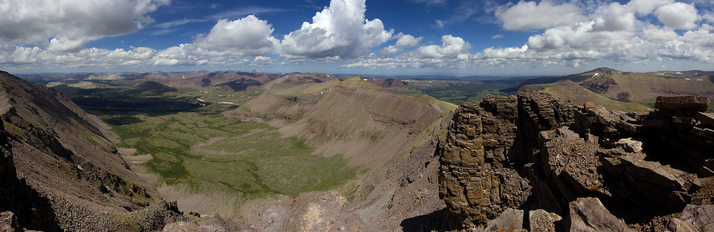
Kings Peak panorama by ashergrey, on Flickr
Long drop by ashergrey, on Flickr
Between rock and the sky by ashergrey, on Flickr
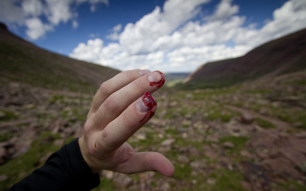
We briefly discussed taking the toilet bowl down to the basin but I felt like it presented too much risk for the reward of a shorter descent. Instead, while descending the Gunsight shortcut I braced my weight against a smallish rock. It shifted, pinching my finger. I yelped and instinctively pulled the injured digit before my face.
A wave of purple bruising spread to replace the pink of the nail bed. Thick, gory blood oozed out from under the front of the nail. It wasn't the kind of bleeding that you can suck on to stanch. We were traveling light and I had left my first aid kit at base camp so the blood dried, goopy like ketchup as we continued the long walk. The finger went numb and I feared I'd broken a bone.
Gunsight shortcut by ashergrey, on Flickr
(GPS track of the ascent/descent)
Sore and restless, we both collapsed to nap in the early afternoon sun. An hour or so later I roused and went off to take a frigid bath in a nearby stream. Refreshed, I pitched an idea to my friend: let's not spend another awful night in the tent. Let's break camp and hike back through the night. We could be back in Salt Lake by 2 or 3 a.m. He agreed. We broke camp in the late afternoon and were on our way.
Slant by ashergrey, on Flickr
Despite having summited earlier that day, we both felt light-footed hiking in the cooler temperatures of the early evening. The light became long and we were treated to some amazing scenery. Dusk fell about the time we reached the river crossing. Much of the walk from that point on required headlamps. As the darkness deepened we increasingly felt the weight of the day bearing down. My friend's headlamp was weak and left him stumbling through the dark. I continually kicked unseen rocks while trying to illuminate his path. We marched and marched, lacking landmarks to help us gauge the length of our ordeal.
We at last reached the trailhead at about 1 a.m. (GPS track). Exhausted, we dropped packs into the back of my car and took a few minutes to admire the moonless sky before setting off for home.
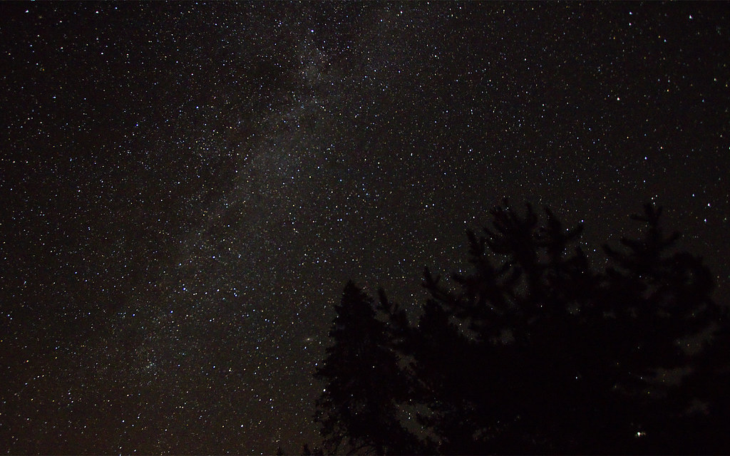
Milky Way by ashergrey, on Flickr
As we pulled out of the trailhead parking lot a big moose was lumbering across the road. It stopped in the path of the headlights, making us wait and reminding us who really owns the high country. In about 36 hours we had covered roughly 35 miles and ascended from 9,700 to 13,500 feet above sea level and back. We arrived home closer to 4 a.m., at which point I fell into a coma. Or something like that.
Featured image for slideshow:

In 2010 I resolved to rectify that. One of my friends from those old days agreed to come along for the journey. Jeff had been out of hiking for awhile and lacked much in the way of modern gear, using an old external frame pack.
We embarked from Salt Lake City the evening of Sunday, August 1 bound for Uintalands near Bear River Service on the Mirror Lake Highway. I had access to a plot here where we could spend the night. This would cut down our driving time to the trailhead the next morning. The plan was for a three day-two night attack on the peak by way of Henry's Fork.
We were on the trail early Monday, getting a jump on the traffic sure to arrive later in the day. We made pretty good time, leap-frogging the few other groups we encountered on our way up the trail. That is, until we were stopped by an obnoxious U.S. Forest Service ranger. He and his younger (silent, probably bored) partner were coming down from the basin with their llamas.
On the Henry's Fork trail by ashergrey, on Flickr
The ranger began to interrogate Jeff and I on our understanding of no trace principles. Our score on the pop quiz was probably somewhere around 80%. He questioned if we planned to bag out our refuse but refused to use adult words to talk about excrement. Instead he talked about "doody", like a child, speaking in a Steve Urkel voice.
Eager to continue we tried to brush him off as kindly as we could, but he insisted. He went on to ask where we'd learned no trace. We answered from the Boy Scouts of America. He then asked which council, to which we replied Great Salt Lake. This made him click his tongue in disapproval.
"The worst no trace campers I see are from the Great Salt Lake Council," he lamented. "In fact, it's the people from outside of Utah that treat this land the best."
To our relief, another group of hikers we had passed near the trailhead caught up at about this time. The ranger honed in on them, restarting his speech. He passed out leaflets about backcountry rules. As he pointed out the bags of trash he'd gathered and gassed on about how much he dislikes Utahns, Jeff and I backed away, tip-toeing with 35-pound packs.
We stopped for lunch just after the river crossing below the basin. Beyond this point the trail became quite muddy, with large sections impassable because of washouts. This forced us to bushwhack long sections of brush 50 to 100 yards at a time. Our plan was to set camp as close to the upper end of the basin as possible. This would allow us to avoid the crowds around the lakes and also shorten our summit climb Tuesday. It would also allow the luxury of a campfire, something that's prohibited around the lakes.
Double Track by ashergrey, on Flickr
As soon as we located a camping spot (GPS track), the Uinta weather did it's usual thing. We dove into the cramped two-man backpacking tent as a steady stream of rain poured from the clouds. Thunder booms reverberated off the talus-covered slopes ringing the basin. Jeff zonked out for a couple hours while I remained awake and restless, listening to the storm.
The precipitation at last blew out, leaving everything glistening. With the air clear we could hear a waterfall roaring somewhere off to the southwest. Feeling light without our packs, we set out to find it. Along the way we encountered this awesome rock. I'd never seen photos from this really cool spot before and took advantage.
Lichen by ashergrey, on Flickr
A different kind of ascent by ashergrey, on Flickr
Isolation by ashergrey, on Flickr
We crossed halfway across the basin, chasing big rodents between the rocks and sloshing across the bogs in order to find the waterfall. It turned out to be relatively small, but sound carries so well in the high country that it had tricked us into believing it was much larger.
Henry's Fork basin falls by ashergrey, on Flickr
Our exploring done, we headed back to camp and stoked a small fire using what dry scraps we could find. Our camp was up near the tree line and there's a dearth of deadfall in upper Henry's Fork because it's been picked over by so many campers. I took off to take some photos while my buddy tried to cook a can of stew on my backpacking stove. In the process he nearly melted my Nalgene bottle.
Rotted Woodwork by ashergrey, on Flickr
Alpenglow by ashergrey, on Flickr
Henry's Fork at dusk by ashergrey, on Flickr
Our sleep came in restless fits that night. I awoke at about 6 a.m., shivering and eager to be out of the cramped tent. Problem is, the mosquitos were swarming. They were big and landed in the water I boiled for oatmeal. Gross.
A group or two passed by on the trail and looking down into the basin we could see more on their way. Not wanting to fight crowds, Jeff and I packed away our stuff and started out for Gunsight Pass. Two old guys (probably in their late 60s) were carrying heavy packs slowly up the trail. We exchanged pleasantries as we passed, joking about the spryness of youth and doggedness of age conversely.
Gunsight Ascent by ashergrey, on Flickr
Upon reaching Gunsight Pass we sought out the Gunsight shortcut, a route that climbs southwest from the pass up the rock-covered slope instead of descending down into Painter Basin. There are stories on the internet that say the USFS is trying to dissuade people from using this route but I can't figure quite why. It's a little steep and hard to follow in places but nothing too treacherous. It requires a bit of route finding but anyone with eyes can pick out the path. The hardest part is finding the right place to descend on the way back down. Get it wrong and you can get cliffed out.
Gunsight Pass by ashergrey, on Flickr
The walk between Gunsight and Anderson Pass is probably the worst part of this hike. You're crossing rock to rock on unstable boulders, picking your own path. Every step is hard on the joints and the impact of elevation becomes evident as breathing turns laborious.
At Anderson Pass we came across a large group of scouts (20+) from the east coast. They were hiking the Highline Trail from east to west. We asked one of their leaders to take our picture. No matter how much I told him to get close with the ultra-wide angle lens he insisted on stepping back, leaving us looking quite small.
At Anderson Pass by ashergrey, on Flickr
From the pass on, the ascent is just rocks, rocks and more rocks. We watched as a few people bailed out down the toilet bowl.
Above Anderson Pass by ashergrey, on Flickr
We reached the top sometime around 11 a.m. There were a lot of people making the summit so we only spent about 20 minutes on top before heading back down. The mob certainly detracted from the experience. I'd hauled my DSLR along to shoot a pano but was so put off that I just fired off some quick shots from the hip. The result was a composition I'm not wild about.
Kings Peak panorama by ashergrey, on Flickr
Long drop by ashergrey, on Flickr
Between rock and the sky by ashergrey, on Flickr
We briefly discussed taking the toilet bowl down to the basin but I felt like it presented too much risk for the reward of a shorter descent. Instead, while descending the Gunsight shortcut I braced my weight against a smallish rock. It shifted, pinching my finger. I yelped and instinctively pulled the injured digit before my face.
A wave of purple bruising spread to replace the pink of the nail bed. Thick, gory blood oozed out from under the front of the nail. It wasn't the kind of bleeding that you can suck on to stanch. We were traveling light and I had left my first aid kit at base camp so the blood dried, goopy like ketchup as we continued the long walk. The finger went numb and I feared I'd broken a bone.
Gunsight shortcut by ashergrey, on Flickr
(GPS track of the ascent/descent)
Sore and restless, we both collapsed to nap in the early afternoon sun. An hour or so later I roused and went off to take a frigid bath in a nearby stream. Refreshed, I pitched an idea to my friend: let's not spend another awful night in the tent. Let's break camp and hike back through the night. We could be back in Salt Lake by 2 or 3 a.m. He agreed. We broke camp in the late afternoon and were on our way.
Slant by ashergrey, on Flickr
Despite having summited earlier that day, we both felt light-footed hiking in the cooler temperatures of the early evening. The light became long and we were treated to some amazing scenery. Dusk fell about the time we reached the river crossing. Much of the walk from that point on required headlamps. As the darkness deepened we increasingly felt the weight of the day bearing down. My friend's headlamp was weak and left him stumbling through the dark. I continually kicked unseen rocks while trying to illuminate his path. We marched and marched, lacking landmarks to help us gauge the length of our ordeal.
We at last reached the trailhead at about 1 a.m. (GPS track). Exhausted, we dropped packs into the back of my car and took a few minutes to admire the moonless sky before setting off for home.
Milky Way by ashergrey, on Flickr
As we pulled out of the trailhead parking lot a big moose was lumbering across the road. It stopped in the path of the headlights, making us wait and reminding us who really owns the high country. In about 36 hours we had covered roughly 35 miles and ascended from 9,700 to 13,500 feet above sea level and back. We arrived home closer to 4 a.m., at which point I fell into a coma. Or something like that.
Featured image for slideshow:

")