Udink
Still right here.
- Joined
- Jan 17, 2012
- Messages
- 1,734
August 30-31, 2019
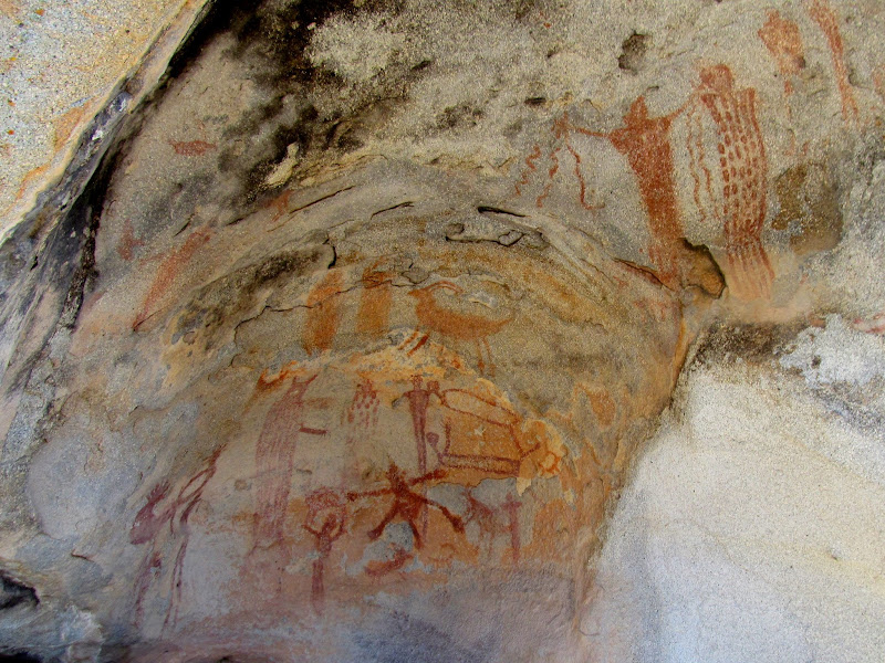
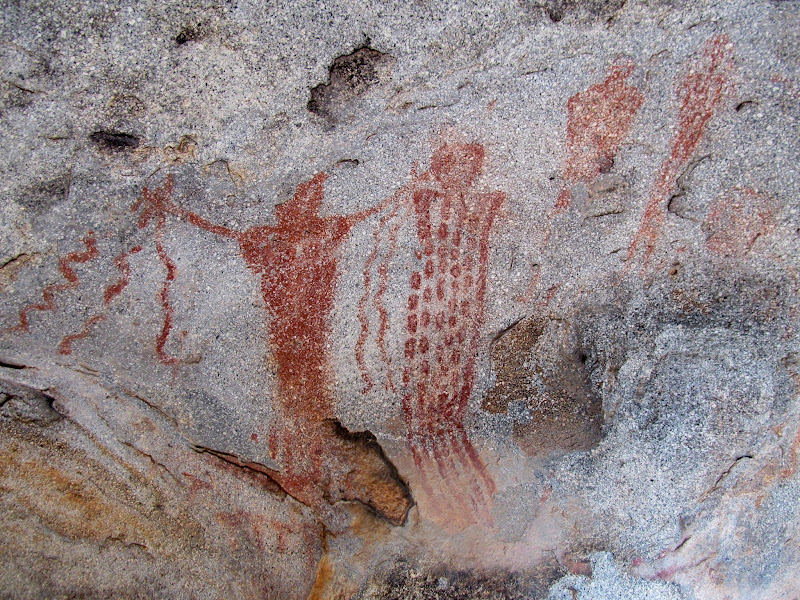
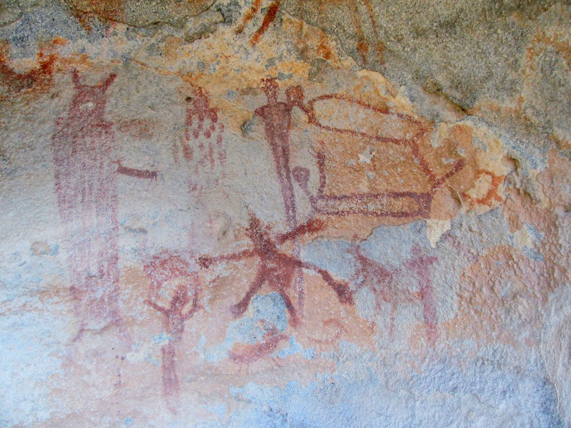
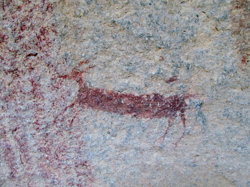
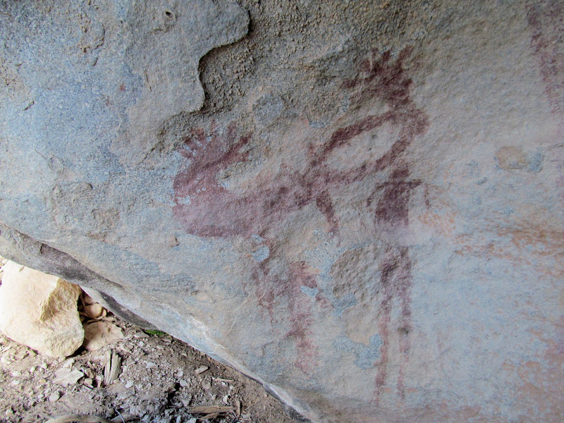
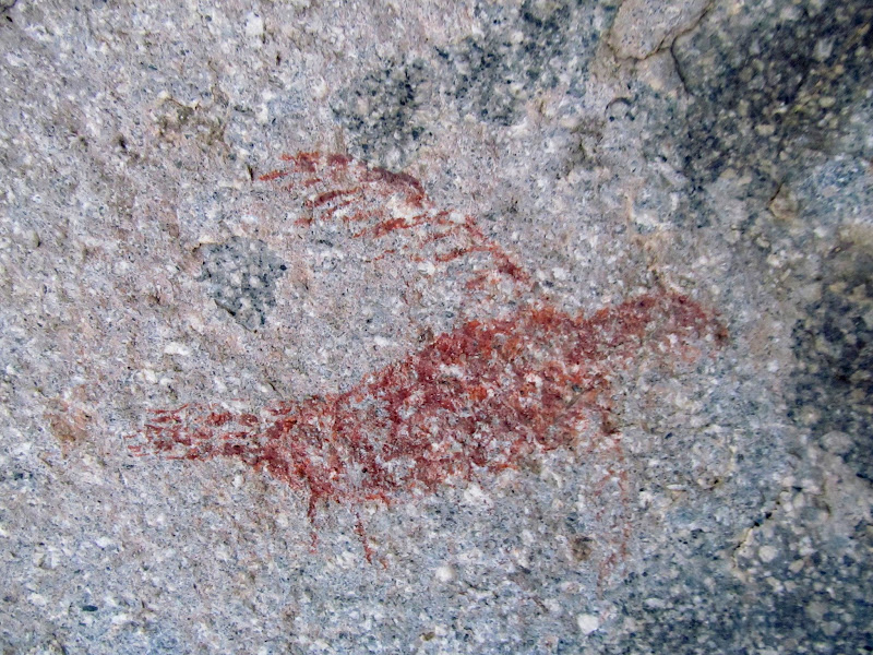
On my 43rd birthday, Chris and I returned to the Henry Mountains to search for some pictographs, with plans to hike Kimble and Turner Peak the following day. This would be my third attempt at finding the Hollow Boulder Panel (here you can see the ill-fated-first and second attempts). I'm happy to report that the third time was a charm! We hiked to four different boulders on this trip without any luck. On the fourth boulder I noticed some potholes that could hold water on top, and I climbed up to get a better look at them. From that slightly higher vantage point I spotted a couple of nearby boulders that I hadn't even noticed in Google Earth. We headed in that direction and the first boulder we encountered was hollowed out underneath and held the pictographs we were after! It was a fairly unusual spot to find rock art--there were other nearby sheltered places closer to the nearest water.
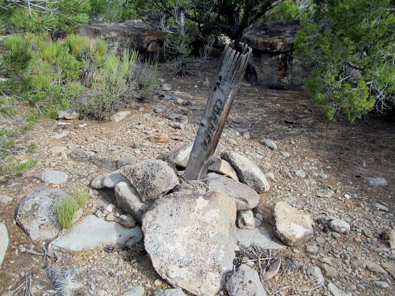
Looks like a section corner, but it's not on a section corner
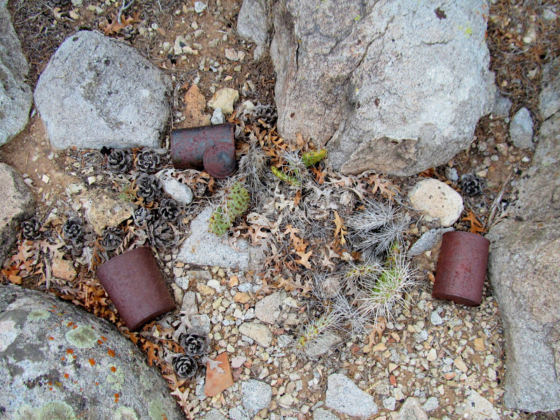
Cans and cactus
Hollow Boulder Panel
Snake holder and a few other figures
Center part of the Hollow Boulder Panel
Tiny animal figure
Strange pictographs
Small bird-like animal
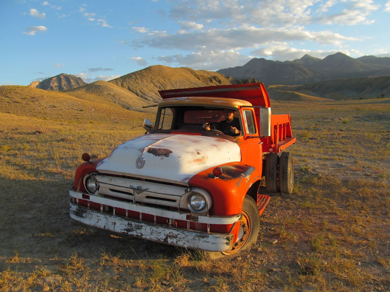
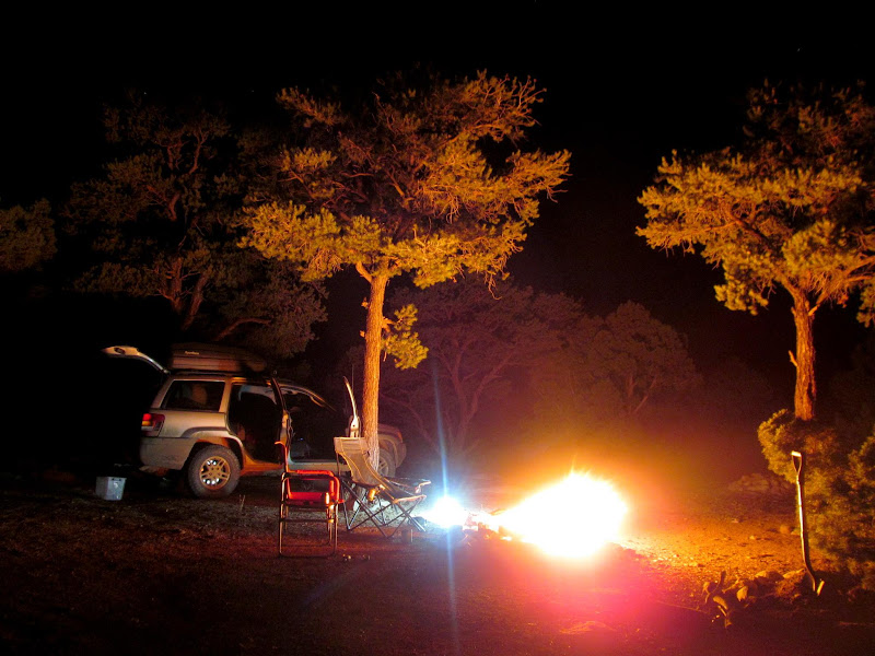
We hiked around a little more and found some pit houses closer to the creek. They appeared to have been excavated by archaeologists, judging from some other pit houses that I've seen which were professionally excavated. As the sun set we headed higher into the Henry Mountains, stopping to check out an old Ford F-600 along the way. We found a spot to camp just north of the county line and enjoyed a night around the camp fire with decent cell service.
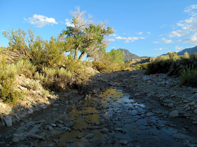
Bull Creek
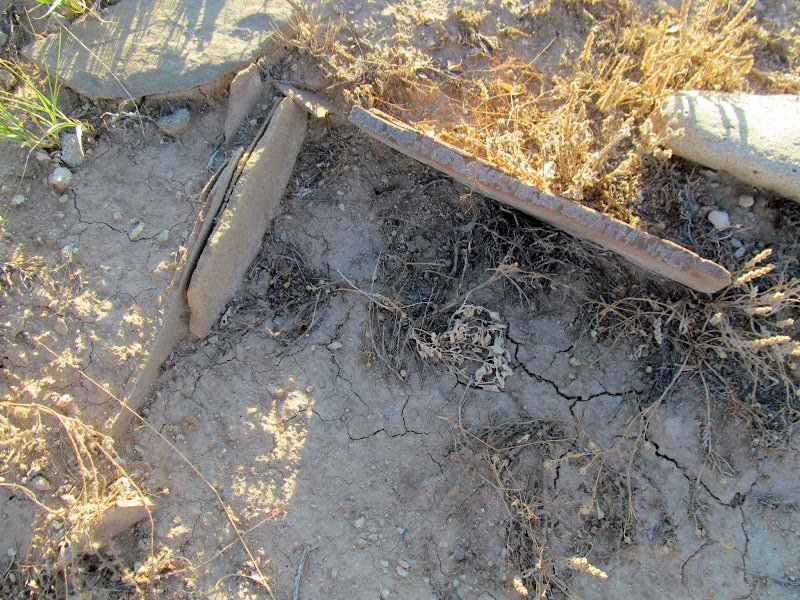
Buried rock slabs
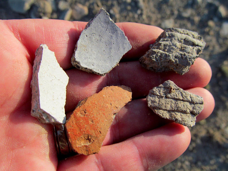
Potsherds
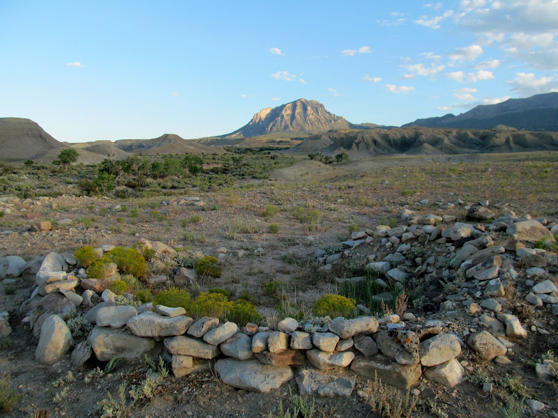
Pit house with Bull Mountain in the distance
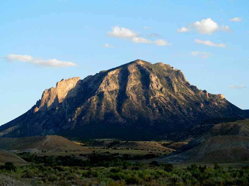
Bull Mountain
Chris in an old Ford F-600 dump truck
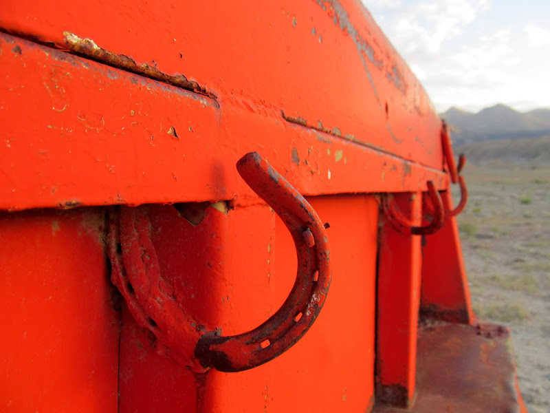
Horseshoes welded to the dump bed
Bull Creek camp
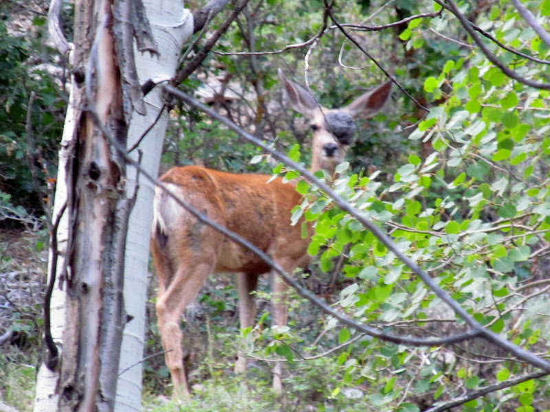
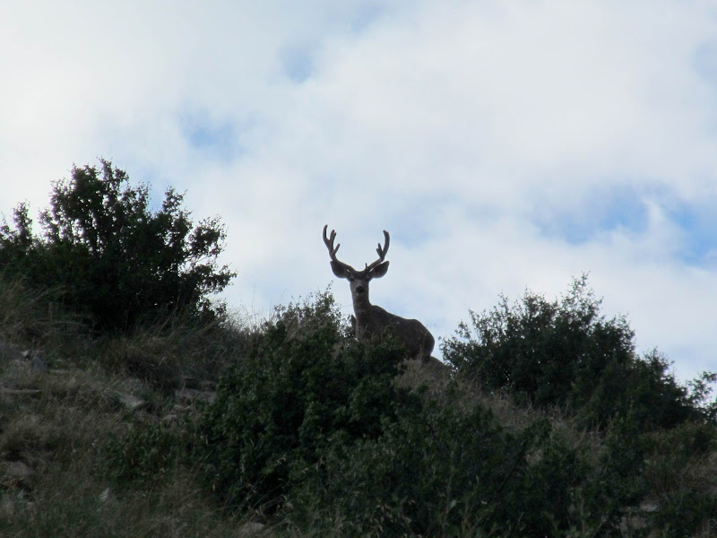
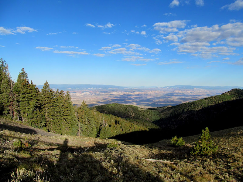
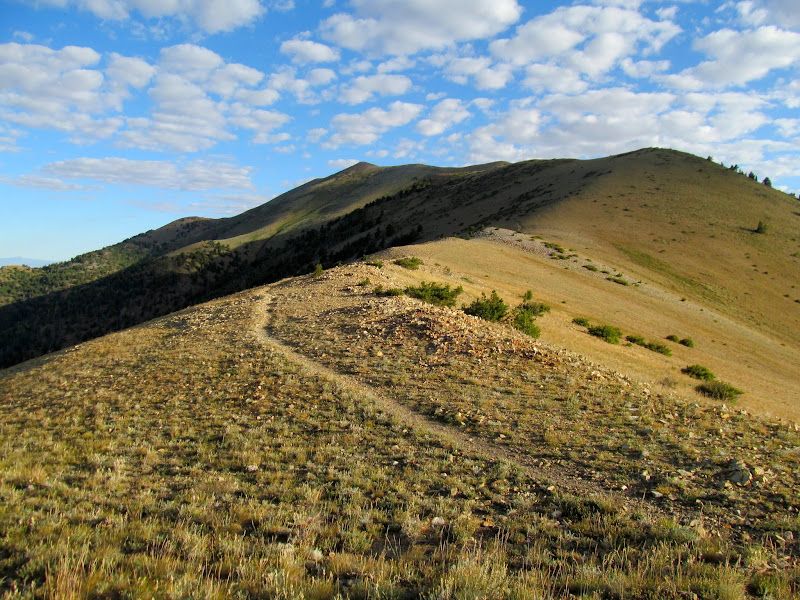
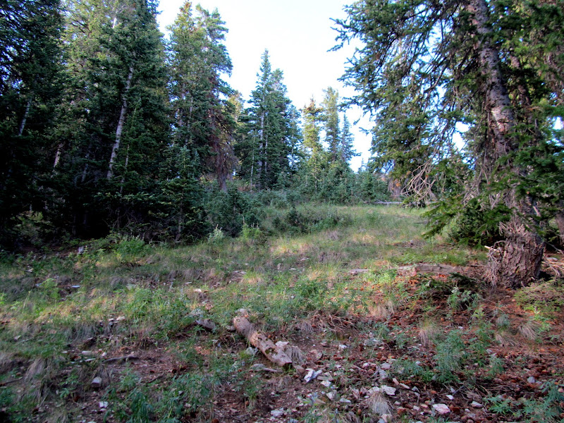
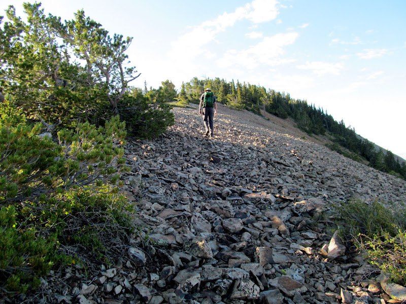
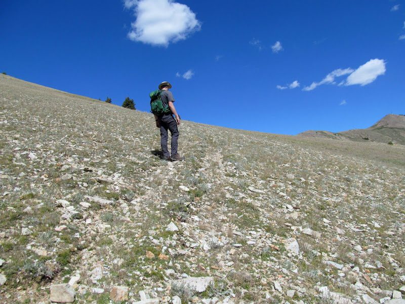
We were awake before 7AM on Saturday morning, and headed up toward Bull Creek Pass to begin the day's hike. Along the way we spotted a deer with a massive tumor on its face, entirely encompassing one eye, but it appeared to be getting around just fine. Closer to the pass there were several large bucks grazing. We parked at Bull Creek Pass and began our hike up South Summit Ridge. The views to the west were incredible in the morning light. The first bit of climbing was steep through brush and trees, but eventually the terrain leveled out and the vegetation thinned out.
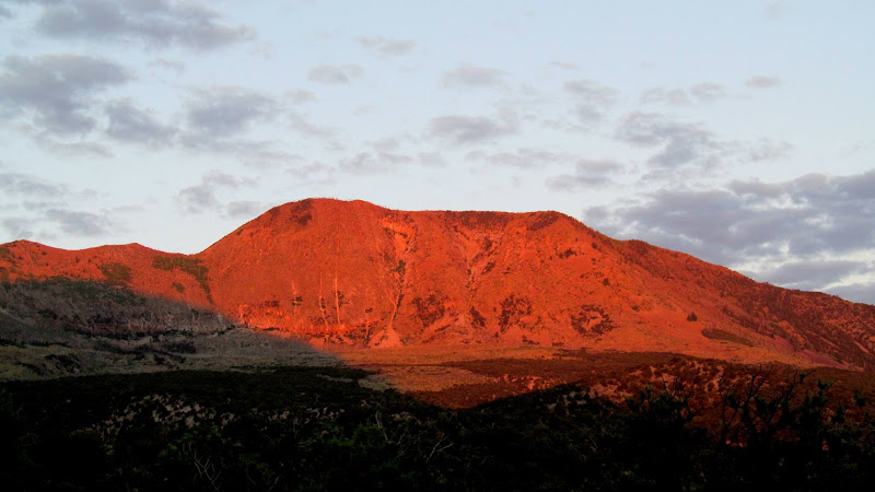
Early morning sun on Horseshoe Ridge
Deer with a huge tumor on its head
Big buck near Bull Creek Pass
View down Bull Creek from the pass
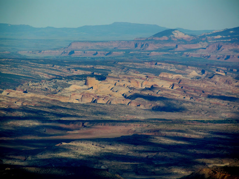
View over Capitol Wash toward the Ant Hill
North Summit Ridge and the trail to Mount Ellen Peak
Steep climb up the South Summit Ridge
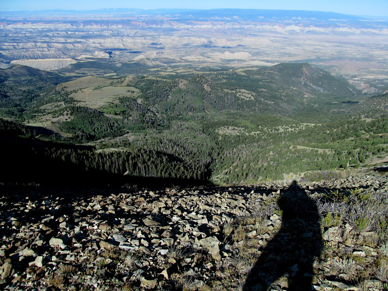
View toward Capitol Reef

Still some steep climbing
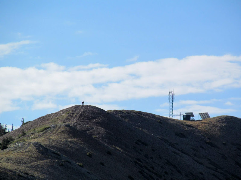
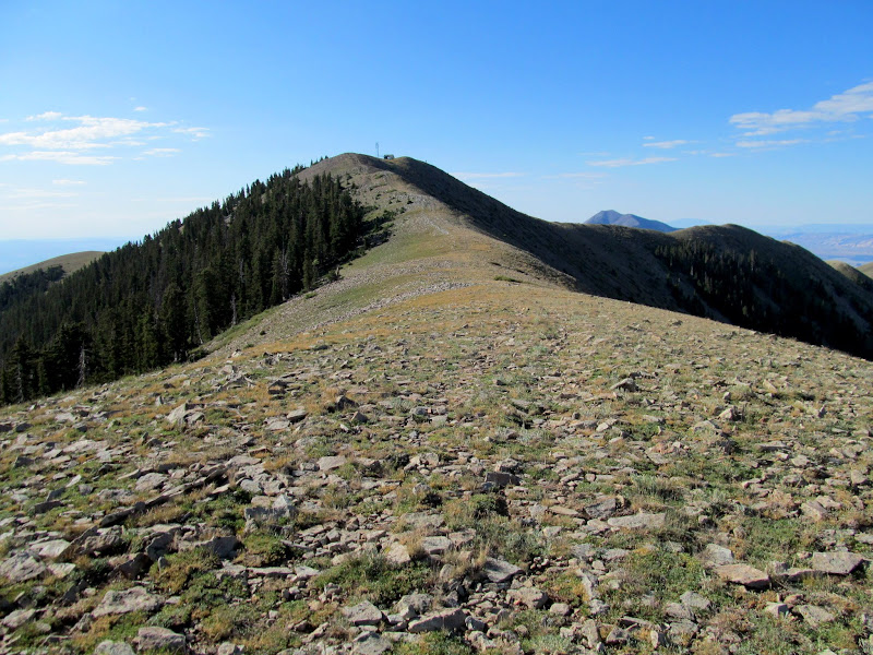
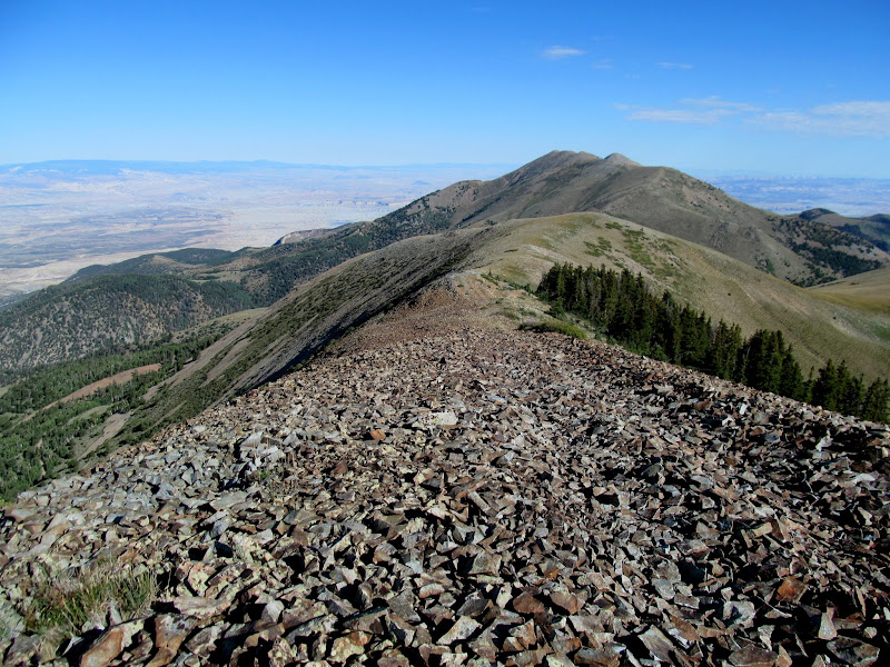
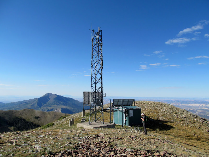
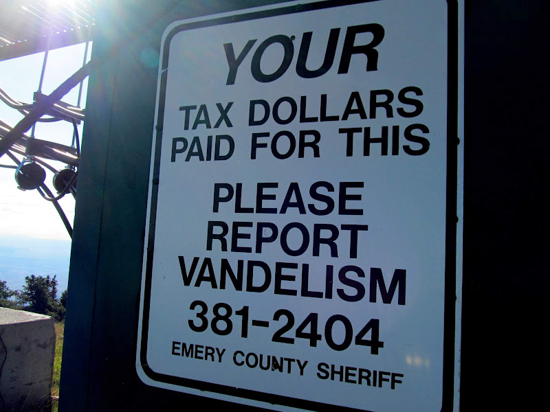
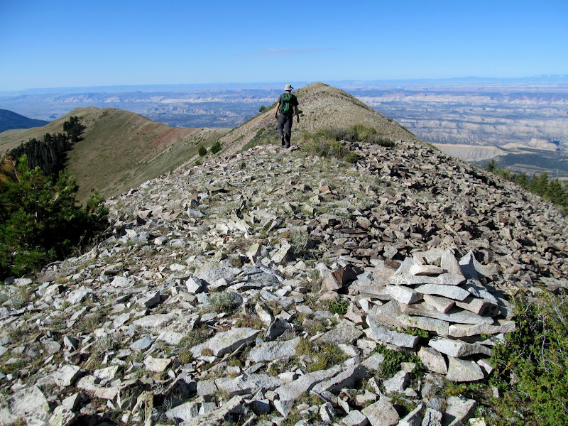
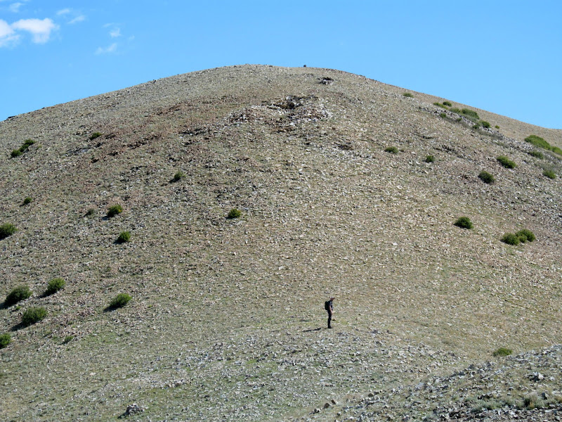
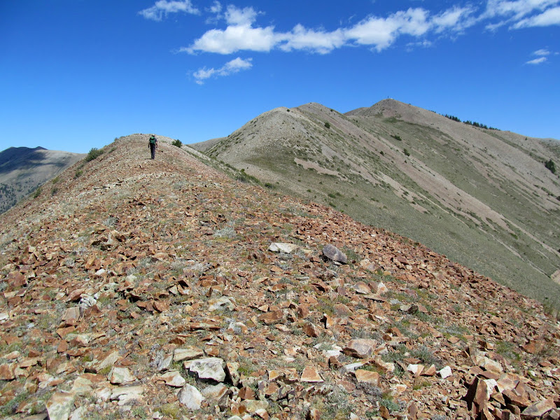
As we neared the highest point on the South Summit Ridge we saw a hiker ahead of us. Along the way there were a couple of what I would assume to be summit shelters, slight depressions surrounded by piles of rock. At the high point was a radio tower used by the Emery County Sheriff's Office, even though it's in Garfield County.
Hiker and radio tower
Summit shelters on South Summit Ridge
Final climb to the high point
Mr. Shadow!
"Road" through the talus
Radio tower on South Summit Ridge
A warning to vandels in Garfield County
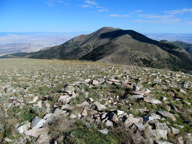
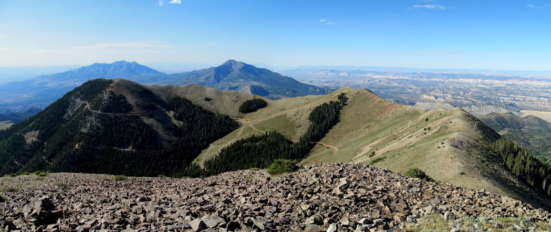
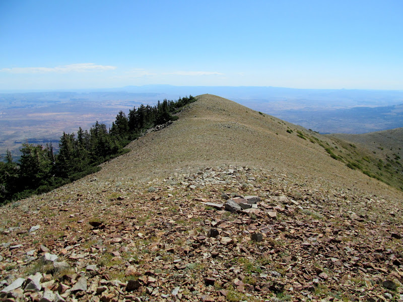
South Summit Ridge and Kimble and Turner Peak (left)
Hiking down the ridge
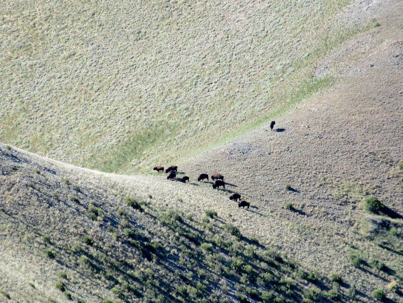
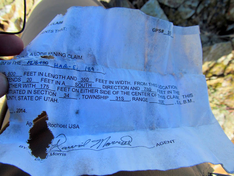
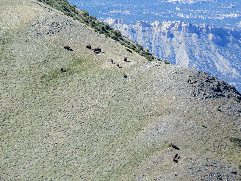
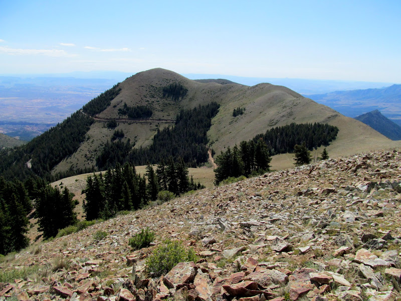
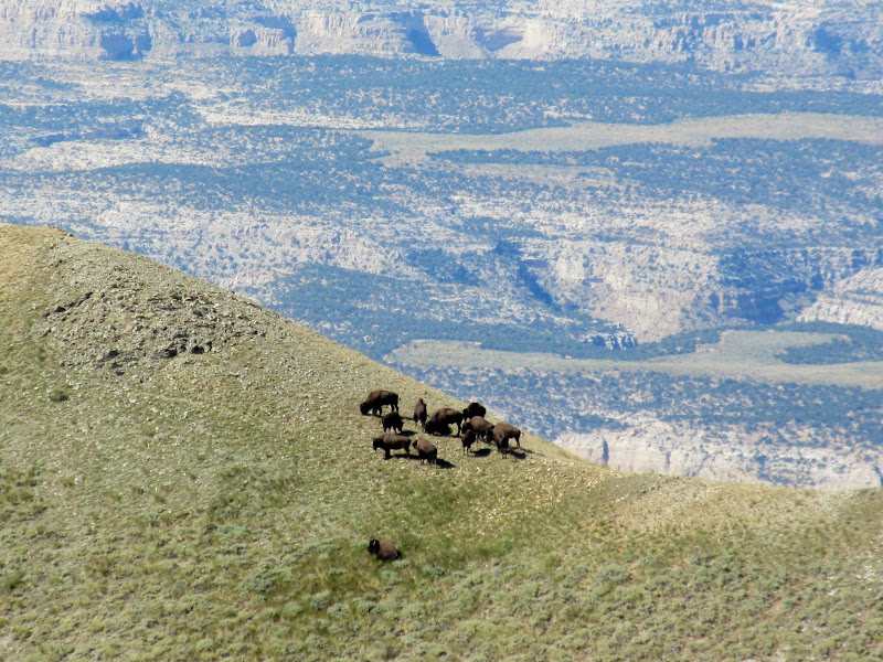
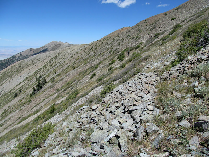
From the high point we descended a steep ridge, followed by several ups and downs as we approached Kimble and Turner Peak. We caught up with the the hiker we'd seen earlier and stopped to chat with him. He was a member of the Ekker family who runs cattle all over southeastern Utah, and was scouting for bison. His family also owns mining claims in Bromide Basin just to the east of where we were standing. The conversation turned to rock art and I got some details from him on some panels in the Dirty Devil River area that I'd eventually visit a couple of months later. While standing there he pointed out a bison herd on the ridge south of us--it was the first bison I'd ever seen in person.
Bromide Basin
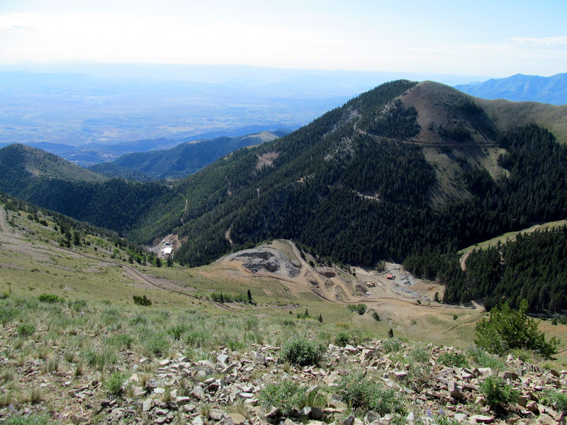
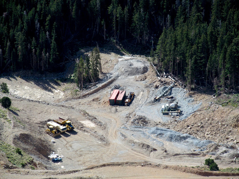
Mine workings in Bromide Basin
Bison
Mining claim chewed up by rodents
Bison
Kimble and Turner Peak
Bison
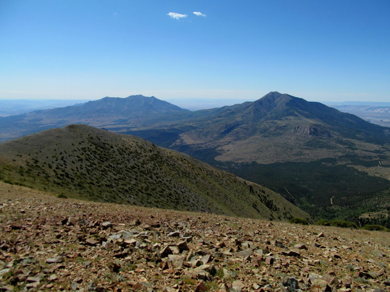
After saying goodbye to Mr. Ekker Chris and I made the final climb to Kimble and Turner Peak, reaching it a little before noon. After a short lunch break there we reversed course and hiked back to Bull Creek Pass, but this time we bypassed a couple of the taller peaks to avoid gaining unnecessary elevation. We made it back at the Jeep before 2PM and headed back to Price, where we had a barbecue/birthday party that evening and then set out on another adventure the next day...
Last steep climb toward Kimble and Turner Peak
Mount Hillers (left) and Mount Pennell
Kimble and Turner Peak
Hiking back up the South Summit Ridge
South Summit Ridge
Side-hilling below South Summit Ridge
Bison on Burned Ridge
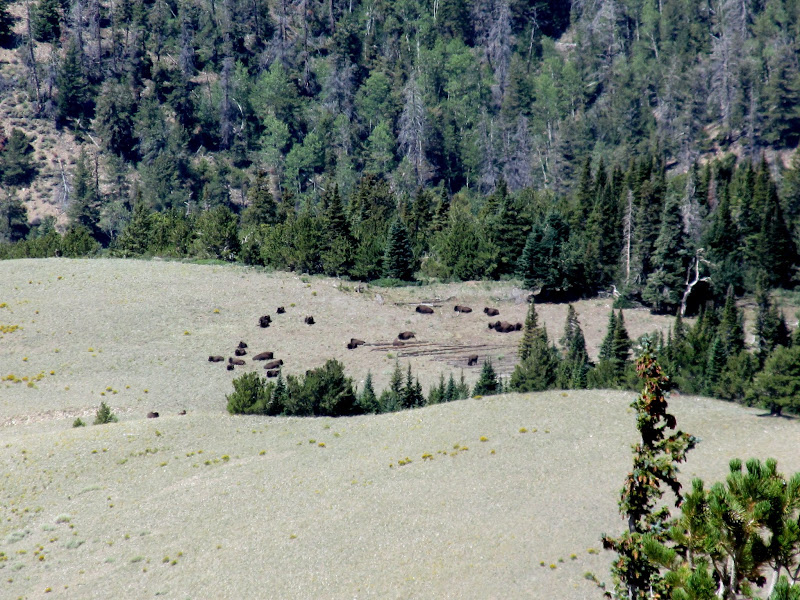
Photo Gallery: Kimble and Turner Peak
GPS Track and Photo Waypoints: Google Earth KMZ
On my 43rd birthday, Chris and I returned to the Henry Mountains to search for some pictographs, with plans to hike Kimble and Turner Peak the following day. This would be my third attempt at finding the Hollow Boulder Panel (here you can see the ill-fated-first and second attempts). I'm happy to report that the third time was a charm! We hiked to four different boulders on this trip without any luck. On the fourth boulder I noticed some potholes that could hold water on top, and I climbed up to get a better look at them. From that slightly higher vantage point I spotted a couple of nearby boulders that I hadn't even noticed in Google Earth. We headed in that direction and the first boulder we encountered was hollowed out underneath and held the pictographs we were after! It was a fairly unusual spot to find rock art--there were other nearby sheltered places closer to the nearest water.
Looks like a section corner, but it's not on a section corner
Cans and cactus
Hollow Boulder Panel
Snake holder and a few other figures
Center part of the Hollow Boulder Panel
Tiny animal figure
Strange pictographs
Small bird-like animal
We hiked around a little more and found some pit houses closer to the creek. They appeared to have been excavated by archaeologists, judging from some other pit houses that I've seen which were professionally excavated. As the sun set we headed higher into the Henry Mountains, stopping to check out an old Ford F-600 along the way. We found a spot to camp just north of the county line and enjoyed a night around the camp fire with decent cell service.
Bull Creek
Buried rock slabs
Potsherds
Pit house with Bull Mountain in the distance
Bull Mountain
Chris in an old Ford F-600 dump truck
Horseshoes welded to the dump bed
Bull Creek camp
We were awake before 7AM on Saturday morning, and headed up toward Bull Creek Pass to begin the day's hike. Along the way we spotted a deer with a massive tumor on its face, entirely encompassing one eye, but it appeared to be getting around just fine. Closer to the pass there were several large bucks grazing. We parked at Bull Creek Pass and began our hike up South Summit Ridge. The views to the west were incredible in the morning light. The first bit of climbing was steep through brush and trees, but eventually the terrain leveled out and the vegetation thinned out.
Early morning sun on Horseshoe Ridge
Deer with a huge tumor on its head
Big buck near Bull Creek Pass
View down Bull Creek from the pass
View over Capitol Wash toward the Ant Hill
North Summit Ridge and the trail to Mount Ellen Peak
Steep climb up the South Summit Ridge
View toward Capitol Reef
Still some steep climbing
As we neared the highest point on the South Summit Ridge we saw a hiker ahead of us. Along the way there were a couple of what I would assume to be summit shelters, slight depressions surrounded by piles of rock. At the high point was a radio tower used by the Emery County Sheriff's Office, even though it's in Garfield County.
Hiker and radio tower
Summit shelters on South Summit Ridge
Final climb to the high point
Mr. Shadow!
"Road" through the talus
Radio tower on South Summit Ridge
A warning to vandels in Garfield County
South Summit Ridge and Kimble and Turner Peak (left)
Hiking down the ridge
From the high point we descended a steep ridge, followed by several ups and downs as we approached Kimble and Turner Peak. We caught up with the the hiker we'd seen earlier and stopped to chat with him. He was a member of the Ekker family who runs cattle all over southeastern Utah, and was scouting for bison. His family also owns mining claims in Bromide Basin just to the east of where we were standing. The conversation turned to rock art and I got some details from him on some panels in the Dirty Devil River area that I'd eventually visit a couple of months later. While standing there he pointed out a bison herd on the ridge south of us--it was the first bison I'd ever seen in person.
Bromide Basin
Mine workings in Bromide Basin
Bison
Mining claim chewed up by rodents
Bison
Kimble and Turner Peak
Bison
After saying goodbye to Mr. Ekker Chris and I made the final climb to Kimble and Turner Peak, reaching it a little before noon. After a short lunch break there we reversed course and hiked back to Bull Creek Pass, but this time we bypassed a couple of the taller peaks to avoid gaining unnecessary elevation. We made it back at the Jeep before 2PM and headed back to Price, where we had a barbecue/birthday party that evening and then set out on another adventure the next day...
Last steep climb toward Kimble and Turner Peak
Mount Hillers (left) and Mount Pennell
Kimble and Turner Peak
Hiking back up the South Summit Ridge
South Summit Ridge
Side-hilling below South Summit Ridge
Bison on Burned Ridge
Photo Gallery: Kimble and Turner Peak
GPS Track and Photo Waypoints: Google Earth KMZ

