- Joined
- Mar 11, 2022
- Messages
- 47
Hello everyone,
The Kannah Creek basin is located on the western slope of the Grand Mesa; the trailhead is maybe a 20-minute drive outside of Grand Junction, CO. It's covered in good detail on the Trails Illustrated #136 'Grand Mesa' map. I did this as a 3-day backpacking loop (over Memorial Day weekend 2021) by taking the Spring Creek trail from the City Intake trailhead up to Blue lake, then over to Carson Lake via Spring Camp and Kannah Creek trails. On the third day I returned to the car via the Coal Creek and Coal Creek Basin trails. If you're short on time, you can shorten the loop to 2 days by using the Kannah creek trail, which basically runs from the trailhead straight up to Carson lake. To fully take in the size of this basin, I recommend the 3 day hike.
If you're looking for some Walden-esque solitude on a busy holiday weekend, this is the place! When I arrived at the trailhead mid day on Memorial Day weekend, there were only about half a dozen cars in the parking lot! The scenery is beautiful - you cross several different plant biomes on your way up as the pictures below show. You start out in a pinion and cactus filled valley at the trailhead and by the time you reach Carson lake you're in a mixed conifer/alpine meadow forest.
Day 1 saw me climbing the Spring Camp trail from the trailhead. For most of the loop finding water wasn't a problem, however this section of the Spring Camp trail was dry up to about the intersection with the Indian Point trail 2500 vertical ft. up. The hike is hot especially near the bottom, so I recommend tanking up on water at the trailhead. Along the way I had beautiful views - below is a shot looking across the basin at the shallow Coal Creek drainage, which would be my decent route on day 3.
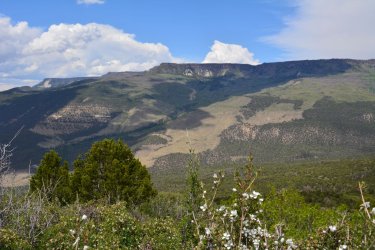
Above, you are in a chaparral type biome with a lot of scub oak. Further up in elevation it changes first into an Aspen mixed forest, then into a conifer mixed forest at Blue lake.
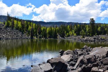
The shores at blue lake were quite rocky. Camping around the lake was limited, the best sites were off of the trail near the lake outlet. The water had a funky taste, but I think this is due to all of the calcium dissolved in the water from the surrounding rocks. Probably the best place to collect water is from the outlet stream at the southern end of the lake.
On the second day after a late start, I backtracked to the Spring Camp trail and followed that to where it intersects with the Kannah creek trail, then followed that all the way to Carson Lake. You loose a little bit of elevation on the way to Kannah creek, but it's not too bad. Water was not a problem during my Memorial Day trip, as most of the streams coming down from the mesa were flowing during this time. Both the Spring Camp and Kannah creek trails were in great shape - it looked like someone from the forest service trimmed back the chaparral along the trail recently. I camped just below Carson lake near some beautiful alpine meadows - as you can see, there are still patches of snow visible at this elevation.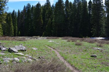
Carson lake is actually a reservoir. As you can see, it was totally drained during my visit. There was a sign there talking about ongoing repair work at the dam, but I didn't see any evidence of recent construction activity. If you are just heading up to Carson lake via the Kannah creek trail, you might be in for a huge disappointment!
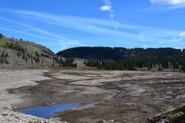
Elevation wise, Carson lake at nearly 10000 ft. is the highpoint of the trip. The Grand Mesa, with all of its lakes and scenery lie just beyond the ridge in the background. From here it was all downhill back to the car on Day 3 via the Coal Creek/Coal Creek Basin trails.
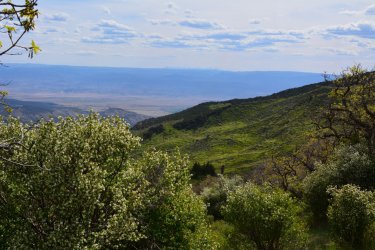
Unlike the Spring Camp/Kannah creek trails, the Coal Creek trail was rough; it was evident that it had not been maintained in years. Large sections of this trail were poorly defined or even undefined. I think a map and compass are essential for this part of the trip. Also, hiking gaiters would not be a bad idea - there's plenty of stinging nettles near the streams that cross the trail, along with other biological baddies in the underbrush. Despite all this I still recommend the Coal Creek trail over the Kannah creek trail for returning to your car. The views of the basin and the Grand Valley beyond along the Coal Creek trail were one of the highlights of the trip. And the route finding provided a wilderness flavor to the trip. It's not too bad - as long as you largely contour, you'll be in good shape. And with all of the views, there are plenty of landmarks to mark your progress.
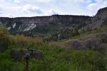
Eventually you'll hit the Coal Creek Basin trail which thankfully is in much better shape than the Coal Creek trail. You'll see this sign and awesome view which is a great reward after all of the bushwhacking.
Coal creek basin was amazing! And unlike the first day, there was decent water available to within a few miles of the car. From Carson lake, expect a solid 7-8 hours of hiking back to the car. Happy trails!
The Kannah Creek basin is located on the western slope of the Grand Mesa; the trailhead is maybe a 20-minute drive outside of Grand Junction, CO. It's covered in good detail on the Trails Illustrated #136 'Grand Mesa' map. I did this as a 3-day backpacking loop (over Memorial Day weekend 2021) by taking the Spring Creek trail from the City Intake trailhead up to Blue lake, then over to Carson Lake via Spring Camp and Kannah Creek trails. On the third day I returned to the car via the Coal Creek and Coal Creek Basin trails. If you're short on time, you can shorten the loop to 2 days by using the Kannah creek trail, which basically runs from the trailhead straight up to Carson lake. To fully take in the size of this basin, I recommend the 3 day hike.
If you're looking for some Walden-esque solitude on a busy holiday weekend, this is the place! When I arrived at the trailhead mid day on Memorial Day weekend, there were only about half a dozen cars in the parking lot! The scenery is beautiful - you cross several different plant biomes on your way up as the pictures below show. You start out in a pinion and cactus filled valley at the trailhead and by the time you reach Carson lake you're in a mixed conifer/alpine meadow forest.
Day 1 saw me climbing the Spring Camp trail from the trailhead. For most of the loop finding water wasn't a problem, however this section of the Spring Camp trail was dry up to about the intersection with the Indian Point trail 2500 vertical ft. up. The hike is hot especially near the bottom, so I recommend tanking up on water at the trailhead. Along the way I had beautiful views - below is a shot looking across the basin at the shallow Coal Creek drainage, which would be my decent route on day 3.

Above, you are in a chaparral type biome with a lot of scub oak. Further up in elevation it changes first into an Aspen mixed forest, then into a conifer mixed forest at Blue lake.

The shores at blue lake were quite rocky. Camping around the lake was limited, the best sites were off of the trail near the lake outlet. The water had a funky taste, but I think this is due to all of the calcium dissolved in the water from the surrounding rocks. Probably the best place to collect water is from the outlet stream at the southern end of the lake.
On the second day after a late start, I backtracked to the Spring Camp trail and followed that to where it intersects with the Kannah creek trail, then followed that all the way to Carson Lake. You loose a little bit of elevation on the way to Kannah creek, but it's not too bad. Water was not a problem during my Memorial Day trip, as most of the streams coming down from the mesa were flowing during this time. Both the Spring Camp and Kannah creek trails were in great shape - it looked like someone from the forest service trimmed back the chaparral along the trail recently. I camped just below Carson lake near some beautiful alpine meadows - as you can see, there are still patches of snow visible at this elevation.

Carson lake is actually a reservoir. As you can see, it was totally drained during my visit. There was a sign there talking about ongoing repair work at the dam, but I didn't see any evidence of recent construction activity. If you are just heading up to Carson lake via the Kannah creek trail, you might be in for a huge disappointment!

Elevation wise, Carson lake at nearly 10000 ft. is the highpoint of the trip. The Grand Mesa, with all of its lakes and scenery lie just beyond the ridge in the background. From here it was all downhill back to the car on Day 3 via the Coal Creek/Coal Creek Basin trails.
Unlike the Spring Camp/Kannah creek trails, the Coal Creek trail was rough; it was evident that it had not been maintained in years. Large sections of this trail were poorly defined or even undefined. I think a map and compass are essential for this part of the trip. Also, hiking gaiters would not be a bad idea - there's plenty of stinging nettles near the streams that cross the trail, along with other biological baddies in the underbrush. Despite all this I still recommend the Coal Creek trail over the Kannah creek trail for returning to your car. The views of the basin and the Grand Valley beyond along the Coal Creek trail were one of the highlights of the trip. And the route finding provided a wilderness flavor to the trip. It's not too bad - as long as you largely contour, you'll be in good shape. And with all of the views, there are plenty of landmarks to mark your progress.
Eventually you'll hit the Coal Creek Basin trail which thankfully is in much better shape than the Coal Creek trail. You'll see this sign and awesome view which is a great reward after all of the bushwhacking.

Coal creek basin was amazing! And unlike the first day, there was decent water available to within a few miles of the car. From Carson lake, expect a solid 7-8 hours of hiking back to the car. Happy trails!

