chandlerwest
Member
- Joined
- Feb 7, 2015
- Messages
- 550
I can't believe it has been a year since I did anything exploratory in Zion NP. Let's blame it on Springdale road construction (installation of parking meters mostly) and not having much uncharted to trudge through. Yesterday I went someplace that doesn't have a name so I'm not even going to tell you where I went. It is a mystery trip report.
With our recent rains I felt that the day could be extremely short. Surely potholes would be filled with water or dry falls would prove to be walls. So I felt I would possibly be home by noon. It turned out being a 6 hour day. I got a chilly, late for me, start. I always like the first picture of a drainage. They always look so jumbled. A mess. Which hide the wonder that lies beyond.

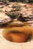
The potholes did not disappoint!
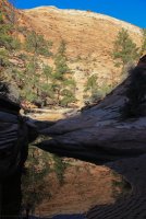
Having scouted this far on an earlier trip I knew this dry fall was here. Having seen a family of three come down it I wasn't concerned about getting past it. Wouldn't it be wondrous and terrifying to see water rushing over this?
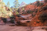
It wasn't too long before I came to this dry fall. I had seen it on Google Earth. Assuming that the fall would be a.....wall, I hoped that I could plow my way up the debris slope. But water took that option out. So I made my way to dry fall.
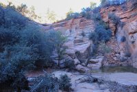
But taking it one section at a time I made it to the top and ready to ride this drainage until It stops me.
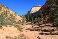
Taking what seemed to be the obvious route I found myself on this ridge/bench above the stream. You fill a bit silly that you evidently made an error but you look around and "it's all good!"
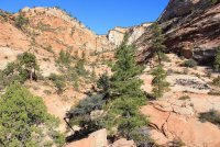
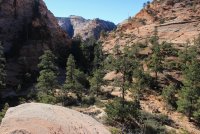
Back on the right course. Eventually things begin to narrow up. There was very little fall color. Hitting fall colors in Zion is a crap shoot!
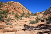
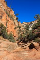
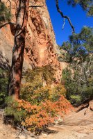
Dang it, I found myself on another higher ridge.
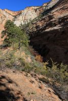


The canyon truly narrows as I got closer to the headwall. Now it was only a matter of how my potholes and boulders I could get around.
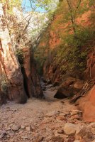

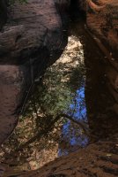
This one had me stumped. It was a horrible stretch from the rock in the right front to something remotely dry but it was going to leave me grossly out of balance. So, after I took this picture, I started throwing rocks trying to get another dry step. I Just got a rock to protrude from the water and knew I needed at least another rock. I threw it and it destroyed everything I had built. Heavy sigh.....laugh! I stood on the right rock and stretched. I am not sure what I did. I think I probably fell my right hand onto the right wall then grabbed for a hold on the boulder (which in retrospect I am thankful I didn't pull down upon myself.) Proving that even with cloggy blue jeans I am still able to contort a bit @Artemus . Anywho ....I made it and continued. While I have this picture queued up I might as well tell the coming out story. I'm on the rock and I just didn't like how the steps played out in my head. I felt like each move was wrong footed and against the pitch. So I went a higher route off to the right of the photo. It was probably eight feet up. Narrow, sandy and pitchy. I skootched along feeling that I was going to loose friction at any split second. I finally reached a point were the slide looked better than Not trying to slide. I made it...all was well.
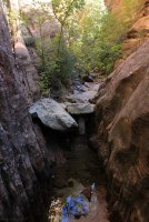
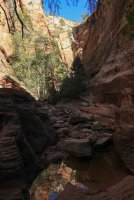
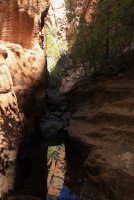
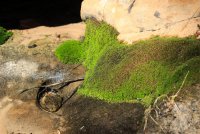
This pool mesmerized me. The moss/algae below the water was breathing/exuding.
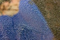
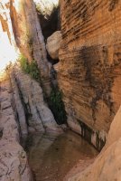
This is the spot that stopped me. The chimney above the boulder blow out and with the water and tilt of the wall ....it just wasn't going to happen.
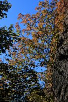
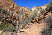
This guy struck me as lost and alone. Manzinitas love to grow in a rats nest environment. But he was down here almost in the stream bed. With this wonderful spotlight. This morning I had the thought. "It is like Charlie Brown's Christmas tree!!!"
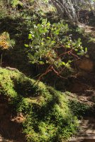
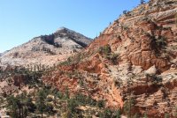
Going in I kept looking up to the right. I knew that there was a notch up there and the wall looked broken enough that I felt it was worth the try to get up it. It was quite the fun route finding puzzle. You stair at the rock long enough, ramps come into focus. I have always felt it would hilarious to have my route plotted on a map just to see the squiggles. (Yes, I know, that technology exists. Just not on the chandlerwest budget.)
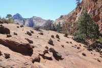
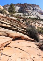
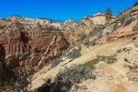
I finally made it to the tranquil slick rock. I have done enough in east Zion to know this was Not the top......but I Had hoped.
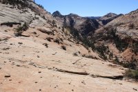
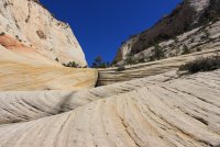
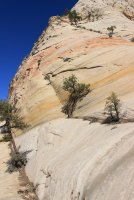
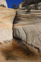

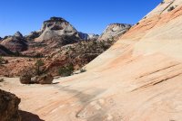
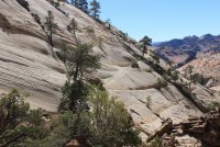
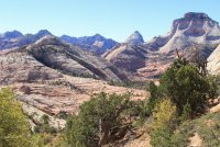
Okay........this is the top!!!!! Where I was hit with a welcoming gusty cold wind.
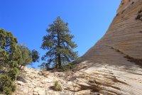
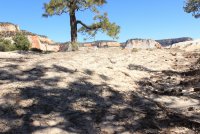
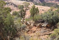
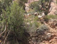
While still physically adjusting to the strong wind and the vertigo I had a couple seconds of terror. Behind me I heard this guttural noise. I turned just in time to see a glimpse of the top of the head of a bighorn sheep. It evidently had been making its way down the slope/wall. Noise identified, I went back to taking pictures.
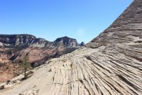

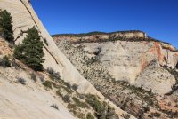
Time to make my way down. "Now where did those bighorns go?" I was a bit self conscious about herding them down the slope. But what else could I do? So I followed as non-aggressively as I could. Looking at one of these photos this morning I felt I did an okay job because the big boy took time to remind one of the girls that she was his.
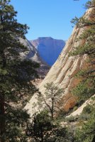
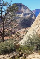

Going down the puzzle slope went faster because you can drop off ledges instead of looking for more comfortable ways around.
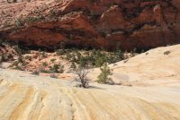
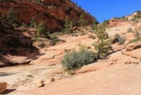
A string of potholes.
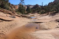
At the brink of the huge dry fall...then going down.....then looking back it.
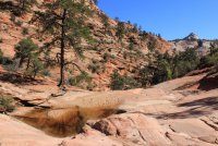
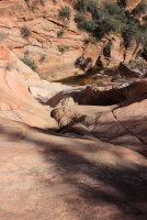
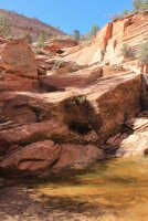
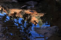
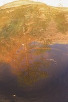
A string of pothole reflections!

A view from the road up to the notch I climbed up to. Not from this side, from the other side.
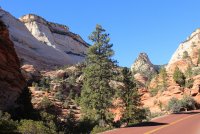
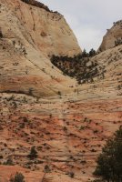
This is a photo of the route up to notch from a 2016 trip. I include it to share a mantra that @Jeffrey Chandler and I have. "ants on a hill". We came up with it in Glacier but, as you all know, it applies everywhere. From a distance a slope can look god awful terrible, but when you are on it you are just "ants on a hill" and the usable depth will become apparent.
Thanks everybody!!!
With our recent rains I felt that the day could be extremely short. Surely potholes would be filled with water or dry falls would prove to be walls. So I felt I would possibly be home by noon. It turned out being a 6 hour day. I got a chilly, late for me, start. I always like the first picture of a drainage. They always look so jumbled. A mess. Which hide the wonder that lies beyond.

The potholes did not disappoint!


Having scouted this far on an earlier trip I knew this dry fall was here. Having seen a family of three come down it I wasn't concerned about getting past it. Wouldn't it be wondrous and terrifying to see water rushing over this?

It wasn't too long before I came to this dry fall. I had seen it on Google Earth. Assuming that the fall would be a.....wall, I hoped that I could plow my way up the debris slope. But water took that option out. So I made my way to dry fall.

But taking it one section at a time I made it to the top and ready to ride this drainage until It stops me.


Taking what seemed to be the obvious route I found myself on this ridge/bench above the stream. You fill a bit silly that you evidently made an error but you look around and "it's all good!"


Back on the right course. Eventually things begin to narrow up. There was very little fall color. Hitting fall colors in Zion is a crap shoot!


Dang it, I found myself on another higher ridge.


The canyon truly narrows as I got closer to the headwall. Now it was only a matter of how my potholes and boulders I could get around.


This one had me stumped. It was a horrible stretch from the rock in the right front to something remotely dry but it was going to leave me grossly out of balance. So, after I took this picture, I started throwing rocks trying to get another dry step. I Just got a rock to protrude from the water and knew I needed at least another rock. I threw it and it destroyed everything I had built. Heavy sigh.....laugh! I stood on the right rock and stretched. I am not sure what I did. I think I probably fell my right hand onto the right wall then grabbed for a hold on the boulder (which in retrospect I am thankful I didn't pull down upon myself.) Proving that even with cloggy blue jeans I am still able to contort a bit @Artemus . Anywho ....I made it and continued. While I have this picture queued up I might as well tell the coming out story. I'm on the rock and I just didn't like how the steps played out in my head. I felt like each move was wrong footed and against the pitch. So I went a higher route off to the right of the photo. It was probably eight feet up. Narrow, sandy and pitchy. I skootched along feeling that I was going to loose friction at any split second. I finally reached a point were the slide looked better than Not trying to slide. I made it...all was well.


This pool mesmerized me. The moss/algae below the water was breathing/exuding.

This is the spot that stopped me. The chimney above the boulder blow out and with the water and tilt of the wall ....it just wasn't going to happen.


This guy struck me as lost and alone. Manzinitas love to grow in a rats nest environment. But he was down here almost in the stream bed. With this wonderful spotlight. This morning I had the thought. "It is like Charlie Brown's Christmas tree!!!"

Going in I kept looking up to the right. I knew that there was a notch up there and the wall looked broken enough that I felt it was worth the try to get up it. It was quite the fun route finding puzzle. You stair at the rock long enough, ramps come into focus. I have always felt it would hilarious to have my route plotted on a map just to see the squiggles. (Yes, I know, that technology exists. Just not on the chandlerwest budget.)


I finally made it to the tranquil slick rock. I have done enough in east Zion to know this was Not the top......but I Had hoped.


Okay........this is the top!!!!! Where I was hit with a welcoming gusty cold wind.


While still physically adjusting to the strong wind and the vertigo I had a couple seconds of terror. Behind me I heard this guttural noise. I turned just in time to see a glimpse of the top of the head of a bighorn sheep. It evidently had been making its way down the slope/wall. Noise identified, I went back to taking pictures.


Time to make my way down. "Now where did those bighorns go?" I was a bit self conscious about herding them down the slope. But what else could I do? So I followed as non-aggressively as I could. Looking at one of these photos this morning I felt I did an okay job because the big boy took time to remind one of the girls that she was his.


Going down the puzzle slope went faster because you can drop off ledges instead of looking for more comfortable ways around.


A string of potholes.

At the brink of the huge dry fall...then going down.....then looking back it.


A string of pothole reflections!

A view from the road up to the notch I climbed up to. Not from this side, from the other side.

This is a photo of the route up to notch from a 2016 trip. I include it to share a mantra that @Jeffrey Chandler and I have. "ants on a hill". We came up with it in Glacier but, as you all know, it applies everywhere. From a distance a slope can look god awful terrible, but when you are on it you are just "ants on a hill" and the usable depth will become apparent.

Thanks everybody!!!

 I am not as frustrated about the hoards who walk the river for some reason. That experience is just so special/unique that I am sort of proud of the common Joe who does it and tolerate their Constant presence. If I can't get them out of the picture I'll use them for perspective.