balzaccom
Member
- Joined
- Sep 30, 2014
- Messages
- 839
We took advantage of some free dates before I was to start teaching again and drove off to visit some old haunts and discover some new spots in the Southwest. Here's a short trip log...and a link to the photos for more details.
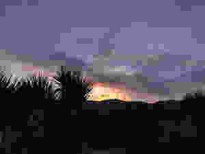
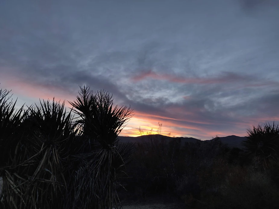
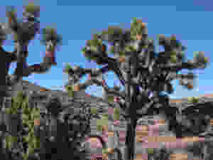
DAY ONE: A long drive down to Joshua Tree, where we had a reservation at Cottonwood Campground. We got the only site left. And after more than nine hours in Le Vin Blanc, we ate a quick dinner, took a quiet walk around the campground, and called it a night. Sunset was delicious.
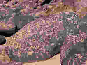
DAY TWO: We couldn't leave Joshua Tree without at least some hiking, so we took the little nature trail first thing in the morning. And then we drove off to see the Blythe Intaglios--truly remarkable desert artwork the should be far more famous than it is. We loved it. Not quite the Nazca Lines, but the only site like it in North America.

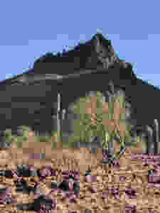
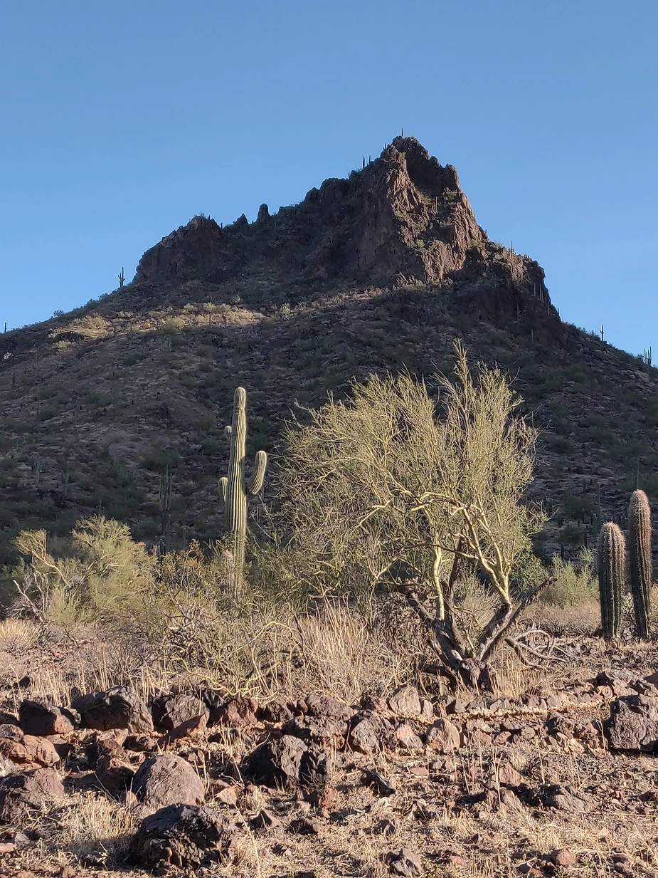
From there we drove to Picacho Peak State Park, where we arrived in time to hike the Callaway Trail and the Nature Trail there, racing the sunset as we did so. A lovely spot, and well worth a stop. Like all Arizona state parks. this one is pricey, at $30 a night, but that includes hot showers, and rules against both drones and generators. What's not to like about that? That's a view from the trail below.
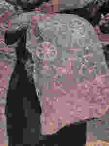
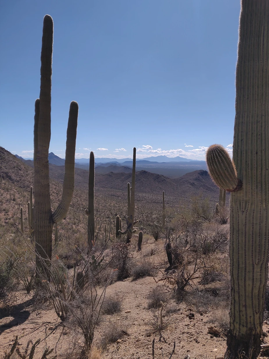
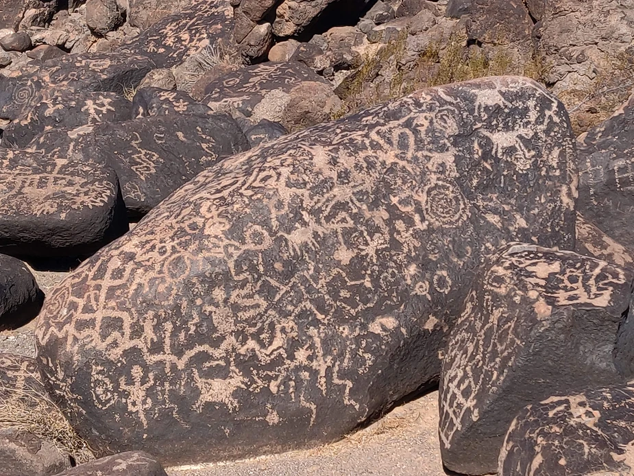
DAY THREE: We stayed camped again at Picacho Peak, because it's only about a half-hour's drive from Saguaro National Park, and we wanted to spend the day there, which we did. This is the western part of that park, and we really enjoyed the Hugh Norris Bajada Loop Trail, that gave us everything from big views across the desert to sandy washes, great Saguaros, and an amazing variety of cacti. And we stopped to see some petroglyphs while we were there.
At the end of the day we drove back via the Picture Rocks Road to see more of the park. Great hike.
DAY FOUR: This was a shot in the dark--we found that we could get a campsite at Chiricahua National Monument in the southeast corner of Arizona, and so we took a leap of faith and drove there.
First we stopped at the eastern part of Saguaro National Park, but only did the scenic drive, since it was a long way to Chiricahua. In fact, it took longer than we thought, but was well worth the trouble. What a lovely spot, high (5,000 feet) in the mountains, with a campground down in a secluded canyon. Just delightful.
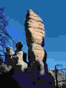
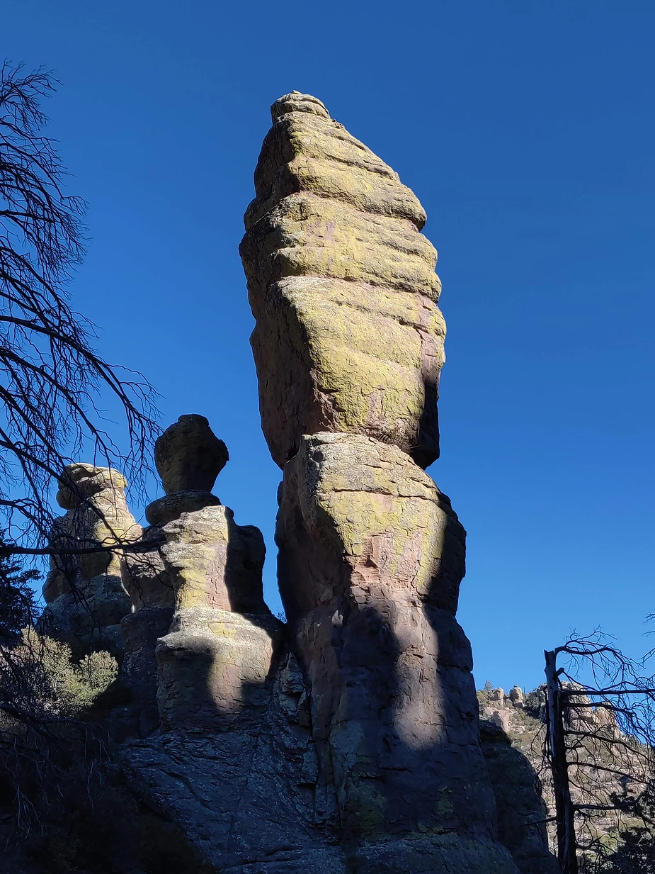
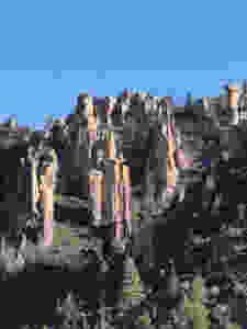
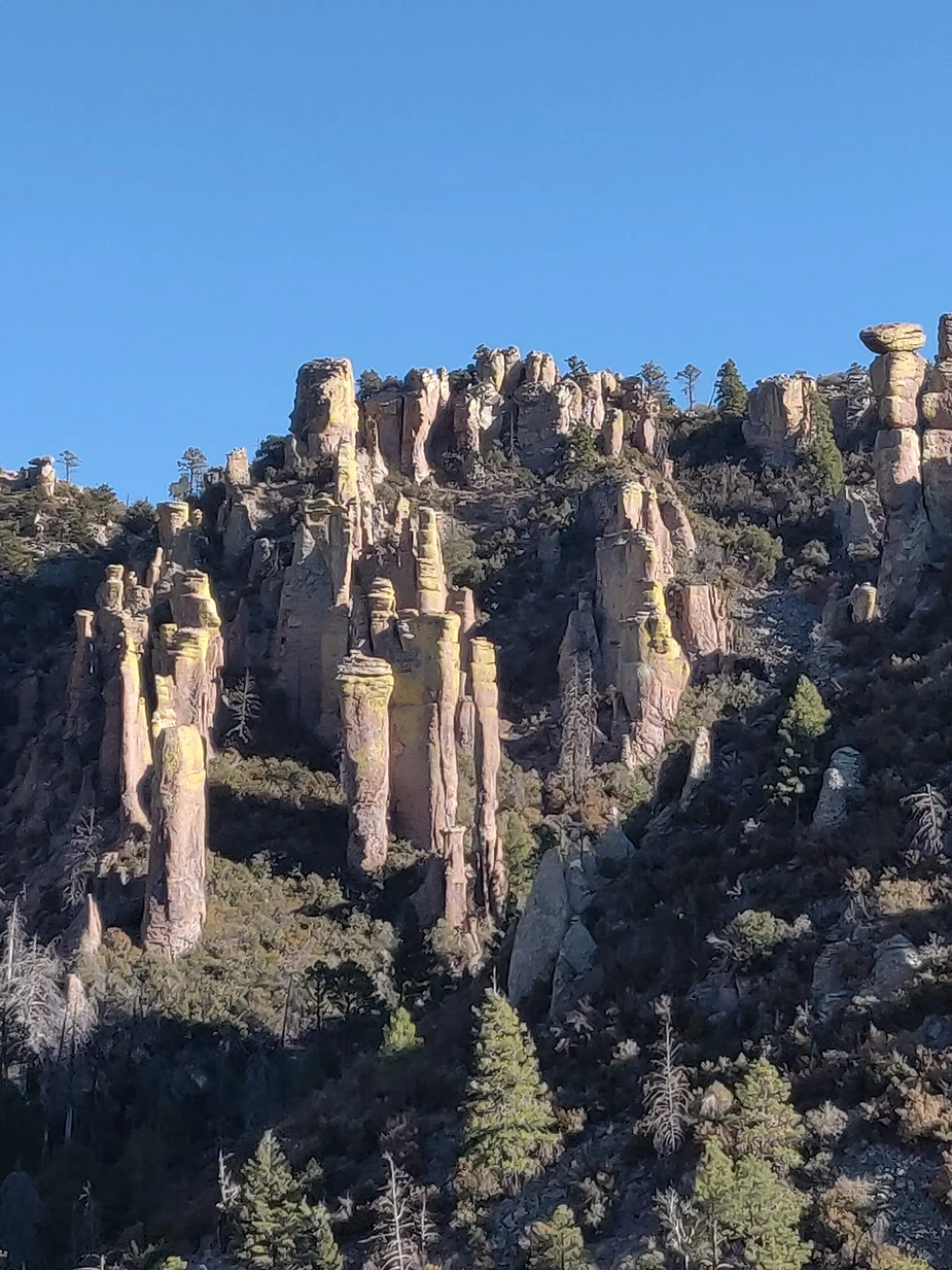
And the rocks exceeded all of our expectations. We hiked the Echo Canyon Loop (counter-clockwise, which had us doing all the steep downhill right off the bat. Our old knees would do it the other way round, next time.) We loved the hike, and the trail takes you right through the middle of these towers.
That night the temperature got down to freezing, our coldest night of the trip. Happily, we were prepared and cozy in the van.
DAY FIVE: This was a long drive across southern Arizona to Organ Pipe Cactus National Monument. On the way, we had a lively experience with an on-coming pickup truck that lost its load of hay right as it approached us. The bales practically exploded off the back of the truck, and flew in all directions, including two right into our lane. I was lucky to be able to swerve and just missed them them both. That got our adrenaline going.
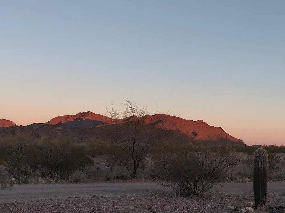
On the other hand, we were not lucky with a campsite here. Normally there should have been plenty, but the park had closed off two-thirds of the site due to COVID protocols. Grrr. So we muttered and groaned--we were counting on these sites for the weekend. On the way in, we had noticed the Desert Diamond casino in the town of Why, some twenty miles away, with a small RV park. So we went and asked them for a site. And we got one, for $25 a night, that sat on the edge of the desert with a view that went on for miles and miles. Fair enough. That's the view below. Peaceful. Beautiful. Just what we needed.
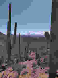
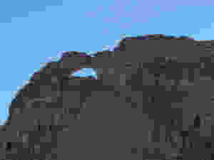
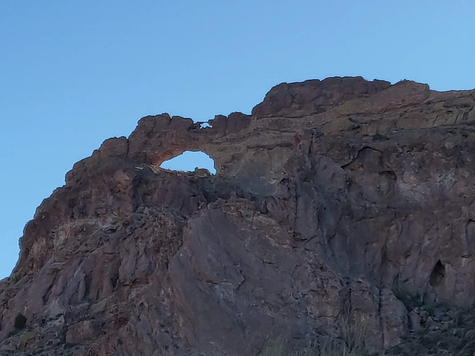
DAY SIX: We had left the latter part of this trip up in the air, mainly because we weren't sure about the weather. But it was fine. So I made a reservation for the following night at Joshua Tree again, and then we set off to explore Organ Pipe. We drove both the Ajo Road and Puerto Blanco Road, and added in a few trails as well: the Estes Canyon Loop and Dripping Springs. This is Arch Rock below.
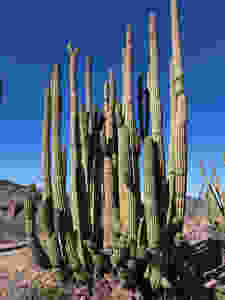
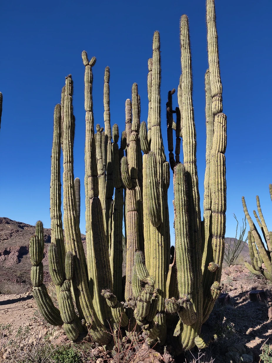
And Organ Pipe Cactus:
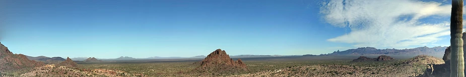
The view from the Dripping Springs Trail:

Combined with nearly 60 miles of dirt roads, it made for a long day. And we finished that day off with the last section of the Puerto Blanco Road taking us along the new and very ugly border wall that seals off the southern end of the park. Ugly and sad.
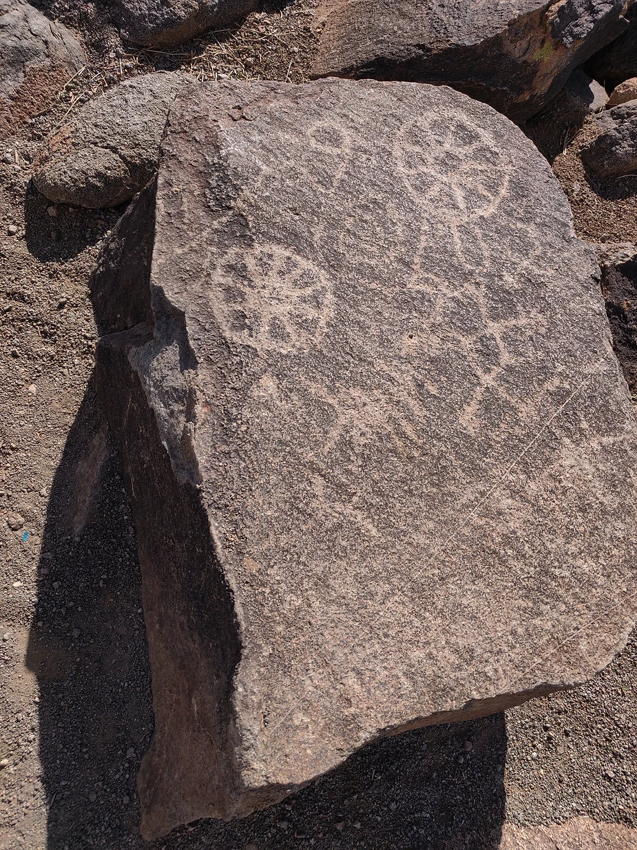
DAY SEVEN: On our way back to Joshua Tree, we wanted to check out a site we had seen n our maps: Painted Rocks Archeological Site, west of Gila Bend. What a treat that was! And there was a BLM campground there, so we could add that to our list of possible camp spots in the future. The rocks were covered with petroglyphs.
From there we drove west to Yuma, and then north to Quartzsite, taking in the the scenery of the lower Colorado. It made for a long day, but we pulled into Joshua Tree well before dark. set up camp, and relaxed, happy to be back in Cottonwood Campground.
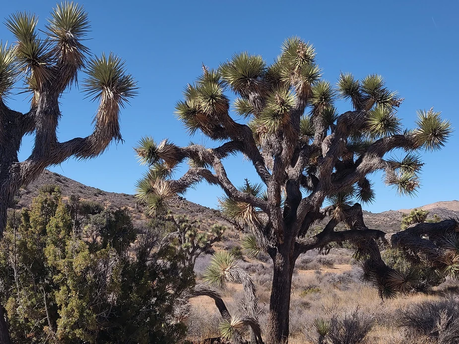
DAY EIGHT: We wanted to hike the Lost Horse Loop Trail here, but we had been told that the trailhead parking lot filled up early, and we had most of the park to traverse to get there. We were disappointed to see the "Parking Lot Full" sign as we reached the turnoff, and were then delighted to see that the sign was wrong. There were certainly a few spaces left. We hit the trail and loved the hike. Weather was cool, with a breeze, and it kept us moving along at a brisk pace.
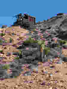
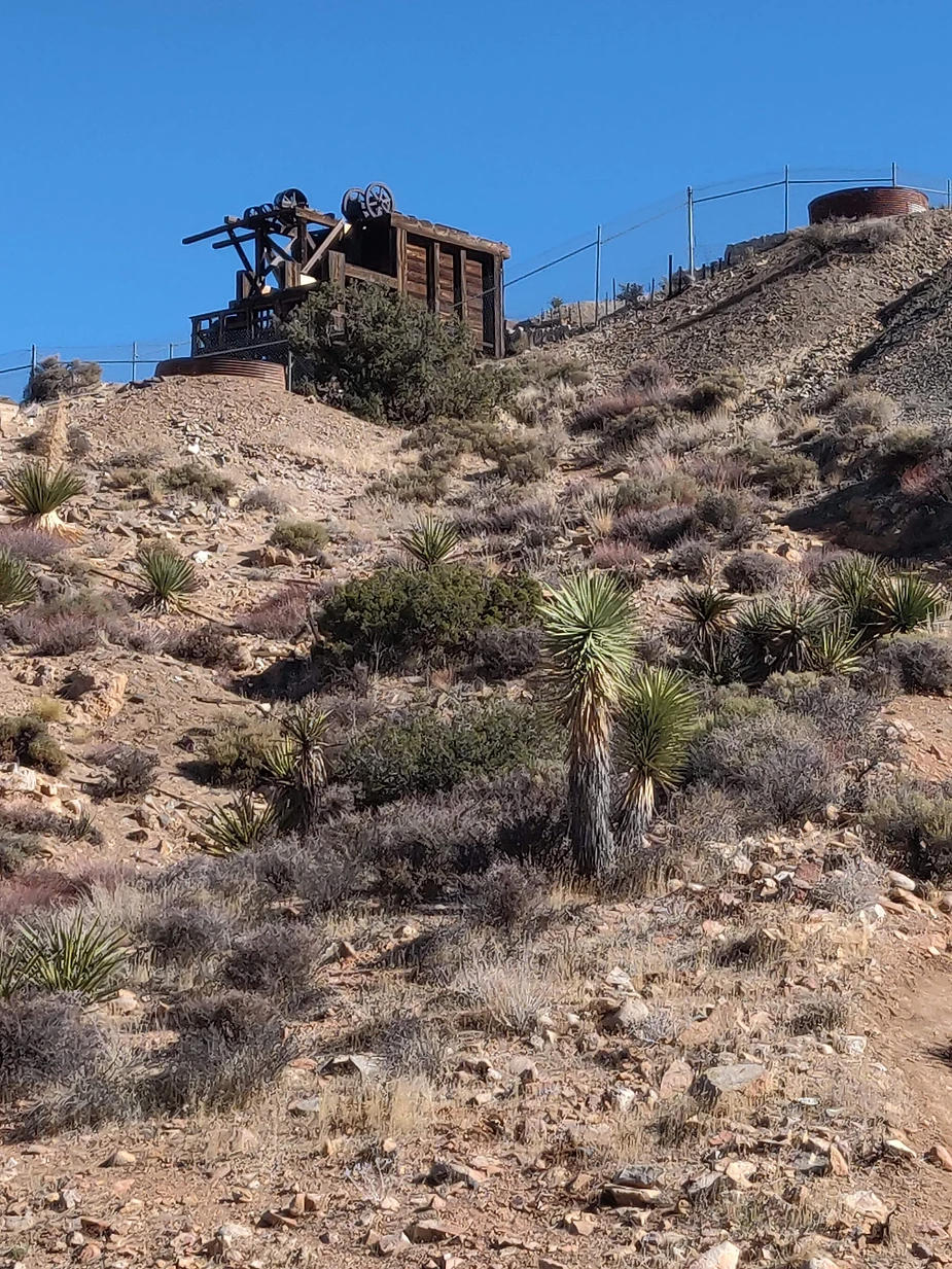
The first part, up to the mine, was more or less expected, but the longer return leg of the loop led us through a wonderful forest of mature Joshua Trees, It was a treat. And the end of the road also gave us a view of the Salton Sea from Keys View.
After stopping at Cap Rock for a quick picnic, we drove north, hoping to get halfway home before dark. But we were also interested in a adventure. So out of Yucca Valley we took the side road to Pioneertown (a Hollywood western movie set, and quite bizarre) and then on to Rimrock, where we tried to take Burns Canyon Road...only to discover that we had been led astray---and were facing a rough 25 mile dirt road through the mountains.
Not today. So we turned back to drove to Highway 247. But before we could get there we found traffic stopped, and people crawling all over the pavement. Turns out someone had dropped a few boxes of metal screws on the road, and about eight cars and their drivers had all stopped to clean up the road. This had all the makings of a true adventure...but within a minute or two they announced that they thought they'd done enough. The road might well be safe.
We took our chances, and drove onward.
In the end, we made it to Lost Hills, west of Bakersfield, where we camped at the RV park behind the gas station. It was perfectly nice, clean, and helpful. But they did lock the restrooms at ten p.m....and we never did find out when they reopened them in the morning...because we left at 6:45 to grab a quick breakfast a Denny's (Outdoors, temperature 42 degrees) before driving the rest of the way home. And the restrooms were locked when we left. Go figure.
No idea why the photos here never post well, but if you want the whole photo log, you can find it here: https://photos.app.goo.gl/iDXq4M2HqgwDX2dK7
DAY ONE: A long drive down to Joshua Tree, where we had a reservation at Cottonwood Campground. We got the only site left. And after more than nine hours in Le Vin Blanc, we ate a quick dinner, took a quiet walk around the campground, and called it a night. Sunset was delicious.
DAY TWO: We couldn't leave Joshua Tree without at least some hiking, so we took the little nature trail first thing in the morning. And then we drove off to see the Blythe Intaglios--truly remarkable desert artwork the should be far more famous than it is. We loved it. Not quite the Nazca Lines, but the only site like it in North America.
From there we drove to Picacho Peak State Park, where we arrived in time to hike the Callaway Trail and the Nature Trail there, racing the sunset as we did so. A lovely spot, and well worth a stop. Like all Arizona state parks. this one is pricey, at $30 a night, but that includes hot showers, and rules against both drones and generators. What's not to like about that? That's a view from the trail below.
DAY THREE: We stayed camped again at Picacho Peak, because it's only about a half-hour's drive from Saguaro National Park, and we wanted to spend the day there, which we did. This is the western part of that park, and we really enjoyed the Hugh Norris Bajada Loop Trail, that gave us everything from big views across the desert to sandy washes, great Saguaros, and an amazing variety of cacti. And we stopped to see some petroglyphs while we were there.
At the end of the day we drove back via the Picture Rocks Road to see more of the park. Great hike.
DAY FOUR: This was a shot in the dark--we found that we could get a campsite at Chiricahua National Monument in the southeast corner of Arizona, and so we took a leap of faith and drove there.
First we stopped at the eastern part of Saguaro National Park, but only did the scenic drive, since it was a long way to Chiricahua. In fact, it took longer than we thought, but was well worth the trouble. What a lovely spot, high (5,000 feet) in the mountains, with a campground down in a secluded canyon. Just delightful.
And the rocks exceeded all of our expectations. We hiked the Echo Canyon Loop (counter-clockwise, which had us doing all the steep downhill right off the bat. Our old knees would do it the other way round, next time.) We loved the hike, and the trail takes you right through the middle of these towers.
That night the temperature got down to freezing, our coldest night of the trip. Happily, we were prepared and cozy in the van.
DAY FIVE: This was a long drive across southern Arizona to Organ Pipe Cactus National Monument. On the way, we had a lively experience with an on-coming pickup truck that lost its load of hay right as it approached us. The bales practically exploded off the back of the truck, and flew in all directions, including two right into our lane. I was lucky to be able to swerve and just missed them them both. That got our adrenaline going.
On the other hand, we were not lucky with a campsite here. Normally there should have been plenty, but the park had closed off two-thirds of the site due to COVID protocols. Grrr. So we muttered and groaned--we were counting on these sites for the weekend. On the way in, we had noticed the Desert Diamond casino in the town of Why, some twenty miles away, with a small RV park. So we went and asked them for a site. And we got one, for $25 a night, that sat on the edge of the desert with a view that went on for miles and miles. Fair enough. That's the view below. Peaceful. Beautiful. Just what we needed.
DAY SIX: We had left the latter part of this trip up in the air, mainly because we weren't sure about the weather. But it was fine. So I made a reservation for the following night at Joshua Tree again, and then we set off to explore Organ Pipe. We drove both the Ajo Road and Puerto Blanco Road, and added in a few trails as well: the Estes Canyon Loop and Dripping Springs. This is Arch Rock below.
And Organ Pipe Cactus:
The view from the Dripping Springs Trail:
Combined with nearly 60 miles of dirt roads, it made for a long day. And we finished that day off with the last section of the Puerto Blanco Road taking us along the new and very ugly border wall that seals off the southern end of the park. Ugly and sad.
DAY SEVEN: On our way back to Joshua Tree, we wanted to check out a site we had seen n our maps: Painted Rocks Archeological Site, west of Gila Bend. What a treat that was! And there was a BLM campground there, so we could add that to our list of possible camp spots in the future. The rocks were covered with petroglyphs.
From there we drove west to Yuma, and then north to Quartzsite, taking in the the scenery of the lower Colorado. It made for a long day, but we pulled into Joshua Tree well before dark. set up camp, and relaxed, happy to be back in Cottonwood Campground.
DAY EIGHT: We wanted to hike the Lost Horse Loop Trail here, but we had been told that the trailhead parking lot filled up early, and we had most of the park to traverse to get there. We were disappointed to see the "Parking Lot Full" sign as we reached the turnoff, and were then delighted to see that the sign was wrong. There were certainly a few spaces left. We hit the trail and loved the hike. Weather was cool, with a breeze, and it kept us moving along at a brisk pace.
The first part, up to the mine, was more or less expected, but the longer return leg of the loop led us through a wonderful forest of mature Joshua Trees, It was a treat. And the end of the road also gave us a view of the Salton Sea from Keys View.
After stopping at Cap Rock for a quick picnic, we drove north, hoping to get halfway home before dark. But we were also interested in a adventure. So out of Yucca Valley we took the side road to Pioneertown (a Hollywood western movie set, and quite bizarre) and then on to Rimrock, where we tried to take Burns Canyon Road...only to discover that we had been led astray---and were facing a rough 25 mile dirt road through the mountains.
Not today. So we turned back to drove to Highway 247. But before we could get there we found traffic stopped, and people crawling all over the pavement. Turns out someone had dropped a few boxes of metal screws on the road, and about eight cars and their drivers had all stopped to clean up the road. This had all the makings of a true adventure...but within a minute or two they announced that they thought they'd done enough. The road might well be safe.
We took our chances, and drove onward.
In the end, we made it to Lost Hills, west of Bakersfield, where we camped at the RV park behind the gas station. It was perfectly nice, clean, and helpful. But they did lock the restrooms at ten p.m....and we never did find out when they reopened them in the morning...because we left at 6:45 to grab a quick breakfast a Denny's (Outdoors, temperature 42 degrees) before driving the rest of the way home. And the restrooms were locked when we left. Go figure.
No idea why the photos here never post well, but if you want the whole photo log, you can find it here: https://photos.app.goo.gl/iDXq4M2HqgwDX2dK7

