July 14th - 18th 2015. Glacier Point, Yosemite to Red's Meadow. Total distance approx. 65 miles.
Inspired by @ZubenElGenubi's Thousand Island Lake trip report, I thought i'd contribute my first real trip report to BCP.
I've wanted to hike the JMT for a few years now but getting the time off from work, as well as coming from the UK and all the extra logistics around resupplies that entails, made things tricky. I figured I would try to complete the first third or so of the trail this year and finish the remainder next summer.
Permits to start from Yosemite are very competitive and hard to get. After 5 consecutive days of faxing and subsequent denials, in mid-January I finally secured a permit to start from Glacier Point. This isn't the "official" start of the JMT but it would mean i'd only miss the first 3.5 miles, which I could complete as a day-hike the day before starting.
Monday 7/13. Happy Isles to Nevada Fall and back, 7 mile round trip.
I'd actually hiked this section of trail 3 years previous, when I day hiked Half Dome. However, the falls were running more on this occasion so I figured I'd hike it again.
Unfortunately this section of trail gets very crowded with tourists during the day, so I set off early to avoid the crowds. I was on the trail by 6.30am - at this time of the morning the sun isn't high enough in the sky to reach the bottom of the valley so it was kinda cool.
The trail first passes Vernal Fall and then climbs to the top of Nevada Fall for approximately 2000ft of elevation gain in 3.5 miles. About a mile into the hike you reach a fork and actually have a choice of two routes to the top - the Mist Trail or the John Muir Trail. I chose to ascend the Mist Trail and descend on the slightly longer John Muir Trail as it's easier on the knees.
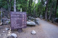
The official start of the John Muir Trail:
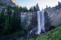
Ascending the slick steps of the Mist Trail beside Vernal Fall:
Above Vernal Fall, the trail passes through a wooded area before climbing a set of steep stairs cut into the rock:
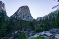
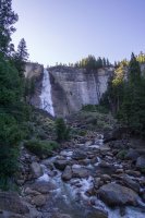
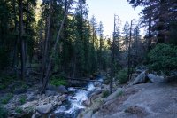
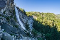
I made it to the top of Nevada Fall by 8.30am and ate a breakfast of fruit and Clif bars.
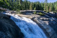
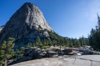
Officially I needed to vacate my campsite in the valley by 11am so I had to hustle to get back down and get packed up. I began the long series of switchbacks down the JMT.
From L>R - Half Dome, Liberty Cap and Nevada Fall seen from the JMT:
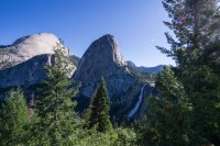
I made it back to camp just after 10.30am, moved my stuff across to the Backpackers Campground and did a bit of the tourist thing for the rest of the day. Man, the valley is beautiful but it's a real zoo

Tuesday 7/14. Glacier Point to Illilouette Creek, 4.5 miles.
My permit stated that I had to start my hike from Glacier Point and camp the first night in Illilouette Basin. To get from the valley floor up to Glacier Point you can either hike the "Four Mile Trail" which ascends 4,500ft of steep switchbacks in 4 miles, or ride a tourist bus up there. I didn't fancy a 4,500ft climb with a full pack so wimped out and took the bus!
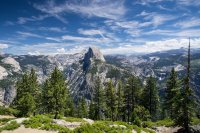
The view from the top is awesome. Half Dome dominates the landscape - dwarfing Vernal and Nevada Falls, where I was yesterday. Unfortunately it's also a zoo up here. I grabbed a Gatorade and ice cream from the small store and then hit the trail. For your first night you must camp in the location stated on your permit, after that you are free to camp wherever you can hike to. Knowing this, I only had a short day of about 4.5 miles to my first night's camp in Illilouette Basin, and it was all downhill.
The trail switchbacks from GP down into the trees. For the first mile and a half I passed maybe half a dozen hikers who were most likely day-hiking to or from the valley floor via the Panorama Trail and Illilouette Falls, a distance of about 8 miles. However, after passing by the turn off for this trail, I didn't see anyone else until late in the evening.
As I was descending through the trees I heard an enormous crack, a fluster of birds and saw a huge tree of over 100ft crash to the ground down in the valley to my left, maybe just 300ft off the trail. This image remained in my head throughout the hike as I walked and camped under many identical trees!
After about 3 miles, the trail descends to the beautiful Illilouette Creek, where hikers must ford the creek to continue. Although the water was deeper than it looked, given the California drought, it wasn't a particularly dangerous crossing although it would surely be different after a heavy snow year.
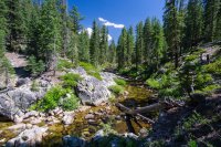
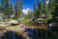
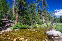
I pitched my tent right beside the creek and did nothing for the rest of the evening other than relax with a fire and read a little before crawling into my tent.
About half an hour after getting into my bag, and just as I was dozing off I heard what I was sure were slow, heavy, padding footsteps which then paused outside my tent followed by a "huffing" and heavy breathing before the footsteps again disappeared off into the night. Was it my imagination? I don't think so. I wasn't fully asleep and was quite certain of what I heard. I *think* it was a black bear but can't be sure. It certainly sounded too large and heavy to be a deer and I can't think of anything else it could have been. Anyway, I slept soundly after that and this was the only "bear encounter" or case of things going bump in the night throughout the whole trip.
Wednesday 7/15. Illilouette Creek to Upper Cathedral Lake, 19 miles.
I was up early, packed and heading up out of Illilouette Basin just as the sun was beginning to peak over Mt Starr King to the East. I wanted to make it to Cathedral Lakes for tonight as I'd heard that sunsets there are spectacular. It would be a long day of about 19 miles and almost 4,000ft elevation gain.
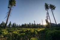
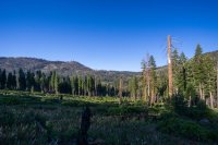
I had to head 4 miles from my campsite to rejoin the JMT at Nevada Fall, where i'd been yesterday. From here the trail heads North East for a steep climb up and out of the valley.
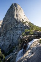
Beyond Half Dome, the trail passes through a 3 mile section of area burned by September 2014's "Meadow Fire". It was kinda ugly but life seems to return fast - there were lots of wildflowers and a number of deer grazing here.
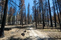
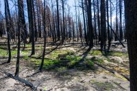
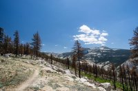
The trail soon climbs steeply up Sunrise Mountain, then passes through Long Meadow and past Sunrise High Sierra Camp, where those with lots of money can come for a stay to experience the High Sierra with canvas tents, luxurious beds and meals cooked for them by chefs. I think I preferred my way of doing it
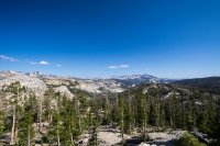
I would crest 3 official passes on this hike - Cathedral Pass being the first, although it's not as serious a climb as most of the others on the JMT. The trail climbs up over the shoulder of Columbia Finger (the pointed peak on the horizon in the photo below), over Cathedral Pass and finally down through the woods to Cathedral Lakes.
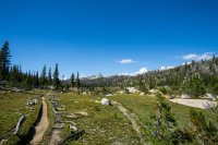
I set up my tent and cooked dinner on the shore, chatting with a guy from North Carolina as we watched the sun set over Cathedral Peak and the sky turned an awesome purple colour.
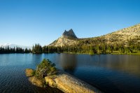
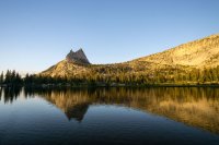
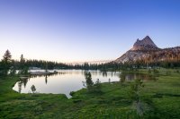
Thursday 7/16. Upper Cathedral Lake to Donohue Base Camp, 17 miles.
Another long day ahead, I awoke at dawn and began the 4.5 mile hike down to where the Tioga Pass Road cuts through Tuolumne Meadows. There's a small store and grill here, I was looking forward to grabbing a burger
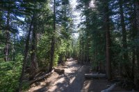
I took the 1.5 mile "loop" out and across Tuolumne Meadows, it was really beautiful:
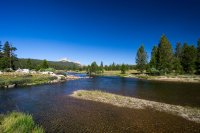
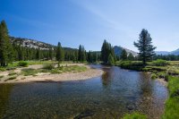
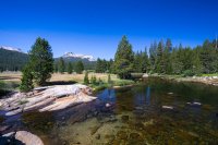
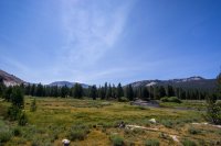
From Tuolumne Meadows, the trail cuts across the Tuolumne River and heads south for a flat 9 mile section along Lyell Canyon.
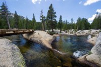
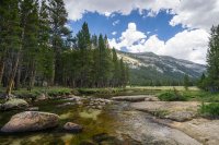
About 3pm, I got the first and only rain of the trip - a typical Sierra mid-afternoon thunderstorm. The clouds moved in, rumbled overhead before the rain started. After 30 minutes it was gone as quickly as it arrived.
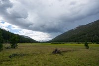
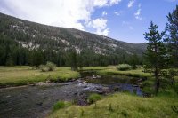
After a good 4 hours hiking through Lyell Canyon, the trail begins the steep climb up towards Donohue Pass. It first crosses the Lyell Fork of the Tuolumne River before reaching a beautiful spot beside a small lake at the foot of the pass that acts as a good spot to camp for the night and has colloquially become known as Donohue Base Camp.
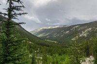
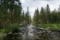
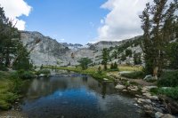
Friday 7/17. Donohue Base Camp to Shadow Creek, 15 miles.
I left camp about 7am to get an early start up and over Donohue Pass - the first high elevation pass on this trail at 11,100ft. From Donohue Base Camp it was a climb of about 1700ft but I actually found it easier than expected. It took me about an hour to reach the top and i'm fairly sure I was the first person over the pass that day, it was a beautiful climb.
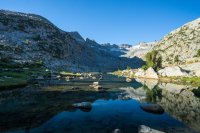
The top of the pass is dotted with small tarns and a beautifully clean, crystal clear lake.
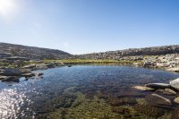
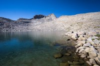
From Donohue Pass, the trail heads south towards the Rush Creek area and Island Pass where you hike past numerous cascading streams and small lakes.
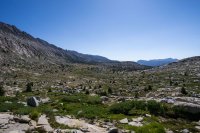
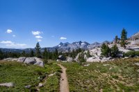
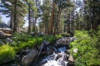
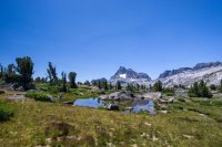
A climb of about 700ft takes you up and over Island Pass before you drop down and the view opens up and you see the iconic view of Thousand Island Lake dwarfed by Mt Ritter and Banner Peak.
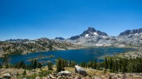
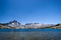
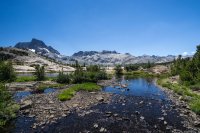
Camping is prohibited within a quarter mile of the lake's outlet but I stopped here for an hour's lunch break and to take in the awesome view. Thousand Island Lake is one of the places that makes people want to hike the JMT, it was awesome to finally be here!
The stunning scenery and beautiful lakes don't let up. Next up after Thousand Island is Emerald Lake:
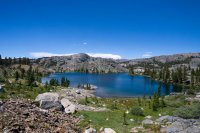
Followed by Ruby Lake, enclosed by steep cliffs:
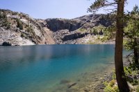
The trail then switchbacks down to Garnet Lake, another iconic body of water beneath Mt Ritter and Banner Peak. I had initially wanted to camp here for the night but it was incredibly windy so I decided to push on for a couple more miles.
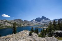
There's a steep climb up from Garnet before you descend down towards the Volcanic Ridge. The rock forms underfoot started to become noticeably different in this area - clearly volcanic.
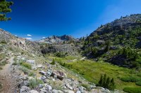
I made camp beside Shadow Creek which was incredibly picturesque, although this was the only place on the trail that I had to deal with some pretty annoying mosquitos. The sunset more than made up for it...
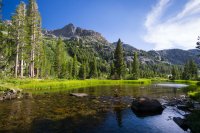
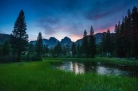
Saturday 7/18. Shadow Creek to Red's Meadow, 12 miles.
My last day on the trail. I ate breakfast whilst watching the sun light up Banner and Ritter over Shadow Creek before hitting the trail towards Shadow Lake.
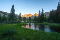
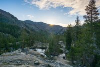
Shadow Creek is a large, pristine lake where camping is prohibited to aid restoration efforts. From here there's a set of fairly steep switchbacks that climb a reasonable amount of elevation, taking you up to Rosalie Lake.
Shadow Lake:
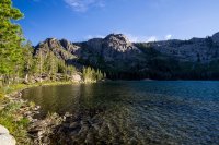
Rosalie Lake:
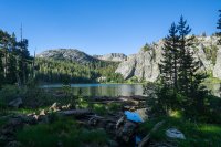
Beyond Roaslie, the trail passes by a number of marshy lakes such as Gladys Lake and Trinity Lake. It also weaves it's way through a large number of blown down trees, a result of the 2011 "Devil's Windstorm".
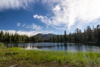
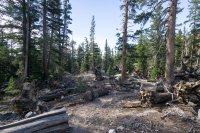
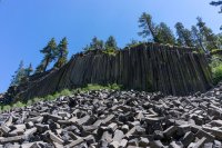
Finally, the trail enters Devil's Postpile National Monument.
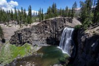
I made a short detour to the nearby Rainbow Falls and after 5 days and 65 miles hiked out to Red's Meadow where I grabbed a cheeseburger from their cafe before taking the shuttle back into Mammoth Lakes.
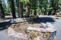
This was an incredible hike and it really only wetted my appetite to complete the entire trail. I'm hoping to get back in July and pick up where I left off by finishing the remaining 150 miles from Red's to Mt Whitney!
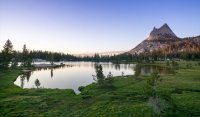
Featured image for home page:
Inspired by @ZubenElGenubi's Thousand Island Lake trip report, I thought i'd contribute my first real trip report to BCP.
I've wanted to hike the JMT for a few years now but getting the time off from work, as well as coming from the UK and all the extra logistics around resupplies that entails, made things tricky. I figured I would try to complete the first third or so of the trail this year and finish the remainder next summer.
Permits to start from Yosemite are very competitive and hard to get. After 5 consecutive days of faxing and subsequent denials, in mid-January I finally secured a permit to start from Glacier Point. This isn't the "official" start of the JMT but it would mean i'd only miss the first 3.5 miles, which I could complete as a day-hike the day before starting.
Monday 7/13. Happy Isles to Nevada Fall and back, 7 mile round trip.
I'd actually hiked this section of trail 3 years previous, when I day hiked Half Dome. However, the falls were running more on this occasion so I figured I'd hike it again.
Unfortunately this section of trail gets very crowded with tourists during the day, so I set off early to avoid the crowds. I was on the trail by 6.30am - at this time of the morning the sun isn't high enough in the sky to reach the bottom of the valley so it was kinda cool.
The trail first passes Vernal Fall and then climbs to the top of Nevada Fall for approximately 2000ft of elevation gain in 3.5 miles. About a mile into the hike you reach a fork and actually have a choice of two routes to the top - the Mist Trail or the John Muir Trail. I chose to ascend the Mist Trail and descend on the slightly longer John Muir Trail as it's easier on the knees.
The official start of the John Muir Trail:

Ascending the slick steps of the Mist Trail beside Vernal Fall:

Above Vernal Fall, the trail passes through a wooded area before climbing a set of steep stairs cut into the rock:


I made it to the top of Nevada Fall by 8.30am and ate a breakfast of fruit and Clif bars.


Officially I needed to vacate my campsite in the valley by 11am so I had to hustle to get back down and get packed up. I began the long series of switchbacks down the JMT.
From L>R - Half Dome, Liberty Cap and Nevada Fall seen from the JMT:

I made it back to camp just after 10.30am, moved my stuff across to the Backpackers Campground and did a bit of the tourist thing for the rest of the day. Man, the valley is beautiful but it's a real zoo

Tuesday 7/14. Glacier Point to Illilouette Creek, 4.5 miles.
My permit stated that I had to start my hike from Glacier Point and camp the first night in Illilouette Basin. To get from the valley floor up to Glacier Point you can either hike the "Four Mile Trail" which ascends 4,500ft of steep switchbacks in 4 miles, or ride a tourist bus up there. I didn't fancy a 4,500ft climb with a full pack so wimped out and took the bus!

The view from the top is awesome. Half Dome dominates the landscape - dwarfing Vernal and Nevada Falls, where I was yesterday. Unfortunately it's also a zoo up here. I grabbed a Gatorade and ice cream from the small store and then hit the trail. For your first night you must camp in the location stated on your permit, after that you are free to camp wherever you can hike to. Knowing this, I only had a short day of about 4.5 miles to my first night's camp in Illilouette Basin, and it was all downhill.
The trail switchbacks from GP down into the trees. For the first mile and a half I passed maybe half a dozen hikers who were most likely day-hiking to or from the valley floor via the Panorama Trail and Illilouette Falls, a distance of about 8 miles. However, after passing by the turn off for this trail, I didn't see anyone else until late in the evening.
As I was descending through the trees I heard an enormous crack, a fluster of birds and saw a huge tree of over 100ft crash to the ground down in the valley to my left, maybe just 300ft off the trail. This image remained in my head throughout the hike as I walked and camped under many identical trees!
After about 3 miles, the trail descends to the beautiful Illilouette Creek, where hikers must ford the creek to continue. Although the water was deeper than it looked, given the California drought, it wasn't a particularly dangerous crossing although it would surely be different after a heavy snow year.


I pitched my tent right beside the creek and did nothing for the rest of the evening other than relax with a fire and read a little before crawling into my tent.
About half an hour after getting into my bag, and just as I was dozing off I heard what I was sure were slow, heavy, padding footsteps which then paused outside my tent followed by a "huffing" and heavy breathing before the footsteps again disappeared off into the night. Was it my imagination? I don't think so. I wasn't fully asleep and was quite certain of what I heard. I *think* it was a black bear but can't be sure. It certainly sounded too large and heavy to be a deer and I can't think of anything else it could have been. Anyway, I slept soundly after that and this was the only "bear encounter" or case of things going bump in the night throughout the whole trip.
Wednesday 7/15. Illilouette Creek to Upper Cathedral Lake, 19 miles.
I was up early, packed and heading up out of Illilouette Basin just as the sun was beginning to peak over Mt Starr King to the East. I wanted to make it to Cathedral Lakes for tonight as I'd heard that sunsets there are spectacular. It would be a long day of about 19 miles and almost 4,000ft elevation gain.


I had to head 4 miles from my campsite to rejoin the JMT at Nevada Fall, where i'd been yesterday. From here the trail heads North East for a steep climb up and out of the valley.

Beyond Half Dome, the trail passes through a 3 mile section of area burned by September 2014's "Meadow Fire". It was kinda ugly but life seems to return fast - there were lots of wildflowers and a number of deer grazing here.


The trail soon climbs steeply up Sunrise Mountain, then passes through Long Meadow and past Sunrise High Sierra Camp, where those with lots of money can come for a stay to experience the High Sierra with canvas tents, luxurious beds and meals cooked for them by chefs. I think I preferred my way of doing it
I would crest 3 official passes on this hike - Cathedral Pass being the first, although it's not as serious a climb as most of the others on the JMT. The trail climbs up over the shoulder of Columbia Finger (the pointed peak on the horizon in the photo below), over Cathedral Pass and finally down through the woods to Cathedral Lakes.


I set up my tent and cooked dinner on the shore, chatting with a guy from North Carolina as we watched the sun set over Cathedral Peak and the sky turned an awesome purple colour.


Thursday 7/16. Upper Cathedral Lake to Donohue Base Camp, 17 miles.
Another long day ahead, I awoke at dawn and began the 4.5 mile hike down to where the Tioga Pass Road cuts through Tuolumne Meadows. There's a small store and grill here, I was looking forward to grabbing a burger

I took the 1.5 mile "loop" out and across Tuolumne Meadows, it was really beautiful:


From Tuolumne Meadows, the trail cuts across the Tuolumne River and heads south for a flat 9 mile section along Lyell Canyon.


About 3pm, I got the first and only rain of the trip - a typical Sierra mid-afternoon thunderstorm. The clouds moved in, rumbled overhead before the rain started. After 30 minutes it was gone as quickly as it arrived.


After a good 4 hours hiking through Lyell Canyon, the trail begins the steep climb up towards Donohue Pass. It first crosses the Lyell Fork of the Tuolumne River before reaching a beautiful spot beside a small lake at the foot of the pass that acts as a good spot to camp for the night and has colloquially become known as Donohue Base Camp.


Friday 7/17. Donohue Base Camp to Shadow Creek, 15 miles.
I left camp about 7am to get an early start up and over Donohue Pass - the first high elevation pass on this trail at 11,100ft. From Donohue Base Camp it was a climb of about 1700ft but I actually found it easier than expected. It took me about an hour to reach the top and i'm fairly sure I was the first person over the pass that day, it was a beautiful climb.

The top of the pass is dotted with small tarns and a beautifully clean, crystal clear lake.


From Donohue Pass, the trail heads south towards the Rush Creek area and Island Pass where you hike past numerous cascading streams and small lakes.


A climb of about 700ft takes you up and over Island Pass before you drop down and the view opens up and you see the iconic view of Thousand Island Lake dwarfed by Mt Ritter and Banner Peak.


Camping is prohibited within a quarter mile of the lake's outlet but I stopped here for an hour's lunch break and to take in the awesome view. Thousand Island Lake is one of the places that makes people want to hike the JMT, it was awesome to finally be here!
The stunning scenery and beautiful lakes don't let up. Next up after Thousand Island is Emerald Lake:

Followed by Ruby Lake, enclosed by steep cliffs:

The trail then switchbacks down to Garnet Lake, another iconic body of water beneath Mt Ritter and Banner Peak. I had initially wanted to camp here for the night but it was incredibly windy so I decided to push on for a couple more miles.

There's a steep climb up from Garnet before you descend down towards the Volcanic Ridge. The rock forms underfoot started to become noticeably different in this area - clearly volcanic.

I made camp beside Shadow Creek which was incredibly picturesque, although this was the only place on the trail that I had to deal with some pretty annoying mosquitos. The sunset more than made up for it...


Saturday 7/18. Shadow Creek to Red's Meadow, 12 miles.
My last day on the trail. I ate breakfast whilst watching the sun light up Banner and Ritter over Shadow Creek before hitting the trail towards Shadow Lake.


Shadow Creek is a large, pristine lake where camping is prohibited to aid restoration efforts. From here there's a set of fairly steep switchbacks that climb a reasonable amount of elevation, taking you up to Rosalie Lake.
Shadow Lake:

Rosalie Lake:

Beyond Roaslie, the trail passes by a number of marshy lakes such as Gladys Lake and Trinity Lake. It also weaves it's way through a large number of blown down trees, a result of the 2011 "Devil's Windstorm".


Finally, the trail enters Devil's Postpile National Monument.

I made a short detour to the nearby Rainbow Falls and after 5 days and 65 miles hiked out to Red's Meadow where I grabbed a cheeseburger from their cafe before taking the shuttle back into Mammoth Lakes.


This was an incredible hike and it really only wetted my appetite to complete the entire trail. I'm hoping to get back in July and pick up where I left off by finishing the remaining 150 miles from Red's to Mt Whitney!
Featured image for home page:

Last edited:
