July 16th - 28th 2016. Devil's Postpile National Monument to Horseshoe Meadow. Total distance hiked: 202 miles.
I love the Colorado Plateau as much as everyone else here, but every now and then I gotta get my fix of the Sierra Nevada. You may or may not remember that last year I completed the first 65 miles of the John Muir Trail from Yosemite to Devil's Postpile. As soon as I finished that section I was determined to get back and finish the rest of the trail.
The weather in the Sierra this July was exceptionally hot, with a real lack of storms and precipitation. I barely even saw a cloud during my time on trail and experienced only 20 mins of rain, thunder & hail on the second to last day. From a photographic perspective this meant the majority of my photos were taken under harsh, direct sunlight. There was also a lack of "epic" sunsets simply due to the fact that there were no clouds in the sky. Finally, I'd hoped to get some great night sky shots but the majority of my hike was under a full moon, which made things almost impossible
Anyway..
Day 1, Saturday 7/16. Devil's Postpile to Duck Creek, 16 miles
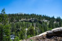
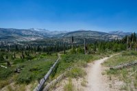
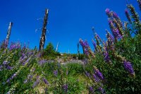
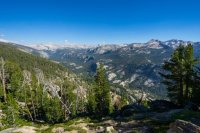
Entering at Devil's Postpile NM, I began exactly where I ended last year. Day 1 is relatively unspectacular, it begins by passing through the NM and then climbing through the hot, dusty and charred remains of 1992's "Rainbow Fire". I hike through Crater Meadow and pass the twin red volcanic cinder cones before eventually breaking out onto a ridge that follows the Cascade Valley. By the time I make camp at Duck Lake I've already climbed almost 3,000ft - although the gain has been quite gradual, making it fairly unnoticeable.

Day 2, Sunday 7/17. Duck Creek to Mono Creek, 18 miles
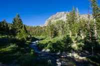
The scenery starts to get good today, finally passing by a number of beautiful lakes and granite peaks that the Sierra is famous for. Leaving camp around 7.30am (this would become my typical start time each day), I have about 2 miles to hike to Purple Lake. It's beautiful here but the skeeters are bad so I don't hang around for long.
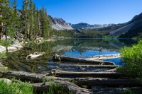
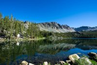
I skirt the shore of Purple Lake, hike up and over a ridge before descending to Lake Virginia - a large lake nestled in a grassy meadow area. I stop for 20 mins for a quick snack and drink (water is plentiful for most of the hike, I rarely carried water and never more than 1 litre - this would almost catch me out towards the end of my hike though!).
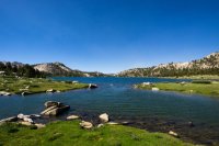
After Lake Virginia I get my first view of the spectacular Silver Divide which I'll cross later in the day as I crest Silver Pass. First, the trail descends almost 1,000ft into Tully Hole where it follows Fish Creek for a while.
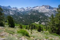
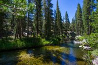
From Fish Creek footbridge it's then a good 1,000ft climb up again to Squaw Lake.
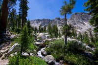
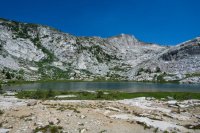
And from Squaw Lake, another 800ft up to Silver Pass, passing the beautiful Chief Lake en route.
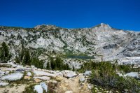
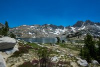
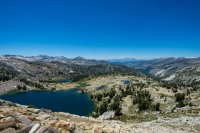
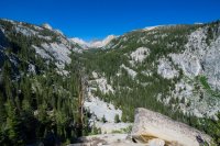
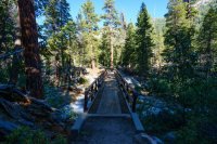
The descent from Silver Pass is fairly gradual but long and seems to take forever to reach Mono Creek. Eventually I reach the footbridge that crosses he creek and make camp. Tomorrow I'll hike 1.5 miles to Lake Edison where I'll catch the water taxi to Vermilion Valley Resort to pick up a small resupply. I've decided that rather than rushing in & out of VVR, I'll take a zero day there and spend the night. Why not? I'm in no rush...

Day 3, Monday 7/18. Mono Creek to Vermilion Valley Resort, 1.5 miles hiked/6 miles on a boat
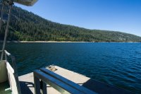
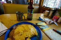
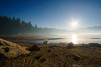
There's half a dozen of us waiting on the arrival of a boat to take us across the water to VVR. If we weren't lazy we could hike 6 miles around the lake to the resort but everyone loves a shortcut right?! The boat has struggled to operate in recent years due to the drought reducing the lake level to a mere puddle but following the best snowpack in 6 years, the lake is almost full again. A 20 minute ride sees us arrive just in time before they stop serving breakfast for the day. An ice cream sandwich, plate of pancakes and a cold beer is a welcome way to start the day!
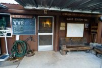
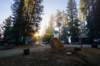
Vermilion Valley Resort is a small settlement of cabins located 3 hours up a twisting single track road from Fresno. They cater to fishermen and people who want to spend a few days up there camping or in a simple cabin. They have a small dining room that serves breakfast & dinner, as well as a small store. Again, the day is hot. I spend it in the shade doing not a whole lot other than talking with other hikers (day hikers/JMTers/PCTers) and drinking plenty of beer. I buy a day and a half's worth of simple food and snacks - enough to get me to Muir Trail Ranch. I eat burger and fries for dinner. Smoke from a nearby wildfire lingers in the air for a few hours...
A note on resupplies: wanting to travel as light as possible, I left Mammoth Lakes with 2.5 days of food - enough to get me to VVR. At VVR I purchased 1.5 days worth of food - enough to get me to Muir Trail Ranch. At MTR I picked up a mailed resupply bucket of 9 days of food - enough (just) to get me out to Horseshoe Meadow.
Night falls, we light the campfire. One girl with a horrendously heavy pack makes smores for us all. We talk and laugh late into the night before retiring to tents...
Day 4, Tuesday 7/19. Vermilion Valley Resort to Marie Lake, 17 miles
I start the day with a big plate of eggs, bacon, hash browns & toast - I could get used to this. After breakfast, I settle up my tab, it comes to $98 for just under 24 hours. I've paid $12 for the ferry, drunk a lot of beer and eaten/purchased a lot of food so I consider this about fair value, especially considering the mark up that inevitably comes with the remote location & the fact that they have to truck everything up from Fresno.
Myself and 2 other hikers want to return to the JMT by way of the Bear Creek Trail. This is a more scenic route back to the trail and avoids a brutal climb up over Bear Ridge. An old boy working at VVR crams us into the back of a beaten up old van and shuttles us out 3 miles to the trailhead. We all get the "VVR Massage" as we're thrown around in the back of the van on the washboarded dirt road...
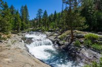
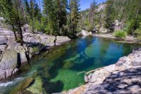
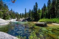
It'll take me all morning to hike the 9 miles back to the JMT but the walk is beautiful, hugging Bear Creek for most of the way, passing by a number of waterfalls and inviting crystal clear swimming holes.
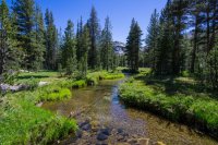
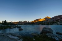
Once back on the JMT, the skeeters are bad again. They seem not to bother me as long as I'm moving, so I get my head down for the afternoon and hustle to Marie Lake, arriving late afternoon. After setting up camp I go to collect water and say hi to a lady taking a swim in the lake. Turns out she's also English and she happens to live only 20 mins from me. Small world!
Day 5, Wednesday 7/20. Marie Lake to McClure Meadow, 19 miles
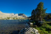
I start the day with the climb up over Selden Pass. Given that Marie Lake is at 10,500ft elevation, Selden turns out to be the easiest pass on the trail with only a 500ft climb to reach the top. The view back towards the lake is awesome.
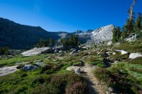
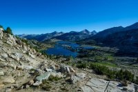
From Selden Pass, it's about 3 hours and a 3,000ft descent to Muir Trail Ranch. For those tackling the trail Northbound that's gotta be a pretty tough slog up to Selden. I pass by the beautiful Sallie Keyes Lakes on the way down.
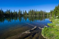
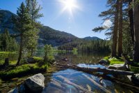
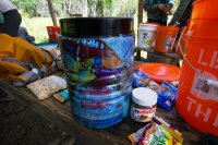
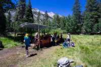
Muir Trail Ranch is where I'll pick up my biggest and final resupply. I'm looking forward to stocking up on food but not looking forward to the pack weight increase! MTR also has a number of hiker buckets where people leave excess food and supplies they don't want to carry. I think I left my sunglasses at VVR so I help myself to a funky dollar-store pair from the buckets, along with some M&Ms and Nutella! I weigh my pack before leaving the ranch. My base weight excluding consumables was 16.5lbs - with 9 days of food and 1 litre of water my pack weight maxes out at 35lbs. It'll get a little lighter each day and I think it's not too bad considering I've met some poor suckers hauling 50, 60 and even 70lb packs!
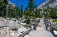
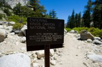
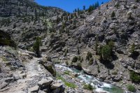
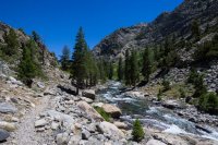
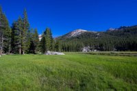
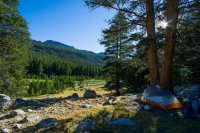
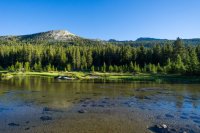
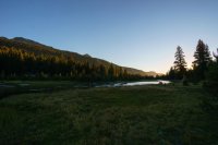
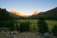
An hour or two after leaving MTR, I cross the boundary into Kings Canyon NP which is where the scenery really starts to get good. I follow the South Fork of the San Joaquin River through a winding, rocky gorge before climbing up into the stunning Evolution Valley for the night.
Day 6, Thursday 7/21. McClure Meadow to LeConte Canyon, 19 miles
From today the trail really starts to hit the high elevations and consistently reaches 12,000ft plus every day until Mt Whitney. The day starts with a solid climb up into the stunning and stark Evolution Basin, an area which holds probably the most amounts of snow I'll encounter on the trail. I pass by Evolution Lake, Sapphire Lake and the huge Wanda Lake.
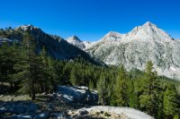
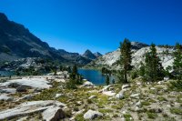
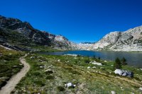
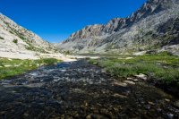
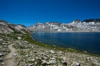
From Wanda Lake I climb up to Muir Pass. Although it's only about a 500ft climb and not particularly steep, to me it feels like quite a long and tough slog. Maybe because it's the first 12,000ft pass I've hit so far? On top there's a small stone hut built by the Sierra Club to provide emergency shelter, it makes a good spot to stop for lunch.
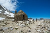
The basin on the south side of the pass is maybe one of my favourite areas of the trail. It's rocky, barren, there's still quite a bit of snow, creeks and waterfalls are everywhere, cascading out of snowfields and across my path. I lose the trail a few times, Helen Lake is brilliantly blue and crystal clear.
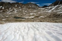
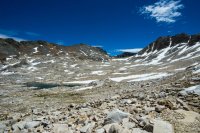
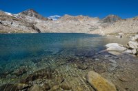
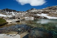
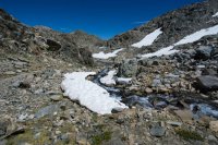
From the top of Muir Pass it's more than 3,000ft down to LeConte Canyon, another tough climb if heading Northbound.

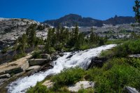
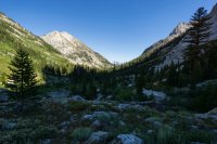
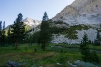
Day 7, Friday 7/22. LeConte Canyon to Upper Palisade Lake, 14 miles
I start the day with a visitor. An enquisitive black bear mooches into camp to see if I'll offer him anything for breakfast. I don't even have to make any kind of noise to scare him off, he gets a little too close and scatters as soon as I stand up. Black bears are big scaredy-cats.
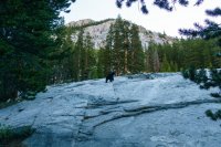
I hike through the Southern end of LeConte Canyon and through the beautiful Grouse Meadow. It's cool, calm and quiet - this would make a beautiful camp spot but the mosquitos here would surely be hell at this time of year. I haven't seen anyone else since the top of Muir Pass at lunchtime yesterday and I won't see anyone until later this afternoon. Whilst the JMT isn't complete solitude, it's also not the freeway that some think it is.
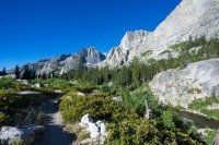
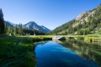
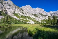
I join Palisade Creek for a hot 4 mile slog through an area full of burned and downed trees. The midday sun beats down relentlessly with nowhere to take cover. At the end of this valley is the Golden Staircase, a notorious and steep section of trail that gains about 2,000ft in a little over 2 miles.
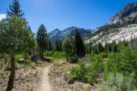
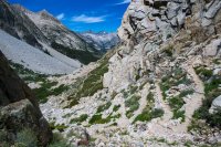
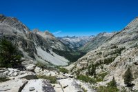
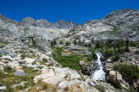
Actually, I don't find the Golden Staircase to be too tough. A steady pace sees me reach the top before I was expecting to and I reach Palisade Lakes. It's only mid-afternoon, I could keep going but it's real hot so I decide to make camp. In front of me is Mather Pass, which I would rather hit first thing tomorrow morning whilst it's cool.
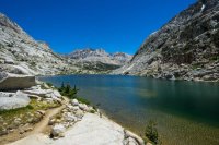
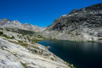
Day 8, Saturday 7/23. Upper Palisade Lake to Lake Marjorie, 15 miles
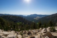
My schedule has now aligned itself nicely so that I'll do one pass a day, each one first thing in the morning. From camp at Upper Palisade Lake it's about a 1,600ft climb up to Mather Pass. In my head I have the idea that this is a tough one, but I don't find it too bad. Although the trail is rocky, which can be painful on the feet, the switchbacks are nicely graded and not too steep. It's also almost all in the shade and it's nice to be out of the heat. The views from the top are great, looking north I can see where I've come from at Palisade Lakes and the view south looks out across Upper Basin.
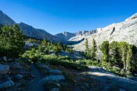
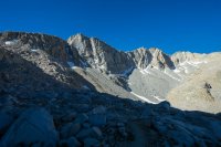
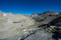
The climb down is initially steep and quite exposed but soon levels out, passing by a number of pristine lakes and along a creek. I hop rocks across the South Fork of the Kings River before another 1,000ft climb up to Bench Lake and then on to Lake Marjorie.
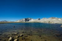
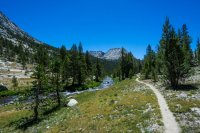
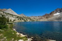
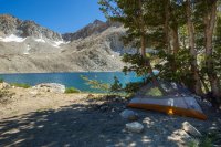
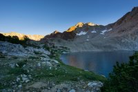
Lake Marjorie is perhaps the bluest lake I've seen yet, it's incredible - almost impossibly blue and clear. I can see dozens of fish (trout?) swimming just below the surface, if you had a rod you could fill your boots here I'm sure. Fresh fish was pretty appealing, I guess I gotta learn how to use a fly rod! I make camp by 3.30pm, do some laundry with lake water in my bear canister and lay clothes out to dry whilst relaxing by the lake.
Day 9, Sunday 7/24. Lake Marjorie to Rae Lakes, 16 miles
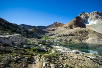
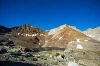
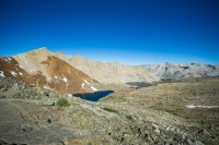
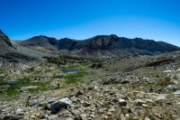
Each day is developing into a familiar pattern now. Start with a climb up over a pass, down through a lake-filled basin to a creek or river, then up again to the next night's camp. I find the climb up over Pinchot Pass to be quite tough, more so than Mather. It's about a 900ft climb that tops out at 12,100ft but it feels long and winding, the pass seems to take an age to arrive. Mt Ickes and Mt Wynne on either side of the pass are interesting for the unsual red/brown colours in their rocks, something I've not seen so far on the trail.
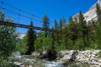
After descending Pinchot Pass the trail eventually meets and follows Woods Creek for about 3 miles. This section of trail frustrated me a bit - it's very indirect, winding up and down, in and out, away from the creek... And all under the blazing hot middday sun. Eventually I meet, and cross, the Woods Creek Suspension Bridge aka The Golden Gate of the Sierras. It's cool to see such an awesome structure so far out in the backcountry. I eat lunch here with an awesome old guy who kindly offers to give me his fishing rod, saying I can either keep it or mail it back to him once off trail! Whilst I would have loved some fresh fish I do decline the offer simply because I wouldn't know what to do with it and I don't really have a pot or pan suitable for grilling fish
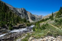
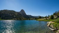
After Woods Creek I start the climb up towards Dollar Lake, Arrowhead Lake and Rae Lakes. This is an area I've been looking forward to, it looks stunning in photos I've seen. Dollar Lake makes an inviting spot to filter some water before the trail winds it's way along the creek, past several waterfalls and beneath the unique-looking Fin Dome.
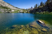
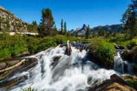
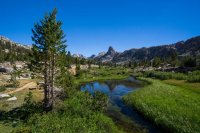
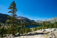
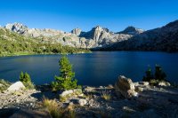
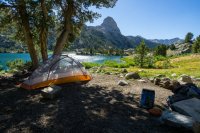
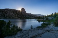
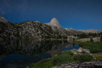
Camp for the night is at Rae Lakes, in the shadow of The Painted Lady and Glen Pass. I wake in the middle of the night and decide to try a couple of night shots but have no real luck, the full moon is still pretty bright.
Day 10, Monday 7/25. Rae Lakes to below Forester Pass, 14 miles
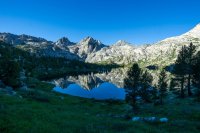
I wind my way around the shore of Rae Lakes, heading for Glen Pass. Many people say this is the hardest pass on the trail and it has a cruel false summit that smacks unsuspecting hikers in the face just when they think they're reaching the top. I'm aware of this so am prepared for it but I share the view that it was the toughest pass I tackled. It was a 1,500ft climb was that was relentlessly steep and it just seemed to keep going up and up. The pass itself is a narrow ridge with steep drop offs on either side. I met a packer with mules on the other side who said he dreads crossing Glen Pass with stock - one wrong step, or if one of them gets nervous, and everyone can go tumbling over the side...
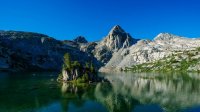
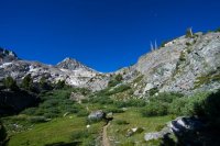
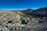
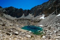
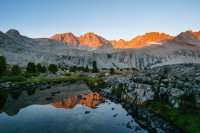
Coming down from Glen Pass, I passed this unbelievably blue & clear lake. With no inlet or outlet it must be purely snow melt that gives it that colour.
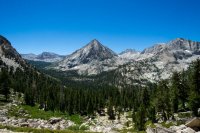
Approaching Bubbs Creek, the imposing East Vidette peak dominates the skyline with it's almost perfectly triangular profile. From there it's a long climb up towards Center Basin and Forester Pass - the highest pass on the trail.
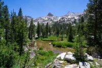
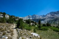
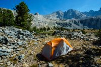
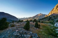

Day 11, Tuesday 7/26. Below Forester Pass to Guitar Lake, 19 miles
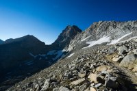
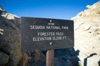
At 13,200ft Forester Pass is pretty imposing so I'm on the trail shortly after 6am for the long climb up. Again, I don't find it as tough as I had expected. I feel pretty good and well conditioned by now, climbing several thousand feet at a time doesn't feel as challenging as it did earlier in the hike. A large snowfield obscures the trail about half way up and I find myself climbing briefly up the wrong ridge as a result. A quick scoot down on my butt across a talus slope puts me back on the right trail and I'm on top of the pass by 8.15am.
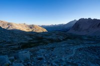
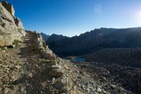
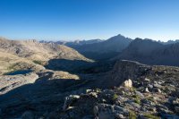
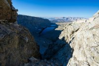
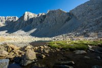
Coming down from Forester I'm followed closely by a Coyote for a good 2 hours and a distance of 4 miles. He seems more inquisitve than threatening, I turn around at times to find him only 5 or 6ft behind me on the trail. I eventually meet a ranger who gives me an email address and urges me to report the incident to the Sequoia NP "Wildlife Technician" as such behaviour is apparently abnormal and could indicate sickness. He didn't look particularly sick to me but I'm no expert.
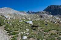
I had originally planned to camp at Tyndall Creek tonight but it's only 11.30am when I reach there so I decide to push on for Guitar Lake at the foot of Mt Whitney. I come up across the open expanse of Bighorn Plateau where another bear crosses the trail in front of me. As soon as he notices me he's off like a shot in the opposite direction.
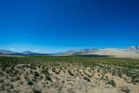
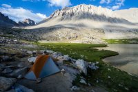
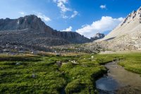
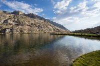
Eventually I reach Crabtree Meadow, between here and Whitney Portal on the East side of Mt Whitney, all human waste must be carried out so I'm required to pick up a wag bag from the ranger station. Thankfully I don't need to use it during the 18 hours I'm in the area. The most significant cloud cover I've seen so far moves in during the afternoon and for a while I think I'm gonna get wet. I set up camp on the shore of Guitar Lake, in the shadow of Mt Whitney and by about 6pm the clouds clear and turns into a beautiful evening.
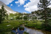
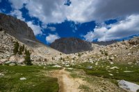
Day 12, Wednesday 7/27. Guitar Lake to Chicken Spring Lake via Mt Whitney Summit, 29 miles
I want to catch sunrise from the top of Mt Whitney so my alarm goes off at 2.30am, urgh. I'm on the trail by 3. My headlamp decided to die on me just 2 days into the hike, I switched out the batteries for new ones at MTR but still nothing - there appears to be corrosion on the battery terminals which I suspect has something to do with it. So here I am, about to summit the highest peak in the lower 48 at 3am without a headlamp. I make do with the flashlight app on my phone and thankfully avoid falling to my death.
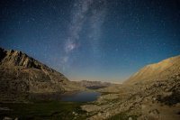
The night sky is amazing as I start hiking, the full moon is finally starting to wane. I fire off a few milky way shots, I'm not totally happy with the results but they're the best I managed to get. Again, I don't find the climb too troubling. The elevation has me huffing & puffing a bit but stopping to catch my breath regularly seems to work and I don't suffer any more serious effects of the altitude. The climb is long but well graded and not too steep. I slow up a little on the final 2 miles as there is no real trail, just boulder hopping. I make it to the summit just before 6am, literally as the sun is peeking over the Inyo Mountains, illuminating the East Face of Whitney and the Owens Valley almost 11,000ft below us.
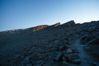
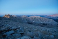
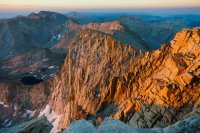
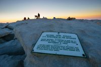
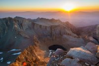
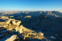
It's freezing cold but I hang out on the summit for about 45 mins before heading down. I'm back at my tent at Guitar Lake by 9.30am, I make some breakfast and coffee. My original plan had been to take another 2 nights between here & exiting at Horseshoe Meadow, however a few thoughts begin to run through my head: I'm running short on food, I'd really love a burger and a shower, it's only 10am.... If I really hustle I can probably get off trail tomorrow. Frantic packing up of camp ensues and I plan to make it as close to Cottonwood Pass as I can today. I'll be pushing 30 miles of hiking today, throw a summit of Mt Whitney in there and it makes for a pretty full on day.
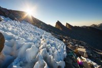
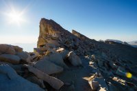
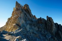
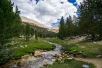
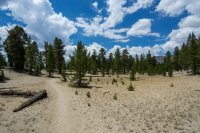
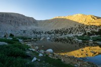
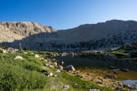
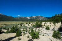
After the previous 12 days of epic mountains and lakes, the final 15 miles was a bit "meh". I didn't have a map for this final section (Yeah, I know. Backpacking 101!) so I wasn't too sure what to expect and was winging it a little bit. It turned out to be fairly flat, sandy, dry and hot. There were a couple of long stretches without water and places where the sandy trail was like walking on a beach. I was thankful to finally round the ridge and see the beautiful Chicken Spring Lake.


Day 13, Thursday 7/28. Chicken Spring Lake to Horseshoe Meadow, 4 miles
From Chicken Spring Lake it was an easy 4 miles over Cottonwood Pass and down to the trailhead at Horseshoe Meadow. I hitched a ride down to Lone Pine with a couple of geologists and ate my own body weight in burgers
I love the Colorado Plateau as much as everyone else here, but every now and then I gotta get my fix of the Sierra Nevada. You may or may not remember that last year I completed the first 65 miles of the John Muir Trail from Yosemite to Devil's Postpile. As soon as I finished that section I was determined to get back and finish the rest of the trail.
The weather in the Sierra this July was exceptionally hot, with a real lack of storms and precipitation. I barely even saw a cloud during my time on trail and experienced only 20 mins of rain, thunder & hail on the second to last day. From a photographic perspective this meant the majority of my photos were taken under harsh, direct sunlight. There was also a lack of "epic" sunsets simply due to the fact that there were no clouds in the sky. Finally, I'd hoped to get some great night sky shots but the majority of my hike was under a full moon, which made things almost impossible
Anyway..
Day 1, Saturday 7/16. Devil's Postpile to Duck Creek, 16 miles
Entering at Devil's Postpile NM, I began exactly where I ended last year. Day 1 is relatively unspectacular, it begins by passing through the NM and then climbing through the hot, dusty and charred remains of 1992's "Rainbow Fire". I hike through Crater Meadow and pass the twin red volcanic cinder cones before eventually breaking out onto a ridge that follows the Cascade Valley. By the time I make camp at Duck Lake I've already climbed almost 3,000ft - although the gain has been quite gradual, making it fairly unnoticeable.


Day 2, Sunday 7/17. Duck Creek to Mono Creek, 18 miles
The scenery starts to get good today, finally passing by a number of beautiful lakes and granite peaks that the Sierra is famous for. Leaving camp around 7.30am (this would become my typical start time each day), I have about 2 miles to hike to Purple Lake. It's beautiful here but the skeeters are bad so I don't hang around for long.


I skirt the shore of Purple Lake, hike up and over a ridge before descending to Lake Virginia - a large lake nestled in a grassy meadow area. I stop for 20 mins for a quick snack and drink (water is plentiful for most of the hike, I rarely carried water and never more than 1 litre - this would almost catch me out towards the end of my hike though!).

After Lake Virginia I get my first view of the spectacular Silver Divide which I'll cross later in the day as I crest Silver Pass. First, the trail descends almost 1,000ft into Tully Hole where it follows Fish Creek for a while.


From Fish Creek footbridge it's then a good 1,000ft climb up again to Squaw Lake.


And from Squaw Lake, another 800ft up to Silver Pass, passing the beautiful Chief Lake en route.


The descent from Silver Pass is fairly gradual but long and seems to take forever to reach Mono Creek. Eventually I reach the footbridge that crosses he creek and make camp. Tomorrow I'll hike 1.5 miles to Lake Edison where I'll catch the water taxi to Vermilion Valley Resort to pick up a small resupply. I've decided that rather than rushing in & out of VVR, I'll take a zero day there and spend the night. Why not? I'm in no rush...


Day 3, Monday 7/18. Mono Creek to Vermilion Valley Resort, 1.5 miles hiked/6 miles on a boat
There's half a dozen of us waiting on the arrival of a boat to take us across the water to VVR. If we weren't lazy we could hike 6 miles around the lake to the resort but everyone loves a shortcut right?! The boat has struggled to operate in recent years due to the drought reducing the lake level to a mere puddle but following the best snowpack in 6 years, the lake is almost full again. A 20 minute ride sees us arrive just in time before they stop serving breakfast for the day. An ice cream sandwich, plate of pancakes and a cold beer is a welcome way to start the day!


Vermilion Valley Resort is a small settlement of cabins located 3 hours up a twisting single track road from Fresno. They cater to fishermen and people who want to spend a few days up there camping or in a simple cabin. They have a small dining room that serves breakfast & dinner, as well as a small store. Again, the day is hot. I spend it in the shade doing not a whole lot other than talking with other hikers (day hikers/JMTers/PCTers) and drinking plenty of beer. I buy a day and a half's worth of simple food and snacks - enough to get me to Muir Trail Ranch. I eat burger and fries for dinner. Smoke from a nearby wildfire lingers in the air for a few hours...


A note on resupplies: wanting to travel as light as possible, I left Mammoth Lakes with 2.5 days of food - enough to get me to VVR. At VVR I purchased 1.5 days worth of food - enough to get me to Muir Trail Ranch. At MTR I picked up a mailed resupply bucket of 9 days of food - enough (just) to get me out to Horseshoe Meadow.
Night falls, we light the campfire. One girl with a horrendously heavy pack makes smores for us all. We talk and laugh late into the night before retiring to tents...
Day 4, Tuesday 7/19. Vermilion Valley Resort to Marie Lake, 17 miles
I start the day with a big plate of eggs, bacon, hash browns & toast - I could get used to this. After breakfast, I settle up my tab, it comes to $98 for just under 24 hours. I've paid $12 for the ferry, drunk a lot of beer and eaten/purchased a lot of food so I consider this about fair value, especially considering the mark up that inevitably comes with the remote location & the fact that they have to truck everything up from Fresno.
Myself and 2 other hikers want to return to the JMT by way of the Bear Creek Trail. This is a more scenic route back to the trail and avoids a brutal climb up over Bear Ridge. An old boy working at VVR crams us into the back of a beaten up old van and shuttles us out 3 miles to the trailhead. We all get the "VVR Massage" as we're thrown around in the back of the van on the washboarded dirt road...
It'll take me all morning to hike the 9 miles back to the JMT but the walk is beautiful, hugging Bear Creek for most of the way, passing by a number of waterfalls and inviting crystal clear swimming holes.


Once back on the JMT, the skeeters are bad again. They seem not to bother me as long as I'm moving, so I get my head down for the afternoon and hustle to Marie Lake, arriving late afternoon. After setting up camp I go to collect water and say hi to a lady taking a swim in the lake. Turns out she's also English and she happens to live only 20 mins from me. Small world!


Day 5, Wednesday 7/20. Marie Lake to McClure Meadow, 19 miles
I start the day with the climb up over Selden Pass. Given that Marie Lake is at 10,500ft elevation, Selden turns out to be the easiest pass on the trail with only a 500ft climb to reach the top. The view back towards the lake is awesome.


From Selden Pass, it's about 3 hours and a 3,000ft descent to Muir Trail Ranch. For those tackling the trail Northbound that's gotta be a pretty tough slog up to Selden. I pass by the beautiful Sallie Keyes Lakes on the way down.


Muir Trail Ranch is where I'll pick up my biggest and final resupply. I'm looking forward to stocking up on food but not looking forward to the pack weight increase! MTR also has a number of hiker buckets where people leave excess food and supplies they don't want to carry. I think I left my sunglasses at VVR so I help myself to a funky dollar-store pair from the buckets, along with some M&Ms and Nutella! I weigh my pack before leaving the ranch. My base weight excluding consumables was 16.5lbs - with 9 days of food and 1 litre of water my pack weight maxes out at 35lbs. It'll get a little lighter each day and I think it's not too bad considering I've met some poor suckers hauling 50, 60 and even 70lb packs!


An hour or two after leaving MTR, I cross the boundary into Kings Canyon NP which is where the scenery really starts to get good. I follow the South Fork of the San Joaquin River through a winding, rocky gorge before climbing up into the stunning Evolution Valley for the night.


Day 6, Thursday 7/21. McClure Meadow to LeConte Canyon, 19 miles
From today the trail really starts to hit the high elevations and consistently reaches 12,000ft plus every day until Mt Whitney. The day starts with a solid climb up into the stunning and stark Evolution Basin, an area which holds probably the most amounts of snow I'll encounter on the trail. I pass by Evolution Lake, Sapphire Lake and the huge Wanda Lake.


From Wanda Lake I climb up to Muir Pass. Although it's only about a 500ft climb and not particularly steep, to me it feels like quite a long and tough slog. Maybe because it's the first 12,000ft pass I've hit so far? On top there's a small stone hut built by the Sierra Club to provide emergency shelter, it makes a good spot to stop for lunch.

The basin on the south side of the pass is maybe one of my favourite areas of the trail. It's rocky, barren, there's still quite a bit of snow, creeks and waterfalls are everywhere, cascading out of snowfields and across my path. I lose the trail a few times, Helen Lake is brilliantly blue and crystal clear.


From the top of Muir Pass it's more than 3,000ft down to LeConte Canyon, another tough climb if heading Northbound.


Day 7, Friday 7/22. LeConte Canyon to Upper Palisade Lake, 14 miles
I start the day with a visitor. An enquisitive black bear mooches into camp to see if I'll offer him anything for breakfast. I don't even have to make any kind of noise to scare him off, he gets a little too close and scatters as soon as I stand up. Black bears are big scaredy-cats.

I hike through the Southern end of LeConte Canyon and through the beautiful Grouse Meadow. It's cool, calm and quiet - this would make a beautiful camp spot but the mosquitos here would surely be hell at this time of year. I haven't seen anyone else since the top of Muir Pass at lunchtime yesterday and I won't see anyone until later this afternoon. Whilst the JMT isn't complete solitude, it's also not the freeway that some think it is.


I join Palisade Creek for a hot 4 mile slog through an area full of burned and downed trees. The midday sun beats down relentlessly with nowhere to take cover. At the end of this valley is the Golden Staircase, a notorious and steep section of trail that gains about 2,000ft in a little over 2 miles.


Actually, I don't find the Golden Staircase to be too tough. A steady pace sees me reach the top before I was expecting to and I reach Palisade Lakes. It's only mid-afternoon, I could keep going but it's real hot so I decide to make camp. In front of me is Mather Pass, which I would rather hit first thing tomorrow morning whilst it's cool.


Day 8, Saturday 7/23. Upper Palisade Lake to Lake Marjorie, 15 miles
My schedule has now aligned itself nicely so that I'll do one pass a day, each one first thing in the morning. From camp at Upper Palisade Lake it's about a 1,600ft climb up to Mather Pass. In my head I have the idea that this is a tough one, but I don't find it too bad. Although the trail is rocky, which can be painful on the feet, the switchbacks are nicely graded and not too steep. It's also almost all in the shade and it's nice to be out of the heat. The views from the top are great, looking north I can see where I've come from at Palisade Lakes and the view south looks out across Upper Basin.


The climb down is initially steep and quite exposed but soon levels out, passing by a number of pristine lakes and along a creek. I hop rocks across the South Fork of the Kings River before another 1,000ft climb up to Bench Lake and then on to Lake Marjorie.


Lake Marjorie is perhaps the bluest lake I've seen yet, it's incredible - almost impossibly blue and clear. I can see dozens of fish (trout?) swimming just below the surface, if you had a rod you could fill your boots here I'm sure. Fresh fish was pretty appealing, I guess I gotta learn how to use a fly rod! I make camp by 3.30pm, do some laundry with lake water in my bear canister and lay clothes out to dry whilst relaxing by the lake.


Day 9, Sunday 7/24. Lake Marjorie to Rae Lakes, 16 miles
Each day is developing into a familiar pattern now. Start with a climb up over a pass, down through a lake-filled basin to a creek or river, then up again to the next night's camp. I find the climb up over Pinchot Pass to be quite tough, more so than Mather. It's about a 900ft climb that tops out at 12,100ft but it feels long and winding, the pass seems to take an age to arrive. Mt Ickes and Mt Wynne on either side of the pass are interesting for the unsual red/brown colours in their rocks, something I've not seen so far on the trail.


After descending Pinchot Pass the trail eventually meets and follows Woods Creek for about 3 miles. This section of trail frustrated me a bit - it's very indirect, winding up and down, in and out, away from the creek... And all under the blazing hot middday sun. Eventually I meet, and cross, the Woods Creek Suspension Bridge aka The Golden Gate of the Sierras. It's cool to see such an awesome structure so far out in the backcountry. I eat lunch here with an awesome old guy who kindly offers to give me his fishing rod, saying I can either keep it or mail it back to him once off trail! Whilst I would have loved some fresh fish I do decline the offer simply because I wouldn't know what to do with it and I don't really have a pot or pan suitable for grilling fish


After Woods Creek I start the climb up towards Dollar Lake, Arrowhead Lake and Rae Lakes. This is an area I've been looking forward to, it looks stunning in photos I've seen. Dollar Lake makes an inviting spot to filter some water before the trail winds it's way along the creek, past several waterfalls and beneath the unique-looking Fin Dome.


Camp for the night is at Rae Lakes, in the shadow of The Painted Lady and Glen Pass. I wake in the middle of the night and decide to try a couple of night shots but have no real luck, the full moon is still pretty bright.


Day 10, Monday 7/25. Rae Lakes to below Forester Pass, 14 miles
I wind my way around the shore of Rae Lakes, heading for Glen Pass. Many people say this is the hardest pass on the trail and it has a cruel false summit that smacks unsuspecting hikers in the face just when they think they're reaching the top. I'm aware of this so am prepared for it but I share the view that it was the toughest pass I tackled. It was a 1,500ft climb was that was relentlessly steep and it just seemed to keep going up and up. The pass itself is a narrow ridge with steep drop offs on either side. I met a packer with mules on the other side who said he dreads crossing Glen Pass with stock - one wrong step, or if one of them gets nervous, and everyone can go tumbling over the side...


Coming down from Glen Pass, I passed this unbelievably blue & clear lake. With no inlet or outlet it must be purely snow melt that gives it that colour.

Approaching Bubbs Creek, the imposing East Vidette peak dominates the skyline with it's almost perfectly triangular profile. From there it's a long climb up towards Center Basin and Forester Pass - the highest pass on the trail.


Day 11, Tuesday 7/26. Below Forester Pass to Guitar Lake, 19 miles
At 13,200ft Forester Pass is pretty imposing so I'm on the trail shortly after 6am for the long climb up. Again, I don't find it as tough as I had expected. I feel pretty good and well conditioned by now, climbing several thousand feet at a time doesn't feel as challenging as it did earlier in the hike. A large snowfield obscures the trail about half way up and I find myself climbing briefly up the wrong ridge as a result. A quick scoot down on my butt across a talus slope puts me back on the right trail and I'm on top of the pass by 8.15am.


Coming down from Forester I'm followed closely by a Coyote for a good 2 hours and a distance of 4 miles. He seems more inquisitve than threatening, I turn around at times to find him only 5 or 6ft behind me on the trail. I eventually meet a ranger who gives me an email address and urges me to report the incident to the Sequoia NP "Wildlife Technician" as such behaviour is apparently abnormal and could indicate sickness. He didn't look particularly sick to me but I'm no expert.

I had originally planned to camp at Tyndall Creek tonight but it's only 11.30am when I reach there so I decide to push on for Guitar Lake at the foot of Mt Whitney. I come up across the open expanse of Bighorn Plateau where another bear crosses the trail in front of me. As soon as he notices me he's off like a shot in the opposite direction.

Eventually I reach Crabtree Meadow, between here and Whitney Portal on the East side of Mt Whitney, all human waste must be carried out so I'm required to pick up a wag bag from the ranger station. Thankfully I don't need to use it during the 18 hours I'm in the area. The most significant cloud cover I've seen so far moves in during the afternoon and for a while I think I'm gonna get wet. I set up camp on the shore of Guitar Lake, in the shadow of Mt Whitney and by about 6pm the clouds clear and turns into a beautiful evening.


Day 12, Wednesday 7/27. Guitar Lake to Chicken Spring Lake via Mt Whitney Summit, 29 miles
I want to catch sunrise from the top of Mt Whitney so my alarm goes off at 2.30am, urgh. I'm on the trail by 3. My headlamp decided to die on me just 2 days into the hike, I switched out the batteries for new ones at MTR but still nothing - there appears to be corrosion on the battery terminals which I suspect has something to do with it. So here I am, about to summit the highest peak in the lower 48 at 3am without a headlamp. I make do with the flashlight app on my phone and thankfully avoid falling to my death.
The night sky is amazing as I start hiking, the full moon is finally starting to wane. I fire off a few milky way shots, I'm not totally happy with the results but they're the best I managed to get. Again, I don't find the climb too troubling. The elevation has me huffing & puffing a bit but stopping to catch my breath regularly seems to work and I don't suffer any more serious effects of the altitude. The climb is long but well graded and not too steep. I slow up a little on the final 2 miles as there is no real trail, just boulder hopping. I make it to the summit just before 6am, literally as the sun is peeking over the Inyo Mountains, illuminating the East Face of Whitney and the Owens Valley almost 11,000ft below us.


It's freezing cold but I hang out on the summit for about 45 mins before heading down. I'm back at my tent at Guitar Lake by 9.30am, I make some breakfast and coffee. My original plan had been to take another 2 nights between here & exiting at Horseshoe Meadow, however a few thoughts begin to run through my head: I'm running short on food, I'd really love a burger and a shower, it's only 10am.... If I really hustle I can probably get off trail tomorrow. Frantic packing up of camp ensues and I plan to make it as close to Cottonwood Pass as I can today. I'll be pushing 30 miles of hiking today, throw a summit of Mt Whitney in there and it makes for a pretty full on day.


After the previous 12 days of epic mountains and lakes, the final 15 miles was a bit "meh". I didn't have a map for this final section (Yeah, I know. Backpacking 101!) so I wasn't too sure what to expect and was winging it a little bit. It turned out to be fairly flat, sandy, dry and hot. There were a couple of long stretches without water and places where the sandy trail was like walking on a beach. I was thankful to finally round the ridge and see the beautiful Chicken Spring Lake.


Day 13, Thursday 7/28. Chicken Spring Lake to Horseshoe Meadow, 4 miles
From Chicken Spring Lake it was an easy 4 miles over Cottonwood Pass and down to the trailhead at Horseshoe Meadow. I hitched a ride down to Lone Pine with a couple of geologists and ate my own body weight in burgers


