priz1234
Member
- Joined
- Jun 10, 2020
- Messages
- 320
This trip report ended up being way longer than I had anticipated it being. I tried to keep the number of photos down as well but if you do want to see more photos and read less text I've set up a Smugmug account recently and I've got a photo centric report over there. Here is the link to that. Right now the JMT is the only thing on there but I plan on adding some more of my stuff there in the future.
John Muir Trail 2021
I haven't spent a whole lot of time backpacking but starting sometime in 2019 I started to get the urge to get out on some longer backpacking trips. I had spent most of my time just doing longer day hikes as I had gotten tired of carrying a heavy pack. But as I did more of these long day hikes I kept on discovering longer trips that I just couldn't quite get to on a day hike. So this urge to get out backpacking just kept on growing. In 2019 we ended up doing a 45 Mile loop in the Uintas in October. Even though it was freezing, it was exactly what I had been looking for. It was such a good trip but I still didn't do anymore backpacking until May of 2020 where me and my wife did a five day trip in Dark Canyon. During this trip we talked a lot about going backpacking more. Just before this trip I had also discovered the world of ultralight backpacking. At this time, I still had a 6 pound tent and a backpack that seemed like it weighed almost as much. But on this trip I convinced my wife that if we invested in lighter weight gear it would make these backpacking trips more enjoyable and we would get out more.
After we got done with this trip to Dark Canyon we actually did begin to invest in some lighter gear and we did a few more trips over the summer. One of these was a 60 Mile 3 and half day trip in the Uintas (Both of our longest trips to date). Over the next couple months we really started to think about even longer trips. This was really when the idea of the JMT came to mind. A little over 200 miles and I figured we could potentially get enough time off of work to get this done. I figured the most days we could get to do the hike would be 16 days. I knew this would be tough to do in 16 days but we decided to give it go. I was able to snag some permits going northbound starting at the Cottonwood Pass trailhead on August 28th.
We had plans to do some longer backpacking trips to train for the JMT but due to various things coming up we weren't able to get too many backpacking trips in. The longest being a 45 Mile 3 day trip in the San Juans. My dad had also planned on coming on the JMT with us and he had been doing a lot of training leading up to the trip. But a few weeks before the trip he got a kidney stone which needed surgery. This was disappointing since I had looked forward to doing such a big trip with him.
The other problem leading up to the trip was all of the wildfires in California. I was checking smoke maps and trying to find peoples reports of the trail every single day in the weeks leading up to the trip. I had seen some videos of the JMT in years before during a bad wildfire season and it seemed like it could get fairly bad. In the end we decided to go for it and if the fires were that bad we would just get off the trail. We live close enough that driving is somewhat reasonable to get to the area and my mom was nice enough to agree to drive us out to the trailhead the night before and also to pick us up at the end in Yosemite.
Even though we had gotten a lot of lightweight gear in preparation for the trip, My pack still weighed 45 pounds on day one including my food and water. We had planned on doing only one resupply on the entire trip. This would be on day 9 at Muir Trail Ranch so we started out with a lot of food weight. The additional weight of the bear can also added up but the biggest problem was my camera gear. I have two competing hobbies; covering as much ground as I possibly can in a day and Photography. These two hobbies do not work well together and the JMT is where I really learned this. I had around 12 pounds of gear that was my Camera setup or stuff that I brought for my camera. The thing I went overboard on was the batteries. I carried 6 camera batteries, two giant battery packs and a solar charger.
Day One: Cottonwood Pass Trailhead to Rock Creek (~14 Miles)
So we made the long drive out to the trailhead and spent the first night at the Cottonwood Pass Campground. I slept absolutely horribly that night. Maybe I was excited or nervous (maybe both). So after a terrible nights sleep I put on my incredibly heavy backpack at started out on the cold morning. This day was full of excitement. It was one of those moments where I couldn't really believe that we were actually doing this and that we were going to be spending the next 16 days out on the trail.
We had arrived in the dark the night before but I could smell a little smoke that night so I was worried about how the smoke situation would be. But after waking up we realized that the smoke was not bad at all. We did get a nice view of Horseshoe Meadows as we climbed up to cottonwood pass but we did see a little smoke hanging around the valley. Once we reached the pass we could see some smoke in the distance.

Once at the pass, we reached the PCT and followed this to Chicken Spring Lake where we filled up our water for the first time. On this first day we could feel the effects of the low snow year. The water at the lake was the only water on the 14 mile stretch from the trailhead to Rock Creek. The lake was even a little low and had no water flowing from the outlet.
The rest of the day was fairly uneventful as we made our way to Rock Creek. We did get some nice views to the west but we also noticed that the smoke got a little worse as the day went on. Something we would also notice on the next few days of the hike.
I was a little worried when I got to camp because I was more sore than I had hoped I would be. This 14 Mile day was supposed to be one of our easiest days of the trip. It was one of the shortest days and had the least amount of elevation gain. I just hoped I would feel better in the morning. It ended up being a pretty nice campsite at rock creek and we only shared the campsite with two other groups of two. We didn't see very much wildlife at all on our trip but we did get a couple deer that came pretty close to our tent on this first night while at camp.

Day 2: Rock Creek to Guitar Lake (~11 Miles)
Day two was supposed to be our shortest day of the trip and with how I was feeling the day before I was pretty happy about that. We did start day two with a climb right away out of rock creek. We made pretty quick time getting up to the next pass.
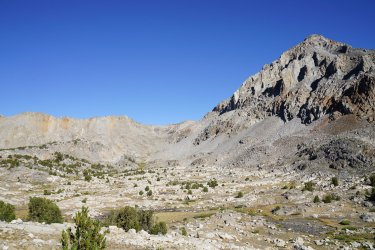
This photo was taken just after we came down from the pass.

The rest of day two was very nice. On the approach to Crabtree Meadows we had some very nice views. We also ran into a ranger who tried to convince us to stay at Crabtree for the night instead of going to Guitar Lake. I get why they don't want people camping up at Guitar lake because it really would be hard to bury anything up there. But we got to Crabtree used there very nice open air pit toilet and then made our way up to the lake. This was one of or busiest campsites of the trip but it was still amazing and we were far enough away from the other people that it wasn't too bad. I also think we were the only other northbounders who were camped here this night.


Day 3: Guitar Lake to Wallace Creek Including Summit of Whitney (~17 Miles)
The start of day 3 didn't go quite as planned. We slept right through our alarm and got a little bit later start going up Whitney then planned. I think we began hiking around 6AM. Not too long after starting the climb we got to this small tarn which had an incredible reflection.

There were a lot of switchbacks going up Whitney but they really weren't that steep. We hadn't had a whole lot of time to acclimate and I was feeling a little slow once we got up to the ridgeline. I also realized that once you hit the ridgeline you still aren't even close to the summit. Once we hit the ridgeline we also ran into all of the hikers coming up from Whitney portal and this part of the trail felt very crowded. We eventually reached the summit. Long before I had thought about the JMT I had wanted to get to Whitney so it felt very good to reach the summit.


Another couple views as we made our way back down from the summit.


After getting back to Guitar lake we packed up camp and decided we would head to Wallace creek for camp. We arrived at Wallace creek a little late and it was packed there. Our busiest campsite of the entire trip. Wasn't really expecting this but we luckily we did find a spot.
Day 4: Wallace Creek to Bubbs creek (~16 Miles)
Day 4, along with day 6 were probably my favorite days of our trip. As soon as we climbed out of Wallace creek we had views almost the entire day.
Just after getting out of Wallace Creek

A few miles after this view we made it up to Bighorn plateau which was probably my favorite part of the trip to this point besides Whitney. The views in every direction were just incredible and there was even a small lake up there.

We then descending into Tyndall creek and then began the long climb up to Forester Pass. To this point in the trip we had not seen a single cloud and I the constant sun exposure had started to get to me. The climb up to the base of forester pass really wasn't that steep but that sun exposure made the climb a little bit harder. This section of the trail was outstanding though. The views all around were incredible.
During this stretch was also when we ran into someone asking us if we had heard anything about the forest closures. He mentioned that a few people he knew had permits cancelled and was wondering if he was going to be able exit out of Whitney Portal. I didn't really know what to think of this and I just figured he had been confused about something. The only thing I could think of that would close the forest would be a fire but today was the best the smoke had been so far. So we continued on our way and made it up to Forester Pass.
A photo looking back towards the way we came up to the pass.

This was the first big pass of the trip and it really felt like it took forever to get down off of the pass down to the tree line. We would end up camping further down this canyon.

Forester pass is just out of frame to the right in this photo

After the lake, the trail was still fairly rocky and my ankle was really starting to feel it. I must have slightly twisted it the day before or sometime this day and all of the rocky trail began to aggravate it. This was one of my toughest moments on the trip. I did bring along an ankle brace because I do have ankle issues but I stubbornly took way too long to put it on. The last few miles were pretty rough and I was really hoping I would feel better in the morning.
During this section we also ran into a couple more people asking about the forest closure. We still had no information about it and nobody else we ran into did either. But with more people talking about it I started to wonder what that would mean for us. But until we heard anything else we would just keep on walking.
Day 5: Bubbs Creek to Woods Creek (~16 Miles)
Waking up the next morning my ankle was definitely feeling better but I decided I would hike the whole day with my ankle brace on. We only had a mile or two before the climb up to Glen pass. On our way down the canyon we ran into someone who gave us a little more information on the forest closure. He told us that the national forests were closed because of fire prevention. He mentioned that he was supposed to resupply at Kearsarge Pass but wasn't able to because he wouldn't be allowed to get back on trail. He said he was basically out of food and was going to try to make it to Whitney that day. I hope he made it because it was a long way to Whitney from there. We tried asking him if it was Just Inyo national forest but he didn't know the names of the forest. At this point I started to get a little more worried because on day 9 we would be entering Sierra national forest. But I held onto hope that it was Just Inyo national forest that was closed.

As we made it further up towards Glen pass we ran into more people talking about the forest closure. They still didn't have very much information but told us there was a sign explaining stuff at the Rae Lake Ranger Station. It ended up not being too bad of a climb up to Glen pass. I thought it was much easier than Forester and the views over the Rae Lakes were amazing.

Just like Forester Pass, it felt like it took so long to get down to the tree line. This was a very nice hike down to get to the lakes with great views all around. We ended up eating lunch at the lakes. What I thought was really cool about Rae lakes was how close together they were and how the outlet of the upper lake was probably 20 feet long before it drained into the lower lake. Also the small islands in the upper lake were pretty cool.

Once we were along the second lake, we ran into the ranger station and read the note that people had talked about. It basically gave no concrete information and said that if going northbound you may or may not be able to continue your hike when you reach the national forest. We did learn though, that it was every national forest in the state of California. It was a little disappointing to hear that it was all of the national forests and we began to really think about if we would be able to finish the hike or not. The note also said that they were not sure if Muir Trail Ranch or VVR would be running still. That was almost more concerning because if MTR shut down we would have no way to get any more food. The note did mention that if you left the national forest, you may not be able to return to the forest. This meant anyone resupplying at Kearsarge pass was either going to have to end their hike there or see if they could stretch their food supply to Whitney.
But we continued on and hoped that we would be able to complete the trail. It was a long descent down to Woods Creek and we dropped down below 9,000 feet. It was definitely a lot hotter down here and to get some more miles in, we decided to cross the super wobbly bridge at woods creek and head a few more miles up the canyon. We ended up getting a nice campsite with only one other person real close to the creek and with some nice views down canyon.

Day 6: Woods Creek to Upper Palisade Lake (~17 Miles)
We had been trying to hit around 17 miles each day and that meant that this day we would need to go over Pinchot and Mather pass. This was going to be 17 Miles and over 5,000 feet of gain. I had heard that Pinchot was very tough going northbound but Mather wasn't too bad. So I was glad that we would be doing Pinchot first. Part of the reason we went up Woods Creek a couple miles the day before was so that we could get some of the elevation gain out of the way for today.
Overall, the climb up to Pinchot was not that hard. Maybe it was because of the expectations I had or maybe it was because the hike up was so amazing.
Looking up towards Pinchot Pass

The view from the other side. There was quite a few reddish rock around Pinchot pass which I was not expecting up in the Sierras. From here you could almost see Mather Pass and it looked like it was a long ways away.

On our way down from Pinchot pass and as we started climbing up to Mather pass we ran into 5 groups who told us make sure to fill up on water before Mather pass because there is no water within 4 miles of the pass and there wasn't water for a couple miles on the other side of the pass as well. We listened as we figured it was good info. I got really confused when we got close to the pass and there were 5 small lakes up near the pass. (There is one out of frame). Have any of you dealt with people who won't filter from standing water? I was so confused. The water was so clear and looked so nice. Coming from the desert, these ponds are cleaner than basically all of the water I get from there. I'm still just shocked at how so many people said there was no water here. You only would have to walk 30 feet off the trail to get to one of these ponds.

Anyways we made it up to the top of Mather pass and I'll try to stop commenting on the scenery so much f but this whole area from Pinchot Pass to Mather pass and Palisades lakes are a the main reason that day 6 was probably my favorite day of our trip. Mather pass was probably my favorite pass and Palisade lakes was probably my favorite single area of the entire trip. We found an amazing campsite situated up above the Upper Lake for this night.


Day 7: Upper Palisade Lake to Creek Below Muir Pass (~17 Miles)
Day 7 could have been the best start to a day we'd had so far by getting to walk past the Palisade Lakes.

From the lakes we made the beautiful but uneventful descent to the middle fork of the kings river. This was another rough moment of the trip. We ate lunch at the junction with the Kings river and realized that we had gone 9 miles but that meant we were only halfway done with the day. And the rest of the day was going to be all uphill. It was a pretty mellow climb for the first 7ish mile of the climb. In this section we really started to notice a lot less people on the trail. This made me start to worry about if we would be able to continue. With less people on the trail I was thinking that meant that they probably kicked people off of the trail that were heading southbound. There was another ranger station along this section of the trail but we didn't gain anymore information here. Just told us again that they were not sure if we would be able to continue and were not sure if MTR would still be operating.
A very cool cliff on our way up the kings river

The last 2 miles of the day were much steeper than the rest but we eventually made it up to our camp. This was also where we had our best wildlife experience of the trip. 3 bucks came right up to our camp and were there for probably 30 minutes just eating.

A little waterfall by our camp

Day 8: Below Muir Pass to Goddard Canyon
We were camped a couple miles below Muir pass the night before. The climb to Muir pass was very enjoyable and was very rocky. This surprised me a little since Muir Pass was lower than quite a few of the other passes we had done. On the way up to Muir Pass we actually ran into someone who was running an Ironman the weekend after completing the JMT. I was wondering if that would hurt or help him in the race but seems crazy to be doing two things like that back to back.
The hut at the top of Muir Pass

From here we made our way past Wanda Lake and down into Evolution Valley. This was a spot I had been wanting to go to for years. Before I even knew what the JMT was. It lived up to my expectations and was one of my favorite areas of the hike. Evolution lake is so hard to describe. It is such an odd shape and wraps around all these rocks. It almost feels like it is multiple lakes.
A very cool spot in Evolution Valley

A view of Evolution Lake. The lake is actually straight ahead on the other side of that hill in front of us as well.

After Evolution Valley we made our way down to Mcclure Meadow where we finally learned our fate on if we would be able to continue our hike. The note at the ranger station stated that if your permit was dated before August 30th you were allowed to continue your hike as planned through the national forest. Luckily, our permit was dated for the 28th. They also said that MTR would still be operating. I was so happy reading this, I knew that we would actually be able to finish the JMT now. We were about halfway done and I was thinking about how disappointing it would be to have to get off trail now. Very shortly after this I had the thought, 'we are ONLY halfway done'. That actually hit fairly hard for both of us. We had been out here for quite awhile already and our bodies and minds were getting tired. The thought that we had to do all of what we had just done again was hard and it made the rest of the hike down into Goddard Canyon feel endless.
A nice view down into Goddard Canyon

Day 9: Goddard Canyon to Marie Lake (~14 Miles)
Day 9 is where it really felt like the trail changed. Even in my mind looking back, it almost feels like two different hikes when I think of the trip before day 9 and after day 9. We started out the day by hiking through Goddard canyon which was much cooler than expected. We then made it to MTR. At MTR we ran into two other hikers and exchanged some food as we had all gotten a little tired of the food we had brought. I did just realize that I haven't mentioned food at all.
Food was something that I would do differently if I were to do a longer trip again. We brought no variety. For breakfast we had Probar meal bars, for lunch we had either tuna and a tortilla or uncooked ramen. And for dinner we ate instant mashed potatoes and plain couscous. We had done this combo plenty of times before but it was always on shorter trips. I realized that on longer trips like this, it might be nice to have some variety. Even our snacks were the same each day. A variety of bars and a few mini Slim Jims.
It was rough filling up our bear cans and then climbing out of MTR. It wasn't the steepest or longest climb, but the climb to Selden Pass was easily the hardest of the trip. Getting all of that weight back was part of it but the heat may have been worse. At MTR we were below 8,000 feet and you could feel it. The pass got easier once we reached Sallie Keys Lake but it was still a tough climb up to the top of the pass. At least you get one of the best Pass views on the JMT at the top.
On the way up to Selden Pass we found out why we hadn't seen hardly any southbounders the last few days. We ran into someone who was hiking the PCT southbound and he told us that there was a ranger at Thousand Island lake that was kicking everyone off of the trail regardless of whether their permit was before August 30th. He said that anyone you see going southbound at that point had basically snuck past the ranger in the night. He said we probably wouldn't see anymore southbounders after him and he was right. We only saw one more a couple days later.
I felt pretty bad for all of those people who were kicked off when they shouldn't have been. For some people this was probably the one year that they were going to be able to hike the JMT or PCT. Even people who weren't forced off by a ranger were essentially forced off due to not being able to resupply. Really the only people who were able to complete the trail at this time were the people like us who were hiking big miles and only had a resupply at MTR. During this day we had learned that even Red's Meadow had closed down. This was a big disappointment for use because we were really looking forward to a burger and we were extremely stupid and didn't buy more fuel at MTR even though we were running a little low.

We had planned on doing more miles this day but the climb up to Selden Pass killed both of us and we decided to set up camp at Marie Lake. I wasn't complaining about that because it was such a great campsite and we had the entire lake to ourselves.

Day 10: Marie Lake to Silver Pass Lake (~19 Miles)
The day we saw one other person. We packed up camp at Marie Lake and began our way down into Bear Creek. I only took two photos once in the creek which I'm a little disappointed about because it was actually very nice.

Then we made it to Bear Ridge.... This was the low point of the hike for me. The climb wasn't too bad, it was a little warm and wasn't too scenic. Once on top of Bear Ridge it was not scenic at all. I would say the least scenic part of the JMT. But it was the descent that killed me. My ankle had mostly recovered by this point but my legs and knees were killing me on this descent. It took me so long to get off of Bear Ridge, it felt like the slowest hiking of my life.
Somewhere along Bear Ridge is also where we decided that we were going to end our hike early. Instead of going to Happy Isles in Yosemite we would end at Tuolumne Meadows. And instead of doing some shorter mileage days like we had planned, we were going to try to hit 20 mile days each day for the rest of the trip. There were a couple reasons we decided to end early but the biggest one is just that we were feeling done and we wanted a day or two of rest before going back to work. The original plan was to end on Sunday morning, drive 9 hours home and then go to work the next day. We both just decided that wasn't what we wanted to do. I realized on the JMT that my motivation isn't as much about just completing something but it is seeing and experiencing very cool places. Before the hike I had a few areas that I really wanted to see and at this point I had seen all of them except Thousand Island Lake. So in my mind, as long as I saw Thousand Island lake, I would see everything that I came out here to see if we ended at Tuolumne. There were a couple other reasons we decided to end early like just being tired, very low on fuel and maybe a couple others. Looking back there is a small part of me that wishes we would have done the whole thing but I still feel really great about the trip. Like I mentioned above, I saw everything I had wanted to see out there and I hiked from Mount Whitney to Yosemite. I also knew that we were for sure be back into Yosemite and would most likely be doing most of the trails that we would have done on the JMT.
Anyways, since we decided we were going to do 20 mile days for the rest of the trip, that meant we needed to get to Silver Pass Lake tonight. I felt much better after we got down to Mono creek and we were able to start climbing again but we dropped so much elevation and it got hot again. We decided to take an hour long nap next to the creek and eat half of our dinner so that we could hike up the last bit in the shade. While we were cooking dinner we saw our one person of the day. It's weird how when you are hiking around tons of people you try to avoid everyone but when you are mostly alone you go up and have long conversations with everyone you see. He went on his way and said he was camping at the lake as well but we didn't see him again that night or the rest of the trip.
A nice meadow a little before reaching the lake.

We ended up getting to the lake just before dark and quickly set up camp before it got too cold. Luckily it wasn't too windy this night because our camp was a little exposed.

Day 11: Silver Pass Lake to Red Cones (~20 Miles)
The day where we saw 0 people. Silver Pass ended up being the easiest of the trip. I guess that happens when you camp right below it.

After leaving Silver Pass, we had another big descent which was still killing my legs. Overall it was a little uneventful for the next part of the day until we hit Virginia and Purple Lakes. There was a pretty decent climb to get up to Lake Virginia but it really wasn't too bad and Lake Virginia exceeded my expectations.

We then made our way past Purple lake and the Duck Lake outlet. After the Duck Lake outlet most of the trail was in the trees and I think it was about 8 miles of this. Just past the Duck Lake outlet we did get some decent views looking back towards Silver Pass though.

We cruised through the last 8 Miles of the day. It was a nice gentle descent all of the way to our campsite at Red Cones.

Day 12: Red Cones to Thousand Island Lake (~19 miles)
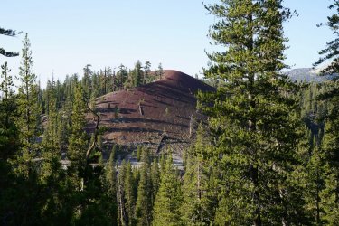
This campsite and red cones was the coldest of the whole trip. It was so weird because we were below 9,000 feet and when we walked about 100 yards from our campsite it was warm. I've never experienced this where a canyon was so extremely colder than the area just around it. The first half of the day wasn't the most interesting as it was mainly through the trees and we didn't get any views. But the trail was nice and smooth and I still had a great time. We did pass Devil's Postpile National Monument which was kind of what I was expecting. It was nice to see but I wouldn't go out of my way to go see it.
Just before the Monument is where the trail started to climb and we were climbing for awhile after this. Eventually we mad our way to Gladys lake. The rest of this day was as good of hiking as we'd had on the entire hike. From Gladys lake you just hop right over to Rosalie Lake and then you hop right over to Shadow Lake.

After Shadow lake, you have a decent climb up to the pass before Garnett Lake. But Garnett lake was incredible.

Another closer up view of Garnett Lake

After Garnett Lake, there is a small climb to get up to Ruby Lake. But from there you just hop right on over to emerald lake and then one more tiny hill and you make it Thousand Island Lake.
Ruby Lake

Thousand Island lake was amazing and we had the entire lake to ourselves. We walked right up to this amazing campsite with a view over the lake.

This was probably our best campsite of the JMT. It was also our last night out on the trail. It felt like a fitting campsite to be our last one. This night is where I first started to realize that we were about done. You really do get into a routine when out hiking for this long and it was weird to think that tomorrow was going to be our last day hiking. It was a very weird moment because I was ready to be done but at the same time I was loving it out here and wasn't ready for it to be over.
Day 13: Thousand Island Lake to Tuolumne Meadow Campground
Woke up the next morning to such a still lake. This really was such a good campsite. This photo was taken probably 30 feet from our tent.

It was a weird day of hiking. I was ready so excited for real food and to get off of the trail but we were still hiking through such amazing scenery. There was a small climb after Thousand Island lake and once on top there were a few small lakes that had even better reflections than the bigger lake we woke up to.

I thought Donahue Pass was going to be one of the easier passes but it was actually fairly difficult going northbound becauase of all of the stairs they built.
A view looking back as we were almost at the top of the pass

Donahue pass was kind of weird pass too. You never got a view off of both sides. It was a little bit of a long hike across the top but once we got across the top we had finally reached Yosemite. It felt very good to make it this far and was kind of crazy looking back at where we had started this hike. Once we got into Yosemite we started to run into people again. In the first 2 miles of being in Yosemite, we saw more people than we had seen in the last 4 days combined.
A view of our last lake on the hike

After the lake we made our way down into the bottom of Lyell Canyon. At this point it felt like we were almost the trailhead and our bodies decided that they were done. I tried telling my legs that we had 8 more miles to go but that didn't help. Even though the last 8 Miles were so flat, it was some of the more difficult hiking of the trip. We were also racing time as we were hoping to get to the store at Tuolumne before 5 so that we could get some better food and a beer.
The meadows in Lyell Canyon were very cool and were a great way to end the trip

It felt odd getting back to civilization. The first thing I noticed was just how loud people are. There were roads, construction, people talking and yelling. Especially after being mostly alone the last few days, it was weird to be surrounded by noise again.
We did make it to the store at 4:45 and then made our way to the backpackers campground to stay for the night.

It felt so good to get to that campground. It was a long and tough hike but was so worth it. If I was to do it again (Planning on it someday) I would try to take some more time. I don't feel like I rushed through it and I thoroughly enjoyed the hike but it would have been nice to just rest a little on the trail. There were quite a few moments where I thought it might be nice to just sit and take an hour or two break while hiking but we weren't able to because we needed to hit miles.
This really was such a good experience and I would highly recommend doing the JMT if you get the chance. I do feel very lucky that I got to experience it in a unique way. I hear so much about how crowded the JMT is but for us it wasn't that at all. The first few days had a decent amount of people but never felt crowded and after day 5 it almost felt like we were alone. We rarely camped near other people and a couple days saw less than 3 people. We also got to experience incredible places like Thousand Island Lake and Marie Lake in a way not too many people get to by being there completely by ourselves.
I really need to get into the Sierras more. After hiking the JMT you realize just how big they really are. I've spent a lot of time looking at maps of the area and there were already so many places I've wanted to go to. Being so close to some of these places just makes we want to get out there even more.
John Muir Trail 2021
I haven't spent a whole lot of time backpacking but starting sometime in 2019 I started to get the urge to get out on some longer backpacking trips. I had spent most of my time just doing longer day hikes as I had gotten tired of carrying a heavy pack. But as I did more of these long day hikes I kept on discovering longer trips that I just couldn't quite get to on a day hike. So this urge to get out backpacking just kept on growing. In 2019 we ended up doing a 45 Mile loop in the Uintas in October. Even though it was freezing, it was exactly what I had been looking for. It was such a good trip but I still didn't do anymore backpacking until May of 2020 where me and my wife did a five day trip in Dark Canyon. During this trip we talked a lot about going backpacking more. Just before this trip I had also discovered the world of ultralight backpacking. At this time, I still had a 6 pound tent and a backpack that seemed like it weighed almost as much. But on this trip I convinced my wife that if we invested in lighter weight gear it would make these backpacking trips more enjoyable and we would get out more.
After we got done with this trip to Dark Canyon we actually did begin to invest in some lighter gear and we did a few more trips over the summer. One of these was a 60 Mile 3 and half day trip in the Uintas (Both of our longest trips to date). Over the next couple months we really started to think about even longer trips. This was really when the idea of the JMT came to mind. A little over 200 miles and I figured we could potentially get enough time off of work to get this done. I figured the most days we could get to do the hike would be 16 days. I knew this would be tough to do in 16 days but we decided to give it go. I was able to snag some permits going northbound starting at the Cottonwood Pass trailhead on August 28th.
We had plans to do some longer backpacking trips to train for the JMT but due to various things coming up we weren't able to get too many backpacking trips in. The longest being a 45 Mile 3 day trip in the San Juans. My dad had also planned on coming on the JMT with us and he had been doing a lot of training leading up to the trip. But a few weeks before the trip he got a kidney stone which needed surgery. This was disappointing since I had looked forward to doing such a big trip with him.
The other problem leading up to the trip was all of the wildfires in California. I was checking smoke maps and trying to find peoples reports of the trail every single day in the weeks leading up to the trip. I had seen some videos of the JMT in years before during a bad wildfire season and it seemed like it could get fairly bad. In the end we decided to go for it and if the fires were that bad we would just get off the trail. We live close enough that driving is somewhat reasonable to get to the area and my mom was nice enough to agree to drive us out to the trailhead the night before and also to pick us up at the end in Yosemite.
Even though we had gotten a lot of lightweight gear in preparation for the trip, My pack still weighed 45 pounds on day one including my food and water. We had planned on doing only one resupply on the entire trip. This would be on day 9 at Muir Trail Ranch so we started out with a lot of food weight. The additional weight of the bear can also added up but the biggest problem was my camera gear. I have two competing hobbies; covering as much ground as I possibly can in a day and Photography. These two hobbies do not work well together and the JMT is where I really learned this. I had around 12 pounds of gear that was my Camera setup or stuff that I brought for my camera. The thing I went overboard on was the batteries. I carried 6 camera batteries, two giant battery packs and a solar charger.
Day One: Cottonwood Pass Trailhead to Rock Creek (~14 Miles)
So we made the long drive out to the trailhead and spent the first night at the Cottonwood Pass Campground. I slept absolutely horribly that night. Maybe I was excited or nervous (maybe both). So after a terrible nights sleep I put on my incredibly heavy backpack at started out on the cold morning. This day was full of excitement. It was one of those moments where I couldn't really believe that we were actually doing this and that we were going to be spending the next 16 days out on the trail.
We had arrived in the dark the night before but I could smell a little smoke that night so I was worried about how the smoke situation would be. But after waking up we realized that the smoke was not bad at all. We did get a nice view of Horseshoe Meadows as we climbed up to cottonwood pass but we did see a little smoke hanging around the valley. Once we reached the pass we could see some smoke in the distance.
Once at the pass, we reached the PCT and followed this to Chicken Spring Lake where we filled up our water for the first time. On this first day we could feel the effects of the low snow year. The water at the lake was the only water on the 14 mile stretch from the trailhead to Rock Creek. The lake was even a little low and had no water flowing from the outlet.
The rest of the day was fairly uneventful as we made our way to Rock Creek. We did get some nice views to the west but we also noticed that the smoke got a little worse as the day went on. Something we would also notice on the next few days of the hike.
I was a little worried when I got to camp because I was more sore than I had hoped I would be. This 14 Mile day was supposed to be one of our easiest days of the trip. It was one of the shortest days and had the least amount of elevation gain. I just hoped I would feel better in the morning. It ended up being a pretty nice campsite at rock creek and we only shared the campsite with two other groups of two. We didn't see very much wildlife at all on our trip but we did get a couple deer that came pretty close to our tent on this first night while at camp.
Day 2: Rock Creek to Guitar Lake (~11 Miles)
Day two was supposed to be our shortest day of the trip and with how I was feeling the day before I was pretty happy about that. We did start day two with a climb right away out of rock creek. We made pretty quick time getting up to the next pass.
This photo was taken just after we came down from the pass.
The rest of day two was very nice. On the approach to Crabtree Meadows we had some very nice views. We also ran into a ranger who tried to convince us to stay at Crabtree for the night instead of going to Guitar Lake. I get why they don't want people camping up at Guitar lake because it really would be hard to bury anything up there. But we got to Crabtree used there very nice open air pit toilet and then made our way up to the lake. This was one of or busiest campsites of the trip but it was still amazing and we were far enough away from the other people that it wasn't too bad. I also think we were the only other northbounders who were camped here this night.
Day 3: Guitar Lake to Wallace Creek Including Summit of Whitney (~17 Miles)
The start of day 3 didn't go quite as planned. We slept right through our alarm and got a little bit later start going up Whitney then planned. I think we began hiking around 6AM. Not too long after starting the climb we got to this small tarn which had an incredible reflection.
There were a lot of switchbacks going up Whitney but they really weren't that steep. We hadn't had a whole lot of time to acclimate and I was feeling a little slow once we got up to the ridgeline. I also realized that once you hit the ridgeline you still aren't even close to the summit. Once we hit the ridgeline we also ran into all of the hikers coming up from Whitney portal and this part of the trail felt very crowded. We eventually reached the summit. Long before I had thought about the JMT I had wanted to get to Whitney so it felt very good to reach the summit.
Another couple views as we made our way back down from the summit.
After getting back to Guitar lake we packed up camp and decided we would head to Wallace creek for camp. We arrived at Wallace creek a little late and it was packed there. Our busiest campsite of the entire trip. Wasn't really expecting this but we luckily we did find a spot.
Day 4: Wallace Creek to Bubbs creek (~16 Miles)
Day 4, along with day 6 were probably my favorite days of our trip. As soon as we climbed out of Wallace creek we had views almost the entire day.
Just after getting out of Wallace Creek
A few miles after this view we made it up to Bighorn plateau which was probably my favorite part of the trip to this point besides Whitney. The views in every direction were just incredible and there was even a small lake up there.
We then descending into Tyndall creek and then began the long climb up to Forester Pass. To this point in the trip we had not seen a single cloud and I the constant sun exposure had started to get to me. The climb up to the base of forester pass really wasn't that steep but that sun exposure made the climb a little bit harder. This section of the trail was outstanding though. The views all around were incredible.
During this stretch was also when we ran into someone asking us if we had heard anything about the forest closures. He mentioned that a few people he knew had permits cancelled and was wondering if he was going to be able exit out of Whitney Portal. I didn't really know what to think of this and I just figured he had been confused about something. The only thing I could think of that would close the forest would be a fire but today was the best the smoke had been so far. So we continued on our way and made it up to Forester Pass.
A photo looking back towards the way we came up to the pass.
This was the first big pass of the trip and it really felt like it took forever to get down off of the pass down to the tree line. We would end up camping further down this canyon.
Forester pass is just out of frame to the right in this photo
After the lake, the trail was still fairly rocky and my ankle was really starting to feel it. I must have slightly twisted it the day before or sometime this day and all of the rocky trail began to aggravate it. This was one of my toughest moments on the trip. I did bring along an ankle brace because I do have ankle issues but I stubbornly took way too long to put it on. The last few miles were pretty rough and I was really hoping I would feel better in the morning.
During this section we also ran into a couple more people asking about the forest closure. We still had no information about it and nobody else we ran into did either. But with more people talking about it I started to wonder what that would mean for us. But until we heard anything else we would just keep on walking.
Day 5: Bubbs Creek to Woods Creek (~16 Miles)
Waking up the next morning my ankle was definitely feeling better but I decided I would hike the whole day with my ankle brace on. We only had a mile or two before the climb up to Glen pass. On our way down the canyon we ran into someone who gave us a little more information on the forest closure. He told us that the national forests were closed because of fire prevention. He mentioned that he was supposed to resupply at Kearsarge Pass but wasn't able to because he wouldn't be allowed to get back on trail. He said he was basically out of food and was going to try to make it to Whitney that day. I hope he made it because it was a long way to Whitney from there. We tried asking him if it was Just Inyo national forest but he didn't know the names of the forest. At this point I started to get a little more worried because on day 9 we would be entering Sierra national forest. But I held onto hope that it was Just Inyo national forest that was closed.
As we made it further up towards Glen pass we ran into more people talking about the forest closure. They still didn't have very much information but told us there was a sign explaining stuff at the Rae Lake Ranger Station. It ended up not being too bad of a climb up to Glen pass. I thought it was much easier than Forester and the views over the Rae Lakes were amazing.
Just like Forester Pass, it felt like it took so long to get down to the tree line. This was a very nice hike down to get to the lakes with great views all around. We ended up eating lunch at the lakes. What I thought was really cool about Rae lakes was how close together they were and how the outlet of the upper lake was probably 20 feet long before it drained into the lower lake. Also the small islands in the upper lake were pretty cool.
Once we were along the second lake, we ran into the ranger station and read the note that people had talked about. It basically gave no concrete information and said that if going northbound you may or may not be able to continue your hike when you reach the national forest. We did learn though, that it was every national forest in the state of California. It was a little disappointing to hear that it was all of the national forests and we began to really think about if we would be able to finish the hike or not. The note also said that they were not sure if Muir Trail Ranch or VVR would be running still. That was almost more concerning because if MTR shut down we would have no way to get any more food. The note did mention that if you left the national forest, you may not be able to return to the forest. This meant anyone resupplying at Kearsarge pass was either going to have to end their hike there or see if they could stretch their food supply to Whitney.
But we continued on and hoped that we would be able to complete the trail. It was a long descent down to Woods Creek and we dropped down below 9,000 feet. It was definitely a lot hotter down here and to get some more miles in, we decided to cross the super wobbly bridge at woods creek and head a few more miles up the canyon. We ended up getting a nice campsite with only one other person real close to the creek and with some nice views down canyon.
Day 6: Woods Creek to Upper Palisade Lake (~17 Miles)
We had been trying to hit around 17 miles each day and that meant that this day we would need to go over Pinchot and Mather pass. This was going to be 17 Miles and over 5,000 feet of gain. I had heard that Pinchot was very tough going northbound but Mather wasn't too bad. So I was glad that we would be doing Pinchot first. Part of the reason we went up Woods Creek a couple miles the day before was so that we could get some of the elevation gain out of the way for today.
Overall, the climb up to Pinchot was not that hard. Maybe it was because of the expectations I had or maybe it was because the hike up was so amazing.
Looking up towards Pinchot Pass
The view from the other side. There was quite a few reddish rock around Pinchot pass which I was not expecting up in the Sierras. From here you could almost see Mather Pass and it looked like it was a long ways away.
On our way down from Pinchot pass and as we started climbing up to Mather pass we ran into 5 groups who told us make sure to fill up on water before Mather pass because there is no water within 4 miles of the pass and there wasn't water for a couple miles on the other side of the pass as well. We listened as we figured it was good info. I got really confused when we got close to the pass and there were 5 small lakes up near the pass. (There is one out of frame). Have any of you dealt with people who won't filter from standing water? I was so confused. The water was so clear and looked so nice. Coming from the desert, these ponds are cleaner than basically all of the water I get from there. I'm still just shocked at how so many people said there was no water here. You only would have to walk 30 feet off the trail to get to one of these ponds.
Anyways we made it up to the top of Mather pass and I'll try to stop commenting on the scenery so much f but this whole area from Pinchot Pass to Mather pass and Palisades lakes are a the main reason that day 6 was probably my favorite day of our trip. Mather pass was probably my favorite pass and Palisade lakes was probably my favorite single area of the entire trip. We found an amazing campsite situated up above the Upper Lake for this night.
Day 7: Upper Palisade Lake to Creek Below Muir Pass (~17 Miles)
Day 7 could have been the best start to a day we'd had so far by getting to walk past the Palisade Lakes.
From the lakes we made the beautiful but uneventful descent to the middle fork of the kings river. This was another rough moment of the trip. We ate lunch at the junction with the Kings river and realized that we had gone 9 miles but that meant we were only halfway done with the day. And the rest of the day was going to be all uphill. It was a pretty mellow climb for the first 7ish mile of the climb. In this section we really started to notice a lot less people on the trail. This made me start to worry about if we would be able to continue. With less people on the trail I was thinking that meant that they probably kicked people off of the trail that were heading southbound. There was another ranger station along this section of the trail but we didn't gain anymore information here. Just told us again that they were not sure if we would be able to continue and were not sure if MTR would still be operating.
A very cool cliff on our way up the kings river
The last 2 miles of the day were much steeper than the rest but we eventually made it up to our camp. This was also where we had our best wildlife experience of the trip. 3 bucks came right up to our camp and were there for probably 30 minutes just eating.
A little waterfall by our camp
Day 8: Below Muir Pass to Goddard Canyon
We were camped a couple miles below Muir pass the night before. The climb to Muir pass was very enjoyable and was very rocky. This surprised me a little since Muir Pass was lower than quite a few of the other passes we had done. On the way up to Muir Pass we actually ran into someone who was running an Ironman the weekend after completing the JMT. I was wondering if that would hurt or help him in the race but seems crazy to be doing two things like that back to back.
The hut at the top of Muir Pass
From here we made our way past Wanda Lake and down into Evolution Valley. This was a spot I had been wanting to go to for years. Before I even knew what the JMT was. It lived up to my expectations and was one of my favorite areas of the hike. Evolution lake is so hard to describe. It is such an odd shape and wraps around all these rocks. It almost feels like it is multiple lakes.
A very cool spot in Evolution Valley
A view of Evolution Lake. The lake is actually straight ahead on the other side of that hill in front of us as well.
After Evolution Valley we made our way down to Mcclure Meadow where we finally learned our fate on if we would be able to continue our hike. The note at the ranger station stated that if your permit was dated before August 30th you were allowed to continue your hike as planned through the national forest. Luckily, our permit was dated for the 28th. They also said that MTR would still be operating. I was so happy reading this, I knew that we would actually be able to finish the JMT now. We were about halfway done and I was thinking about how disappointing it would be to have to get off trail now. Very shortly after this I had the thought, 'we are ONLY halfway done'. That actually hit fairly hard for both of us. We had been out here for quite awhile already and our bodies and minds were getting tired. The thought that we had to do all of what we had just done again was hard and it made the rest of the hike down into Goddard Canyon feel endless.
A nice view down into Goddard Canyon
Day 9: Goddard Canyon to Marie Lake (~14 Miles)
Day 9 is where it really felt like the trail changed. Even in my mind looking back, it almost feels like two different hikes when I think of the trip before day 9 and after day 9. We started out the day by hiking through Goddard canyon which was much cooler than expected. We then made it to MTR. At MTR we ran into two other hikers and exchanged some food as we had all gotten a little tired of the food we had brought. I did just realize that I haven't mentioned food at all.
Food was something that I would do differently if I were to do a longer trip again. We brought no variety. For breakfast we had Probar meal bars, for lunch we had either tuna and a tortilla or uncooked ramen. And for dinner we ate instant mashed potatoes and plain couscous. We had done this combo plenty of times before but it was always on shorter trips. I realized that on longer trips like this, it might be nice to have some variety. Even our snacks were the same each day. A variety of bars and a few mini Slim Jims.
It was rough filling up our bear cans and then climbing out of MTR. It wasn't the steepest or longest climb, but the climb to Selden Pass was easily the hardest of the trip. Getting all of that weight back was part of it but the heat may have been worse. At MTR we were below 8,000 feet and you could feel it. The pass got easier once we reached Sallie Keys Lake but it was still a tough climb up to the top of the pass. At least you get one of the best Pass views on the JMT at the top.
On the way up to Selden Pass we found out why we hadn't seen hardly any southbounders the last few days. We ran into someone who was hiking the PCT southbound and he told us that there was a ranger at Thousand Island lake that was kicking everyone off of the trail regardless of whether their permit was before August 30th. He said that anyone you see going southbound at that point had basically snuck past the ranger in the night. He said we probably wouldn't see anymore southbounders after him and he was right. We only saw one more a couple days later.
I felt pretty bad for all of those people who were kicked off when they shouldn't have been. For some people this was probably the one year that they were going to be able to hike the JMT or PCT. Even people who weren't forced off by a ranger were essentially forced off due to not being able to resupply. Really the only people who were able to complete the trail at this time were the people like us who were hiking big miles and only had a resupply at MTR. During this day we had learned that even Red's Meadow had closed down. This was a big disappointment for use because we were really looking forward to a burger and we were extremely stupid and didn't buy more fuel at MTR even though we were running a little low.
We had planned on doing more miles this day but the climb up to Selden Pass killed both of us and we decided to set up camp at Marie Lake. I wasn't complaining about that because it was such a great campsite and we had the entire lake to ourselves.
Day 10: Marie Lake to Silver Pass Lake (~19 Miles)
The day we saw one other person. We packed up camp at Marie Lake and began our way down into Bear Creek. I only took two photos once in the creek which I'm a little disappointed about because it was actually very nice.
Then we made it to Bear Ridge.... This was the low point of the hike for me. The climb wasn't too bad, it was a little warm and wasn't too scenic. Once on top of Bear Ridge it was not scenic at all. I would say the least scenic part of the JMT. But it was the descent that killed me. My ankle had mostly recovered by this point but my legs and knees were killing me on this descent. It took me so long to get off of Bear Ridge, it felt like the slowest hiking of my life.
Somewhere along Bear Ridge is also where we decided that we were going to end our hike early. Instead of going to Happy Isles in Yosemite we would end at Tuolumne Meadows. And instead of doing some shorter mileage days like we had planned, we were going to try to hit 20 mile days each day for the rest of the trip. There were a couple reasons we decided to end early but the biggest one is just that we were feeling done and we wanted a day or two of rest before going back to work. The original plan was to end on Sunday morning, drive 9 hours home and then go to work the next day. We both just decided that wasn't what we wanted to do. I realized on the JMT that my motivation isn't as much about just completing something but it is seeing and experiencing very cool places. Before the hike I had a few areas that I really wanted to see and at this point I had seen all of them except Thousand Island Lake. So in my mind, as long as I saw Thousand Island lake, I would see everything that I came out here to see if we ended at Tuolumne. There were a couple other reasons we decided to end early like just being tired, very low on fuel and maybe a couple others. Looking back there is a small part of me that wishes we would have done the whole thing but I still feel really great about the trip. Like I mentioned above, I saw everything I had wanted to see out there and I hiked from Mount Whitney to Yosemite. I also knew that we were for sure be back into Yosemite and would most likely be doing most of the trails that we would have done on the JMT.
Anyways, since we decided we were going to do 20 mile days for the rest of the trip, that meant we needed to get to Silver Pass Lake tonight. I felt much better after we got down to Mono creek and we were able to start climbing again but we dropped so much elevation and it got hot again. We decided to take an hour long nap next to the creek and eat half of our dinner so that we could hike up the last bit in the shade. While we were cooking dinner we saw our one person of the day. It's weird how when you are hiking around tons of people you try to avoid everyone but when you are mostly alone you go up and have long conversations with everyone you see. He went on his way and said he was camping at the lake as well but we didn't see him again that night or the rest of the trip.
A nice meadow a little before reaching the lake.
We ended up getting to the lake just before dark and quickly set up camp before it got too cold. Luckily it wasn't too windy this night because our camp was a little exposed.
Day 11: Silver Pass Lake to Red Cones (~20 Miles)
The day where we saw 0 people. Silver Pass ended up being the easiest of the trip. I guess that happens when you camp right below it.
After leaving Silver Pass, we had another big descent which was still killing my legs. Overall it was a little uneventful for the next part of the day until we hit Virginia and Purple Lakes. There was a pretty decent climb to get up to Lake Virginia but it really wasn't too bad and Lake Virginia exceeded my expectations.
We then made our way past Purple lake and the Duck Lake outlet. After the Duck Lake outlet most of the trail was in the trees and I think it was about 8 miles of this. Just past the Duck Lake outlet we did get some decent views looking back towards Silver Pass though.
We cruised through the last 8 Miles of the day. It was a nice gentle descent all of the way to our campsite at Red Cones.
Day 12: Red Cones to Thousand Island Lake (~19 miles)
This campsite and red cones was the coldest of the whole trip. It was so weird because we were below 9,000 feet and when we walked about 100 yards from our campsite it was warm. I've never experienced this where a canyon was so extremely colder than the area just around it. The first half of the day wasn't the most interesting as it was mainly through the trees and we didn't get any views. But the trail was nice and smooth and I still had a great time. We did pass Devil's Postpile National Monument which was kind of what I was expecting. It was nice to see but I wouldn't go out of my way to go see it.
Just before the Monument is where the trail started to climb and we were climbing for awhile after this. Eventually we mad our way to Gladys lake. The rest of this day was as good of hiking as we'd had on the entire hike. From Gladys lake you just hop right over to Rosalie Lake and then you hop right over to Shadow Lake.
After Shadow lake, you have a decent climb up to the pass before Garnett Lake. But Garnett lake was incredible.
Another closer up view of Garnett Lake
After Garnett Lake, there is a small climb to get up to Ruby Lake. But from there you just hop right on over to emerald lake and then one more tiny hill and you make it Thousand Island Lake.
Ruby Lake
Thousand Island lake was amazing and we had the entire lake to ourselves. We walked right up to this amazing campsite with a view over the lake.
This was probably our best campsite of the JMT. It was also our last night out on the trail. It felt like a fitting campsite to be our last one. This night is where I first started to realize that we were about done. You really do get into a routine when out hiking for this long and it was weird to think that tomorrow was going to be our last day hiking. It was a very weird moment because I was ready to be done but at the same time I was loving it out here and wasn't ready for it to be over.
Day 13: Thousand Island Lake to Tuolumne Meadow Campground
Woke up the next morning to such a still lake. This really was such a good campsite. This photo was taken probably 30 feet from our tent.
It was a weird day of hiking. I was ready so excited for real food and to get off of the trail but we were still hiking through such amazing scenery. There was a small climb after Thousand Island lake and once on top there were a few small lakes that had even better reflections than the bigger lake we woke up to.
I thought Donahue Pass was going to be one of the easier passes but it was actually fairly difficult going northbound becauase of all of the stairs they built.
A view looking back as we were almost at the top of the pass
Donahue pass was kind of weird pass too. You never got a view off of both sides. It was a little bit of a long hike across the top but once we got across the top we had finally reached Yosemite. It felt very good to make it this far and was kind of crazy looking back at where we had started this hike. Once we got into Yosemite we started to run into people again. In the first 2 miles of being in Yosemite, we saw more people than we had seen in the last 4 days combined.
A view of our last lake on the hike
After the lake we made our way down into the bottom of Lyell Canyon. At this point it felt like we were almost the trailhead and our bodies decided that they were done. I tried telling my legs that we had 8 more miles to go but that didn't help. Even though the last 8 Miles were so flat, it was some of the more difficult hiking of the trip. We were also racing time as we were hoping to get to the store at Tuolumne before 5 so that we could get some better food and a beer.
The meadows in Lyell Canyon were very cool and were a great way to end the trip
It felt odd getting back to civilization. The first thing I noticed was just how loud people are. There were roads, construction, people talking and yelling. Especially after being mostly alone the last few days, it was weird to be surrounded by noise again.
We did make it to the store at 4:45 and then made our way to the backpackers campground to stay for the night.
It felt so good to get to that campground. It was a long and tough hike but was so worth it. If I was to do it again (Planning on it someday) I would try to take some more time. I don't feel like I rushed through it and I thoroughly enjoyed the hike but it would have been nice to just rest a little on the trail. There were quite a few moments where I thought it might be nice to just sit and take an hour or two break while hiking but we weren't able to because we needed to hit miles.
This really was such a good experience and I would highly recommend doing the JMT if you get the chance. I do feel very lucky that I got to experience it in a unique way. I hear so much about how crowded the JMT is but for us it wasn't that at all. The first few days had a decent amount of people but never felt crowded and after day 5 it almost felt like we were alone. We rarely camped near other people and a couple days saw less than 3 people. We also got to experience incredible places like Thousand Island Lake and Marie Lake in a way not too many people get to by being there completely by ourselves.
I really need to get into the Sierras more. After hiking the JMT you realize just how big they really are. I've spent a lot of time looking at maps of the area and there were already so many places I've wanted to go to. Being so close to some of these places just makes we want to get out there even more.
Attachments
Last edited:

