- Joined
- Aug 23, 2016
- Messages
- 138
For years I had heard my friend Ken talk about kayaking Isle Royale. I finally made it up there with him this year. We took the Ranger III ferry from Houghton MI to Rock Harbor, Isle Royale. We brought 15 nights of food with plans to circumnavigate the island. You can paddle all the way around in a week if the weather cooperates but this late in the season you can count on a lot of windbound days. There is a lot of great hiking to be had so the plan was to paddle when we could and hike when we couldn't. We ended up burning through a lot of our weather days early in the trip so worried a little about making our ferry connection out of there but it all worked out in the end.
Day Zero
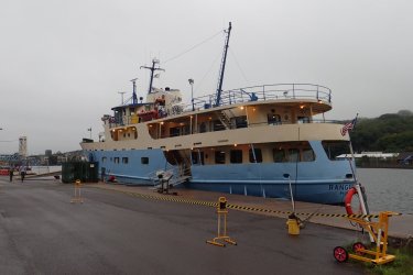
The Ranger III before boarding in Houghton, MI. This is a pretty big boat and I had taken my meclazine so I was confident I would make the crossing without getting seasick. Hahahahahaha!
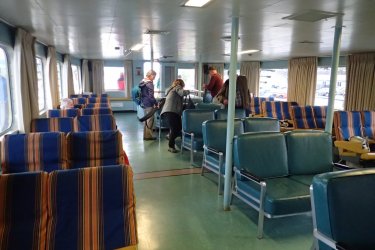
Upper deck passenger seating. They take all your gear (including kayaks or canoes) and load it separately. So you just bring a "carry-on" with you to the seating area.
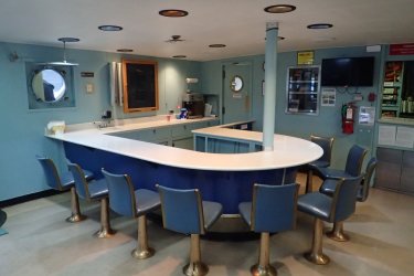
Canteen on lower level. Closed for Covid and never reopened.
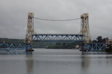
Lift bridge on the way out to Lake Superior
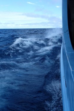
It started getting rough so I headed down to the lower deck in the stern of the ship, where wave motion is least. Still got really seasick. Just miserable.
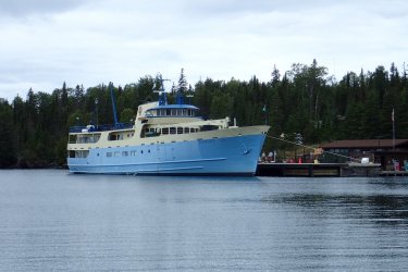
Ranger III at Rock Harbor
Here is a map of our route:
Click here to view on CalTopo
Day 1
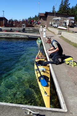
Rock Harbor on Isle Royale is sort of a zoo. There is a lodge there plus a restaurant, post office, general store and park visitor center and a large campground. Since the ferry arrived in the afternoon and I was in no shape to go anywhere we camped at Rock Harbor the first night. Here we are getting ready to head out the next morning. The people in the background are getting ready to board the...
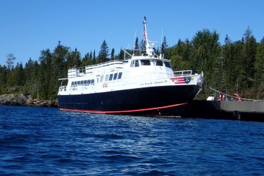
...Isle Royale Queen IV headed for Copper Harbor, MI. It was supposed to be there yesterday but it was too rough for this smaller boat to make the trip across.
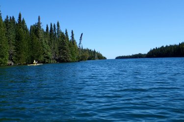
We were soon on the water headed north with a tailwind hoping to round the northeast end of the island and put the infamous Blake Point behind us.
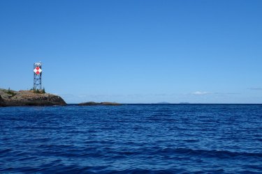
Here is the infamous Blake Point. It is super exposed and can be treacherous. With a southwest wind it was a piece of cake. But as soon as we rounded the point we had a good 15 kt wind in our faces. Too rough to take pictures for a while after that.
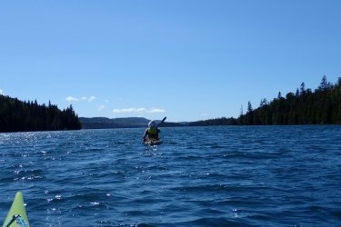
To avoid the wind we decided to paddle up Duncan Bay and take the Canoe portage across to the main lake.
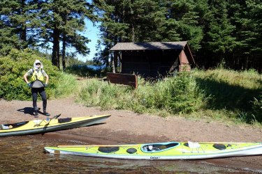
Duncan Bay Narrows Campsite. Many of the campsites on the water are equipped with screened, 3-sided shelters. We stayed in several of these (but not this one).
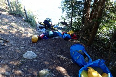
Kayaks are not made for portaging but the several-hundred-yard carry beat miles of strong headwind.
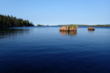
The rest of the day was a mix of sheltered water and headwinds.
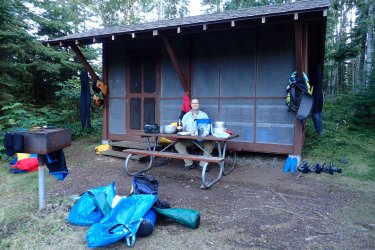
Our shelter on Belle Isle
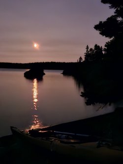
Moonrise on Belle Isle
Day 2,3,4
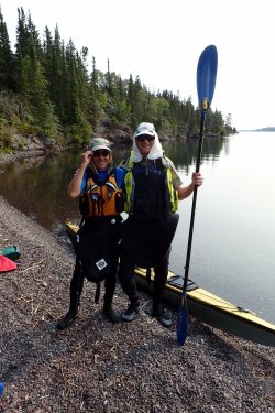
Getting ready to leave Belle Isle. We met Wayne and Sam there. They were base-camping and fishing. They invited us to join them for a fish dinner but we needed to take advantage of good paddling weather and move on, They took our picture as we were heading out. We got their picture when we met them again at the end of the trip.
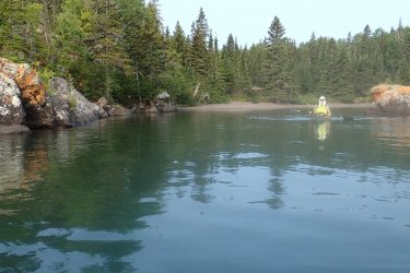
Leaving Belle Isle. Unfortunately my camera lens was fogged up.
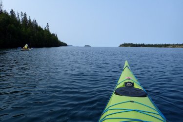
On the way to Todd Harbor.
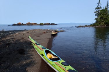
I think this was the closest thing to sand we saw the entire trip. Isle Royale is made mostly of virtually quartz-free igneous rock that does not yield much in the way of sand. A good beach on Isle Royale is one made of smaller rocks.
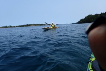
A picture of Ken and my finger
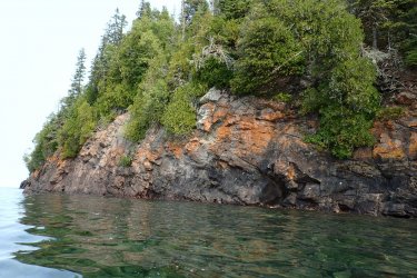
Typical shoreline on the northwestern side of the island. The lava flows and other layers dip to the southeast so in this side of Isle Royale they tend to break across the layers and form a steep, inaccessible coast. You can just make out the bedding planes dipping into the cliff.
We spent three nights at Todd Harbor waiting for good enough conditions to continue paddling. From here to the southwestern end of the island the shoreline is very exposed and there are limited options for landing if there is any component of onshore wind. But there are good hiking opportunities from here. Unfortunately we were here on Labor Day weekend and were joined by boisterous power-boaters who tied up at the dock overnight.
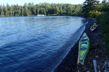
Beach at Todd Harbor. Nice and sheltered here.
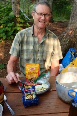
Dinner at Todd Harbor campsite (but forgot to include the parmesan cheese in the photo). Ken is quite the backcountry chef. Olive oil in the Nalgene, onion and garlic ready to be sliced and sauteed.
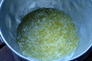
Here's the onion and garlic!
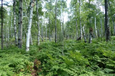
There are areas of birch/aspen forest on Isle Royale that are very open. I have not seen forest like this anywhere else. Another oddity of the forest here is cold-climate boreal forest at the lowest elevations adjacent to Lake Superior and warmer-climate eastern forest at higher elevations away from the cold lake.
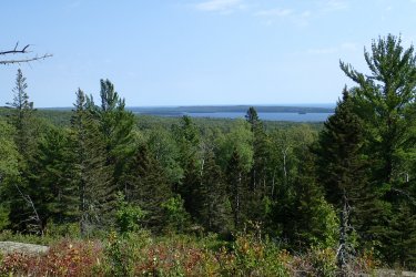
View to southeast from the central spine of the island, Greenstone Ridge. Looking at Siskiwit Lake with Lake Superior behind. Our camp is behind us. We'll be paddling the shoreline visible here in a week or so. Useless trivia: the leftmost island visible here in Siskiwit Lake is Ryan Island, the largest island in the largest lake in the largest island in the largest lake in the world.
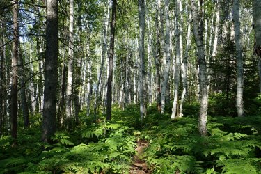
More interesting forest
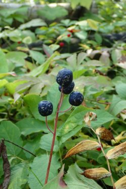
Blue-bead lily berries
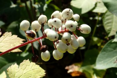
Doll's eye berries
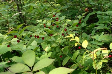
Solomon seal berries
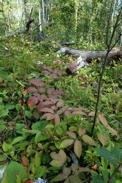
Fall color in the undergrowth. I think the reddish plant is wild sarsaparilla.
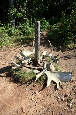
Yellowstone NP has lots of signs adorned with elk antlers, here it's moose.
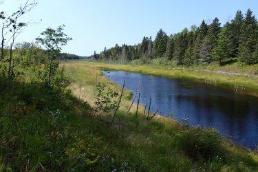
One of the many wetlands on Isle Royale.
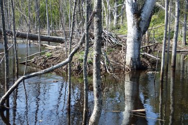
Beaver lodge and beaver
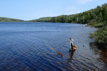
Hatchet Lake
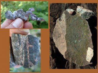
We also hiked to an old copper mine site and found some native copper in the tailings. Ken was really good at finding it. I hardly found any.
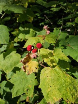
Thimbleberries
Day 5, 6
Good paddling weather today with a bit of a headwind. We had to make a critical decision. We could either make it a short day and stop at Little Todd Harbor or press on to Hugginin Cove. Listening to the weather radio we were getting a pretty consistent forecast of all hell breaking loose in three nights with some excellent paddling weather the day before. We opted for two nights at Little Todd, a beautiful, secluded camp, then one long day to Grace Island. The storm was predicted to come out of the north and Ken was pretty sure the camp shelters on Grace were nestled on the south side of the island.
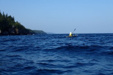
Headed for Little Todd. The view ahead is typical of this part of the shoreline--steep and rocky right to the water as far as you can see. We will need one full day of the right wind to make it along here.
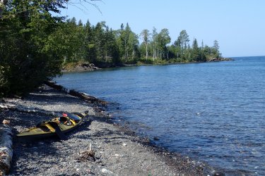
Beach at Little Todd Harbor camp
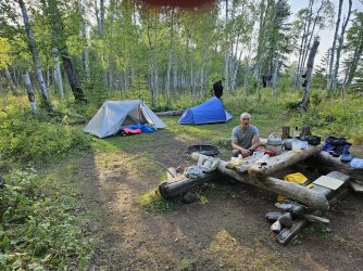
Wonderful campsite with driftwood furniture. We brought my MSR Whisperlight stove and Ken's gigantic cook kit. Since you are not carrying everything on your back you can put what amounts to an infinite amount of fuel in the stern of the kayaks and cook some pretty elaborate meals.
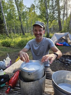
What's for dinner tonight?
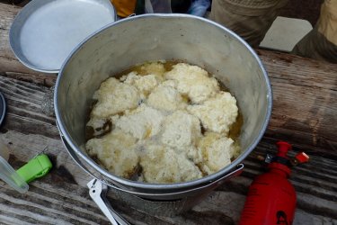
Chicken and dumplings! Courtesy of Ken, the master chef.
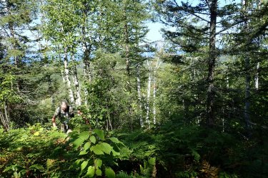
Ken had the great idea to hike cross-country up to Greenstone Ridge to the lookout tower at Ishpeming Point. He had done a similar hike 30 years ago and assured me the forest was much more open than I might think. Actually, he was right and it turned out to be a fun hike. A few places were pretty thick and you had to thread needles between wetlands but overall it was fairly easy walking.
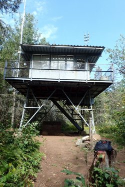
The forest had grown up since the tower was built so there was not much of a view but it was still worth the walk
Day 7
18 mile paddle today to Grace Island. Weather forecast predicted light tailwind so should not be too difficult. Well, somehow they were off 180 degrees on the wind direction and we had a slight headwind most of the day. The marine forecast for tonight included a gale warning and predicted waves of four to eight feet with some waves to ten feet. The shoreline we were paddling would be facing right into the storm so we were keen to get to the sheltered waters around Grace Island.
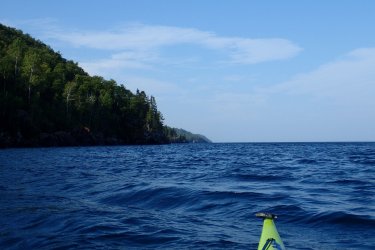
It was a beautiful day and we made good time
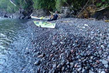
There were not many places to stop. This beach was typical
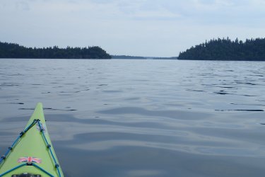
By late afternoon the wind died completely and it was strangely calm. Here we are rounding the southwest end of Isle Royale and approaching Grace Island.
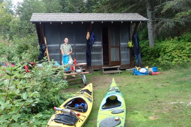
Luckily there was a shelter available and we moved right in and pulled our boats way up out of the water in anticipation of the storm.
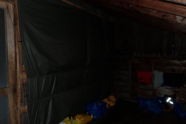
The camp shelters faced south and were on the south side of the island--perfect for weathering this storm. About the time we got our dinner dishes put away it started raining. There was rain, wind and lightning all night. Since the storm was coming from the north and the shelter face south we didn't need a tarp over the screened side of the shelter. No way the wind could possibly shift, right? Well, we woke up at 4 AM with rain blowing right in. About the time we got the tarp up the wind shifted back to the north. Oh well, should have put it up before going to sleep.
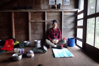
It blew and rained all day the next day so we stayed put and napped, read and ate.
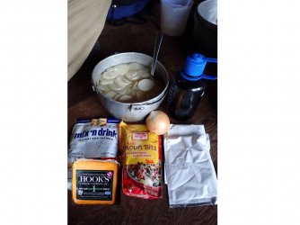
Another of Ken's gourmet meals--scalloped potatoes. You soak the dried potatoes all day so need to make it on a non-paddling day
Day 9
A relatively short day today. And marine weather forecast looked good. We should be protected from the wind as we start moving up the southeastern side of the island. We were headed for Long Point, where Ken had camped before.
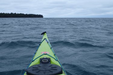
It was windy until we rounded Cumberland point and turned to the northeast
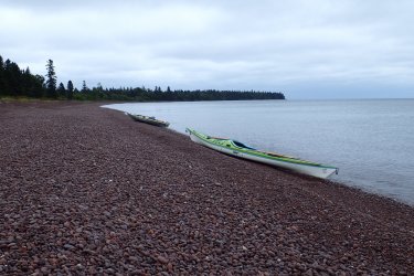
Rest stop at Rainbow Cove. This part of the island is made of reddish brown conglomerate rather than the dark volcanic rocks we had been seeing up until now. The beaches, however, are still just rocks.
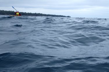
We were sheltered from the north wind but there were some decent size swells left over from the storm.
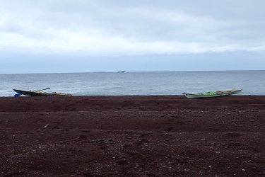
The beach at Long Point with our kayaks, the Isle Royale Queen (another park service ferry) and a Great Lakes ore boat
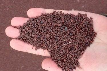
Isle Royale "sand"
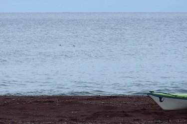
The two dark specks are otters. They cruised by shortly after we arrived.
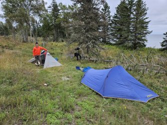
Camp at Long Point. There were a lot of meadows here where bedrock was about six inches below the ground.
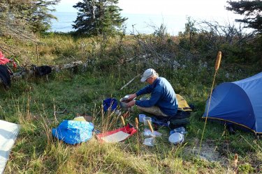
Master chef at work
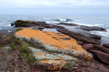
Moss and lichens at Long Point
Day 10
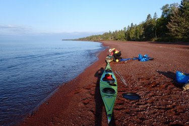
Loading the boats in the morning. There was no way to get a good picture without my shadow in it.
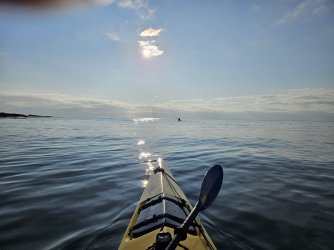
Slight tailwind today! Still some swells left over from the storm but nice and smooth overall.
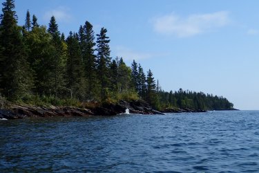
On this side of Isle Royale the rock layers are inclined upward into the island. That makes for a gentler slope along the shoreline.
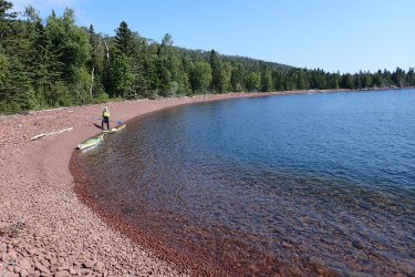
Quick break at Little Boat Harbor
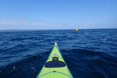
We had planned to stay at the campground in Siskiwit Bay but were getting a little worried about making our ferry connection. Conditions were good for cutting straight across to Malone Bay instead so that's what we did. Here we are starting the crossing.
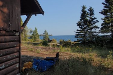
It was a long paddle to Malone Bay but we had a tailwind most of the way. We stayed in a shelter there.
Day 11
The plan for today was a short paddle up to Chippewa Harbor. But beyond Chippewa Harbor is an exposed section of shoreline where you really want favorable winds. The weather forecast was for gentle tailwinds today but difficult winds tomorrow so we opted to press on to Daisy Farm instead. I was really looking forward to Chippewa Harbor but we definitely made the right call as the wind really did pick up the next day. Anyway, it was a beautiful day on the water.
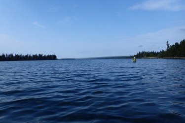
Leaving Malone Bay
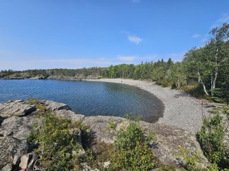
Lunch stop at Greenstone Beach. We are back in the volcanic rocks now.
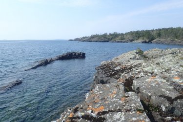
Looking back the way we came. You can really see the rock layers sloping up out of the lake here.
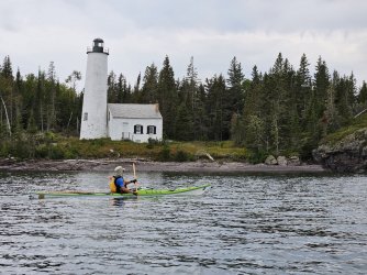
Rock Harbor lighthouse
Day 12
The wind came up strong today out of the northwest so we stayed close to camp. The Edison Fish Camp and Rock Harbor lighthouse were just across the bay from Daisy Farm campsite and it was sheltered enough water we could paddle over there.
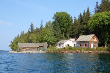
Pete and Laura Edison lived here in the ice-free months for decades making their living by fishing. We met a woman at Daisy Farm campsite who had been out here in, I think around 1970, and paddled over to see the fish camp. Pete Edison was still there at that time and he gave her a tour and fed her lunch. Now it is staffed by National Park people during the summer.
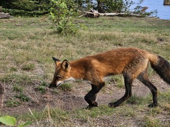
A very tame fox near the dock at Daisy Farm. There are no bears or raccoons on Isle Royale to steal your food. And very few rodents. So far the wolves also leave you alone. We were warned that the foxes were known to carry off all manner of small items left lying about. We didn't have any trouble with them but they sure did not have any fear of people.
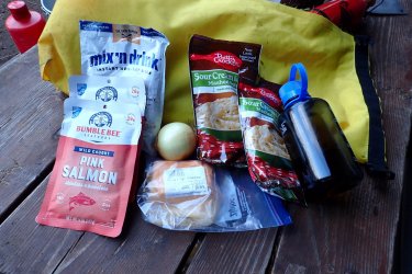
Another gourmet meal
Day 13
Hiked up to the Greenstone Ridge again today then broke camp for a short paddle up to Tookers Island. A pretty bad headwind and some big waves on the open lake but we had relatively sheltered paddling through a bunch of small islands.
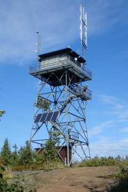
Mount Ojibway lookout.
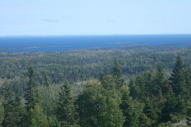
View from the tower. We paddled through those islands on the first day.
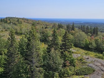
Another view from the tower. Later today we'll be paddling through some of the small islands in the distance.
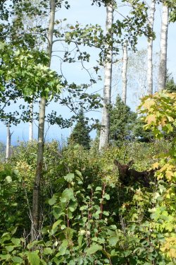
On the way down from the lookout we saw our first and only moose of the trip
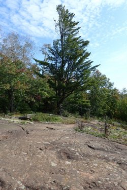
Glacially striated bedrock and a large white pine
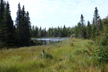
Typical Isle Royale wetland
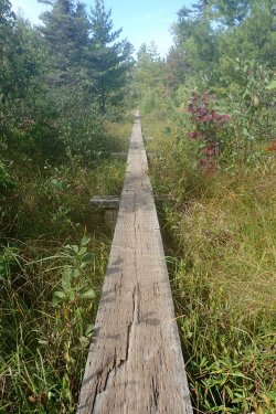
Long boardwalk through a large wetland
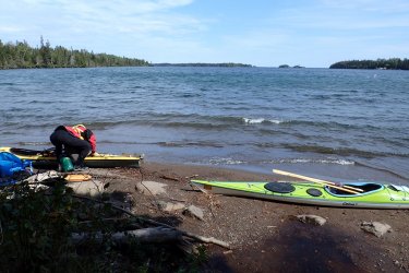
Getting ready to launch into another headwind.
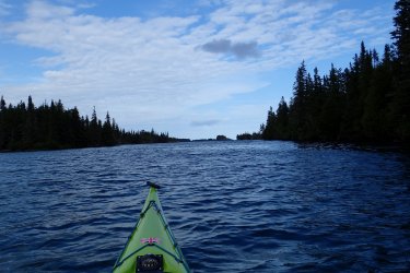
Luckily we were able to thread our way between small islands and avoid most of the wind
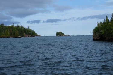
And the islands sheltered us from waves
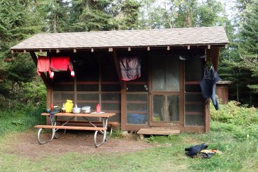
We had another nice dry shelter on Tookers Island
Day 14
Last night the wind just howled and we could hear the waves pounding our island where it faced Lake Superior. I started worrying we would be windbound again and would miss our ferry. I finally had to put in earplugs to try to stop obsessing about the weather. Turned out conditions were not bad where we would be paddling.
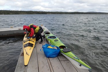
Getting ready for the last paddling of the trip. Only a mile and a half back to Rock Harbor but we'll have a wicked headwind. Luckily we'll be sheltered from the main lake so no big waves.
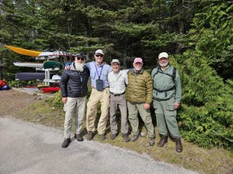
Back at Rock Harbor we ran into Wayne and Sam, whom we had met on Belle Isle at the start of our trip. Wayne, Ken, me, Sam and their friend... whose name I cannot recall at the moment, who joined them on Belle Isle after we left.
There are shelters at the campsite at Rock Harbor but none were empty when we arrived. A young woman, Sam, had a shelter to herself and invited Ken and I to share it with her. She had just finished a week-long backpacking trip and was heading out tomorrow on the Ranger III with us. Apart from Wayne and Sam we met only one other kayaking party. We met one canoeist. The vast majority of people come here to go backpacking. The weather was beautiful so we took a brief hike out to Scoville Point
Day 15
Broke camp, got situated on the ferry and cruised back to Houghton today. The crossing was nice and smooth. Quite a bit more enjoyable than the ride out there!
This was a great trip but a little stressful. We used up a lot of our weather days early in the trip and started to worry about making it back to catch the ferry. We were heading out on the last run of Ranger III back to Houghton so if we missed it we would have been in a bind. There would have been other options but the hassle and expense could have been bad.
Day Zero

The Ranger III before boarding in Houghton, MI. This is a pretty big boat and I had taken my meclazine so I was confident I would make the crossing without getting seasick. Hahahahahaha!

Upper deck passenger seating. They take all your gear (including kayaks or canoes) and load it separately. So you just bring a "carry-on" with you to the seating area.

Canteen on lower level. Closed for Covid and never reopened.

Lift bridge on the way out to Lake Superior

It started getting rough so I headed down to the lower deck in the stern of the ship, where wave motion is least. Still got really seasick. Just miserable.

Ranger III at Rock Harbor
Here is a map of our route:
Click here to view on CalTopo
Day 1

Rock Harbor on Isle Royale is sort of a zoo. There is a lodge there plus a restaurant, post office, general store and park visitor center and a large campground. Since the ferry arrived in the afternoon and I was in no shape to go anywhere we camped at Rock Harbor the first night. Here we are getting ready to head out the next morning. The people in the background are getting ready to board the...

...Isle Royale Queen IV headed for Copper Harbor, MI. It was supposed to be there yesterday but it was too rough for this smaller boat to make the trip across.

We were soon on the water headed north with a tailwind hoping to round the northeast end of the island and put the infamous Blake Point behind us.

Here is the infamous Blake Point. It is super exposed and can be treacherous. With a southwest wind it was a piece of cake. But as soon as we rounded the point we had a good 15 kt wind in our faces. Too rough to take pictures for a while after that.

To avoid the wind we decided to paddle up Duncan Bay and take the Canoe portage across to the main lake.

Duncan Bay Narrows Campsite. Many of the campsites on the water are equipped with screened, 3-sided shelters. We stayed in several of these (but not this one).

Kayaks are not made for portaging but the several-hundred-yard carry beat miles of strong headwind.

The rest of the day was a mix of sheltered water and headwinds.

Our shelter on Belle Isle

Moonrise on Belle Isle
Day 2,3,4

Getting ready to leave Belle Isle. We met Wayne and Sam there. They were base-camping and fishing. They invited us to join them for a fish dinner but we needed to take advantage of good paddling weather and move on, They took our picture as we were heading out. We got their picture when we met them again at the end of the trip.

Leaving Belle Isle. Unfortunately my camera lens was fogged up.

On the way to Todd Harbor.

I think this was the closest thing to sand we saw the entire trip. Isle Royale is made mostly of virtually quartz-free igneous rock that does not yield much in the way of sand. A good beach on Isle Royale is one made of smaller rocks.

A picture of Ken and my finger

Typical shoreline on the northwestern side of the island. The lava flows and other layers dip to the southeast so in this side of Isle Royale they tend to break across the layers and form a steep, inaccessible coast. You can just make out the bedding planes dipping into the cliff.
We spent three nights at Todd Harbor waiting for good enough conditions to continue paddling. From here to the southwestern end of the island the shoreline is very exposed and there are limited options for landing if there is any component of onshore wind. But there are good hiking opportunities from here. Unfortunately we were here on Labor Day weekend and were joined by boisterous power-boaters who tied up at the dock overnight.

Beach at Todd Harbor. Nice and sheltered here.

Dinner at Todd Harbor campsite (but forgot to include the parmesan cheese in the photo). Ken is quite the backcountry chef. Olive oil in the Nalgene, onion and garlic ready to be sliced and sauteed.

Here's the onion and garlic!

There are areas of birch/aspen forest on Isle Royale that are very open. I have not seen forest like this anywhere else. Another oddity of the forest here is cold-climate boreal forest at the lowest elevations adjacent to Lake Superior and warmer-climate eastern forest at higher elevations away from the cold lake.

View to southeast from the central spine of the island, Greenstone Ridge. Looking at Siskiwit Lake with Lake Superior behind. Our camp is behind us. We'll be paddling the shoreline visible here in a week or so. Useless trivia: the leftmost island visible here in Siskiwit Lake is Ryan Island, the largest island in the largest lake in the largest island in the largest lake in the world.

More interesting forest

Blue-bead lily berries

Doll's eye berries

Solomon seal berries

Fall color in the undergrowth. I think the reddish plant is wild sarsaparilla.

Yellowstone NP has lots of signs adorned with elk antlers, here it's moose.

One of the many wetlands on Isle Royale.

Beaver lodge and beaver

Hatchet Lake

We also hiked to an old copper mine site and found some native copper in the tailings. Ken was really good at finding it. I hardly found any.

Thimbleberries
Day 5, 6
Good paddling weather today with a bit of a headwind. We had to make a critical decision. We could either make it a short day and stop at Little Todd Harbor or press on to Hugginin Cove. Listening to the weather radio we were getting a pretty consistent forecast of all hell breaking loose in three nights with some excellent paddling weather the day before. We opted for two nights at Little Todd, a beautiful, secluded camp, then one long day to Grace Island. The storm was predicted to come out of the north and Ken was pretty sure the camp shelters on Grace were nestled on the south side of the island.

Headed for Little Todd. The view ahead is typical of this part of the shoreline--steep and rocky right to the water as far as you can see. We will need one full day of the right wind to make it along here.

Beach at Little Todd Harbor camp

Wonderful campsite with driftwood furniture. We brought my MSR Whisperlight stove and Ken's gigantic cook kit. Since you are not carrying everything on your back you can put what amounts to an infinite amount of fuel in the stern of the kayaks and cook some pretty elaborate meals.

What's for dinner tonight?

Chicken and dumplings! Courtesy of Ken, the master chef.

Ken had the great idea to hike cross-country up to Greenstone Ridge to the lookout tower at Ishpeming Point. He had done a similar hike 30 years ago and assured me the forest was much more open than I might think. Actually, he was right and it turned out to be a fun hike. A few places were pretty thick and you had to thread needles between wetlands but overall it was fairly easy walking.

The forest had grown up since the tower was built so there was not much of a view but it was still worth the walk
Day 7
18 mile paddle today to Grace Island. Weather forecast predicted light tailwind so should not be too difficult. Well, somehow they were off 180 degrees on the wind direction and we had a slight headwind most of the day. The marine forecast for tonight included a gale warning and predicted waves of four to eight feet with some waves to ten feet. The shoreline we were paddling would be facing right into the storm so we were keen to get to the sheltered waters around Grace Island.

It was a beautiful day and we made good time

There were not many places to stop. This beach was typical

By late afternoon the wind died completely and it was strangely calm. Here we are rounding the southwest end of Isle Royale and approaching Grace Island.

Luckily there was a shelter available and we moved right in and pulled our boats way up out of the water in anticipation of the storm.

The camp shelters faced south and were on the south side of the island--perfect for weathering this storm. About the time we got our dinner dishes put away it started raining. There was rain, wind and lightning all night. Since the storm was coming from the north and the shelter face south we didn't need a tarp over the screened side of the shelter. No way the wind could possibly shift, right? Well, we woke up at 4 AM with rain blowing right in. About the time we got the tarp up the wind shifted back to the north. Oh well, should have put it up before going to sleep.

It blew and rained all day the next day so we stayed put and napped, read and ate.

Another of Ken's gourmet meals--scalloped potatoes. You soak the dried potatoes all day so need to make it on a non-paddling day
Day 9
A relatively short day today. And marine weather forecast looked good. We should be protected from the wind as we start moving up the southeastern side of the island. We were headed for Long Point, where Ken had camped before.

It was windy until we rounded Cumberland point and turned to the northeast

Rest stop at Rainbow Cove. This part of the island is made of reddish brown conglomerate rather than the dark volcanic rocks we had been seeing up until now. The beaches, however, are still just rocks.

We were sheltered from the north wind but there were some decent size swells left over from the storm.

The beach at Long Point with our kayaks, the Isle Royale Queen (another park service ferry) and a Great Lakes ore boat

Isle Royale "sand"

The two dark specks are otters. They cruised by shortly after we arrived.

Camp at Long Point. There were a lot of meadows here where bedrock was about six inches below the ground.

Master chef at work

Moss and lichens at Long Point
Day 10

Loading the boats in the morning. There was no way to get a good picture without my shadow in it.

Slight tailwind today! Still some swells left over from the storm but nice and smooth overall.

On this side of Isle Royale the rock layers are inclined upward into the island. That makes for a gentler slope along the shoreline.

Quick break at Little Boat Harbor

We had planned to stay at the campground in Siskiwit Bay but were getting a little worried about making our ferry connection. Conditions were good for cutting straight across to Malone Bay instead so that's what we did. Here we are starting the crossing.

It was a long paddle to Malone Bay but we had a tailwind most of the way. We stayed in a shelter there.
Day 11
The plan for today was a short paddle up to Chippewa Harbor. But beyond Chippewa Harbor is an exposed section of shoreline where you really want favorable winds. The weather forecast was for gentle tailwinds today but difficult winds tomorrow so we opted to press on to Daisy Farm instead. I was really looking forward to Chippewa Harbor but we definitely made the right call as the wind really did pick up the next day. Anyway, it was a beautiful day on the water.

Leaving Malone Bay

Lunch stop at Greenstone Beach. We are back in the volcanic rocks now.

Looking back the way we came. You can really see the rock layers sloping up out of the lake here.

Rock Harbor lighthouse
Day 12
The wind came up strong today out of the northwest so we stayed close to camp. The Edison Fish Camp and Rock Harbor lighthouse were just across the bay from Daisy Farm campsite and it was sheltered enough water we could paddle over there.

Pete and Laura Edison lived here in the ice-free months for decades making their living by fishing. We met a woman at Daisy Farm campsite who had been out here in, I think around 1970, and paddled over to see the fish camp. Pete Edison was still there at that time and he gave her a tour and fed her lunch. Now it is staffed by National Park people during the summer.

A very tame fox near the dock at Daisy Farm. There are no bears or raccoons on Isle Royale to steal your food. And very few rodents. So far the wolves also leave you alone. We were warned that the foxes were known to carry off all manner of small items left lying about. We didn't have any trouble with them but they sure did not have any fear of people.

Another gourmet meal
Day 13
Hiked up to the Greenstone Ridge again today then broke camp for a short paddle up to Tookers Island. A pretty bad headwind and some big waves on the open lake but we had relatively sheltered paddling through a bunch of small islands.

Mount Ojibway lookout.

View from the tower. We paddled through those islands on the first day.

Another view from the tower. Later today we'll be paddling through some of the small islands in the distance.

On the way down from the lookout we saw our first and only moose of the trip

Glacially striated bedrock and a large white pine

Typical Isle Royale wetland

Long boardwalk through a large wetland

Getting ready to launch into another headwind.

Luckily we were able to thread our way between small islands and avoid most of the wind

And the islands sheltered us from waves

We had another nice dry shelter on Tookers Island
Day 14
Last night the wind just howled and we could hear the waves pounding our island where it faced Lake Superior. I started worrying we would be windbound again and would miss our ferry. I finally had to put in earplugs to try to stop obsessing about the weather. Turned out conditions were not bad where we would be paddling.

Getting ready for the last paddling of the trip. Only a mile and a half back to Rock Harbor but we'll have a wicked headwind. Luckily we'll be sheltered from the main lake so no big waves.

Back at Rock Harbor we ran into Wayne and Sam, whom we had met on Belle Isle at the start of our trip. Wayne, Ken, me, Sam and their friend... whose name I cannot recall at the moment, who joined them on Belle Isle after we left.
There are shelters at the campsite at Rock Harbor but none were empty when we arrived. A young woman, Sam, had a shelter to herself and invited Ken and I to share it with her. She had just finished a week-long backpacking trip and was heading out tomorrow on the Ranger III with us. Apart from Wayne and Sam we met only one other kayaking party. We met one canoeist. The vast majority of people come here to go backpacking. The weather was beautiful so we took a brief hike out to Scoville Point
Day 15
Broke camp, got situated on the ferry and cruised back to Houghton today. The crossing was nice and smooth. Quite a bit more enjoyable than the ride out there!
This was a great trip but a little stressful. We used up a lot of our weather days early in the trip and started to worry about making it back to catch the ferry. We were heading out on the last run of Ranger III back to Houghton so if we missed it we would have been in a bind. There would have been other options but the hassle and expense could have been bad.
Last edited:
