misSOULa
Onward and upward
- Joined
- Aug 20, 2016
- Messages
- 49
I received an invitation to join in on an attempt of Wyoming's tallest point, Gannett Peak back in May. Knowing it was one of the hardest state high points due to its remoteness, weather, and potential for technical climbing, I began to do my homework and research. I gathered that the best time window tends to be early July, as snow conditions can make glacial travel over Dinwoody glacier more safe, as well as keeping the bergschrund of Gooseneck glacier closed. However for reading every successful attempt story, I read 3-4 unsuccessful bids, for many various reasons. I also had no experience on snow travel requiring ice axes/crampons/setting up snow anchors to climb, aside from a glacier travel safety class I took earlier in the Spring with a group I am a part of called the RockyMountaineers. The "leader" of the party, my friend Royce, however has taken a full mountaineering course, and has climbed peaks most of the cascade volcanoes such as Rainier, Adams, and Baker. I knew physically I was up for the challenge, so I threw my hat into the ring. A group of four dwindled down to just the two of us when we decided to make our eight hour drive from Missoula, MT down to Pinedale, WY, and get our first experience of the Wind River range.
Here is our route on Caltopo:
Click here to view on CalTopo
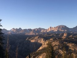
Night one: Getting to the Elkhart Park trailhead at about 6pm, we loaded our packs with much more gear than I am used to carrying on a multi-day trip: iceaxe, crampons, harness/protection, snow picket, and 60m climbing rope. I never weighed my pack, but I would estimate it to be around the 50lb mark. The highest altitude I had been to prior to this trip was 10,179, so I would be breaking my own record with practically every step I took. We hustled to photographer point with the sun beginning to set, and got to Eklund lake just as it began to get dark. The mosquitoes were horrendous so the tent was put up hastily, beanbags hung, and quickly to bed. Tomorrow was going to a long haul to get as far into Titcomb Basin as we could.
Photographer Point
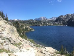
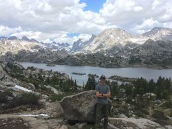
Day Two: From Eklund lake we passed by multiple lakes including Seneca Lake, with lots of up and down. The trail was in a very mucky state. We crossed paths with many backpackers in search of fish, which I would imagine with so many mosquitoes, they were having good luck. One couple on their way with climbing gear stopped we asked them where they had been climbing. An attempt on Gannett was foiled by going up the wrong snow chute, running out of time on the summit ridge with the top only 500 feet away. They warned us about the marmots in the basin, which will chew anything left out, their trekking pole handles the victim. Eventually getting to Island Lake, you get that million dollar view. No wonder its such a popular destination in the Winds. We kept on slogging back to maybe a half mile above the upper Titcomb Lake, set up camp, and both found ourselves quite tired. We had fortunately planned the trip with a two day window for the summit attempt for weather, rest, etc.
Seneca Lake
Island Lake
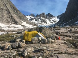
Day Three: We moved our camp to as high as we possibly could up Titcomb Basin, right below the massive granite wall of Helen Peak. A large overhanging boulder with windbreak wall already made was a perfect spot. we went and scoped out our route to Gannett: up and over Bonney Pass. Trying to get our bearings for the area since we were going to be doing an alpine start of 1am. Loading up on as much calories as possible, we set an alarm for midnight and laid in our sleeping bags at 6pm.
Camp from our second night:
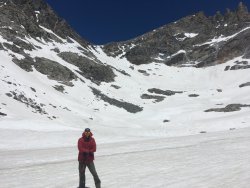
Standing below Bonney Pass:
Day Four: When the alarm went off at midnight, I had not slept for a second. My mind had been racing about the upcoming attempt: what we would see? How steep the climb? Would this be above my experience/comfort zone? It was time to find out. Ice axe in hand, crampons on feet, and headlamps on, we aimed for Bonney Pass by 1am. The moon was partially out so the snow was somewhat visible compared to the dark rock. We found fragments of a boot pack, but would then lose it. So slowly but surely we made our way up the ~30 degree snowfield. The snow conditions were perfect, crampons and axe biting, the wind was dead calm. And I felt absolutely amazing. High energy, focused mindset, truly engaged for the task at hand. Which surprised for from getting no sleep the night prior. My confidence grew as we neared the saddle, making great time, and finally seeing the massive summit of Gannett that had been hidden up until this point. Looking up into the sky took us by surprise as well, a comet! Neither Royce nor I had known about NEOWISE until seeing it at the top of Bonney, a spectacular added bonus. Everything was going great, until it wasn't...
My partner Royce started to really slow down, saying he really didn't feel well. We sat and took a five minute break, when the vommiting began. An attempt to get down water and food led to no avail. He mentions that he's felt this way before, likely signs of altitude sickness. But wanted to see if we could keep going, because Gannett was right there! Another 10 minutes walking down from Bonney onto Dinwoody glacier, and his symptoms only got worse. We sat down again, and with first light beginning to hit the peaks, the tough but wise choice to turn around made. Back at Bonney Pass, I left Royce to make his slow trek back down to camp to rest. I had too many mixed emotions going on internally; of frustration, excitement, clarity. I did not want to make it all the way back here and leave empty handed. So I looked to the west at the ridgeline of Miriam Peak, which I knew nothing about, other than I was not far from the top. Making quick work of the rock/snow hopping, I dropped pack and crampons and found myself at the nontechnical but incredibly exposed summit block. Things were flowing, fear was gone, and I sat atop Miriam peak at approx 5am and watched the alpenglow fade and the sun rise on Gannett, and the numerous other 13,000 ft peaks surrounding me.
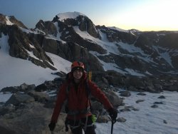
Bonney Pass, with Gannett behind me
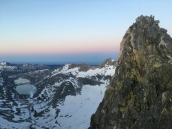
Miriam Peak summit block, with Titcomb Basin below
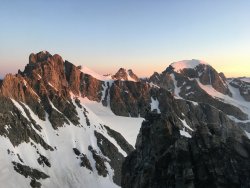
Sitting atop Miriam peak looking north
After a moment or two to soak in this surreal place around me, I hustled back down to catch up with Royce to check on him. Getting back to camp, he laid down to rest for a few hours. Meanwhile I sat on a boulder with my thoughts to try assure myself that not getting the summit of Gannett was okay, and to appreciate where I was. He was still not feeling a 100%, we made it as far out as we could that day, setting up camp at Island Lake.
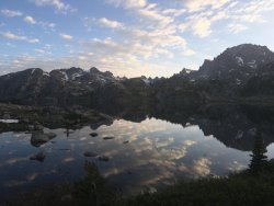
Day Five: A long, 11 mile push back to the trailhead, with our eyes kept to the ground. The reward: a beer and burger at Wind River Brewing, a mighty fine way to finish the trip. Except for the eight hour drive back home. I'll be back for Gannett one day, just not anytime soon.
Cheers
A short film I made of my trip:
Here is our route on Caltopo:
Click here to view on CalTopo
Night one: Getting to the Elkhart Park trailhead at about 6pm, we loaded our packs with much more gear than I am used to carrying on a multi-day trip: iceaxe, crampons, harness/protection, snow picket, and 60m climbing rope. I never weighed my pack, but I would estimate it to be around the 50lb mark. The highest altitude I had been to prior to this trip was 10,179, so I would be breaking my own record with practically every step I took. We hustled to photographer point with the sun beginning to set, and got to Eklund lake just as it began to get dark. The mosquitoes were horrendous so the tent was put up hastily, beanbags hung, and quickly to bed. Tomorrow was going to a long haul to get as far into Titcomb Basin as we could.
Photographer Point

Day Two: From Eklund lake we passed by multiple lakes including Seneca Lake, with lots of up and down. The trail was in a very mucky state. We crossed paths with many backpackers in search of fish, which I would imagine with so many mosquitoes, they were having good luck. One couple on their way with climbing gear stopped we asked them where they had been climbing. An attempt on Gannett was foiled by going up the wrong snow chute, running out of time on the summit ridge with the top only 500 feet away. They warned us about the marmots in the basin, which will chew anything left out, their trekking pole handles the victim. Eventually getting to Island Lake, you get that million dollar view. No wonder its such a popular destination in the Winds. We kept on slogging back to maybe a half mile above the upper Titcomb Lake, set up camp, and both found ourselves quite tired. We had fortunately planned the trip with a two day window for the summit attempt for weather, rest, etc.
Seneca Lake

Island Lake

Day Three: We moved our camp to as high as we possibly could up Titcomb Basin, right below the massive granite wall of Helen Peak. A large overhanging boulder with windbreak wall already made was a perfect spot. we went and scoped out our route to Gannett: up and over Bonney Pass. Trying to get our bearings for the area since we were going to be doing an alpine start of 1am. Loading up on as much calories as possible, we set an alarm for midnight and laid in our sleeping bags at 6pm.
Camp from our second night:

Standing below Bonney Pass:

Day Four: When the alarm went off at midnight, I had not slept for a second. My mind had been racing about the upcoming attempt: what we would see? How steep the climb? Would this be above my experience/comfort zone? It was time to find out. Ice axe in hand, crampons on feet, and headlamps on, we aimed for Bonney Pass by 1am. The moon was partially out so the snow was somewhat visible compared to the dark rock. We found fragments of a boot pack, but would then lose it. So slowly but surely we made our way up the ~30 degree snowfield. The snow conditions were perfect, crampons and axe biting, the wind was dead calm. And I felt absolutely amazing. High energy, focused mindset, truly engaged for the task at hand. Which surprised for from getting no sleep the night prior. My confidence grew as we neared the saddle, making great time, and finally seeing the massive summit of Gannett that had been hidden up until this point. Looking up into the sky took us by surprise as well, a comet! Neither Royce nor I had known about NEOWISE until seeing it at the top of Bonney, a spectacular added bonus. Everything was going great, until it wasn't...
My partner Royce started to really slow down, saying he really didn't feel well. We sat and took a five minute break, when the vommiting began. An attempt to get down water and food led to no avail. He mentions that he's felt this way before, likely signs of altitude sickness. But wanted to see if we could keep going, because Gannett was right there! Another 10 minutes walking down from Bonney onto Dinwoody glacier, and his symptoms only got worse. We sat down again, and with first light beginning to hit the peaks, the tough but wise choice to turn around made. Back at Bonney Pass, I left Royce to make his slow trek back down to camp to rest. I had too many mixed emotions going on internally; of frustration, excitement, clarity. I did not want to make it all the way back here and leave empty handed. So I looked to the west at the ridgeline of Miriam Peak, which I knew nothing about, other than I was not far from the top. Making quick work of the rock/snow hopping, I dropped pack and crampons and found myself at the nontechnical but incredibly exposed summit block. Things were flowing, fear was gone, and I sat atop Miriam peak at approx 5am and watched the alpenglow fade and the sun rise on Gannett, and the numerous other 13,000 ft peaks surrounding me.
Bonney Pass, with Gannett behind me

Miriam Peak summit block, with Titcomb Basin below

Sitting atop Miriam peak looking north

After a moment or two to soak in this surreal place around me, I hustled back down to catch up with Royce to check on him. Getting back to camp, he laid down to rest for a few hours. Meanwhile I sat on a boulder with my thoughts to try assure myself that not getting the summit of Gannett was okay, and to appreciate where I was. He was still not feeling a 100%, we made it as far out as we could that day, setting up camp at Island Lake.

Day Five: A long, 11 mile push back to the trailhead, with our eyes kept to the ground. The reward: a beer and burger at Wind River Brewing, a mighty fine way to finish the trip. Except for the eight hour drive back home. I'll be back for Gannett one day, just not anytime soon.
Cheers
A short film I made of my trip:
