Udink
Still right here.
- Joined
- Jan 17, 2012
- Messages
- 1,734
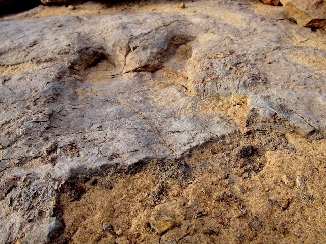
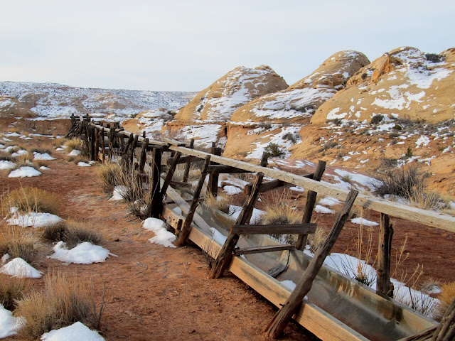
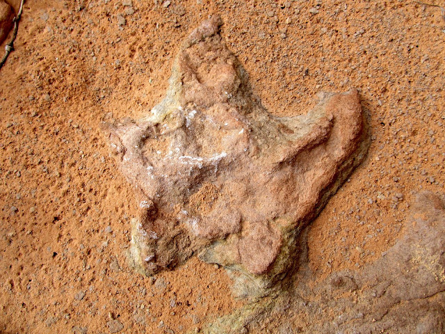
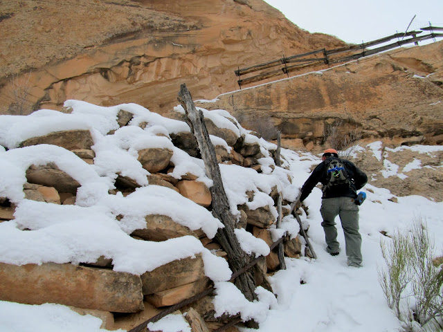
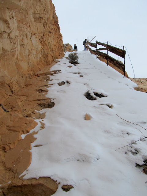
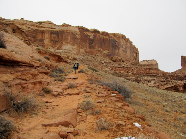
For my last hiking trip of 2013 I finally got an opportunity to visit Horseshoe Canyon. Alan invited me to come along with him, Wade, Kari, and Travis, the latter two of whom I hadn't met but had heard much about from the others. At 6AM on Saturday Alan and Kari swung by my place and picked me up, then we met Wade and Travis near the UT-24/I-70 junction and they hopped in with us. By about 8:40 we were at the trailhead and started hiking down the old road into Horseshoe Canyon, constructed by Lou and Arth Chaffin (and many others) between 1928 and 1929. During the descent we saw a couple of dinosaur footprints fossilized in the sandstone and a water tank and trough used by ranchers before this area became part of Canyonlands National Park in 1971.
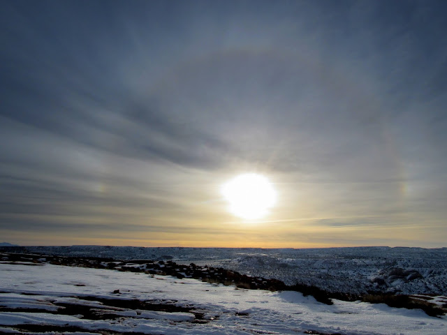
Sun halo at the Horseshoe Canyon trailhead
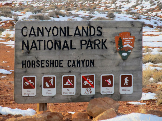
No, no, no, no, no, and yes
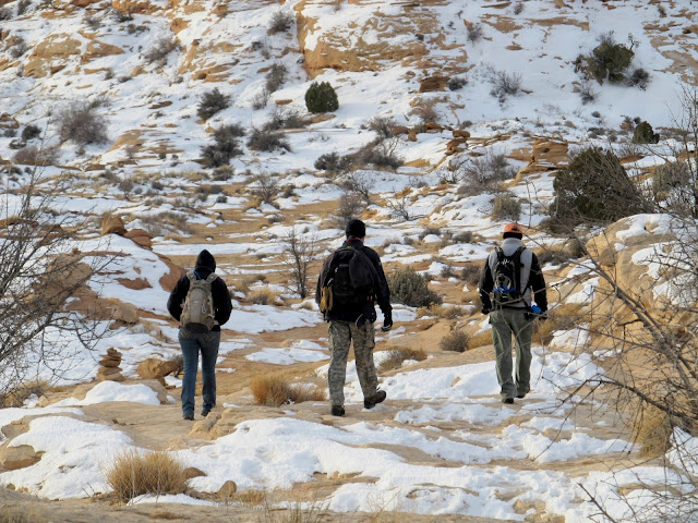
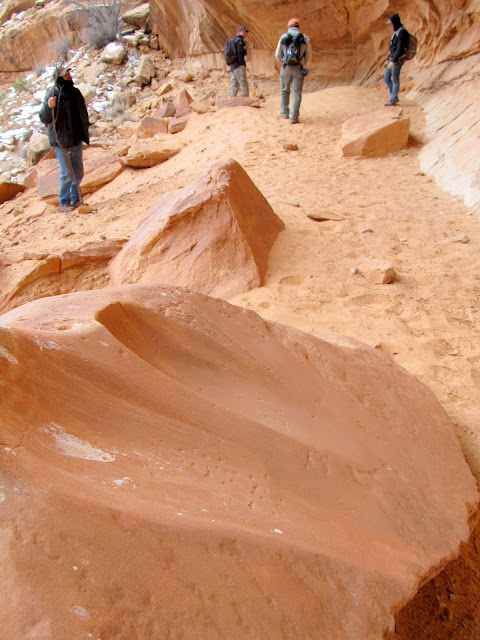
Walking down the old road into Horseshoe Canyon
Dinosaur track
Troughs near a water tank
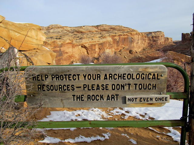
Sign on a gate along the trail
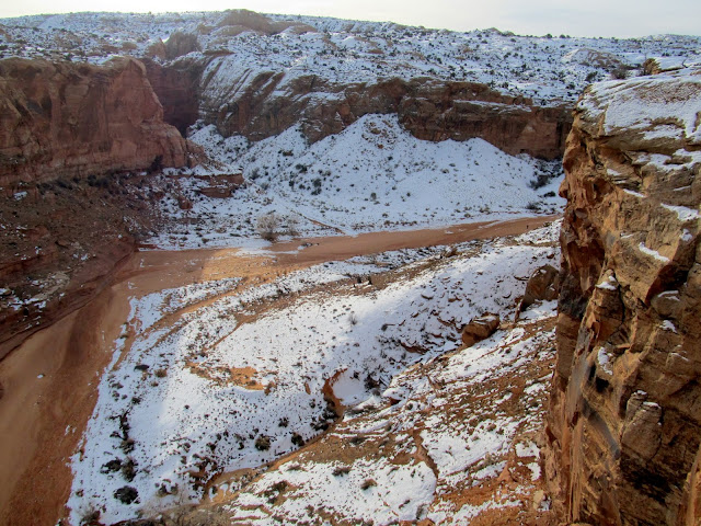
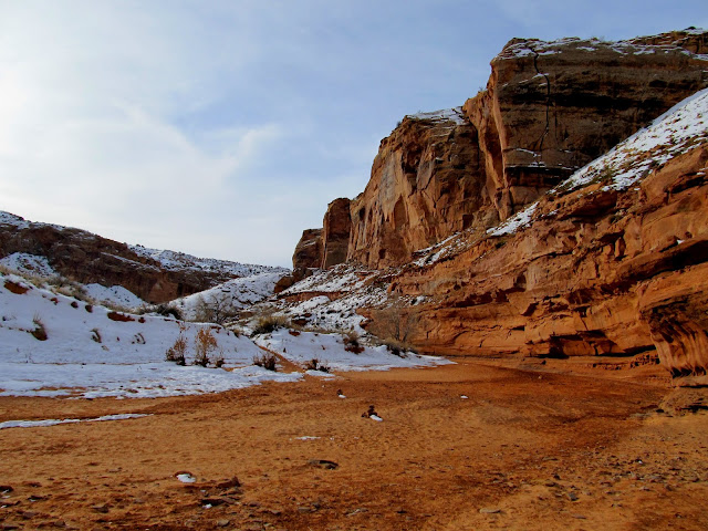
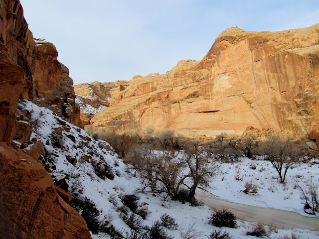
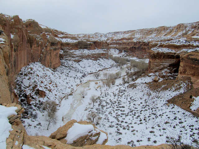
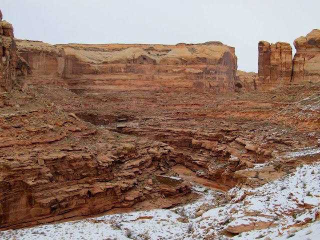
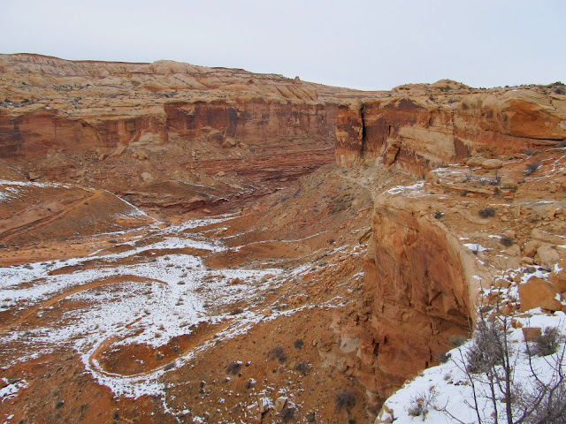
View up Horseshoe Canyon from the trail
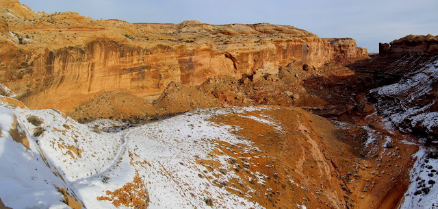
Lower part of the old road into Horseshoe Canyon
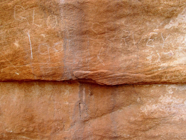
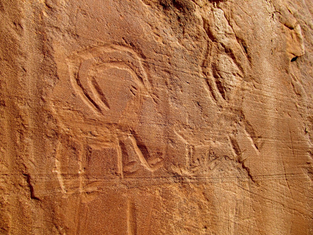
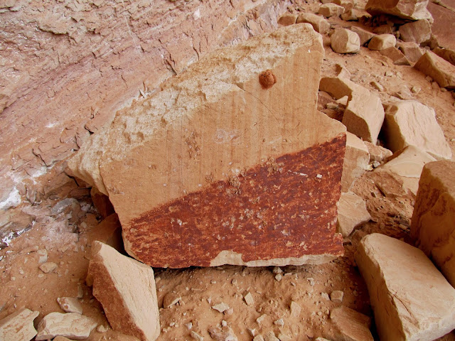
Just below the final break in the cliffs before we reached the canyon bottom there were some inscriptions in the cliff. Some were apparently recent and had been rubbed out or covered with pine sap, presumably by the Park Service, but some were historic and were left alone. My favorite read "GLO Survey," left by members of a survey team from the General Land Office (predecessor to the BLM). We hit the canyon bottom and sort of fanned out, looking for rock art or inscriptions as we hiked up the canyon. There are four main pictograph panels marked on the USGS topo map, and for which coordinates are easily found on the internet, but we were sure we'd find others. And we did. After only ten minutes after reaching the canyon bottom we encountered a small but nice petroglyph panel.
Two inscriptions: GLO Survey and RTB SLC
Bottom of the road in Horseshoe Canyon
The first petroglyph site we encountered
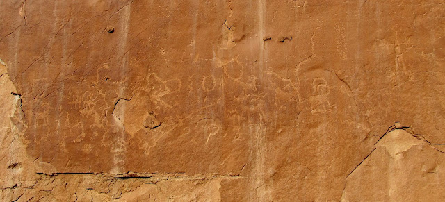
Petroglyphs
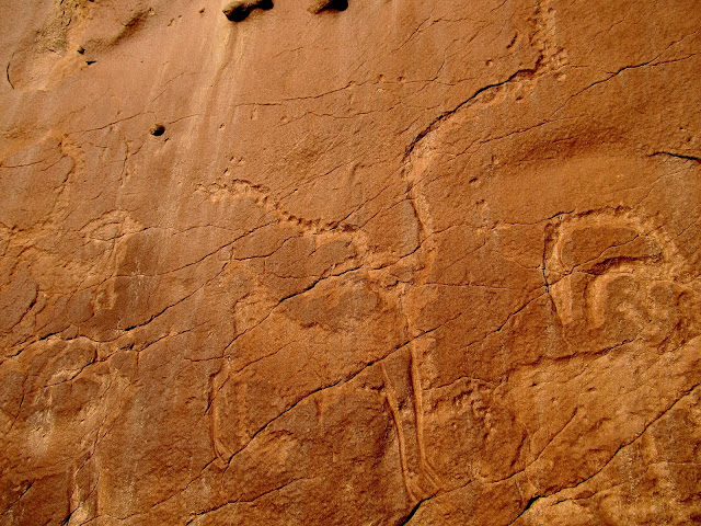
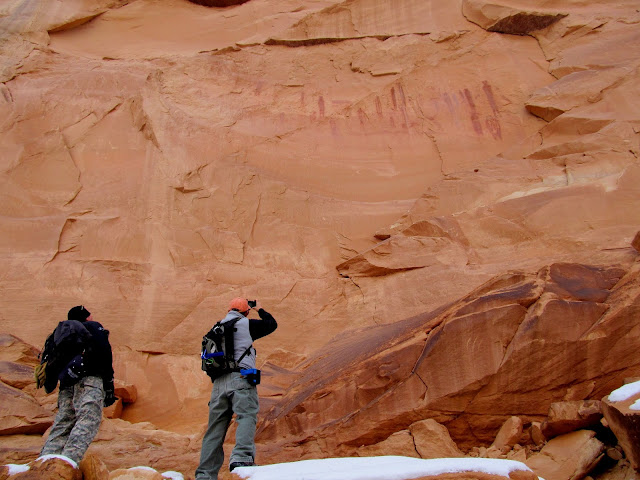
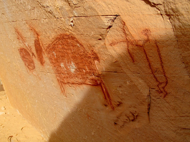
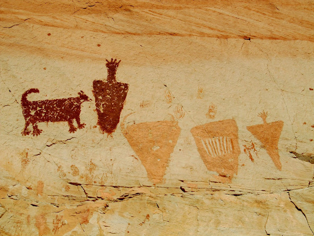
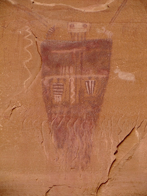
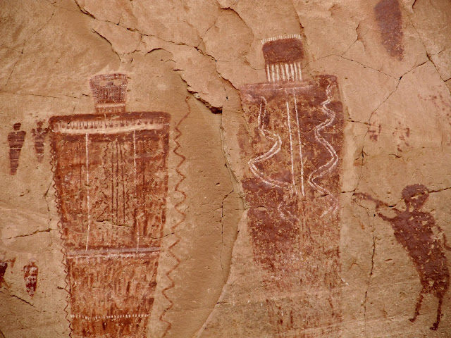
We visited the first two main pictograph panels, named High Gallery and Horseshoe Gallery, which were quite close together. The latter was quite large and had a smattering of petroglyphs and grinding marks in boulders, along with many pictographs.
Approaching the High Gallery
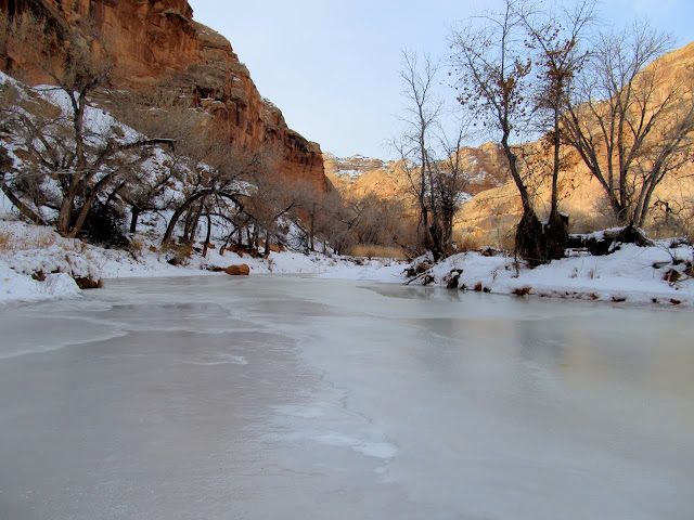
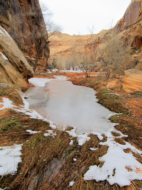
Ice in Horseshoe Canyon
High Gallery
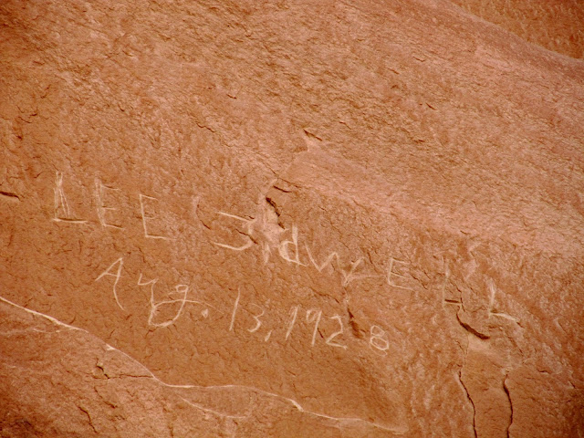
Lee Tidwell, Aug. 13, 1928
View from the High Gallery across the canyon to Horseshoe Gallery
Incised petroglyphs near Horseshoe Gallery
Grinding marks
Travis, Alan, and Kari at Horseshoe Gallery
Hunter waiting in the shadows
Elk
Stick man--incised then painted figure
Horseshoe Gallery
Horseshoe Gallery
Horseshoe Gallery
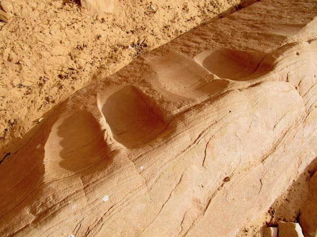
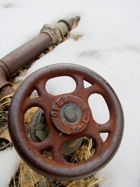
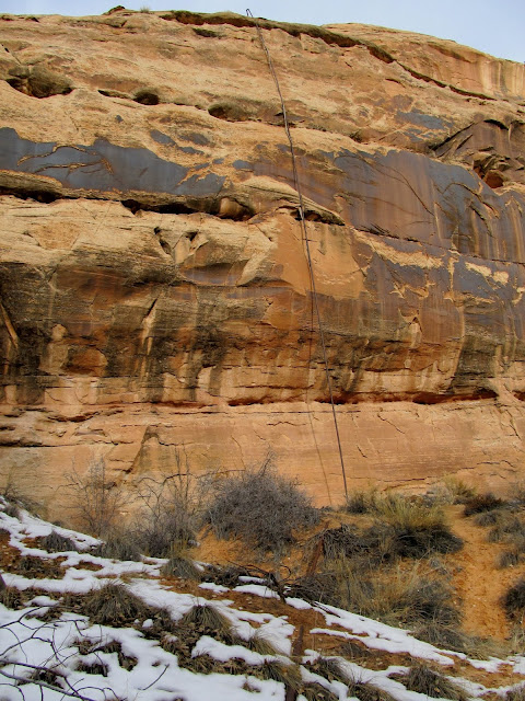
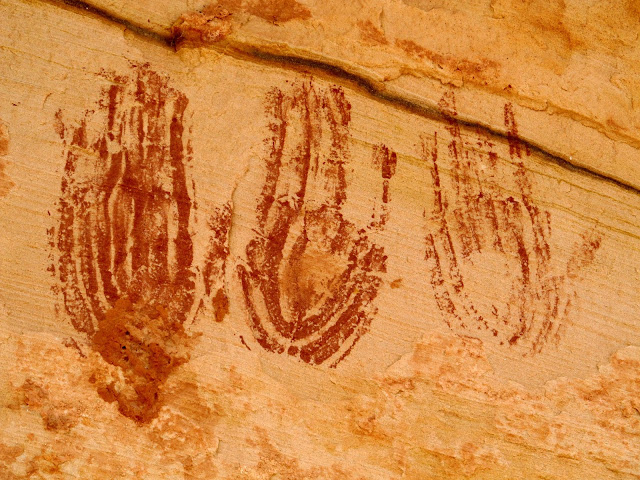
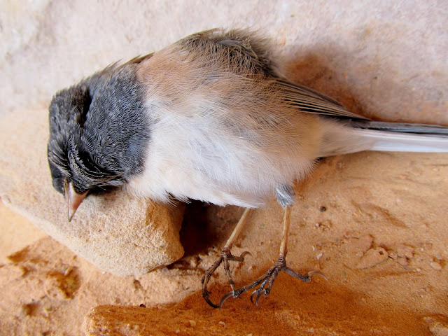
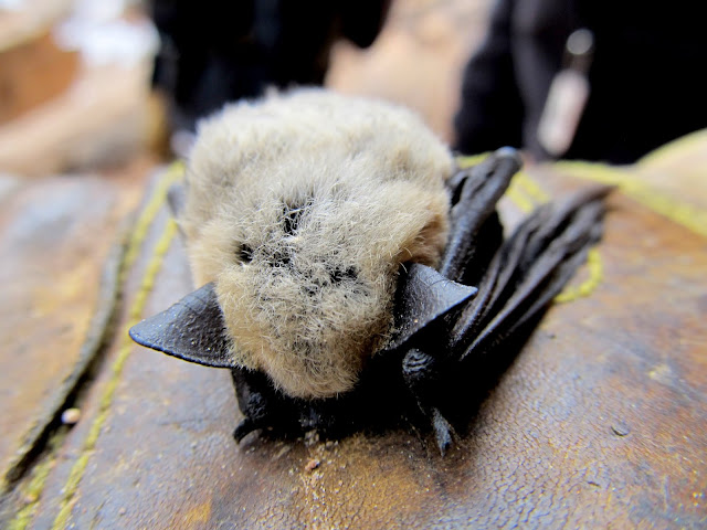
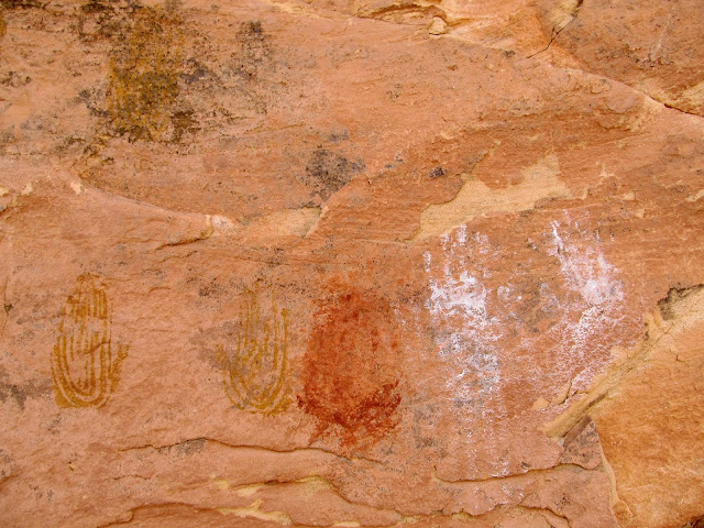
Beyond Horseshoe Gallery was the place where a pipe hangs down the canyon wall, coming in from the water tank and trough we'd passed during the hike in. There used to be a pump in the canyon where ranchers pumped spring water up to the rim, but not much was left except the pipes and a shutoff valve. The next rock art site we found was a small alcove that contained mostly handprint pictographs. We also, strangely, found a dead bird and a dead bat in the alcove.
Water valve
Pipe leading to the canyon rim
Grinding marks in an alcove
Handprint pictographs
Dead bird
Dead bat that was near the dead bird
Handprint pictographs
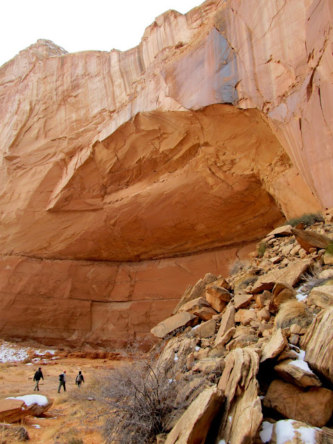
Next we reached Alcove Gallery. The alcove was enormous and must have made quite a comfortable home, providing shelter from the elements and a nice, sandy floor. There were a lot of pictographs and quite a few more modern inscriptions, some of them right over the top of the rock art. Across the canyon from the alcove I spotted a "CLS" inscription written in a cross. It was undated but looked very old, with white lichen growing over the top of it.
Approaching Alcove Gallery
Alcove Gallery
Alcove Gallery
Bob Vance, 1904
View out of the alcove
This CLS inscription was undated but looked quite old
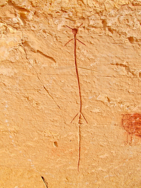
On the way to the main attraction, the Great Gallery, I spotted a single pictograph high up on a cliff and found another dinosaur footprint. We also passed a lone hiker on his way out--his was the only vehicle at the trailhead when we'd arrived.
Lone pictograph
Dinosaur footprint
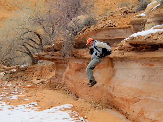
Alan jumping off a ledge
Approaching the Great Gallery
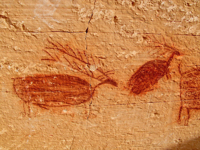
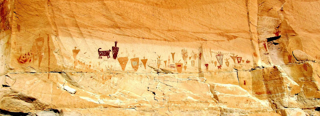
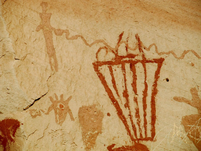
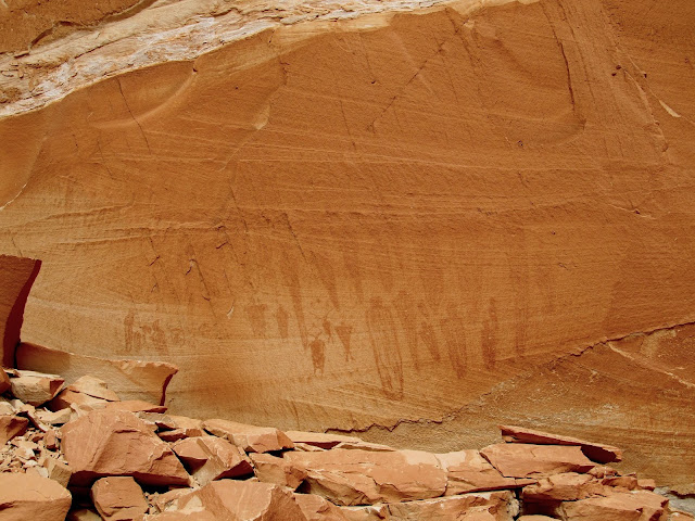
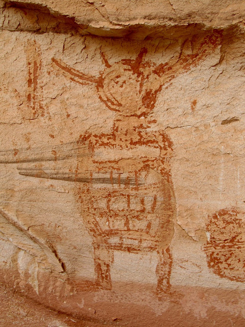
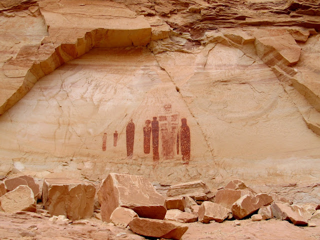
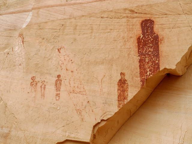
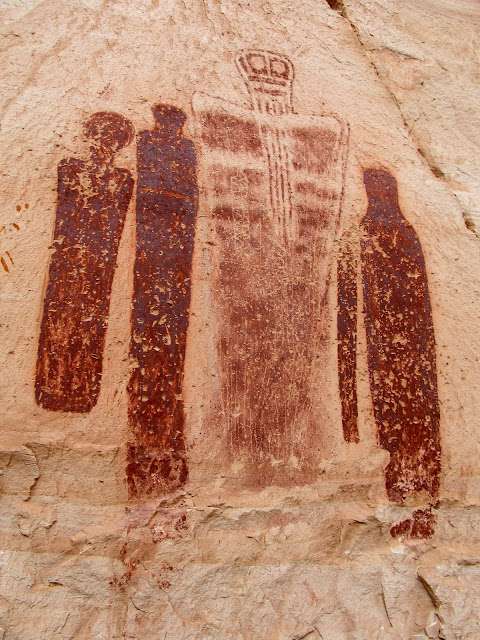
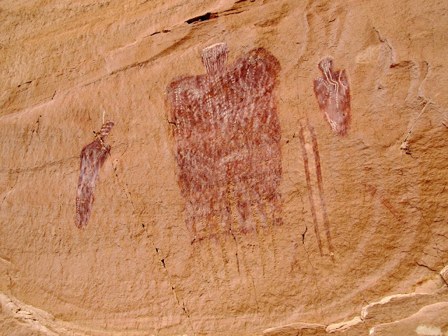
The Great Gallery was, well, great! Alan and I spent a great deal of time photographing the individual pictographs while the others sat down for lunch. We spent about 45 minutes there before moving along and heading farther up the canyon.
Great Gallery
Great Gallery
Great Gallery
Great Gallery
Great Gallery
Fallen rock with pictographs on it
Great Gallery
Great Gallery
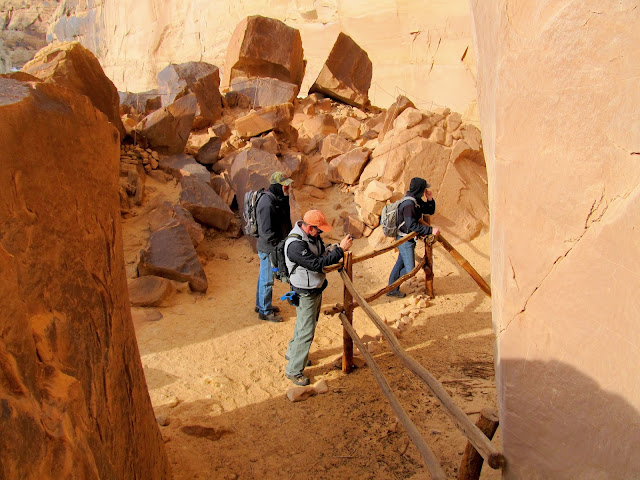
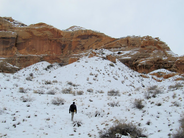
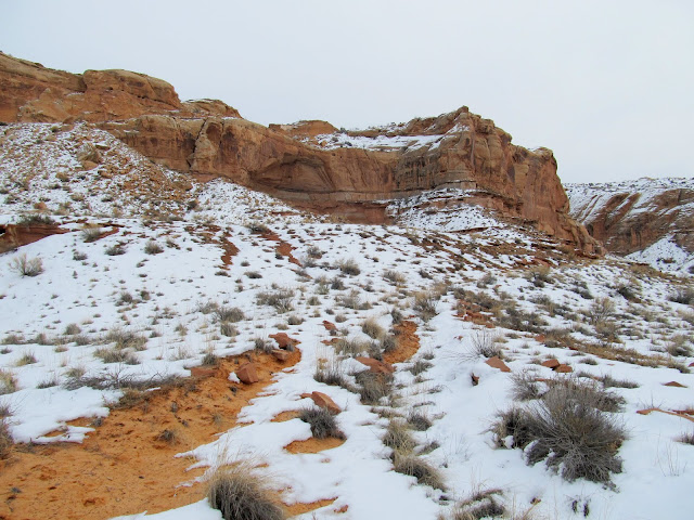
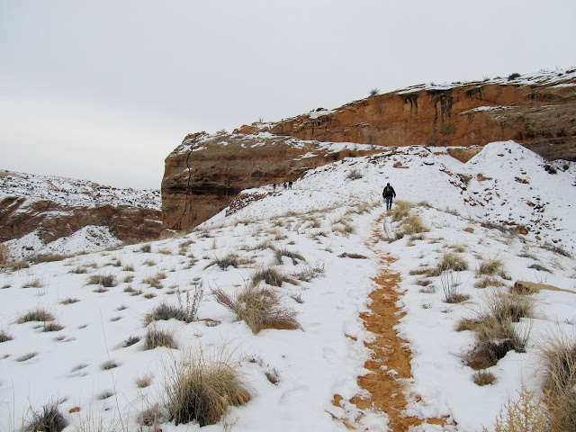
Just up-canyon from the Great Gallery is the Deadman's Trail, an old stock trail blasted out of the canyon wall. It was a steep, snowy ascent up the first part until we reached the spot where the trail goes up a steep sandstone ramp to the canyon rim. We only went as far as the top of the canyon rim, but the trail continues to climb and eventually connects to a dirt road after about a mile. After a brief rest at the top, we turned around and headed back down the canyon, passing another solo hiker just north of the Great Gallery. We took a short hike up Water Canyon but didn't find much of interest there.
Starting up the Deadman's Trail
Deadman's Trail
Deadman's Trail
View up Horseshoe Canyon from the Deadman's Trail
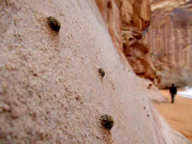
Concretions on the canyon wall
Spring in Water Canyon
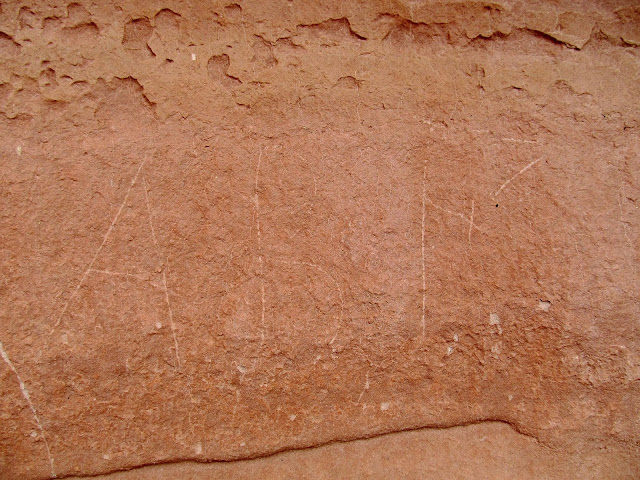
Undated but old-looking ABF inscription near Water Canyon
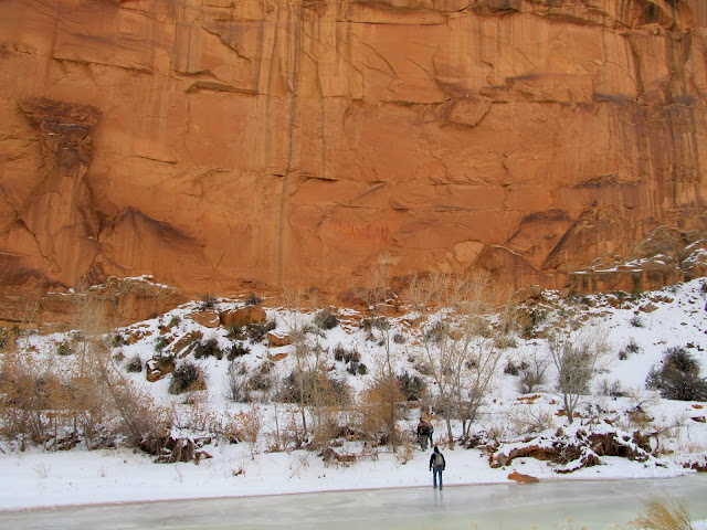
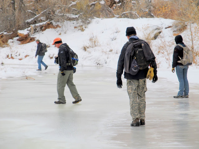
Ice skating across the canyon
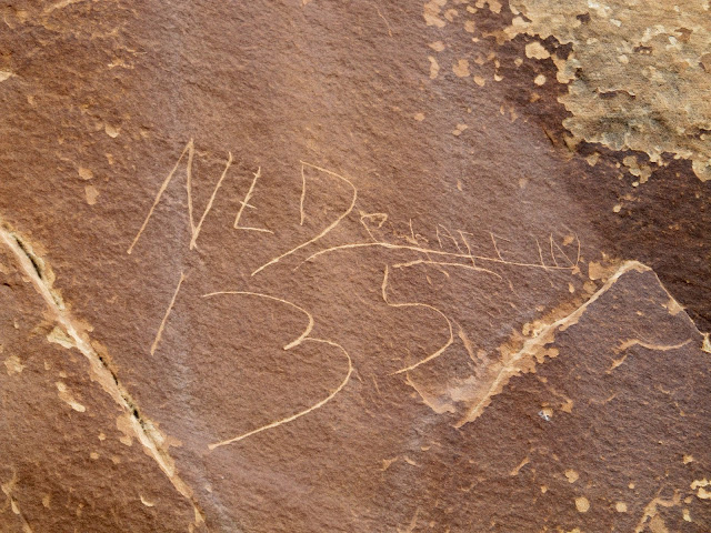
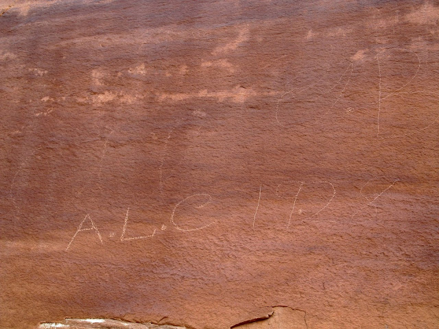
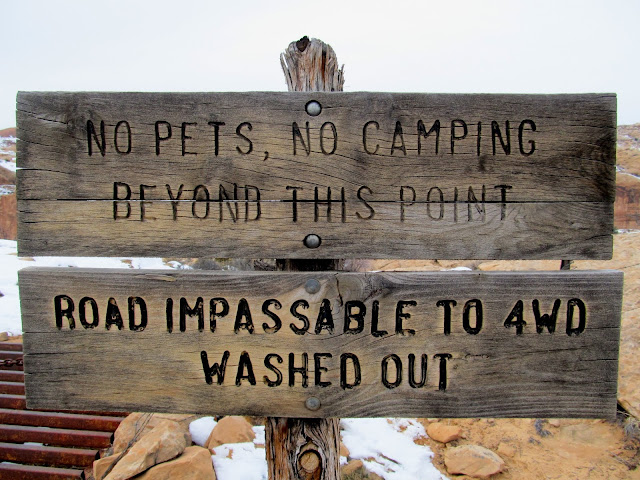
Our final point of interest was the road on the east side of Horseshoe Canyon, opposite from where we'd descended into the canyon that morning. I was out of energy and almost chose not to make the climb out on the east side, but I trudged on and I'm very glad I did. There were a lot of inscriptions from the road builders, including writings by Ned and Arth Chaffin. Some of the inscriptions were 20 feet high on the cliff above the road and had been made before material was blasted away to make the road grade. At the top of the road was an NPS sign-in box and a kiosk with signs telling people all the things they can't do in the National Park. It also mentioned that the road was closed because it was washed out, though I'd wager my mostly-stock Jeep could negotiate it.
Starting up the old road on the east side of Horseshoe Canyon
View down Horseshoe Canyon
Ned Chaffin inscription, presumably from 1935
Bulldozer marks on the side of the old road
A.L.C. (Arthur L. Chaffin) 1928
View of the lower section of the old road
No, no, and I dare you
View across the canyon to the road blasted into the cliffs
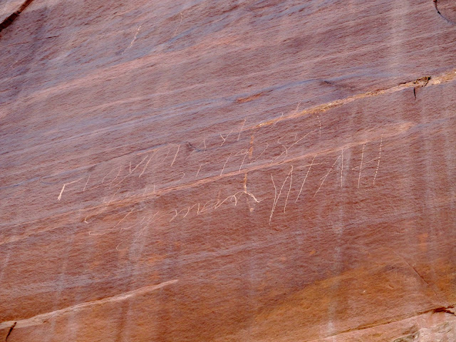
Floyd Taylor, Jan. 25, 1928, Lyman, Utah
We descended back into the canyon and I dragged my ass back up the road on the west side toward the trailhead. We had climbed down into and then back out of the canyon a total of three times. I was the last one back to the truck waiting at the trailhead. The round-trip distance was only 10.3 miles and took about eight hours, but with a lot of elevation loss and gain it had worn me out.
Climbing back up the west side of the old road toward the trailhead
Climbing back up the west side of the old road toward the trailhead
Full photo gallery:
https://picasaweb.google.com/Dennis.Udink/HorseshoeCanyon
[parsehtml]<iframe width="800" height="600" frameborder="0" scrolling="no" marginheight="0" marginwidth="0" src="https://maps.google.com/maps?q=http:%2F%2Fudink.org%2Fgeo%2FHorseshoeCanyon.kmz&hl=en&sspn=0.082005,0.169086&t=h&ie=UTF8&ll=38.458899,-110.205488&spn=0.040326,0.068579&z=14&output=embed"></iframe><br /><small><a href="https://maps.google.com/maps?q=http:%2F%2Fudink.org%2Fgeo%2FHorseshoeCanyon.kmz&hl=en&sspn=0.082005,0.169086&t=h&ie=UTF8&ll=38.458899,-110.205488&spn=0.040326,0.068579&z=14&source=embed" style="color:#0000FF;text-align:left">View Larger Map</a></small>[/parsehtml]http://udink.org/geo/HorseshoeCanyon.kmz
Featured image for home page:

Sun halo at the Horseshoe Canyon trailhead
No, no, no, no, no, and yes
Walking down the old road into Horseshoe Canyon
Dinosaur track
Troughs near a water tank
Sign on a gate along the trail
View up Horseshoe Canyon from the trail
Lower part of the old road into Horseshoe Canyon
Just below the final break in the cliffs before we reached the canyon bottom there were some inscriptions in the cliff. Some were apparently recent and had been rubbed out or covered with pine sap, presumably by the Park Service, but some were historic and were left alone. My favorite read "GLO Survey," left by members of a survey team from the General Land Office (predecessor to the BLM). We hit the canyon bottom and sort of fanned out, looking for rock art or inscriptions as we hiked up the canyon. There are four main pictograph panels marked on the USGS topo map, and for which coordinates are easily found on the internet, but we were sure we'd find others. And we did. After only ten minutes after reaching the canyon bottom we encountered a small but nice petroglyph panel.
Two inscriptions: GLO Survey and RTB SLC
Bottom of the road in Horseshoe Canyon
The first petroglyph site we encountered
Petroglyphs
We visited the first two main pictograph panels, named High Gallery and Horseshoe Gallery, which were quite close together. The latter was quite large and had a smattering of petroglyphs and grinding marks in boulders, along with many pictographs.
Approaching the High Gallery
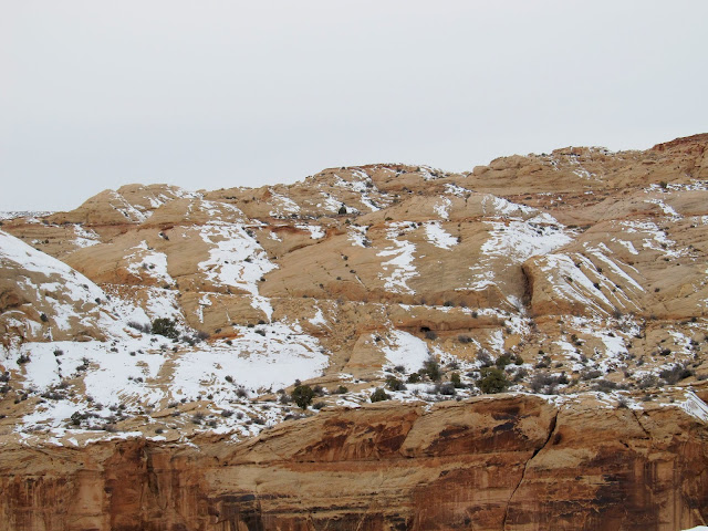
Ice in Horseshoe Canyon
High Gallery
Lee Tidwell, Aug. 13, 1928
View from the High Gallery across the canyon to Horseshoe Gallery
Incised petroglyphs near Horseshoe Gallery
Grinding marks
Travis, Alan, and Kari at Horseshoe Gallery
Hunter waiting in the shadows
Elk
Stick man--incised then painted figure
Horseshoe Gallery
Horseshoe Gallery
Horseshoe Gallery
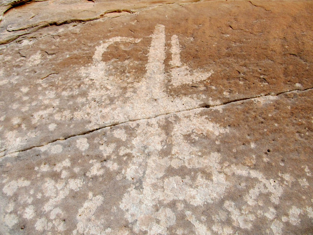
Beyond Horseshoe Gallery was the place where a pipe hangs down the canyon wall, coming in from the water tank and trough we'd passed during the hike in. There used to be a pump in the canyon where ranchers pumped spring water up to the rim, but not much was left except the pipes and a shutoff valve. The next rock art site we found was a small alcove that contained mostly handprint pictographs. We also, strangely, found a dead bird and a dead bat in the alcove.
Water valve
Pipe leading to the canyon rim
Grinding marks in an alcove
Handprint pictographs
Dead bird
Dead bat that was near the dead bird
Handprint pictographs
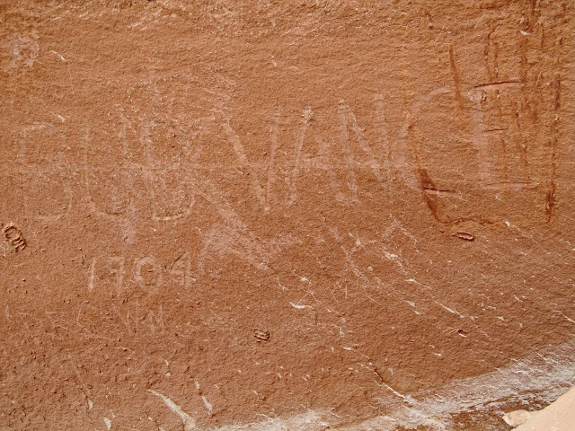
Next we reached Alcove Gallery. The alcove was enormous and must have made quite a comfortable home, providing shelter from the elements and a nice, sandy floor. There were a lot of pictographs and quite a few more modern inscriptions, some of them right over the top of the rock art. Across the canyon from the alcove I spotted a "CLS" inscription written in a cross. It was undated but looked very old, with white lichen growing over the top of it.
Approaching Alcove Gallery
Alcove Gallery
Alcove Gallery
Bob Vance, 1904
View out of the alcove
This CLS inscription was undated but looked quite old
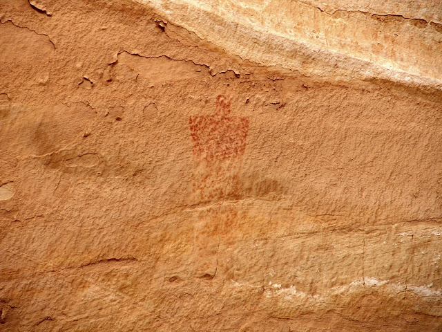
On the way to the main attraction, the Great Gallery, I spotted a single pictograph high up on a cliff and found another dinosaur footprint. We also passed a lone hiker on his way out--his was the only vehicle at the trailhead when we'd arrived.
Lone pictograph
Dinosaur footprint
Alan jumping off a ledge
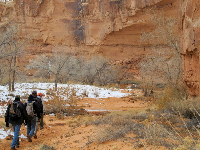
Approaching the Great Gallery
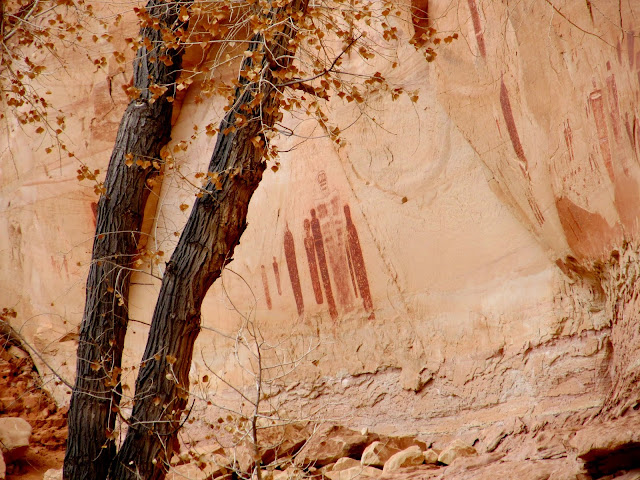
The Great Gallery was, well, great! Alan and I spent a great deal of time photographing the individual pictographs while the others sat down for lunch. We spent about 45 minutes there before moving along and heading farther up the canyon.
Great Gallery
Great Gallery
Great Gallery
Great Gallery
Great Gallery
Fallen rock with pictographs on it
Great Gallery
Great Gallery
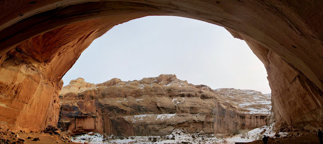
Just up-canyon from the Great Gallery is the Deadman's Trail, an old stock trail blasted out of the canyon wall. It was a steep, snowy ascent up the first part until we reached the spot where the trail goes up a steep sandstone ramp to the canyon rim. We only went as far as the top of the canyon rim, but the trail continues to climb and eventually connects to a dirt road after about a mile. After a brief rest at the top, we turned around and headed back down the canyon, passing another solo hiker just north of the Great Gallery. We took a short hike up Water Canyon but didn't find much of interest there.
Starting up the Deadman's Trail
Deadman's Trail
Deadman's Trail
View up Horseshoe Canyon from the Deadman's Trail
Concretions on the canyon wall
Spring in Water Canyon
Undated but old-looking ABF inscription near Water Canyon
Ice skating across the canyon
Our final point of interest was the road on the east side of Horseshoe Canyon, opposite from where we'd descended into the canyon that morning. I was out of energy and almost chose not to make the climb out on the east side, but I trudged on and I'm very glad I did. There were a lot of inscriptions from the road builders, including writings by Ned and Arth Chaffin. Some of the inscriptions were 20 feet high on the cliff above the road and had been made before material was blasted away to make the road grade. At the top of the road was an NPS sign-in box and a kiosk with signs telling people all the things they can't do in the National Park. It also mentioned that the road was closed because it was washed out, though I'd wager my mostly-stock Jeep could negotiate it.
Starting up the old road on the east side of Horseshoe Canyon
View down Horseshoe Canyon
Ned Chaffin inscription, presumably from 1935
Bulldozer marks on the side of the old road
A.L.C. (Arthur L. Chaffin) 1928
View of the lower section of the old road
No, no, and I dare you
View across the canyon to the road blasted into the cliffs
Floyd Taylor, Jan. 25, 1928, Lyman, Utah
We descended back into the canyon and I dragged my ass back up the road on the west side toward the trailhead. We had climbed down into and then back out of the canyon a total of three times. I was the last one back to the truck waiting at the trailhead. The round-trip distance was only 10.3 miles and took about eight hours, but with a lot of elevation loss and gain it had worn me out.
Climbing back up the west side of the old road toward the trailhead
Climbing back up the west side of the old road toward the trailhead
Full photo gallery:
https://picasaweb.google.com/Dennis.Udink/HorseshoeCanyon
[parsehtml]<iframe width="800" height="600" frameborder="0" scrolling="no" marginheight="0" marginwidth="0" src="https://maps.google.com/maps?q=http:%2F%2Fudink.org%2Fgeo%2FHorseshoeCanyon.kmz&hl=en&sspn=0.082005,0.169086&t=h&ie=UTF8&ll=38.458899,-110.205488&spn=0.040326,0.068579&z=14&output=embed"></iframe><br /><small><a href="https://maps.google.com/maps?q=http:%2F%2Fudink.org%2Fgeo%2FHorseshoeCanyon.kmz&hl=en&sspn=0.082005,0.169086&t=h&ie=UTF8&ll=38.458899,-110.205488&spn=0.040326,0.068579&z=14&source=embed" style="color:#0000FF;text-align:left">View Larger Map</a></small>[/parsehtml]http://udink.org/geo/HorseshoeCanyon.kmz
Featured image for home page: