Kullaberg63
Member
- Joined
- Mar 6, 2014
- Messages
- 667
Horse Canyon, Needles.
This tributary to the famous Salt Creek is not as impressively vast, has no springs or running water but instead presents you with miles of deep sandy wash bottom, and, as used to be the case with Salt, permits vehicle travel in it's entirety.
From a backpacking viewpoint at least the water aspect makes it unattractive. But the bottomless sand in Horse takes the joy out of the 20+ mile day hike otherwise needed to view just a few of the sights.
In other words a capable 4x4 is considered the best method of travel. But also here there's issues. Often the NPS closes off this option, sometimes even for years!
Right now Horse is indeed closed and judging from how things look in there it's been like that a while. The helpful ranger said the problem stems from quicksand in the very wet Salt Creek approach miles.
I wasn't interested in the jeeping anyway, as I don't own such an apparatus. I also share most hikers sentiments about spending 8-10 hours slogging in sand: no thanks. On the other hand these many complications regarding access would surely guarantee some solitude if one actually ventured in there.
After a week or so of growing fascination with this elusive defile I felt a bike would be the ticket. Not any bike, off course. It's been tried; just read Kelsey's experiences! But lately a new breed of all terrain bikes, commonly known as the fatbike, have taken hold of the all too willing consumer. The absolutely massive tires on such a beast will eat up sandy miles effortlessly and cruise on most wintery surfaces, but otherwise doesn't provide many benefits over a traditional mountain bike. Too much of a specialized rig for me, so I've mostly ignored the concept.
That is until a few seasons ago when Surly introduced the 'mid fat' moniker and attached it to a unique 29er bike with voluminous tires. They weren't ridiculously big tires (3" as opposed to 4.8"), but quite a bit larger than anything seen yet on this wheel size platform. It turned out to be everything I've ever wanted in a versatile, no nonsense expedition bike.
While I have used mine on many backcountry multiday trips, I've never ventured onto true fatbike terrain for miles and miles with it. The endless sandy washes of an out and back in Horse Canyon would be the test.
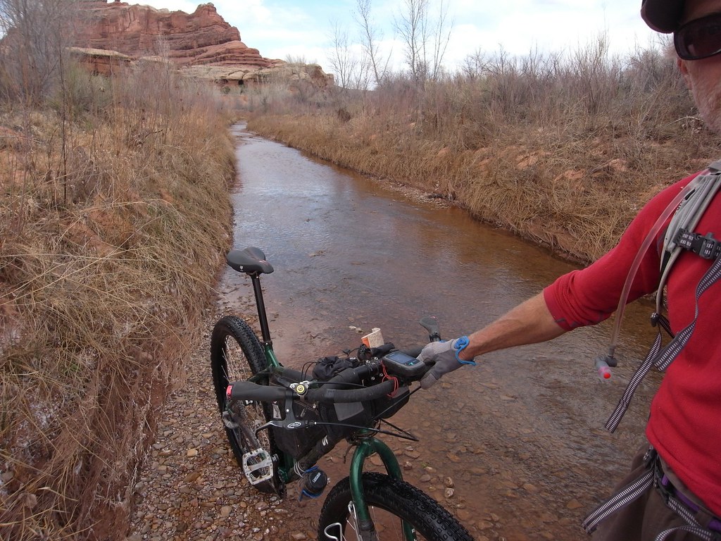
image by kullaberg631, on Flickr
It started out well, although somewhat unusual: a couple of miles riding upstream in several inches of water. This was the Salt Creek part. It had no resemblance to a jeep trail, and I had an overwhelming feeling of breaking numerous Park Service rules by riding a bike through apparent untouched wilderness.
After a while things got confusing with braided stream flow, 3 foot tall recently cut sand banks and willow thickets. Still no sign of this terrain being navigated by vehicles. A promising looking wash off to the left did indeed turn into Horse Canyon. It was off course completely dry and featured wall to wall sand for the next 8 miles.
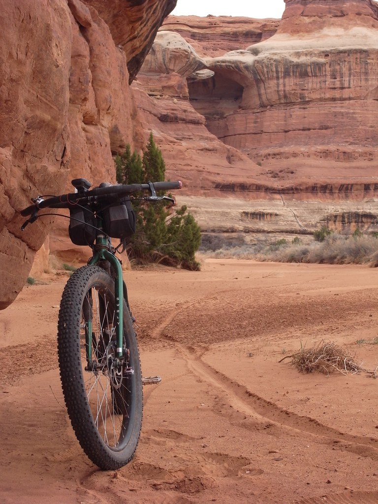
image by kullaberg631, on Flickr
First recognizable feature was Paul Bunyan's Potty.
More arches ensued. Two trails to these always striking features were marked on the map in the way upper parts of the canyon, and while they eventually led to respectively Fortress and Castle arches, none of of them seemed to have been used or maintained for a long time.
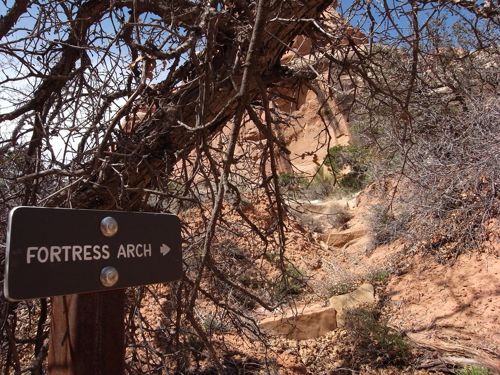
image by kullaberg631, on Flickr
This little sign hidden in the shade of a prolific shrub was the only signage in upper Horse. In the background the overgrown trail.
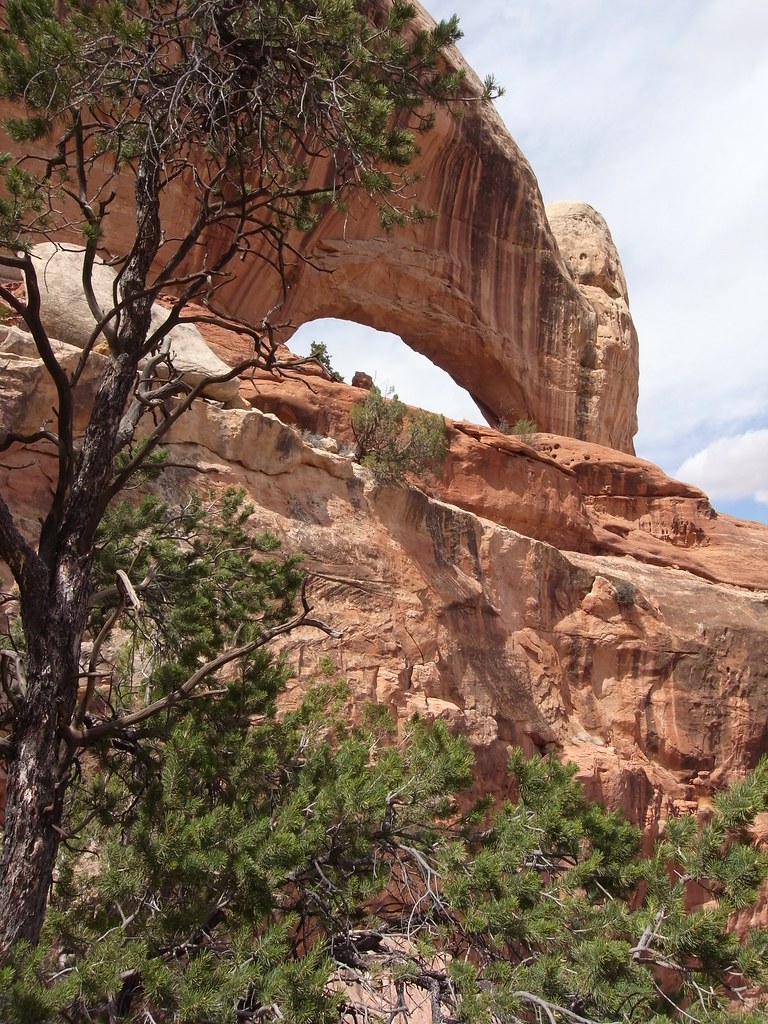
image by kullaberg631, on Flickr
Here Fortress arch from as close as one can get from the southeast side without negotiating the wall in the foreground. It looked doable at one spot, maybe low fifth class, but downclimbing it later would have been scary.
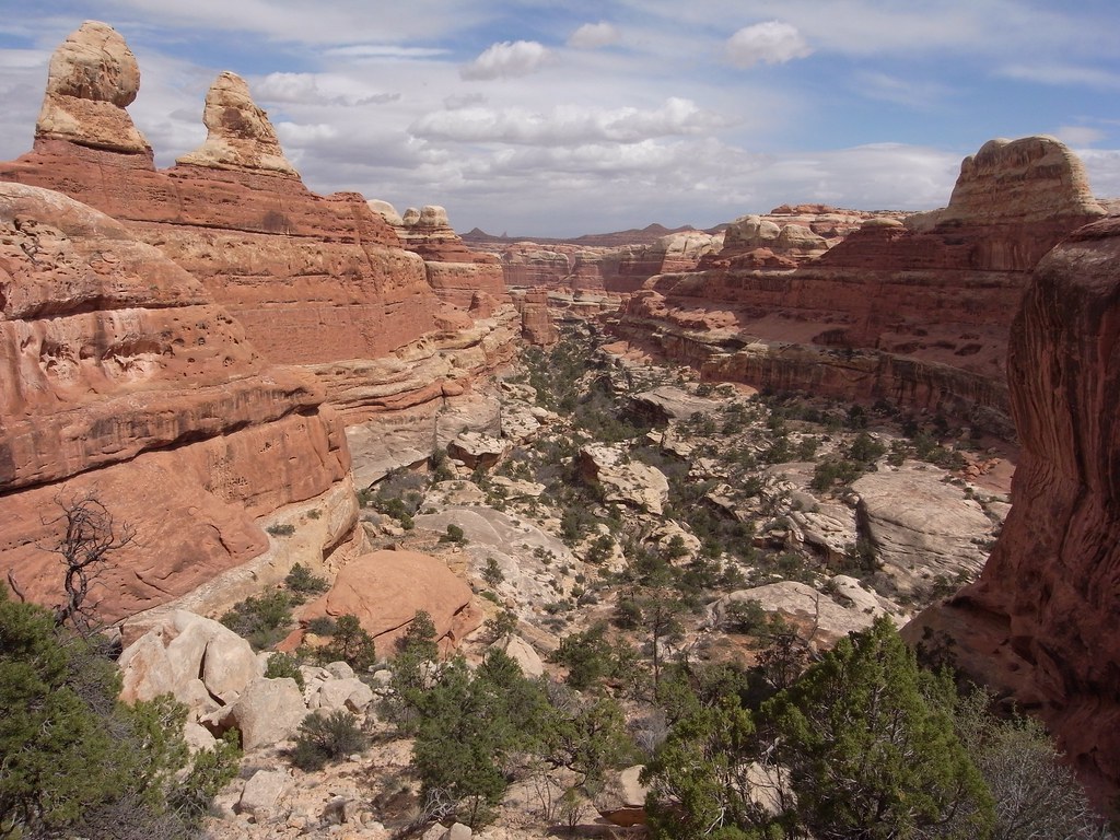
image by kullaberg631, on Flickr
View down towards the main drainage from the same spot as the above pic. One of the Sixshooters, likely The North one, barely visible on the horizon.
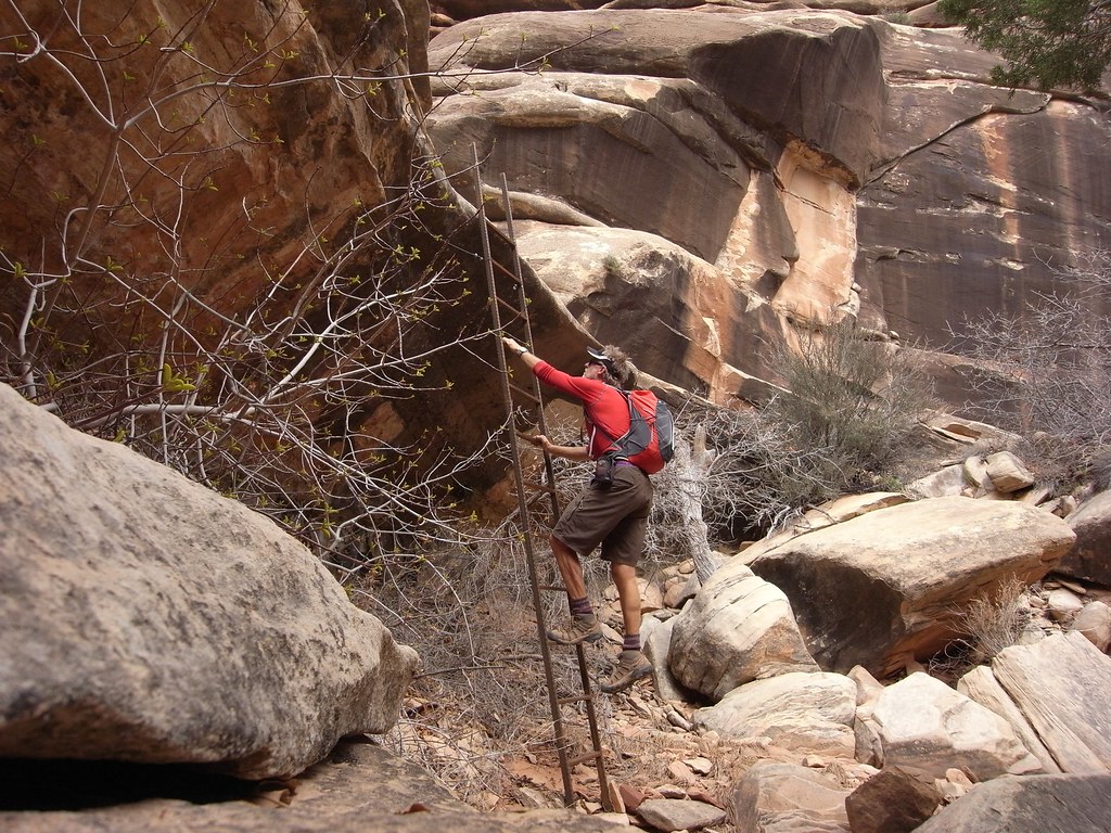
image by kullaberg631, on Flickr
The start to the Castle arch trail was completely unmarked and not obvious at all (one had to pay really good attention to routefinding to find anything in here). Once on this obscure path it surprised me with this seemingly recent ladder installation.
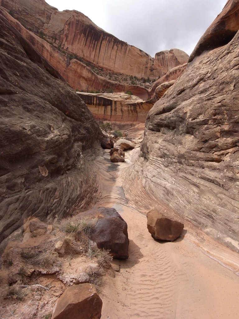
image by kullaberg631, on Flickr
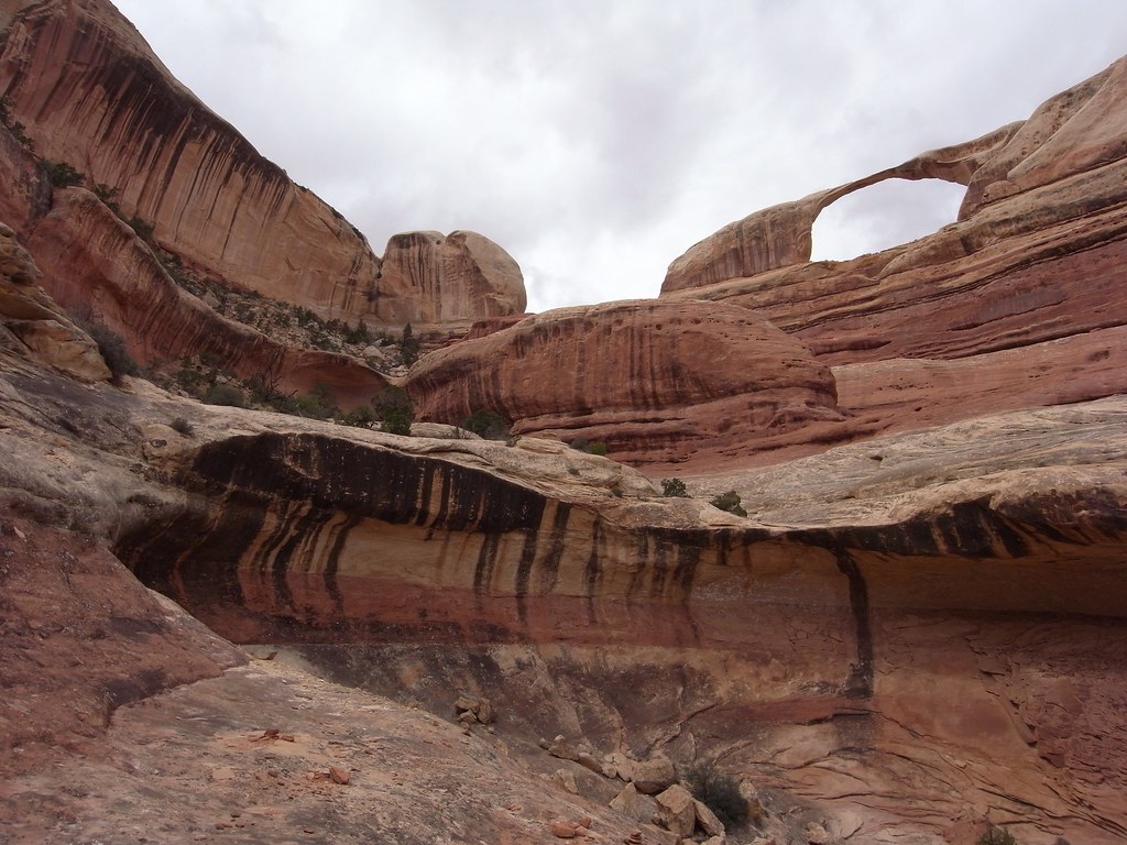
image by kullaberg631, on Flickr
Castle arch from the closest vantage point. I tried climbing the holdless slabby slope on the left for further progress up the canyon, but it was just that degree or so too step to support my feet.
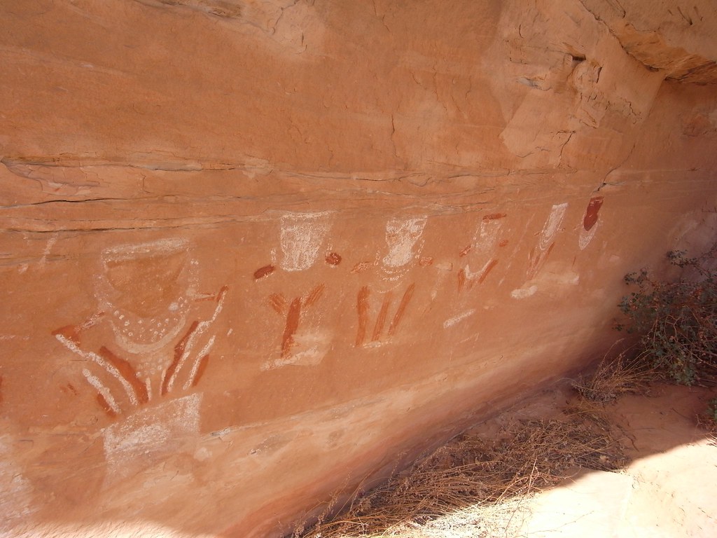
image by kullaberg631, on Flickr
I came across many other arches too, but got nowhere near to see all the ones scattered in this complex canyon system reminiscent of the Maze proper. Anasazi ruins and structures appeared literally around every corner. Many of them would have required major climbing efforts to reach, not to mention build.
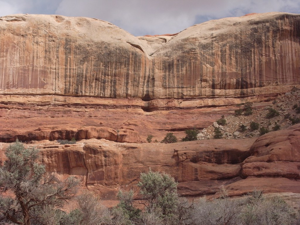
image by kullaberg631, on Flickr
In the center of this pic near some gaping holes in horizontal seams is a big ruin with at least part of the steep climb up there aided by a leaning log.
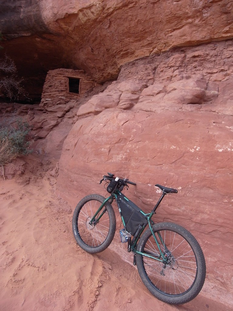
image by kullaberg631, on Flickr
All together a worthwhile day exploring in complete solitude, with the bike actually being pedaled the whole time, as opposed to pushed. Although no doubt a true fatty would have been considerable less effort.
Featured image for home page:
This tributary to the famous Salt Creek is not as impressively vast, has no springs or running water but instead presents you with miles of deep sandy wash bottom, and, as used to be the case with Salt, permits vehicle travel in it's entirety.
From a backpacking viewpoint at least the water aspect makes it unattractive. But the bottomless sand in Horse takes the joy out of the 20+ mile day hike otherwise needed to view just a few of the sights.
In other words a capable 4x4 is considered the best method of travel. But also here there's issues. Often the NPS closes off this option, sometimes even for years!
Right now Horse is indeed closed and judging from how things look in there it's been like that a while. The helpful ranger said the problem stems from quicksand in the very wet Salt Creek approach miles.
I wasn't interested in the jeeping anyway, as I don't own such an apparatus. I also share most hikers sentiments about spending 8-10 hours slogging in sand: no thanks. On the other hand these many complications regarding access would surely guarantee some solitude if one actually ventured in there.
After a week or so of growing fascination with this elusive defile I felt a bike would be the ticket. Not any bike, off course. It's been tried; just read Kelsey's experiences! But lately a new breed of all terrain bikes, commonly known as the fatbike, have taken hold of the all too willing consumer. The absolutely massive tires on such a beast will eat up sandy miles effortlessly and cruise on most wintery surfaces, but otherwise doesn't provide many benefits over a traditional mountain bike. Too much of a specialized rig for me, so I've mostly ignored the concept.
That is until a few seasons ago when Surly introduced the 'mid fat' moniker and attached it to a unique 29er bike with voluminous tires. They weren't ridiculously big tires (3" as opposed to 4.8"), but quite a bit larger than anything seen yet on this wheel size platform. It turned out to be everything I've ever wanted in a versatile, no nonsense expedition bike.
While I have used mine on many backcountry multiday trips, I've never ventured onto true fatbike terrain for miles and miles with it. The endless sandy washes of an out and back in Horse Canyon would be the test.

image by kullaberg631, on Flickr
It started out well, although somewhat unusual: a couple of miles riding upstream in several inches of water. This was the Salt Creek part. It had no resemblance to a jeep trail, and I had an overwhelming feeling of breaking numerous Park Service rules by riding a bike through apparent untouched wilderness.
After a while things got confusing with braided stream flow, 3 foot tall recently cut sand banks and willow thickets. Still no sign of this terrain being navigated by vehicles. A promising looking wash off to the left did indeed turn into Horse Canyon. It was off course completely dry and featured wall to wall sand for the next 8 miles.

image by kullaberg631, on Flickr
First recognizable feature was Paul Bunyan's Potty.
More arches ensued. Two trails to these always striking features were marked on the map in the way upper parts of the canyon, and while they eventually led to respectively Fortress and Castle arches, none of of them seemed to have been used or maintained for a long time.

image by kullaberg631, on Flickr
This little sign hidden in the shade of a prolific shrub was the only signage in upper Horse. In the background the overgrown trail.

image by kullaberg631, on Flickr
Here Fortress arch from as close as one can get from the southeast side without negotiating the wall in the foreground. It looked doable at one spot, maybe low fifth class, but downclimbing it later would have been scary.

image by kullaberg631, on Flickr
View down towards the main drainage from the same spot as the above pic. One of the Sixshooters, likely The North one, barely visible on the horizon.

image by kullaberg631, on Flickr
The start to the Castle arch trail was completely unmarked and not obvious at all (one had to pay really good attention to routefinding to find anything in here). Once on this obscure path it surprised me with this seemingly recent ladder installation.

image by kullaberg631, on Flickr

image by kullaberg631, on Flickr
Castle arch from the closest vantage point. I tried climbing the holdless slabby slope on the left for further progress up the canyon, but it was just that degree or so too step to support my feet.

image by kullaberg631, on Flickr
I came across many other arches too, but got nowhere near to see all the ones scattered in this complex canyon system reminiscent of the Maze proper. Anasazi ruins and structures appeared literally around every corner. Many of them would have required major climbing efforts to reach, not to mention build.

image by kullaberg631, on Flickr
In the center of this pic near some gaping holes in horizontal seams is a big ruin with at least part of the steep climb up there aided by a leaning log.

image by kullaberg631, on Flickr
All together a worthwhile day exploring in complete solitude, with the bike actually being pedaled the whole time, as opposed to pushed. Although no doubt a true fatty would have been considerable less effort.
Featured image for home page:

Last edited:
