balzaccom
Member
- Joined
- Sep 30, 2014
- Messages
- 897
This Sunday I decided I had to get up into the mountains, and took advantage of an invitation to work on the Hite Cove trail with a group of local volunteers. For those of you who don't know, Hite Cove Trail runs along the South Fork of the Merced from Savage's Trading Post up to Hite Cove itself, where there are some relics of the gold mining era, and then continues as a rough route all the way up to Wawona.
Savage's by the way, has an interesting role in the history of Yosemite. It was originally a trading post owned by Mr. Savage, who enjoyed a relatively comfortable relationship with the local native Americans. Then things got ugly, he got killed, they got attacked and confined....well, it wasn't the best part of our local California history. But it was important
.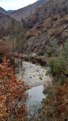
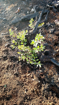
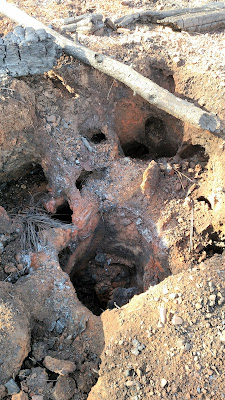
The Hite Cove trail is most popular during the spring, when the wildflowers can be simply stunning. But this time of year, it has a very different character, particularly after the huge Ferguson Fire raced through this area. The hope is that the fire will open the door to a particularly large wildflower explosion this spring, and we'd like the trail in good condition when that happens. At the same time, the fire opened up the tree cover so that there are more views along the canyon, and the geology in particular is more apparent.
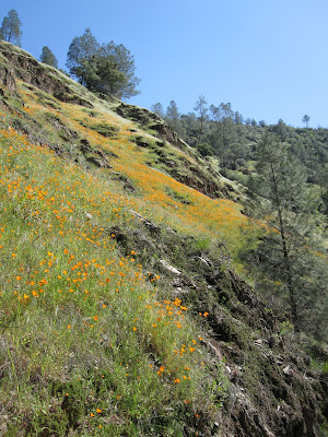 Here's one more photo, of what the poppies can look like in the springtime along the Hite Cove Trail.
As has always been the case, I really enjoyed meeting the trail volunteers and working with them. They have a deep appreciation for the whole region and lots of stories to tell about their own experiences as well as those of others who've hiked here. It was a good day, and we got a lot done on the trail.
Here's the link to the photos: https://photos.app.goo.gl/C4qXV17mSzLSYQHx9
Savage's by the way, has an interesting role in the history of Yosemite. It was originally a trading post owned by Mr. Savage, who enjoyed a relatively comfortable relationship with the local native Americans. Then things got ugly, he got killed, they got attacked and confined....well, it wasn't the best part of our local California history. But it was important
.
The Hite Cove trail is most popular during the spring, when the wildflowers can be simply stunning. But this time of year, it has a very different character, particularly after the huge Ferguson Fire raced through this area. The hope is that the fire will open the door to a particularly large wildflower explosion this spring, and we'd like the trail in good condition when that happens. At the same time, the fire opened up the tree cover so that there are more views along the canyon, and the geology in particular is more apparent.
Here's one more photo, of what the poppies can look like in the springtime along the Hite Cove Trail.As has always been the case, I really enjoyed meeting the trail volunteers and working with them. They have a deep appreciation for the whole region and lots of stories to tell about their own experiences as well as those of others who've hiked here. It was a good day, and we got a lot done on the trail.
Here's the link to the photos: https://photos.app.goo.gl/C4qXV17mSzLSYQHx9