Yvonne
I lava it!!!
- Joined
- Jan 19, 2012
- Messages
- 4,177
I've done some of the shorter segments of both the Hurricane Rim and the Hurricane Canal trail. Today I decided to do the entire loop hike because I finally had more than 2 hours to hike, lol.
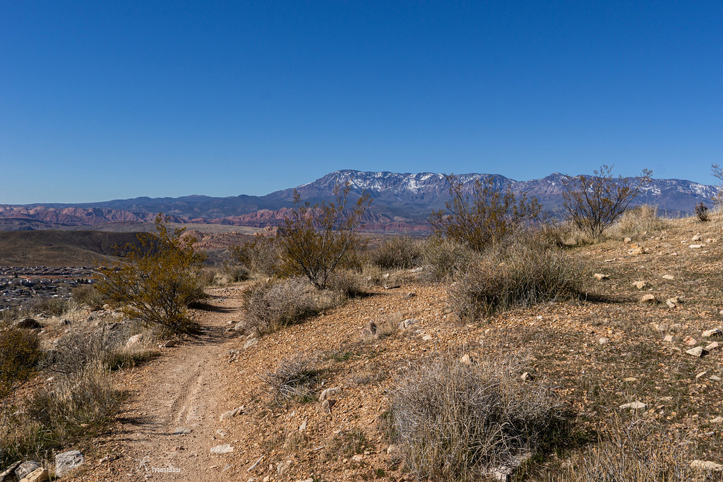
I parked at the Hurricane Hill parking lot just off Highway 59 when you come up the hill. It was Saturday, and a holiday weekend, so it was busy like crazy. It was a great sunny day and already super warm. I was glad I've chosen to wear just a t-shirt and capris. I got my stuff ready and hit the trail.
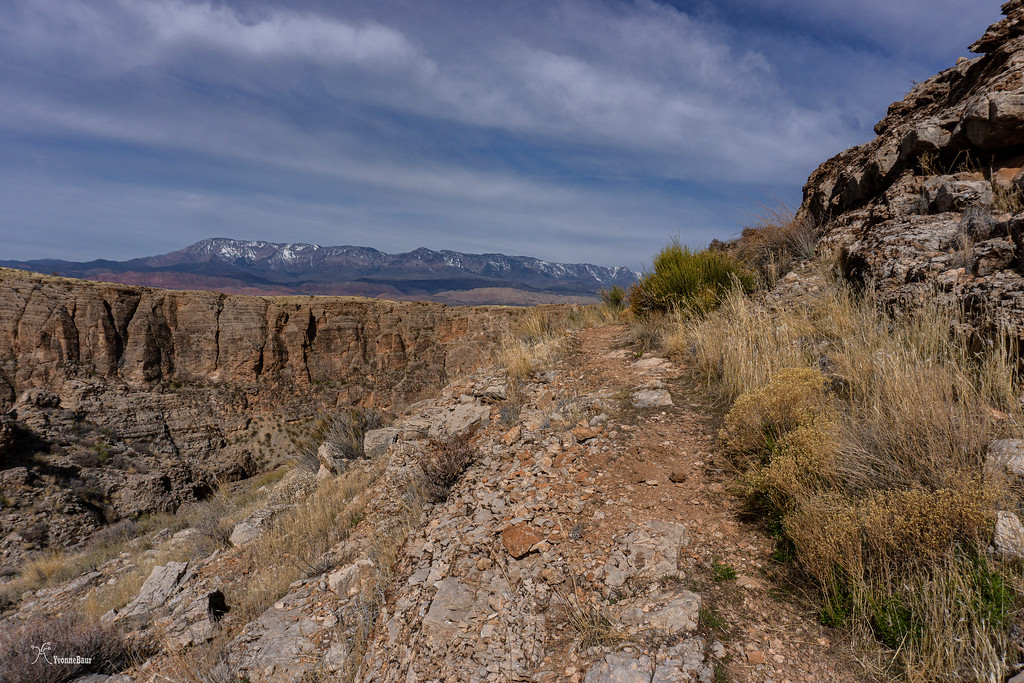
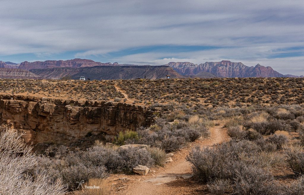
The first half mile followed parallel to the highway, but as soon as it turned away, it was quit and beautiful.
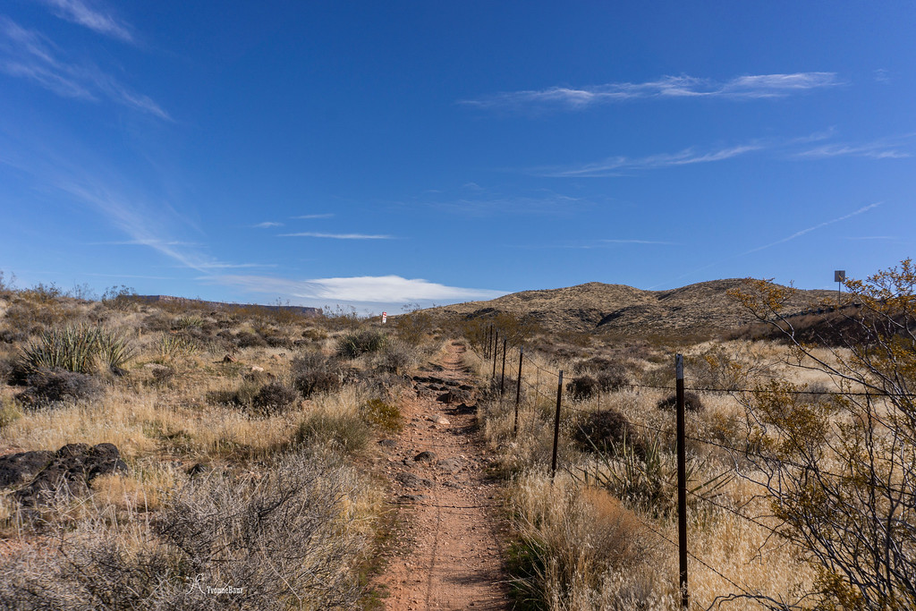
the trail is parallel to the road
It didn't take long, and the first outcrops of limestone were visible along the trail. And with the limestone, I found the first fossils.
Pine Valley Mountain, a large laccolith, in the distance with some limestone outcrops in the foreground
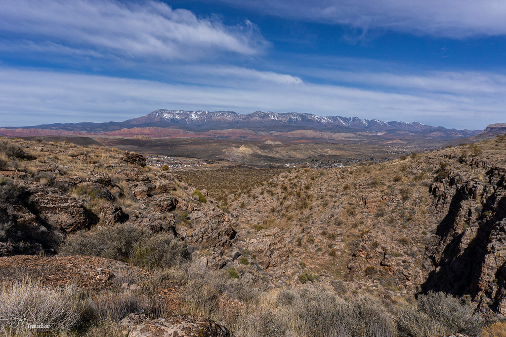
The trail was winding its way up, offering expansive views to the west towards Pine Valley Mountain and Hurricane and La Verkin. I really enjoyed the views. Since I was hiking in the transition zone between the Basin and Range Province and the Colorado Plateau, there was still a great abundance of Creosote Bushes. They are natives to the Basin and Range and disappear entirely as soon as you cross over to the Colorado Plateau.
Creosote Bushes cover the sedimentary hills
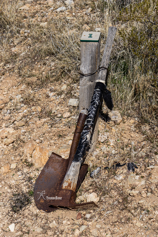
some of the mile markers had interesting stuff
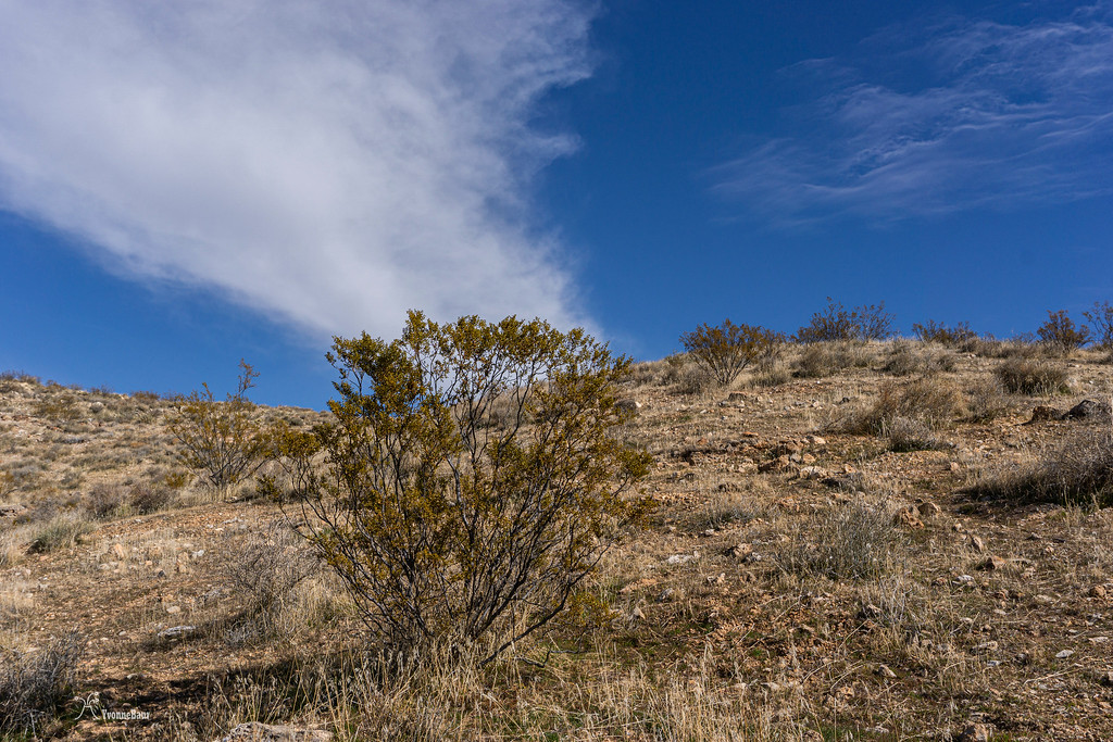
the views were amazing along the first mile and a half
After the first initial short climb, the views in all directions stayed terrific. To the northeast, the Flying Monkey Mesa, aka Hurricane Mesa, dominated the view. This mesa is a military testing facility, and back in the 50s, they used life monkeys for their parachute testings. Hence the name Flying Monkey Mesa. Geologically, this mesa is part of the chocolate cliffs. In addition to the Moenkopi Formation, you'll find a lot of petrified wood in the Petrified Forest Member of the Chinle Formation.
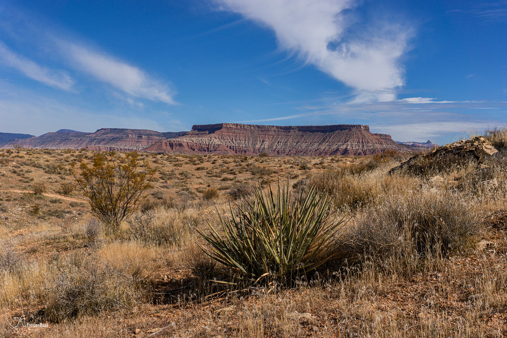
Flying Monkey Mesa
I shortly stopped at Panorama Point, a scenic viewpoint where I enjoyed the views towards Zion, Pine Valley Mountain, plus the canyon below where the Hurricane Canal is located.
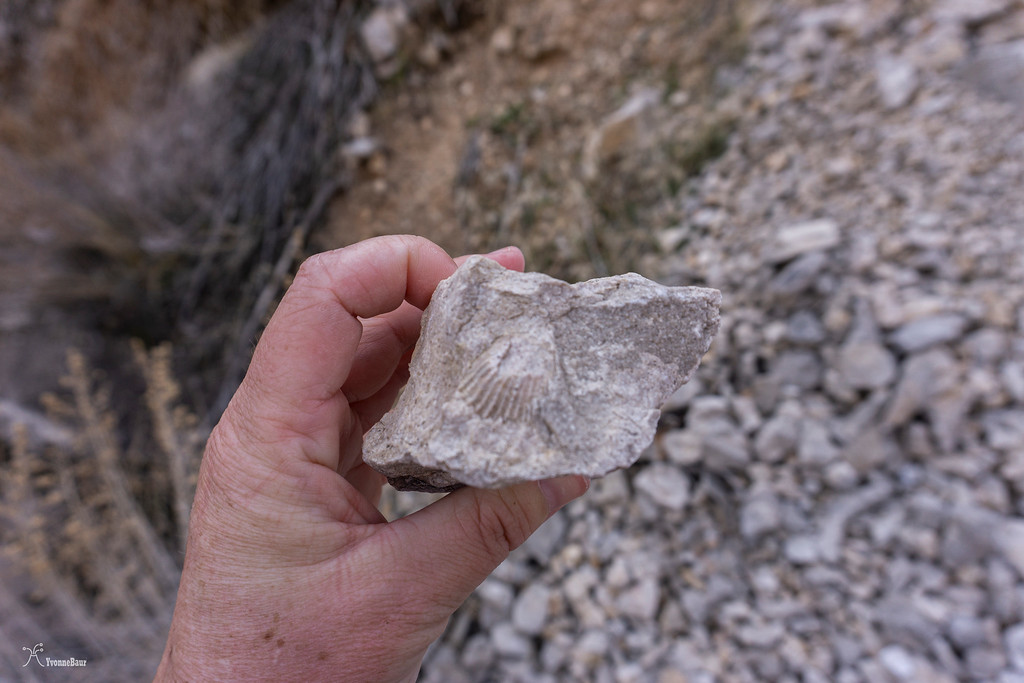
Even here, I found some good-sized fossils.
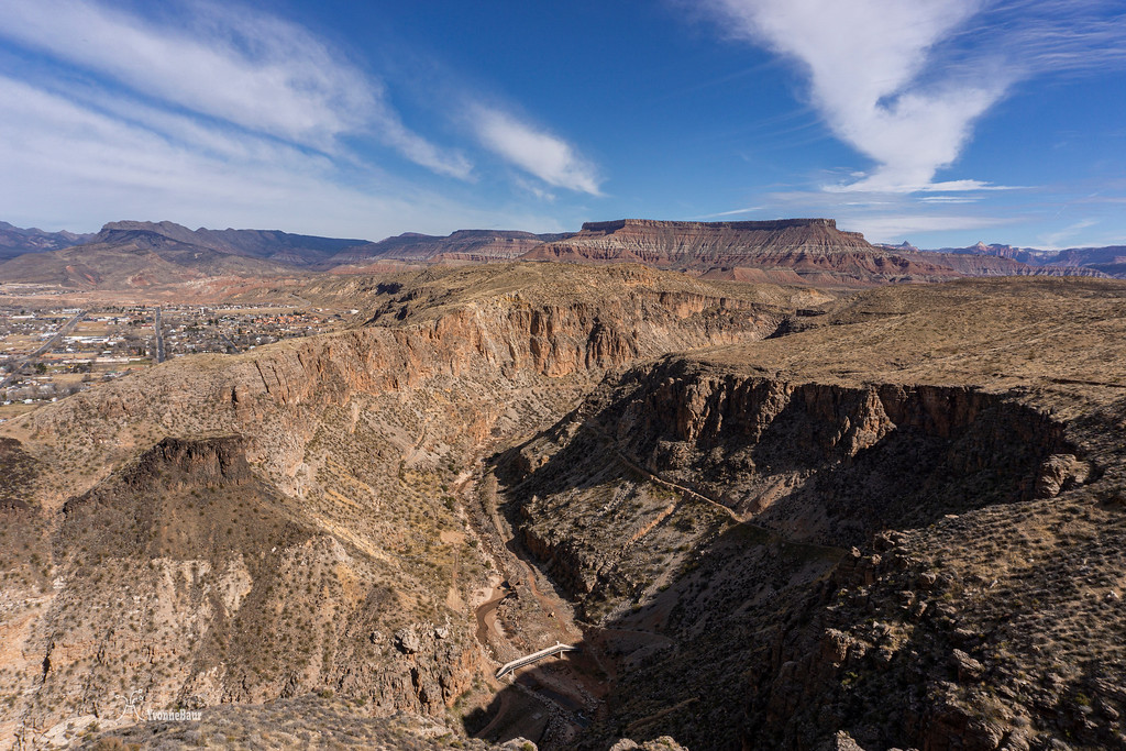
Soon after, the trail junction with the Canal Trail appeared, and I turned left. The trail went gradually downhill, and I reached another viewpoint from where I had a good view down to the Pah Tempe hot springs. Too bad they are closed for so many years now, they looked so inviting to me.
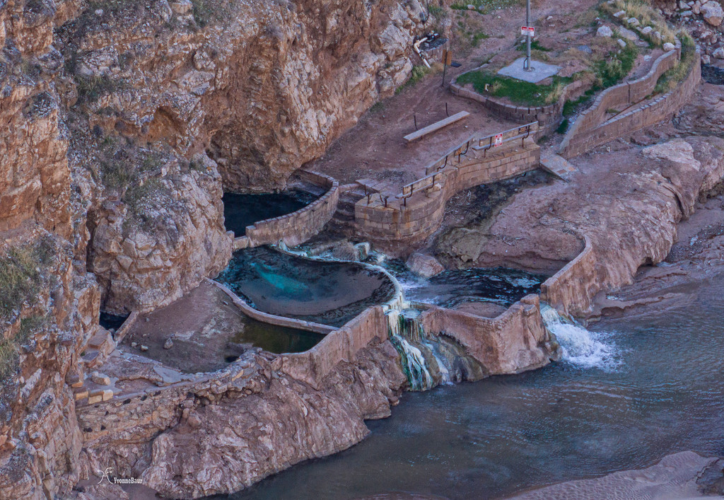
Pah Tempe hot springs
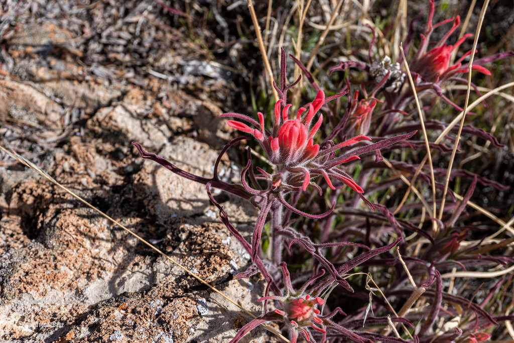
the first wildflowers of the year
Soon after, I reached a spot which was called The Drop. The drop from here down to the canal was really steep, with a lot of crumbly loose rocks.
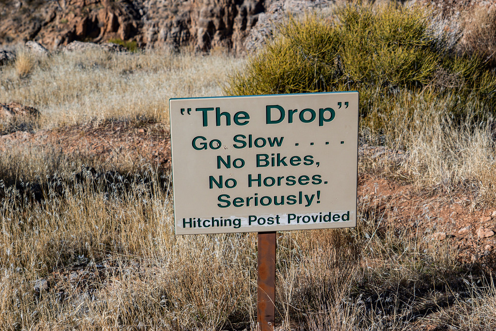
pictures do not pay justice, but it was pretty steep going down from there
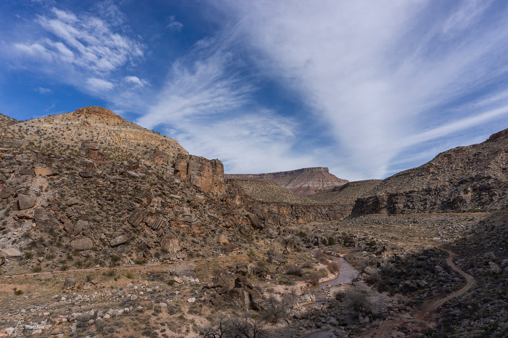
Finally, I reached the canal, which was surprisingly wide with sort of an earthen wall. It was pretty cool, and I enjoyed to walk in it a lot. The entire canal was dug with hand tools - pickaxe, shovel; you name it. The pioneer life must have been pretty rough doing that.
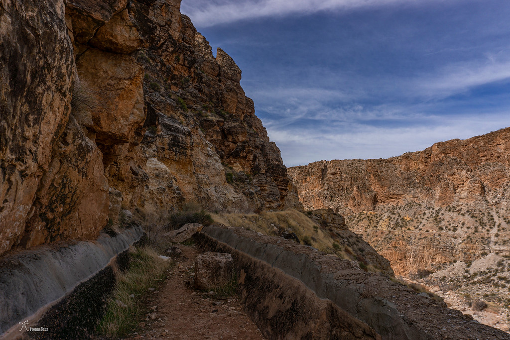
The canal with walls of fossiliferous limestone
Within a few minutes, I reached a bypass tunnel, and you have to crawl through it. The whole structure was pretty cool, and I was glad I brought a flashlight.
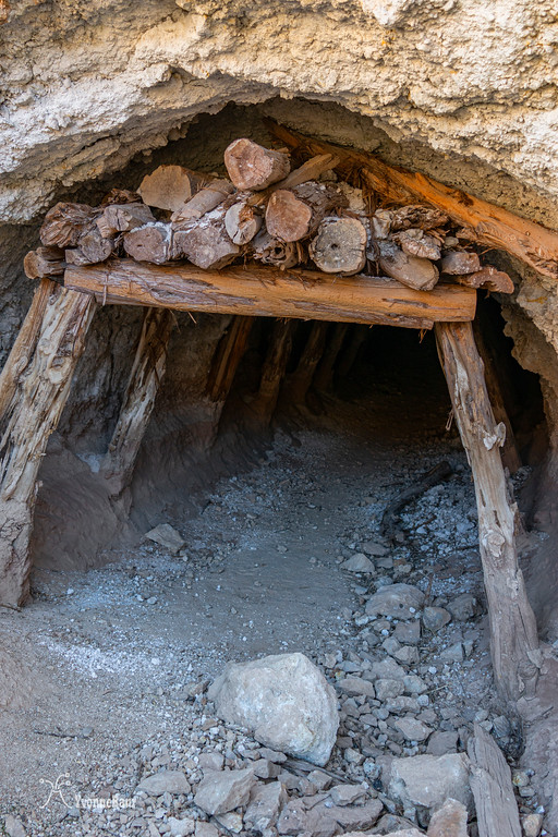
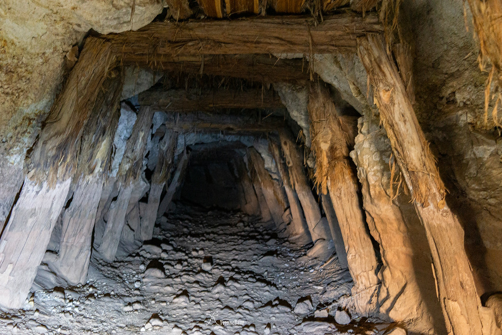
inside the tunnel
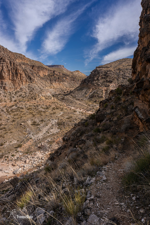
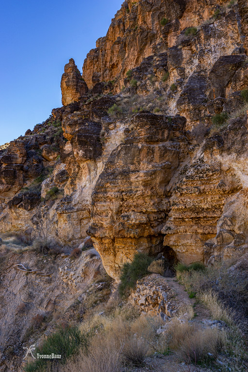
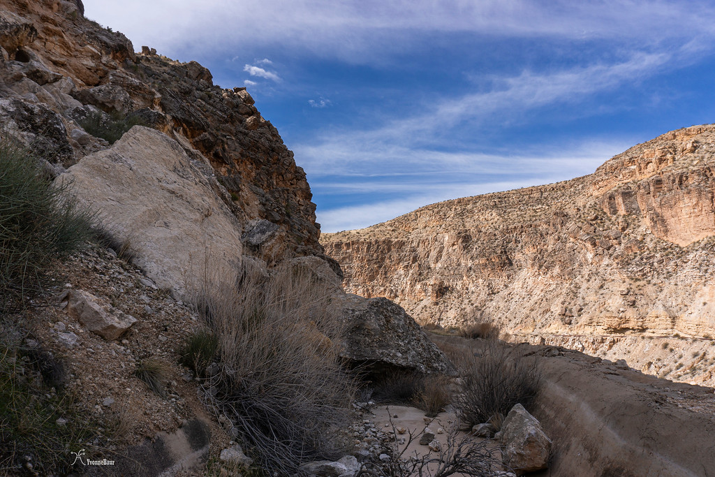
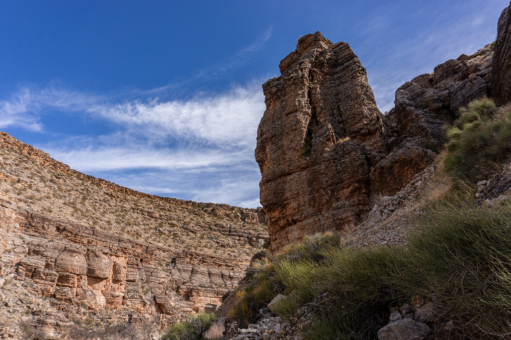
Soon after the tunnel, the views towards the cliffs became seriously cool, and limestone cliffs were towering above me.
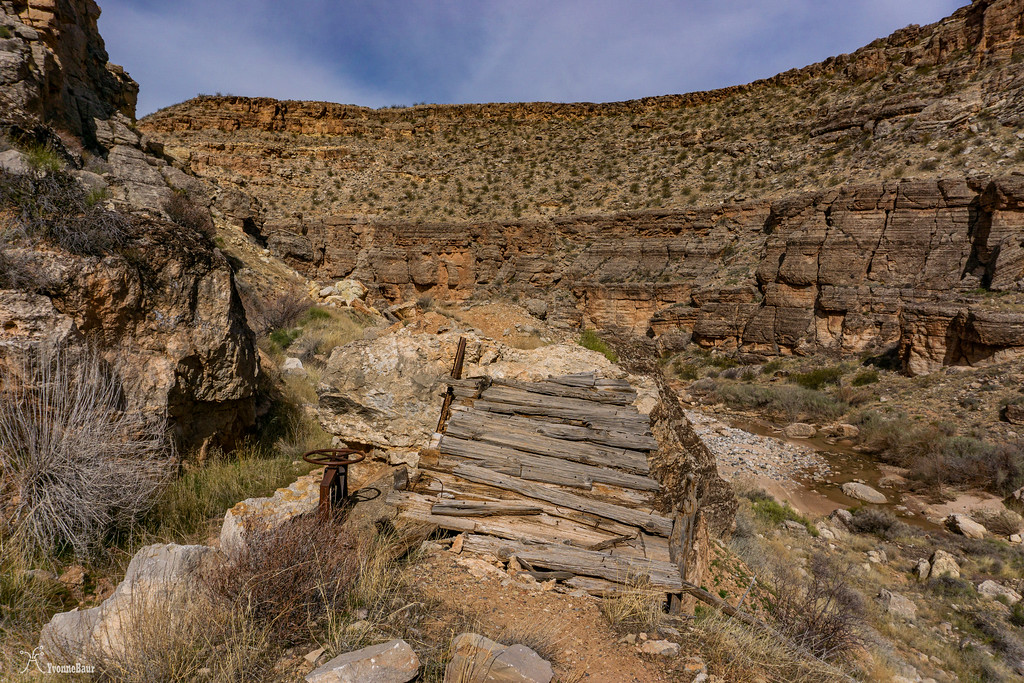
The next junction came, and I decided to walk a bit along the Chinatown Wash Flume. At the end of a massive box canyon was a trestle left, and the canal initially went around the area. But massive landslides covered vast parts of the canal here, and this part was abandoned. I always wondered why they build a canal in the first place in such an unstable environment.
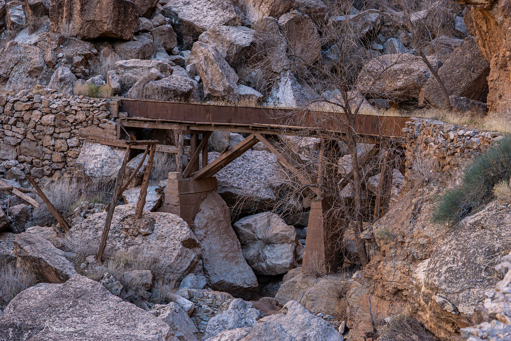
The old trestle
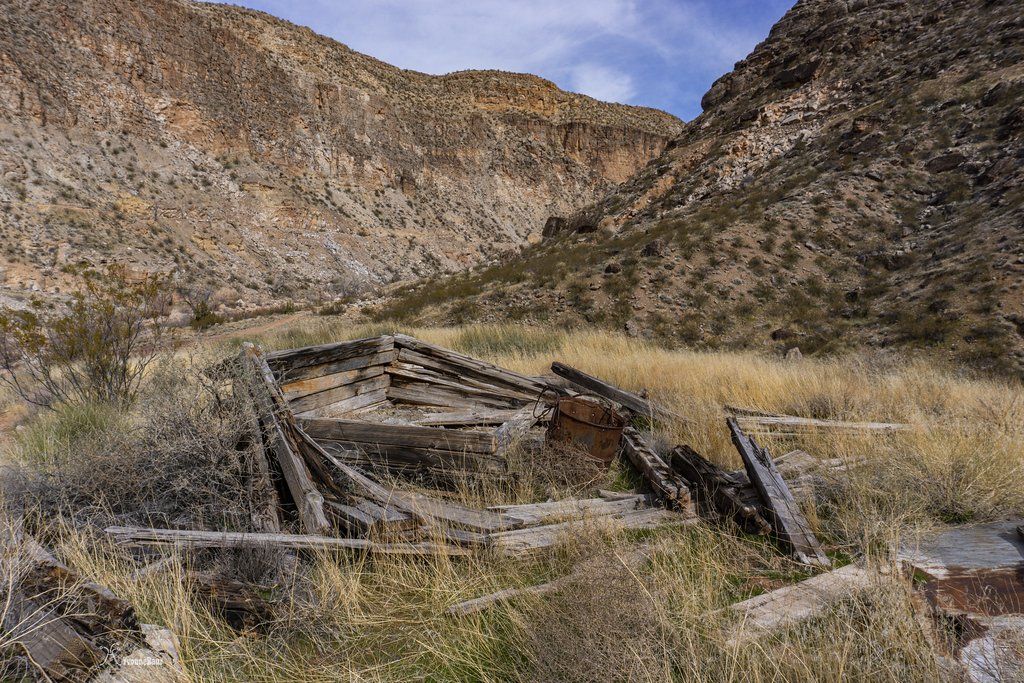
I retraced my steps and went down towards the Virgin River. Chinatown Wash entered the river at this point, and a camp was once down here where supplies were stored. One of the old ruins was still there.
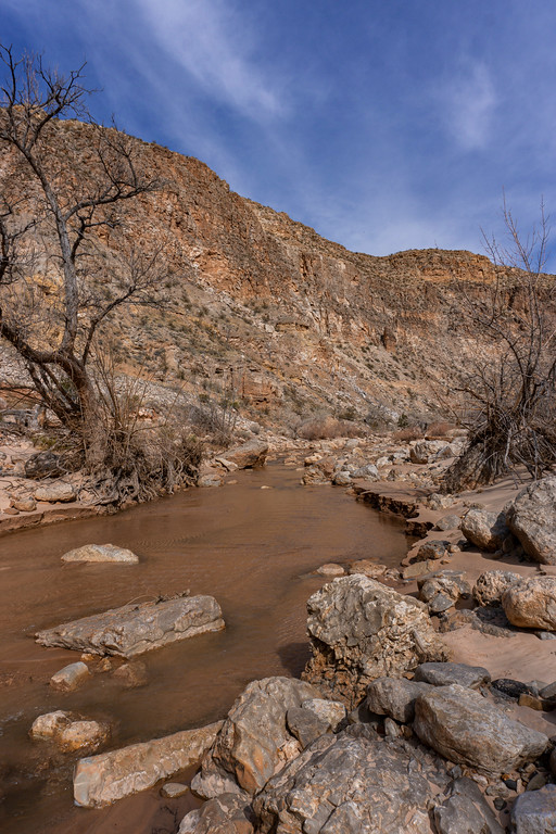
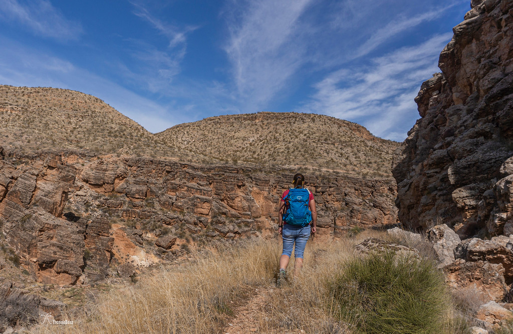
I took a short snack break next to the river and continued. The next initial climb followed, and it would bring me back to the canal.
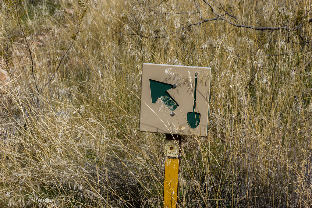
trail sign
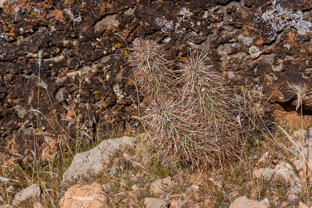
some of my prickly friends along the climb up
back on the canal
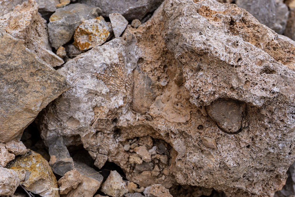
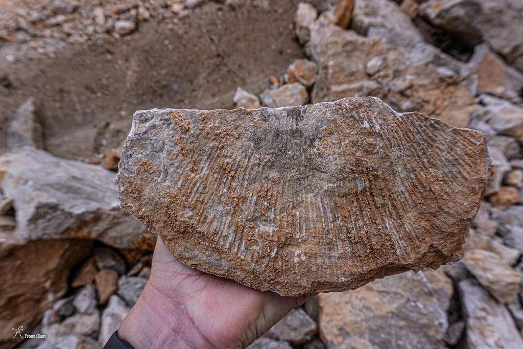
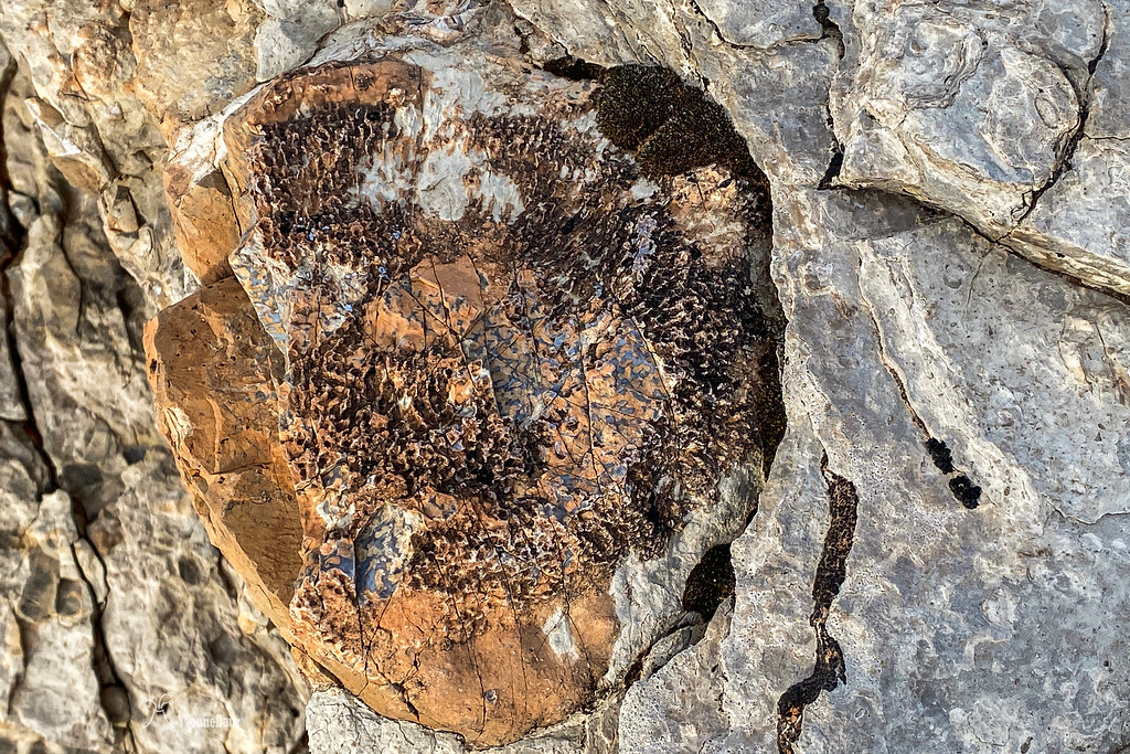
After a while, I encountered the first of several rockfalls and rubble of fossiliferous limestone covered the original canal. I stopped for a while and looked around. And I found exactly what I was looking for: fossils everywhere!! They were just lying next to my feet. This was one of the most amazing geology playgrounds ever, lol.
fossils in a rocks
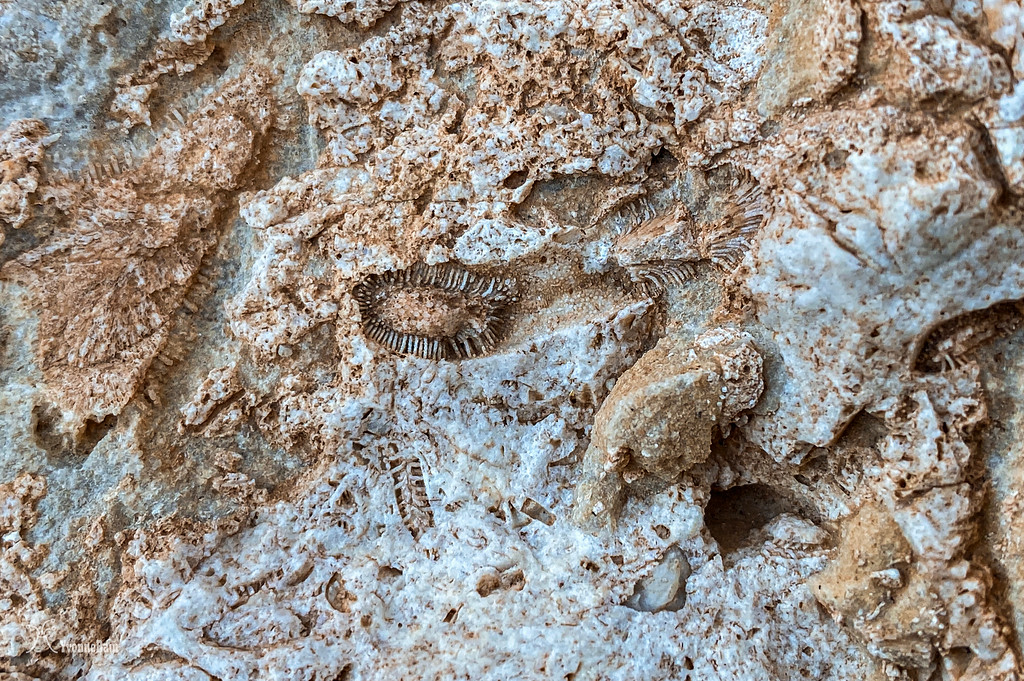
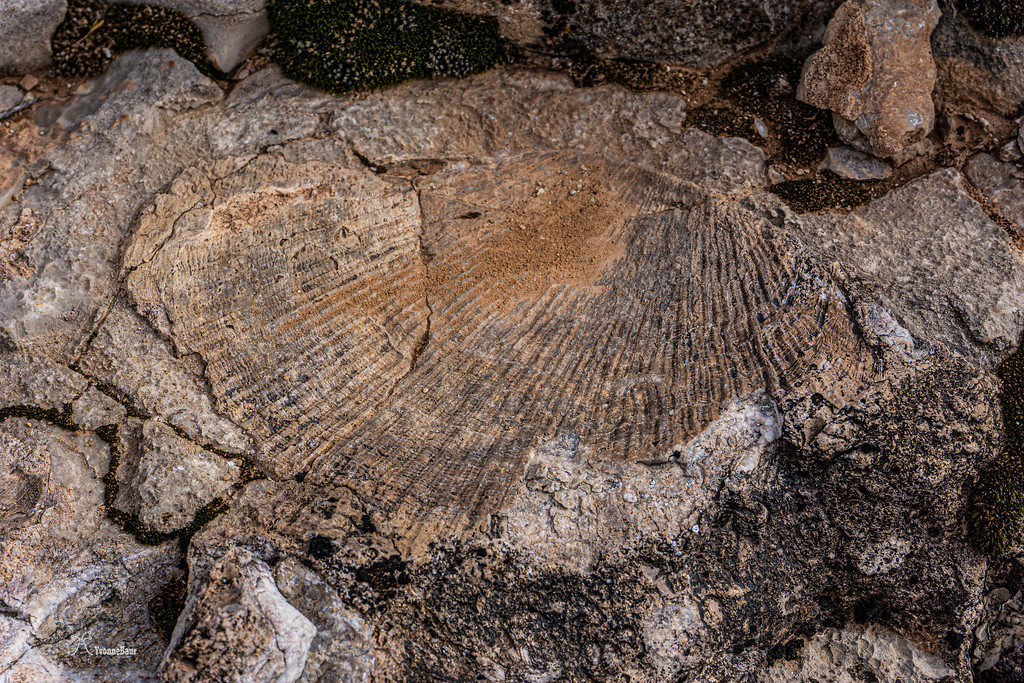
Bryozoan fossils
more bryozoans
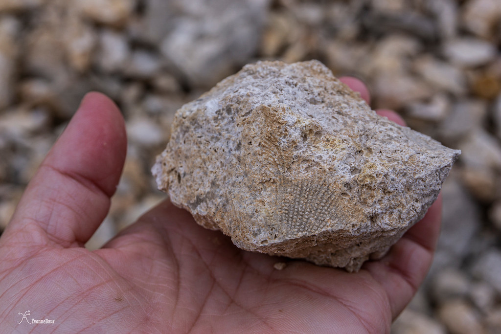
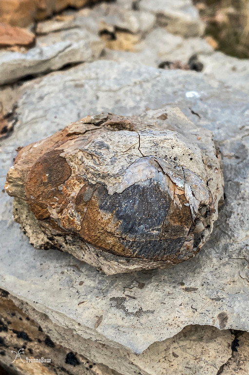
While exploring the next pile of rubble, I definitely hit the jackpot and found a huge piece of a brachiopod fossil in a piece of limestone. It was so cool and almost entirely intact.
The best find of the day!!
I could barely move forward; there was just so much to see and to explore. And another pile of rubble followed, and I found more fossils in it.
I finally let go and continued my hike.
Limestone Hoodoos
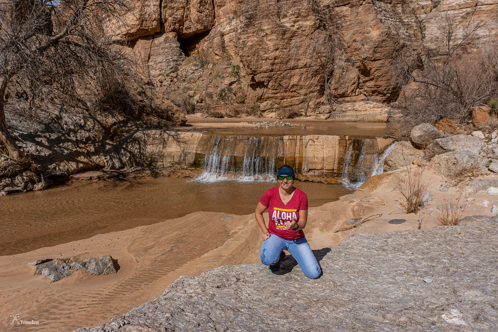
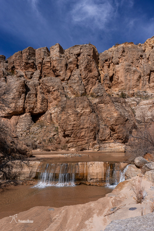
After a while, I reached the confluence with the La Verkin canal, and I headed back down to the river. The little waterfall was a refreshing new sight, and I can totally see me there in a month or two sitting underneath it.
Back on the canal, I encountered several of the historical remnants of the canal like old gates and wooden structures. It was like a walk back into history and pretty cool.
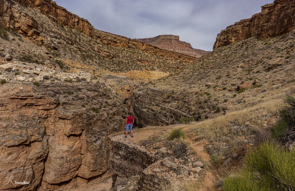
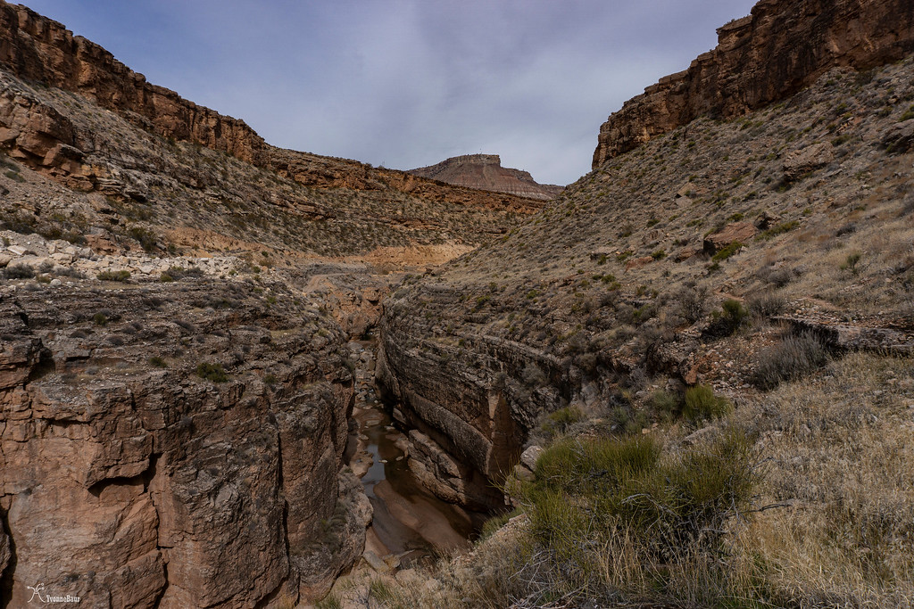
Closer to the Virgin River Dam, the canyon steepened up, and the walls became pretty narrow. If it would be a month later or two, I would have walked through the water and explored the little slot canyon. For now, it was just the view from above.

small slot canyon near the Virgin River Dam
Selfie above the slot canyon
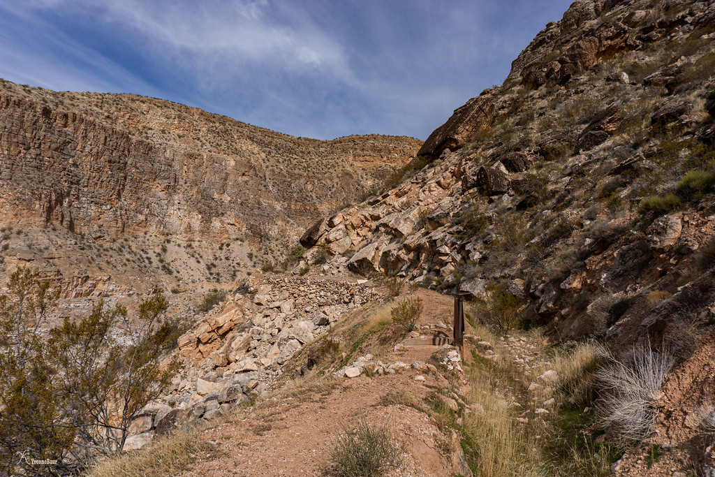
Shortly after the slot section, the trail started to climb up again and would eventually reach the rim again.
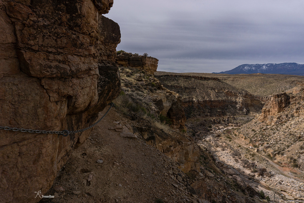
The trail was steep in some sections with a lot of loose rocks, so careful foot placement was needed. I was surprised to find a section with chains. The chains were in a part where you definitely do not need them at all.
Eventually, I reached the rim, and a few hundred feet away, I could see the Virgin River Dam trailhead. I continued on the Hurricane Rim trail, which would bring me back to the Hurricane Hill trailhead about 5.5 miles away.
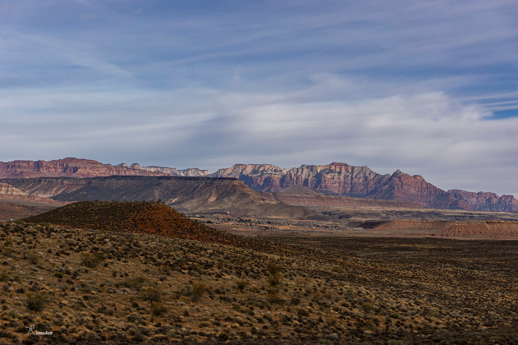
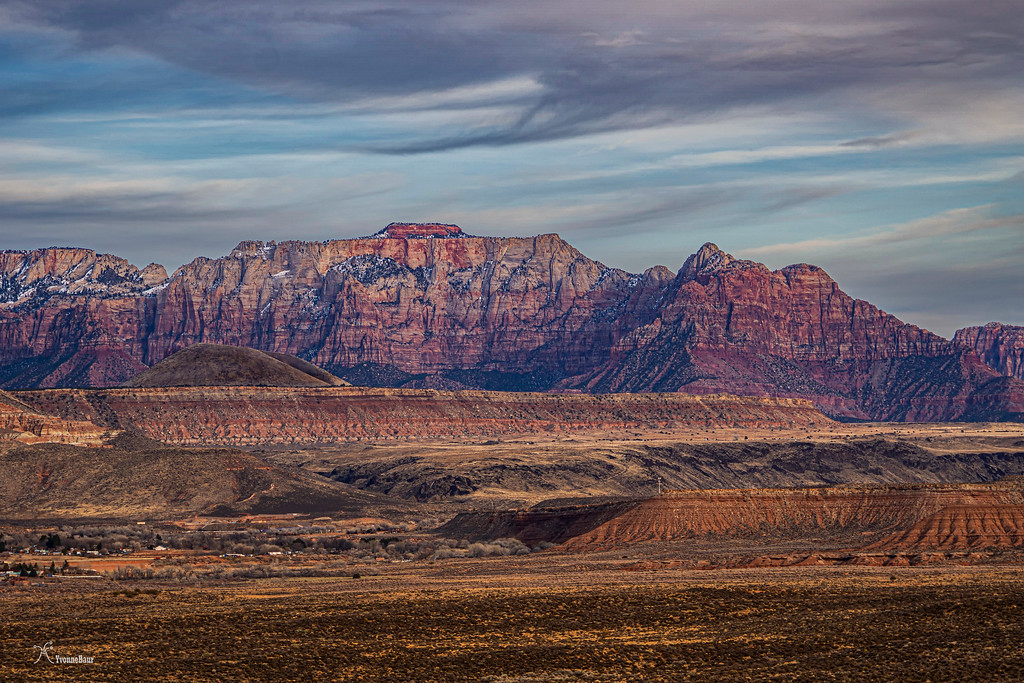
One of the advantages of the rim trail was the amazing view toward Zion and the amazing Zion Cliffs. That's a view that never gets old.
Zion Cliffs in the distance
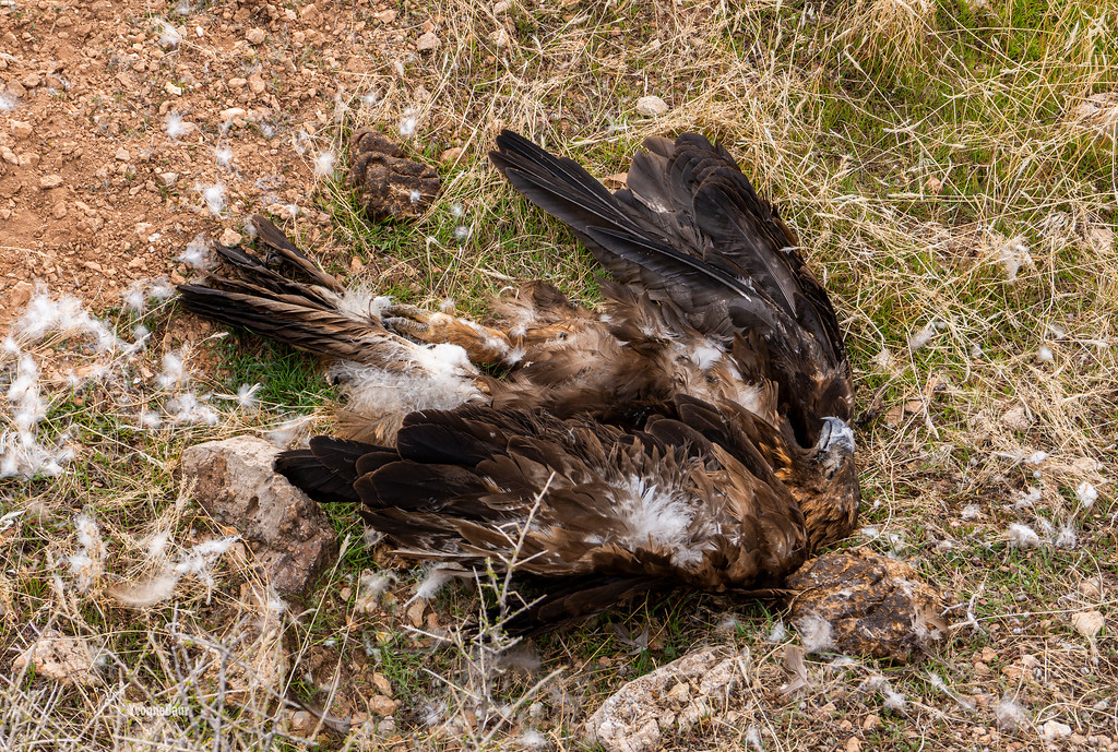
Close to reaching Chinatown Wash, another fossil hunting ground, I found a dead Golden Eagle who obviously died during a fight as there were a lot of feathers all around. It was pretty sad to see this majestic bird down dead on the ground.
I stopped at some of the outcrops along Chinatown Wash and looked for fossils again. And there were plenty all over the place.
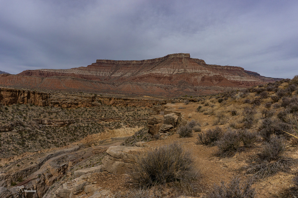
The last two and a half miles back offered a few magnificent views again, and I enjoyed the scenery many times while catching my breath.
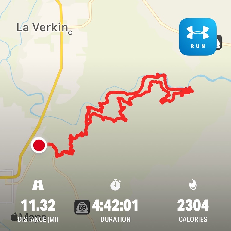
After 11.3 miles and 4 hours and 42 minutes, I was back at my car. It was a great hike, and I definitely want to repeat in a month when all the wildflowers are out, and the river is a bit warmer so I can have a splash. And it is always great to be back to look for fossils.
I parked at the Hurricane Hill parking lot just off Highway 59 when you come up the hill. It was Saturday, and a holiday weekend, so it was busy like crazy. It was a great sunny day and already super warm. I was glad I've chosen to wear just a t-shirt and capris. I got my stuff ready and hit the trail.
The first half mile followed parallel to the highway, but as soon as it turned away, it was quit and beautiful.
the trail is parallel to the road
It didn't take long, and the first outcrops of limestone were visible along the trail. And with the limestone, I found the first fossils.
Pine Valley Mountain, a large laccolith, in the distance with some limestone outcrops in the foreground
The trail was winding its way up, offering expansive views to the west towards Pine Valley Mountain and Hurricane and La Verkin. I really enjoyed the views. Since I was hiking in the transition zone between the Basin and Range Province and the Colorado Plateau, there was still a great abundance of Creosote Bushes. They are natives to the Basin and Range and disappear entirely as soon as you cross over to the Colorado Plateau.
Creosote Bushes cover the sedimentary hills
some of the mile markers had interesting stuff
the views were amazing along the first mile and a half
After the first initial short climb, the views in all directions stayed terrific. To the northeast, the Flying Monkey Mesa, aka Hurricane Mesa, dominated the view. This mesa is a military testing facility, and back in the 50s, they used life monkeys for their parachute testings. Hence the name Flying Monkey Mesa. Geologically, this mesa is part of the chocolate cliffs. In addition to the Moenkopi Formation, you'll find a lot of petrified wood in the Petrified Forest Member of the Chinle Formation.
Flying Monkey Mesa
I shortly stopped at Panorama Point, a scenic viewpoint where I enjoyed the views towards Zion, Pine Valley Mountain, plus the canyon below where the Hurricane Canal is located.
Even here, I found some good-sized fossils.
Soon after, the trail junction with the Canal Trail appeared, and I turned left. The trail went gradually downhill, and I reached another viewpoint from where I had a good view down to the Pah Tempe hot springs. Too bad they are closed for so many years now, they looked so inviting to me.
Pah Tempe hot springs
the first wildflowers of the year
Soon after, I reached a spot which was called The Drop. The drop from here down to the canal was really steep, with a lot of crumbly loose rocks.
pictures do not pay justice, but it was pretty steep going down from there
Finally, I reached the canal, which was surprisingly wide with sort of an earthen wall. It was pretty cool, and I enjoyed to walk in it a lot. The entire canal was dug with hand tools - pickaxe, shovel; you name it. The pioneer life must have been pretty rough doing that.
The canal with walls of fossiliferous limestone
Within a few minutes, I reached a bypass tunnel, and you have to crawl through it. The whole structure was pretty cool, and I was glad I brought a flashlight.
inside the tunnel
Soon after the tunnel, the views towards the cliffs became seriously cool, and limestone cliffs were towering above me.
The next junction came, and I decided to walk a bit along the Chinatown Wash Flume. At the end of a massive box canyon was a trestle left, and the canal initially went around the area. But massive landslides covered vast parts of the canal here, and this part was abandoned. I always wondered why they build a canal in the first place in such an unstable environment.
The old trestle
I retraced my steps and went down towards the Virgin River. Chinatown Wash entered the river at this point, and a camp was once down here where supplies were stored. One of the old ruins was still there.
I took a short snack break next to the river and continued. The next initial climb followed, and it would bring me back to the canal.
trail sign
some of my prickly friends along the climb up
back on the canal
After a while, I encountered the first of several rockfalls and rubble of fossiliferous limestone covered the original canal. I stopped for a while and looked around. And I found exactly what I was looking for: fossils everywhere!! They were just lying next to my feet. This was one of the most amazing geology playgrounds ever, lol.
fossils in a rocks
Bryozoan fossils
more bryozoans
While exploring the next pile of rubble, I definitely hit the jackpot and found a huge piece of a brachiopod fossil in a piece of limestone. It was so cool and almost entirely intact.
The best find of the day!!
I could barely move forward; there was just so much to see and to explore. And another pile of rubble followed, and I found more fossils in it.
I finally let go and continued my hike.
Limestone Hoodoos
After a while, I reached the confluence with the La Verkin canal, and I headed back down to the river. The little waterfall was a refreshing new sight, and I can totally see me there in a month or two sitting underneath it.
Back on the canal, I encountered several of the historical remnants of the canal like old gates and wooden structures. It was like a walk back into history and pretty cool.
Closer to the Virgin River Dam, the canyon steepened up, and the walls became pretty narrow. If it would be a month later or two, I would have walked through the water and explored the little slot canyon. For now, it was just the view from above.
small slot canyon near the Virgin River Dam
Selfie above the slot canyon
Shortly after the slot section, the trail started to climb up again and would eventually reach the rim again.
The trail was steep in some sections with a lot of loose rocks, so careful foot placement was needed. I was surprised to find a section with chains. The chains were in a part where you definitely do not need them at all.
Eventually, I reached the rim, and a few hundred feet away, I could see the Virgin River Dam trailhead. I continued on the Hurricane Rim trail, which would bring me back to the Hurricane Hill trailhead about 5.5 miles away.
One of the advantages of the rim trail was the amazing view toward Zion and the amazing Zion Cliffs. That's a view that never gets old.
Zion Cliffs in the distance
Close to reaching Chinatown Wash, another fossil hunting ground, I found a dead Golden Eagle who obviously died during a fight as there were a lot of feathers all around. It was pretty sad to see this majestic bird down dead on the ground.
I stopped at some of the outcrops along Chinatown Wash and looked for fossils again. And there were plenty all over the place.
The last two and a half miles back offered a few magnificent views again, and I enjoyed the scenery many times while catching my breath.
After 11.3 miles and 4 hours and 42 minutes, I was back at my car. It was a great hike, and I definitely want to repeat in a month when all the wildflowers are out, and the river is a bit warmer so I can have a splash. And it is always great to be back to look for fossils.
