- Joined
- Jul 23, 2013
- Messages
- 1,666
Navajo Knobs has been a hike in Capitol Reef National Park that I've wanted to do for a long time. I've continually put it off because it's longer than so many other nearby hikes and yet so easy to access. Given that our family visits the area so often, I've always said to myself: It'll be there next time. That next time finally happened.
Monday - July 4, 2016
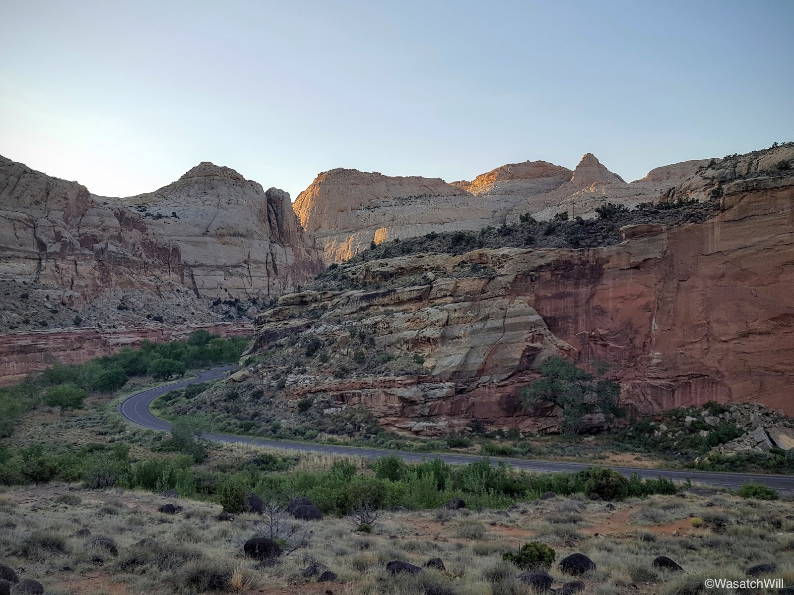
Normally I would shy away from hiking in the desert in mid-summer where water sources don't exist along the way, especially longer distance hikes. However, being at the top end of the Grand Staircase, much of Capitol Reef sits well over 5000 feet in elevation. This helps cool down temperatures overnight and in the early morning to make hiking more pleasant, even in the dog days of summer. Considering that and the fact that the trail leading up to Navajo Knobs runs along the west side of some higher cliffs, I knew there'd be shade for much of the way if I got an early enough start on the trail. With Jess's OK, I got up and drove down the road from Torrey to the trailhead in the Park and got started on the trail just before 7 am. It would have been a half hour sooner, had I not left my phone with its all important camera back in Torrey, causing me to turn around to go back and get it.
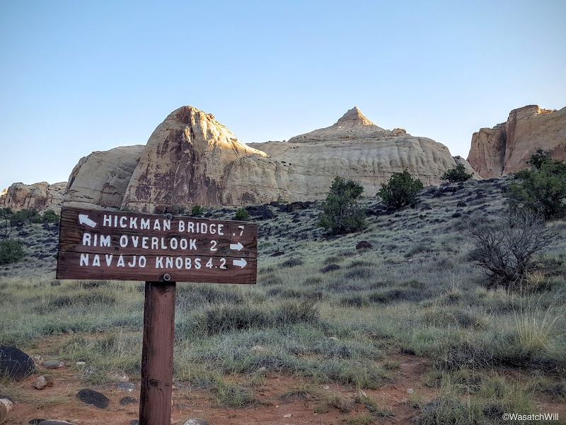
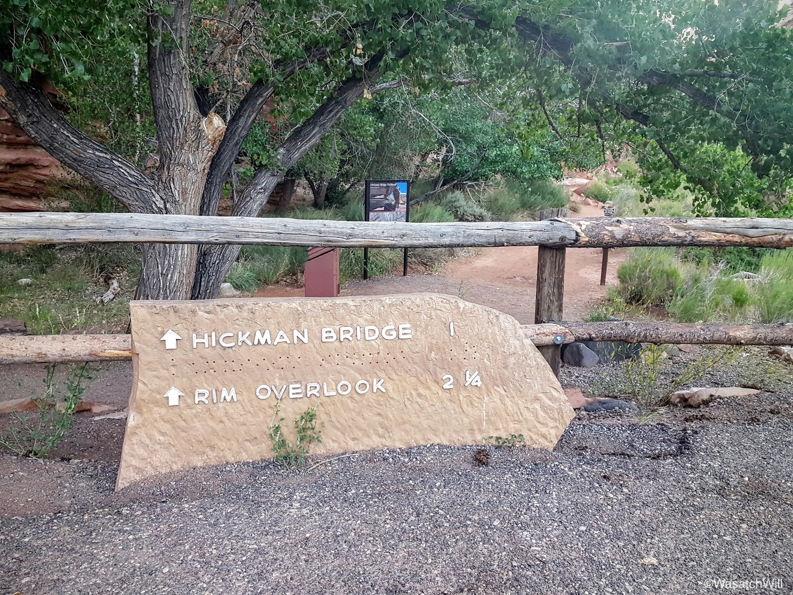
The Navajo Knobs trail shares a trailhead with the much more popular Hickman Bridge, and with that being such a popular hike, and the trailhead only being able to accommodate a couple dozen vehicles, the trailhead can fill up quickly. As true for most other hikes, not only is starting early the ticket to beating the heat, it's also the ticket to beating the crowds and securing an easy parking spot.

The trailhead
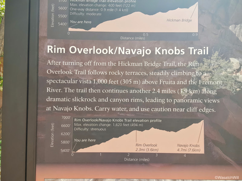
Trail info

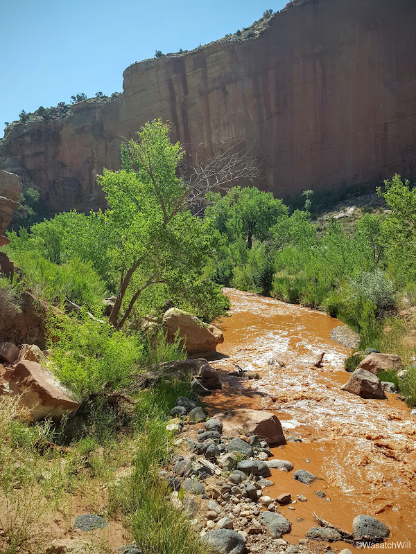
The trail and the Fremont River

Morning light begins to creep into the Fremont River gorge
Moments from the start, I arrived at the fork. One way continued on to Hickman Bridge, a point I had been to a few times before, while the other would lead me up unfamiliar territory the rest of the way. I made the turn for the latter.
The turnoff for Navajo Knobs

Plenty of shade left
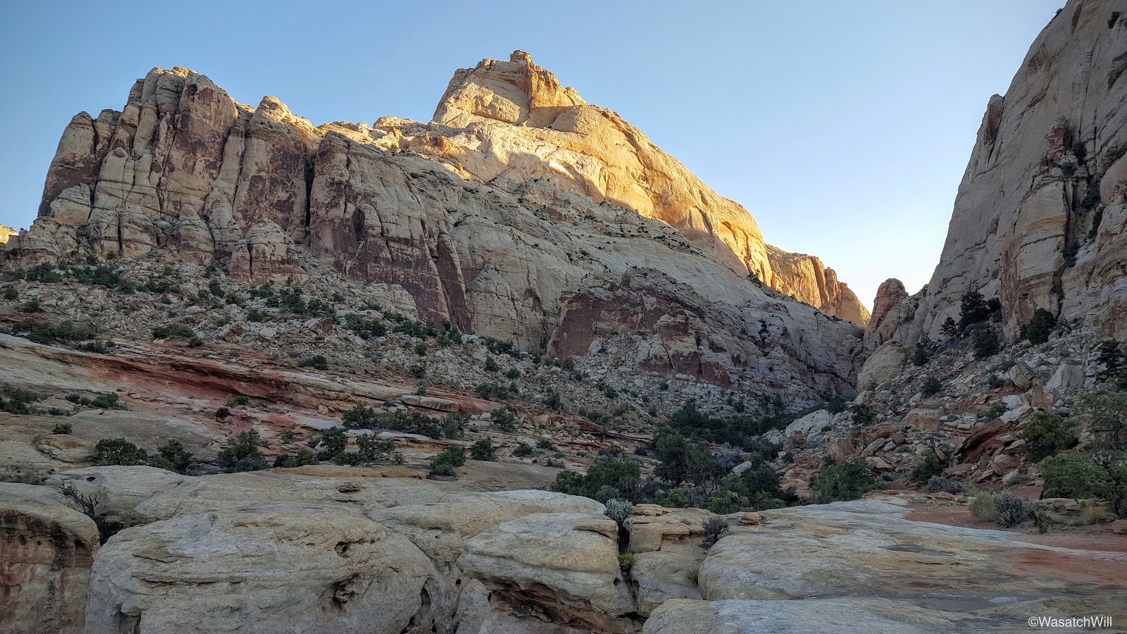
Every now and then, as I ascended up the trail, I'd look back to see what the sun light was doing. One reason was just to be sure I didn't miss a nice picture. The other reason was to keep track of how much shade I'd have left to keep cool in.
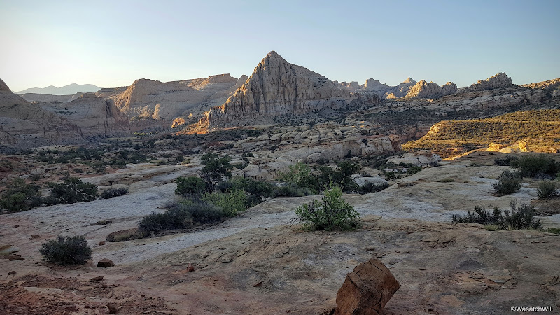
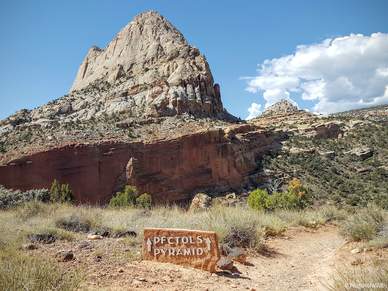
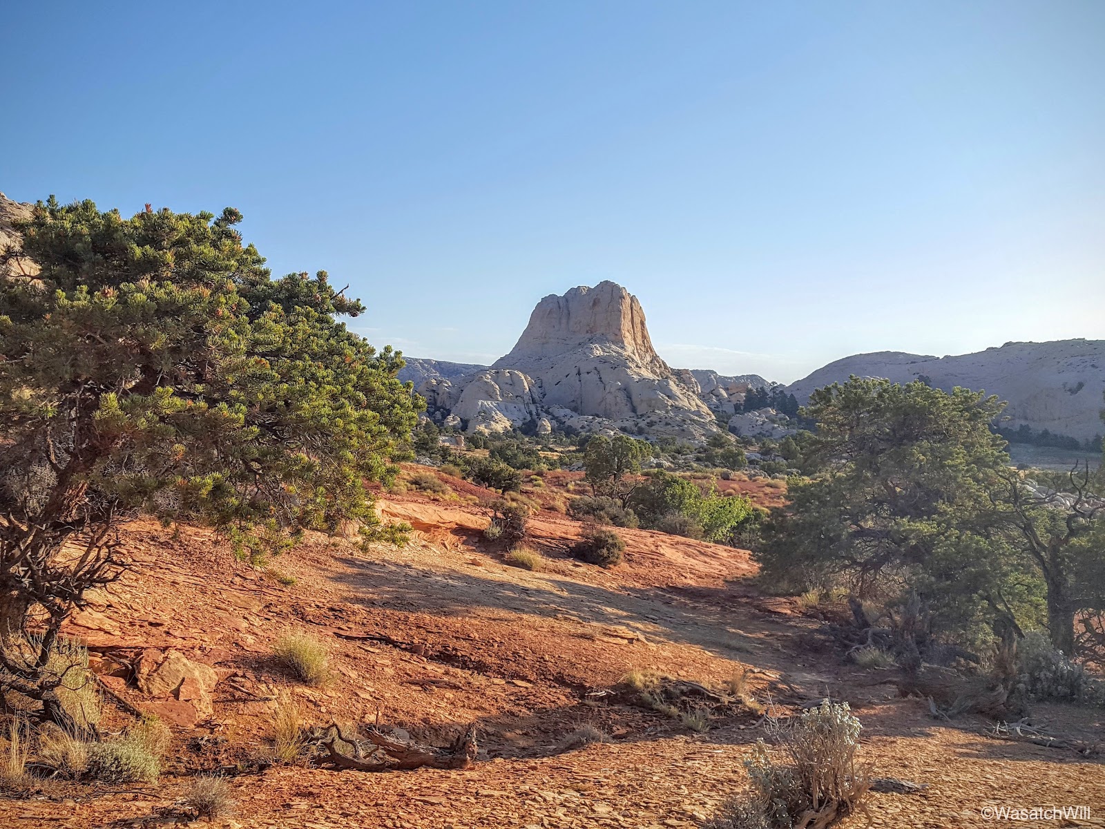
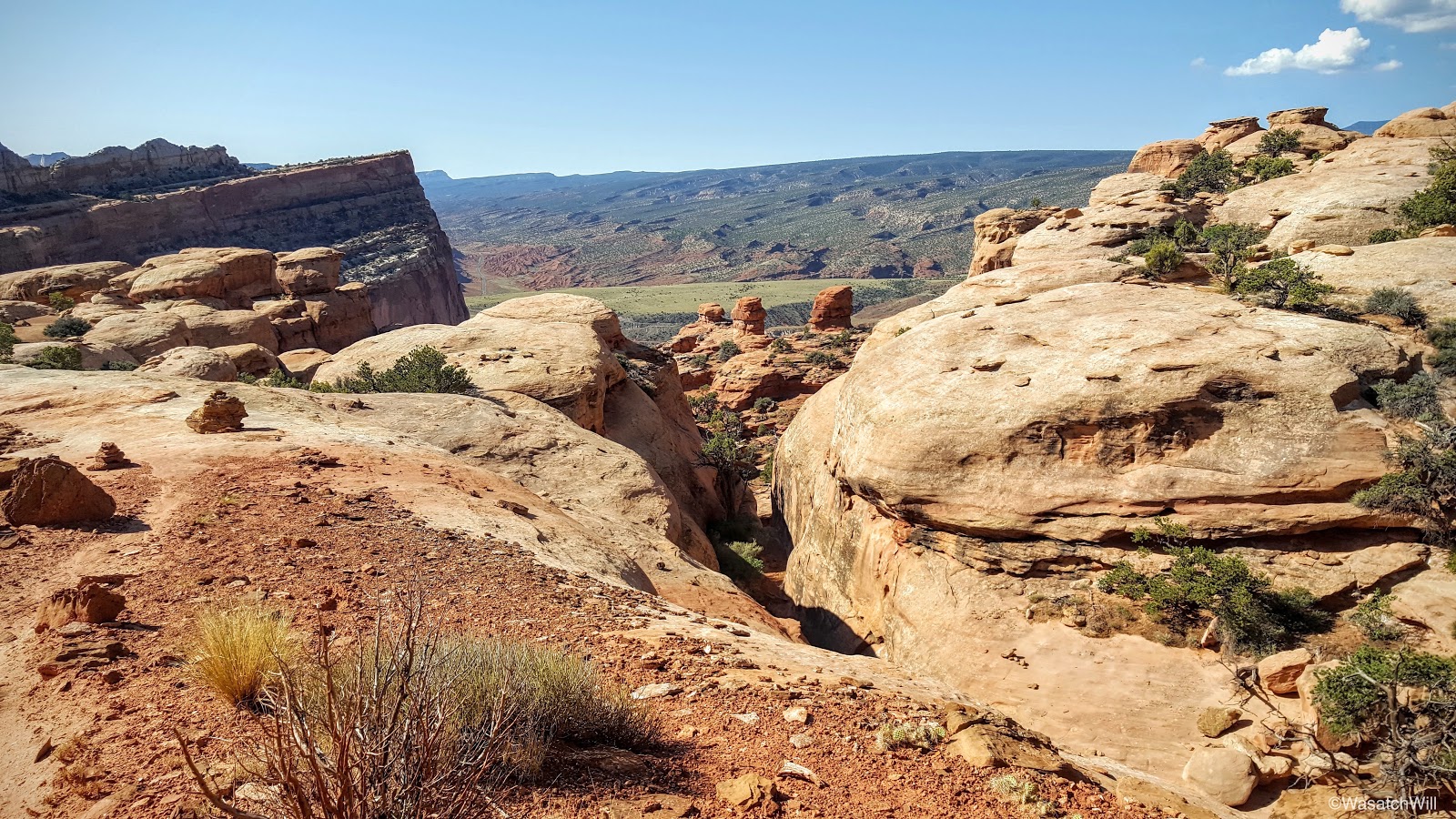
A look back at Pectol's Pyramid
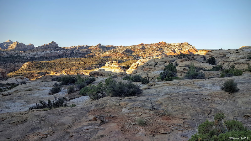
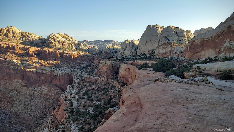
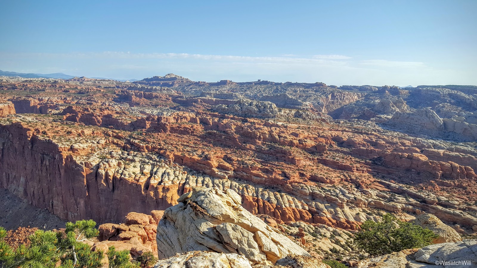
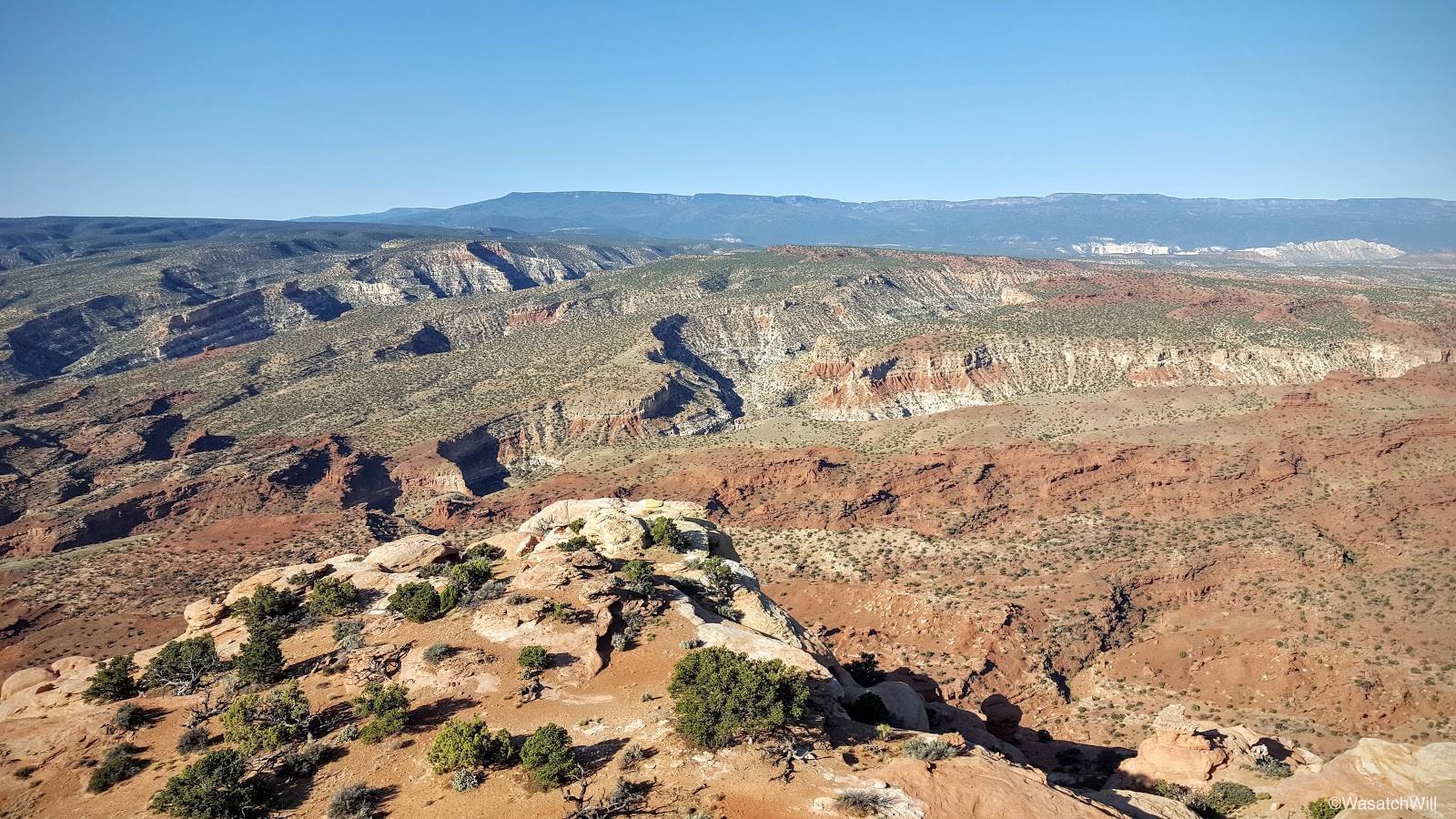
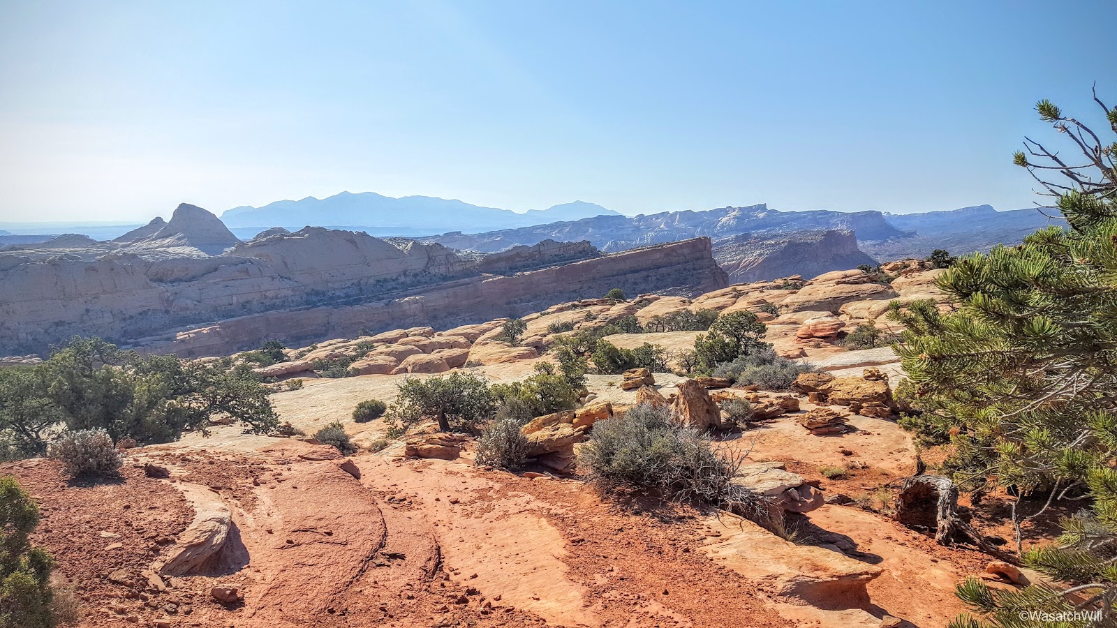
A look back south across the high country of Captiol Reef
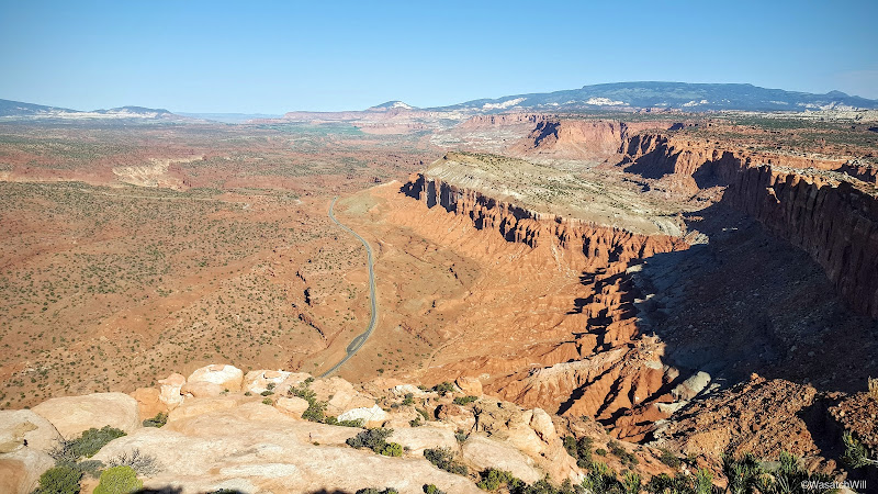
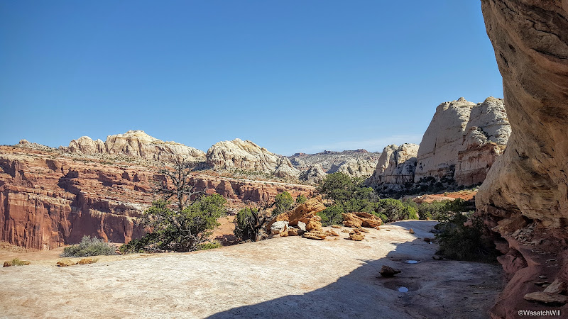
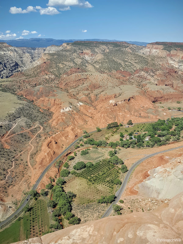
I made one brief stop at the Rim Overlook where I surveyed historic Fruita down below, but didn't tarry long, because again, shade. I wanted to maintain as much of it as possible for the ascent up.
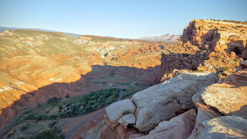
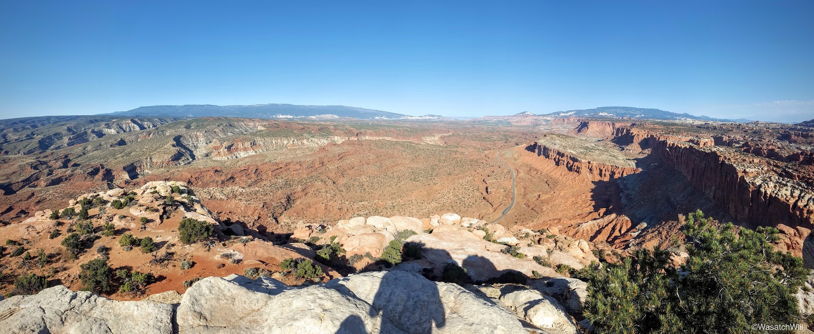
A quick look down into Fruita from the Rim Overlook
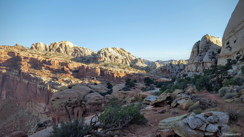
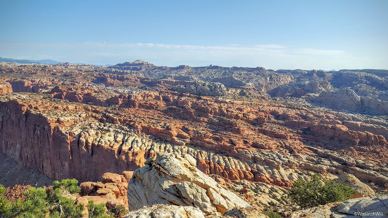
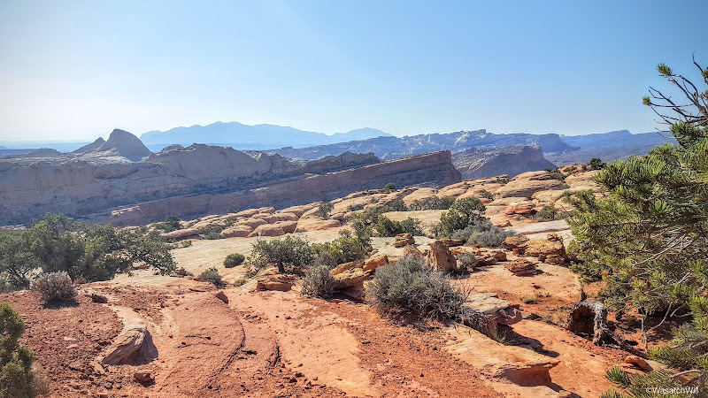
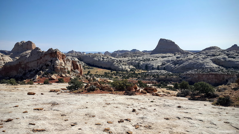
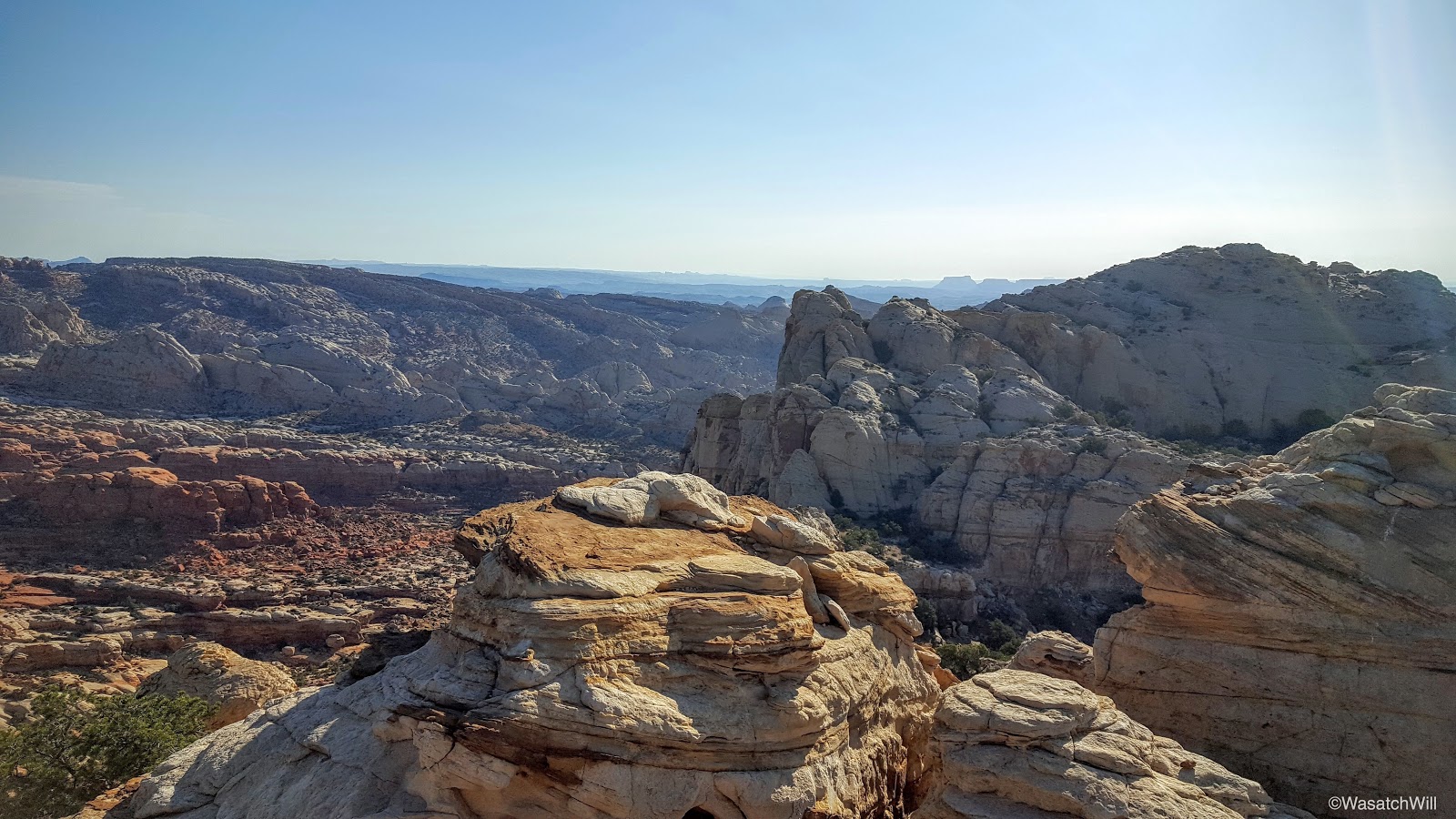
So onward I went as I continued to progress this beautiful high desert ascent.
A view north from the trail
An landmark with no name
Another view north further up the trail
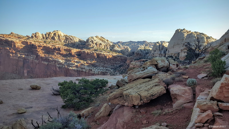
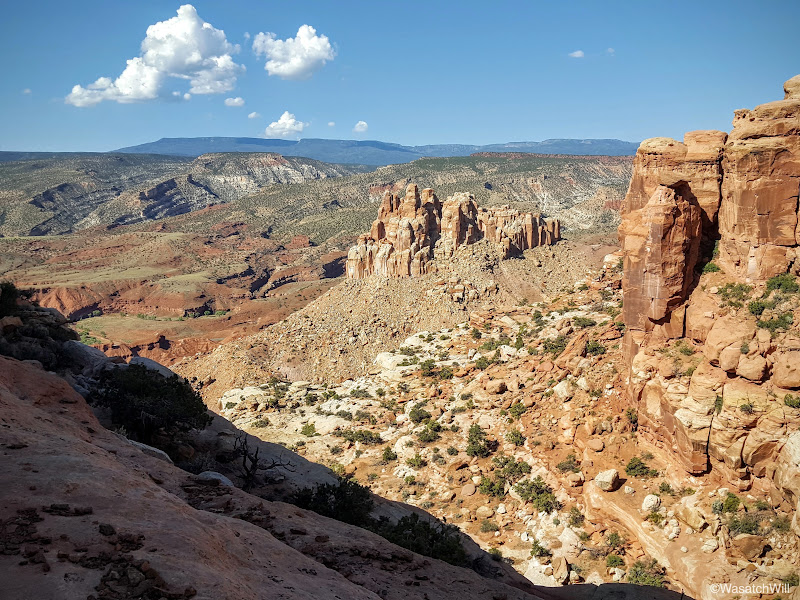
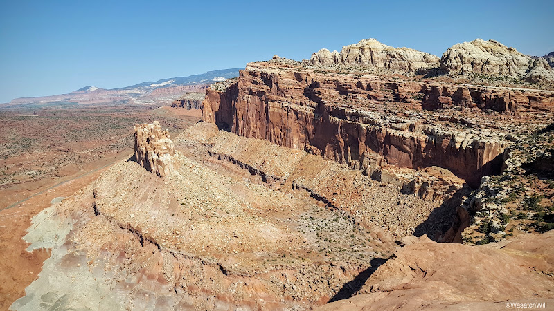
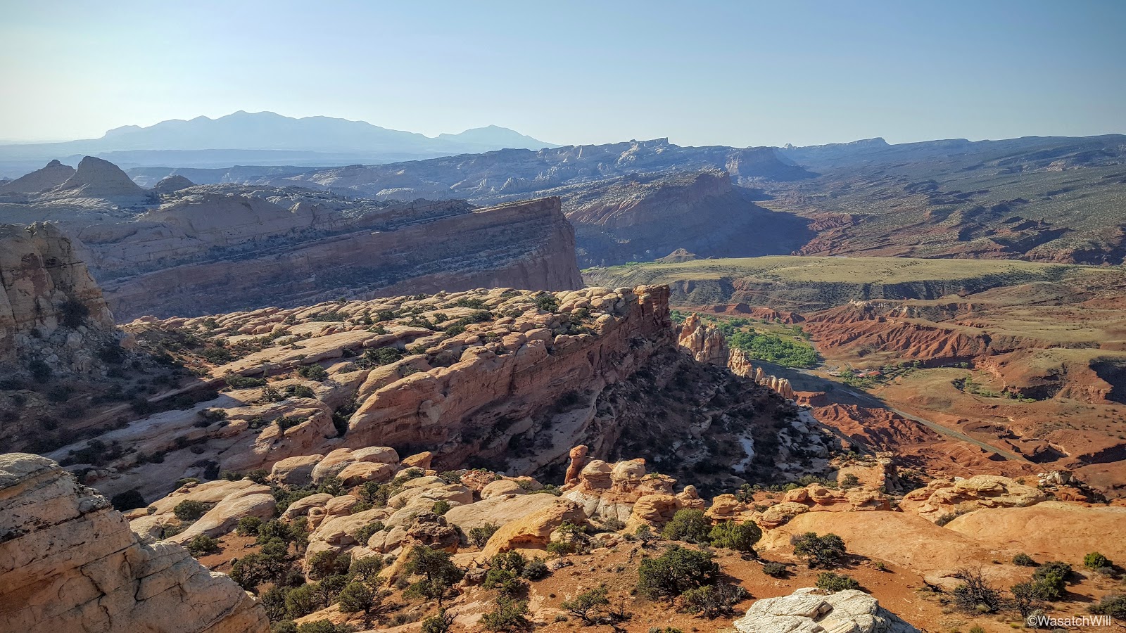
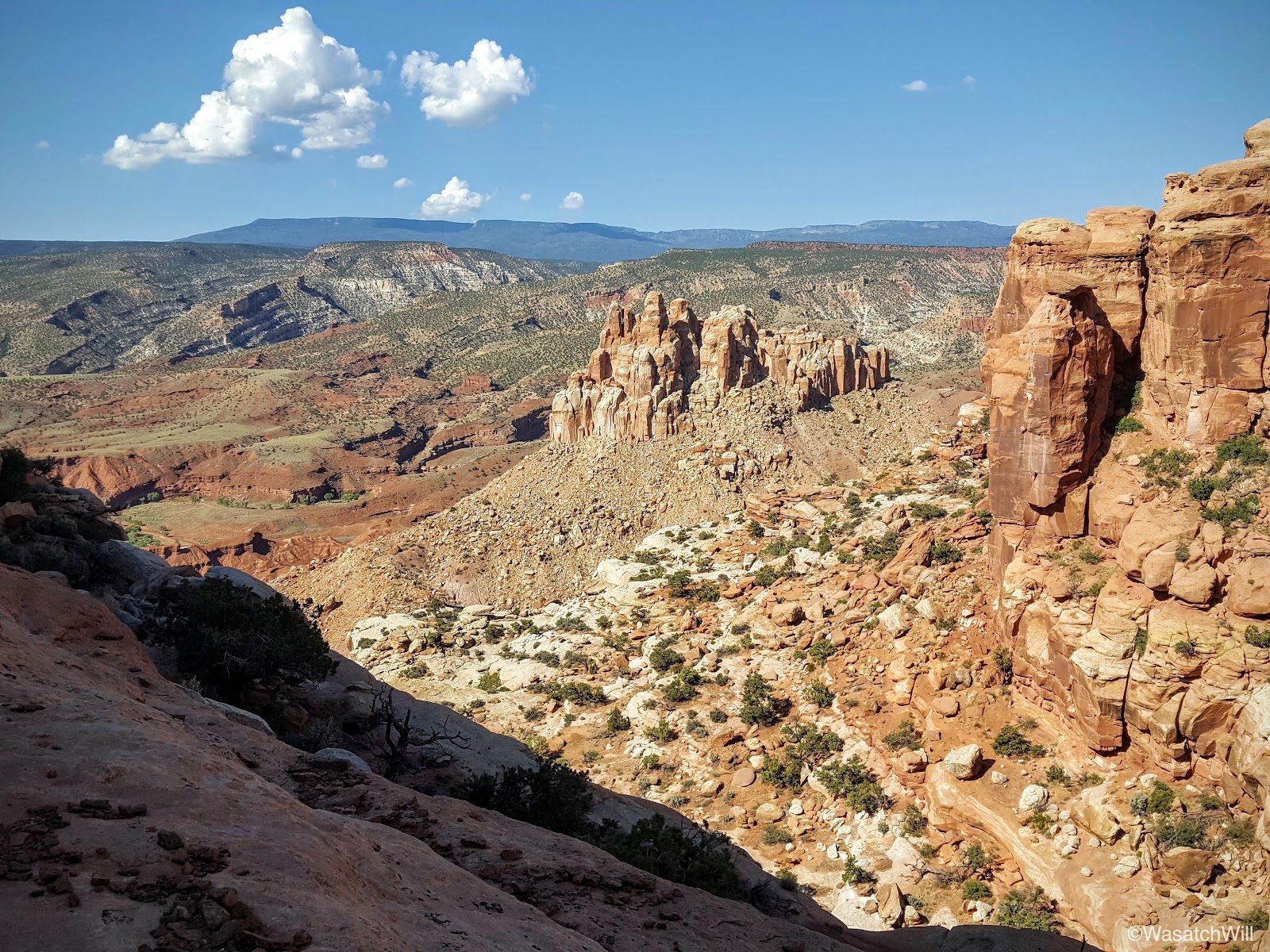
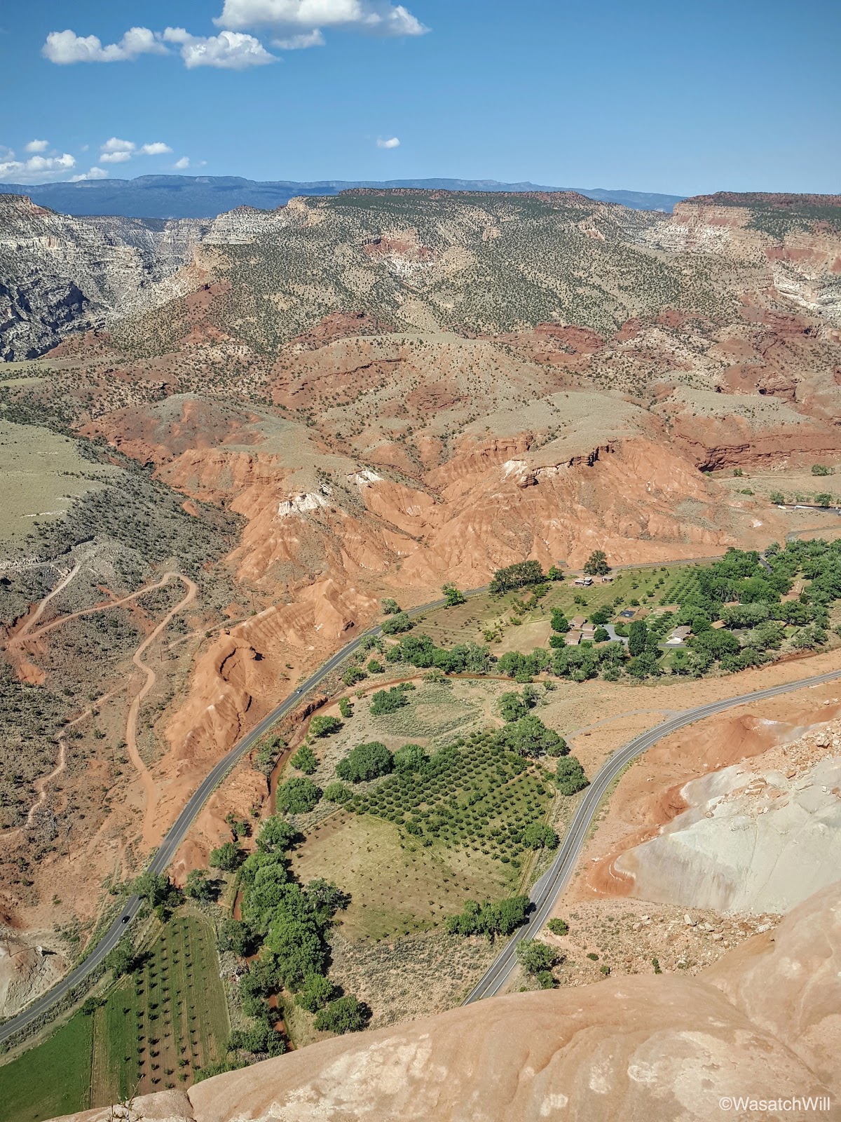
After a couple of miles, I found myself staring down at another iconic landmark of Capitol Reef, The Castle. Have been used to see it from below and passing by it so many times on the countless drives I've made along the highway through the park, it was neat to see it from a new angle well above it. My destination, Navajo Knobs, was also now visible along the top of the cliff above it. It was a "so close, but still so far away" moment.

The Castle (left middle) and Navajo Knobs (top center)
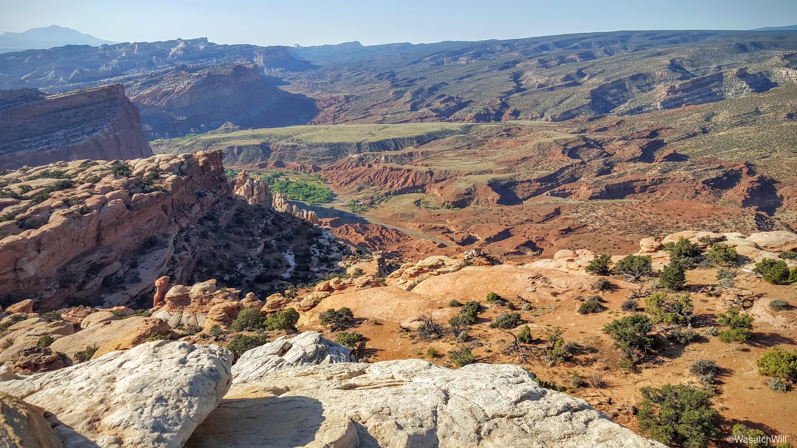
Northward along the rim
Still moving northward
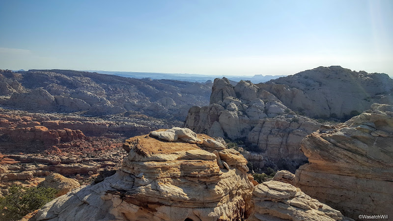
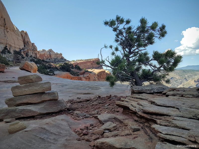
After about another mile, the Knobs became more defined as I continued to close in on them.

Navajo Knobs (top right)
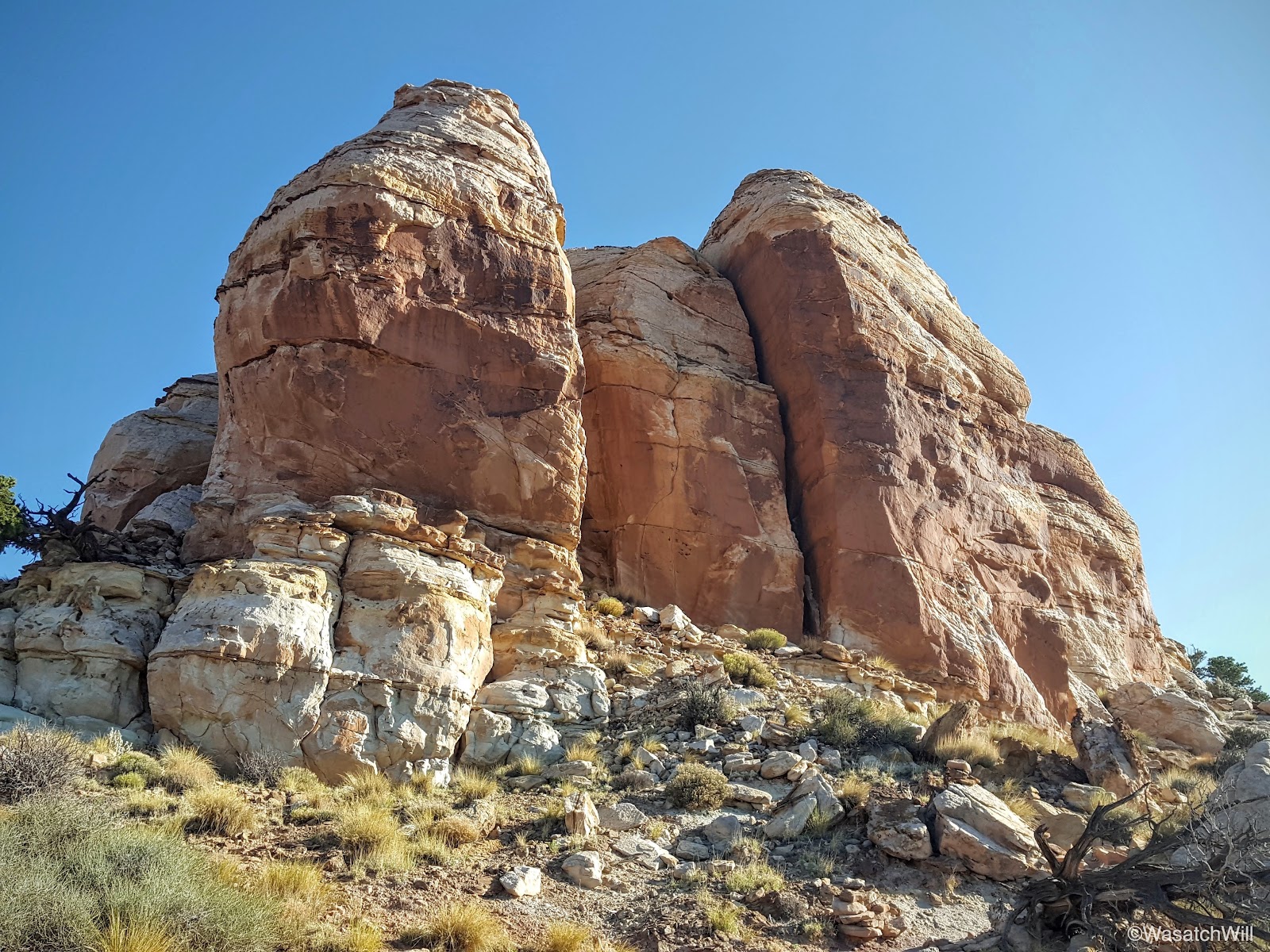
And before I knew it, with the sun now fully out, I was standing at the base. I sized up the knobby rocks for a moment. Looks like a fun climb.

Navajo Knobs
As it turns out, it was a fun little climb. The route, which leads up the back or west side is just some real simple class 3 climbing with little to no real dangerous exposure. And just like that, I was all alone at the top taking in yet another breathtaking view across all 360 degrees of the horizon.
View west: Thousand Lake Mountain (right horizon), Highway 24 and Mummy Cliffs
View north into Spring Canyon drainage
View east with Factory Butte on the horizon

View southeast with Henry Mountains rising on the left horizon
View south with a bit of Fruita visible
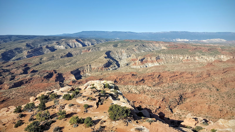
Looking southwest with Boulder Mountain along the horizon
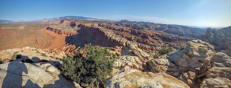
West Panorama
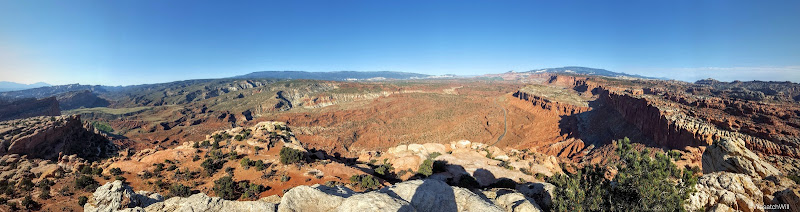
North Panorama
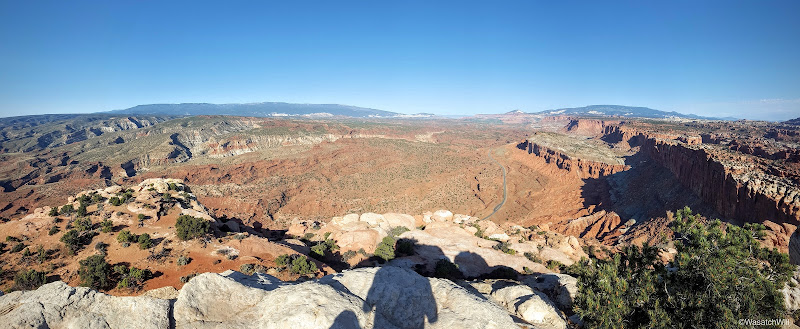
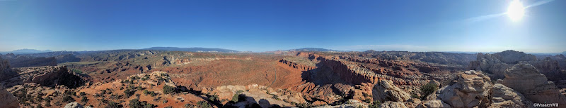
180 West Panorama
360 Panorama

Selfie
Since it was Independence Day, I thought it appropriate to snap a few pics of the nation and state flag. It made me extra thankful to live in a country and a state with such a variety of majestic landscapes that has been preserved and protected for the recreation and enjoyment of the public. More importantly, it's a blessing to live in a land of abundant freedom and liberty.
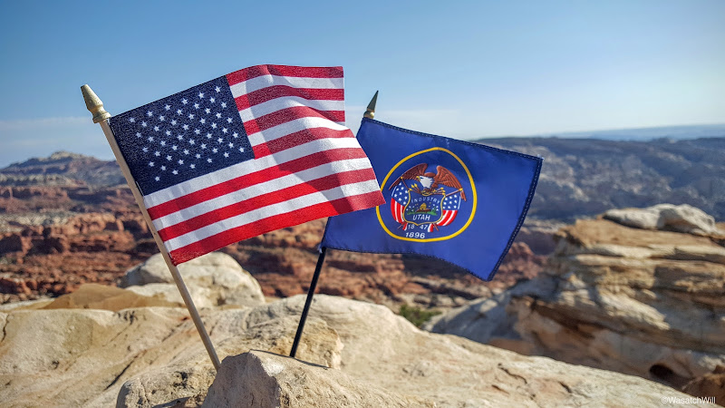
Celebrating Independence Day
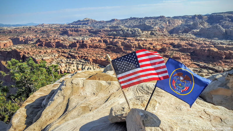
Home of the Free
I was lucky to have it all to myself the whole time I was up there. It was so peaceful, a contrast with the grand parade that was taking place among an enormous crowd of people at the very same time in my neighborhood back home in Provo. Satisfied with my time up top, having soaked in the views and ingesting some much deserved calories, I began the long descent back down to the trailhead.
Descending down the trail

Looking down a small slot
The Castle
Recapturing a bit of shade on the way down
Looking back up trail toward Navajo Knobs
Looking back down at the Castle and Navajo Knobs from the rim
Capitol Dome (right horizon)
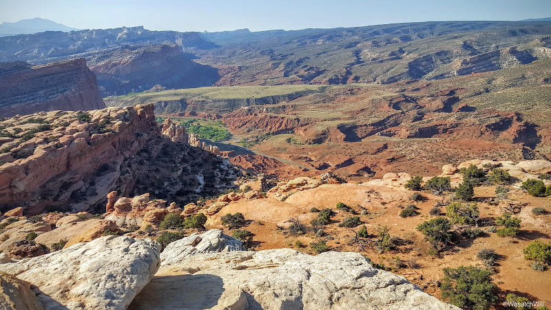
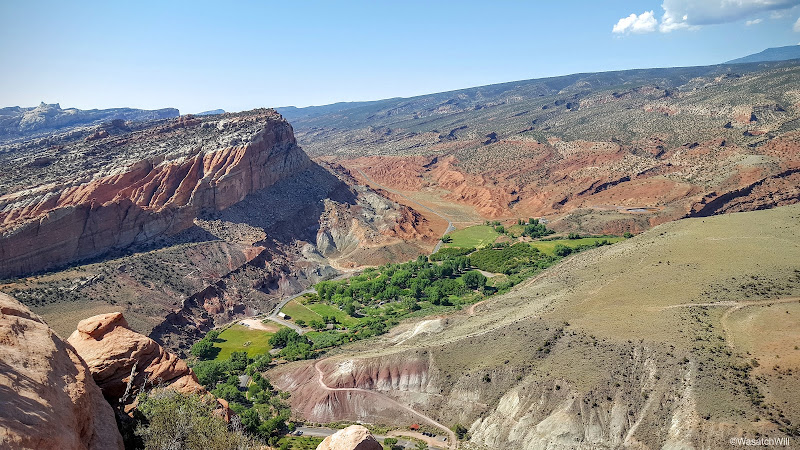
I couldn't resist detouring up to the site of a little radio tower that sits along the edge of the rim overlooking Fruita. It offered some fantastic views down at the Visitor Center and on up the Sulfur Creek and Fremont River gorges.
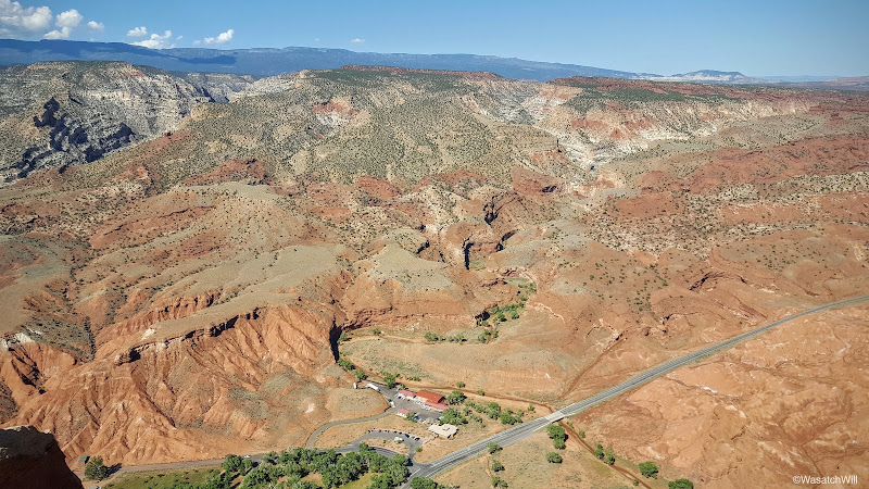
Fremont River gorge (upper left), Visitor Center (bottom middle), Highway 24, and Sulfur Creek gorge (above visitor center)
Fruita orchards
I also made another quick stop back at the Rim Overlook.
Looking south across Fruita
Nearby was one of the many lizards that were consistently sighted along the trail. I became jealous of how easy it was for this little guy to find shade. The heat of summer was definitely starting to manifest itself.

This lizard knows how to keep cool
One last little side spur off trail revealed an overlook to Hickman Bridge.
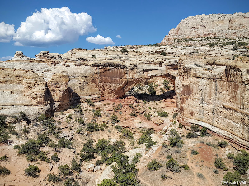
Hickman Bridge Overlook
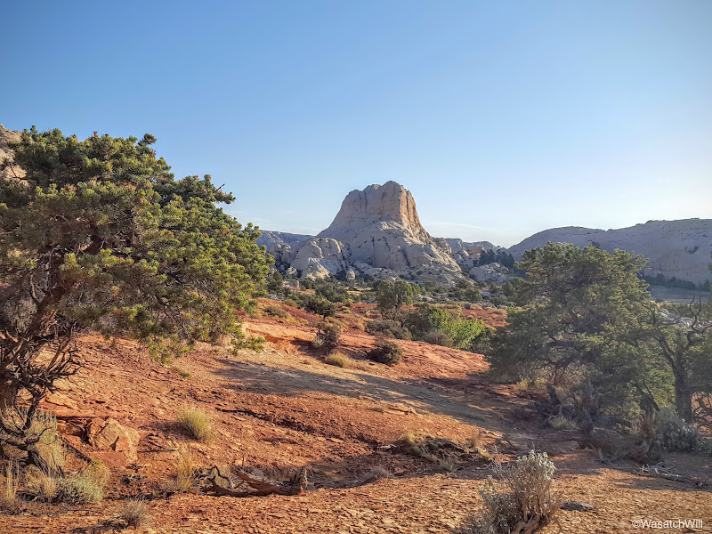
I also enjoyed views of Pectol's Pyramid.
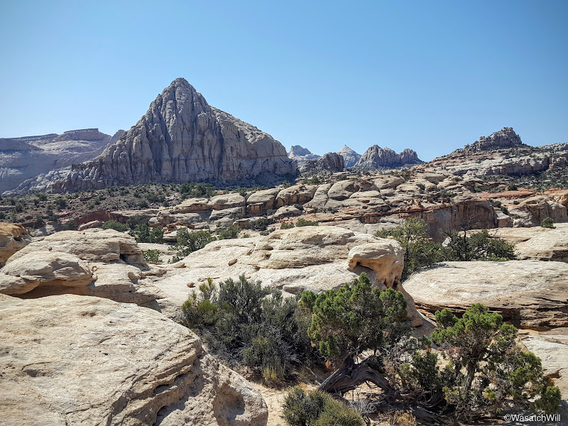
Pectol's Pyramid
Pectol's Pyramid gets its name from Ephraim Pectol, the great-great-grandfather of my wife, Jessica. As noted in another recent post, he had been among the first residents of modern day Torrey, Utah. He raised a large family, explored much of the surrounding landscape, compiled quite a collection of ancient artifacts from his explorations before the antiquities act was passed making it illegal to do so, owned and operated the Chuckwagon shop and motel for a time, served as a Mormon Bishop, and was eventually elected to serve the Utah State Legislature.
While a member of the the legislature, he and his brother-in-law, Joe Hickman, worked at securing federal protection for a section of what is now Captiol Reef National Park. The efforts were successful in getting President Franklin D. Roosevelt to establish a national monument in 1937. The monument later evolved with acquisition of additional land and ultimately became a full fledged national park when President Nixon signed a bill making it so in 1971.
Thus, Ephraim Pectol can appropriately be attributed as father and founder of what is now Capitol Reef National Park.
Pectol's Pyramid
Passing by the marker for Pectol's Pyramid also meant the trailhead where my car awaited was nigh. Just a half mile or so of descending back down to the banks of the Fremont River before I was able to conclude the hike.
Fremont River

Approaching the trailhead
This was a terrific hike and to my surprise, being a big holiday weekend, I encountered nobody along the way up. On the way back down, I encountered a few couples and groups venturing up the way I had come. I nodded to each of them while silently thanking them for starting their hikes later, leaving me the solitude I was able to enjoy. Of course, once down to the junction with the Hickman Bridge trail, many more people were coming and going, as expected.
For all 8+ miles, it took me a little over 4 hours, including a good 45 minutes of relaxing at the top of Navajo Knobs.
Monday - July 4, 2016
Normally I would shy away from hiking in the desert in mid-summer where water sources don't exist along the way, especially longer distance hikes. However, being at the top end of the Grand Staircase, much of Capitol Reef sits well over 5000 feet in elevation. This helps cool down temperatures overnight and in the early morning to make hiking more pleasant, even in the dog days of summer. Considering that and the fact that the trail leading up to Navajo Knobs runs along the west side of some higher cliffs, I knew there'd be shade for much of the way if I got an early enough start on the trail. With Jess's OK, I got up and drove down the road from Torrey to the trailhead in the Park and got started on the trail just before 7 am. It would have been a half hour sooner, had I not left my phone with its all important camera back in Torrey, causing me to turn around to go back and get it.
The Navajo Knobs trail shares a trailhead with the much more popular Hickman Bridge, and with that being such a popular hike, and the trailhead only being able to accommodate a couple dozen vehicles, the trailhead can fill up quickly. As true for most other hikes, not only is starting early the ticket to beating the heat, it's also the ticket to beating the crowds and securing an easy parking spot.
The trailhead
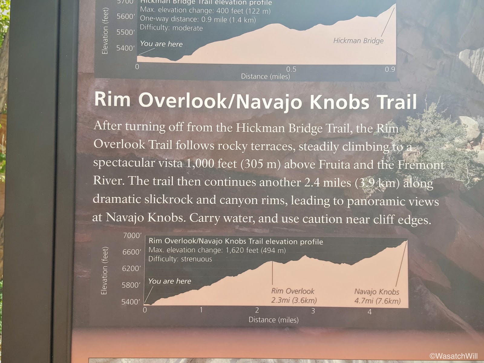
Trail info
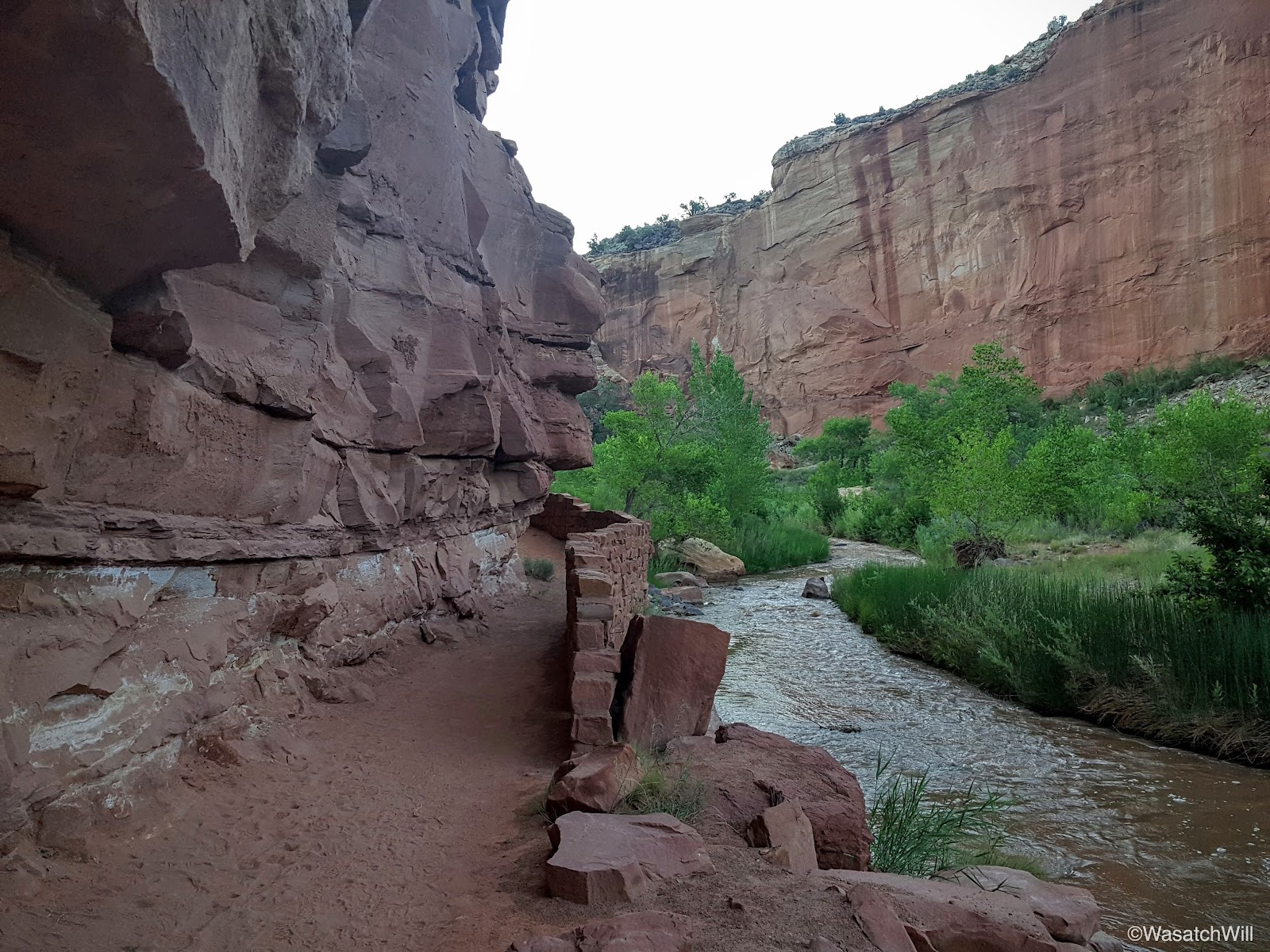
The trail and the Fremont River
Morning light begins to creep into the Fremont River gorge
Moments from the start, I arrived at the fork. One way continued on to Hickman Bridge, a point I had been to a few times before, while the other would lead me up unfamiliar territory the rest of the way. I made the turn for the latter.

The turnoff for Navajo Knobs
Plenty of shade left
Every now and then, as I ascended up the trail, I'd look back to see what the sun light was doing. One reason was just to be sure I didn't miss a nice picture. The other reason was to keep track of how much shade I'd have left to keep cool in.

A look back at Pectol's Pyramid

A look back south across the high country of Captiol Reef
I made one brief stop at the Rim Overlook where I surveyed historic Fruita down below, but didn't tarry long, because again, shade. I wanted to maintain as much of it as possible for the ascent up.
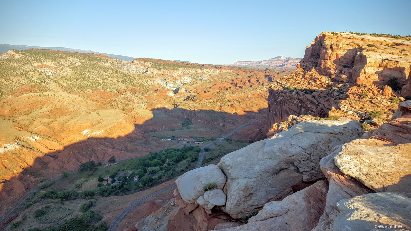
A quick look down into Fruita from the Rim Overlook
So onward I went as I continued to progress this beautiful high desert ascent.

A view north from the trail
An landmark with no name

Another view north further up the trail
After a couple of miles, I found myself staring down at another iconic landmark of Capitol Reef, The Castle. Have been used to see it from below and passing by it so many times on the countless drives I've made along the highway through the park, it was neat to see it from a new angle well above it. My destination, Navajo Knobs, was also now visible along the top of the cliff above it. It was a "so close, but still so far away" moment.
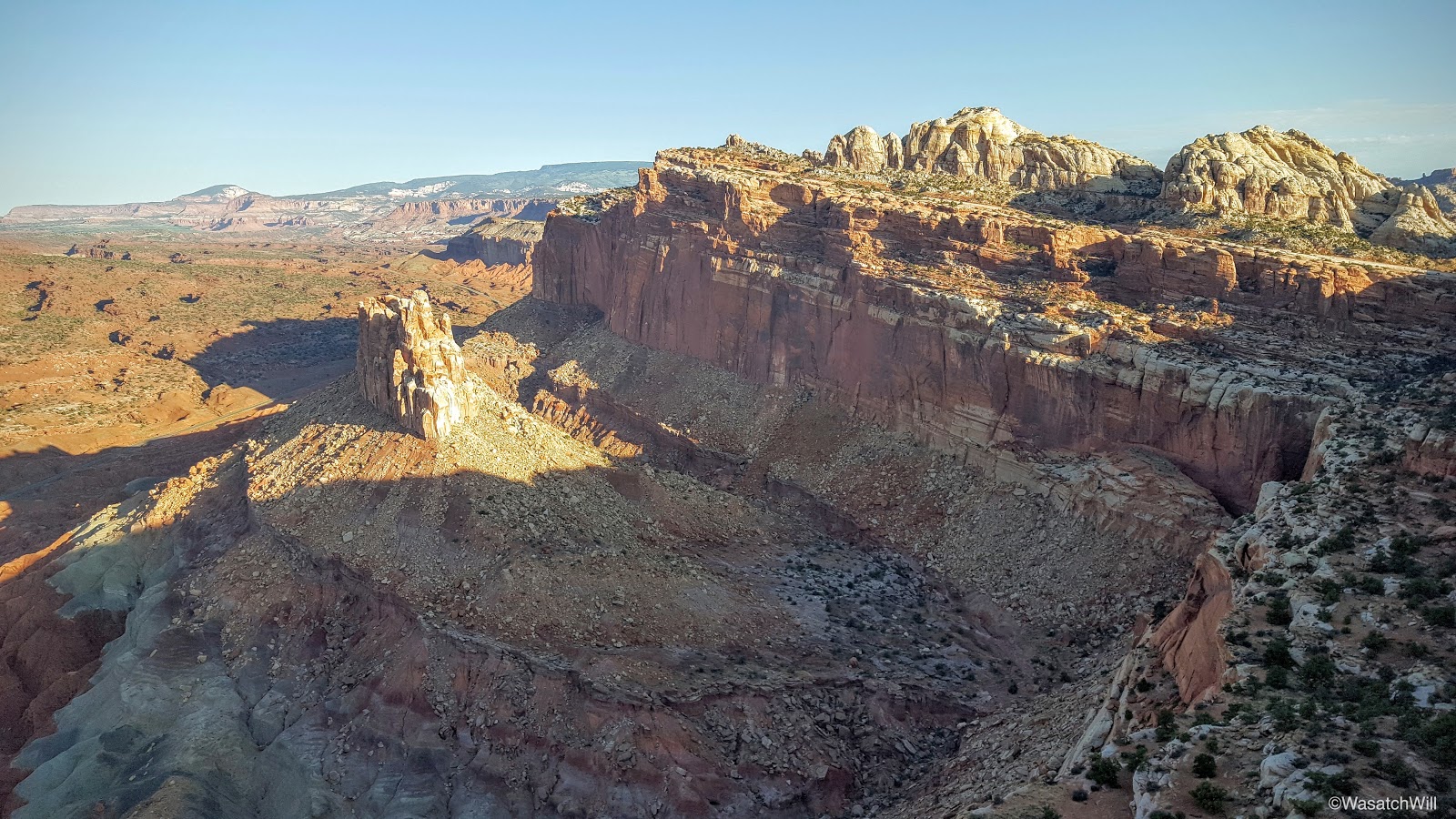
The Castle (left middle) and Navajo Knobs (top center)

Northward along the rim

Still moving northward
After about another mile, the Knobs became more defined as I continued to close in on them.
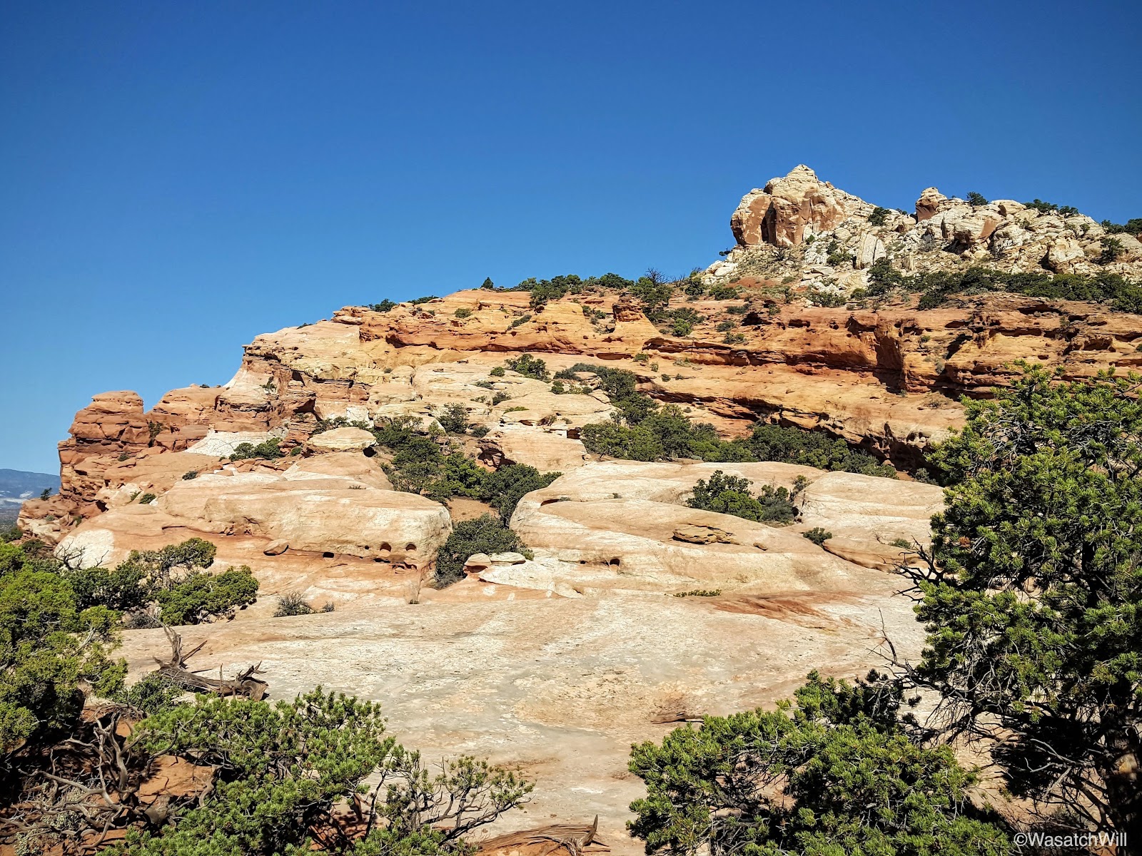
Navajo Knobs (top right)
And before I knew it, with the sun now fully out, I was standing at the base. I sized up the knobby rocks for a moment. Looks like a fun climb.
Navajo Knobs
As it turns out, it was a fun little climb. The route, which leads up the back or west side is just some real simple class 3 climbing with little to no real dangerous exposure. And just like that, I was all alone at the top taking in yet another breathtaking view across all 360 degrees of the horizon.

View west: Thousand Lake Mountain (right horizon), Highway 24 and Mummy Cliffs
View north into Spring Canyon drainage
View east with Factory Butte on the horizon
View southeast with Henry Mountains rising on the left horizon
View south with a bit of Fruita visible
Looking southwest with Boulder Mountain along the horizon
West Panorama

North Panorama

180 West Panorama

360 Panorama
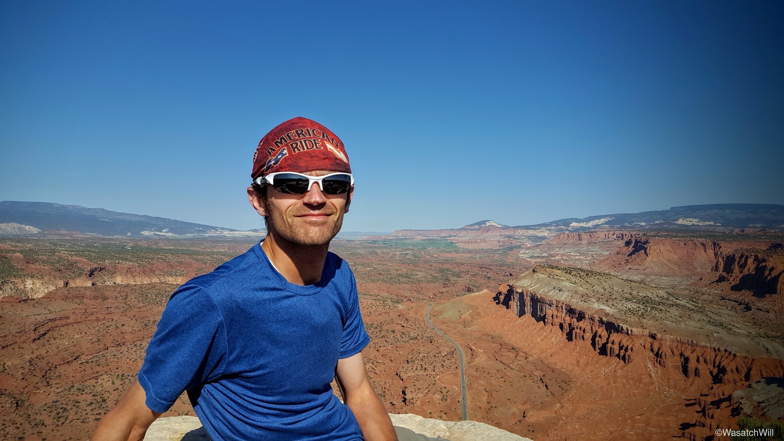
Selfie
Since it was Independence Day, I thought it appropriate to snap a few pics of the nation and state flag. It made me extra thankful to live in a country and a state with such a variety of majestic landscapes that has been preserved and protected for the recreation and enjoyment of the public. More importantly, it's a blessing to live in a land of abundant freedom and liberty.

Celebrating Independence Day

Home of the Free
I was lucky to have it all to myself the whole time I was up there. It was so peaceful, a contrast with the grand parade that was taking place among an enormous crowd of people at the very same time in my neighborhood back home in Provo. Satisfied with my time up top, having soaked in the views and ingesting some much deserved calories, I began the long descent back down to the trailhead.
Descending down the trail
Looking down a small slot
The Castle

Recapturing a bit of shade on the way down

Looking back up trail toward Navajo Knobs
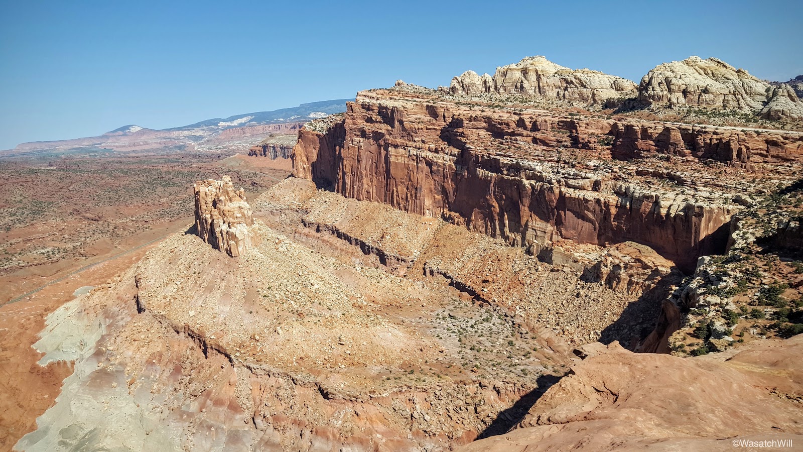
Looking back down at the Castle and Navajo Knobs from the rim

Capitol Dome (right horizon)
I couldn't resist detouring up to the site of a little radio tower that sits along the edge of the rim overlooking Fruita. It offered some fantastic views down at the Visitor Center and on up the Sulfur Creek and Fremont River gorges.
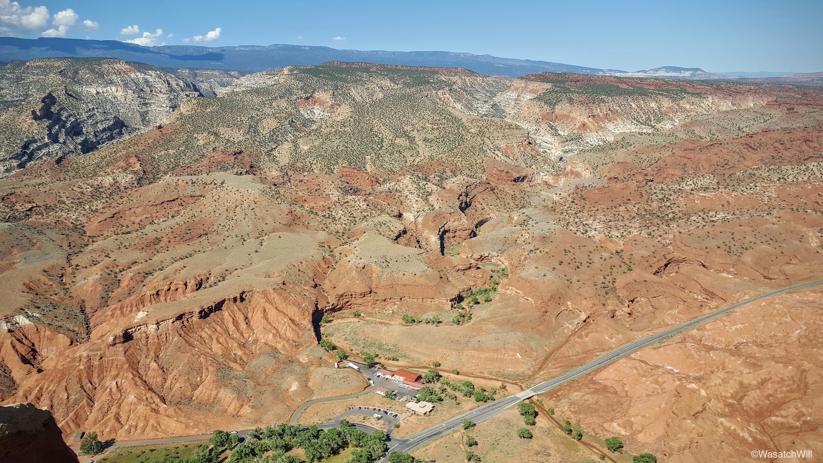
Fremont River gorge (upper left), Visitor Center (bottom middle), Highway 24, and Sulfur Creek gorge (above visitor center)
Fruita orchards
I also made another quick stop back at the Rim Overlook.

Looking south across Fruita
Nearby was one of the many lizards that were consistently sighted along the trail. I became jealous of how easy it was for this little guy to find shade. The heat of summer was definitely starting to manifest itself.
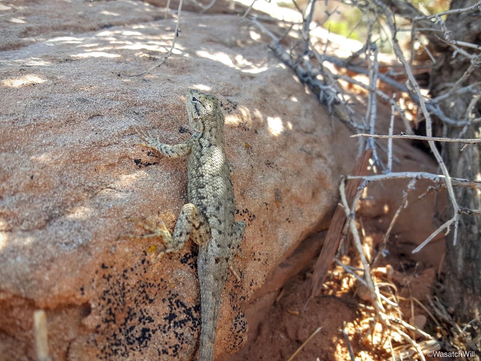
This lizard knows how to keep cool
One last little side spur off trail revealed an overlook to Hickman Bridge.

Hickman Bridge Overlook
I also enjoyed views of Pectol's Pyramid.

Pectol's Pyramid
Pectol's Pyramid gets its name from Ephraim Pectol, the great-great-grandfather of my wife, Jessica. As noted in another recent post, he had been among the first residents of modern day Torrey, Utah. He raised a large family, explored much of the surrounding landscape, compiled quite a collection of ancient artifacts from his explorations before the antiquities act was passed making it illegal to do so, owned and operated the Chuckwagon shop and motel for a time, served as a Mormon Bishop, and was eventually elected to serve the Utah State Legislature.
While a member of the the legislature, he and his brother-in-law, Joe Hickman, worked at securing federal protection for a section of what is now Captiol Reef National Park. The efforts were successful in getting President Franklin D. Roosevelt to establish a national monument in 1937. The monument later evolved with acquisition of additional land and ultimately became a full fledged national park when President Nixon signed a bill making it so in 1971.
Thus, Ephraim Pectol can appropriately be attributed as father and founder of what is now Capitol Reef National Park.

Pectol's Pyramid
Passing by the marker for Pectol's Pyramid also meant the trailhead where my car awaited was nigh. Just a half mile or so of descending back down to the banks of the Fremont River before I was able to conclude the hike.
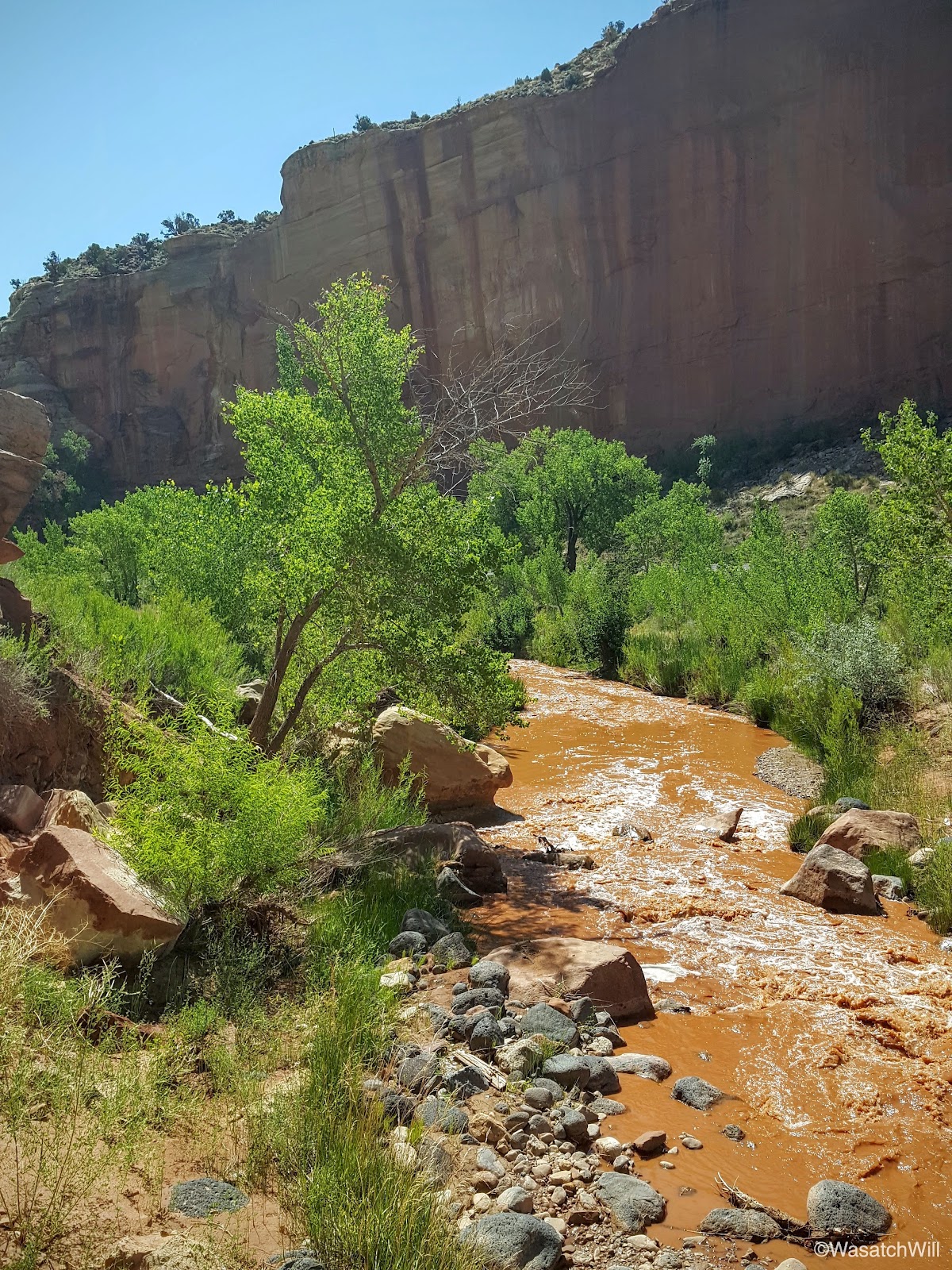
Fremont River
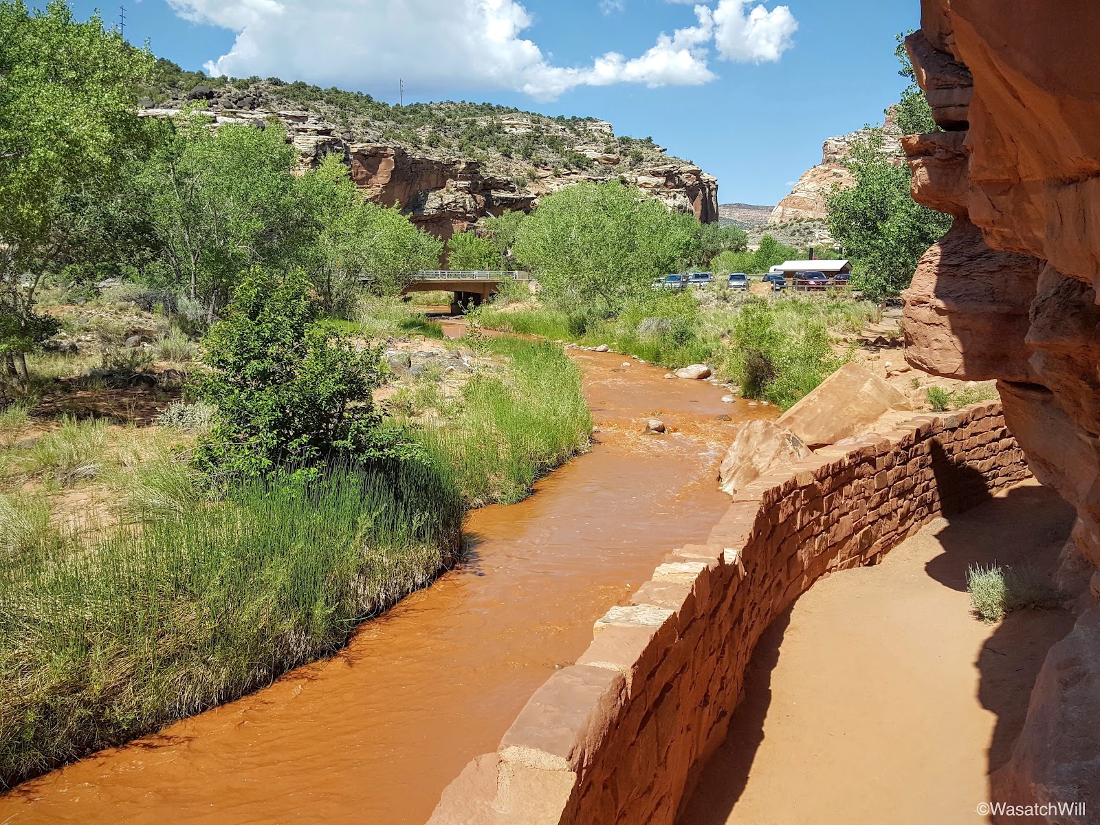
Approaching the trailhead
This was a terrific hike and to my surprise, being a big holiday weekend, I encountered nobody along the way up. On the way back down, I encountered a few couples and groups venturing up the way I had come. I nodded to each of them while silently thanking them for starting their hikes later, leaving me the solitude I was able to enjoy. Of course, once down to the junction with the Hickman Bridge trail, many more people were coming and going, as expected.
For all 8+ miles, it took me a little over 4 hours, including a good 45 minutes of relaxing at the top of Navajo Knobs.