Yvonne
I lava it!!!
- Joined
- Jan 19, 2012
- Messages
- 4,181
This is a pretty short but steep hike, and definitely a leg burner. I really enjoy hikes with a lot of elevation gain and expansive views as a reward, so I thought I give it a try. This wonderful leg burner has an elevation gain of 2,200 ft in 2.5 miles up to the summit. It's only a short 5-mile roundtrip hike but the views are outstanding from the top of Avalanche Peak in all directions.
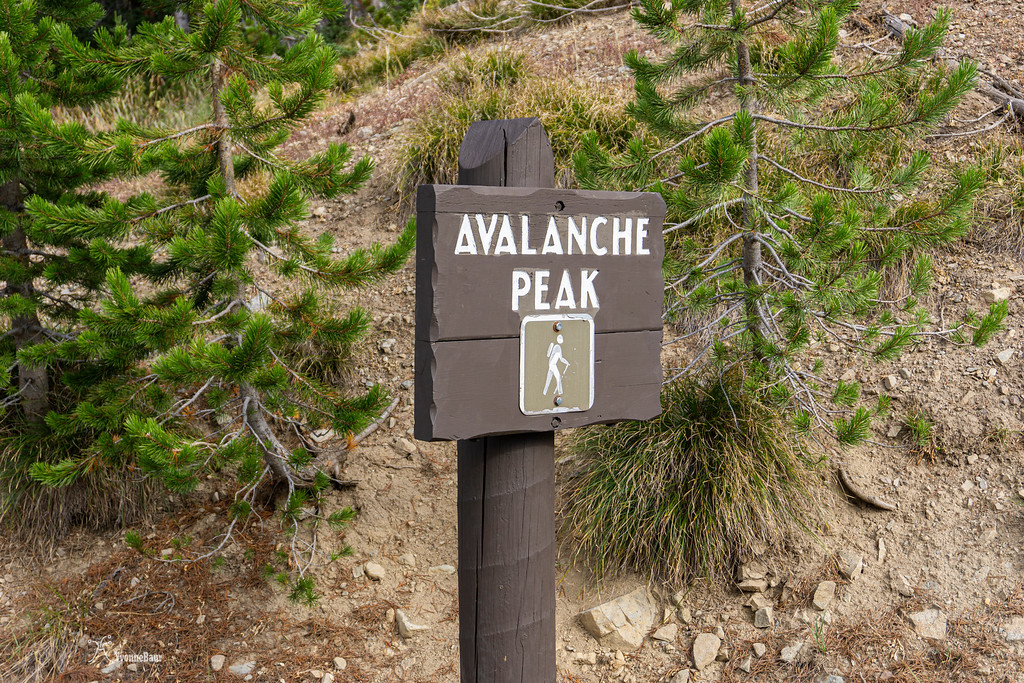
I left early from my base camp at Canyon campground and headed over toward the East Entrance and Sylvan Pass. There is a small parking lot on the right side of the road and to start hiking, you have to cross the road.
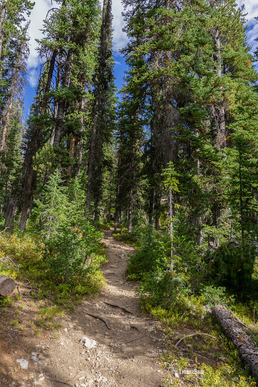
the first part of the trail goes through a lodgepole pine forest and immediately starts climbing up. I was glad I was already here in the park for a week and already seasoned to the higher elevation.
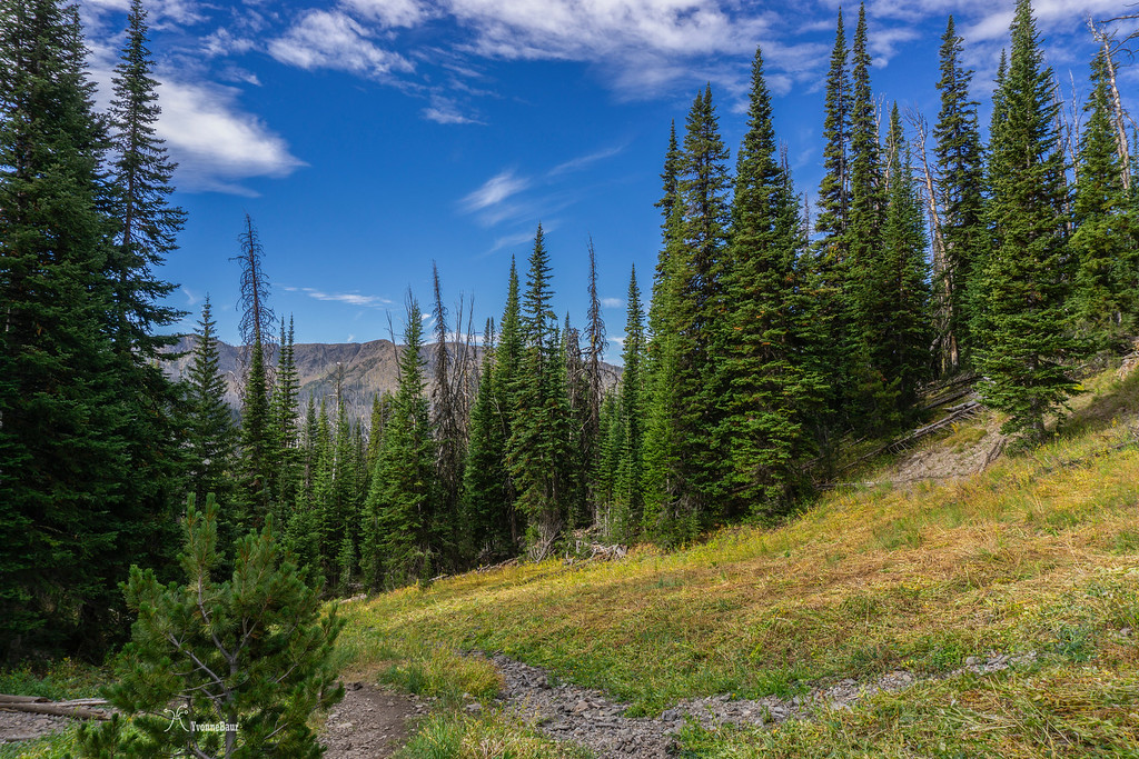
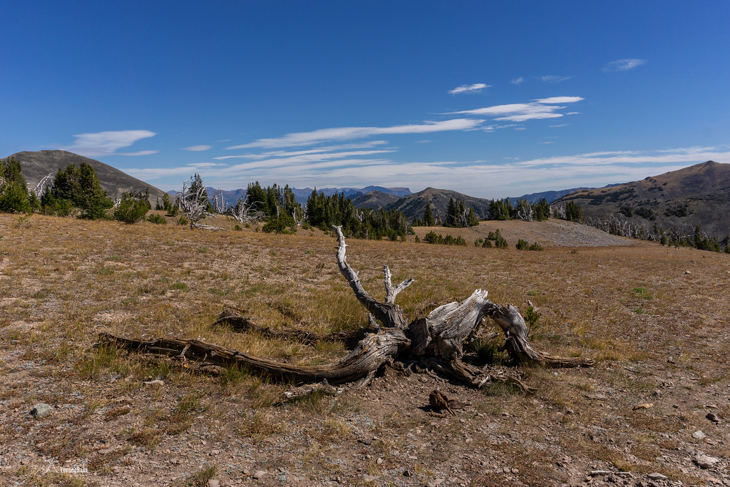
After about the first 0.7 miles the forest becomes more open and the first views come into place.
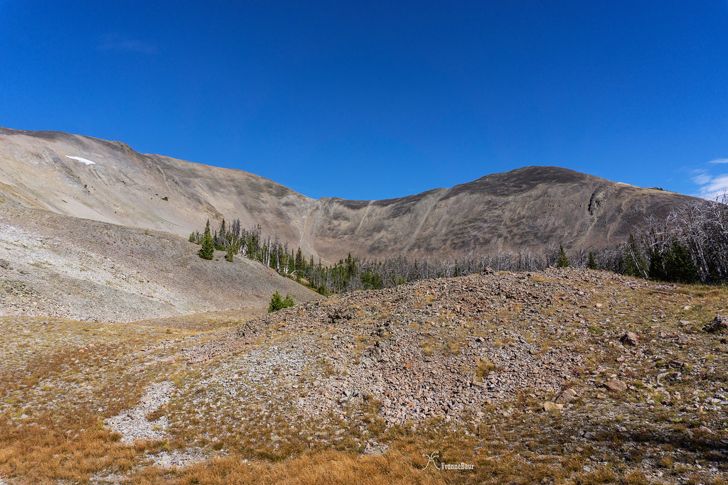
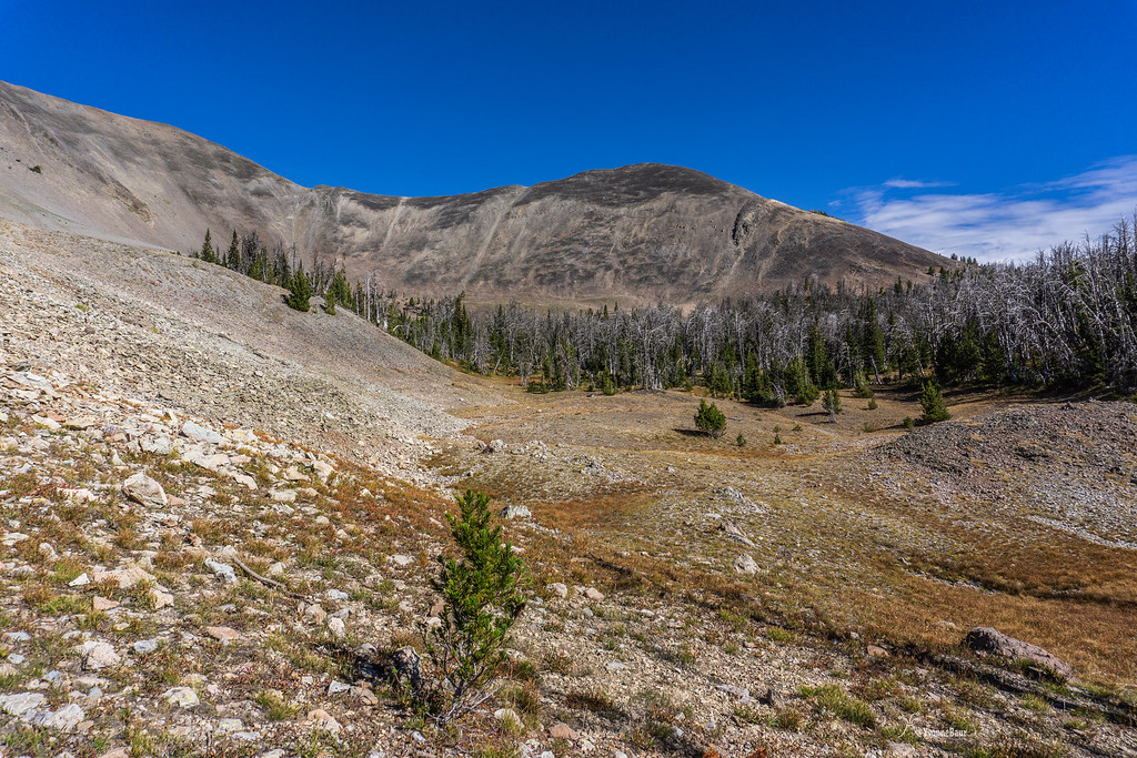
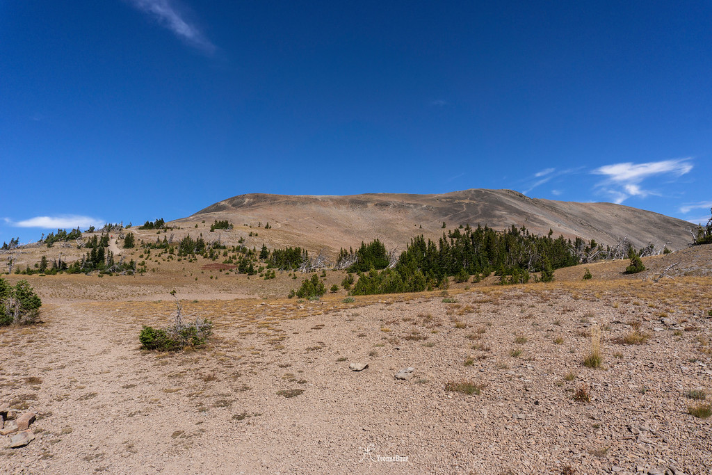
After a bit over a mile, I left the forest and the entire scenery opens up. Scree slopes descend into a large bowl below Avalanche Peak. This was definitely a good excuse to take a picture break and catch my breath. From this point on, the trail was mostly above tree line.
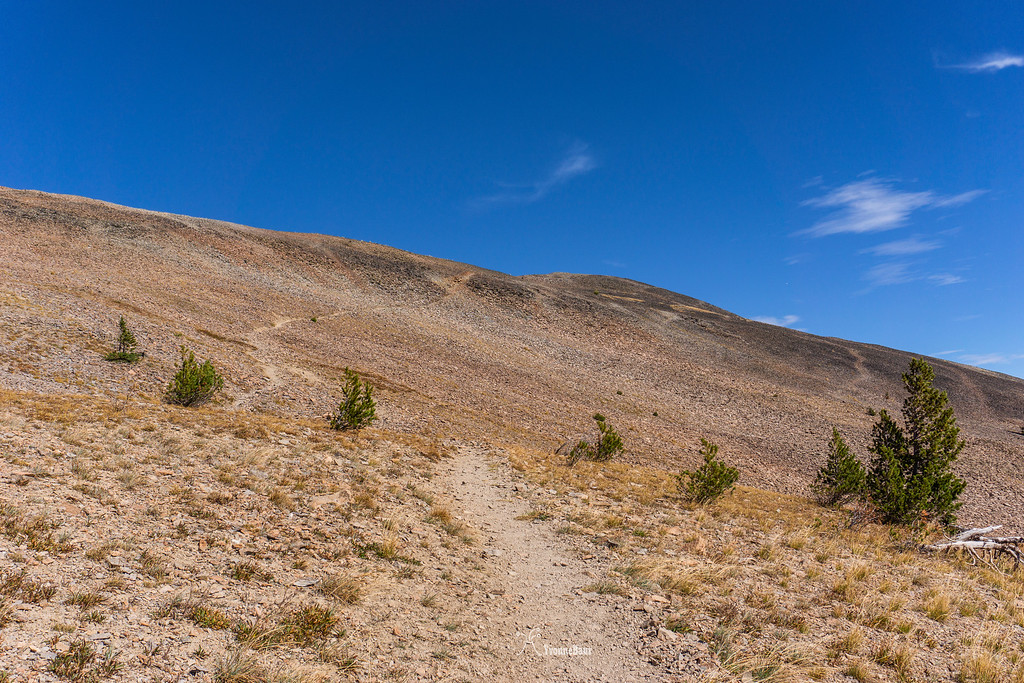
From this point, it was mostly switchbacks. I gained a lot of elevation in a short amount of time and with each switchback, the views started to get better.
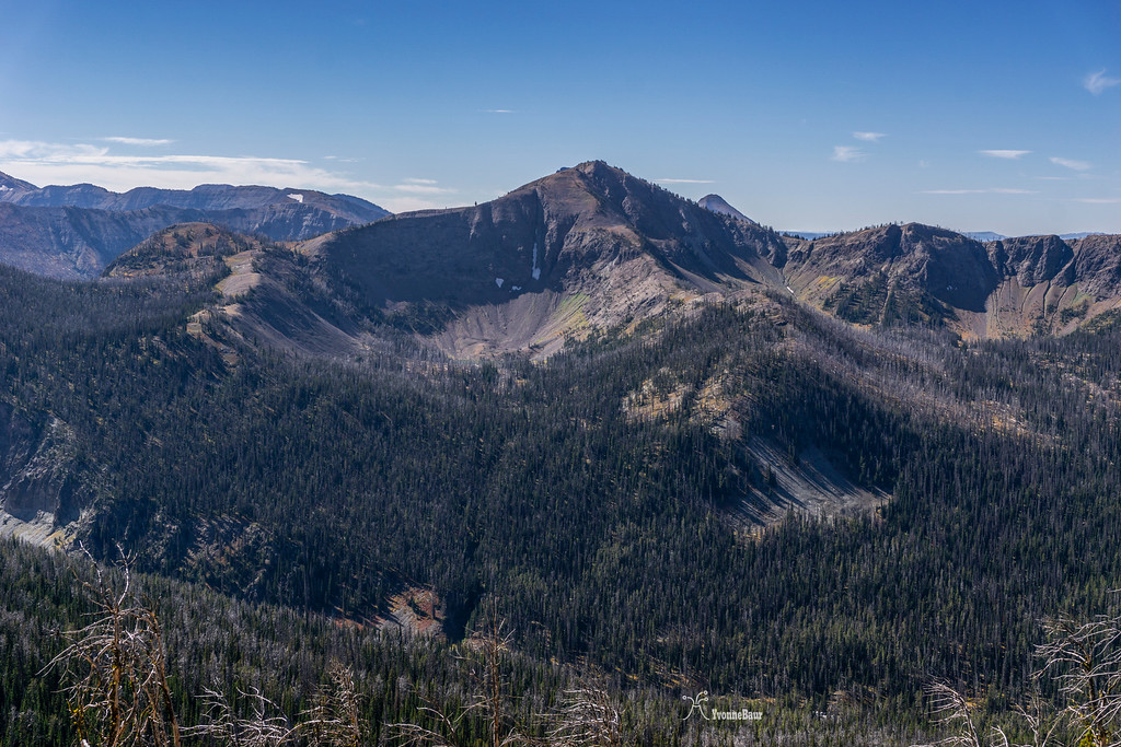
looking south towards Mt. Doane
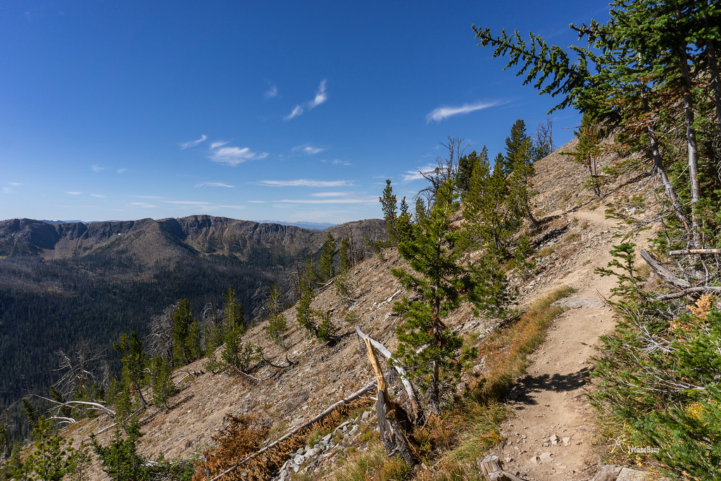
The trail continues to climb
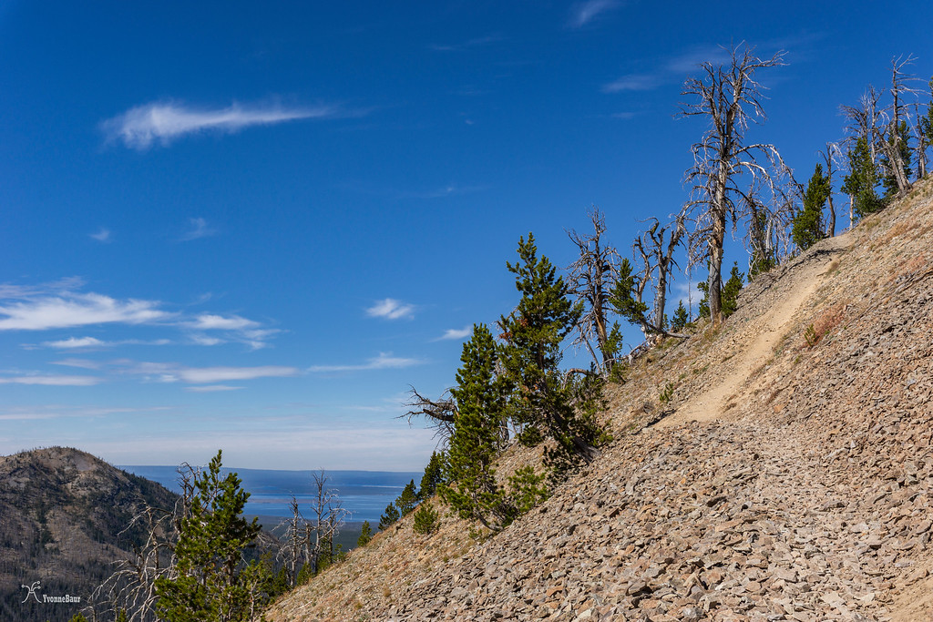
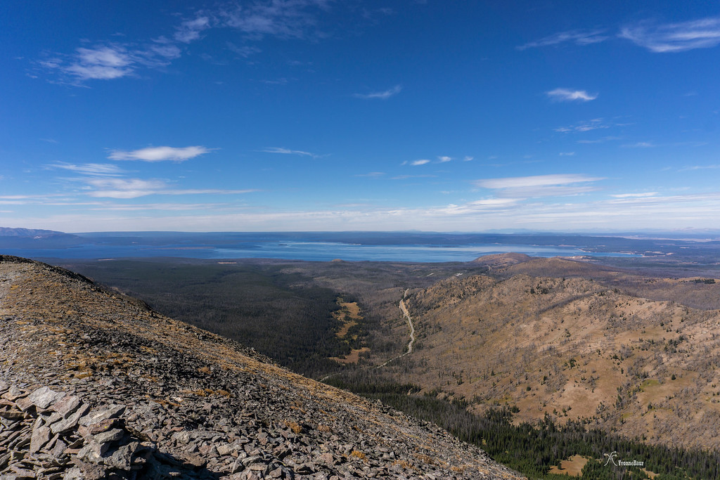
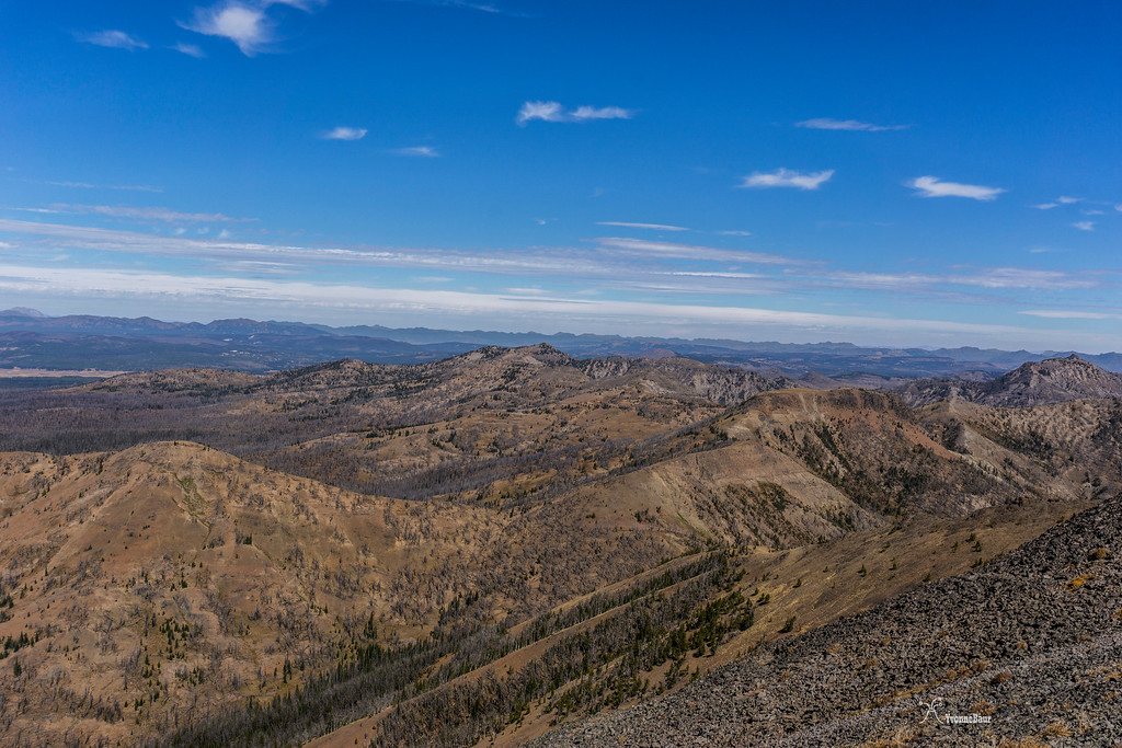
more elevation gain and first view toward Yellowstone Lake
After about 1.7 miles the trail briefly flattens. The final ascend was still ahead of me.
Going Up
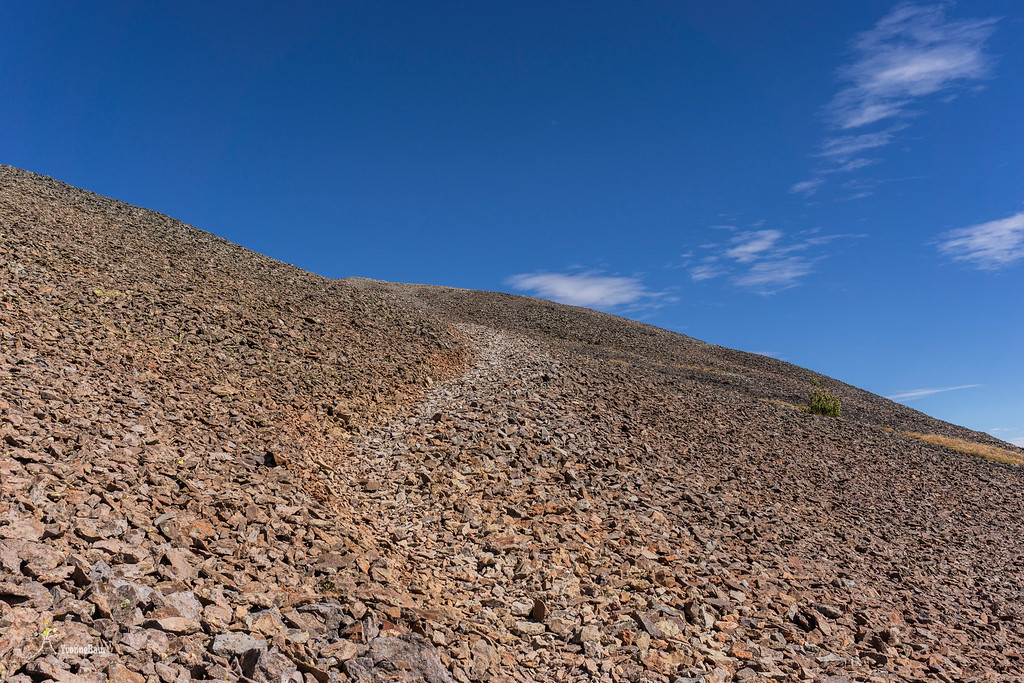
Trail across the scree
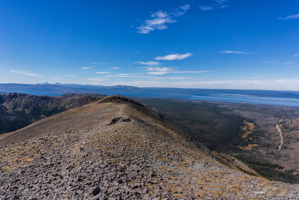
After a while, I got another great view of Yellowstone Lake and the entire area
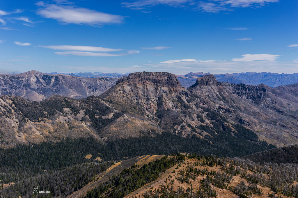
View towrds Mount Chittenden and Cathedral Peak
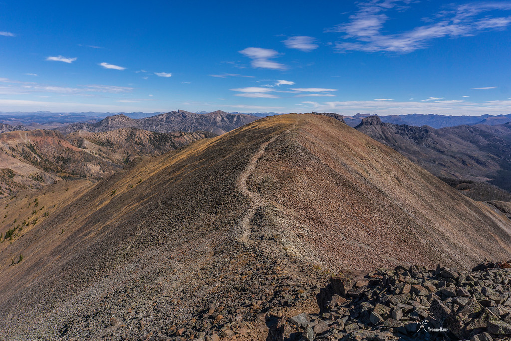
I finally started to walk across the last ridge to the summit with the Tetons in the distance and Mt. Sheridan
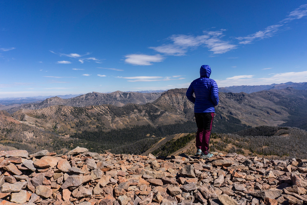
Amazing views in all directions, this was definitely worth the effort.

Eventually, I reached the summit. It was super windy up here and only a few windbreaks erected by other hikers brought some relief.
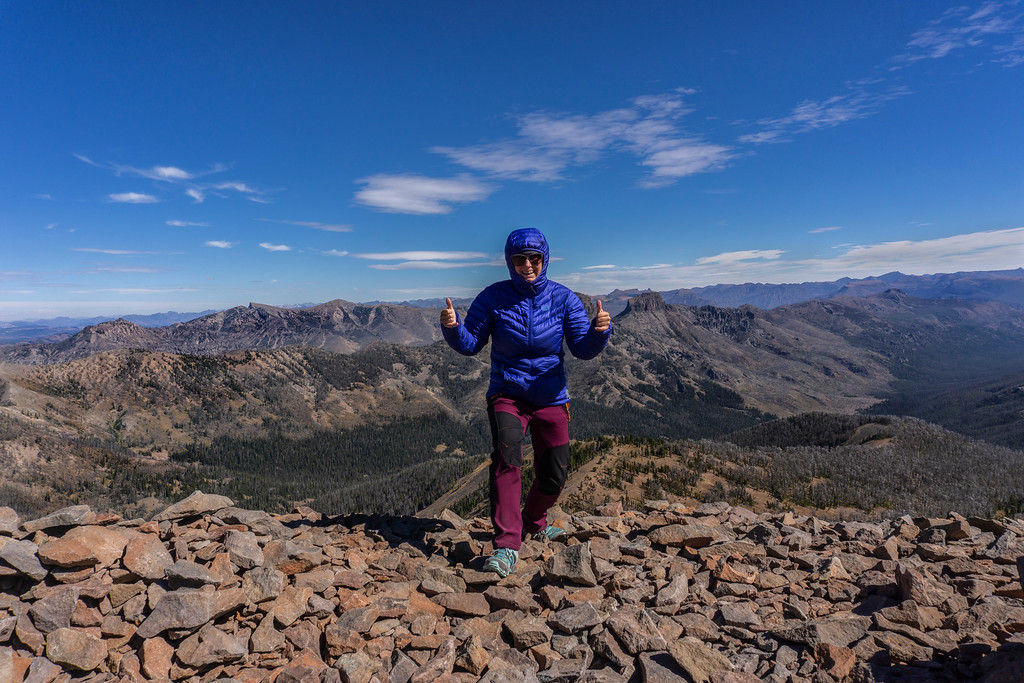
I made it!!
Admiring the view
Silvertip Peak and Shoshone National Forest to the northeast
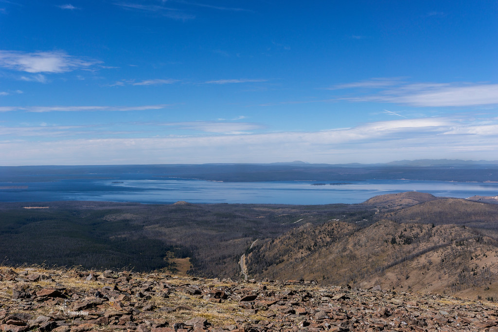
another view of Yellowstone Lake and Mount Sheridan in the distance
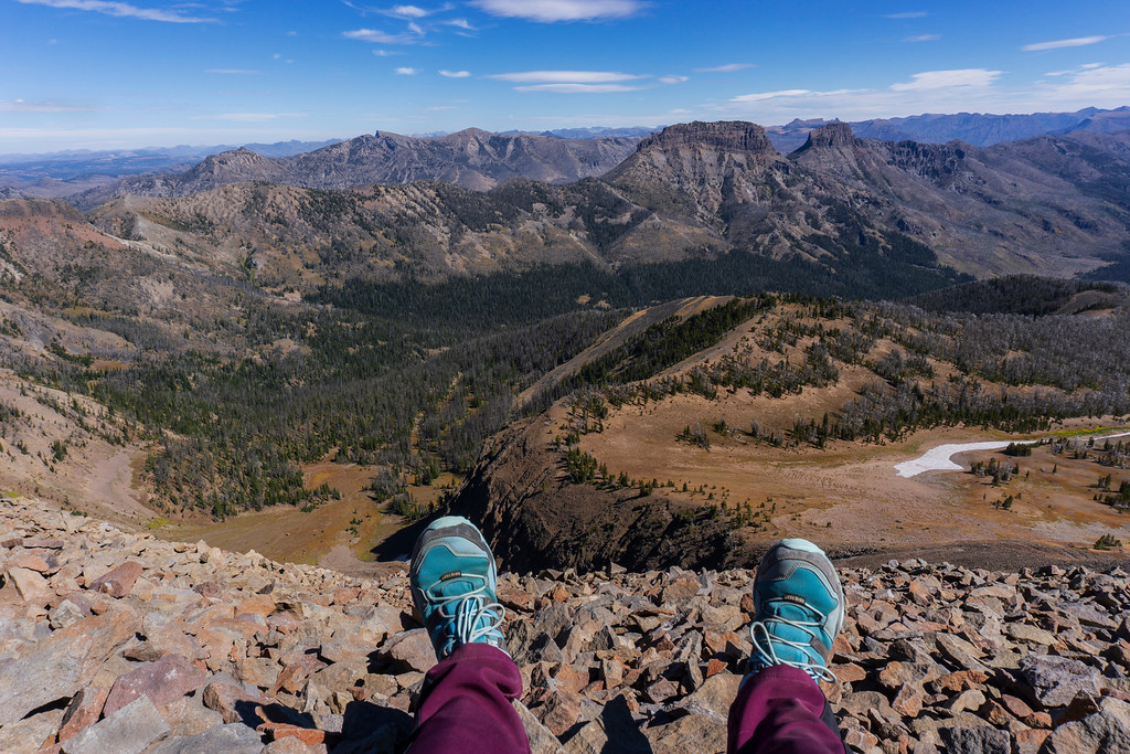
I sat down and enjoyed the view during a lunch break. I was the only one up there.
The hike back down was definitely much faster but pretty tough on my knees because it was so steep.
Eventually, I reached the trailhead again and 5 miles of awesomeness are behind me.
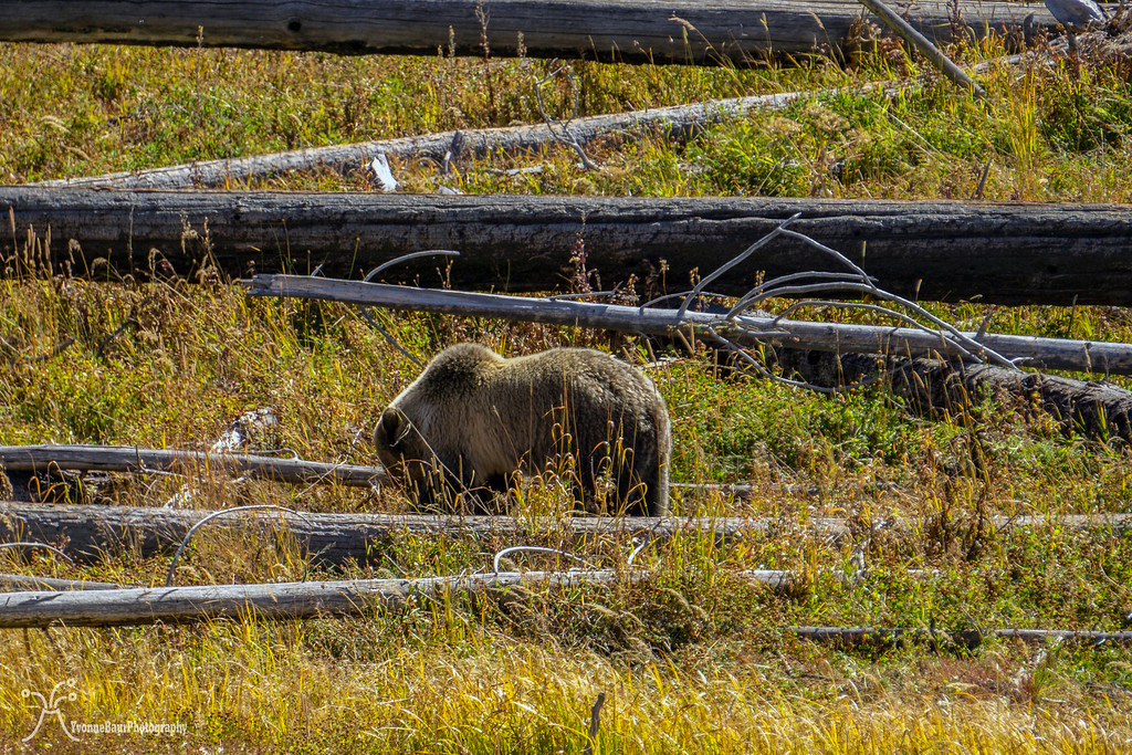
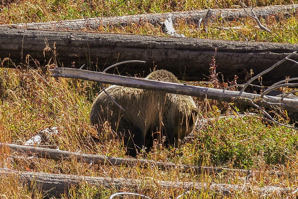
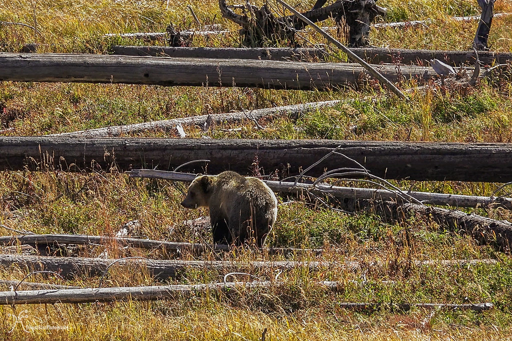
On the way back to Yellowstone Lake I stopped at Nine Miles trailhead because there was a Grizzly roaming around between the deadfall and snags.
This was a great finish of a great hike and I was actually happy I didn't see Grizzlies on any of my hikes. Each time I saw bears were when I headed from one hike to the next and they were close to the road.
I left early from my base camp at Canyon campground and headed over toward the East Entrance and Sylvan Pass. There is a small parking lot on the right side of the road and to start hiking, you have to cross the road.
the first part of the trail goes through a lodgepole pine forest and immediately starts climbing up. I was glad I was already here in the park for a week and already seasoned to the higher elevation.
After about the first 0.7 miles the forest becomes more open and the first views come into place.
After a bit over a mile, I left the forest and the entire scenery opens up. Scree slopes descend into a large bowl below Avalanche Peak. This was definitely a good excuse to take a picture break and catch my breath. From this point on, the trail was mostly above tree line.
From this point, it was mostly switchbacks. I gained a lot of elevation in a short amount of time and with each switchback, the views started to get better.
looking south towards Mt. Doane
The trail continues to climb
more elevation gain and first view toward Yellowstone Lake
After about 1.7 miles the trail briefly flattens. The final ascend was still ahead of me.
Going Up
Trail across the scree
After a while, I got another great view of Yellowstone Lake and the entire area
View towrds Mount Chittenden and Cathedral Peak
I finally started to walk across the last ridge to the summit with the Tetons in the distance and Mt. Sheridan
Amazing views in all directions, this was definitely worth the effort.
Eventually, I reached the summit. It was super windy up here and only a few windbreaks erected by other hikers brought some relief.
I made it!!
Admiring the view
Silvertip Peak and Shoshone National Forest to the northeast
another view of Yellowstone Lake and Mount Sheridan in the distance
I sat down and enjoyed the view during a lunch break. I was the only one up there.
The hike back down was definitely much faster but pretty tough on my knees because it was so steep.
Eventually, I reached the trailhead again and 5 miles of awesomeness are behind me.
On the way back to Yellowstone Lake I stopped at Nine Miles trailhead because there was a Grizzly roaming around between the deadfall and snags.
This was a great finish of a great hike and I was actually happy I didn't see Grizzlies on any of my hikes. Each time I saw bears were when I headed from one hike to the next and they were close to the road.
