Kyle P
Member
- Joined
- Jul 25, 2013
- Messages
- 73
My friend and I have long been looking for a good backpacking and fly fishing trip and finally got one in. With the help of uintahiker on here, we chose the Wind Rivers and did not regret it! Here is an email I sent to my fishing friends so I am sorry about the different text colors. I just copied and pasted it so hopefully this works.
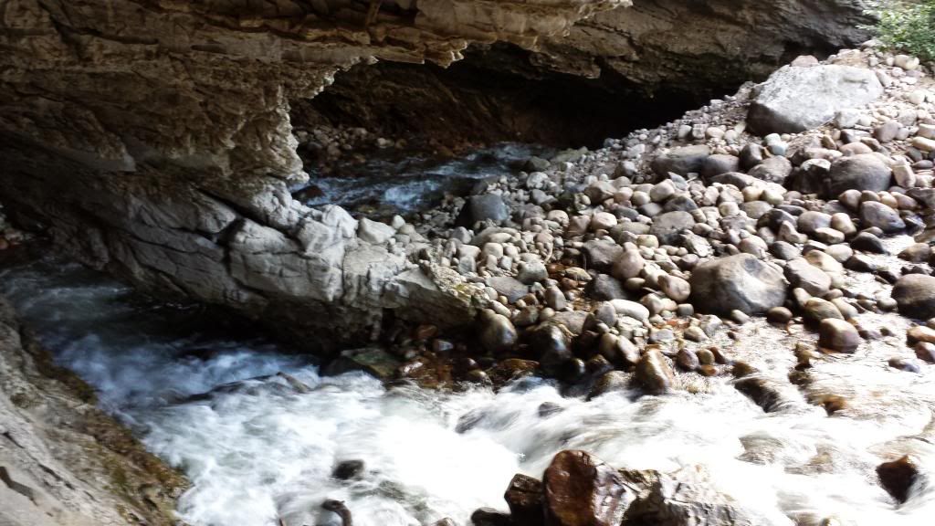
When we first arrived to the Wind Rivers, we stopped by The Sinks. This is basically a place where the Popo Agie river runs into the ground for a few miles. It then boils back up in a spring a few miles further down. Where it comes back up, you can see some GIANT trout in the water but it is closed to fishing. It sure was fun to look at them though. They are like the trout you would see swimming around in a fish tank in a Cabelas, just enormous. Below you can see where the water runs into the ground.
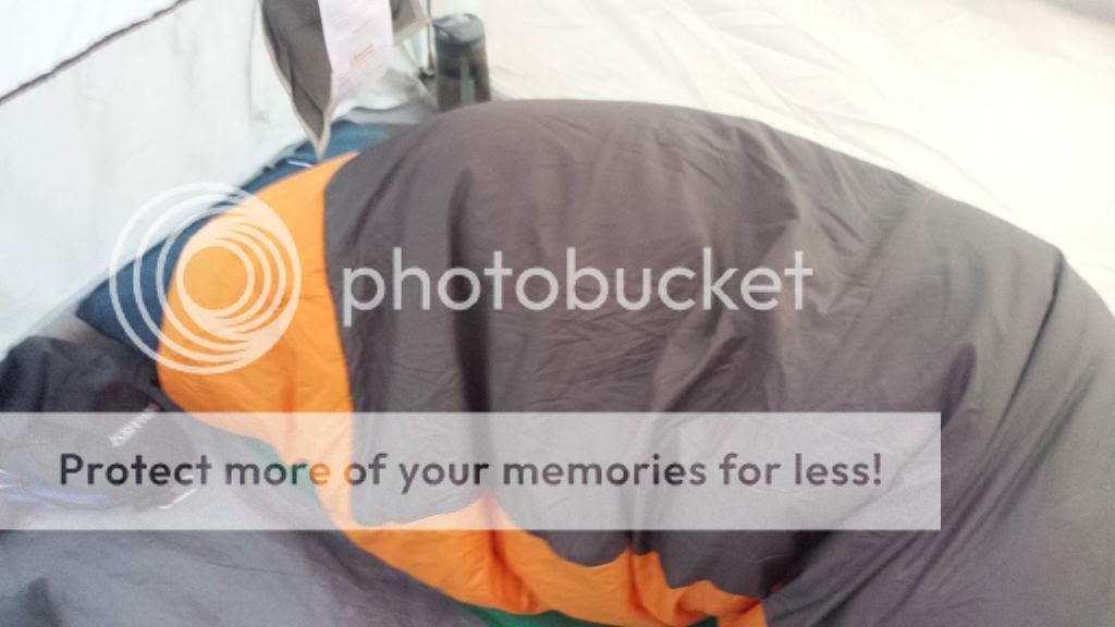
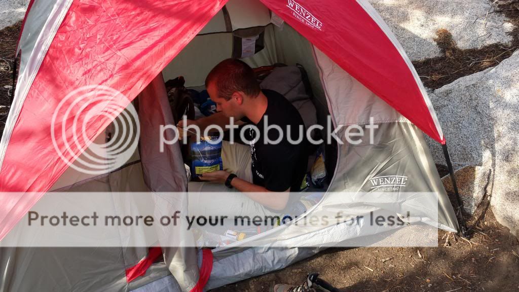
Our plan then once we arrived was to camp at Worthen Meadows Reservoir the first night, then start the hike early the next morning. After a bit of a drive up the mountains, we arrived to the lake and set up camp. That night was the coldest night we would have. We were both very bundled up as you can see in the photo below. Yes there is a person in that sleeping bag and I was still cold!
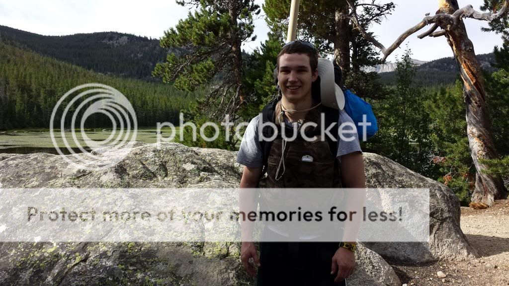
After getting up and getting everything packed, we started to head for the trail, but we quickly noticed something was wrong, the trail did not appear to be where it was supposed to be and the lake that we had arrived at the night before did not look right either, we had camped at the wrong lake! Instead of Worthen Meadows, we were at Frye Lake. So we hopped in the truck and drove to the correct lake. It turns out that if we had camped at the lake we wanted to, we would have had to pay $14 for a camping spot so we actually saved some money. We then parked in the trailhead parking lot and now were finally on our way.
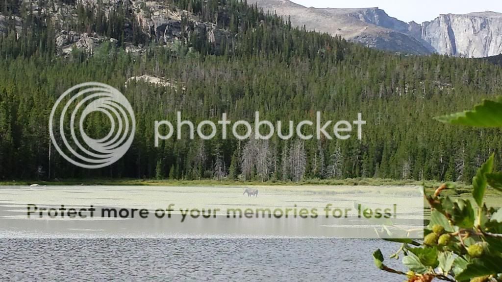
After about 20 minutes of hiking we came to Roaring Fork Lake and after giving it a quick look over we could see there was something in the middle of the lake. There was cow moose out there! We were pretty pumped to see that! We snuck up to the edge of the lake and snapped some quick pictures before moving on. It is tough to see, but you can see the moose in the picture with Andy below as well.
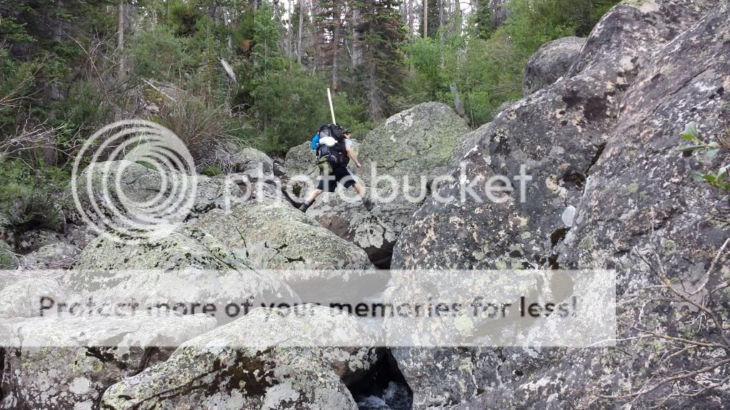
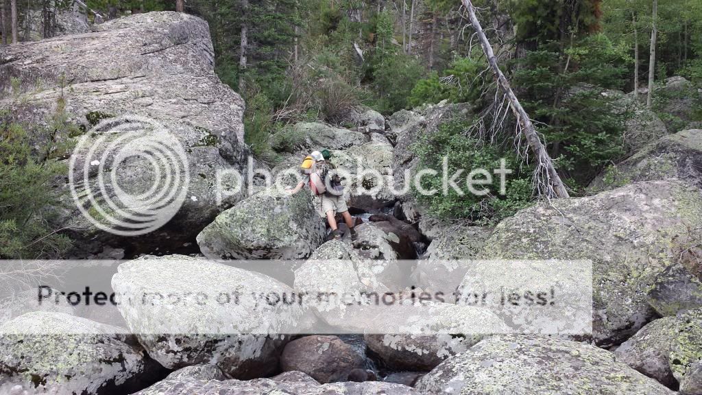
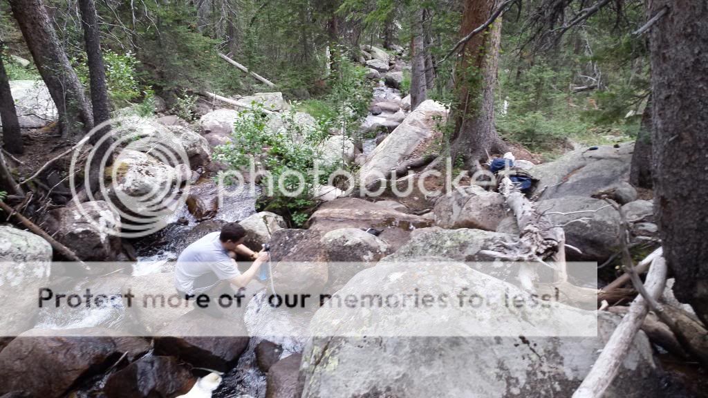
After this point, we would be going off the trail for the rest of the day. I had gotten a lot of advice for places to hike and fish from a guy on a forum online and one of the places he said there was not much written about was Leg Lake. So that is where our first place was that we wanted to hike to. It was about a 5 mile hike without a trail. To get there, we would follow a stream through the mountains that should lead us there. This stream went through some pretty thick trees and when it got really thick, the easiest way to navigate the stream was often to hop on the rocks in the stream. They were actually not slippery at all so we would do this when walking along the stream became too tough. Below is also a picture of Andy pumping water. We had a water filter that we used to clean water and then we would also place some droplets in the water to help purify it and this made the water drinkable.
We followed Roaring Fork Creek as it went up through the mountains and made many splits. These splits were sometimes tough to locate because it could be a very small creek pouring in or it could be an obvious large stream pouring in, but finding these splits was important for knowing our location. There were also many "false" splits where an uncharted small creek came in that we would have to ignore.
While following this creek we did come up on a group of people with llamas to help their hike. It was good to talk to them about our location as it reassured us on our location in the mountains when their thoughts on tje location matched ours. We continued on the hike and around 1:30 came upon a lake. We knew it was not Leg Lake since we were supposed to run into a couple other small lakes before getting there but if this was one of those lakes, that would be good to see as it would mean we were on the right track. Well, it turned out it was not one of our lakes and we missed one of the splits from the stream! We were not sure how we missed this split but we did. So we then had to hop through a large boulder field about a half mile till we found the lake we were supposed to have come upon. Hopping through these boulders was not easy. They were very large and it was tiring but we thought this was easier than hiking all the way around them.
After much more hiking along the creek and Andy fighting off cramps in both legs, we arrived at a large stone wall that stretched high into the sky with a lake at the bottom. Was this our Leg Lake? After looking at the map and GPS, it was clear that it was not. Our lake was over that stone wall. Now I could see why there was not much written on this lake. It was nestled in the tops of the mountains! They say once you have wrestled, everything else in life is easy. Andy and I certainly try to live by that and won't back down from a challenge so after already being very tired from the long tough hike, we started to try to find a way up this wall. It was a long slow climb up many boulders that were piled up on one side of the wall. But eventually we made it to Leg Lake.
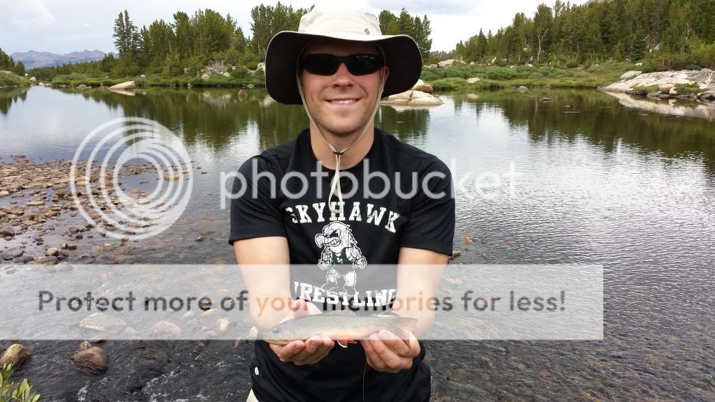
This lake was amazing and was surrounded by giant cliffs. Because of the lack of people making it to the lake, it is rumored to have some of the biggest fish in the area. So we set up camp and quickly started fishing. Andy fished the point where the stream exits the lake while I fished further down the stream before it drops down over that rock wall we came up. I was able to get some hits from trout but for some reason could not get a hook up. Finally right before it was time to head to camp to cook dinner, I got a small rainbow.
The only spot that was suitable for camping here because of rocks was up on top of a large rock formation. It was actually a pretty neat location. Camp was at about 10,600 ft in elevation. To get water, fish, or clean up, we had to climb down from this rock to get down to the stream.
In the photo below, you can see a cliff in the background. That is part of the cliff that surrounds Leg Lake.
Below is Leg Lake
Here are two views from the top of the path we climbed up to Leg Lake, also this is where the stream from Leg Lake heads into the valley
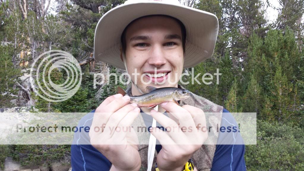
The next morning we went fishing for a bit before continuing our hike. I went back to the spot I fished the night before since I had seen plenty of trout and Andy fished the lake again. Along the stream, both in the morning and the night before, there was about a 17 inch rainbow that would sprint away as soon as my fly would drift in front of it. I was fairly certain he had not seen me as I had taken great care to sneak up from behind to cast above him but he just wanted nothing to do with my fly. His nose had white bumps on it like the fish do in the aquariums at Cabelas so I was thinking he might have been caught recently and had quite a fight. While fishing this spot again, I did manage to catch my first Golden Trout though!
After fishing in the morning, we had a quick breakfast, took some last pictures, and headed off to our next location.
To start the days hike, we had to hike back down into the valley then over to the Roaring Fork Mountain Range to our west. We would be heading over the mountain range in a "low" place that I had chosen to cross this range at. Once we got in the valley, a storm rolled in and we had to hunker down under some trees and wait it out. We sat there about an hour. During this hour, we realized that our current trip plan would probably not work and we needed to cut out the last portion of it if we wanted to get more fishing in. So we began to plan a new route with basically cutting out the Deep Creek Lakes part of our trip.
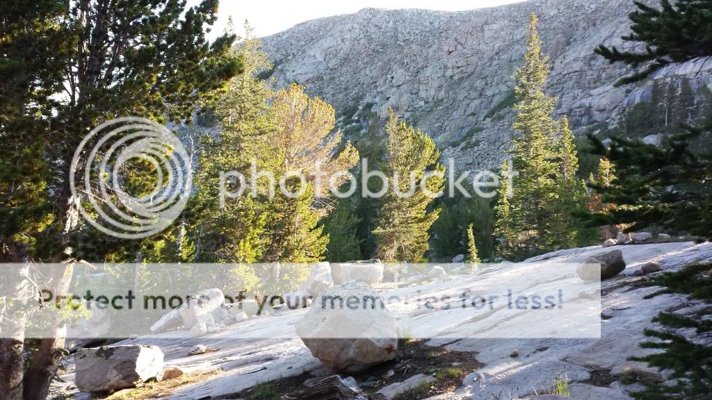
After the rains were over, we continued up the mountain. After walking up through many trees, we reached the top of the tree line and were now entering large boulders that we would be scaling for the rest of the hike. At the base of the boulders we ran into the group with llamas we had seen before. They planned to cross here as well but were a little nervous about it. Andy and I continued on as they watched our progress up the mountain. The picture below shows the boulders we scaled. At this mountain we started at about 10,400 ft and at the top were at 11,080 ft. It was a long tough hike but we got it done. The picture below shows the boulders. The picture does not do the height of this mountain justice.
Andy at the top of the Roaring Fork Mountain Range with the valley we came from in the background. If you look really closely, you can see the group of people with the llamas at the base of the boulders. They are on the left side of the picture, on the right edge of the green space.
When we reached the top of this range, another storm quickly rolled in so we found some good boulders for hunkering against and took out the tent's rain cover to cover ourselves with. While up there, some very strong winds came through and it also began to snow on us! As soon as this blew over, we began to hurry off the mountain to get to the next valley, Stough Creek. When we got to the edge of the mountain, we were greeted with an amazing view of Stough Creek from the mountains as shown below.
Myself double checking our location while we have a good view of the valley
And Andy making the climb down the other side of the mountain
Once we reached the bottom, we found some nice creeks to fish where they enter an unnamed lake. Right where these were entering the lake I saw a fish frenzy like I have never seen before. Brook Trout were flying out of the water all over! They were going crazy! Andy and I quickly rigged up some flies and caught a few of them before this frenzy came to a sudden end.
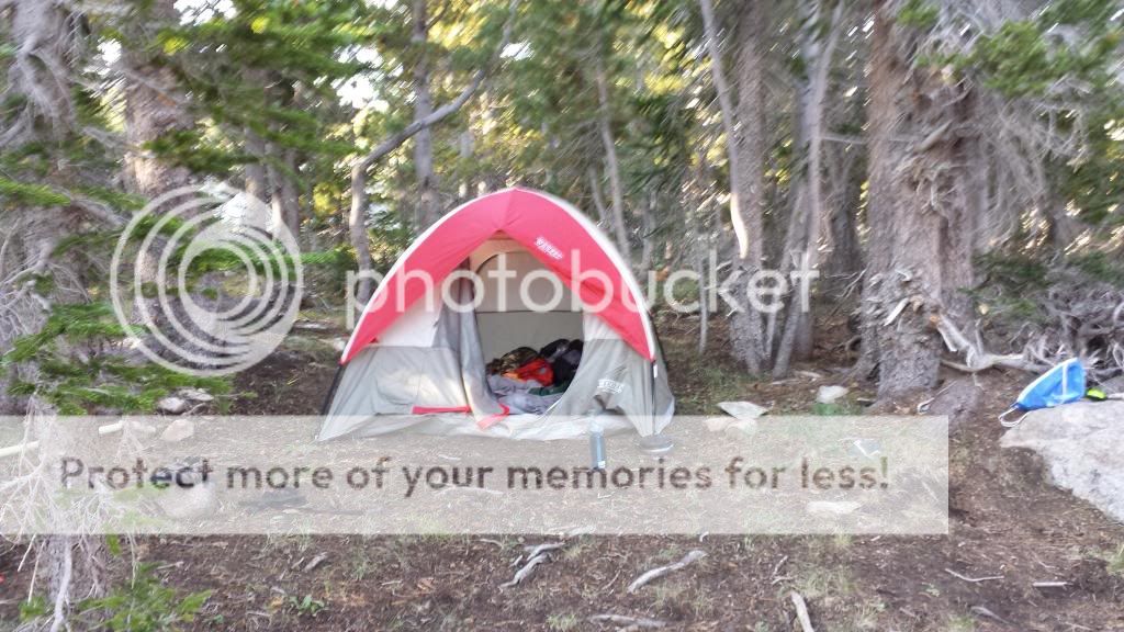
It was starting to get a bit late, so we moved down Stough Creek to find a good camping location. Once we found one, we went off fishing again. Andy started up on the stream, and I began by fishing where the stream entered another small unnamed lake. On my first cast, the fly was not on the water for more than a second and a brook trout nailed it while soaring out of the water. I then sent out another cast and the same thing! This happened on about every cast! They were hitting the flies like you see the sharks hit the seals on the discovery channel during shark week. They would fly nearly a foot out of the water! Once in a while you could see the trout under water dart out from under a rock before slamming the fly. It was a lot of fun catching those. I even caught one that was smaller than my index finger. The biggest one was just shy of 10 inches. I then went to meet up with Andy and he had some bad news for me. While he was fishing, he had seen his fly go under and was not sure if it was hit or not so he set the hook. Unfortunately his fly was snagged and when he set the hook, his pole snapped. He did catch a couple trout before this though.
We then went back to camp and hit the sack.
The views out of our tent
Andy fishing the stream above the small lake
The next morning, we went to the location where I caught the trout the night before and had some more fun with them switching off using my pole...
Andy with a small Brookie
A colorful Brookie
After having some fun with fish, we moved off to what we decided would be our last fishing location. We were going to try a part of the Popo Agie that is supposed to have some Cutthroats in it. We would fish for those, then start the hike back to the truck. Since we cut out part of the trip and were short a fishing pole, we were going to cut the trip about a day shorter which would also allow Andy to get back for an event that he would have missed otherwise.
We fished that last stream for a while and did not catch a cutthroat but did catch a bunch more brookies. We had a lot of fun with them, then started back to the truck. We got most the way back, then camped and took off the next morning (Thursday morning).
For those of you that are wondering, the main fly that worked well and I used about the whole time was an elk hair caddis with "yellow wrapping" around the hook. This worked everywhere I tried it. I used both size 14 & 16 in that and both worked well.
This trip was a ton of fun and I hope to do something like it someday in the future!
Here are a couple extra neat pictures from the trip
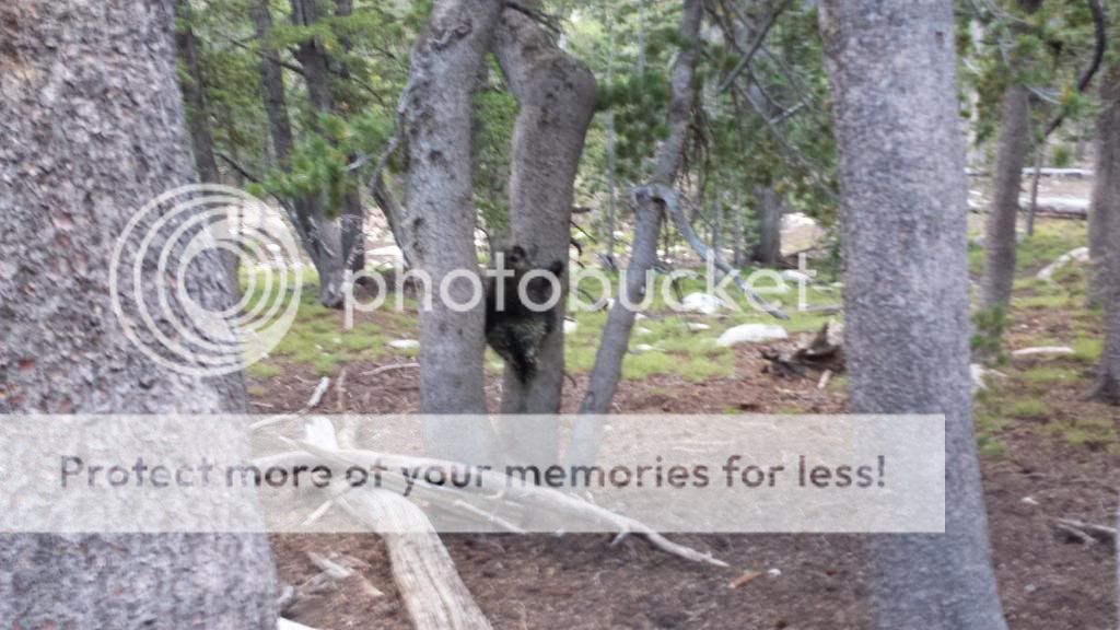
A porcupine
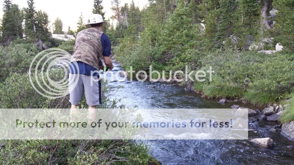
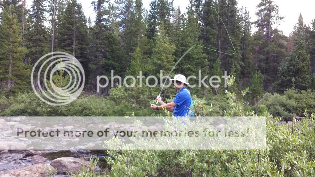
Fly fishing the Popo Agie
Some cattle in a valley
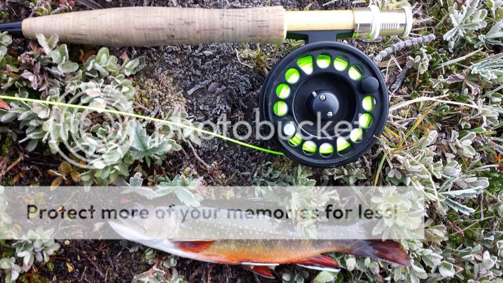
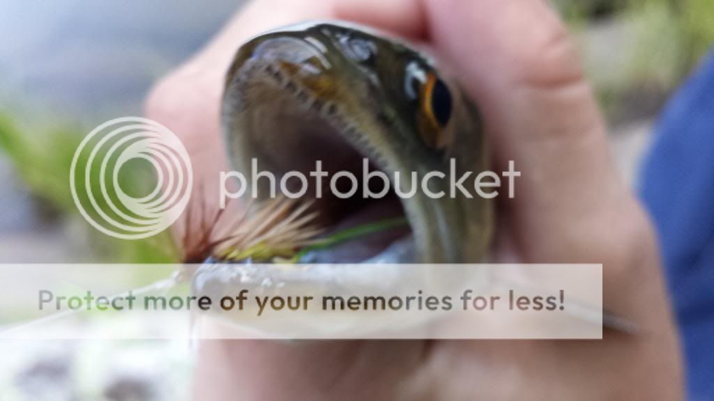
A hungry brook trout
Featured image for home page:

When we first arrived to the Wind Rivers, we stopped by The Sinks. This is basically a place where the Popo Agie river runs into the ground for a few miles. It then boils back up in a spring a few miles further down. Where it comes back up, you can see some GIANT trout in the water but it is closed to fishing. It sure was fun to look at them though. They are like the trout you would see swimming around in a fish tank in a Cabelas, just enormous. Below you can see where the water runs into the ground.
Our plan then once we arrived was to camp at Worthen Meadows Reservoir the first night, then start the hike early the next morning. After a bit of a drive up the mountains, we arrived to the lake and set up camp. That night was the coldest night we would have. We were both very bundled up as you can see in the photo below. Yes there is a person in that sleeping bag and I was still cold!
After getting up and getting everything packed, we started to head for the trail, but we quickly noticed something was wrong, the trail did not appear to be where it was supposed to be and the lake that we had arrived at the night before did not look right either, we had camped at the wrong lake! Instead of Worthen Meadows, we were at Frye Lake. So we hopped in the truck and drove to the correct lake. It turns out that if we had camped at the lake we wanted to, we would have had to pay $14 for a camping spot so we actually saved some money. We then parked in the trailhead parking lot and now were finally on our way.
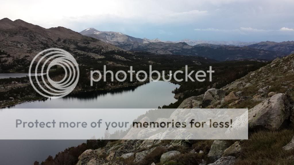
After about 20 minutes of hiking we came to Roaring Fork Lake and after giving it a quick look over we could see there was something in the middle of the lake. There was cow moose out there! We were pretty pumped to see that! We snuck up to the edge of the lake and snapped some quick pictures before moving on. It is tough to see, but you can see the moose in the picture with Andy below as well.
After this point, we would be going off the trail for the rest of the day. I had gotten a lot of advice for places to hike and fish from a guy on a forum online and one of the places he said there was not much written about was Leg Lake. So that is where our first place was that we wanted to hike to. It was about a 5 mile hike without a trail. To get there, we would follow a stream through the mountains that should lead us there. This stream went through some pretty thick trees and when it got really thick, the easiest way to navigate the stream was often to hop on the rocks in the stream. They were actually not slippery at all so we would do this when walking along the stream became too tough. Below is also a picture of Andy pumping water. We had a water filter that we used to clean water and then we would also place some droplets in the water to help purify it and this made the water drinkable.
We followed Roaring Fork Creek as it went up through the mountains and made many splits. These splits were sometimes tough to locate because it could be a very small creek pouring in or it could be an obvious large stream pouring in, but finding these splits was important for knowing our location. There were also many "false" splits where an uncharted small creek came in that we would have to ignore.
While following this creek we did come up on a group of people with llamas to help their hike. It was good to talk to them about our location as it reassured us on our location in the mountains when their thoughts on tje location matched ours. We continued on the hike and around 1:30 came upon a lake. We knew it was not Leg Lake since we were supposed to run into a couple other small lakes before getting there but if this was one of those lakes, that would be good to see as it would mean we were on the right track. Well, it turned out it was not one of our lakes and we missed one of the splits from the stream! We were not sure how we missed this split but we did. So we then had to hop through a large boulder field about a half mile till we found the lake we were supposed to have come upon. Hopping through these boulders was not easy. They were very large and it was tiring but we thought this was easier than hiking all the way around them.
After much more hiking along the creek and Andy fighting off cramps in both legs, we arrived at a large stone wall that stretched high into the sky with a lake at the bottom. Was this our Leg Lake? After looking at the map and GPS, it was clear that it was not. Our lake was over that stone wall. Now I could see why there was not much written on this lake. It was nestled in the tops of the mountains! They say once you have wrestled, everything else in life is easy. Andy and I certainly try to live by that and won't back down from a challenge so after already being very tired from the long tough hike, we started to try to find a way up this wall. It was a long slow climb up many boulders that were piled up on one side of the wall. But eventually we made it to Leg Lake.
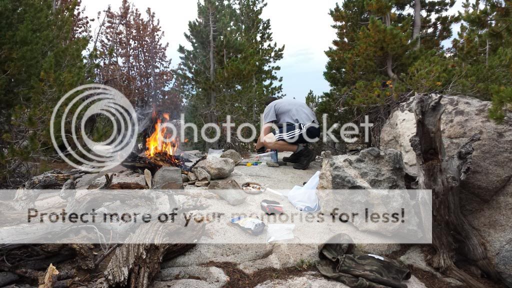
This lake was amazing and was surrounded by giant cliffs. Because of the lack of people making it to the lake, it is rumored to have some of the biggest fish in the area. So we set up camp and quickly started fishing. Andy fished the point where the stream exits the lake while I fished further down the stream before it drops down over that rock wall we came up. I was able to get some hits from trout but for some reason could not get a hook up. Finally right before it was time to head to camp to cook dinner, I got a small rainbow.
The only spot that was suitable for camping here because of rocks was up on top of a large rock formation. It was actually a pretty neat location. Camp was at about 10,600 ft in elevation. To get water, fish, or clean up, we had to climb down from this rock to get down to the stream.
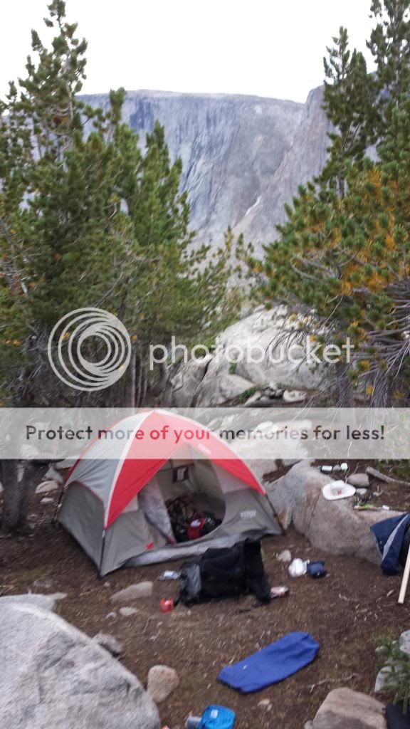
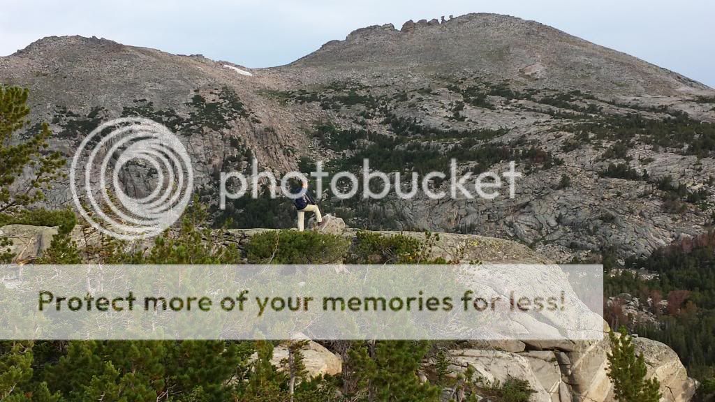
In the photo below, you can see a cliff in the background. That is part of the cliff that surrounds Leg Lake.
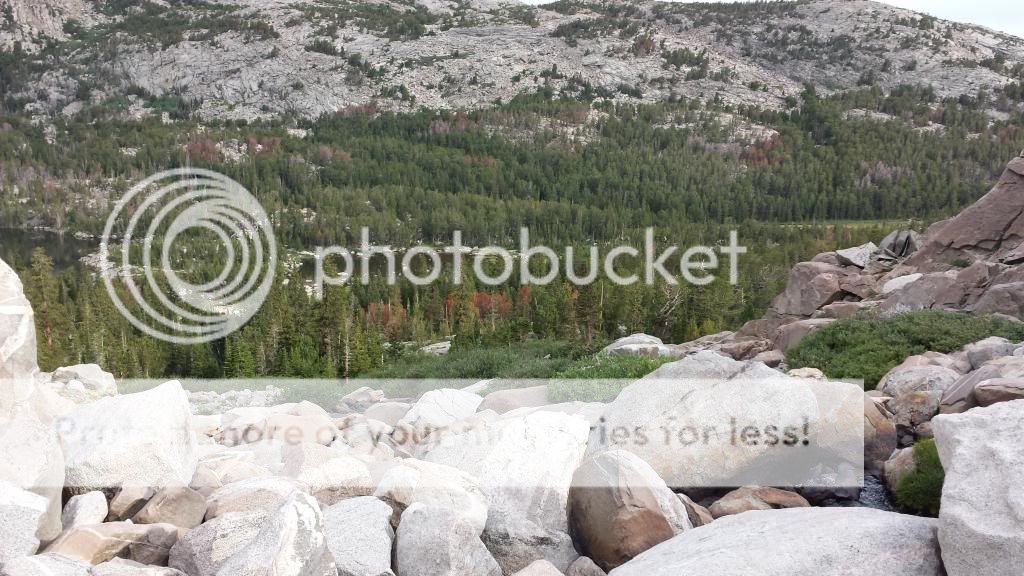
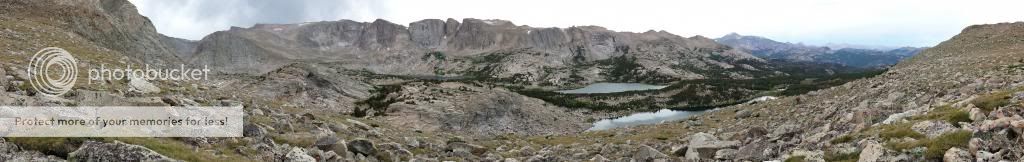
Below is Leg Lake
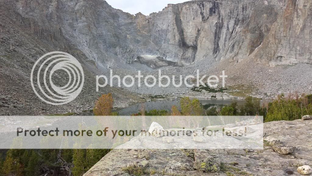
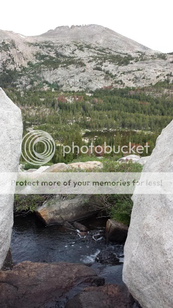
Here are two views from the top of the path we climbed up to Leg Lake, also this is where the stream from Leg Lake heads into the valley
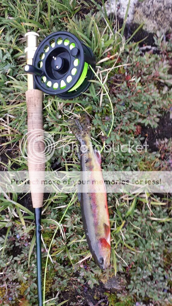
The next morning we went fishing for a bit before continuing our hike. I went back to the spot I fished the night before since I had seen plenty of trout and Andy fished the lake again. Along the stream, both in the morning and the night before, there was about a 17 inch rainbow that would sprint away as soon as my fly would drift in front of it. I was fairly certain he had not seen me as I had taken great care to sneak up from behind to cast above him but he just wanted nothing to do with my fly. His nose had white bumps on it like the fish do in the aquariums at Cabelas so I was thinking he might have been caught recently and had quite a fight. While fishing this spot again, I did manage to catch my first Golden Trout though!
After fishing in the morning, we had a quick breakfast, took some last pictures, and headed off to our next location.
To start the days hike, we had to hike back down into the valley then over to the Roaring Fork Mountain Range to our west. We would be heading over the mountain range in a "low" place that I had chosen to cross this range at. Once we got in the valley, a storm rolled in and we had to hunker down under some trees and wait it out. We sat there about an hour. During this hour, we realized that our current trip plan would probably not work and we needed to cut out the last portion of it if we wanted to get more fishing in. So we began to plan a new route with basically cutting out the Deep Creek Lakes part of our trip.
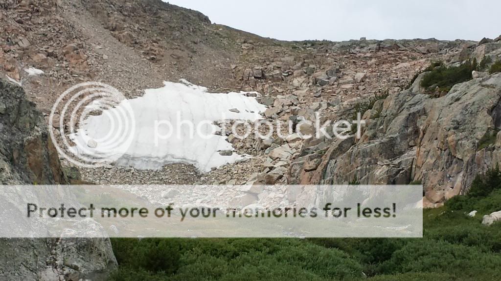
After the rains were over, we continued up the mountain. After walking up through many trees, we reached the top of the tree line and were now entering large boulders that we would be scaling for the rest of the hike. At the base of the boulders we ran into the group with llamas we had seen before. They planned to cross here as well but were a little nervous about it. Andy and I continued on as they watched our progress up the mountain. The picture below shows the boulders we scaled. At this mountain we started at about 10,400 ft and at the top were at 11,080 ft. It was a long tough hike but we got it done. The picture below shows the boulders. The picture does not do the height of this mountain justice.
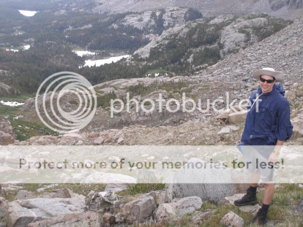
Andy at the top of the Roaring Fork Mountain Range with the valley we came from in the background. If you look really closely, you can see the group of people with the llamas at the base of the boulders. They are on the left side of the picture, on the right edge of the green space.
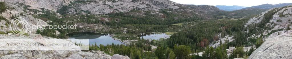
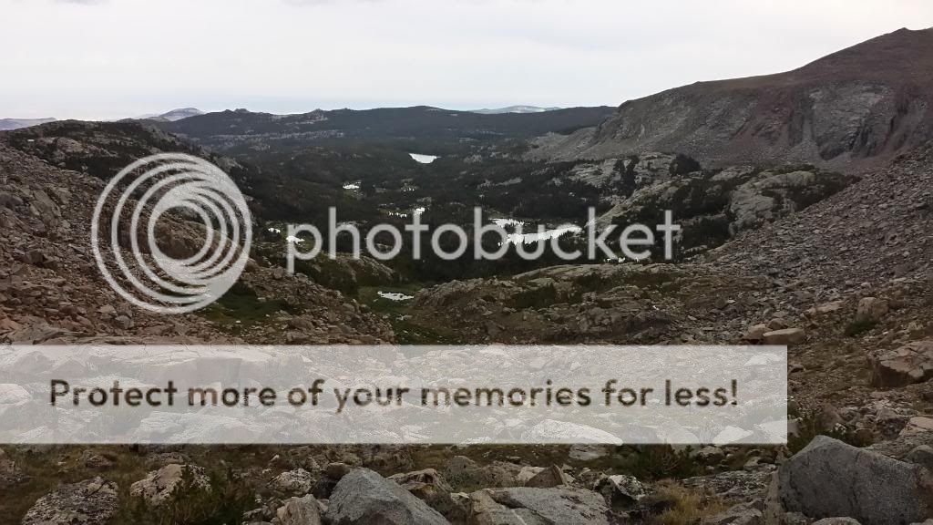
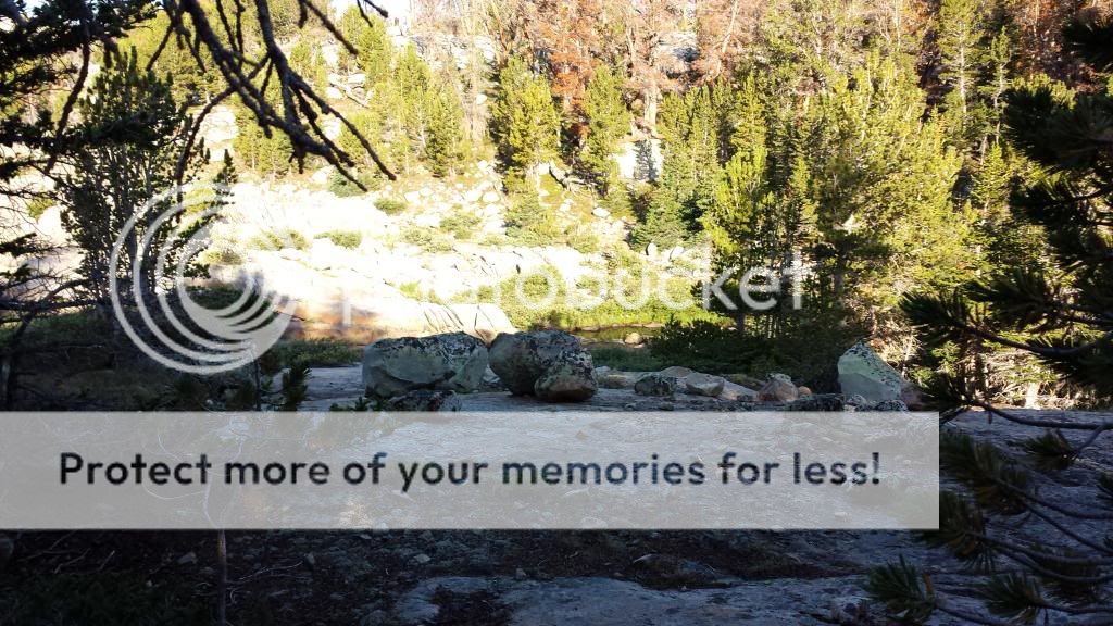
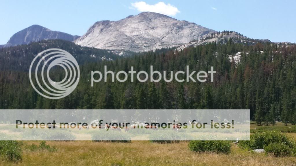
When we reached the top of this range, another storm quickly rolled in so we found some good boulders for hunkering against and took out the tent's rain cover to cover ourselves with. While up there, some very strong winds came through and it also began to snow on us! As soon as this blew over, we began to hurry off the mountain to get to the next valley, Stough Creek. When we got to the edge of the mountain, we were greeted with an amazing view of Stough Creek from the mountains as shown below.
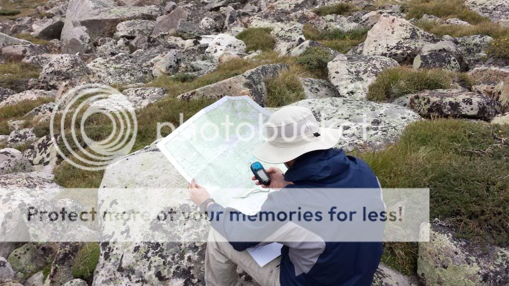
Myself double checking our location while we have a good view of the valley
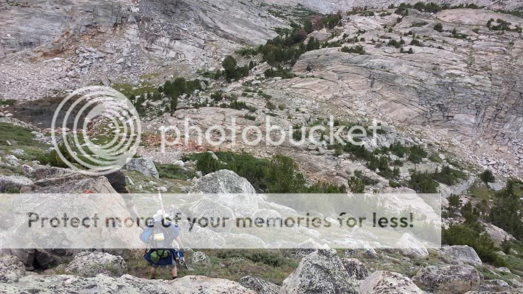
And Andy making the climb down the other side of the mountain
Once we reached the bottom, we found some nice creeks to fish where they enter an unnamed lake. Right where these were entering the lake I saw a fish frenzy like I have never seen before. Brook Trout were flying out of the water all over! They were going crazy! Andy and I quickly rigged up some flies and caught a few of them before this frenzy came to a sudden end.
It was starting to get a bit late, so we moved down Stough Creek to find a good camping location. Once we found one, we went off fishing again. Andy started up on the stream, and I began by fishing where the stream entered another small unnamed lake. On my first cast, the fly was not on the water for more than a second and a brook trout nailed it while soaring out of the water. I then sent out another cast and the same thing! This happened on about every cast! They were hitting the flies like you see the sharks hit the seals on the discovery channel during shark week. They would fly nearly a foot out of the water! Once in a while you could see the trout under water dart out from under a rock before slamming the fly. It was a lot of fun catching those. I even caught one that was smaller than my index finger. The biggest one was just shy of 10 inches. I then went to meet up with Andy and he had some bad news for me. While he was fishing, he had seen his fly go under and was not sure if it was hit or not so he set the hook. Unfortunately his fly was snagged and when he set the hook, his pole snapped. He did catch a couple trout before this though.
We then went back to camp and hit the sack.
The views out of our tent
Andy fishing the stream above the small lake
The next morning, we went to the location where I caught the trout the night before and had some more fun with them switching off using my pole...
Andy with a small Brookie
A colorful Brookie
After having some fun with fish, we moved off to what we decided would be our last fishing location. We were going to try a part of the Popo Agie that is supposed to have some Cutthroats in it. We would fish for those, then start the hike back to the truck. Since we cut out part of the trip and were short a fishing pole, we were going to cut the trip about a day shorter which would also allow Andy to get back for an event that he would have missed otherwise.
We fished that last stream for a while and did not catch a cutthroat but did catch a bunch more brookies. We had a lot of fun with them, then started back to the truck. We got most the way back, then camped and took off the next morning (Thursday morning).
For those of you that are wondering, the main fly that worked well and I used about the whole time was an elk hair caddis with "yellow wrapping" around the hook. This worked everywhere I tried it. I used both size 14 & 16 in that and both worked well.
This trip was a ton of fun and I hope to do something like it someday in the future!
Here are a couple extra neat pictures from the trip
A porcupine
Fly fishing the Popo Agie
Some cattle in a valley
A hungry brook trout
Featured image for home page:

") ) I would split Roaring Fork into two days and hit Leg on the second. Then spend the next day or two in the amazing area of Stough Creek.
) I would split Roaring Fork into two days and hit Leg on the second. Then spend the next day or two in the amazing area of Stough Creek.