Udink
Still right here.
- Joined
- Jan 17, 2012
- Messages
- 1,734
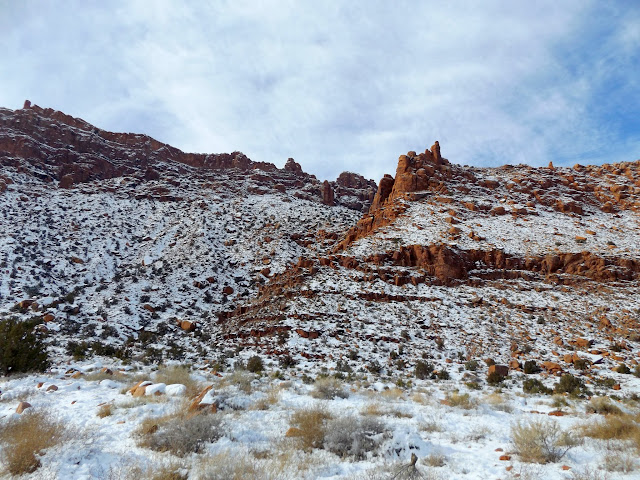
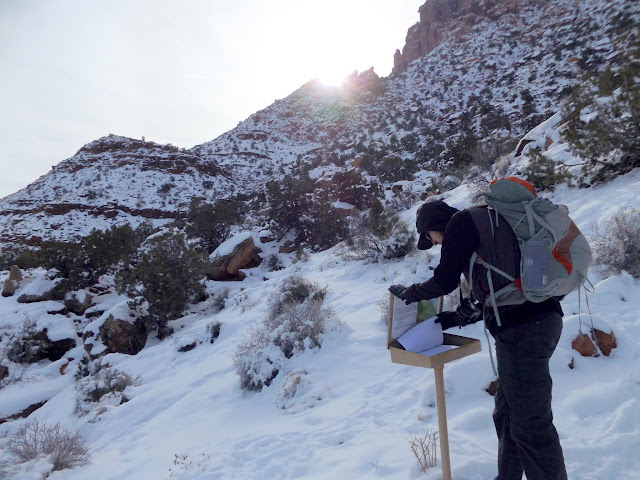
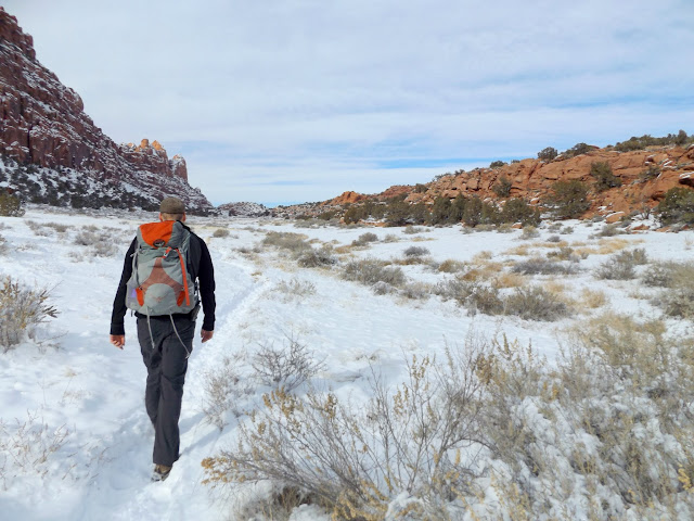
A while back I'd seen a photo of some Indian ruins near Hidden Valley that looked interesting, and I knew from looking at the listings for nearby geocaches that there was at least one rock art panel in the area. It didn't sound like it would be a spectacular trip but it'd be fun to hit the Moab area in the snow. The only research I did was to locate the trailhead and draw an approximate route to follow in my GPS. Chris and I got a somewhat late start from Price and didn't arrive at the trailhead 'til 10:45AM. Based on satellite imagery in Google Earth I was expecting a rough, rocky route up the first 600 feet of ascent along the trail into Hidden Valley. Instead we found a well-constructed trail on which the snow had already been packed from moderate use since the last snowfall. One guy was coming down the trail as we headed up.
Steep break in the cliffs that leads into Hidden Valley
Trailhead register
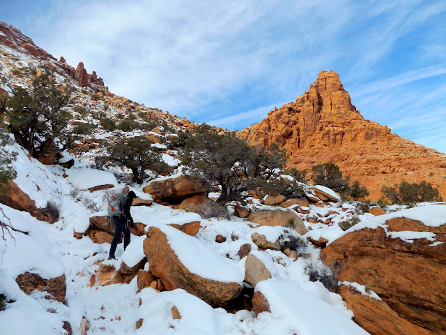
Trail into Hidden Valley
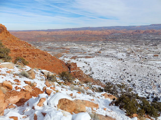
Moab
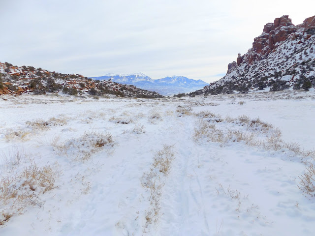
After the trail leveled out it was an easy, pleasant 1.5-mile walk through the snow in Hidden Valley. I strayed from the trail a couple of times to search some cliffs and boulders for rock art and to find one geocache that was buried under the snow. I was glad I'd brought my gaiters, while Chris was wishing he hadn't left his at home. At the pass between Hidden Valley and the Moab Rim area we found one more geocache, then left the trail to check out a small petroglyph panel that I'd spotted with binoculars.
Hidden Valley
Hidden Valley
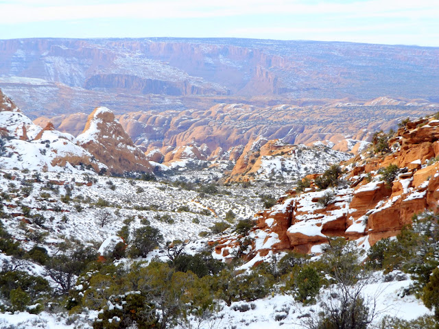
View northwest from the saddle toward Moab Rim
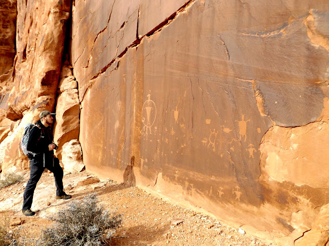
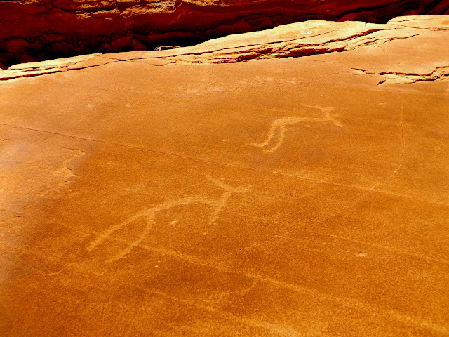
The first petroglyphs we encountered
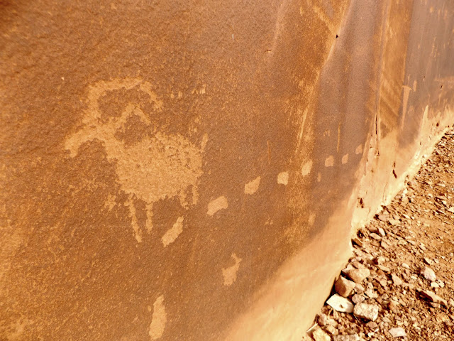
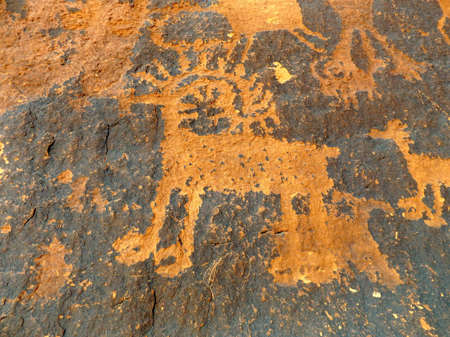
Bighorn sheep (lower-right) with elaborate horns
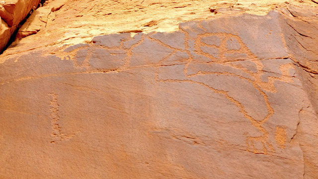
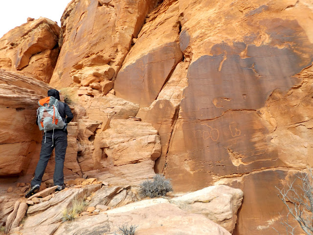
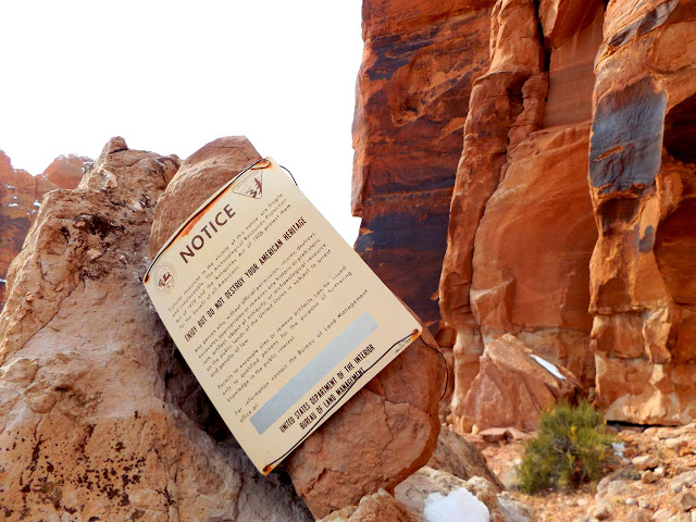
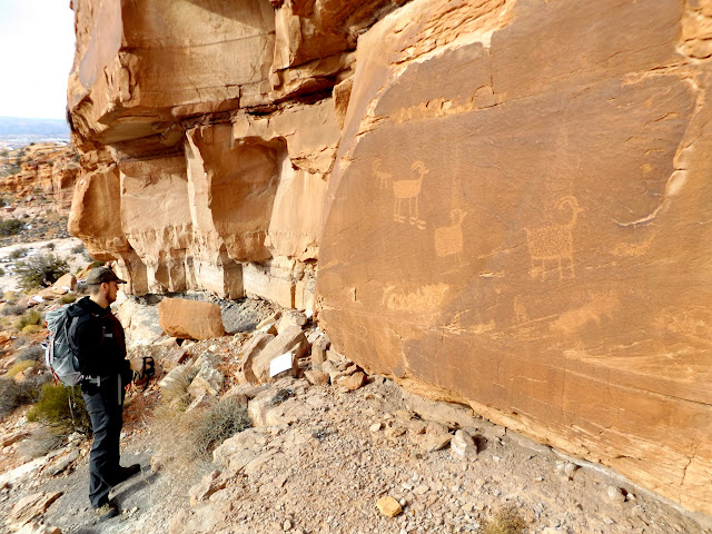
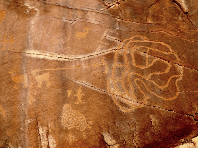
We continued hiking off-trail on the way to the ruins. A BLM sign alerted us to the possibility of something interesting ahead. Beyond the sign were some petroglyphs and an 1899 inscription. Continuing along the base of the cliffs we encountered more and more and more rock art--it just kept going! It was good stuff, too. There were many different animals depicted, large and small figures of all kinds, and some pretty unusual petroglyphs. I was continually surprised at just how much rock art was in the area.
Notice: something cool is just around the corner
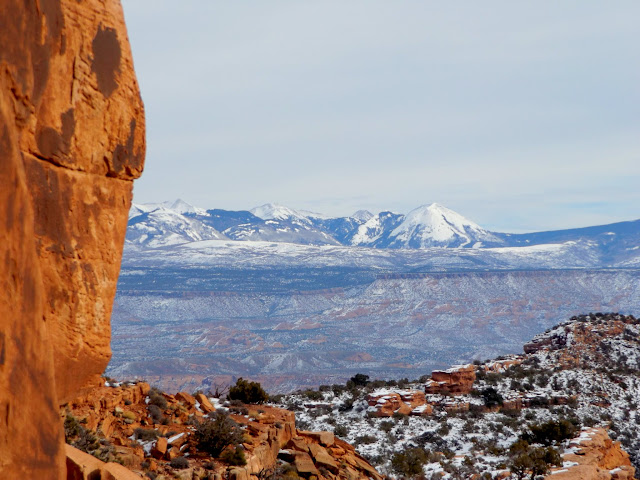
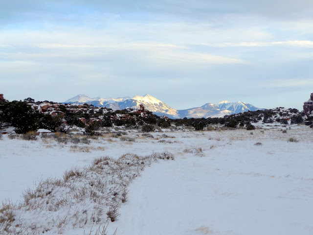
La Sal Mountains
C.A.R., June 2, 1899
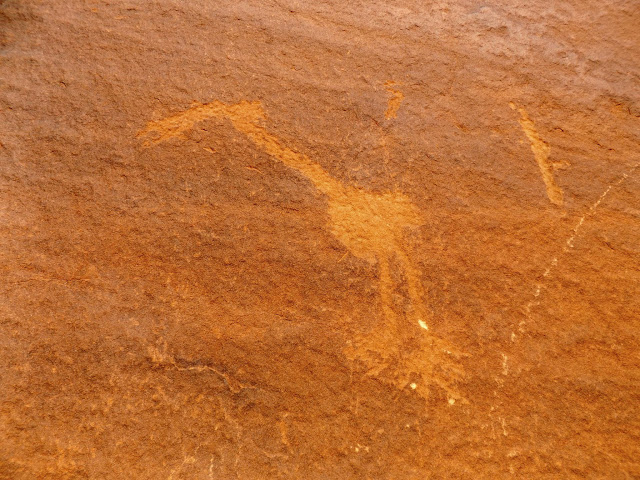
Crane petroglyph
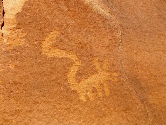
Mouse?
Bear tracks
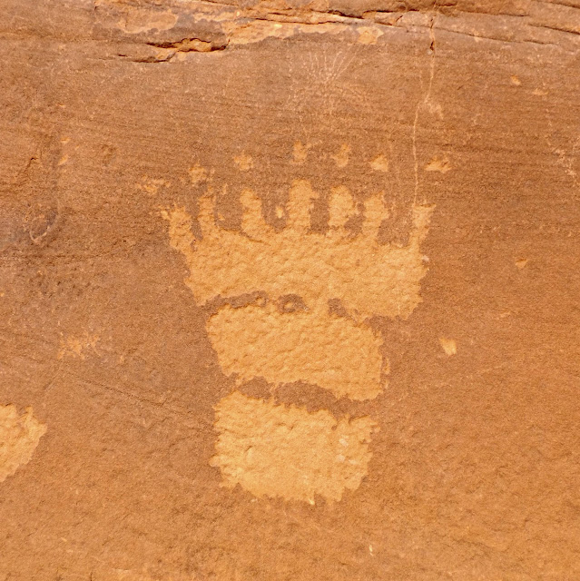
Seven-toed bear track
Chris at a petroglyph panel
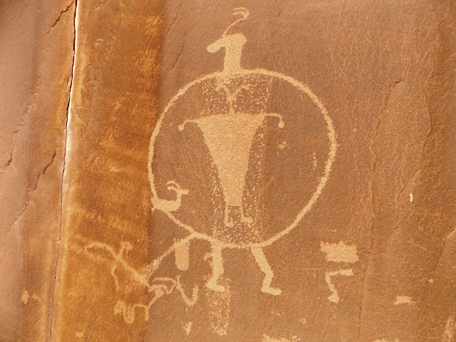
One figure enclosed within another
Bighorn sheep and tracks
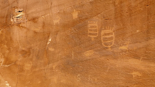
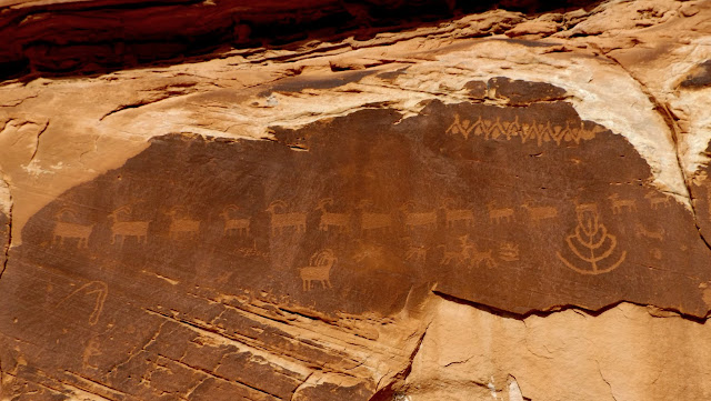
Line of 14 bighorn sheep
Rabbits?
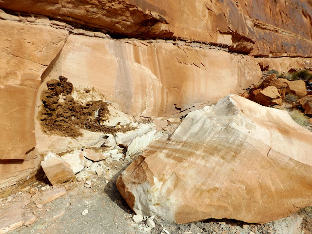
Recent rockfall that probably has petroglyphs on it
Large sheep petroglyphs
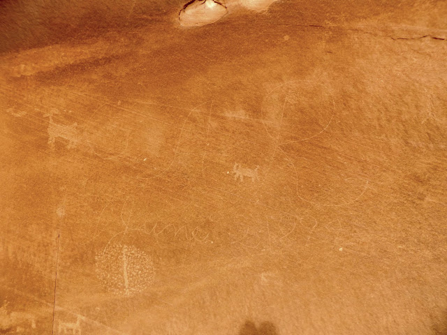
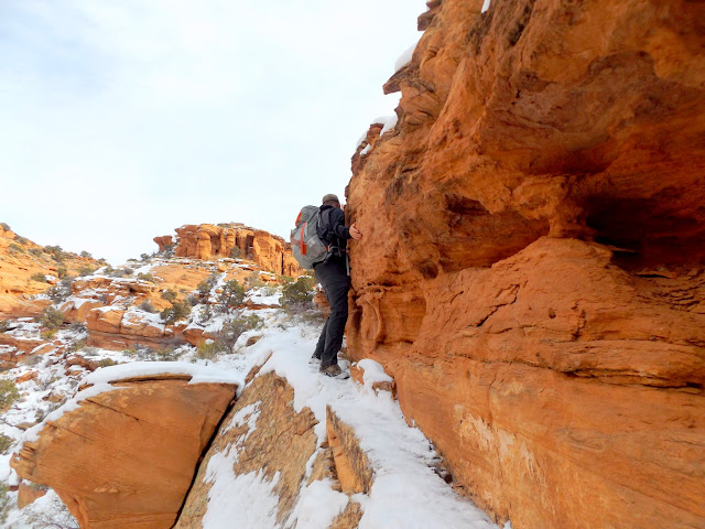
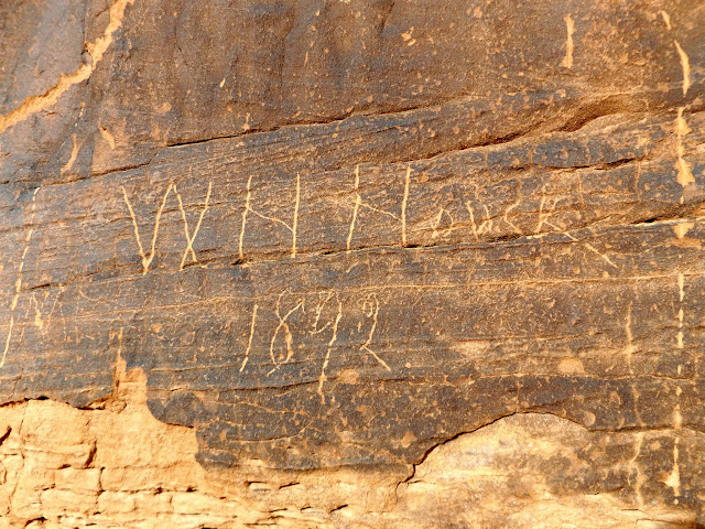
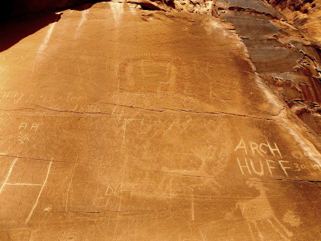
The cliff band ended but, just around the corner and across a small valley, there were more cliffs with yet more rock art that I could see with my binoculars. We had to scoot across a narrow, snow-covered ledge to get around the head of the valley in order to access the shelf between cliff bands where I'd spotted the other rock art. At the first panel on this side of the valley we stopped for a late lunch. A man and a dog walked on the trail across the valley while we ate--they'd apparently come up the Moab Rim trail. We continued walking the cliffs. The rock art here was just as plentiful, but there were many more inscriptions, the oldest of which was dated 1884.
Sketchy traverse in the snow
Skirting around a small valley
Faint life-sized deer petroglyph
Dancing men
Swordfight!
Fancy bighorn
Whacky stuff
W.H. Houck 1892
Circular petroglyph figure around a faint red pictograph
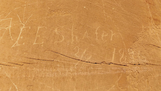
E.E. Shafer, 2/8 1896
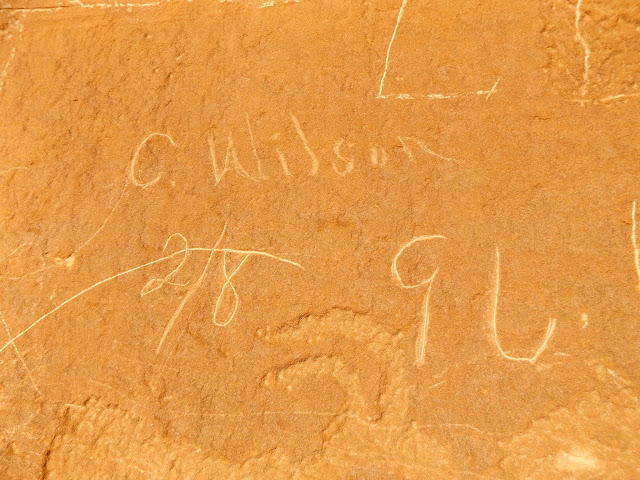
C. Wilson 2/8 1896
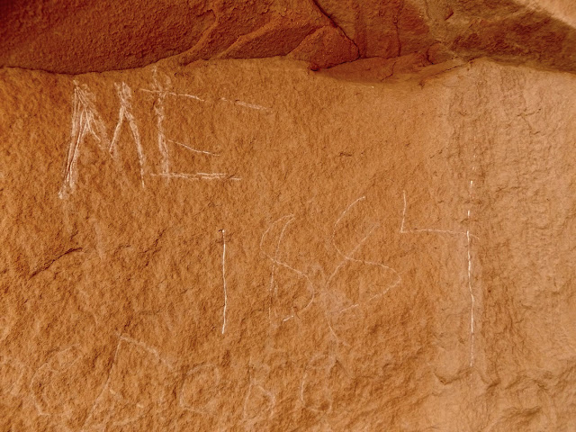
M.E. 1884
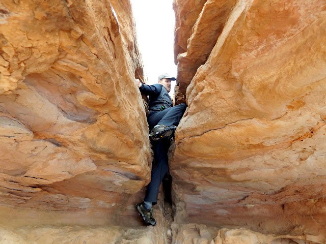
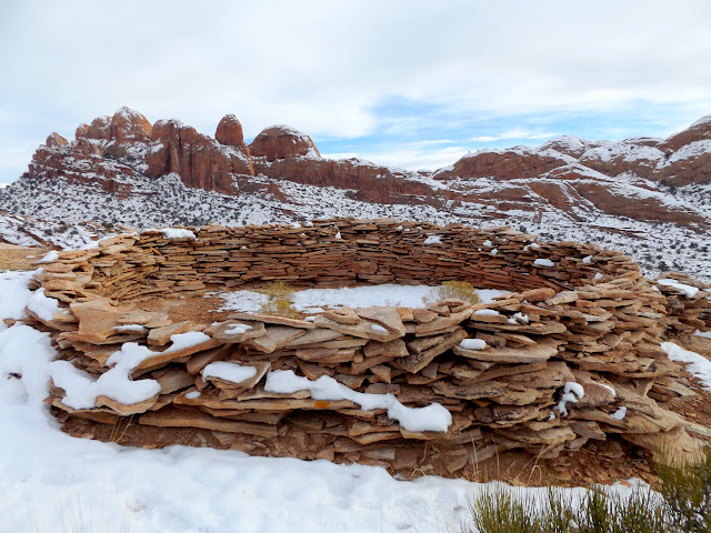
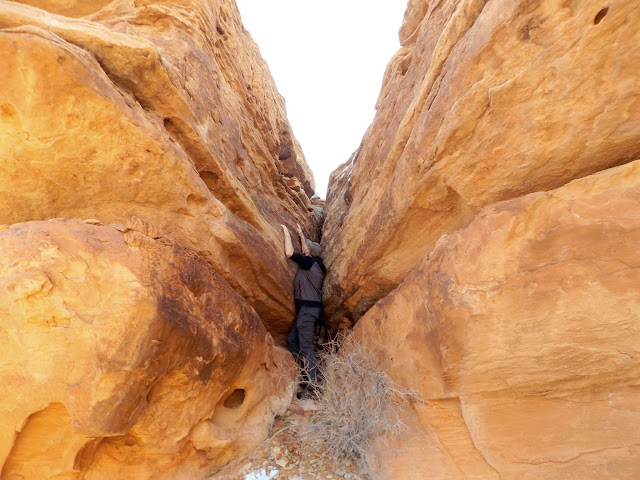
Finally, late in the day, Chris and I arrived at one of the ruins we'd planned on visiting. The ruin is on top of a narrow ridge surrounded by cliffs, with only a single, narrow crack in the cliffs that leads to the top. Chris climbed up with some difficulty, and I stayed below to help spot him on the climb back down. Since it was getting late, instead of taking turns on top I just handed my camera up to Chris and he took a few photos for me. The other ruin was atop a different ridge with a similar crack that leads to the top, but it was much more difficult to climb. Neither of us was comfortable completing the climb, and we found a different access point that may have led to the top, but it was snow-covered and we didn't want to attempt it in those conditions.
Climbing up to an Indian ruin
Circular ruin
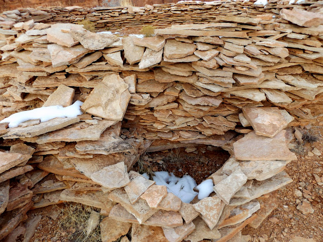
Small room/compartment off the main ruin
Attempting to climb to a second ruin
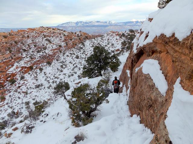
To get back into Hidden Valley we took a different route than we'd used earlier in the day. It had a couple of potentially treacherous spots where a slip in the snow would have almost surely resulted in injury, but it cut out a lot of backtracking to get on our original route in. Once we regained the Hidden Valley trail we kept a quick pace in order to get back to the trailhead before dark. Seeing some wonderful low-angle light on the La Sals made me quicken my pace further in the hopes of getting some sunset photos of the mountains before the sun disappeared completely. The sun set just as we reached the top of the steep section of trail leading down into the valley, and we got back to the Jeep about 10 minutes before full dark. It had been a surprisingly excellent day of rock art viewing. Most trips I go on are meticulously planned and I usually know exactly what to expect. This one was the opposite, and probably closer to the way things should be.
Sketchy, snow-covered route back into Hidden Valley
Hidden Valley and the La Sals
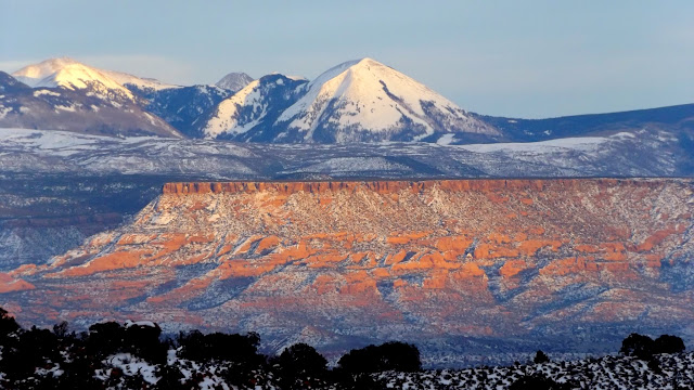
Haystack Mountain above South Mesa
La Sals seen from Hidden Valley
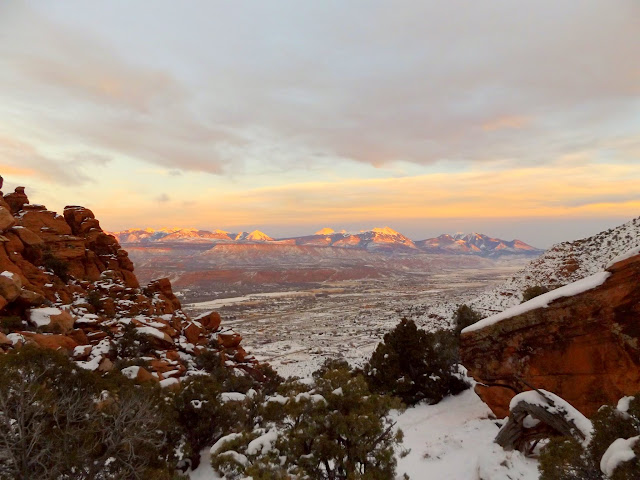
Photo Gallery: Hidden Valley
Steep break in the cliffs that leads into Hidden Valley
Trailhead register
Trail into Hidden Valley
Moab
After the trail leveled out it was an easy, pleasant 1.5-mile walk through the snow in Hidden Valley. I strayed from the trail a couple of times to search some cliffs and boulders for rock art and to find one geocache that was buried under the snow. I was glad I'd brought my gaiters, while Chris was wishing he hadn't left his at home. At the pass between Hidden Valley and the Moab Rim area we found one more geocache, then left the trail to check out a small petroglyph panel that I'd spotted with binoculars.
Hidden Valley
Hidden Valley
View northwest from the saddle toward Moab Rim
The first petroglyphs we encountered
Bighorn sheep (lower-right) with elaborate horns
We continued hiking off-trail on the way to the ruins. A BLM sign alerted us to the possibility of something interesting ahead. Beyond the sign were some petroglyphs and an 1899 inscription. Continuing along the base of the cliffs we encountered more and more and more rock art--it just kept going! It was good stuff, too. There were many different animals depicted, large and small figures of all kinds, and some pretty unusual petroglyphs. I was continually surprised at just how much rock art was in the area.
Notice: something cool is just around the corner
La Sal Mountains
C.A.R., June 2, 1899
Crane petroglyph
Mouse?
Bear tracks
Seven-toed bear track
Chris at a petroglyph panel
One figure enclosed within another
Bighorn sheep and tracks
Line of 14 bighorn sheep
Rabbits?
Recent rockfall that probably has petroglyphs on it
Large sheep petroglyphs
The cliff band ended but, just around the corner and across a small valley, there were more cliffs with yet more rock art that I could see with my binoculars. We had to scoot across a narrow, snow-covered ledge to get around the head of the valley in order to access the shelf between cliff bands where I'd spotted the other rock art. At the first panel on this side of the valley we stopped for a late lunch. A man and a dog walked on the trail across the valley while we ate--they'd apparently come up the Moab Rim trail. We continued walking the cliffs. The rock art here was just as plentiful, but there were many more inscriptions, the oldest of which was dated 1884.
Sketchy traverse in the snow
Skirting around a small valley
Faint life-sized deer petroglyph
Dancing men
Swordfight!
Fancy bighorn
Whacky stuff
W.H. Houck 1892
Circular petroglyph figure around a faint red pictograph
E.E. Shafer, 2/8 1896
C. Wilson 2/8 1896
M.E. 1884
Finally, late in the day, Chris and I arrived at one of the ruins we'd planned on visiting. The ruin is on top of a narrow ridge surrounded by cliffs, with only a single, narrow crack in the cliffs that leads to the top. Chris climbed up with some difficulty, and I stayed below to help spot him on the climb back down. Since it was getting late, instead of taking turns on top I just handed my camera up to Chris and he took a few photos for me. The other ruin was atop a different ridge with a similar crack that leads to the top, but it was much more difficult to climb. Neither of us was comfortable completing the climb, and we found a different access point that may have led to the top, but it was snow-covered and we didn't want to attempt it in those conditions.
Climbing up to an Indian ruin
Circular ruin
Small room/compartment off the main ruin
Attempting to climb to a second ruin
To get back into Hidden Valley we took a different route than we'd used earlier in the day. It had a couple of potentially treacherous spots where a slip in the snow would have almost surely resulted in injury, but it cut out a lot of backtracking to get on our original route in. Once we regained the Hidden Valley trail we kept a quick pace in order to get back to the trailhead before dark. Seeing some wonderful low-angle light on the La Sals made me quicken my pace further in the hopes of getting some sunset photos of the mountains before the sun disappeared completely. The sun set just as we reached the top of the steep section of trail leading down into the valley, and we got back to the Jeep about 10 minutes before full dark. It had been a surprisingly excellent day of rock art viewing. Most trips I go on are meticulously planned and I usually know exactly what to expect. This one was the opposite, and probably closer to the way things should be.
Sketchy, snow-covered route back into Hidden Valley
Hidden Valley and the La Sals
Haystack Mountain above South Mesa
La Sals seen from Hidden Valley
Photo Gallery: Hidden Valley