Kevin, who had hiked with me and Eric last year, in the Bechler, was in Yellowstone a few days ahead of our scheduled Shoshone Lake hike. We decided we would do a quick overnight on the Saturday before, and Kevin got a permit for a site along Hellroaring Creek. (2H6, I think).
Hellroaring is a creek, and a mountain. The gray mountain to the left, in the picture below, is Hellroaring Mountain (I think). The creek that flows through the center of the picture is Hellroaring Creek. You can only see a bit of water in this picture, but you can see most of where we hiked. We started on a hill to the right, and descended to just about where you can see the creek. Then we turned upstream, and hiked into the trees to our campsite. Once we set up our camp, we did a dayhike upstream to where there’s a bridge to cross the stream. We walked up to the bridge, took some pictures, and went back to camp

The Hellroaring Trailhead has a fairly large parking lot. We each got a parking space, and then we headed down the trail. At first, you’re in a lightly wooded area, and then you come to a bluff, with no trees to block the view, and suddenly, it gets very beautiful very fast. The water below is the Yellowstone River, which is about to enter the Black Canyon of the Yellowstone. I was supposed to hike through that about 3 weeks before, but was snowed out. Oh well, it’ll be there for another trip. On this trip, our campsite was to be under that gently pointed knob to the left of center. It was supposed to be about 2.5 miles from the trailhead.

After descending the hill by switchbacks, we came to a high suspension bridge, over the Yellowstone River. I’d have taken a picture of the river, but I was afraid I’d drop my phone. So, no picture of the Yellowstone River from here. Hikers and stock use this bridge. The water is a goodly ways down, and rushing and gushing.

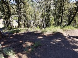
Once you get across the bridge, you climb a little hill, and then end up in a little forest. The first time I went through here, all I could think about was how it looks like mountain lion habitat. Others have agreed. I don’t know if it really is mountain lion habitat, but it wouldn’t surprise me. It’s a beautiful space to walk through, and different than the rest of the hike. It’s a fairly short segment, maybe three tenths of a mile, and then you are spit out into sagebrush.

Just a little more of the rocky forest.

Once you leave the forest, you’re in the sage with glorious views of the Hellroaring area. The sage smells wonderful.

That little pond is visible from the Grand Loop Road, in a couple of places. If you go around the pond, to the creek, that’s where you’re supposed to be able to ford Hellroaring Creek, when it’s lower. At this time of year (mid-July), it was too high to ford. We turned right, and headed upstream.

You can see some of the flowers that were blooming. More of those later.

Once we got up the trail a little ways, I turned back and took a picture of the ridge downstream. I’m not sure what its name is, but that’s where the Grand Loop Road is, perched on the side of that ridge.

Here’s the sign for our campsite. We headed down the hill toward the creek. Step 1 was to hang our food. I had a new rope throwing technique, and managed to get a rope over the bear pole relatively quickly. That was much better than the previous year, when Eric tried taking pictures of me trying to get the rope over the bear pole, and I made a rather wild pitch and nearly took out his knee.


I used my Altaplex again. It’s really light, and seems to work well in wind, and it has kept me dry in the rain. For the rest of the summer, however, I switched to a Big Sky Soul. But on this trip, it was great.

Here’s the kitchen area, with a food bag hanging.

From by the bear pole, it’s only a few steps to Hellroaring Creek.

After some lunch, we headed up to see the bridge. It was supposed to be a little over a mile.

It was mostly up, with a little down here and there. You can kind of see some of the flowers.


When we entered the forest, as opposed to intermittent forest and meadow, we were close to the bridge.

This was the first view of the creak going downstream.

The bridge. It was meant for people and stock.

Looking upstream from the bridge.

We sat and looked downstream for a bit.

Then we headed back to the campsite.

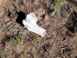
In this area of the park, there are always elk antlers and skulls and bones.

Gallardia.

Gallardia and geraniums.

The view from inside my tent. (I had to take a nap, to make sure everything was set up correctly. It’s how you test.)

The view as I settled into the tent for the night.

Heading out the next morning.

The moon was still up.


There are lots of glacial erratics in this area.


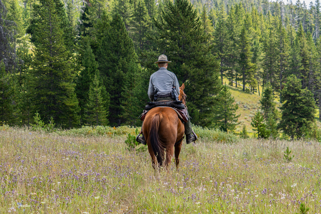
We missed the opportunity to get a picture of a couple of rangers on horses, by a minute or two. It would have made a nice picture. Kevin says he only sees rangers when I’m along.


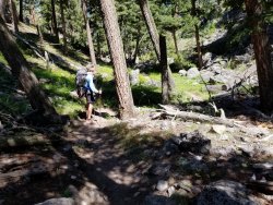
The trail up the ridge is steep and seems like it’s never going to end. I’m seeing a blur on the picture, too. Probably a stupid mosquito. They were really out. They keep the crowds away, though. That and the fear of bears. And mountain lions. And wolves. And Bigfoot.

On the way home, I spotted this little bear. He’s why we hang our food—to keep him and us safe. He seems happy enough eating flowers and grasses.
A couple of days later, Kevin and I met to hike around Shoshone Lake. That was the plan anyway...

Hellroaring is a creek, and a mountain. The gray mountain to the left, in the picture below, is Hellroaring Mountain (I think). The creek that flows through the center of the picture is Hellroaring Creek. You can only see a bit of water in this picture, but you can see most of where we hiked. We started on a hill to the right, and descended to just about where you can see the creek. Then we turned upstream, and hiked into the trees to our campsite. Once we set up our camp, we did a dayhike upstream to where there’s a bridge to cross the stream. We walked up to the bridge, took some pictures, and went back to camp
The Hellroaring Trailhead has a fairly large parking lot. We each got a parking space, and then we headed down the trail. At first, you’re in a lightly wooded area, and then you come to a bluff, with no trees to block the view, and suddenly, it gets very beautiful very fast. The water below is the Yellowstone River, which is about to enter the Black Canyon of the Yellowstone. I was supposed to hike through that about 3 weeks before, but was snowed out. Oh well, it’ll be there for another trip. On this trip, our campsite was to be under that gently pointed knob to the left of center. It was supposed to be about 2.5 miles from the trailhead.
After descending the hill by switchbacks, we came to a high suspension bridge, over the Yellowstone River. I’d have taken a picture of the river, but I was afraid I’d drop my phone. So, no picture of the Yellowstone River from here. Hikers and stock use this bridge. The water is a goodly ways down, and rushing and gushing.
Once you get across the bridge, you climb a little hill, and then end up in a little forest. The first time I went through here, all I could think about was how it looks like mountain lion habitat. Others have agreed. I don’t know if it really is mountain lion habitat, but it wouldn’t surprise me. It’s a beautiful space to walk through, and different than the rest of the hike. It’s a fairly short segment, maybe three tenths of a mile, and then you are spit out into sagebrush.
Just a little more of the rocky forest.
Once you leave the forest, you’re in the sage with glorious views of the Hellroaring area. The sage smells wonderful.
That little pond is visible from the Grand Loop Road, in a couple of places. If you go around the pond, to the creek, that’s where you’re supposed to be able to ford Hellroaring Creek, when it’s lower. At this time of year (mid-July), it was too high to ford. We turned right, and headed upstream.
You can see some of the flowers that were blooming. More of those later.
Once we got up the trail a little ways, I turned back and took a picture of the ridge downstream. I’m not sure what its name is, but that’s where the Grand Loop Road is, perched on the side of that ridge.
Here’s the sign for our campsite. We headed down the hill toward the creek. Step 1 was to hang our food. I had a new rope throwing technique, and managed to get a rope over the bear pole relatively quickly. That was much better than the previous year, when Eric tried taking pictures of me trying to get the rope over the bear pole, and I made a rather wild pitch and nearly took out his knee.
I used my Altaplex again. It’s really light, and seems to work well in wind, and it has kept me dry in the rain. For the rest of the summer, however, I switched to a Big Sky Soul. But on this trip, it was great.
Here’s the kitchen area, with a food bag hanging.
From by the bear pole, it’s only a few steps to Hellroaring Creek.
After some lunch, we headed up to see the bridge. It was supposed to be a little over a mile.
It was mostly up, with a little down here and there. You can kind of see some of the flowers.
When we entered the forest, as opposed to intermittent forest and meadow, we were close to the bridge.
This was the first view of the creak going downstream.
The bridge. It was meant for people and stock.
Looking upstream from the bridge.
We sat and looked downstream for a bit.
Then we headed back to the campsite.
In this area of the park, there are always elk antlers and skulls and bones.
Gallardia.
Gallardia and geraniums.
The view from inside my tent. (I had to take a nap, to make sure everything was set up correctly. It’s how you test.)
The view as I settled into the tent for the night.
Heading out the next morning.
The moon was still up.
There are lots of glacial erratics in this area.
We missed the opportunity to get a picture of a couple of rangers on horses, by a minute or two. It would have made a nice picture. Kevin says he only sees rangers when I’m along.
The trail up the ridge is steep and seems like it’s never going to end. I’m seeing a blur on the picture, too. Probably a stupid mosquito. They were really out. They keep the crowds away, though. That and the fear of bears. And mountain lions. And wolves. And Bigfoot.
On the way home, I spotted this little bear. He’s why we hang our food—to keep him and us safe. He seems happy enough eating flowers and grasses.
A couple of days later, Kevin and I met to hike around Shoshone Lake. That was the plan anyway...
Attachments
Last edited:
")