Hell Roaring Lake, Sawtooths Idaho

leatherman

Huh?
Joined
Jan 24, 2012
Messages
138
I did this hike in July 2011. Overall round trip is just over 9 miles and the elevation gain is only about 600 feet which made for a relaxing hike through the forest. The majority of the elevation gain is during the first 1/2 mile where the trail climbs and tops out on a moraine then proceeds up through a wide canyon. Hell Roaring Creek is nearby the trail and visible at times but there are no river crossings. There are several good camping spots on the left side of the lake, although some of them appeared to be pretty close together. During the peak summer months this is one of the most popular destinations in the Sawtooths so it's not the best for solitude.

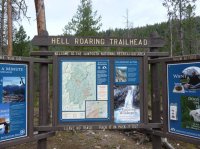
Sign at the trailhead...
P1080104.JPG

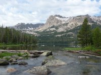
First view of the lake.
P1080107.JPG

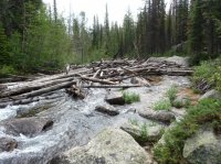
Hell Roaring Creek outlet
P1080108.JPG


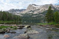
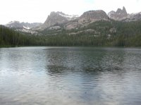
Another view of the lake. The protrusion of rock on the ridgeline is call the Finger of Fate. I saw a video somewhere, probably youtube, where some people were climbing it. Pretty cool stuff.
P1080115.JPG


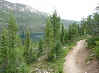
I continued up the trail for another mile. It starts to climb after you go past the lake and I had thoughts of going over a pass to reach the next lake but decided to turn around at this point when it started to lightning. There are several lakes further along and they would make a great 2-3 day loop backpacking trip.
P1080114.JPG


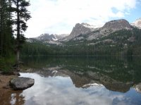
One more picture of the lake. The storm passed by to the south and I wished I had just waited for a while before turning around, but it was still a nice hike that made for a great day. P1080111.JPG
Featured image for slideshow:
slide.jpg
 
This is a neat area...
I hiked up there once in May with my brother in law in May... There was a bit more snow up there then he thought there would be.. At least we were able to pitch our tent on a dryish section... We saw only 2 other people on the trail, so we weren't the only crazy people.

Cool pictures Wes. I think it's neat to see how a place might look during the winter time, with the ice covering the lake and snow on the hillsides. The trail looks easy to find....just follow the stream. I wouldn't like wading in ice-cold ankle deep water and then trudging thru the snow, that's really hard on the feet.
 
Yeah that trip was a little rough on the feet since they were soaked! The trail started off nice then as we got up a bit the water and snow came into play. Made me wish I didn't have shorts on! The next year we hiked the Alice to Toxaway and were planning to come down Hell Roaring Trail.... The snow in July was a bit much in spots for this hike. And the Mosquitos were horrible. We cut out Imogene and Hell Roaring section and went back out at Pettit Lake. There were some awesome views, but to much snow up high and to many bites below.
 
Awesome! I've been dying to get up to the Sawtooths but still haven't made it. Being an Idahoan, have you spend a lot of time there? Like can I hit you up for advice on where to go, etc? :)
 
Nice! This lake was on our to do list when we went to the Sawtooth last summer, but we didn't end up doing it. Now that I've got backpacking gear I look forward to doing the Alice-Toxaway Loop. Hopefully next summer.:)
 
Awesome! I've been dying to get up to the Sawtooths but still haven't made it. Being an Idahoan, have you spend a lot of time there? Like can I hit you up for advice on where to go, etc? :)
Absolutely! I've spent a lot of car camping days there, mostly doing day hikes but I'd be happy to give some recommendations. Not to hijack this forum, but this website http://idahoalpinezone.com/ has some excellent TR's and pics of the Sawtooths and other ranges in Idaho. When you start to plan your trip let me know!
 
I love it when I go googling for route information and it's backcountrypost that comes up! I totally forgot about this TR. So, leatherman, that 9 miles round trip, is that from the lower trailhead or the upper? I was planning about 5 from the lower but I came across this trip report from some guys who say they thought it was 5 but it turned out to be 10. Or perhaps it just felt like 10 to them because they don't get out much? Hmmm...
 
I love it when I go googling for route information and it's backcountrypost that comes up! I totally forgot about this TR. So, leatherman, that 9 miles round trip, is that from the lower trailhead or the upper? I was planning about 5 from the lower but I came across this trip report from some guys who say they thought it was 5 but it turned out to be 10. Or perhaps it just felt like 10 to them because they don't get out much? Hmmm...

9 miles round trip from the lower trailhead, 5 from the upper.
 
This is from the lower TH. My trail map says its 10.2 miles RT, my guide book says 9.8 RT, so take your pick. From the lower TH, the trail takes you up the side of a moraine, and the rest is a stroll in the woods. I'm really hoping you can make it on up to Imogene.

To get to the TH, head south from Stanley on highway 75 for approximately 12 miles. Look for the 4th of July Road sign, which points left (East). You'll want to go the opposite way, right, the road will take you to a bridge over the Salmon River, then comes to a "T". Bear left and follow it until you see the TH marker on the right hand side of the road.
 

Don't like ads? Become a BCP Supporting Member and kiss them all goodbye. Click here for more info.

Back
Top