- Joined
- May 19, 2012
- Messages
- 2,017
Hat Flat is a group of 3 small canyons located between Slickhorn Canyon and Grand Gulch. You would hardly know they are there, only 200' deep or so. It looked like a very good place to go early in January (2011), so my friend Louis and I left Carbondale in very cold weather, a big storm had just come through. And it got colder the closer we got to Moab, a little overcast and way colder than we wanted, like in the teens at 11am. It was supposed to be much warmer according to the weather report. Luckily it did just that, the closer we got to Blanding it got warmer and sunnier. You turn off of sr261 oposite Cigarette Springs Road and head as if you were going to the Government Tralhead. Instead, turn left 1 mile before the final turn to the Government Trail. If you see the Government trailhead sign you have gone too far. We parked a couple of miles down this road, where the plow had stopped.
The snow was about 6" deep and crusty. The weather was spectacular, in the mid 30's, but we were warm.
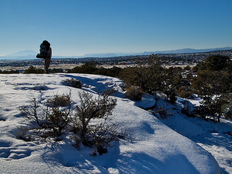
We followed the road, which splits 2 of the canyons from the 3rd. This is looking west, we camped at the lower end of the canyon in the foreground, following the road down and then up the canyon a short distance:
Hiking up the lower end of the canyon:
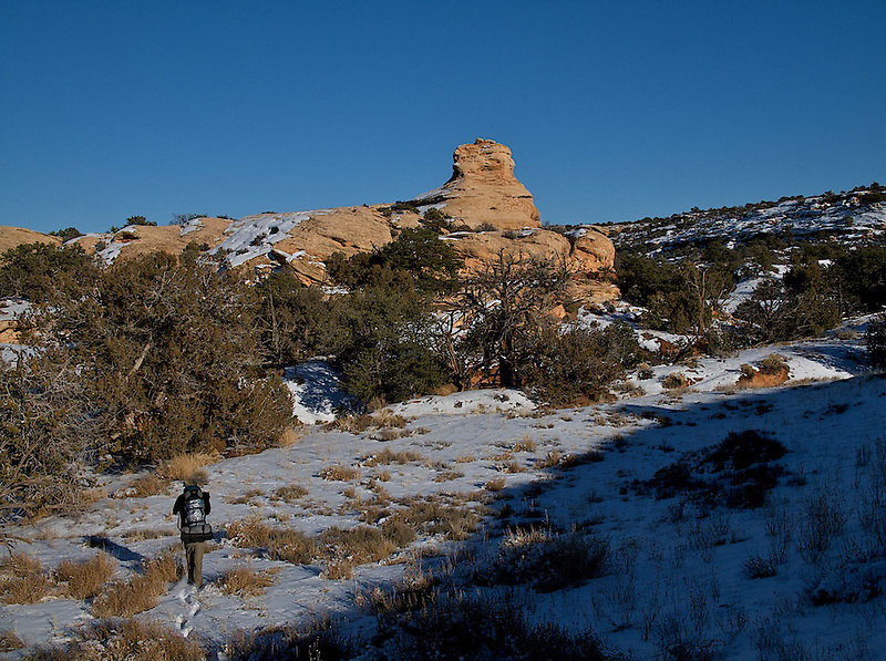
We really had no idea where we were going, other than up this little canyon.
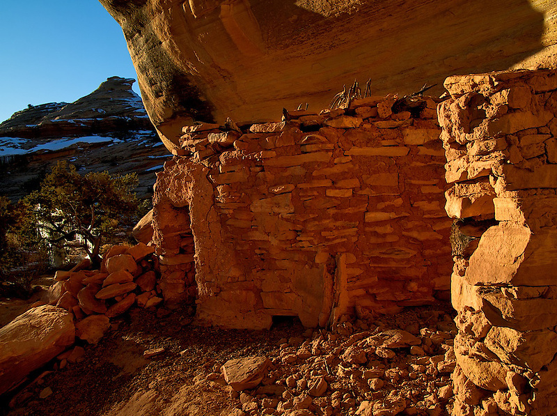
We saw a big alcove a short way up, and found this ruin:
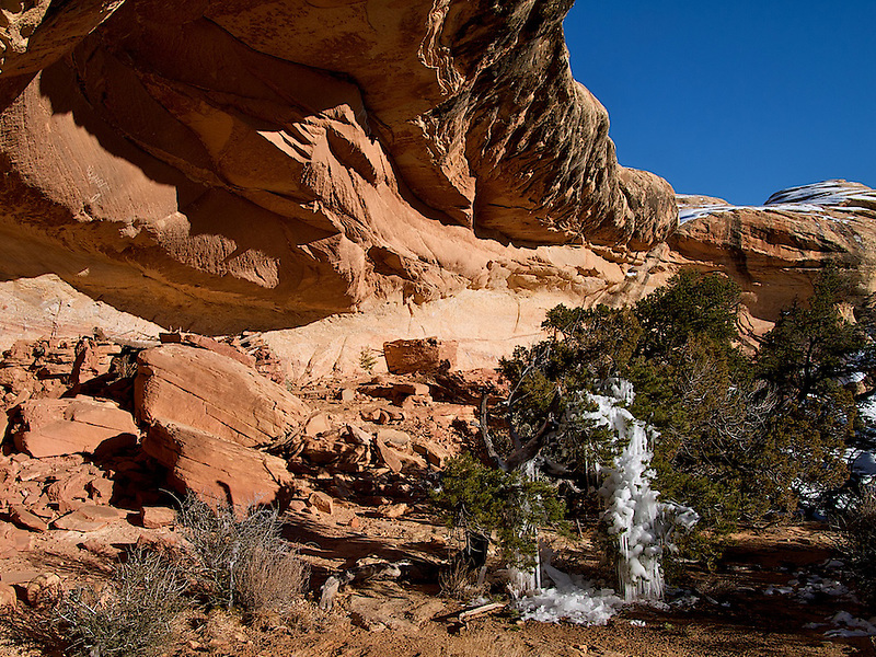
It was an amazing place, sunny and warm and protected. What I loved most about it was that you walked right up to it, no precipitous ledges or defensive walls, this place had a great vibe. A party place. The main part of the ruin was to the left (in the pic above) a couple of the walls had fallen in and the roof collapsed.
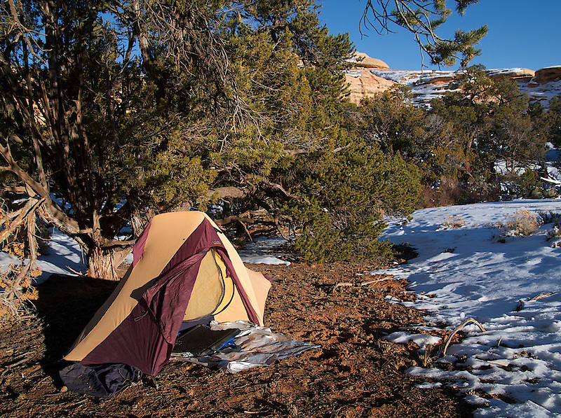
I found a nice warm spot some distance from the ruin for my camp.
Around 9 am the following morning:
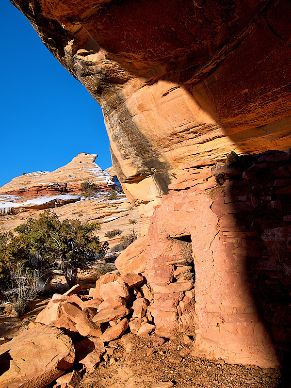
Looking the other direction,toward the smaller storage building, it was 30 degrees colder with no sun:
We stayed clear of what appeared to be the kiva:

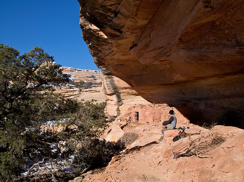
This place is an energy collector, the sun hit early and stayed late. You could teach a class in solar design right here. It was significantly warmer sitting in the alcove, which is where we hung out and cooked, on the slickrock terraces nearby.
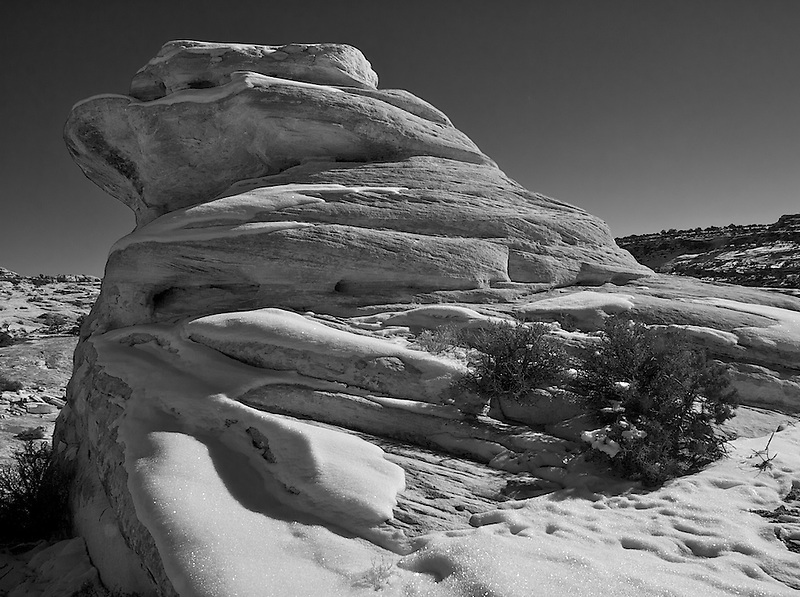
We decided to explore for the day the area between the 2 canyons, heading straight up towards the knob in the pic above and turning up canyon. It was all slickrock, and pretty much void of snow, temps in the mid 30's but warm again, no wind. A perfect day.
View of the ruin from the the start of our day hike, my tent is out of the picture to the right:


The hike was spectacularly unspectacular if you know what I mean, cool slickrock and rock formations. It seems like Navajo Mountain is getting harder and harder to see as time goes on, or is it just me?
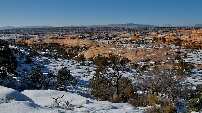
A view into the canyon to the west, maybe explore here this winter:


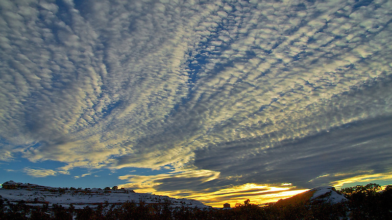
We doubled back and arrived at the alcove in time for a beautiful sunset and dinner. I dd not bring my tripod, as my pack was pretty heavy, but that was a mistake I guess. The sunset was spectacular. When I have my camera I am too busy taking pictures and not enjoying the sunset, so maybe it was better this way.
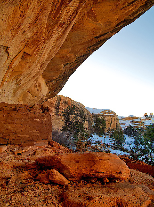
The last of the sun, at 4:45, almost a solid 8 hours of direct sunlight. And because the overhang was so deep (30-50') I bet this place has little sun in the summer:

We left the following morning retracing our steps back up to the car.
This was a great trip, just wandering up a little canyon and finding this place was pretty memorable.
Featured image for home page:

The snow was about 6" deep and crusty. The weather was spectacular, in the mid 30's, but we were warm.
We followed the road, which splits 2 of the canyons from the 3rd. This is looking west, we camped at the lower end of the canyon in the foreground, following the road down and then up the canyon a short distance:
Hiking up the lower end of the canyon:
We really had no idea where we were going, other than up this little canyon.
We saw a big alcove a short way up, and found this ruin:
It was an amazing place, sunny and warm and protected. What I loved most about it was that you walked right up to it, no precipitous ledges or defensive walls, this place had a great vibe. A party place. The main part of the ruin was to the left (in the pic above) a couple of the walls had fallen in and the roof collapsed.
I found a nice warm spot some distance from the ruin for my camp.
Around 9 am the following morning:
Looking the other direction,toward the smaller storage building, it was 30 degrees colder with no sun:
We stayed clear of what appeared to be the kiva:
This place is an energy collector, the sun hit early and stayed late. You could teach a class in solar design right here. It was significantly warmer sitting in the alcove, which is where we hung out and cooked, on the slickrock terraces nearby.
We decided to explore for the day the area between the 2 canyons, heading straight up towards the knob in the pic above and turning up canyon. It was all slickrock, and pretty much void of snow, temps in the mid 30's but warm again, no wind. A perfect day.
View of the ruin from the the start of our day hike, my tent is out of the picture to the right:
The hike was spectacularly unspectacular if you know what I mean, cool slickrock and rock formations. It seems like Navajo Mountain is getting harder and harder to see as time goes on, or is it just me?
A view into the canyon to the west, maybe explore here this winter:
We doubled back and arrived at the alcove in time for a beautiful sunset and dinner. I dd not bring my tripod, as my pack was pretty heavy, but that was a mistake I guess. The sunset was spectacular. When I have my camera I am too busy taking pictures and not enjoying the sunset, so maybe it was better this way.
The last of the sun, at 4:45, almost a solid 8 hours of direct sunlight. And because the overhang was so deep (30-50') I bet this place has little sun in the summer:
We left the following morning retracing our steps back up to the car.
This was a great trip, just wandering up a little canyon and finding this place was pretty memorable.
Featured image for home page:
Last edited: