- Joined
- Jul 23, 2013
- Messages
- 1,666
If you've been following me and my posts over time, you probably know how often I visit Capitol Reef National Park and the surrounding area. With my in-laws now living in Torrey and my wife being a great-great-granddaughter of the man considered to be the father of Capitol Reef National Park, Ephraim Pectol, one might say I've married into the park. With the many visits over the years, I've been trying to get familiar with as much of the park as reasonably possible. Halls Creek and its narrows had been looming for a long time. Thinking it might well be the best of the park, at least subjectively, I had been saving it for last with some vein plan to progress southward with each area I intended to tour. But alas, I couldn't resist any longer and took the opportunity to make a trip of it sooner. This was due in large part to recently reviewing some older trip reports of the place that resurfaced here on BCP as well as new. For the renewed inspiration, a debt of gratitude goes out to @Nick, @NateGeesaman, @lostlandscapes, and @Ross!!!
Tuesday - April 3, 2018
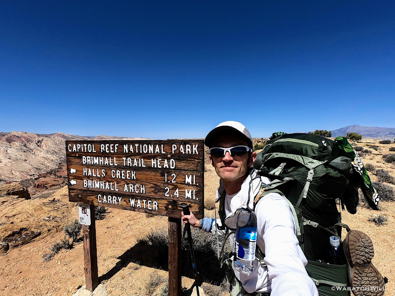
I started out the day by leaving my home in Provo bright and early. I had planned to arrive at the Visitor Center in Fruita right when they opened at 8 in order to have no trouble with parking (it was a Spring Break week for many) and to be the first one to get a permit for the day and thereby hopefully be the first one to register at the trailhead for that day. That plan didn't work out to time, instead getting to the Visitor Center just after 10. The parking wasn't bad and I was able to get my permit pretty quickly. I asked how many others they had signed up for the same area and the ranger said there were two other groups, one who'd be going in with the same agenda I had (2 nights) and were already on their way down, and another group who were spending the whole week. I wondered aloud how much competition there might be for a much sought after and coveted camp site location. The ranger said they weren't sure if the others even knew about it. Time would tell.
A couple hours later, I arrived at the trailhead. It had been my first time driving down the Notom road further than Notom itself. I was surprised to see a handful of cars at each of the trailhead lots along the way for the various slot canyons that drain off the eastern ridges of the majestic Waterpocket Fold. Still, far less than the more tourist-laden trailheads of the Fruita district.
When I arrived at Halls Creek Overlook, I was again surprised to find more than a couple vehicles there. Instead, there were somewhere between half a dozen to a dozen vehicles. I knew some were probably just there for the day, perhaps just checking out Brimhall Bridge or hiking a few miles northward to see Hamburger Rocks.
I had myself a nice little 'sammich' I had picked up on the way down for lunch while enjoying the views from the trailhead which doubled as an overlook down into the Halls Creek runway.

Halls Creek Overlook
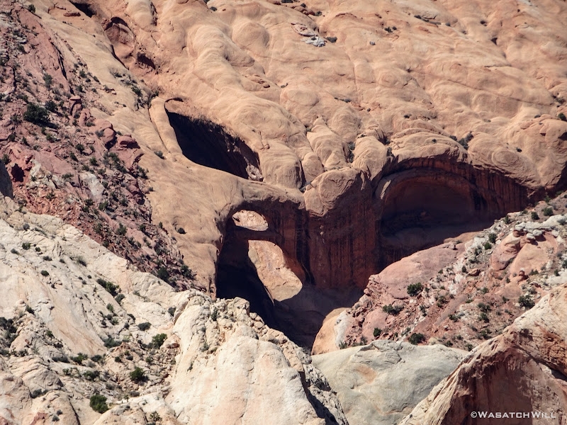
Brimhall Bridge from afar
With my tummy full of food, my pack full of gear, and my spirit full of excitement, I began the hike.
Trailhead selfie
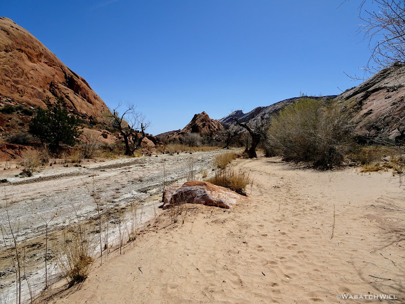
About a mile later, after descending something close to 800 feet off of Hall Mesa, I reached Halls Creek...or...more so, Halls Wash, at this point and almost immediately, the first crossing of it.
First time across Halls Creek
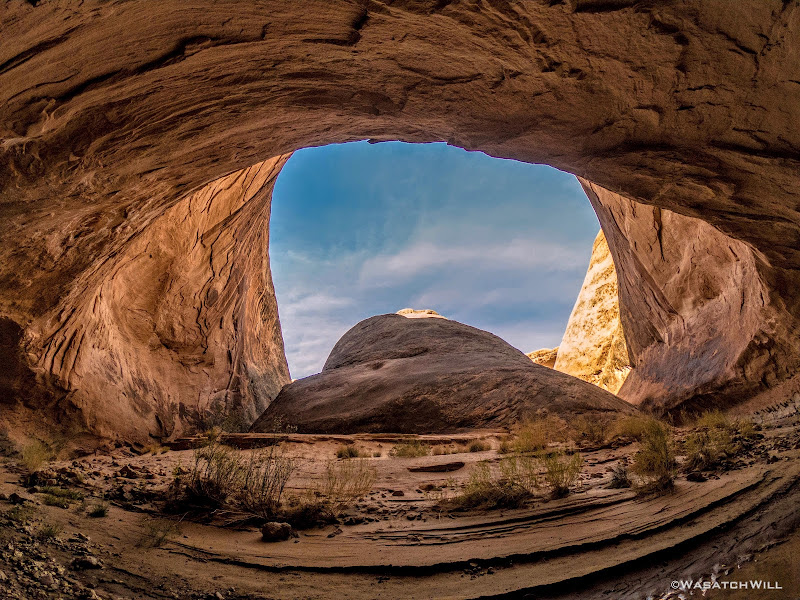
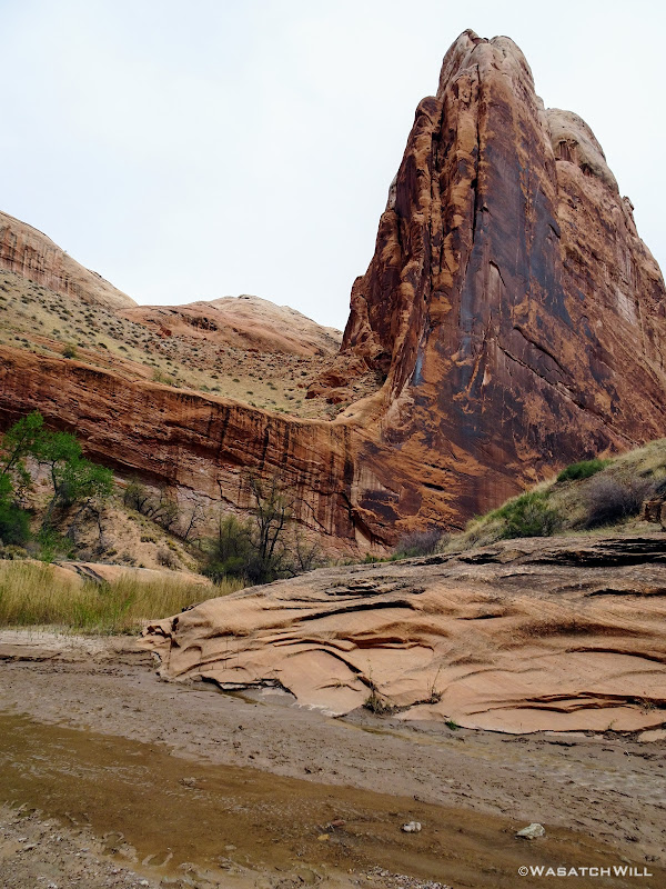
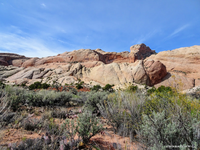
A couple miles and a number of creek crossings later and I found myself passing by Red Slide. I knew there'd be some hoodoos to look out for but didn't have any knowledge of a cave to be found along the landmark as well. I'm simply going to call it Red Slide Cave. It was tempting to go up and check it out, but I was eager to keep moving on with hopes of possibly catching up and passing anyone in front of me and increasing any chance of obtaining the prized camp spot.
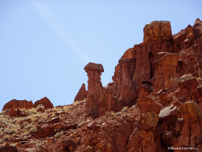
Red Slide hoodoo
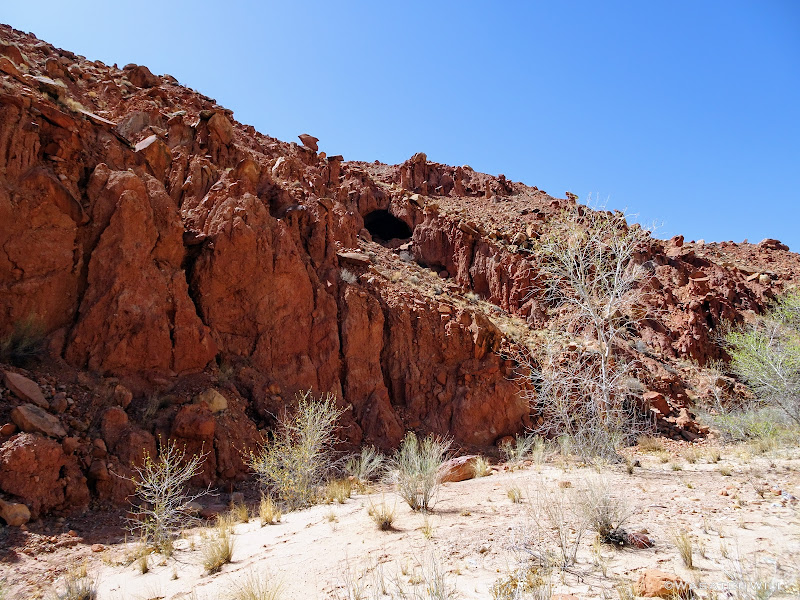
'Red Slide Cave'
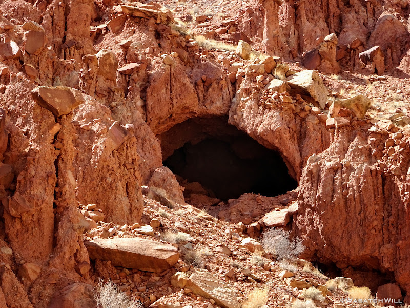
'Red Slide Cave' closer up

More hoodoos
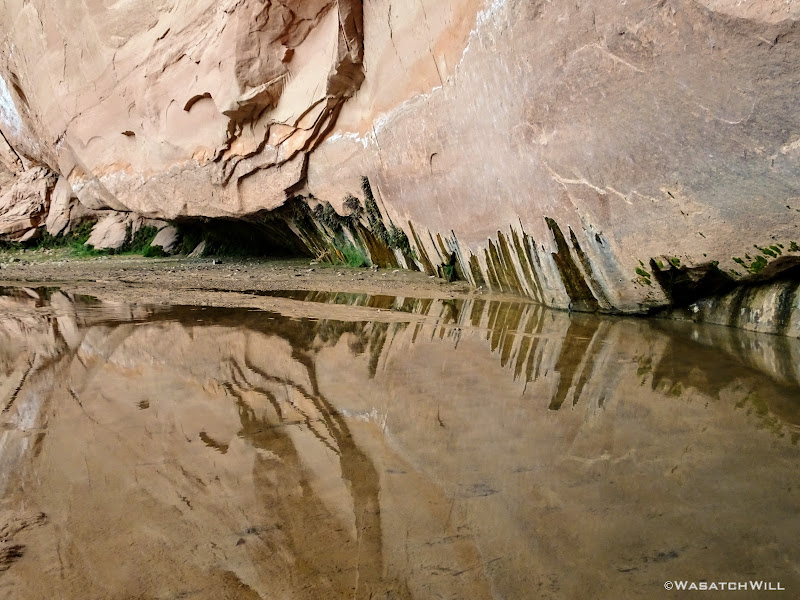
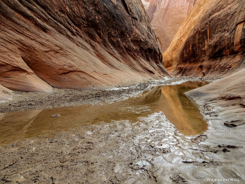
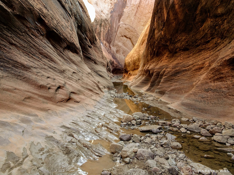
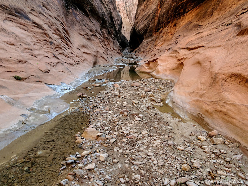
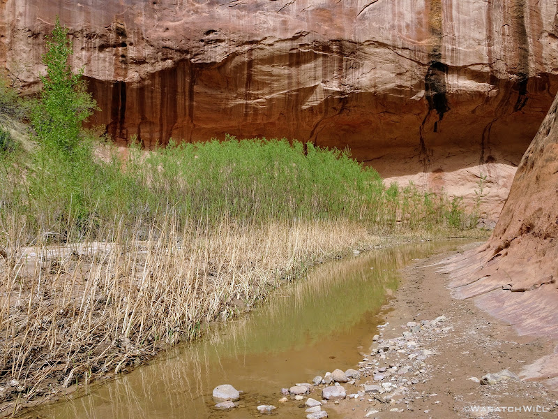
The walk was a long one, 7 miles or so in a fairly straight forward direction from the first creek/wash crossing, before I reached the emergence of the perennial part of the creek and the start of the loop through the narrows. Fortunately, there was plenty of scenery and several crossings of the meandering creek/wash to keep things interesting enough along the way.
Near the start of the narrows, I had actually encountered a member of one of the parties down there. She had gotten separated from an older guy she had come down with and asked me to be on the lookout for him and to let him know she had set up camp right near the mouth of the narrows section if I came a across him. A quarter mile later, I bumped into the guy looking for his partner. I updated him with the info I had just been given and wished him well.
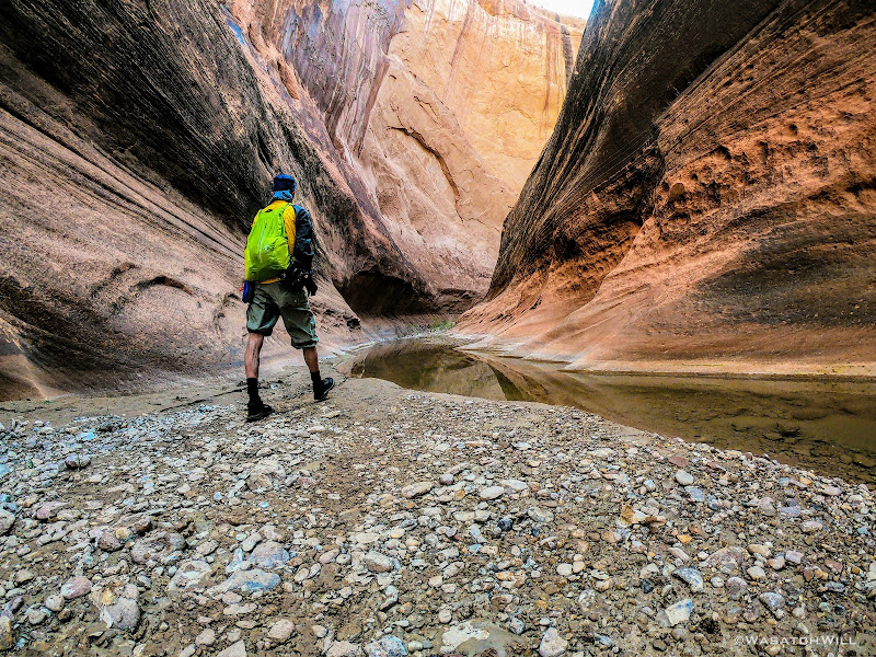
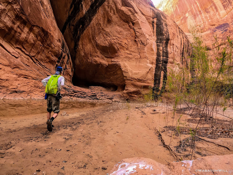
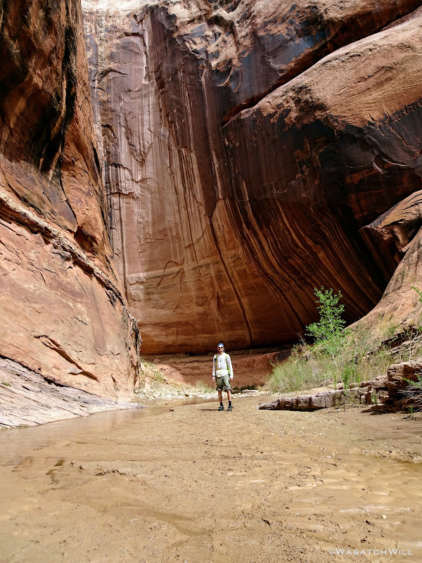
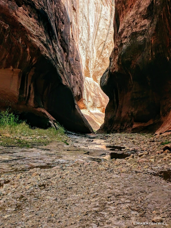
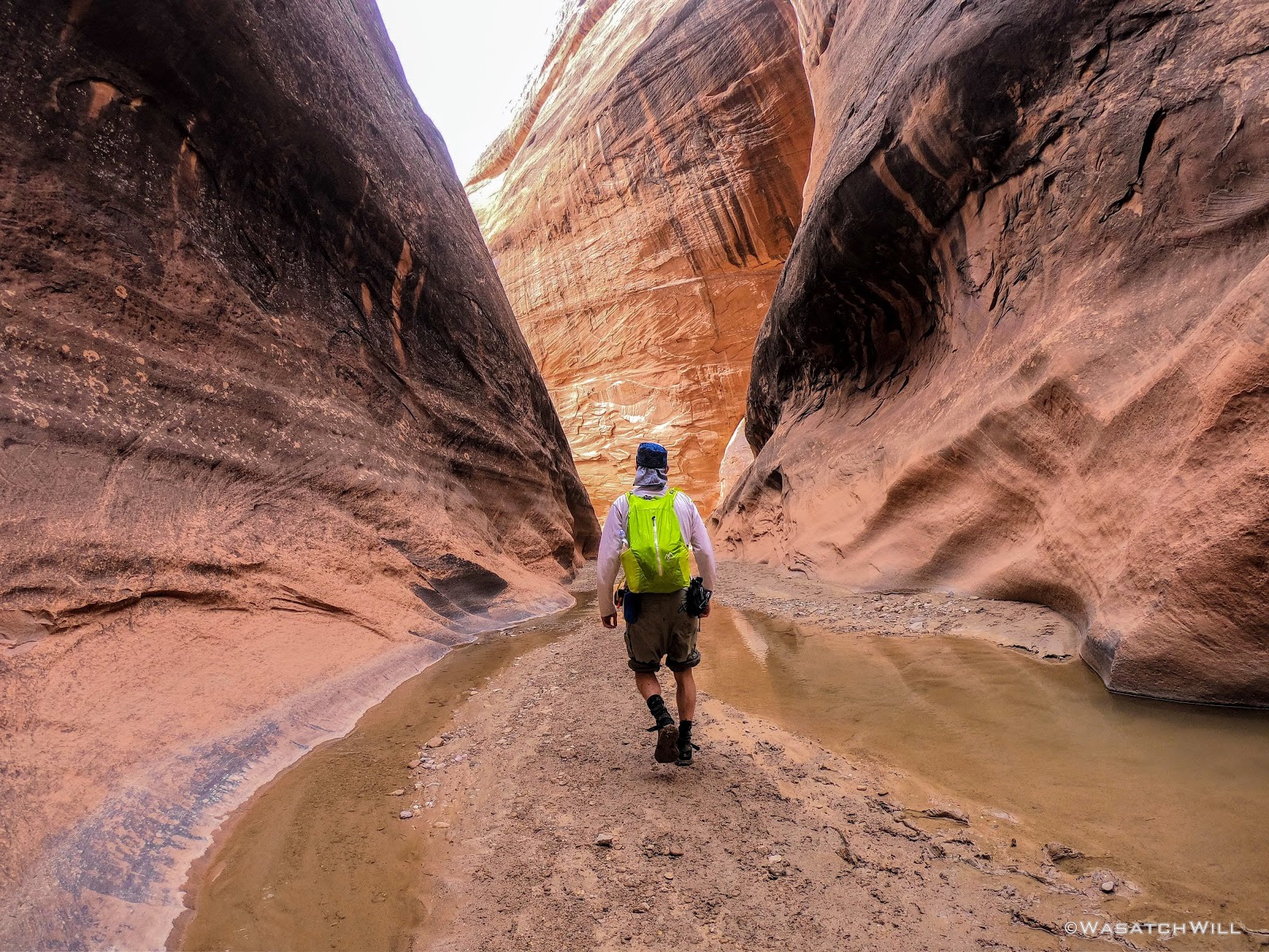
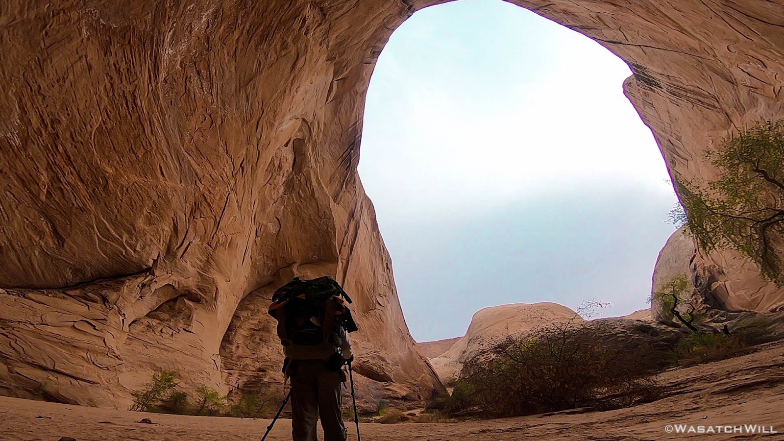
Into the narrows section I went.
Entering the narrows
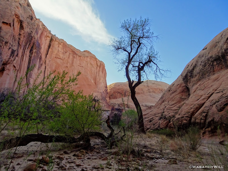
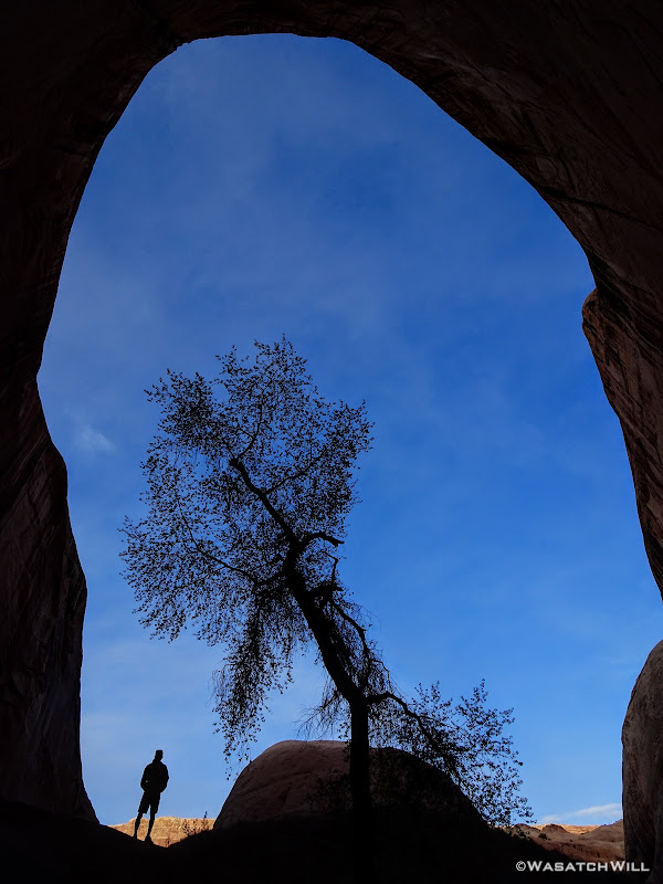
Tree standing guard in the narrows
After a good little stroll further, I arrived where I had anticipated on camping, a massive amphitheater style alcove. In fact, some refer to this space as The Amphitheater. It was so quiet (no echos) coming around the final bend into it that I was sure it was completely empty and available. But at the last second, I spotted a group of five or six perched down on the edge of the large flat sand bank. I had a chat with them and found out they were from Oregon, the group that had been spending the whole week hanging about.
They were going to stay put there for the night and so I was prepared to move on, but upon learning I was alone, they invited me to stick around and find a spot nearby. I thanked them and told them I didn't want to intrude and would scope around for something that allowed each of us a bit more privacy and separation.
They weren't sure what their plans were for the following day yet, so I told them I'd probably want to move onto the flat if they ended up taking off the next morning. They had already toured the narrows that day and were looking to head up to the rim top the next day.
I asked them how they liked it and they were impressed. Knowing that some sections of it had involved deep wading and even swimming for some people in the past, I asked them for a bit of beta on that. They informed me that the water never got much past above their knees in any one section. It was bittersweet to think I probably wouldn't be trying out the ultralight $1 float ring I had picked up at the Family Dollar in Loa on the drive down.
I bid them farewell and wandered up a higher bench across the creek a few hundred feet away where I found a spot just flat enough for a solo tent nestled along some rocks that offered a nice little barrier between the group and my lonesome self. It would do. I was grateful to yet again, enjoy the experience of camping in such a setting.
Inside 'The Amphitheater'

Camp, night #1
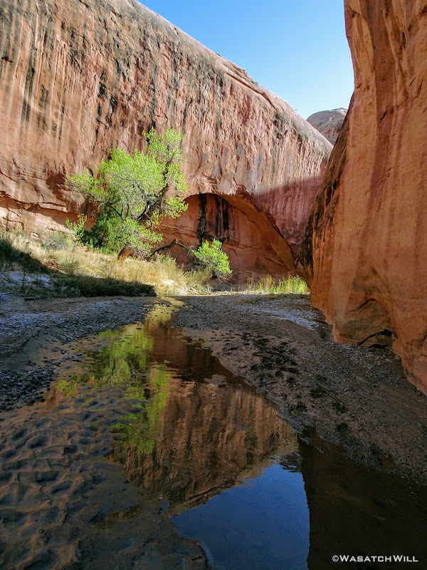
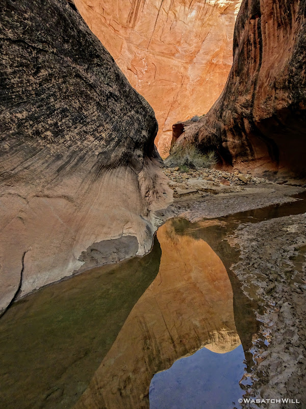
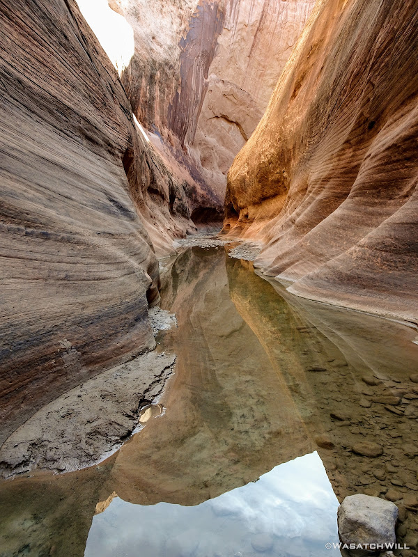
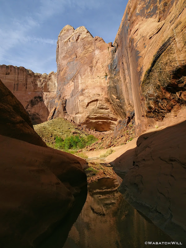
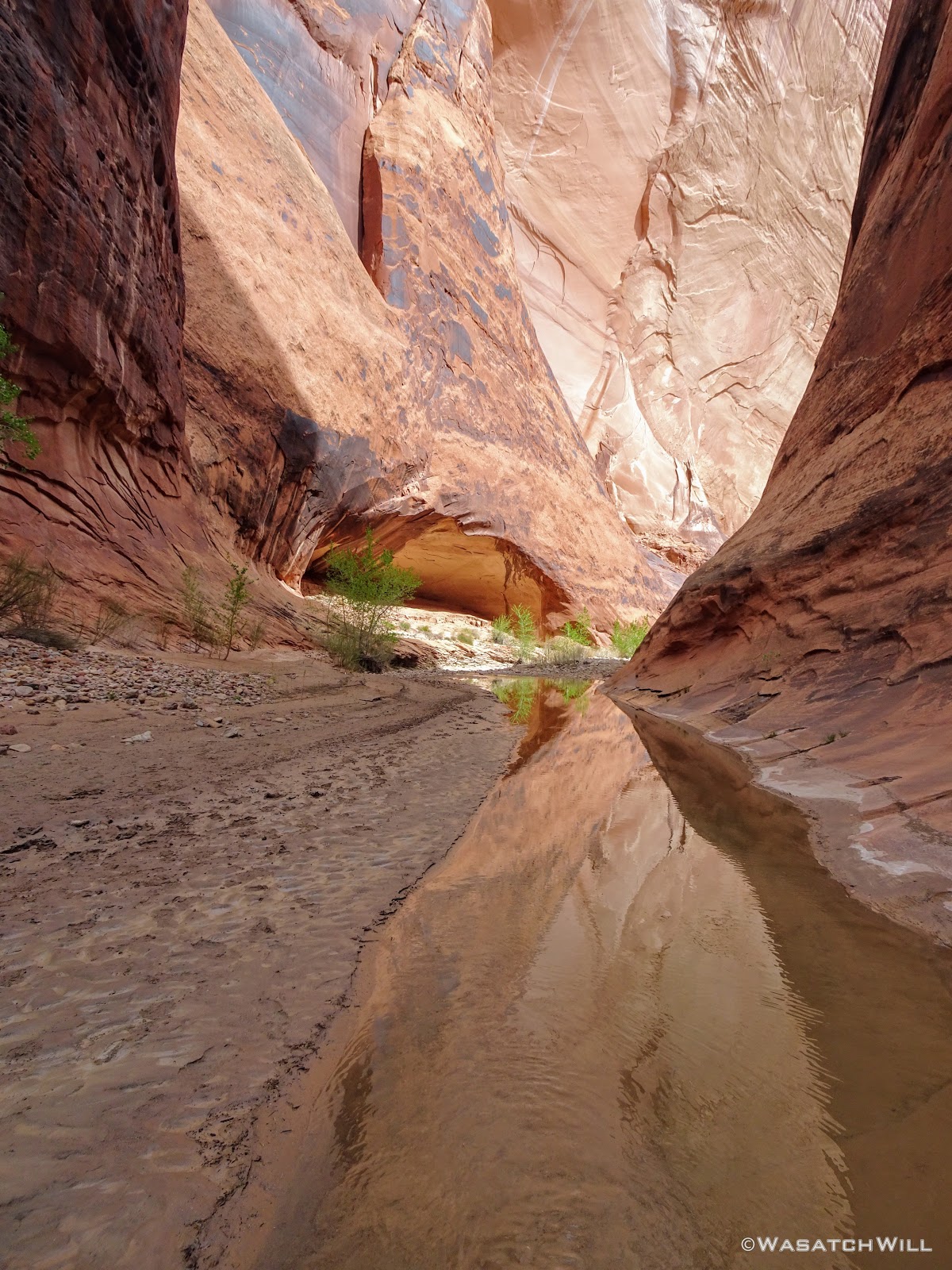
With camp all set up, I wandered down along the creek a bit in both directions, just taking in the scale of the whole place and soaking up the beauty and wonder of it all.
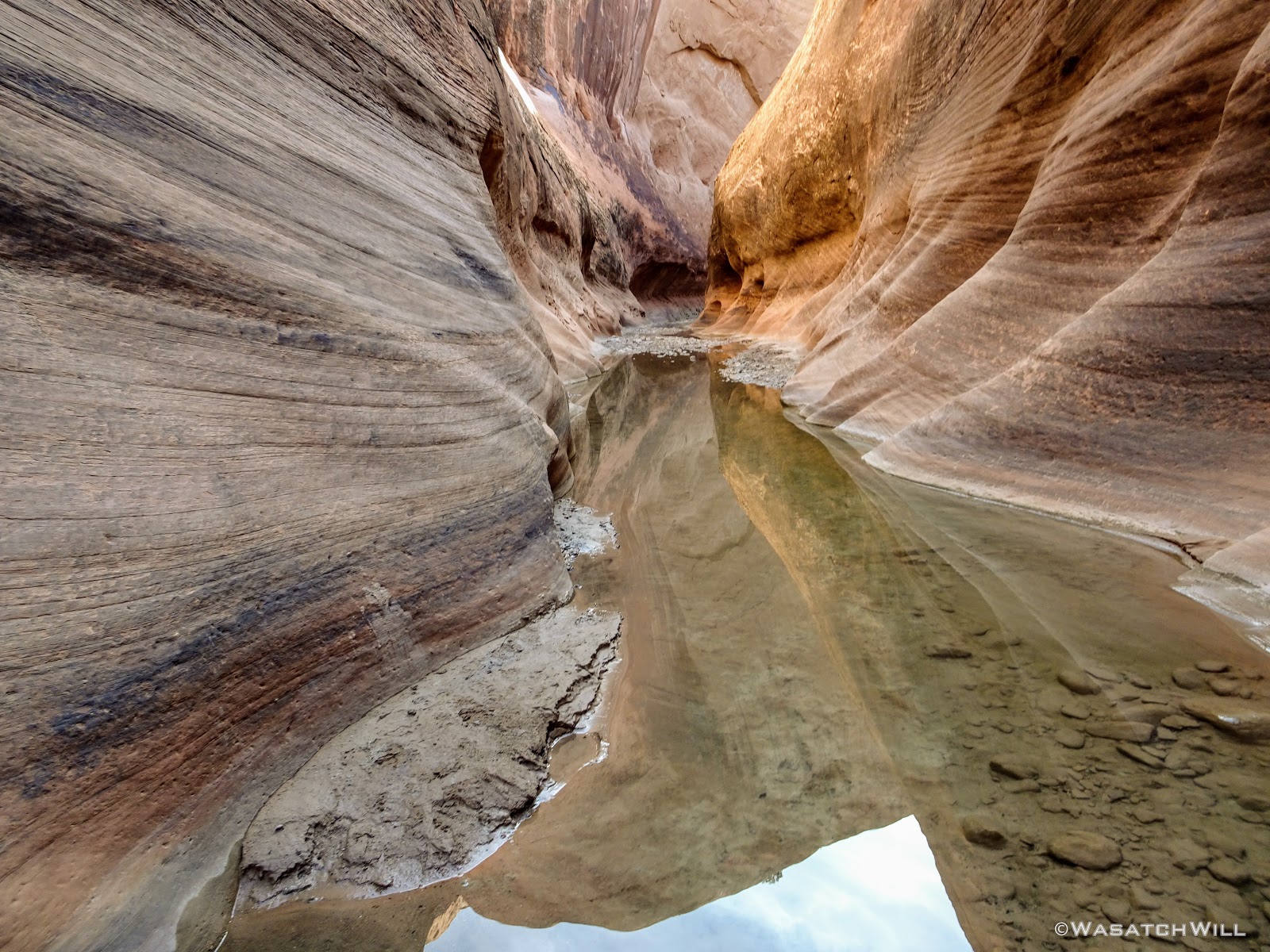
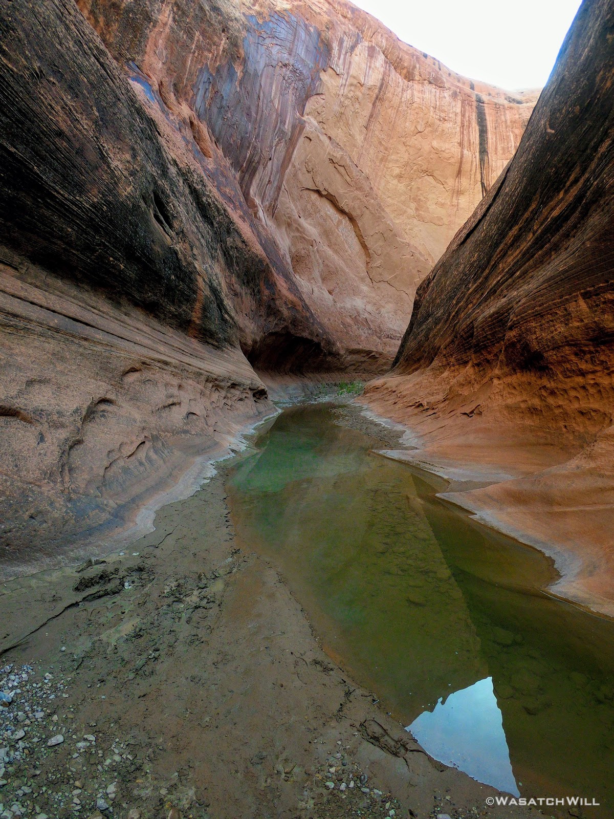
Amphitheater reflection
I soon returned to my camp and enjoyed a quiet dinner and an early bed time, still full of excitement for what was to come the next day.
Wednesday - April 4, 2018
The next morning brought with it clear blue skies. Perfect weather for a watery walk down the creek. The group hollered up to me and informed me they were packing up and that the alcove was all mine for the taking. I opted to just keep my camp where it was for the time being and move one with gearing up for a day of touring the rest of the narrows. If the alcove was still all empty when I returned, I'd consider moving my camp down to the big flat then.
Once done with breakfast, I descended the bench down to the creek, filtered up a bottle of water, and set sail down the canyon.
From here, I'll just let the following pictures do the talking for a while and leave it to the reader to fill in their own captions.


***NOTE: It was at this point where @Jammer survived his now infamous flash flood event.***


In the latter, lower half of the narrows, I encountered the narrowest section and what would be the deepest wader of the day. I'd call it the 'Chasm'. Bring it on!
Into the 'Chasm'

GoPro selfie in the 'Chasm'

'Chasm'
Beginning of the wade through the 'Chasm'

The 'Chasm' wader

Video still of myself walking through the 'Chasm'
Another video still of myself walking through the 'Chasm'
The Oregonians proved to be an honest bunch. The wader was nothing more than a few inches above my knees at its deepest point. Hooray!

Desert Varnish
Several minutes later, the narrows opened back up and I had reached the other side of Hall Divide. Needless to say, the hike thus far had been breathtaking and beautiful.
I had only encountered two other groups through the narrows, beyond the Oregon group. A group that appeared to be a mother and her two teenage sons who were hiking it upstream, the opposite direction, followed by the two I ran into the day before, now reunited. I chatted with the latter two for a bit, learning that the woman had actually attended the same high school I started out at, having gone on to graduate a year sooner than me. I immediately recognized her name and we had a small world moment.
Moving on...

Exiting the narrows
Looking up toward the rim
Crossing over Hall Divide provided some beautiful panoramic views from itself, views that may well have been worth the 8 mile hike down for themselves. I had been seriously considering on working my way up and over to the rim above the narrows and making my way back to the creek that way, but ultimately chose to stick to the path and close out the loop the standard way.

Looking south from Hall Divide
There were few flowers blooming along the trails yet, but the ones that were out provided some welcome colors.
Desert flowers
Along Hall Divide
Hall Divide Panorama (westward)
Hall Divide Panorama (northward)
As I crested over the Divide, I bumped into another couple. They were a middle-aged married pair who were en route of hiking the whole Heyduke trail, having started weeks before up in Arches National Park. Awesome!!!
Heyduke couple
A short while later, I rejoined the creek at the loop's junction where I encountered another group of three taking a water rest who were in progress of doing a modified section of the Heyduke, having started out on the Boulder Mail Trail and were en route to finishing out through Stevens Canyon and Coyote Gulch.
Not far from them was the Oregon group, camped out just above the creek.
I raced on back to my camp from there and found the whole alcove to still be free from anyone else. I decided to go ahead and move my camp down, just because.
It was about 4 in the afternoon at this point so I felt like I had a couple hours to just chill until I'd be ready to do dinner. I took the opportunity to do some reading, watch some downloaded videos on my phone, and ultimately take a little nap to pass the time.
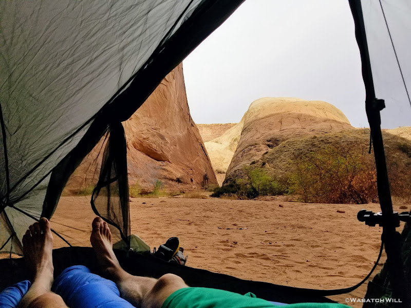
Tent view
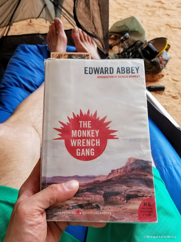
Edward Abbey time
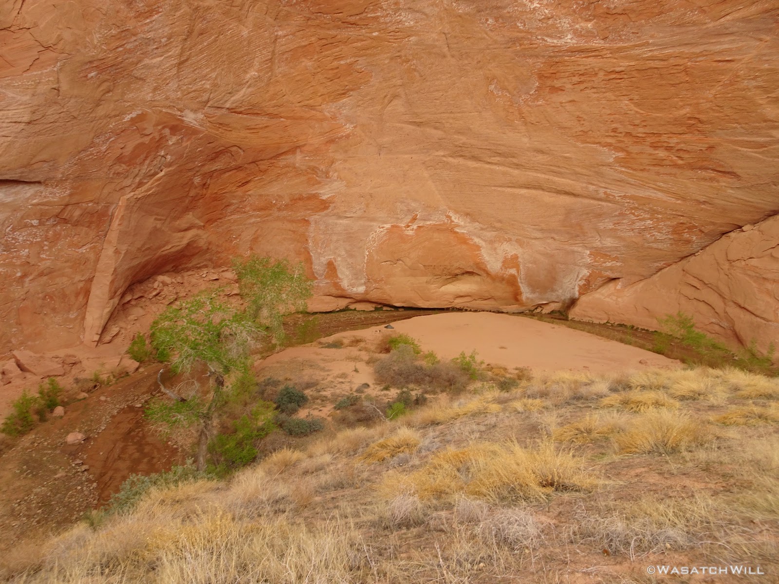
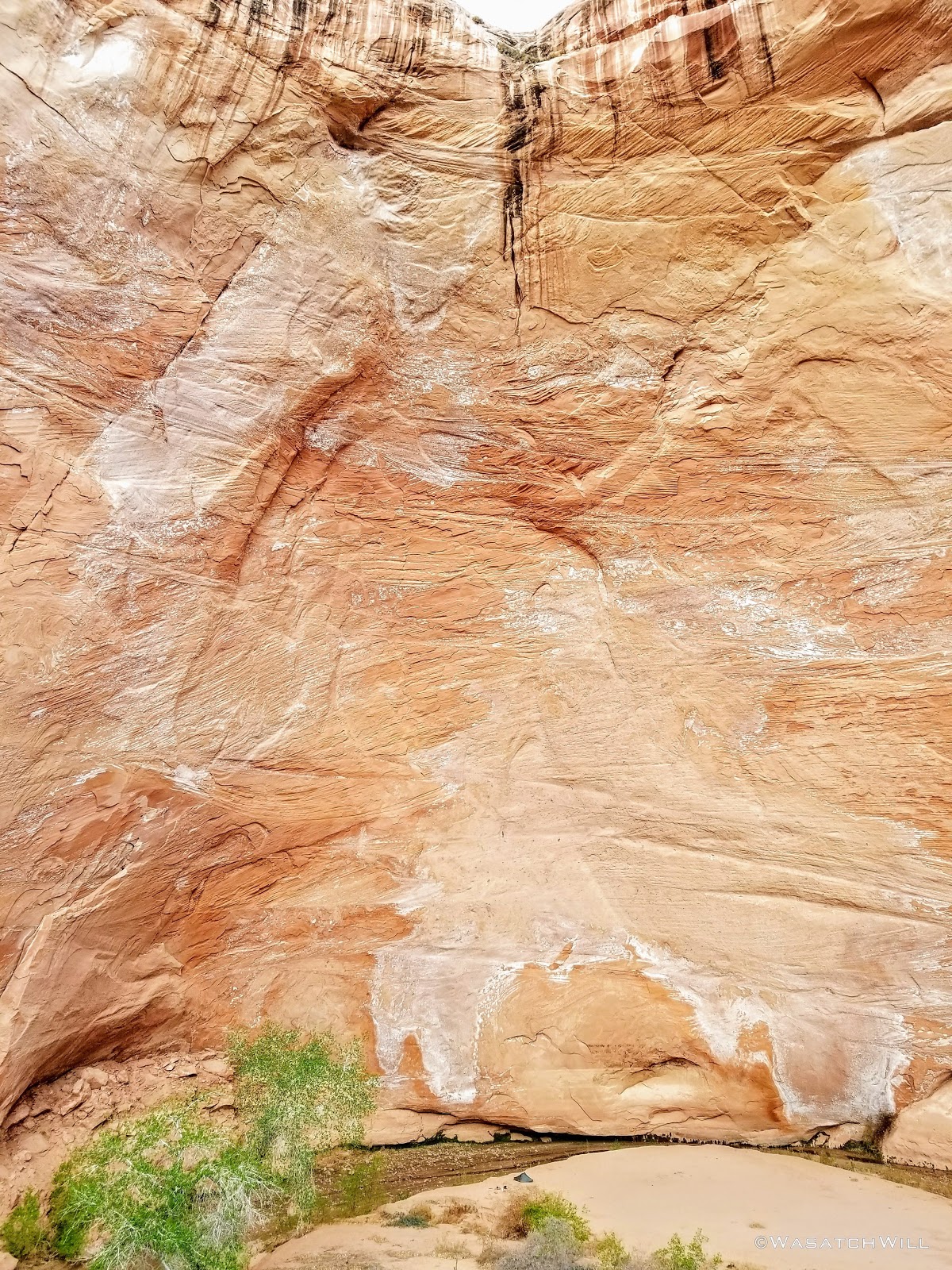
The sky had become overcast through the afternoon, but had started clearing up again when I awoke. I got out and made the most of it with getting some pictures to take in the scale of the alcove. Despite lugging along my DSLR with me, I wasn't able to get any very wide view shots with it. I was only willing to bring along its kit 18mm lens. I had boughten a new 14mm lens for it, but opted to leave it back at home due to the fact that the lens itself is more than twice the size and twice the weight of the camera's body. Even then, a 10mm lens may have been the only thing to do it justice.
I had recently got a new GoPro that I was able to use for capturing some wider images for the sake of scale and perspective. Beyond that, my phone's panorama mode worked out satisfactory enough for some vertical panorama shots too.
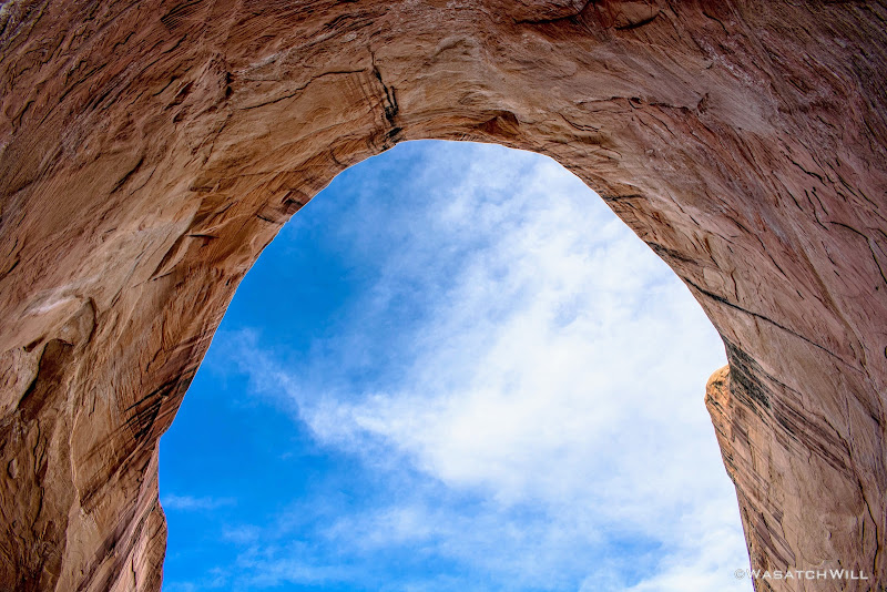
The roof of 'The Amphitheater'
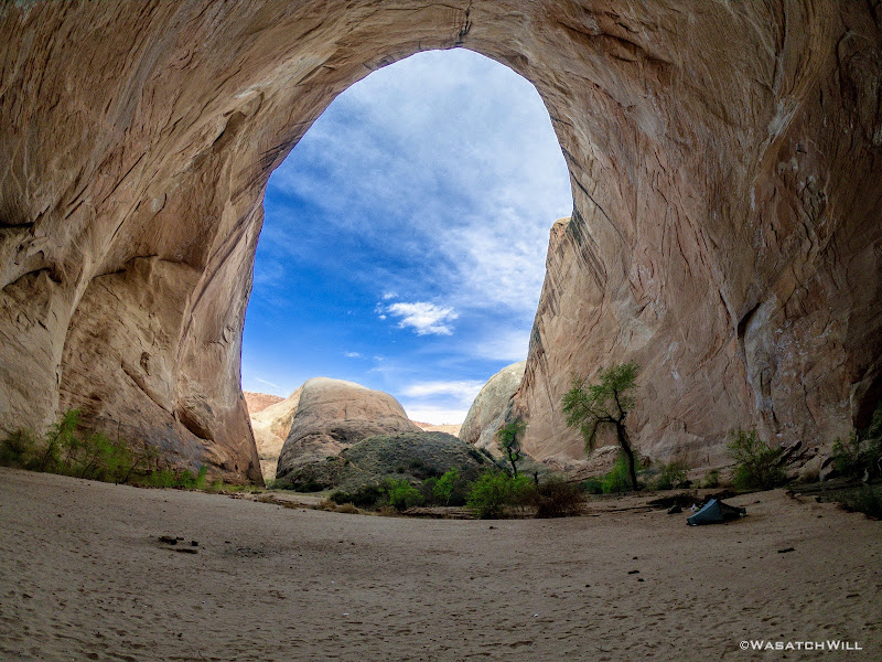
'The Amphitheater'

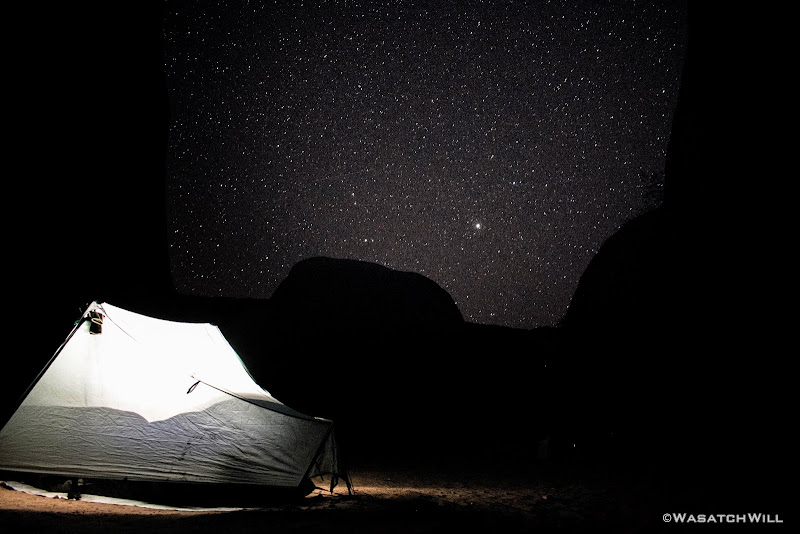
Camp, night #2

'Tree of Life'
'Out of darkness, into the light'
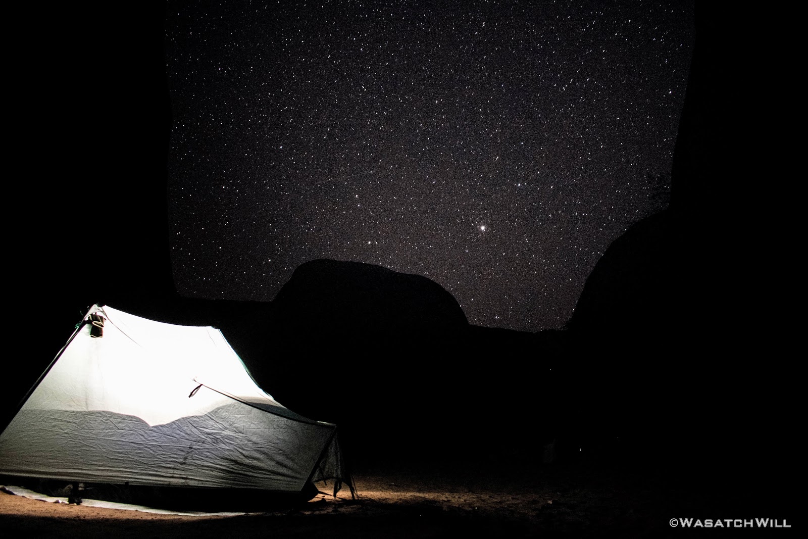
The sun soon set with out much drama while I ate some dinner and prepared to retire for the night. Before settling into the tent for good, I took a stab at a few night shots, but was pretty tired to fuss around with settings too much. I also didn't have a very sturdy tripod for the DSLR on me, as that would have only added even more weight that I didn't want to carry.
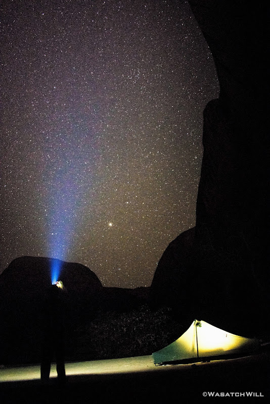
Playing with a long exposure
Goodnight!
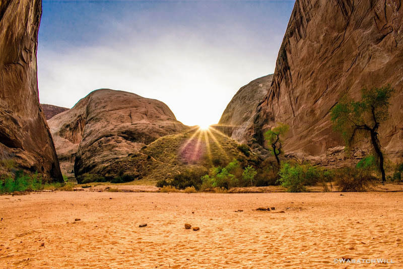
The third and final day of the trip started off with a pleasant sunrise. Nothing too dramatic, but a nice compliment of blue and orange nonetheless.

Sunrise
I played around with the DSLR a bit more, trying to frame up some sunbursts. I'm still trying to teach myself Lightroom for editing RAW images, so forgive me if they appear to be over-processed.
Sunburst #1

Sunburst #2
Sunburst #3
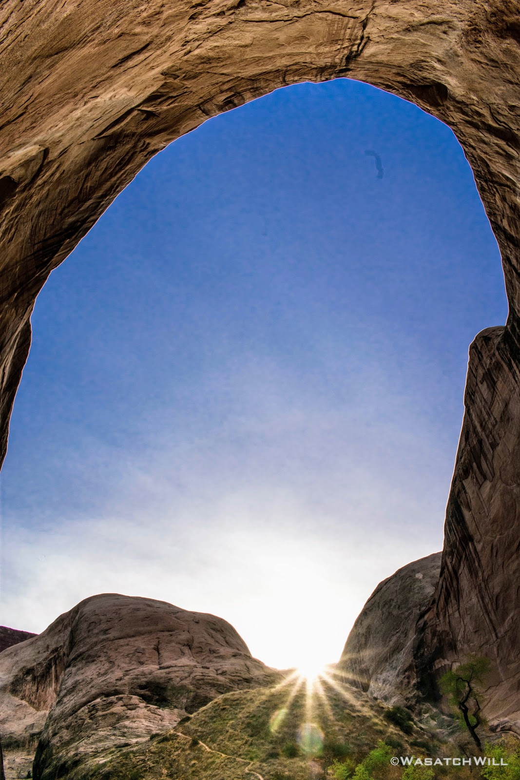
From camp, I noticed a social trail winding its way up the bend. I decided to follow it up to a nice little overlook of the alcove.
Again, the size of the enclosed space was nothing short of amazing. Here's some shots of my tent nestled in the alcove as seen from the overlook for an alternate sense of scale.

'The Amphitheater' Overlook

'The Amphitheater' Overlook
On the way back down the path I paused to observe some of the smaller details in the form of cactus, the crytobiotic soil providing such a fertile space for all the growing flora, and a caterpillar I about stepped on.

Cactus

Prickly Pear Cactus with buds

Fuzzy caterpillar
And then there was the only creepy crawly I ever have nightmares about...a scorpion! It was my first time ever seeing one in the wild. And it had the nerve to by hiding out right under my food bag back at camp. This after walking all around camp, barefoot. After looking up more info on the ones that can be found in that region, I'm guessing this was a small one of the Desert Hairy variety.

Creepy scorpion
Same scorpion
Back at camp, I packed up and took my breakfast on the go in the form of a cereal bar.

Heading out
On the way out, I felt like I was being stalked only to discover what looked like a skull face engraved into the rock.
Skull face
The hike back out was as pleasant as it was coming down and in. The sky bounced back and forth between being overcast, to clear and blue and back to overcast. When the sky was clear, the air grew quite warm, but not overbearingly hot.
Halls Creek Trail panorama (northward)
Southern flanks of Waterpocket Fold

Halls Creek Trail panorama (westward)
A few more flowers would be observed along the way.

Pretty flowers
I was especially in awe of this red Indian Paintbrush I stumbled upon that had purple stocks.

Indian Paintbrush
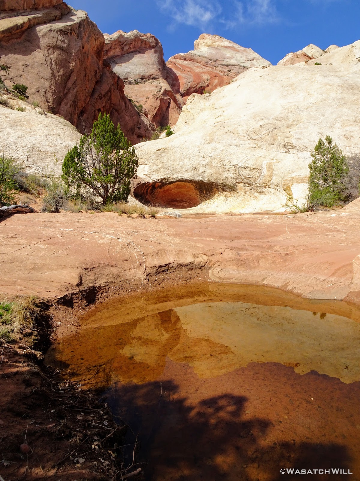
Unlike the hike in, this time, I'd pause for a lunch break and water refill at Fountain Tanks. It turned out to be quite the gathering place. There was an older fellow camped out nearby who had been spending the week poking around the Fold and exploring some of the old mining camps in the vicinity. There was another guy with his teenage daughter who were on their way up to the narrows for the night. The group from Oregon caught up and stopped by. And then there was another group of 6 on their way to the narrows, but for whatever reason, they raced on by.
Had it been any warmer, some of the upper pools would have been tempting to jump into, but no doubt it would have been suicide by hypothermia, if not drowning, with no anchored hand line to pull myself out with. That, and swimming in pools such as these are highly discouraged because of how it can affect and contaminate a fragile ecosystem that relies on them.

Lower Fountain Tanks
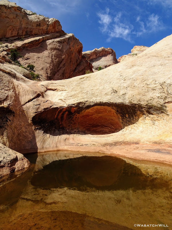
Lower Fountain Tank
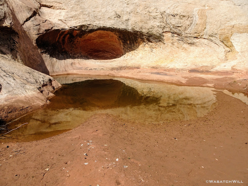
Fountain Tank reflection
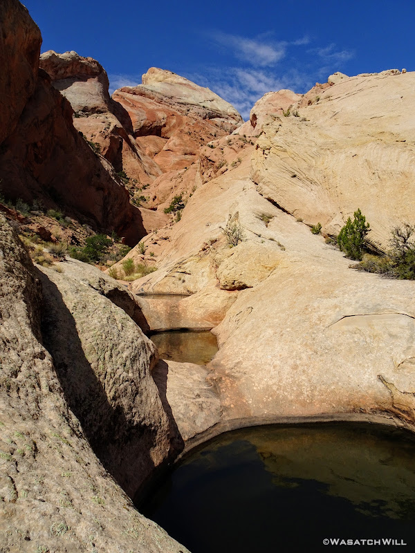
Upper Fountain Tanks
Upper Fountain Tanks drainage
Not long after leaving the tanks behind, I paused for a few more views of the Red Slide area.

Red Slide
Red Slide hoodoo
Once back at the final crossing of Halls Creek and the start of the ascent back up the mesa to the trailhead, I had to make one last decision. I had wanted to drop my pack and take a stroll up to Brimhall Bridge. I took a rest and reviewed the map. It'd be about a mile up and a mile back. I was feeling pretty exhausted from carrying a pack that was a bit heavier than I usually carry (no thanks to the DSLR, an extra set of clothes, Teva sandals, and all the extra snacks I have a bad habit of packing along). I had also come down with a cough (one that had turned out to be highly contagious with the rest of my family and some folks at work), so my body was feeling a bit more fatigued from having to fight off that sudden illness. It was also getting later into the afternoon and there was still a good bit of driving to be done to meet up with my family who'd come down to Torrey earlier in the day. And then there was the final mile up 800 feet just to get back to the car.
Had it not been for the illness, I likely would have made a run for the bridge. But rather than be too greedy, I thought the wiser of it this time and left Brimhall for another day.
At long last, I arrived back at my car, where I disconnected from my pack much more joyfully than I had in a long time. Excited to get back to Torrey to spend the rest of the week with my family, I drove on out. It'd be my first time ever driving up the famed Burr Trail, complete with its switchbacks and the ever beautiful Circle Cliffs, and yes, even a cattle roundup to slow things down just before passing through Boulder.

Cattle roundup
Finally, I had arrived in Torrey where my family, a warm shower, a delightful barbecue chicken dinner, and a good night's sleep to precede a day long tour through Cathedral Valley awaited. I'm glad I didn't hold out any longer on making the trip happen and look forward to when logistics allow me to bring back my wife, Jessica, and any friends.
Video:
------------------------------------------------------------------------------------------------------------------------------
Day 1
Tuesday - April 3, 2018
I started out the day by leaving my home in Provo bright and early. I had planned to arrive at the Visitor Center in Fruita right when they opened at 8 in order to have no trouble with parking (it was a Spring Break week for many) and to be the first one to get a permit for the day and thereby hopefully be the first one to register at the trailhead for that day. That plan didn't work out to time, instead getting to the Visitor Center just after 10. The parking wasn't bad and I was able to get my permit pretty quickly. I asked how many others they had signed up for the same area and the ranger said there were two other groups, one who'd be going in with the same agenda I had (2 nights) and were already on their way down, and another group who were spending the whole week. I wondered aloud how much competition there might be for a much sought after and coveted camp site location. The ranger said they weren't sure if the others even knew about it. Time would tell.
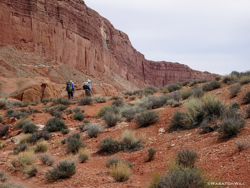
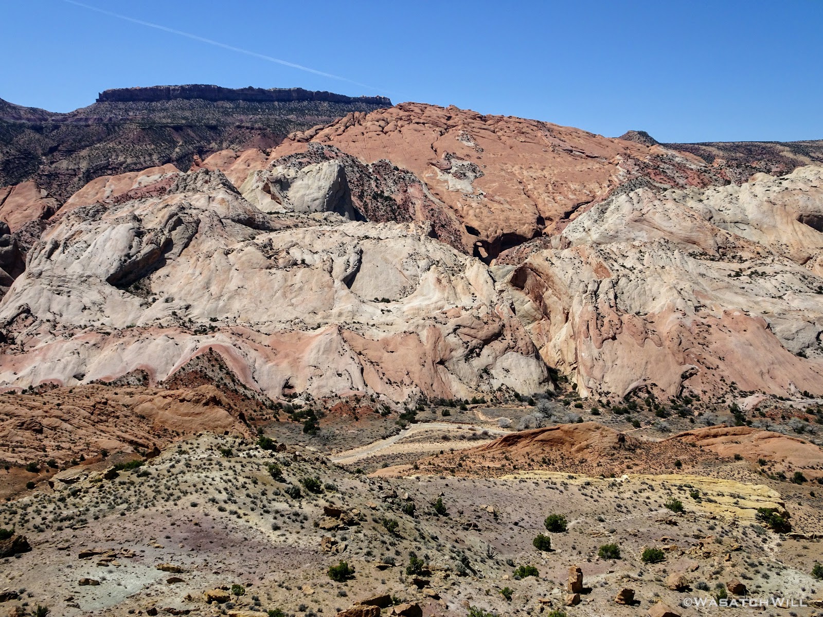
A couple hours later, I arrived at the trailhead. It had been my first time driving down the Notom road further than Notom itself. I was surprised to see a handful of cars at each of the trailhead lots along the way for the various slot canyons that drain off the eastern ridges of the majestic Waterpocket Fold. Still, far less than the more tourist-laden trailheads of the Fruita district.
When I arrived at Halls Creek Overlook, I was again surprised to find more than a couple vehicles there. Instead, there were somewhere between half a dozen to a dozen vehicles. I knew some were probably just there for the day, perhaps just checking out Brimhall Bridge or hiking a few miles northward to see Hamburger Rocks.
I had myself a nice little 'sammich' I had picked up on the way down for lunch while enjoying the views from the trailhead which doubled as an overlook down into the Halls Creek runway.
Halls Creek Overlook

Brimhall Bridge from afar
With my tummy full of food, my pack full of gear, and my spirit full of excitement, I began the hike.

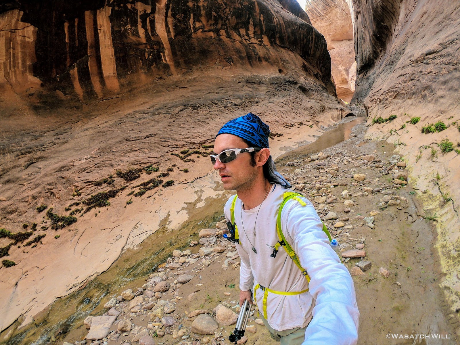
Trailhead selfie
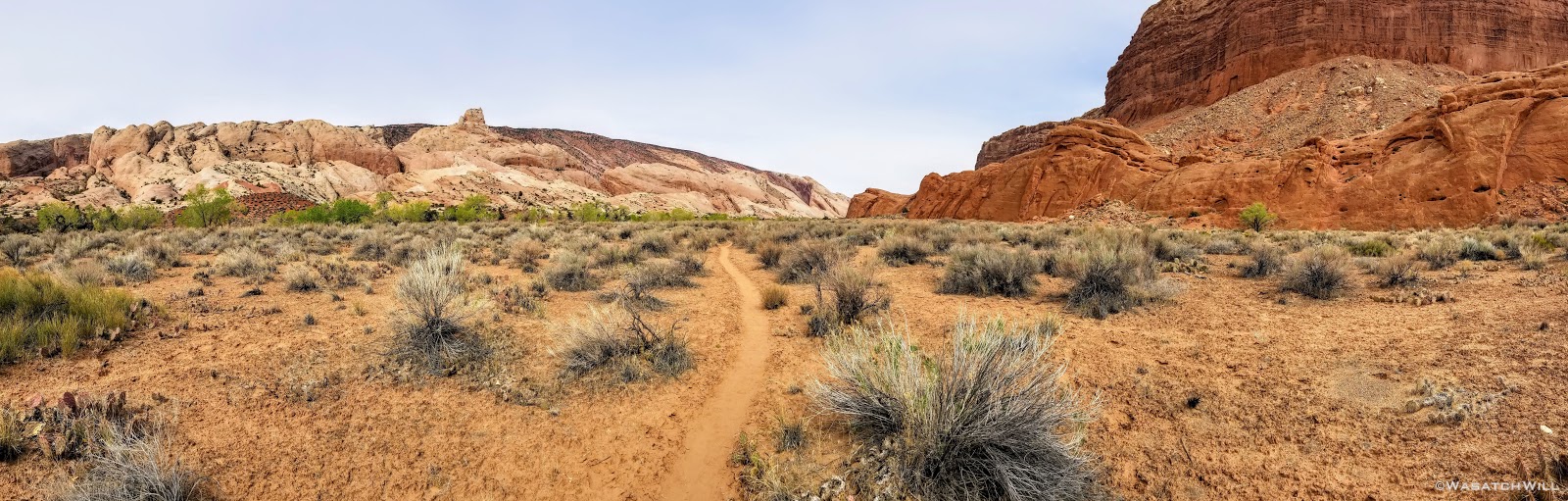
About a mile later, after descending something close to 800 feet off of Hall Mesa, I reached Halls Creek...or...more so, Halls Wash, at this point and almost immediately, the first crossing of it.

First time across Halls Creek
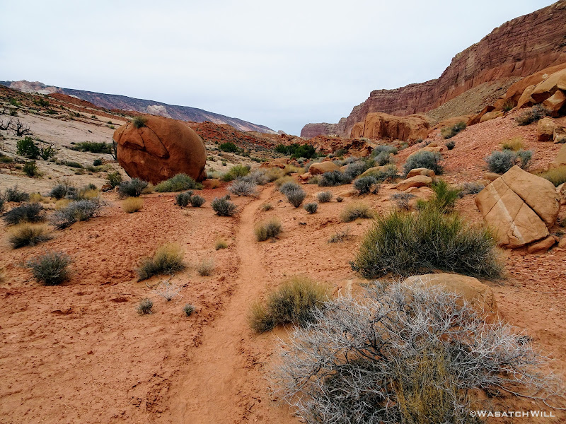
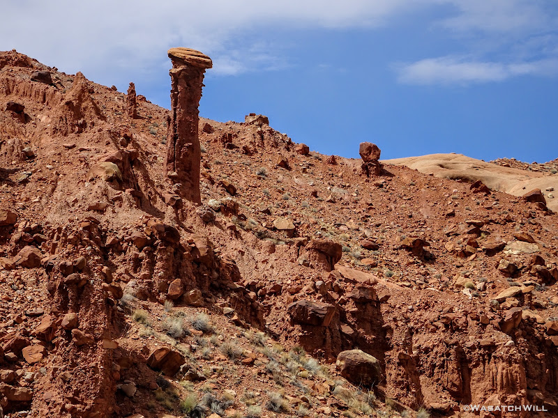
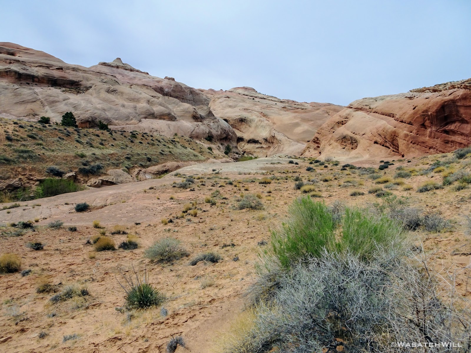
A couple miles and a number of creek crossings later and I found myself passing by Red Slide. I knew there'd be some hoodoos to look out for but didn't have any knowledge of a cave to be found along the landmark as well. I'm simply going to call it Red Slide Cave. It was tempting to go up and check it out, but I was eager to keep moving on with hopes of possibly catching up and passing anyone in front of me and increasing any chance of obtaining the prized camp spot.

Red Slide hoodoo

'Red Slide Cave'

'Red Slide Cave' closer up
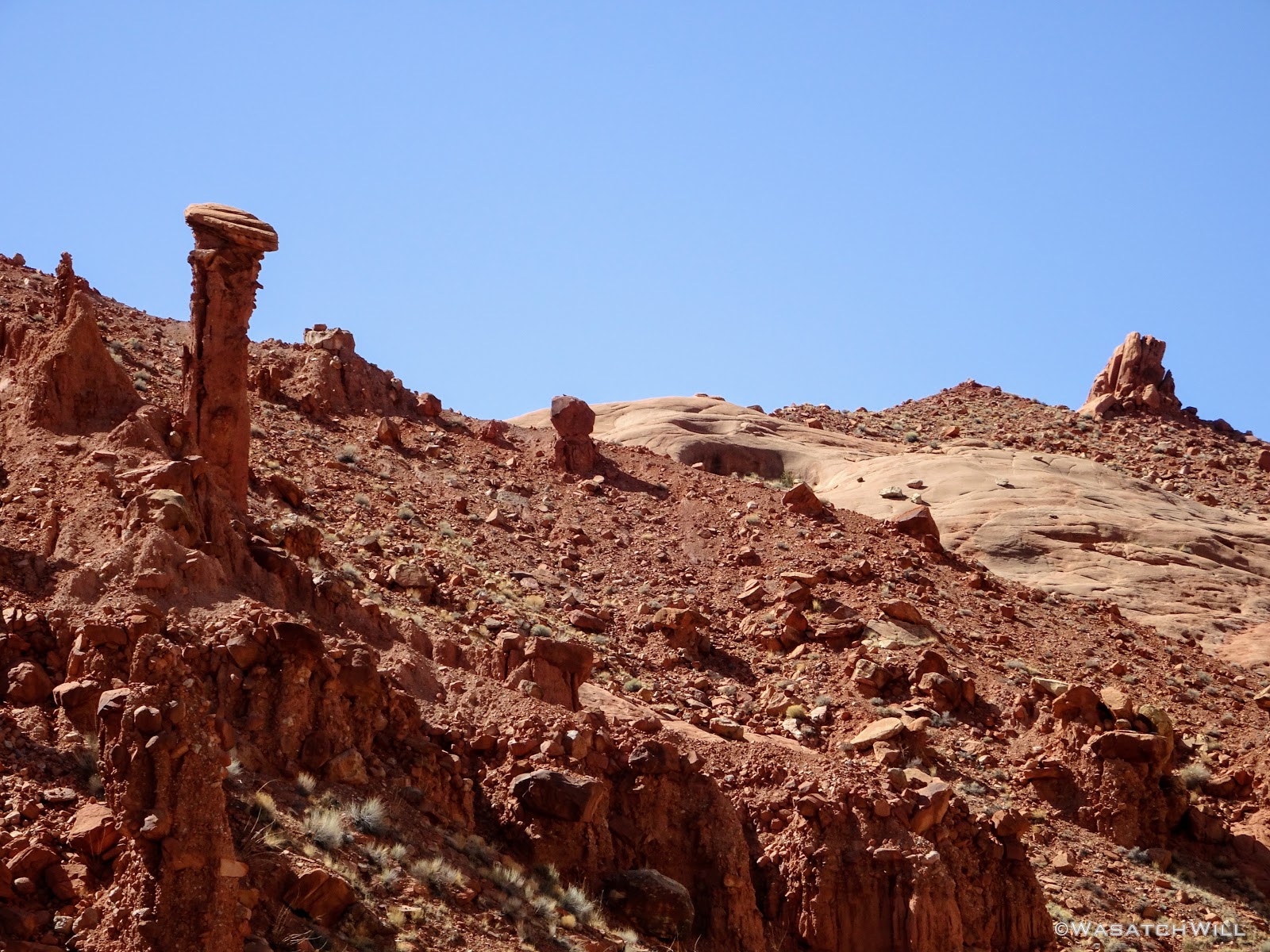
More hoodoos
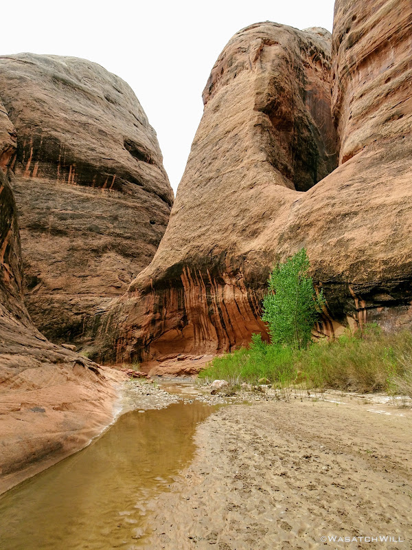
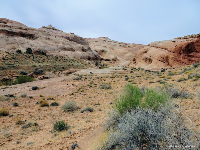
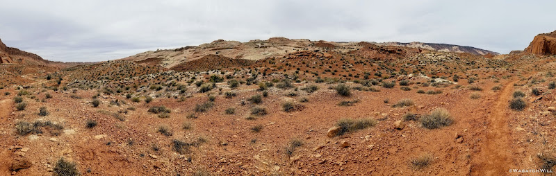
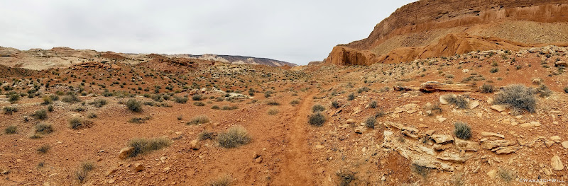
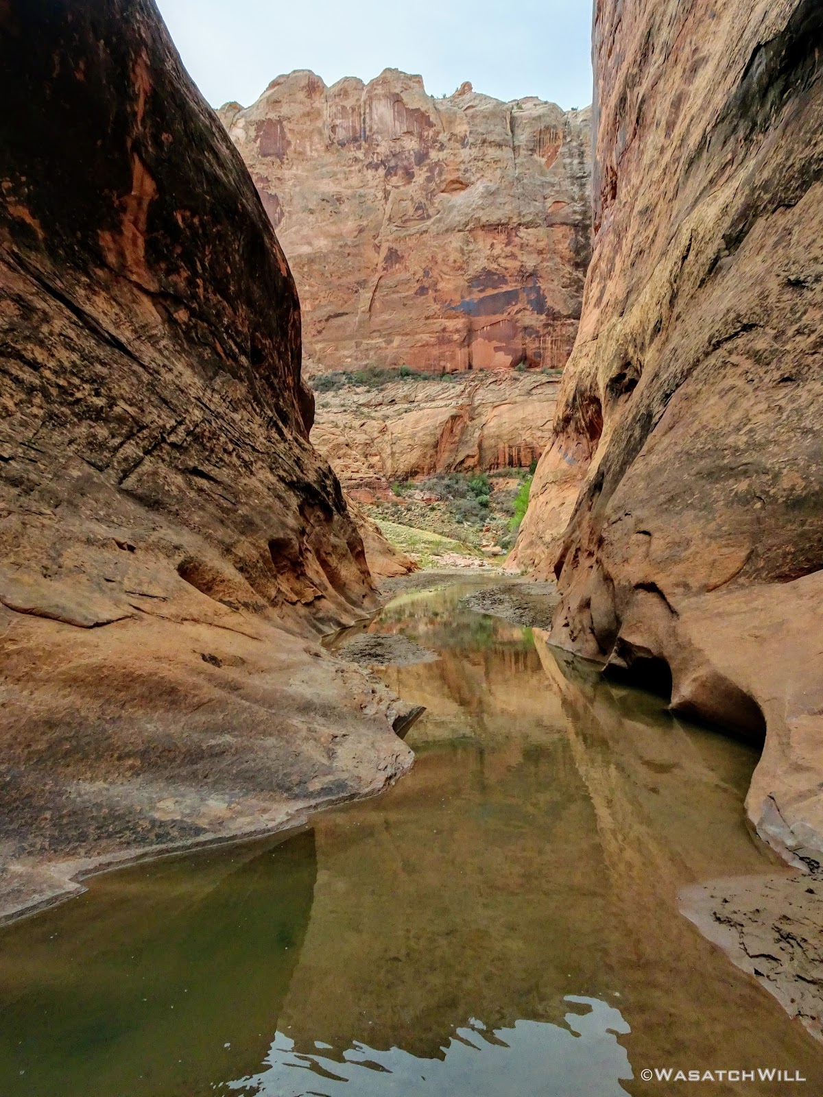
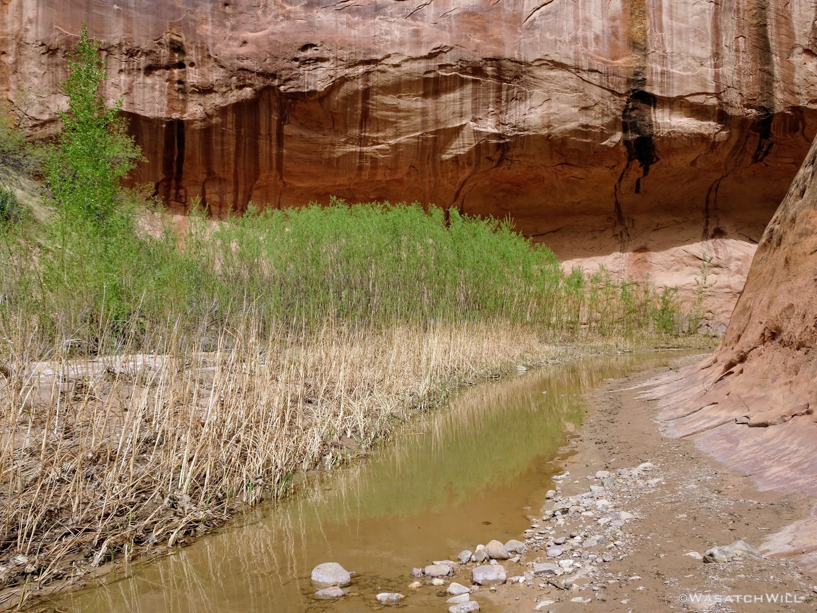
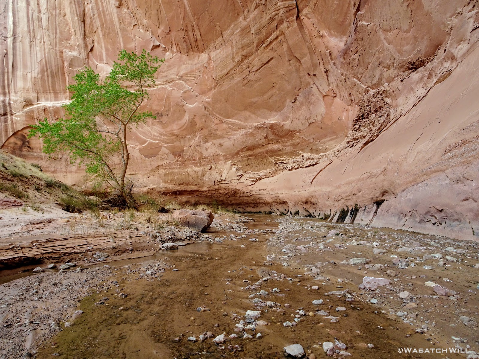
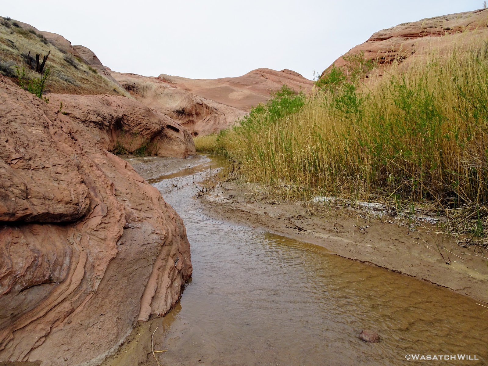
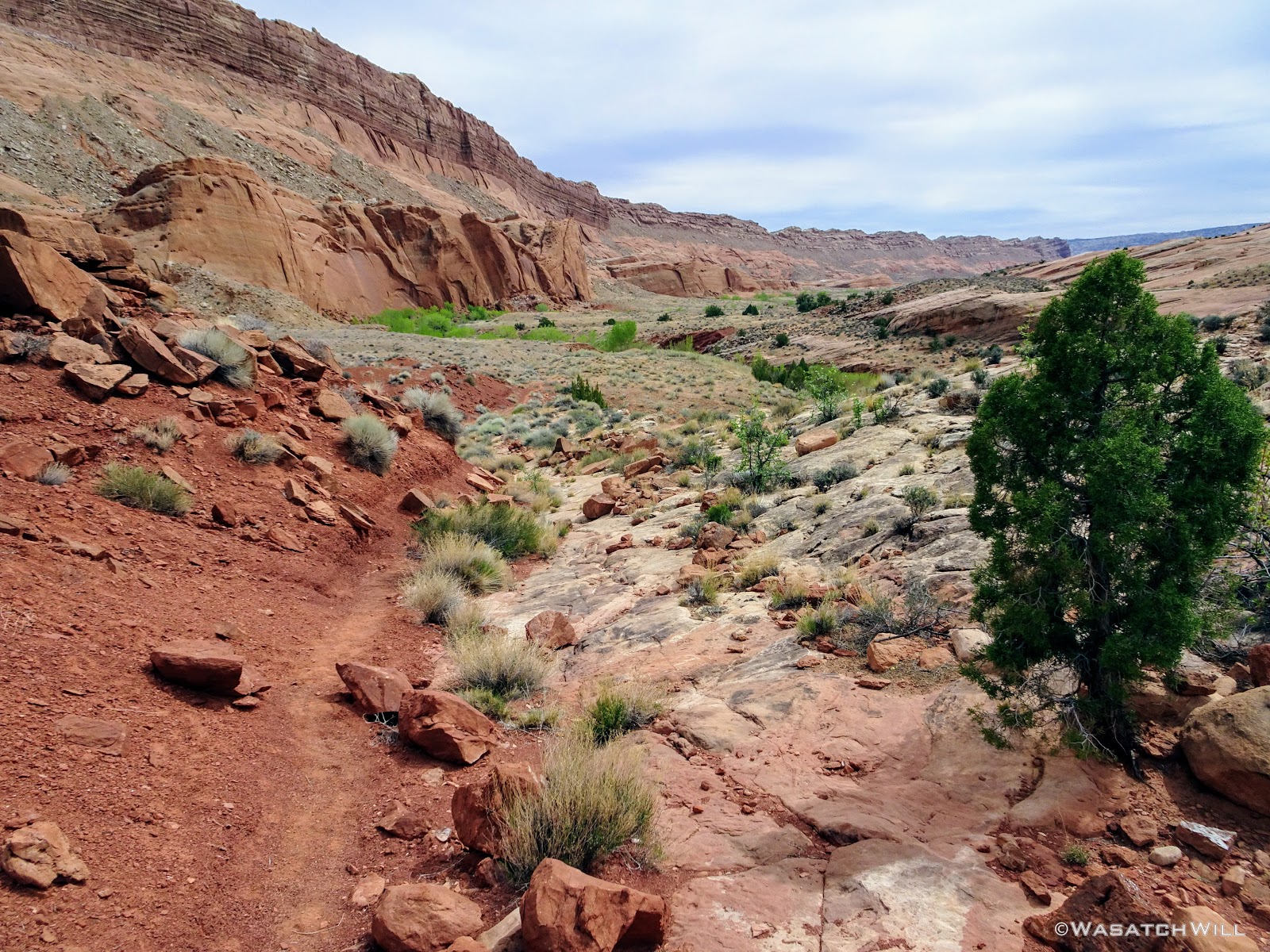
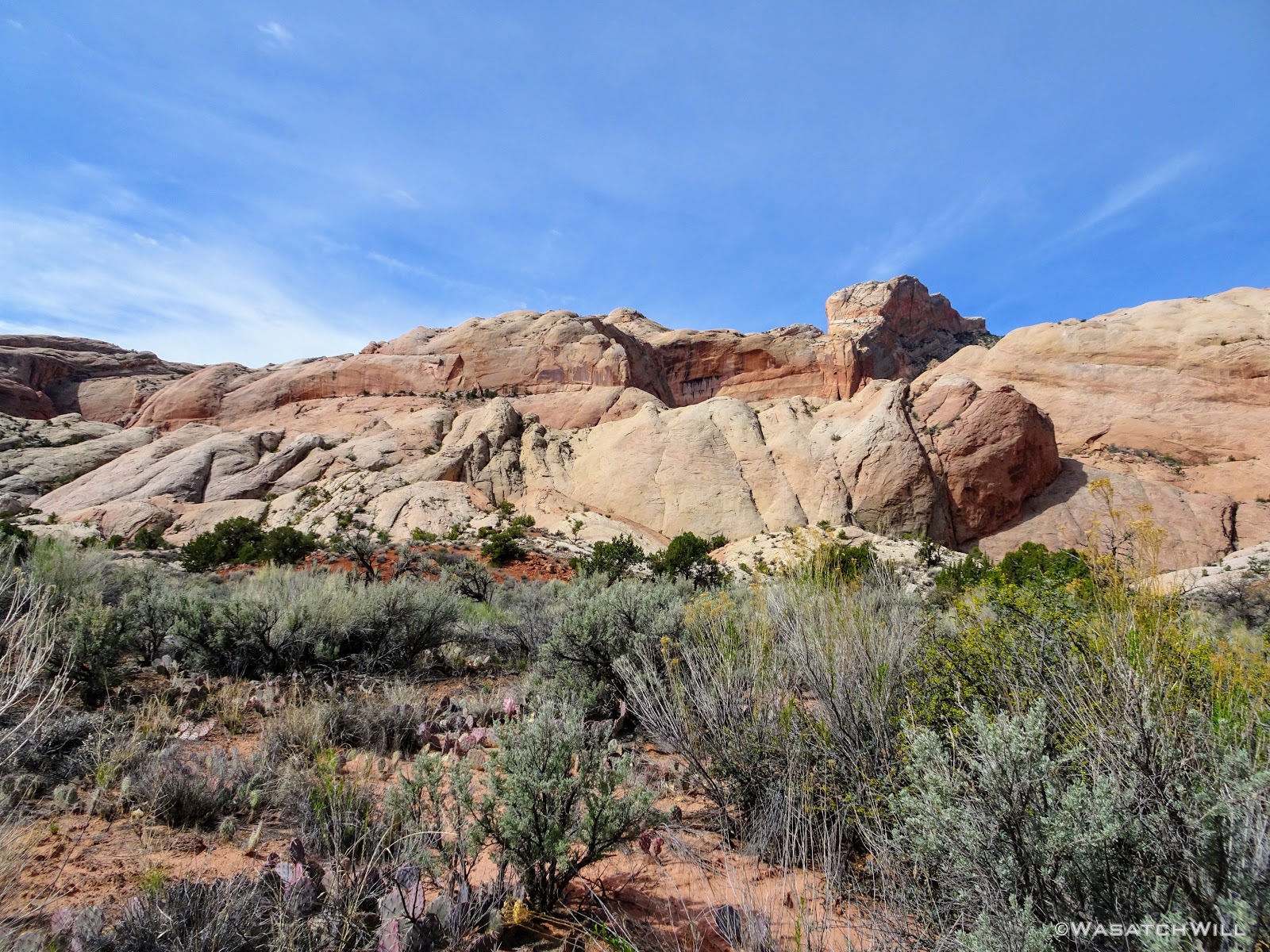
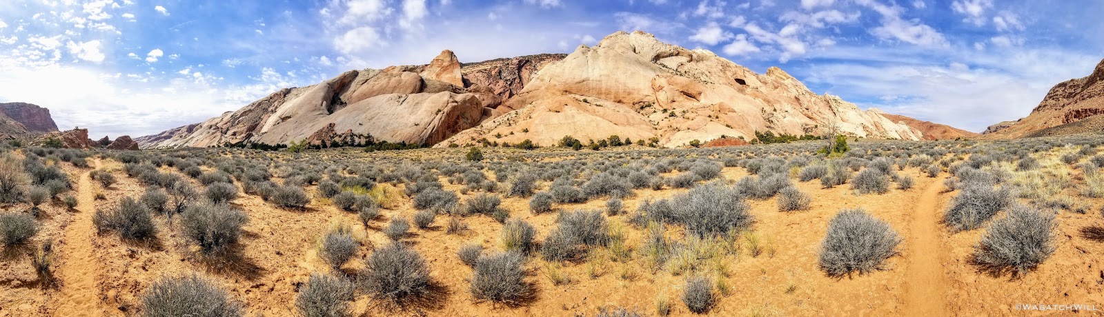
The walk was a long one, 7 miles or so in a fairly straight forward direction from the first creek/wash crossing, before I reached the emergence of the perennial part of the creek and the start of the loop through the narrows. Fortunately, there was plenty of scenery and several crossings of the meandering creek/wash to keep things interesting enough along the way.
Near the start of the narrows, I had actually encountered a member of one of the parties down there. She had gotten separated from an older guy she had come down with and asked me to be on the lookout for him and to let him know she had set up camp right near the mouth of the narrows section if I came a across him. A quarter mile later, I bumped into the guy looking for his partner. I updated him with the info I had just been given and wished him well.
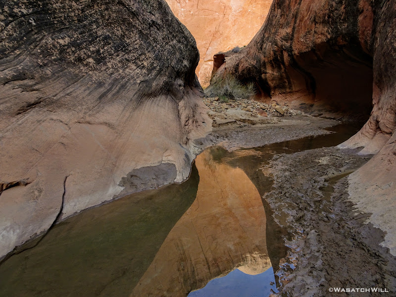
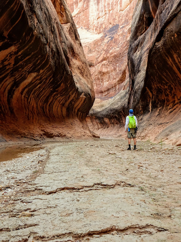
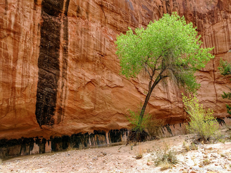
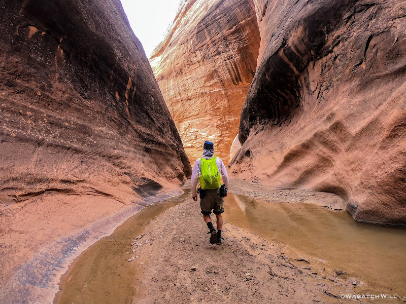
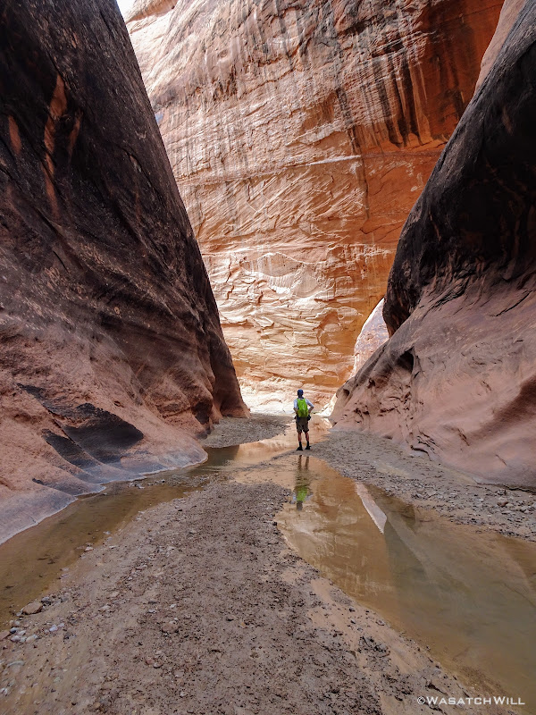
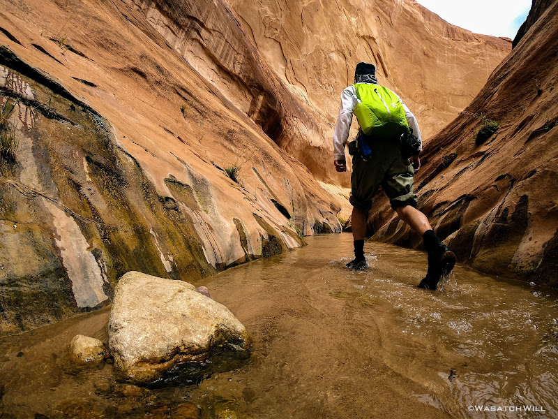
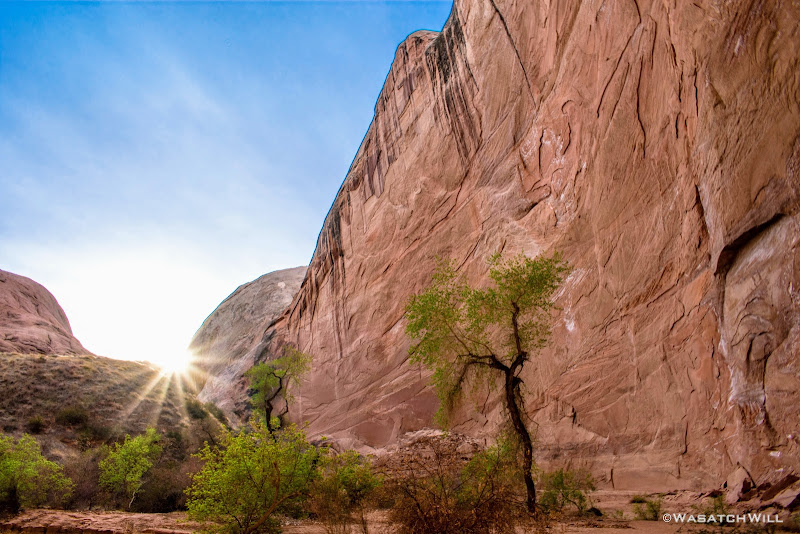
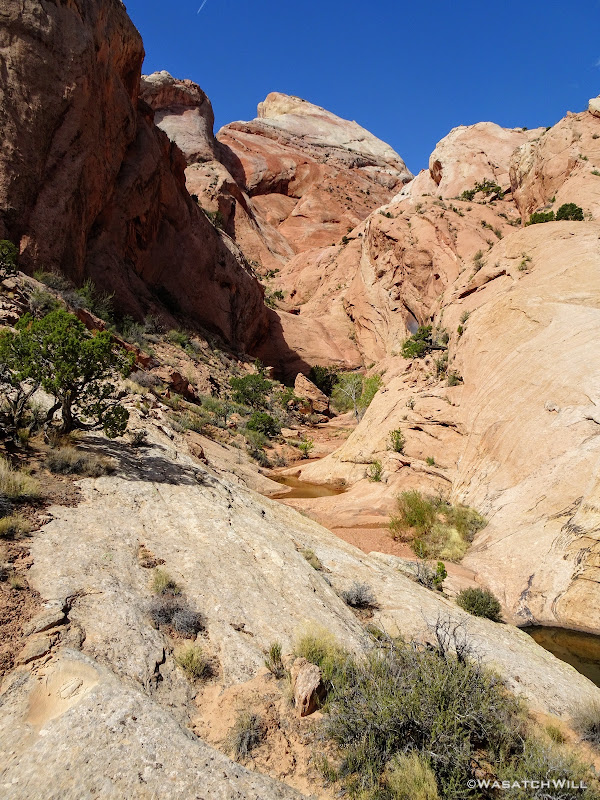
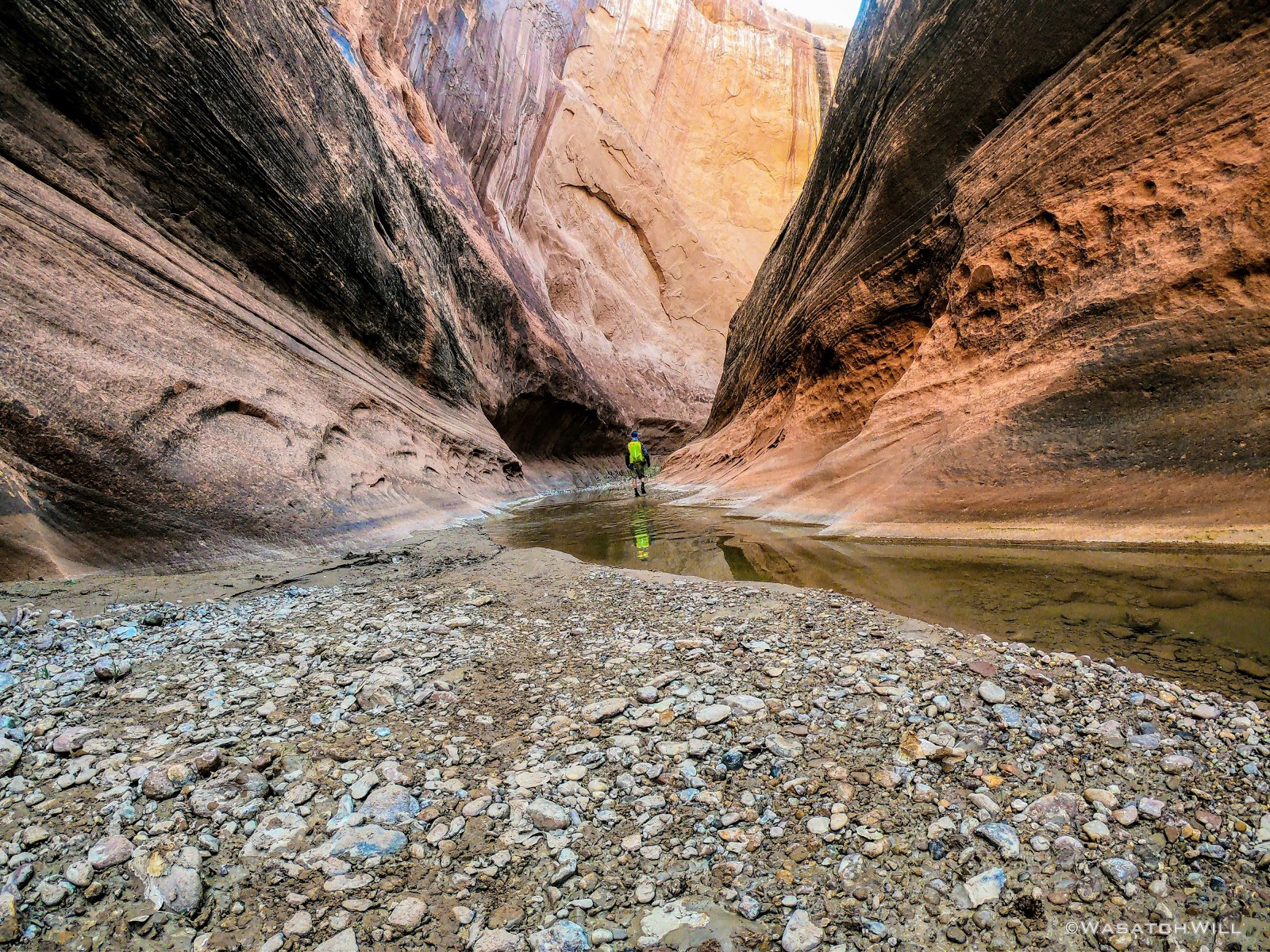
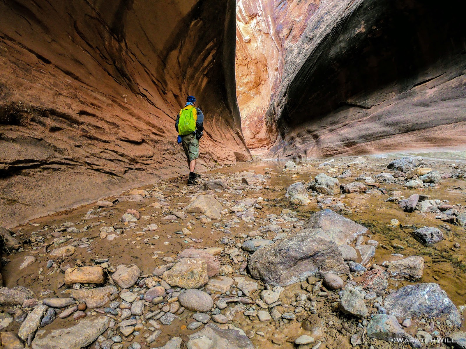
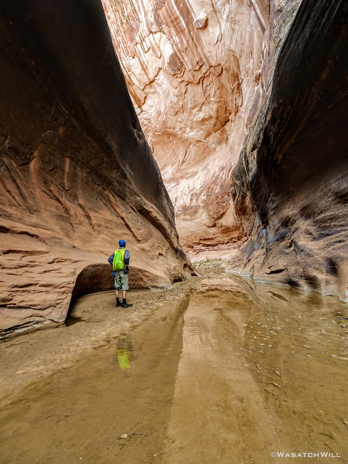
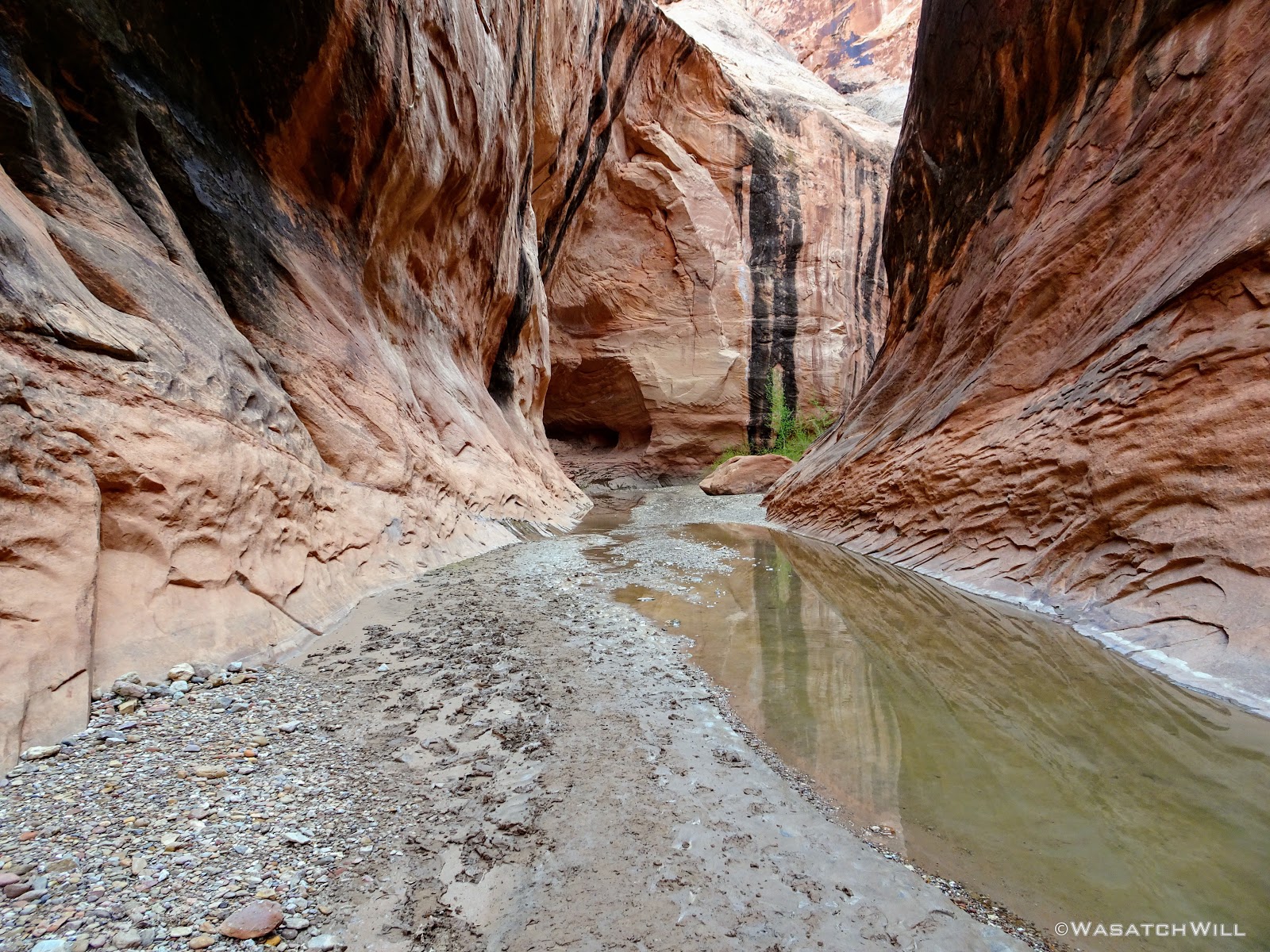
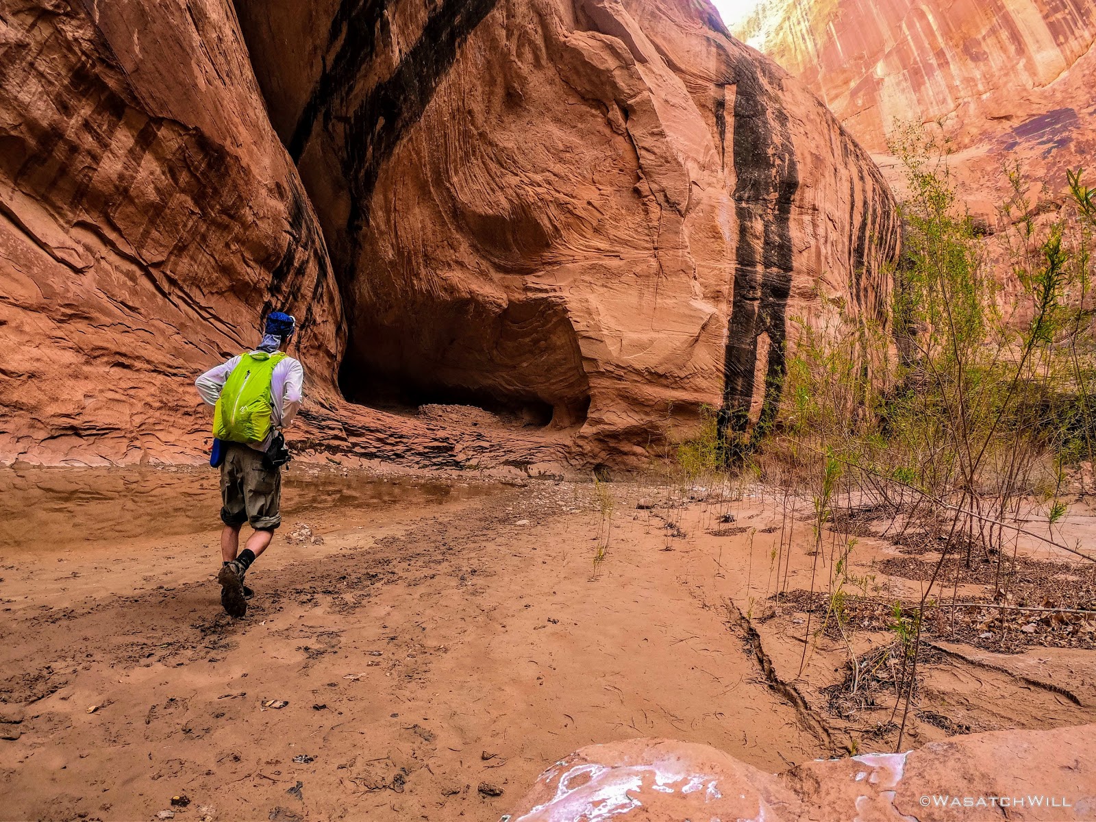
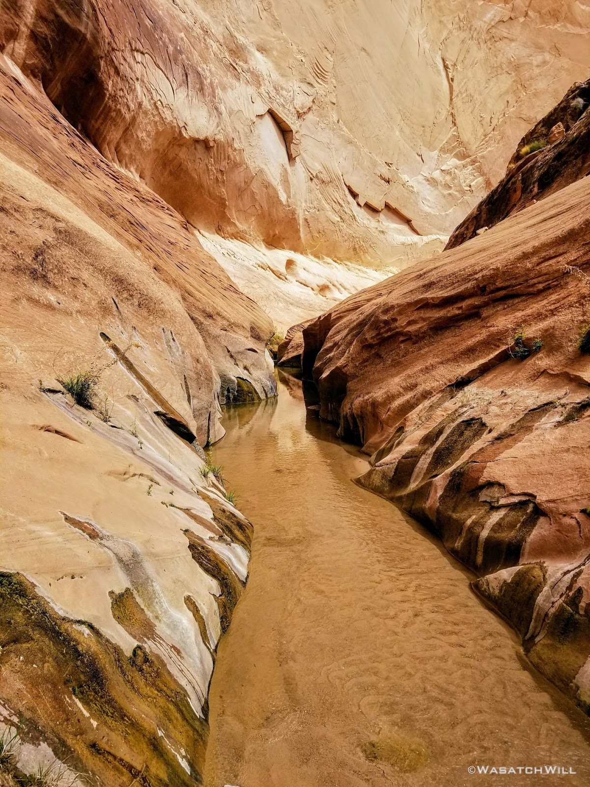
Into the narrows section I went.

Entering the narrows

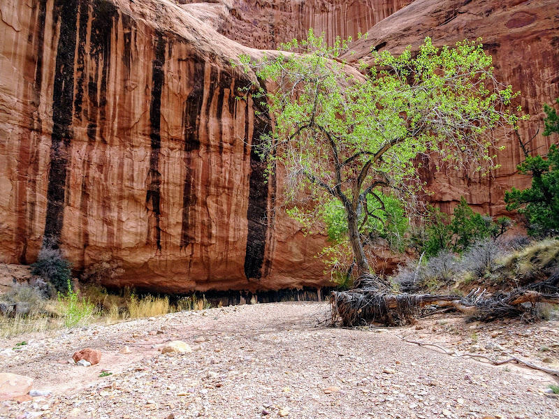
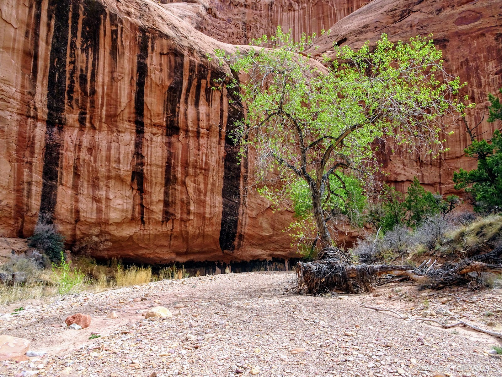
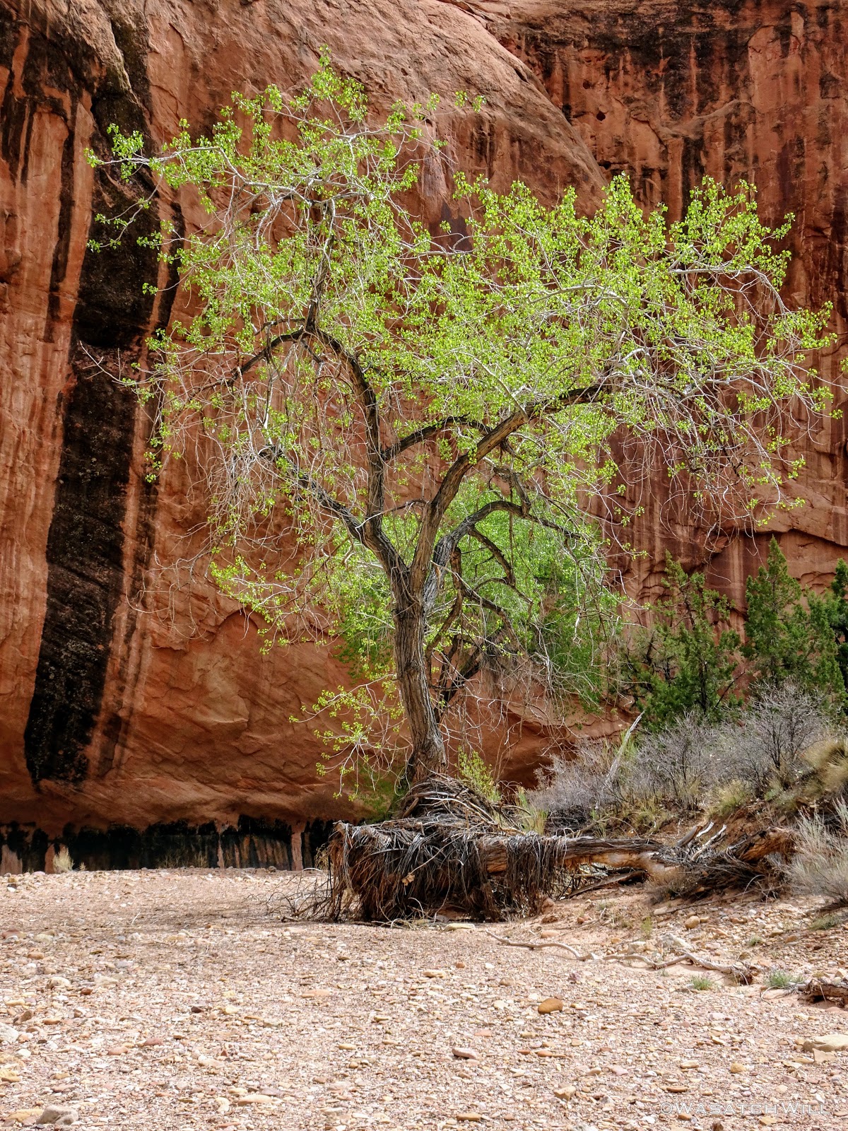
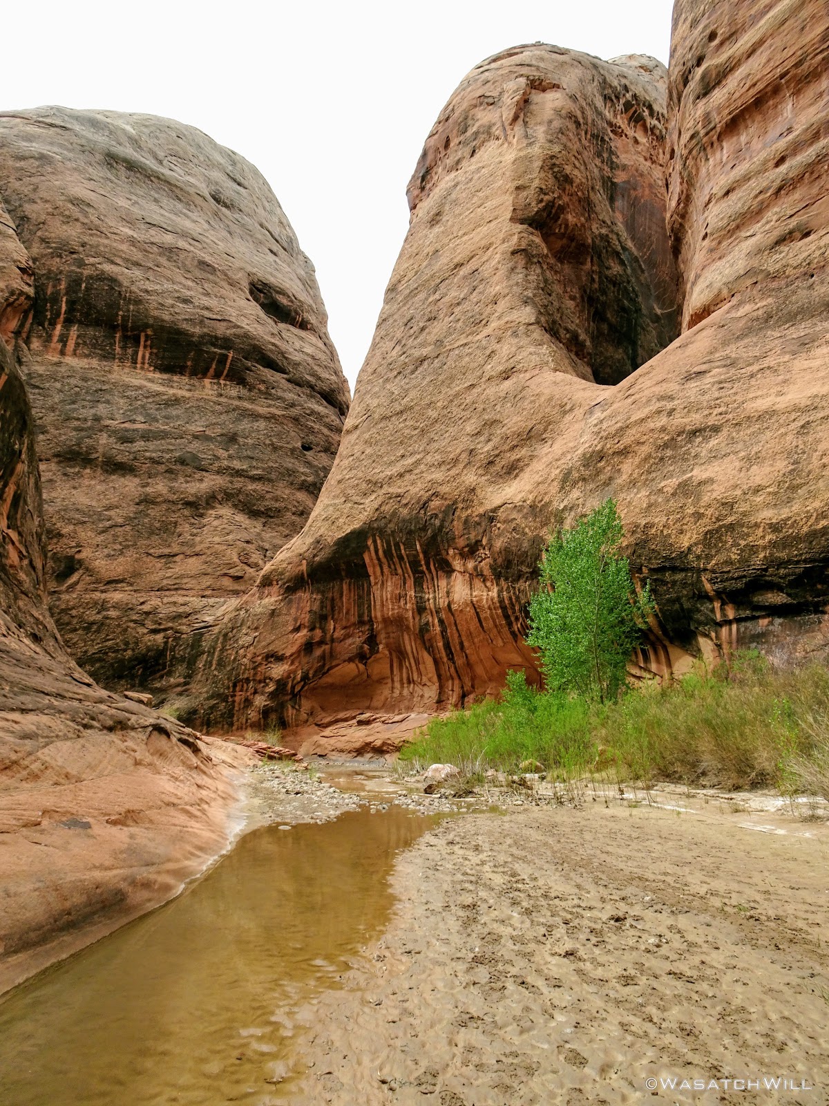
Tree standing guard in the narrows
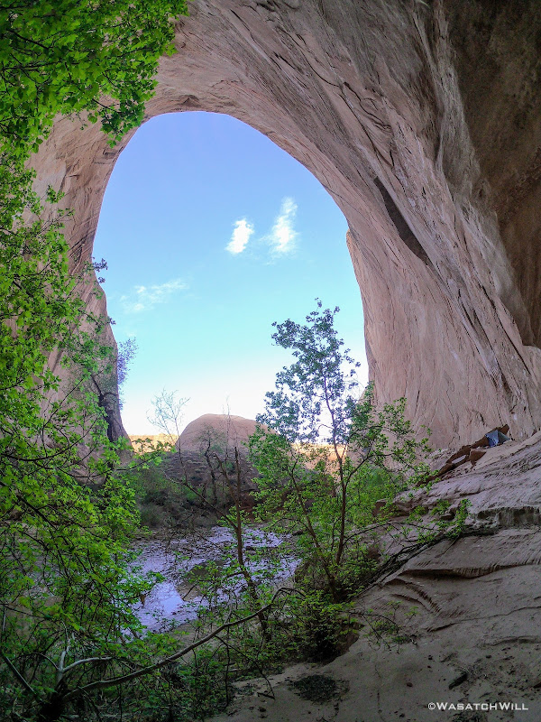
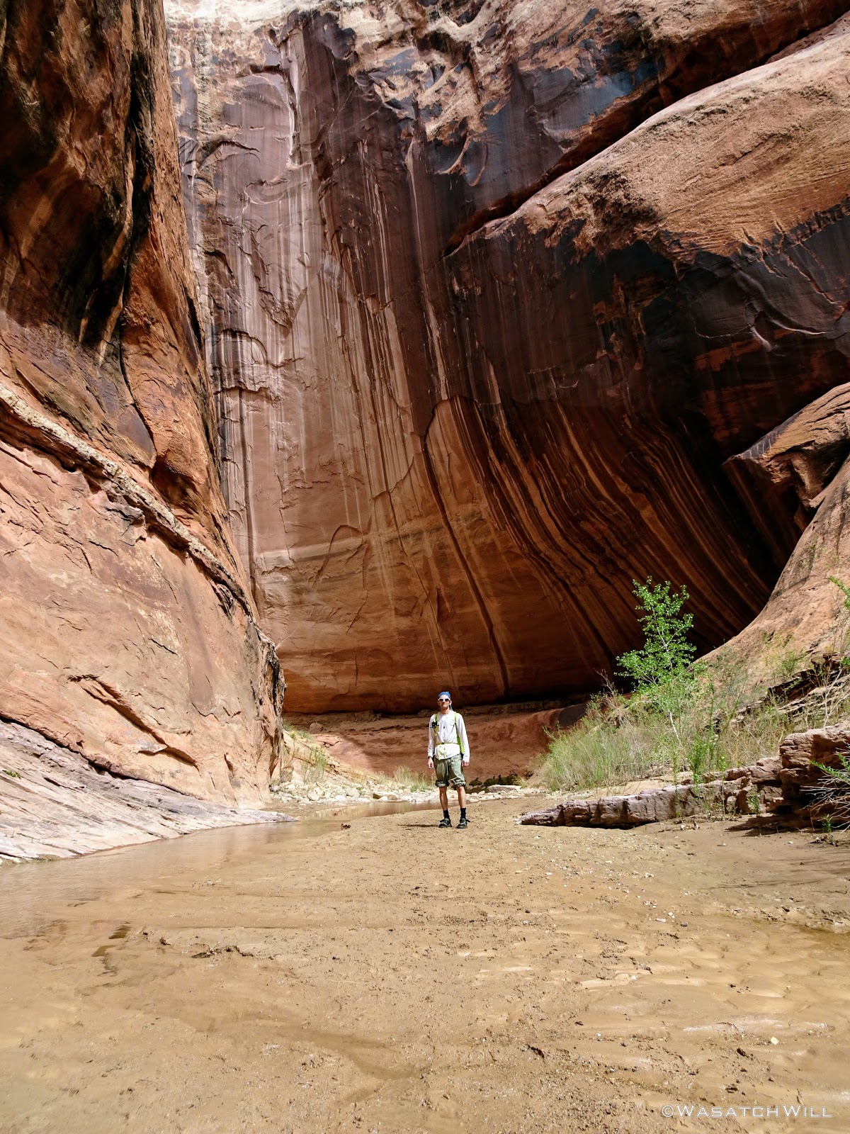
After a good little stroll further, I arrived where I had anticipated on camping, a massive amphitheater style alcove. In fact, some refer to this space as The Amphitheater. It was so quiet (no echos) coming around the final bend into it that I was sure it was completely empty and available. But at the last second, I spotted a group of five or six perched down on the edge of the large flat sand bank. I had a chat with them and found out they were from Oregon, the group that had been spending the whole week hanging about.
They were going to stay put there for the night and so I was prepared to move on, but upon learning I was alone, they invited me to stick around and find a spot nearby. I thanked them and told them I didn't want to intrude and would scope around for something that allowed each of us a bit more privacy and separation.
They weren't sure what their plans were for the following day yet, so I told them I'd probably want to move onto the flat if they ended up taking off the next morning. They had already toured the narrows that day and were looking to head up to the rim top the next day.
I asked them how they liked it and they were impressed. Knowing that some sections of it had involved deep wading and even swimming for some people in the past, I asked them for a bit of beta on that. They informed me that the water never got much past above their knees in any one section. It was bittersweet to think I probably wouldn't be trying out the ultralight $1 float ring I had picked up at the Family Dollar in Loa on the drive down.
I bid them farewell and wandered up a higher bench across the creek a few hundred feet away where I found a spot just flat enough for a solo tent nestled along some rocks that offered a nice little barrier between the group and my lonesome self. It would do. I was grateful to yet again, enjoy the experience of camping in such a setting.

Inside 'The Amphitheater'
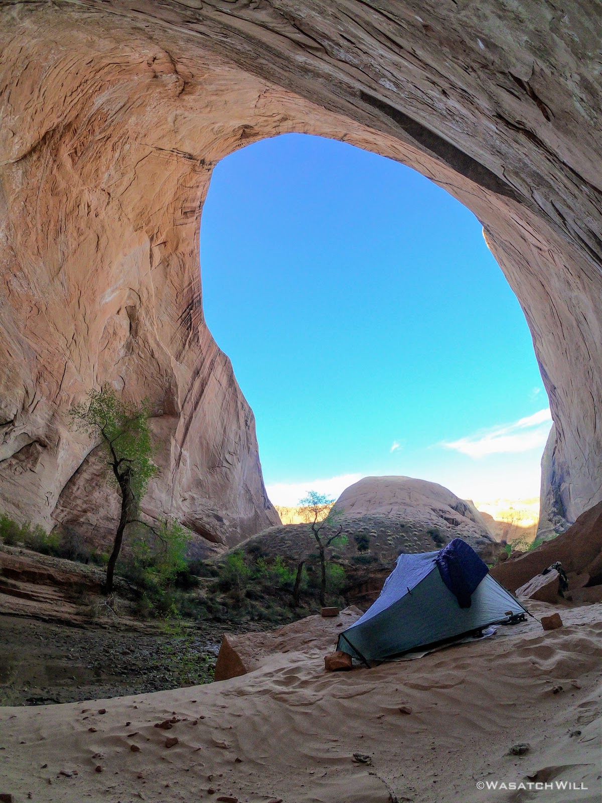
Camp, night #1
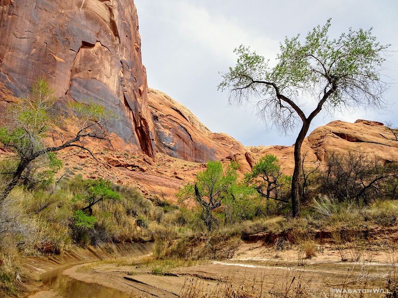
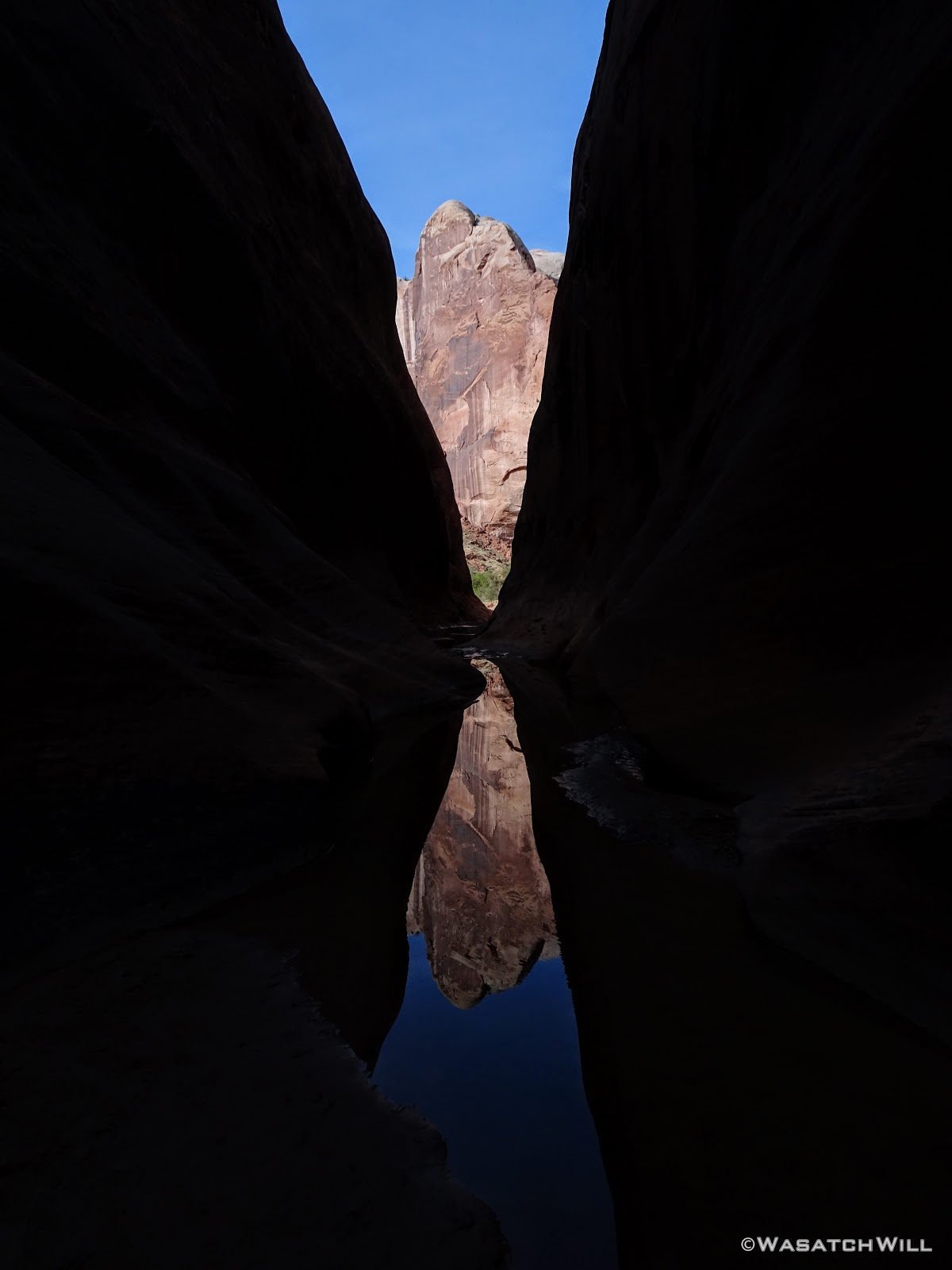
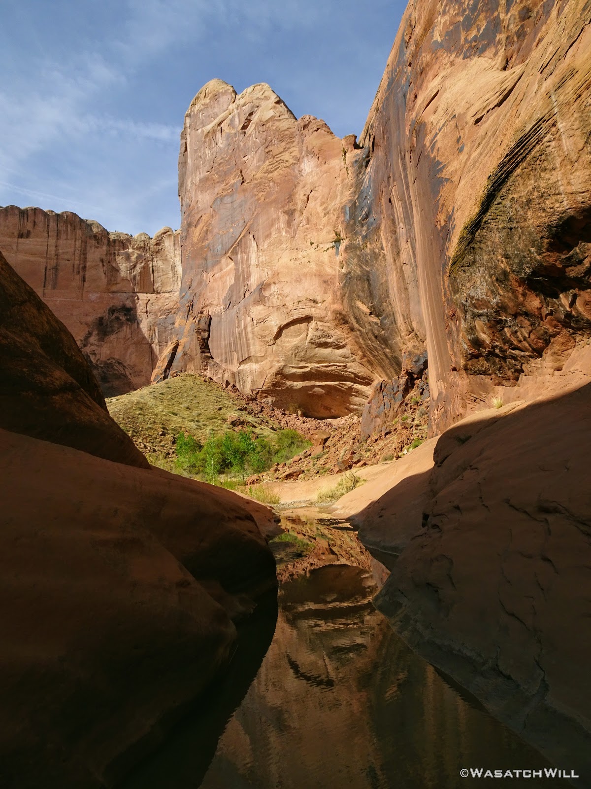
With camp all set up, I wandered down along the creek a bit in both directions, just taking in the scale of the whole place and soaking up the beauty and wonder of it all.
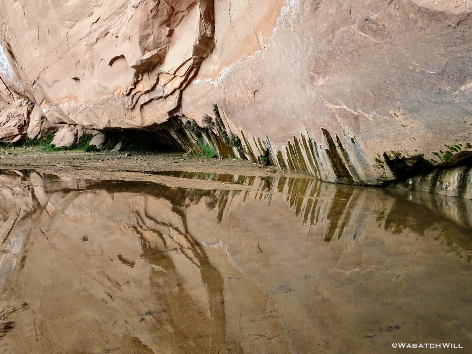
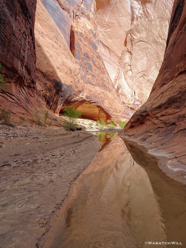
Amphitheater reflection
I soon returned to my camp and enjoyed a quiet dinner and an early bed time, still full of excitement for what was to come the next day.
------------------------------------------------------------------------------------------------------------------------------
Day 2
Wednesday - April 4, 2018
The next morning brought with it clear blue skies. Perfect weather for a watery walk down the creek. The group hollered up to me and informed me they were packing up and that the alcove was all mine for the taking. I opted to just keep my camp where it was for the time being and move one with gearing up for a day of touring the rest of the narrows. If the alcove was still all empty when I returned, I'd consider moving my camp down to the big flat then.
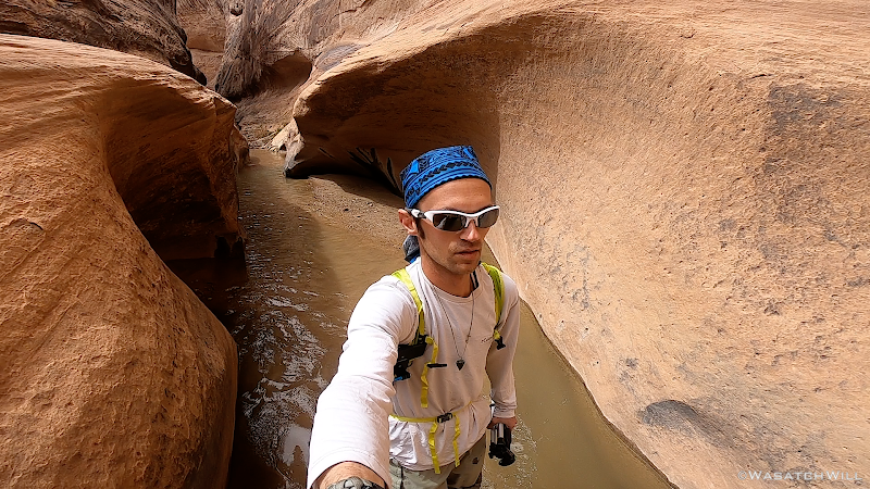
Once done with breakfast, I descended the bench down to the creek, filtered up a bottle of water, and set sail down the canyon.
From here, I'll just let the following pictures do the talking for a while and leave it to the reader to fill in their own captions.


***NOTE: It was at this point where @Jammer survived his now infamous flash flood event.***


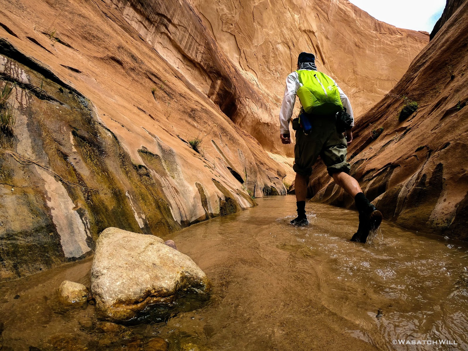
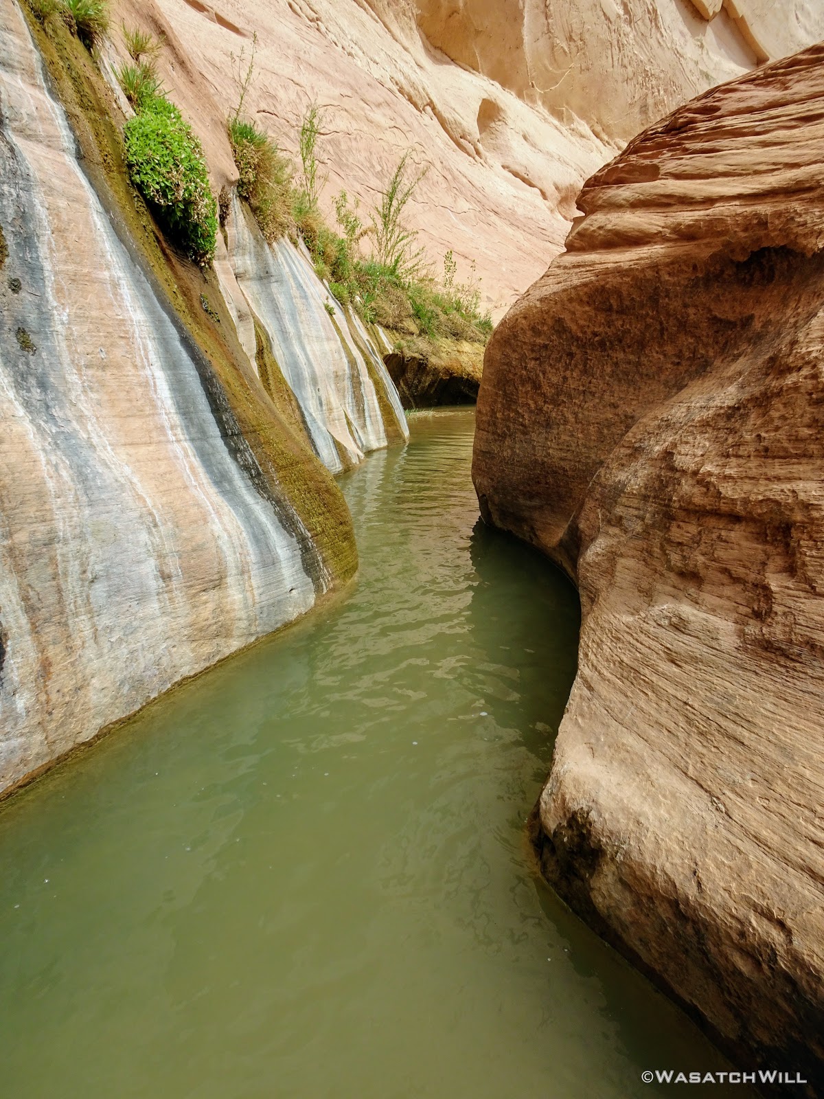
In the latter, lower half of the narrows, I encountered the narrowest section and what would be the deepest wader of the day. I'd call it the 'Chasm'. Bring it on!

Into the 'Chasm'
GoPro selfie in the 'Chasm'
'Chasm'
Beginning of the wade through the 'Chasm'
The 'Chasm' wader
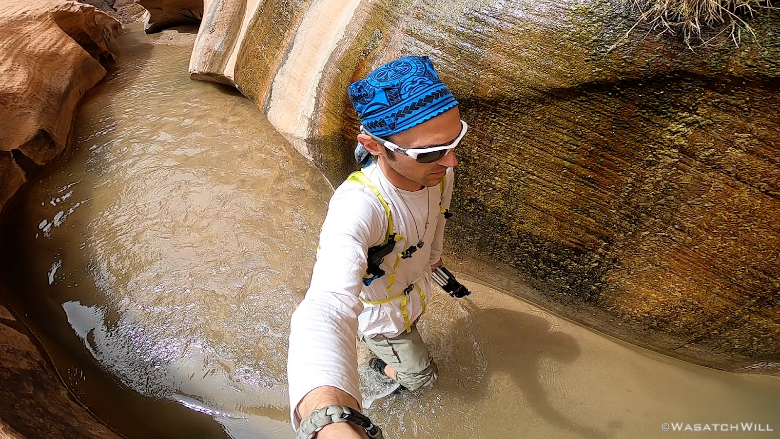
Video still of myself walking through the 'Chasm'

Another video still of myself walking through the 'Chasm'
The Oregonians proved to be an honest bunch. The wader was nothing more than a few inches above my knees at its deepest point. Hooray!
Desert Varnish
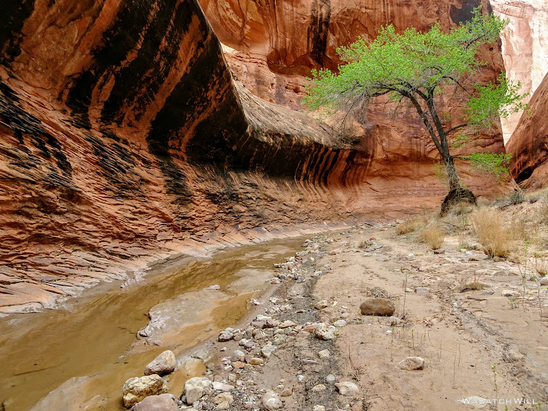
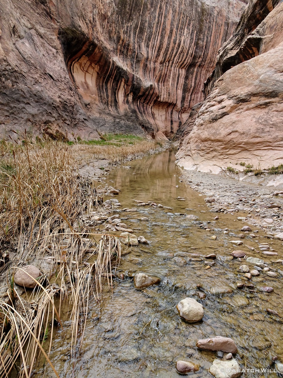
Several minutes later, the narrows opened back up and I had reached the other side of Hall Divide. Needless to say, the hike thus far had been breathtaking and beautiful.
I had only encountered two other groups through the narrows, beyond the Oregon group. A group that appeared to be a mother and her two teenage sons who were hiking it upstream, the opposite direction, followed by the two I ran into the day before, now reunited. I chatted with the latter two for a bit, learning that the woman had actually attended the same high school I started out at, having gone on to graduate a year sooner than me. I immediately recognized her name and we had a small world moment.
Moving on...
Exiting the narrows
Looking up toward the rim
Crossing over Hall Divide provided some beautiful panoramic views from itself, views that may well have been worth the 8 mile hike down for themselves. I had been seriously considering on working my way up and over to the rim above the narrows and making my way back to the creek that way, but ultimately chose to stick to the path and close out the loop the standard way.
Looking south from Hall Divide
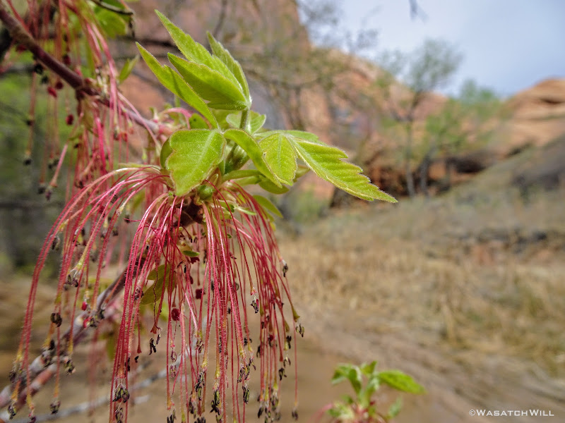
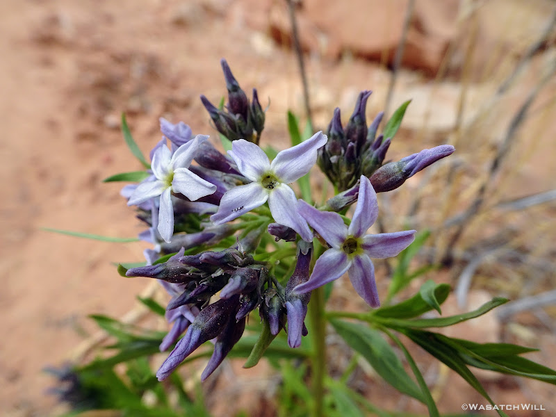
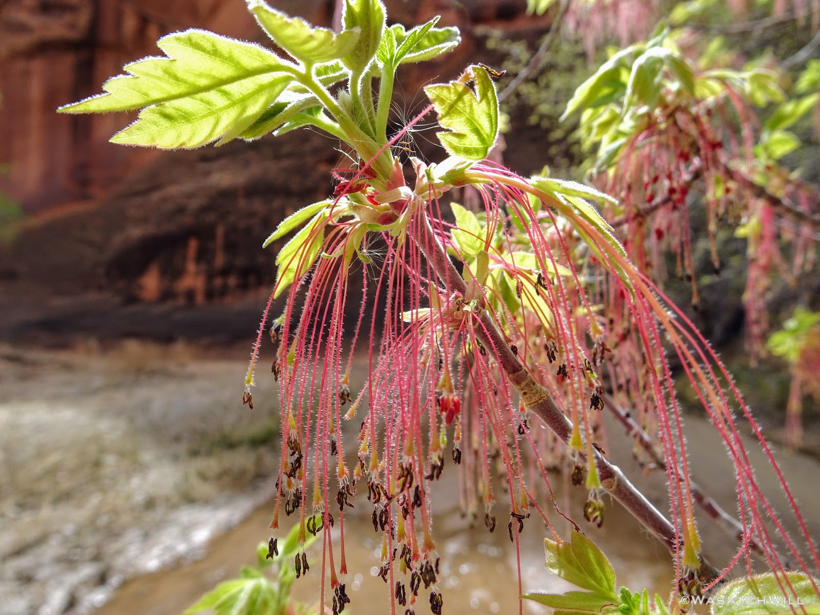
There were few flowers blooming along the trails yet, but the ones that were out provided some welcome colors.
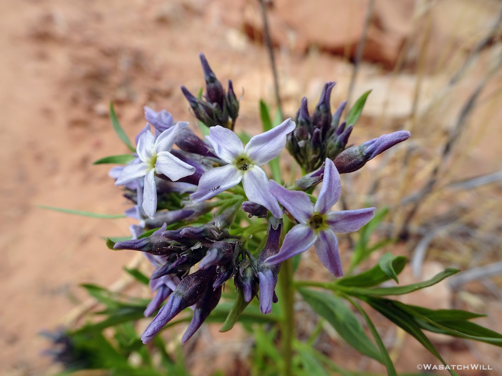
Desert flowers

Along Hall Divide
Hall Divide Panorama (westward)

Hall Divide Panorama (northward)
As I crested over the Divide, I bumped into another couple. They were a middle-aged married pair who were en route of hiking the whole Heyduke trail, having started weeks before up in Arches National Park. Awesome!!!

Heyduke couple
A short while later, I rejoined the creek at the loop's junction where I encountered another group of three taking a water rest who were in progress of doing a modified section of the Heyduke, having started out on the Boulder Mail Trail and were en route to finishing out through Stevens Canyon and Coyote Gulch.
Not far from them was the Oregon group, camped out just above the creek.
I raced on back to my camp from there and found the whole alcove to still be free from anyone else. I decided to go ahead and move my camp down, just because.
It was about 4 in the afternoon at this point so I felt like I had a couple hours to just chill until I'd be ready to do dinner. I took the opportunity to do some reading, watch some downloaded videos on my phone, and ultimately take a little nap to pass the time.
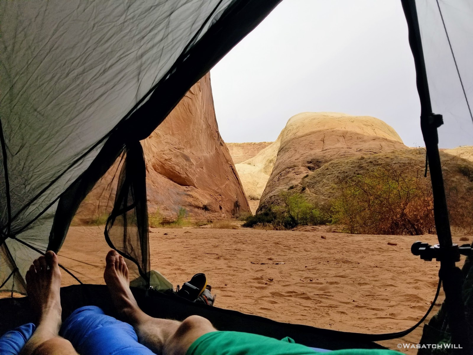
Tent view
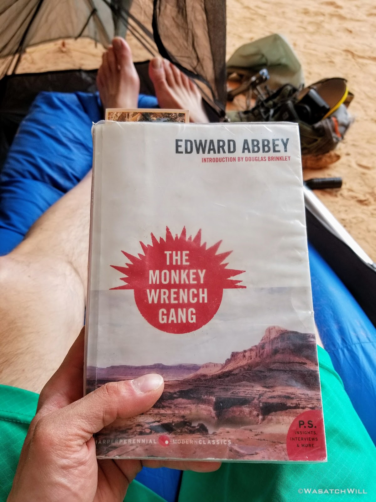
Edward Abbey time
The sky had become overcast through the afternoon, but had started clearing up again when I awoke. I got out and made the most of it with getting some pictures to take in the scale of the alcove. Despite lugging along my DSLR with me, I wasn't able to get any very wide view shots with it. I was only willing to bring along its kit 18mm lens. I had boughten a new 14mm lens for it, but opted to leave it back at home due to the fact that the lens itself is more than twice the size and twice the weight of the camera's body. Even then, a 10mm lens may have been the only thing to do it justice.
I had recently got a new GoPro that I was able to use for capturing some wider images for the sake of scale and perspective. Beyond that, my phone's panorama mode worked out satisfactory enough for some vertical panorama shots too.

The roof of 'The Amphitheater'
'The Amphitheater'
Camp, night #2
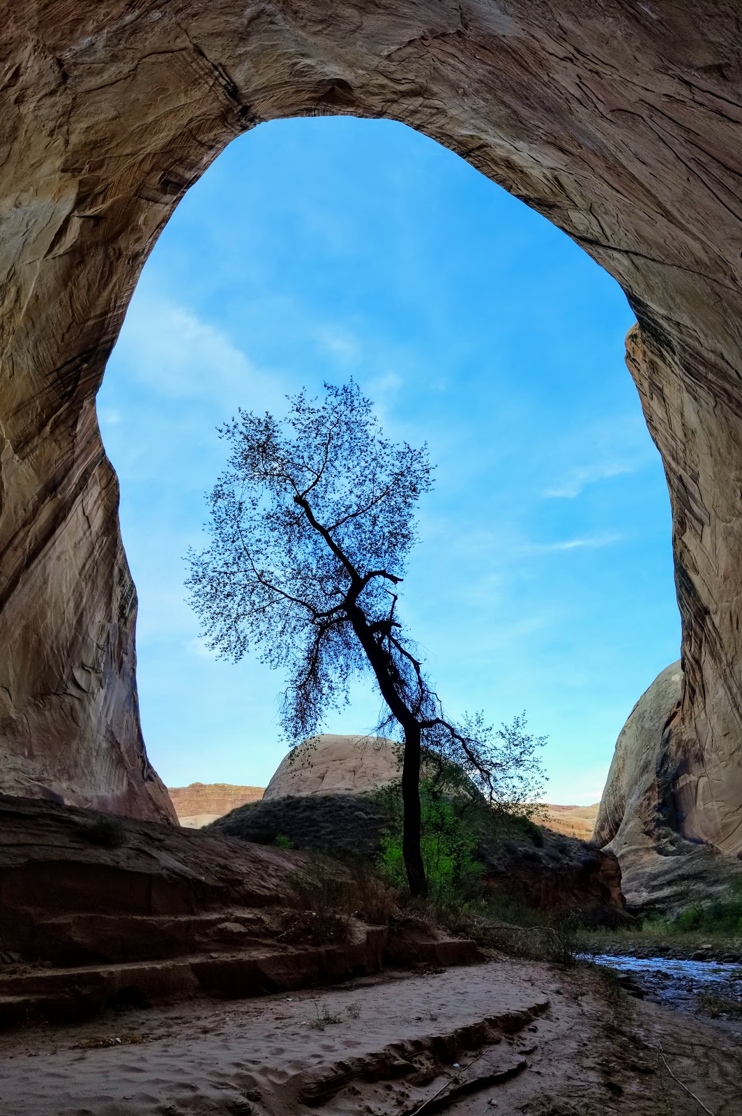
'Tree of Life'

'Out of darkness, into the light'
The sun soon set with out much drama while I ate some dinner and prepared to retire for the night. Before settling into the tent for good, I took a stab at a few night shots, but was pretty tired to fuss around with settings too much. I also didn't have a very sturdy tripod for the DSLR on me, as that would have only added even more weight that I didn't want to carry.
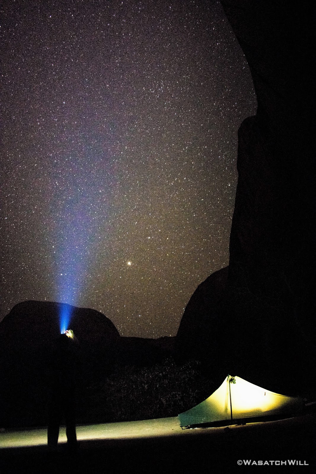
Playing with a long exposure
Goodnight!
------------------------------------------------------------------------------------------------------------------------------
Day 3
Thursday - April 5, 2018
Thursday - April 5, 2018
The third and final day of the trip started off with a pleasant sunrise. Nothing too dramatic, but a nice compliment of blue and orange nonetheless.
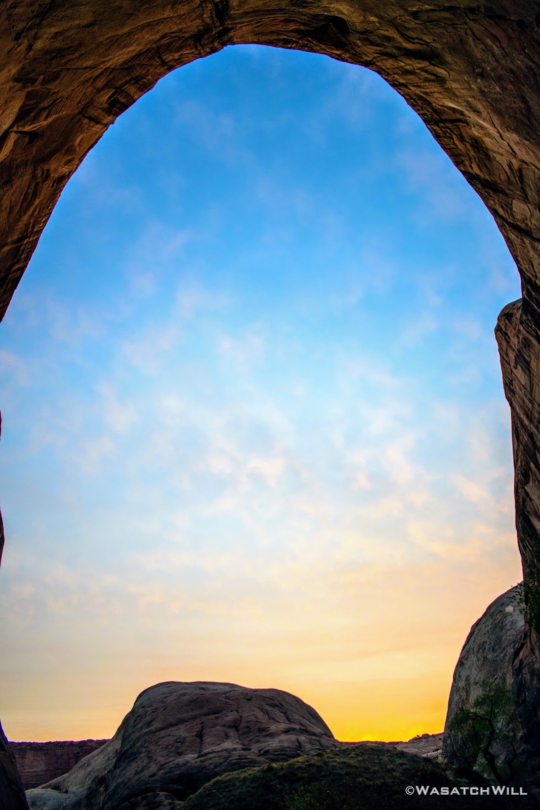
Sunrise
I played around with the DSLR a bit more, trying to frame up some sunbursts. I'm still trying to teach myself Lightroom for editing RAW images, so forgive me if they appear to be over-processed.
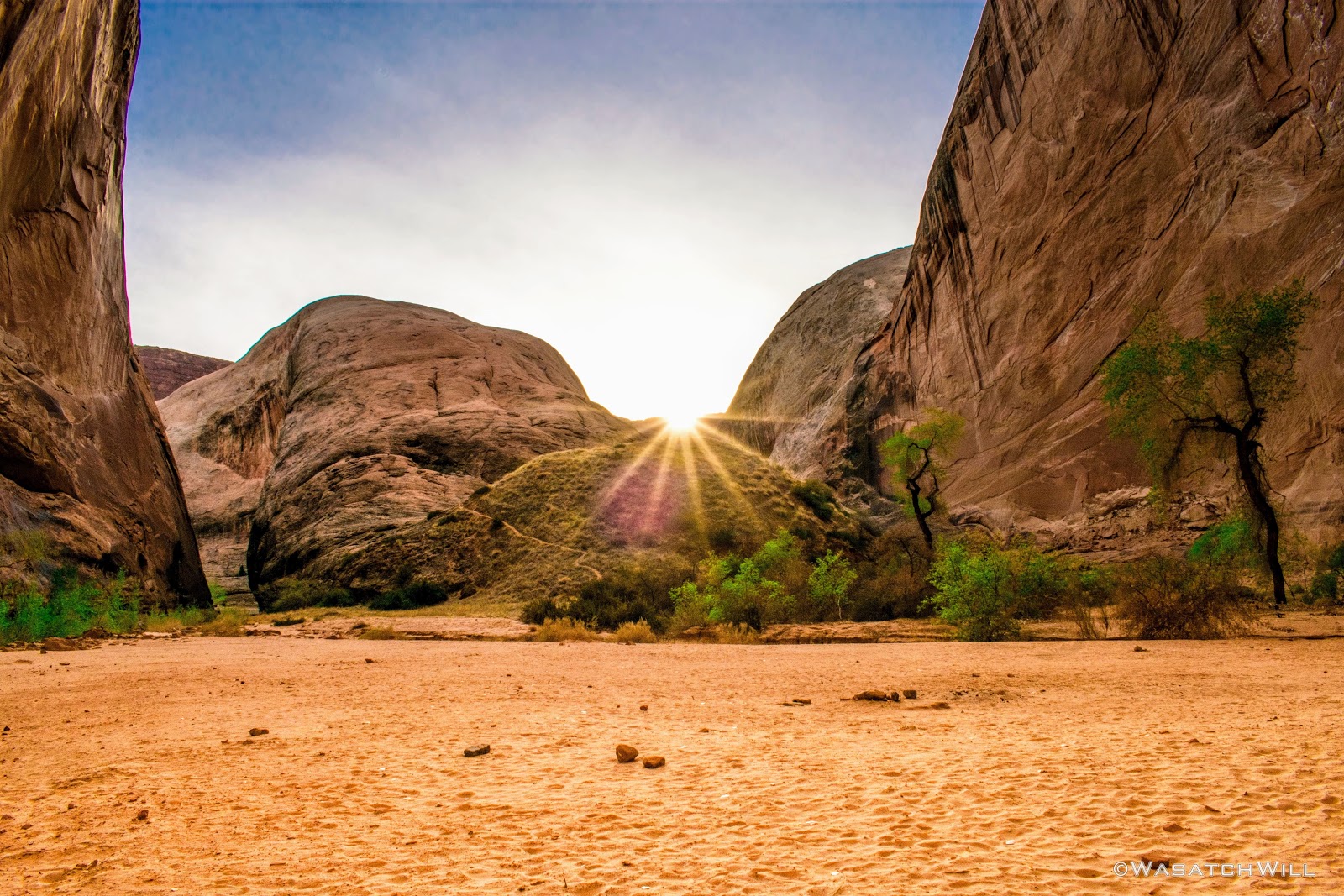
Sunburst #1
Sunburst #2

Sunburst #3
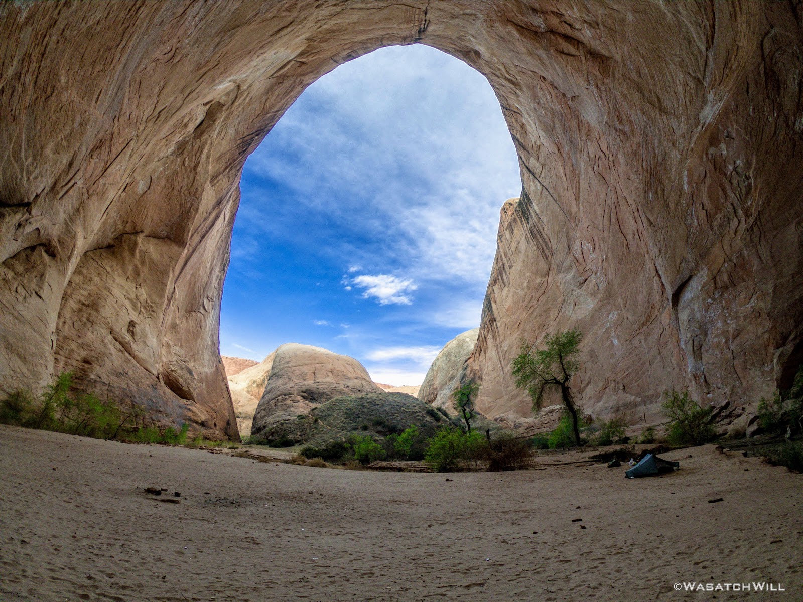
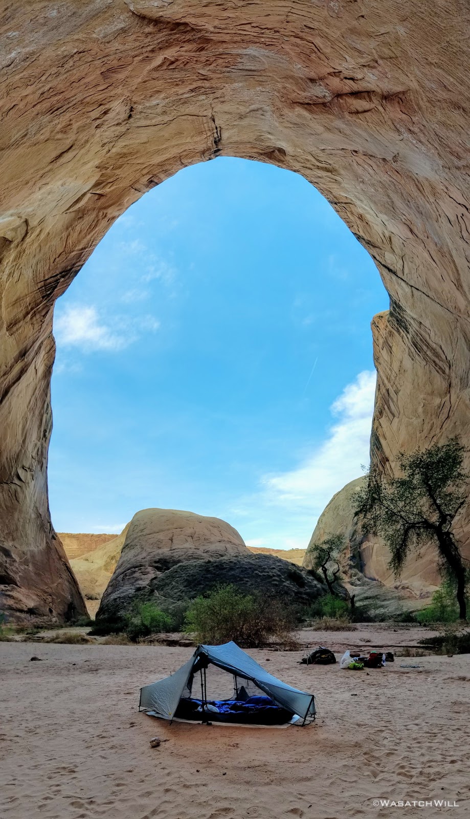
From camp, I noticed a social trail winding its way up the bend. I decided to follow it up to a nice little overlook of the alcove.
Again, the size of the enclosed space was nothing short of amazing. Here's some shots of my tent nestled in the alcove as seen from the overlook for an alternate sense of scale.
'The Amphitheater' Overlook
'The Amphitheater' Overlook
On the way back down the path I paused to observe some of the smaller details in the form of cactus, the crytobiotic soil providing such a fertile space for all the growing flora, and a caterpillar I about stepped on.
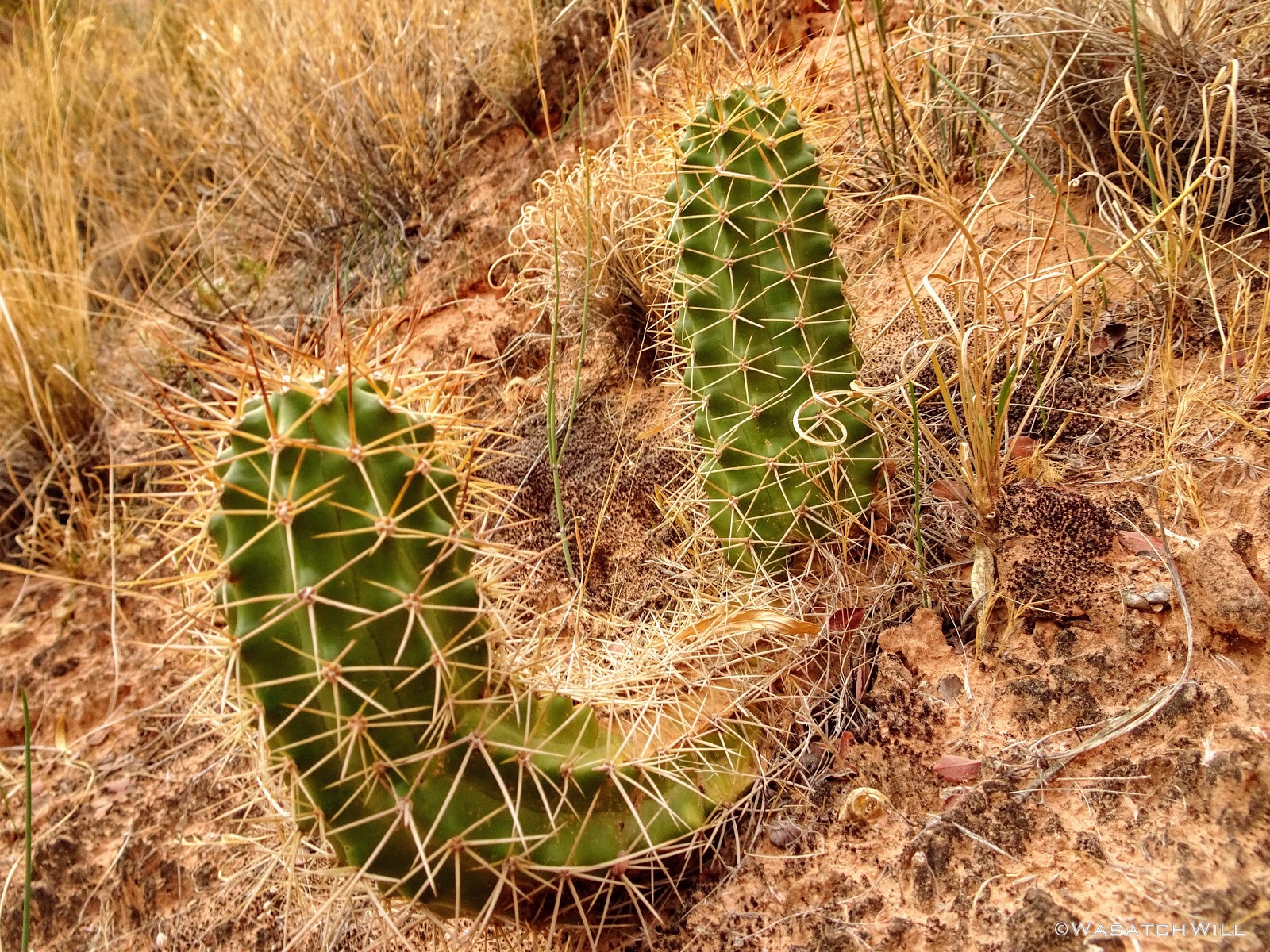
Cactus
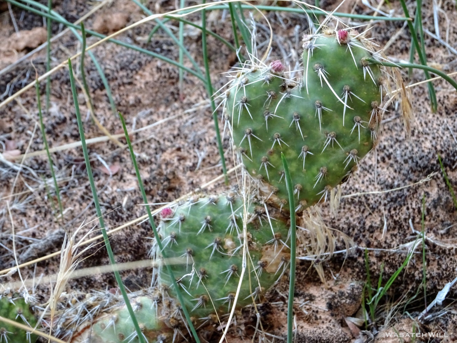
Prickly Pear Cactus with buds

Fuzzy caterpillar
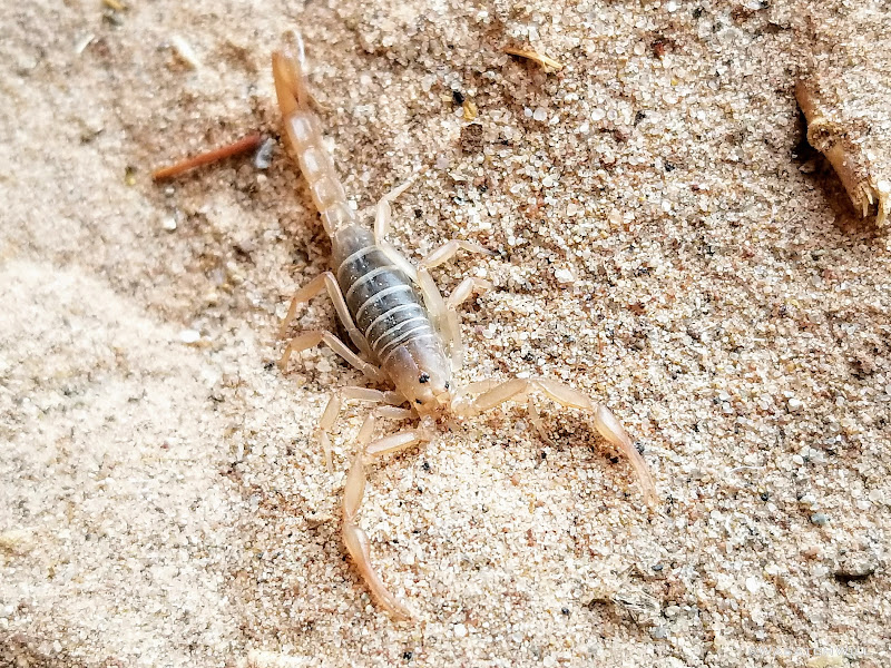
And then there was the only creepy crawly I ever have nightmares about...a scorpion! It was my first time ever seeing one in the wild. And it had the nerve to by hiding out right under my food bag back at camp. This after walking all around camp, barefoot. After looking up more info on the ones that can be found in that region, I'm guessing this was a small one of the Desert Hairy variety.
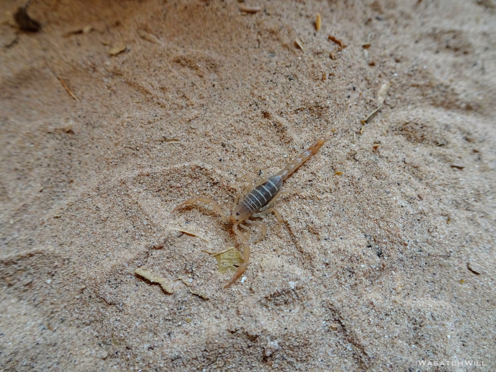
Creepy scorpion

Same scorpion
Back at camp, I packed up and took my breakfast on the go in the form of a cereal bar.
Heading out
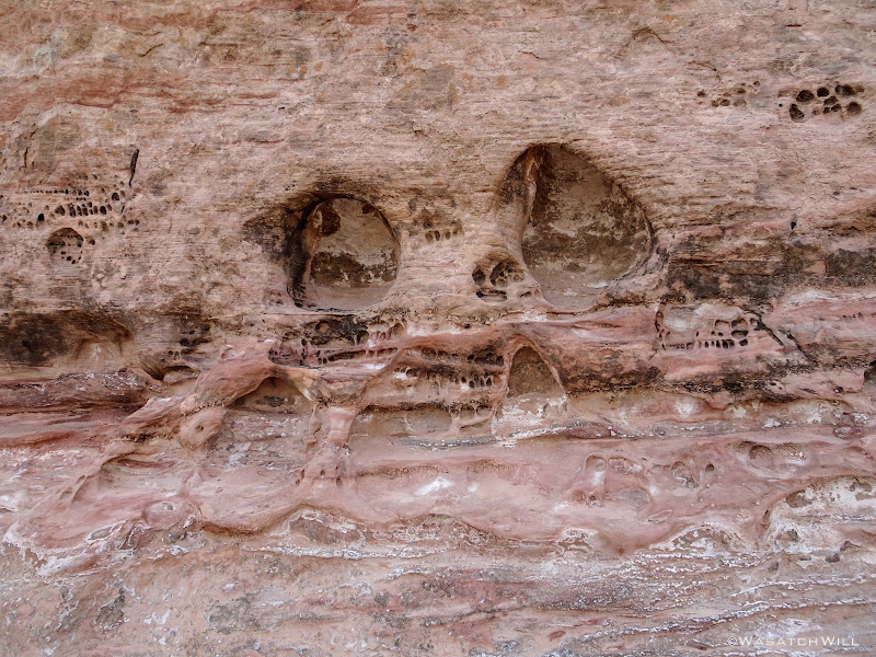
On the way out, I felt like I was being stalked only to discover what looked like a skull face engraved into the rock.

Skull face
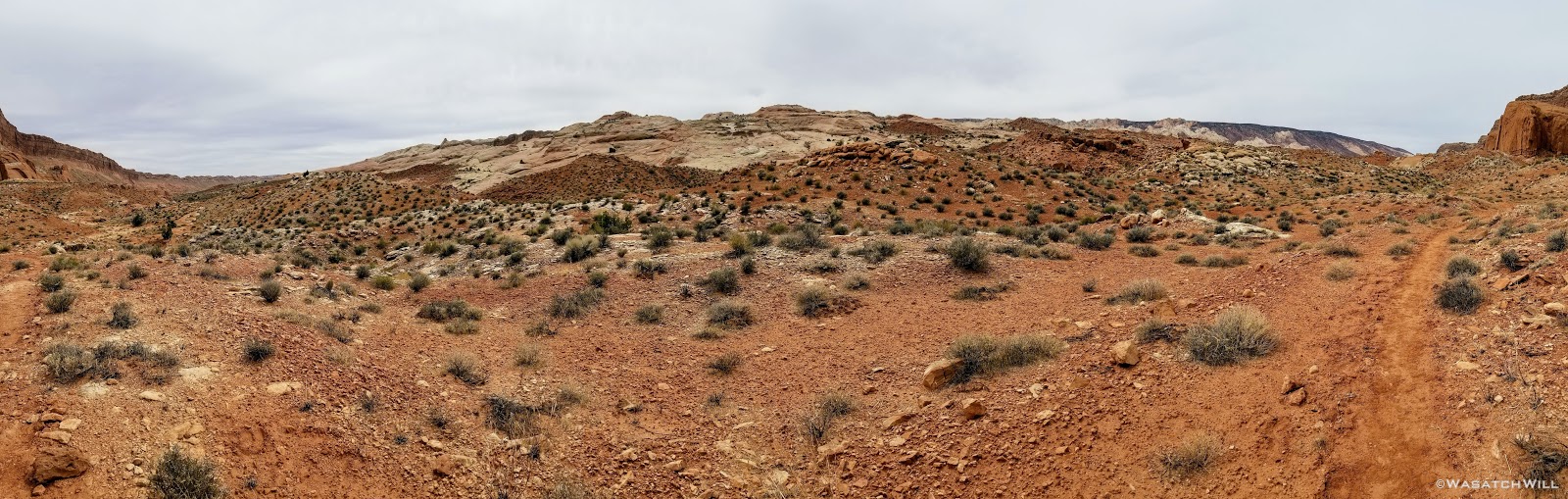
The hike back out was as pleasant as it was coming down and in. The sky bounced back and forth between being overcast, to clear and blue and back to overcast. When the sky was clear, the air grew quite warm, but not overbearingly hot.
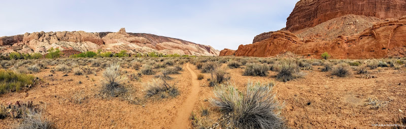
Halls Creek Trail panorama (northward)
Southern flanks of Waterpocket Fold
Halls Creek Trail panorama (westward)
A few more flowers would be observed along the way.
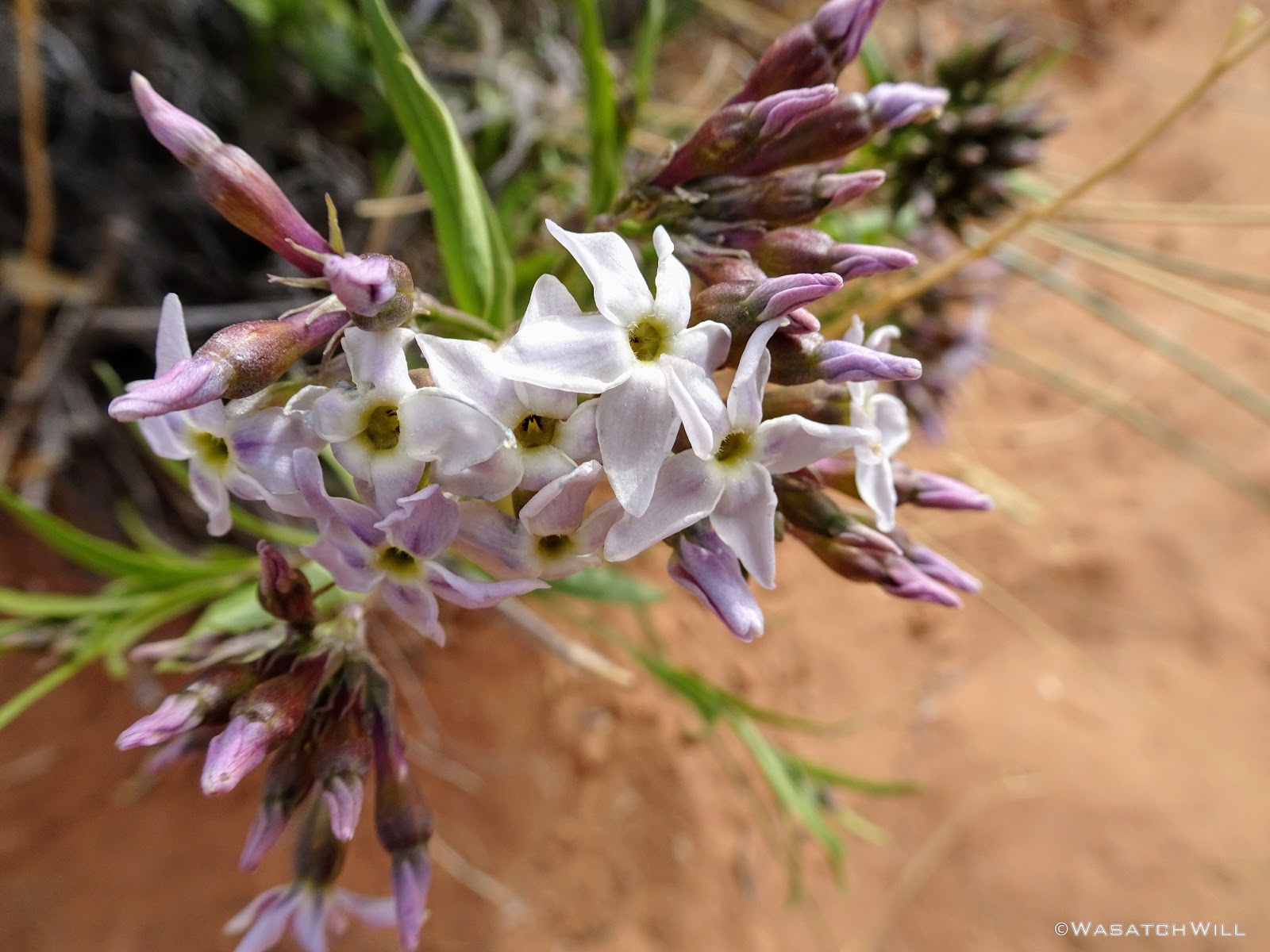
Pretty flowers
I was especially in awe of this red Indian Paintbrush I stumbled upon that had purple stocks.
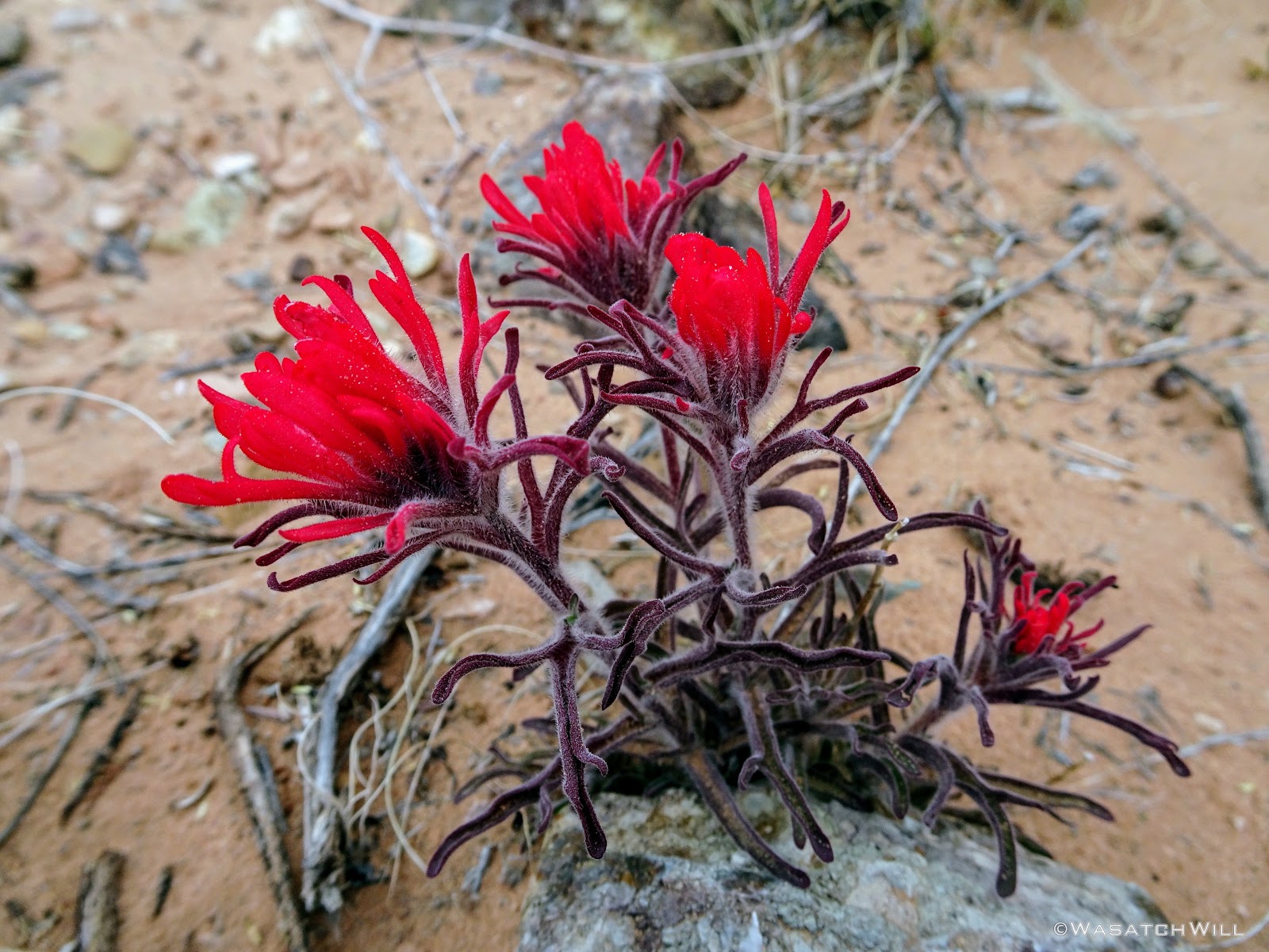
Indian Paintbrush
Unlike the hike in, this time, I'd pause for a lunch break and water refill at Fountain Tanks. It turned out to be quite the gathering place. There was an older fellow camped out nearby who had been spending the week poking around the Fold and exploring some of the old mining camps in the vicinity. There was another guy with his teenage daughter who were on their way up to the narrows for the night. The group from Oregon caught up and stopped by. And then there was another group of 6 on their way to the narrows, but for whatever reason, they raced on by.
Had it been any warmer, some of the upper pools would have been tempting to jump into, but no doubt it would have been suicide by hypothermia, if not drowning, with no anchored hand line to pull myself out with. That, and swimming in pools such as these are highly discouraged because of how it can affect and contaminate a fragile ecosystem that relies on them.
Lower Fountain Tanks

Lower Fountain Tank

Fountain Tank reflection

Upper Fountain Tanks

Upper Fountain Tanks drainage
Not long after leaving the tanks behind, I paused for a few more views of the Red Slide area.
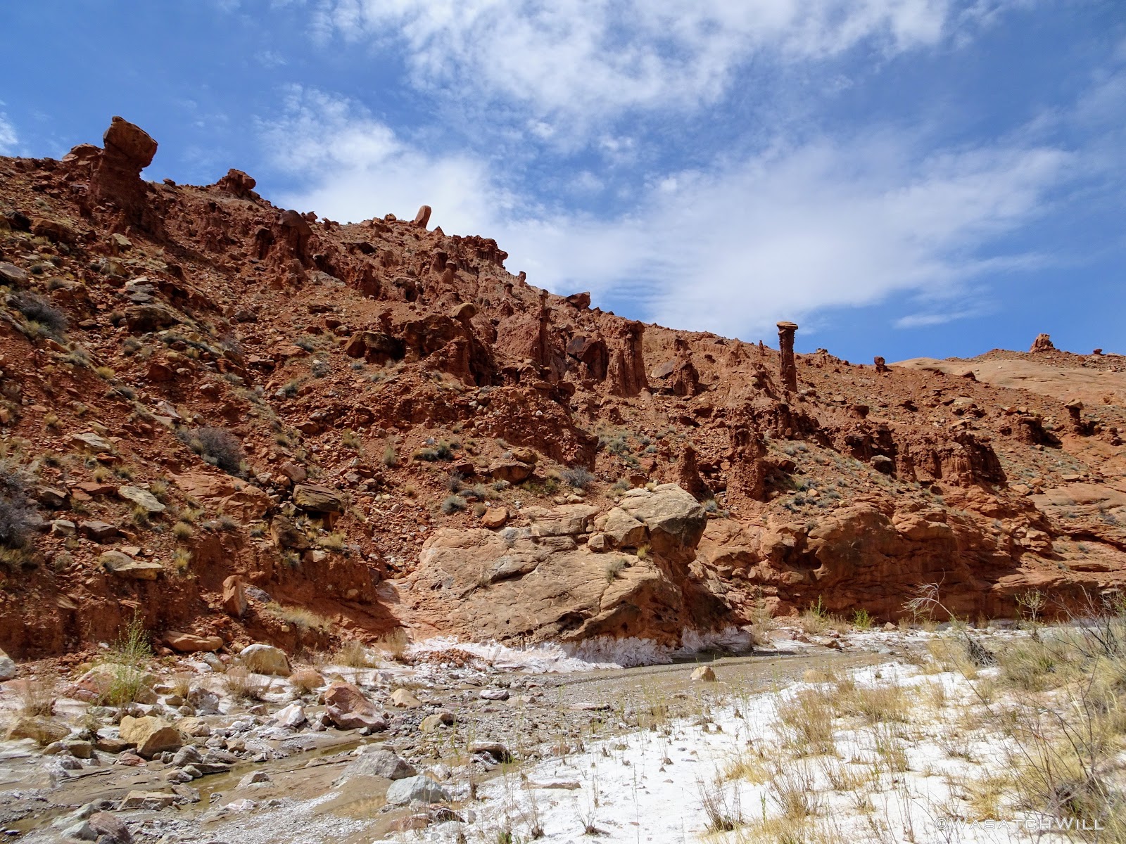
Red Slide

Red Slide hoodoo
Once back at the final crossing of Halls Creek and the start of the ascent back up the mesa to the trailhead, I had to make one last decision. I had wanted to drop my pack and take a stroll up to Brimhall Bridge. I took a rest and reviewed the map. It'd be about a mile up and a mile back. I was feeling pretty exhausted from carrying a pack that was a bit heavier than I usually carry (no thanks to the DSLR, an extra set of clothes, Teva sandals, and all the extra snacks I have a bad habit of packing along). I had also come down with a cough (one that had turned out to be highly contagious with the rest of my family and some folks at work), so my body was feeling a bit more fatigued from having to fight off that sudden illness. It was also getting later into the afternoon and there was still a good bit of driving to be done to meet up with my family who'd come down to Torrey earlier in the day. And then there was the final mile up 800 feet just to get back to the car.
Had it not been for the illness, I likely would have made a run for the bridge. But rather than be too greedy, I thought the wiser of it this time and left Brimhall for another day.
At long last, I arrived back at my car, where I disconnected from my pack much more joyfully than I had in a long time. Excited to get back to Torrey to spend the rest of the week with my family, I drove on out. It'd be my first time ever driving up the famed Burr Trail, complete with its switchbacks and the ever beautiful Circle Cliffs, and yes, even a cattle roundup to slow things down just before passing through Boulder.
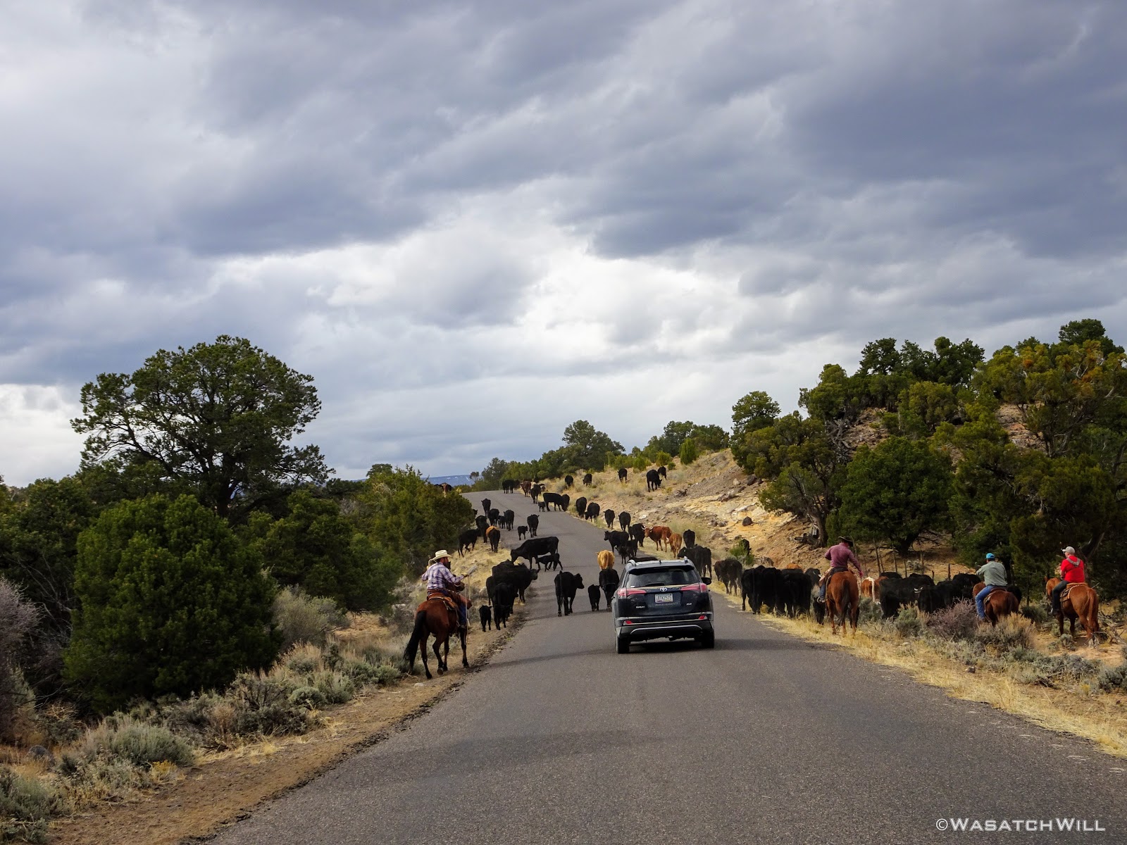
Cattle roundup
Finally, I had arrived in Torrey where my family, a warm shower, a delightful barbecue chicken dinner, and a good night's sleep to precede a day long tour through Cathedral Valley awaited. I'm glad I didn't hold out any longer on making the trip happen and look forward to when logistics allow me to bring back my wife, Jessica, and any friends.
Video:
")